SuDSCutting - Scheme and SuDSCutting - HaulageWidening250m Study areaPotentially contaminated land
?
N
Rev
Client
Project
Drawing title
Scale
Drawing number
Jacobs No.DO NOT SCALE@ A3
This drawing is not to be used in whole or part other than for the intendedpurpose and project as defined on this drawing. Refer to the contract for fullterms and conditions.
B2140005BIM No.
Rev. Rev. Date Purpose of revision Apprv'dRev'dCheckdOrig/Dwn
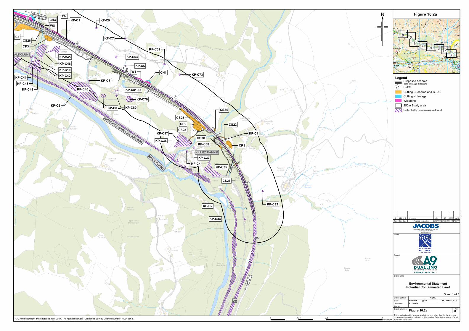
Figure 10.2a
1:10,000
0
JCrNOV 20170 RTES Publication
Drawing Status FINAL
VSM AJG
Environmental StatementPotential Contaminated Land
SuDSCutting - Scheme and SuDSCutting - HaulageWidening250m Study areaPotentially contaminated land
?
N
Rev
Client
Project
Drawing title
Scale
Drawing number
Jacobs No.DO NOT SCALE@ A3
This drawing is not to be used in whole or part other than for the intendedpurpose and project as defined on this drawing. Refer to the contract for fullterms and conditions.
B2140005BIM No.
Rev. Rev. Date Purpose of revision Apprv'dRev'dCheckdOrig/Dwn
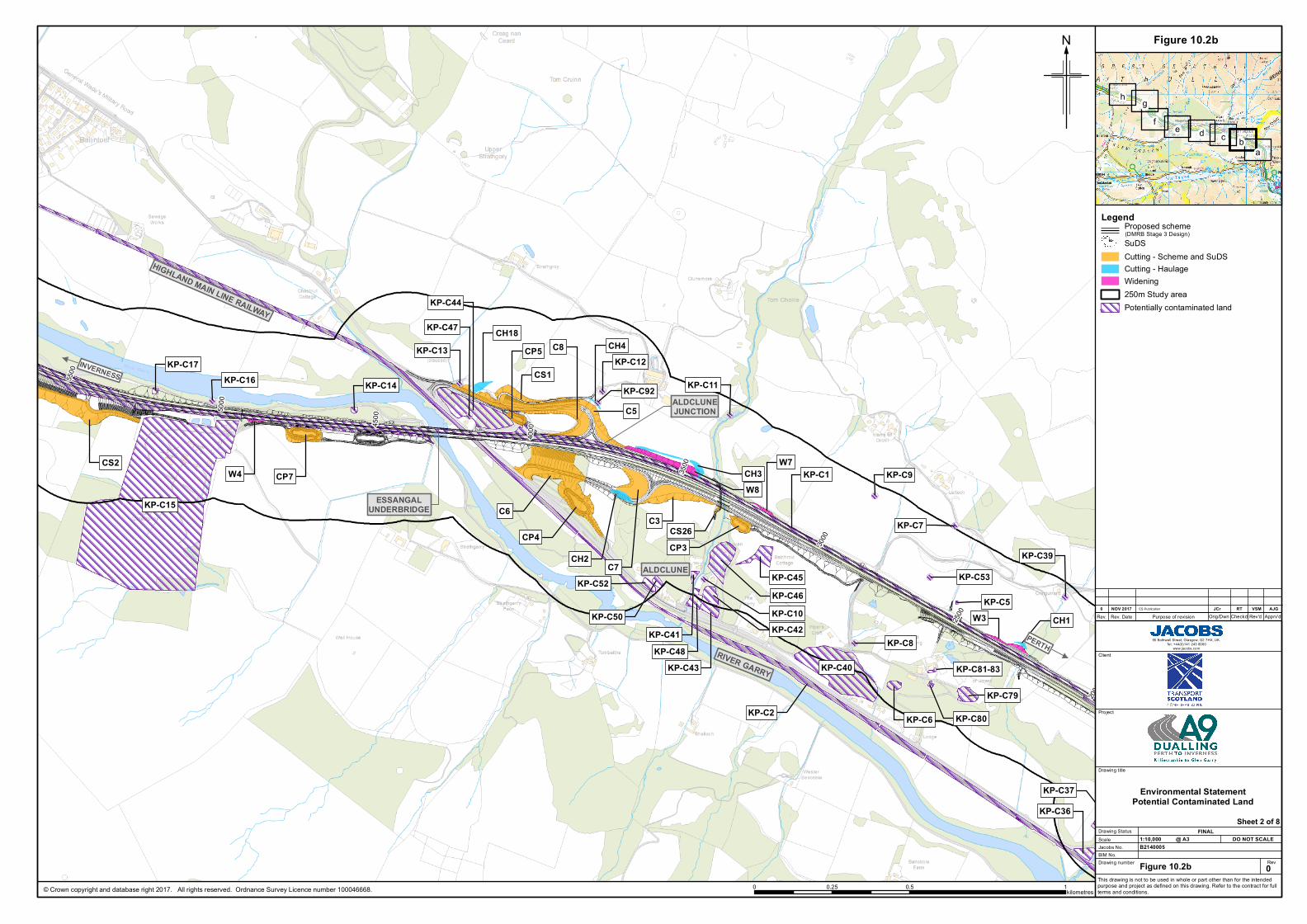
Figure 10.2b
1:10,000
0
JCrNOV 20170 RTES Publication
Drawing Status FINAL
VSM AJG
Environmental StatementPotential Contaminated Land
SuDSCutting - Scheme and SuDSCutting - HaulageWidening250m Study areaPotentially contaminated land
?
N
Rev
Client
Project
Drawing title
Scale
Drawing number
Jacobs No.DO NOT SCALE@ A3
This drawing is not to be used in whole or part other than for the intendedpurpose and project as defined on this drawing. Refer to the contract for fullterms and conditions.
B2140005BIM No.
Rev. Rev. Date Purpose of revision Apprv'dRev'dCheckdOrig/Dwn
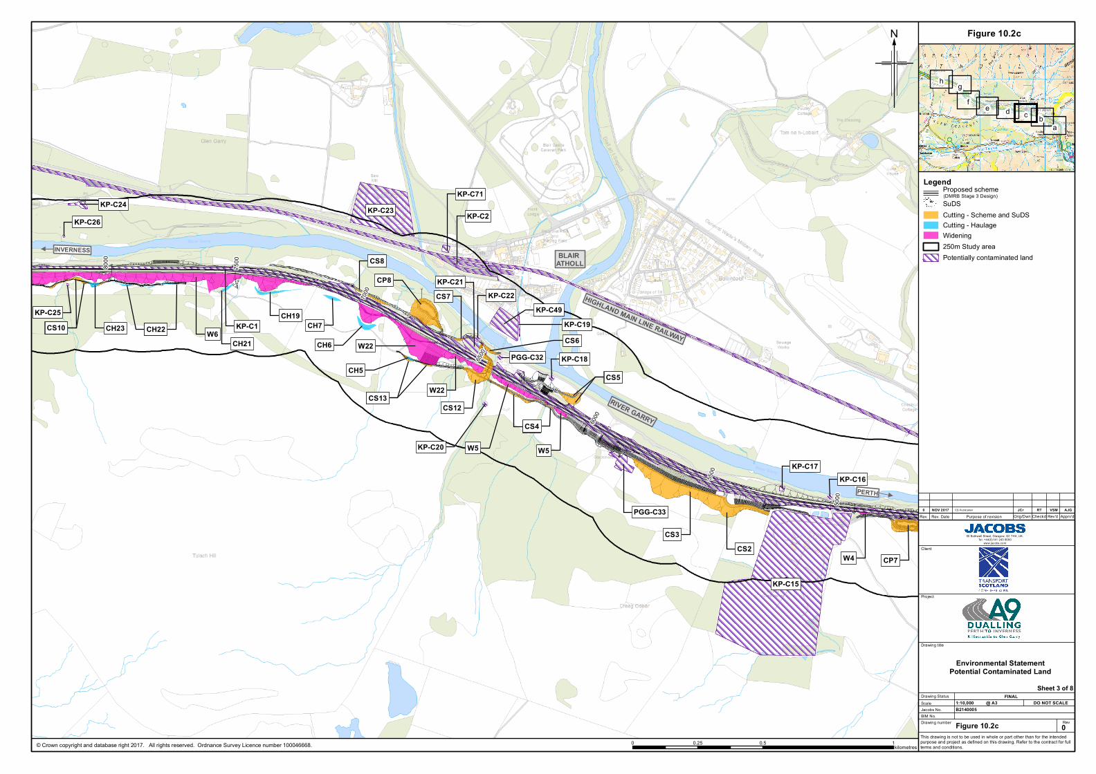
Figure 10.2c
1:10,000
0
JCrNOV 20170 RTES Publication
Drawing Status FINAL
VSM AJG
Environmental StatementPotential Contaminated Land
SuDSCutting - Scheme and SuDSCutting - HaulageWidening250m Study areaPotentially contaminated land
?
N
Rev
Client
Project
Drawing title
Scale
Drawing number
Jacobs No.DO NOT SCALE@ A3
This drawing is not to be used in whole or part other than for the intendedpurpose and project as defined on this drawing. Refer to the contract for fullterms and conditions.
B2140005BIM No.
Rev. Rev. Date Purpose of revision Apprv'dRev'dCheckdOrig/Dwn
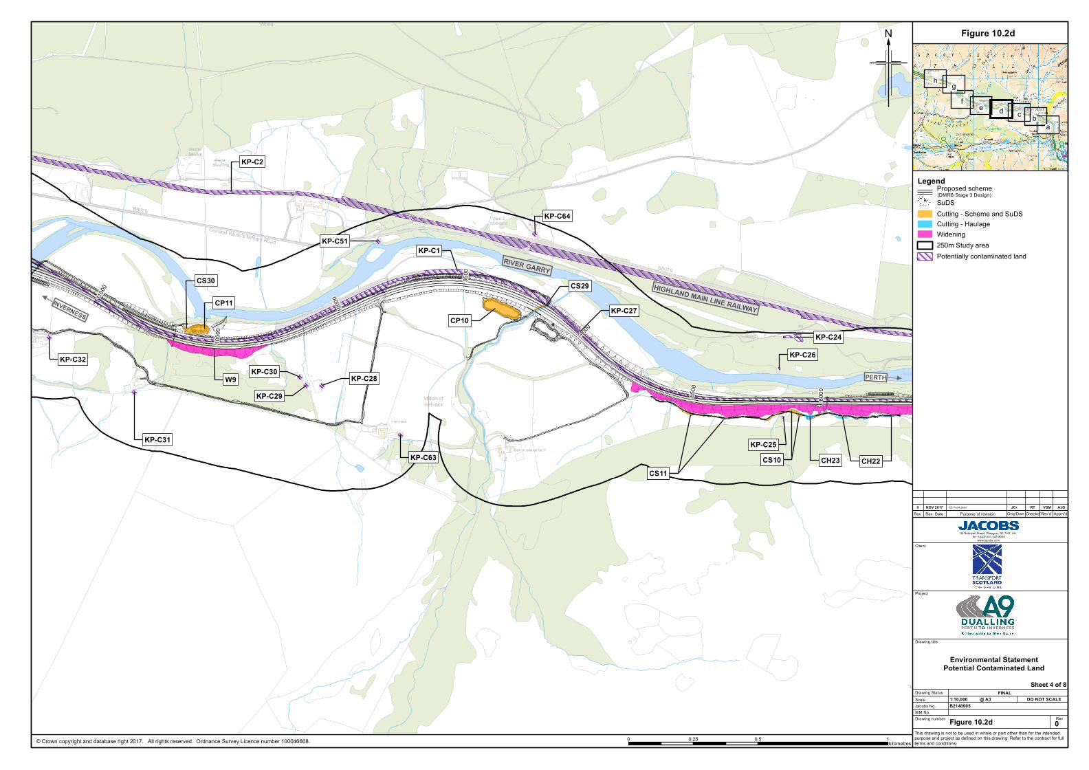
Figure 10.2d
1:10,000
0
JCrNOV 20170 RTES Publication
Drawing Status FINAL
VSM AJG
Environmental StatementPotential Contaminated Land
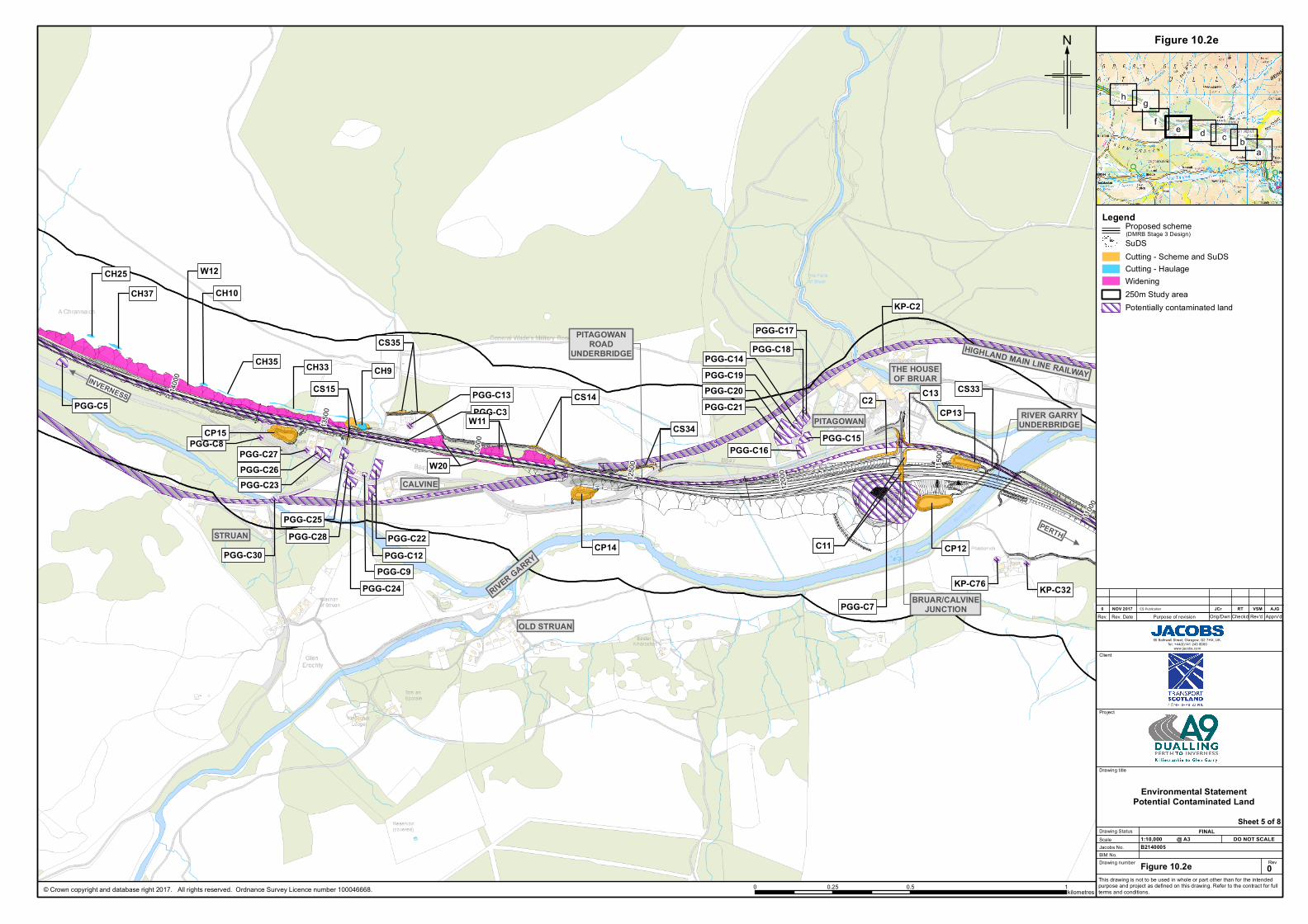
SuDSCutting - Scheme and SuDSCutting - HaulageWidening250m Study areaPotentially contaminated land
?
N
Rev
Client
Project
Drawing title
Scale
Drawing number
Jacobs No.DO NOT SCALE@ A3
This drawing is not to be used in whole or part other than for the intendedpurpose and project as defined on this drawing. Refer to the contract for fullterms and conditions.
B2140005BIM No.
Rev. Rev. Date Purpose of revision Apprv'dRev'dCheckdOrig/Dwn
Figure 10.2e
1:10,000
0
JCrNOV 20170 RTES Publication
Drawing Status FINAL
VSM AJG
Environmental StatementPotential Contaminated Land
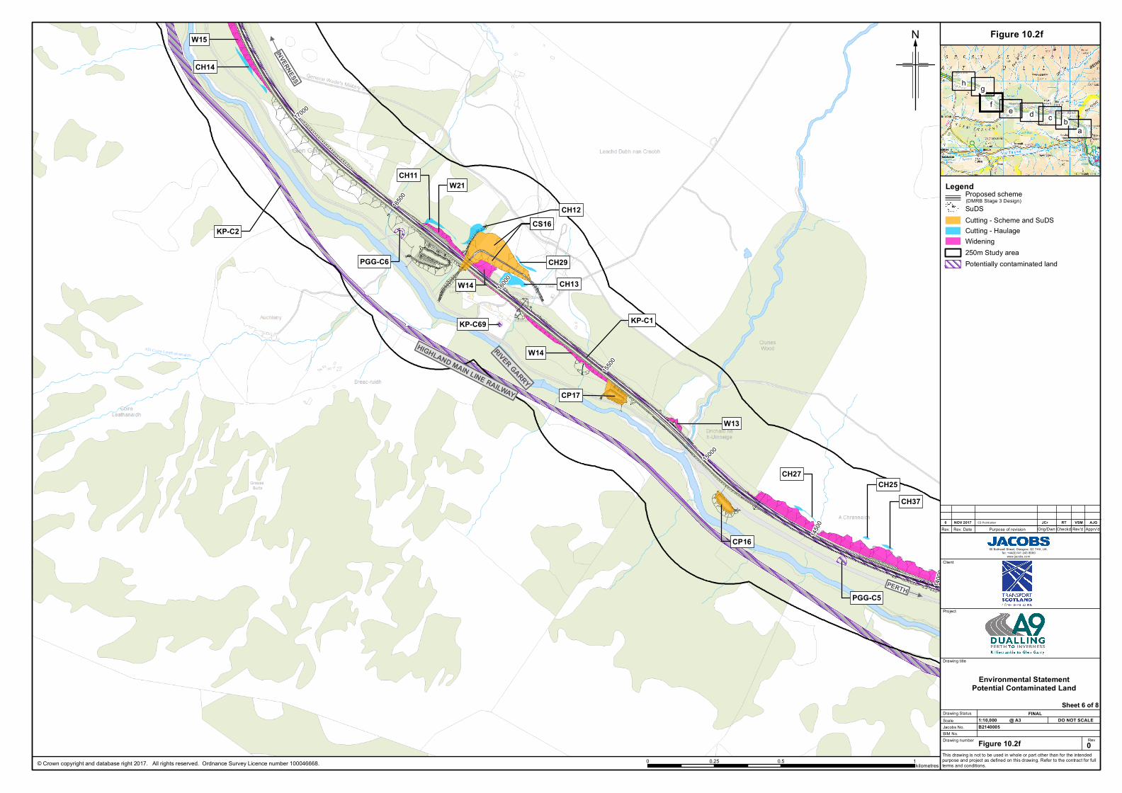
SuDSCutting - Scheme and SuDSCutting - HaulageWidening250m Study areaPotentially contaminated land
?
N
Rev
Client
Project
Drawing title
Scale
Drawing number
Jacobs No.DO NOT SCALE@ A3
This drawing is not to be used in whole or part other than for the intendedpurpose and project as defined on this drawing. Refer to the contract for fullterms and conditions.
B2140005BIM No.
Rev. Rev. Date Purpose of revision Apprv'dRev'dCheckdOrig/Dwn
Figure 10.2f
1:10,000
0
JCrNOV 20170 RTES Publication
Drawing Status FINAL
VSM AJG
Environmental StatementPotential Contaminated Land
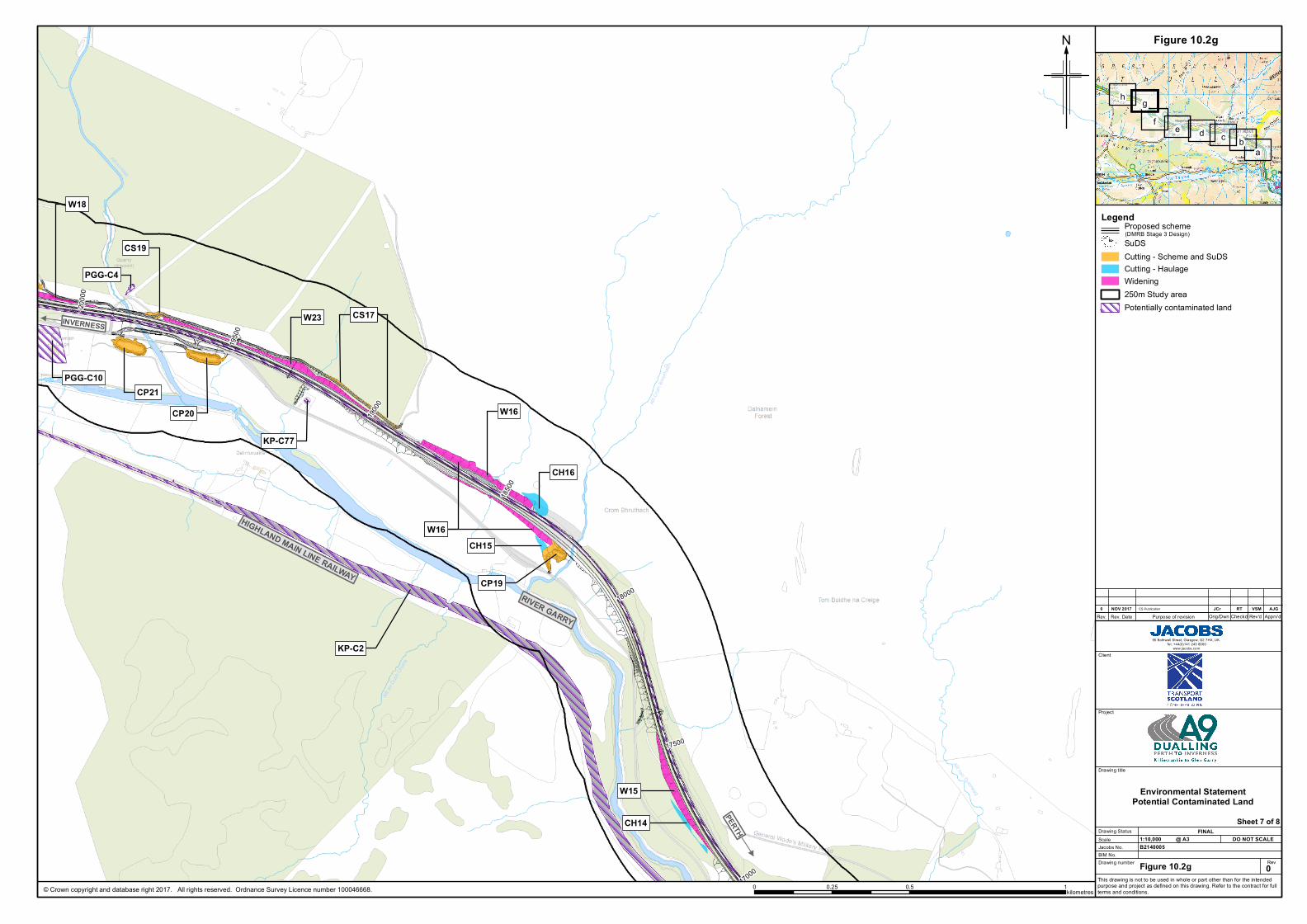
SuDSCutting - Scheme and SuDSCutting - HaulageWidening250m Study areaPotentially contaminated land
?
N
Rev
Client
Project
Drawing title
Scale
Drawing number
Jacobs No.DO NOT SCALE@ A3
This drawing is not to be used in whole or part other than for the intendedpurpose and project as defined on this drawing. Refer to the contract for fullterms and conditions.
B2140005BIM No.
Rev. Rev. Date Purpose of revision Apprv'dRev'dCheckdOrig/Dwn
Figure 10.2g
1:10,000
0
JCrNOV 20170 RTES Publication
Drawing Status FINAL
VSM AJG
Environmental StatementPotential Contaminated Land
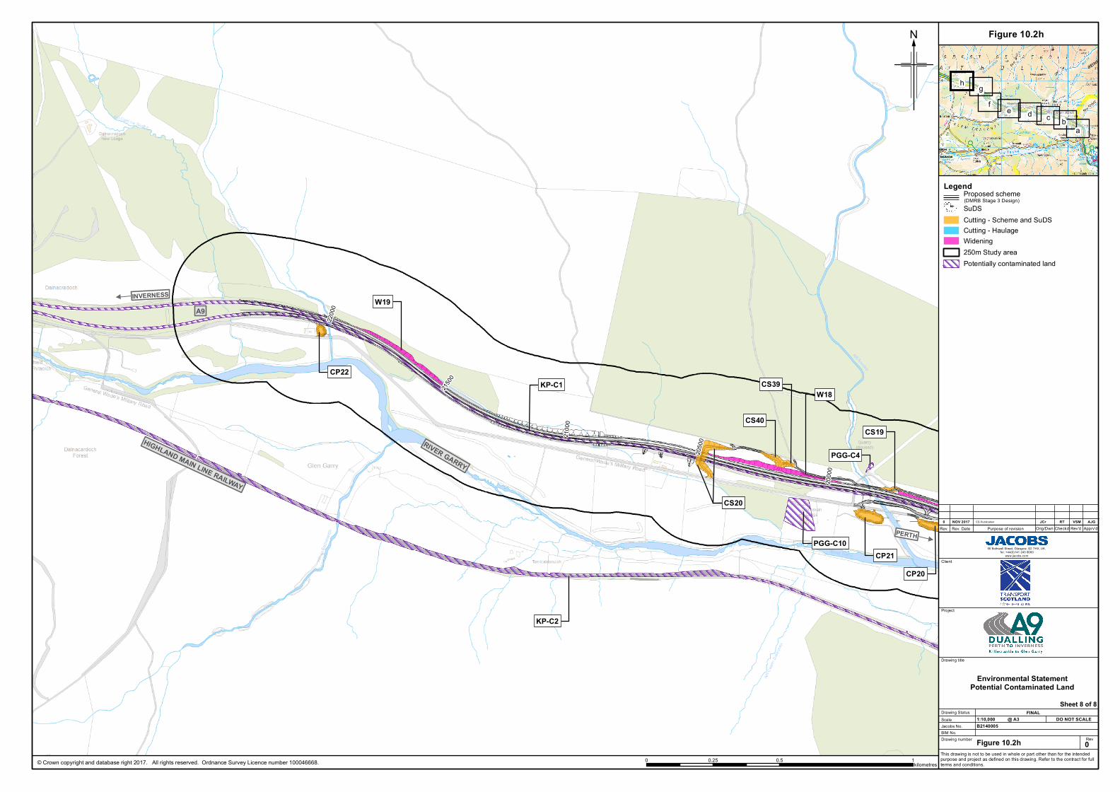
SuDSCutting - Scheme and SuDSCutting - HaulageWidening250m Study areaPotentially contaminated land
?
N
Rev
Client
Project
Drawing title
Scale
Drawing number
Jacobs No.DO NOT SCALE@ A3
This drawing is not to be used in whole or part other than for the intendedpurpose and project as defined on this drawing. Refer to the contract for fullterms and conditions.
B2140005BIM No.
Rev. Rev. Date Purpose of revision Apprv'dRev'dCheckdOrig/Dwn
Figure 10.2h
1:10,000
0
JCrNOV 20170 RTES Publication
Drawing Status FINAL
VSM AJG
Environmental StatementPotential Contaminated Land