44
Sukhothai Uttaradit Phitsanulok Phetchabun

SukhothaiUttaradit Phitsanulok Phetchabun
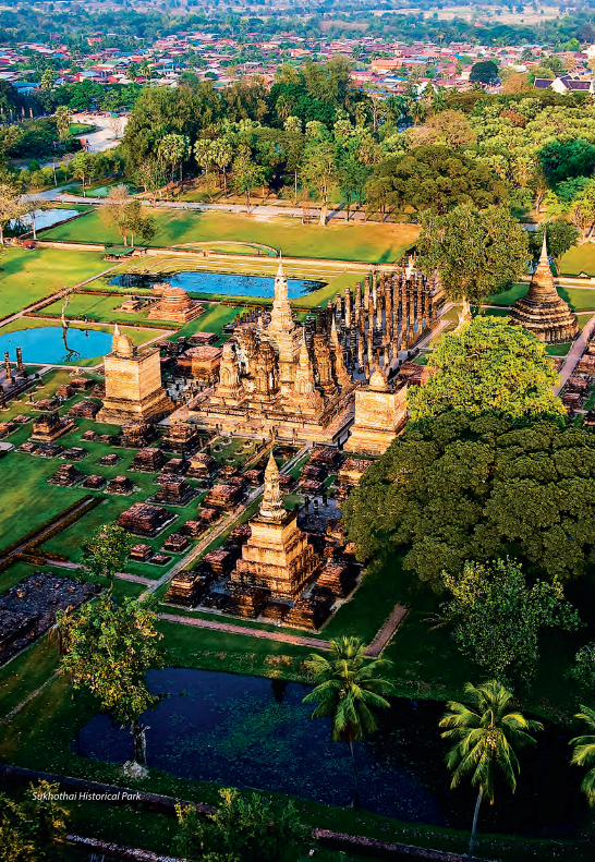
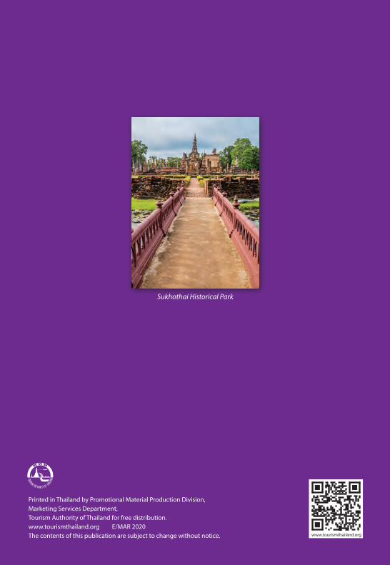
Sukhothai Historical Park

CONTENTS
SUKHOTHAI 8 City Attractions 9 Special Events 21 Local Products 22 How to Get There 22
UTTARADIT 24 City Attractions 25 Out-Of-City Attractions 25 Special Events 29 Local Products 29 How to Get There 29
PHITSANULOK 30 City Attractions 31 Out-Of-City Attractions 33 Special Events 36 Local Products 36 How to Get There 36
PHETCHABUN 38 City Attractions 39 Out-Of-City Attractions 39 Special Events 41 Local Products 43 How to Get There 43

SukhothaiSukhothai Uttaradit Phitsanulok Phetchabun


SUKHOTHAIPhra Achana, , Wat Si Chum
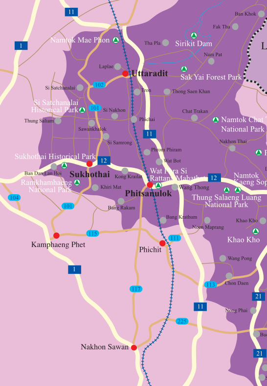
Sukhothai is located on the lower edge of the northern region, with the provincial capital situated some 450 kms. north of Bangkok and some 350 kms. south of Chiang Mai. The province covers an area of 6,596 sq. kms. and is above all noted as the centre of the legendary Kingdom of Sukhothai, with major historical remains at Sukhothai and Si Satchanalai. Its main natural attraction is Ramkhamhaeng National Park, which is also known as ‘Khao Luang’. The provincial capital, sometimes called New Sukhothai, is a small town lying on the Yom River whose main business is serving tourists who visit the nearby Sukhothai Historical Park.
CITY ATTRACTIONSPhra Mae Ya ShrineSituated in front of the City Hall, the Shrine houses the Phra Mae Ya figure, in ancient queen’s dress, said to have been made by King Ramkhamhaeng as a dedication to his late mother Nang Sueang.
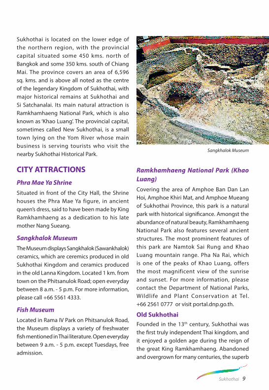
Sangkhalok MuseumThe Museum displays Sangkhalok (Sawankhalok) ceramics, which are ceremics produced in old Sukhothai Kingdom and ceramics produced in the old Lanna Kingdom. Located 1 km. from town on the Phitsanulok Road; open everyday between 8 a.m. - 5 p.m. For more information, please call +66 5561 4333.
Fish MuseumLocated in Rama IV Park on Phitsanulok Road, the Museum displays a variety of freshwater fish mentioned in Thai literature. Open everyday between 9 a.m. - 5 p.m. except Tuesdays, free admission.
Ramkhamhaeng National Park (Khao Luang)Covering the area of Amphoe Ban Dan Lan Hoi, Amphoe Khiri Mat, and Amphoe Mueang of Sukhothai Province, this park is a natural park with historical significance. Amongst the abundance of natural beauty, Ramkhamhaeng National Park also features several ancient structures. The most prominent features of this park are Namtok Sai Rung and Khao Luang mountain range. Pha Na Rai, which is one of the peaks of Khao Luang, offers the most magnificent view of the sunrise and sunset. For more information, please contact the Department of National Parks, Wildlife and Plant Conservation at Tel. +66 2561 0777 or visit portal.dnp.go.th.
Old Sukhothai Founded in the 13th century, Sukhothai was the first truly independent Thai kingdom, and it enjoyed a golden age during the reign of the great King Ramkhamhaeng. Abandoned and overgrown for many centuries, the superb
Sangkhalok Museum
9Sukhothai
temples and monuments of this splendid city have been restored in Sukhothai Historical Park, a UNESCO World Heritage Site. A must-see for all travellers, Sukhothai is one of the most important historical sites in Southeast Asia.
HISTORICAL BACKGROUND Sukhothai, which means “Dawn of Happiness”, was the first kingdom of the Thais, formed after Thai forces drove the Khmers out of the city, a major frontier post of the Khmer Empire, and established it as their capital in 1238. The first king’s son, Ramkhamhaeng, ascended the throne in 1278 and reigned for forty years. A fine warrior, King Ramkhamhaeng the Great made Sukhothai a powerful and extensive kingdom which included many parts of what are today neighbouring countries. King Ramkhamhaeng the Great opened direct political relations with China and made two trips there, from which he brought back Chinese artisans who taught the pottery techniques to the Thais, resulting in the famous Sangkhalok ceramics. A major achievement of his reign was the revision of various forms of the Khmer alphabet into a system suitable for the writing of Thai. The alphabet that the king invented in 1283 is essentially the same that is used today.
The kingdom of Sukhothai during the reign of King Ramkhamhaeng the Great is noted for prosperity and happiness, as recorded in a stone inscription well-known to Thais. “This realm of Sukhothai is good. In the water there are fish; in the fields there is rice. The ruler does not levy a tax on the people who travel along the road together, leading their oxen on the way to trade and riding their horses on the way to sell. Whoever wants to
trade in elephants, so trades. Whoever wants to trade in horses, so trades. Whoever wants to trade in silver and gold, so trades.”
King Ramkhamhaeng the Great also promoted religion and culture, and through his efforts, Buddhism progressed among the people. Inspirational faith gave birth to classic forms of Thai religious art. Images of the Buddha sculpted during the Sukhothai era are cultural treasures which impart a feeling of peace and serenity. Eight kings ruled Sukhothai, whose gradual decline occurred during the last two reigns. The end of the first Thai kingdom came in 1365 when it was reduced to a vassal state by Ayutthaya, a young and rising Thai power to the south, which became the capital for four centuries, succeeded by Bangkok.
Sukhothai Historical ParkThe Park is located 12 kms. from Sukhothai town on the Tak Highway; open daily between 6.00 a.m. - 9.00 p.m. Bicycles can be rented for touring the ruins. The Park’s Tourist Service Centre Tel. +66 5569 7310 provides information and displays models of historical buildings and structures of the old Sukhothai. Lying over an extensive area, ruins of the royal palaces, Buddhist temples, city gates, walls, moats, dams, ditches, ponds, canals and the water dyke control system are preserved, with major restoration by the Fine Arts Department in cooperation with UNESCO.
Inside The City WallsThe core city was surrounded by walls and earthen ramparts; this forms the centre of the historical park. It was rectangular, measuring 1,300 m. by 1,800 m., with four gates. A stone inscription reveals that King Ramkhamhaeng the Great set up a bell at one of the gates. If his
10 Sukhothai
subjects needed help, they could ring the bell and the king would come out to settle disputes and dispense justice. Within the walls are the remains of 35 structures. The most notable are described as follows:
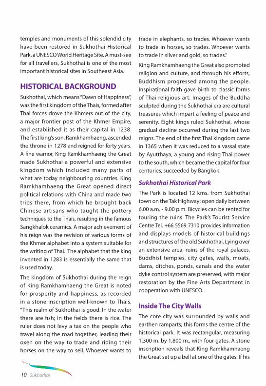
Royal Palace and Wat MahathatThe Royal Palace lies in the centre of the city, surrounded by a moat and contains two main compounds – the royal residence and the royal sanctuary. Here, the famous
stone inscription of King Ramkhamhaeng the Great was found by King Mongkut (Rama IV ) in the 19th century together with par t of the stone throne cal led Manangkhasila-at. King Ramkhamhaeng the Great set up a throne in the midst of a sugar-palm grove where, at his request, a monk preached on Buddhist holy days and the king conducted the affairs of state on other days. This throne was later installed in Bangkok’s Temple of the Emerald Buddha.
Lying west of the Royal Palace compound is Wat Mahathat, the royal sanctuary, which is Sukhothai’s largest temple with a customary main chedi in a lotus-bud shape and ruined wihan (image hall). At the base of the chedi are Buddhist disciples sitting in adoration, and on the pedestal are sitting Buddha images. In front of this reliquary is a large hall formerly containing a remarkable sitting bronze Buddha image of the Sukhothai style, which was cast and installed by King Lithai of Sukhothai in 1362. In the late 18th century, the image was moved to the Wihan of Wat Suthat in Bangkok under the command of King Rama I and has since been named Phra Si Sakaya Muni. In front of the large hall is another smaller one which was probably built during the Ayutthaya period. Its main Buddha image (8 m. high) was installed inside a separate building. In front of the southern image, a sculpture called Khom Dam Din was found, now kept in the Mae Ya Shrine near the Sukhothai City Hall. To the south stands a pedestal of a large stepped chedi adorned with beautiful mural paintings, whose lowest platform is adorned with beautiful stucco figures of demons, elephants, and lions with angels riding on their backs.
Wat Mahathat
11Sukhothai

King Ramkhamhaeng the Great MonumentSituated to the north of Wat Mahathat, the bronze statue of King Ramkhamhaeng the Great sits on a throne with a bas-relief at the base depicting the king’s life.
Wat Si SawaiSituated amid magnificent scenery southwest of Wat Mahathat is Wat Si Sawai, with three prangs surrounded by a laterite wall. Inside
the wall, the wihan in the west, built of laterite, is separated from the main prang (Khmer-style pagoda) which was constructed in the Lop Buri or Hindu-style. A trace of the Hindu sculpture ‘Sayomphu’ was found here, indicating that this was originally a Hindu shrine, later converted into a Buddhist temple.
Wat Traphang NgoenSituated to the west of Wat Mahathat is Wat Traphang Ngoen with its square pedestal,
King Ramkhamhaeng the Great Monument Wat Mahathat
12 Sukhothai

main sanctuary and stucco standing Buddha image measuring four niches. There is a wihan to the front, and to the east of the pond is an island with an ubosot (assembly hall). This edifice has crumbled and only its pedestal and laterite columns remain. Many monuments and magnificent scenery are visible from this location.
Wat Sa SiLocated to the northwest of Wat Mahathat, Wat Sa Si is a historical ancient site that is situated on an island in the middle of the pond called Traphang Trakuan. The most prominent feature of this temple is the Lankan-style bell-shaped chedi. Wat Sa Si regarded as one of the most scenic sites in Sukhothai.
Wat Chana SongkhramSituated to the north of Wat Mahathat is Wat Chana Songkhram. Its main sanctuary is
a round Singhalese-style chedi. In front of the chedi is the base of a wihan and behind the chedi stands an ubosot. Bases of twelve small chedi are also visible. Near Charot Withithong Road is a strange chedi with three bases, one on top of the other.
San Ta Pha Daeng or Deity ShrineSituated to the north of Wat Mahathat is San Ta Pha Daeng. This monument consists of a single laterite prang with a staircase in the front. Sandstone Hindu divine objects (Lop Buri-style) were found here.
Wat MaiSituated to the north of Wat Mahathat is Wat Mai. The main sanctuary is an Ayutthaya-style brick wihan with its columns made of laterite. A bronze image of Buddha under a Naga (a Lop Buri-style image) was found here and is now preserved in the Ramkhamhaeng National Museum.
Wat Chana Songkhram
13Sukhothai

Wat Traphang ThongSituated to the east of Wat Mahathat is Wat Traphang Thong, which is located on an island in the middle of the large pond. There is a ruined laterite Singhalese-style chedi and a new mondop containing the Lord Buddha’s Footprint slab that was created by King Lithai in 1390. An annual fair to worship this sacred footprint takes place during the Loi Krathong Festival.
Ramkhamhaeng National MuseumThe museum offers an outstanding introduction to the arts and crafts of Sukhothai and its vassal cities, displaying objects unearthed or collected from Sukhothai and nearby provinces. Inside the spacious building are Khmer statues, Sukhothai-style Buddha statues, Sawankhalok ceramics and other archaeo- logicalartefacts gathered from the area.
Open everyday between 8.30 a.m. - 4.30 p.m. For more information, call +66 5569 7026.
Outside The City walls
The Sites to the North
Wat Phra Phai LuangThis temple lies 500 m. north of San Luang Gate (nor thern gate) . This sanctuar y, formerly a Khmer-Hindu Shrine but later c o n v e r t e d i n t o a B u d d h i s t t e m p l e , is surrounded by a moat. It is second in importance to Wat Mahathat. Inside, there are three prangs like Wat Si Sawai, but the southern and the central ones have crumbled leaving only the northern one that shows the beautiful decoration of stucco figures. In front of these prangs are a wihan and a crumbled chedi; the latter has a pedestal decorated with stucco of sitting Buddha images. A mondop
Wat Phra Phai Luang
14 Sukhothai

contains ruined Buddha images in four postures – sitting, reclining, standing and walking. A Sivalinga (phallic emblem of Hindu gods) was unearthed in the compound of this sanctuary.
Ruins of the Old Celadon Factory (Thuriang Kiln)Thuriang Kiln is a site where Sukhothai celadons were made. Kilns found in this area measuring 100 m. by 700 m. Each kiln is divided into three sections; the fire area, the baking oven and the fuel. The pottery unearthed here mostly has three painted designs on the bottom – a disc, a fish and a f lower. For t y-n ine k i lns and smal l edifices are found, and there is a pond which was dug into the stone located to the north of the site.
Wat Si ChumThis lies about 1,500 m. north of Wat Mahathat and was originally surrounded by a moat. A square mondop (an edifice which is square in plan, cubicle in form, with a pyramidal superstructure for roofing), which is the main sanctuary, contains a monumental stucco-over-brick Buddha image in the attitude of Subduing Mara, called Phra Achana. This Buddha measures 11.3 m. from knee to knee. The width of the mondop is 32 metres on each side and the height is 15 metres, while the walls are 3 metres thick. There are remains of the passageway in the left inner wall which leads to the above crossbeam. On the ceiling of the passageway are more than fifty engraved slate slabs illustrating scenes from the Jataka epic.
Wat Si Chum
15Sukhothai

The Sites to the West
Wat Saphan HinSituated on a 200-metre-high hill, the sanctuary is approached by a pathway of slate slabs.
Wat Chang Rop This temple features a bell-shaped chedi on a square base decorated with 24 sculptures of elephant, which is the origin of the name of the temple ‘chang rop’ which means ‘surrounded by elephants’.
Phra Ruang DamThis earthwork dam was built to hold back water between Khao Phra Bat Yai and Khao Kio-Ai-Ma since the ancient period, and was referred to in the famous Sukhothai stone inscription. It was later restored by the Irrigation Department.
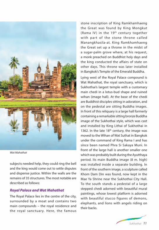
The Site to the SouthWat ChetuphonThis temple features a mondop enshrining four Buddha images in different postures– sitting, standing, walking, and reclining. The outer walls of the mondop still retain a section in the form of a slate pillar with balustrade window. There is an entrance to the mondop to the north. Just behind the mondop is a small sanctuary which contains a Buddha image known locally as Phra Si Ariya Mettrai, the Future Lord Buddha.
The Sites to the EastWat Chang LomThis temple is located to the north of Charot Withithong Road with a bell-shaped chedi of Ceylonese influence standing at the centre. The chedi is situated on a three-tiered square base with a platform decorated with rows of
Wat Saphan Hin
16 Sukhothai
elephants. This type of elephant-decorated chedi is to be seen in many ancient towns of the Sukhothai period; for example, Kamphaeng Phet and Si Satchanalai.
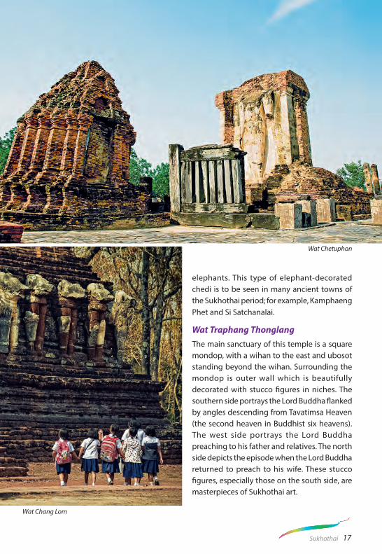
Wat Traphang ThonglangThe main sanctuary of this temple is a square mondop, with a wihan to the east and ubosot standing beyond the wihan. Surrounding the mondop is outer wall which is beautifully decorated with stucco figures in niches. The southern side portrays the Lord Buddha flanked by angles descending from Tavatimsa Heaven (the second heaven in Buddhist six heavens). The west side portrays the Lord Buddha preaching to his father and relatives. The north side depicts the episode when the Lord Buddha returned to preach to his wife. These stucco figures, especially those on the south side, are masterpieces of Sukhothai art.
Wat Chetuphon
Wat Chang Lom
17Sukhothai

Ramkhamhaeng National Park (Khao Luang Sukhothai)This exquisite national park with a combined natural and historical background covers an area of 341 sq. kms. of high hills and steep cliffs, some over 1,200 m. high. The park features natural attractions; such as, waterfalls, varied vegetation and wildlife, alongside archaeological remains. This park is accessed via Highway 101 south from Sukhothai for about 20 kms., then west via a 16 km. laterite road. Trekkers are required to bring their own food and essential equipment with them. Bungalows and tents are available. For more information, please contact the Department of National Parks, Wildlife and Plant Conservation at Tel. 1362 or Contact Visitor center Tel. +66 2561 0777 or visit portal.dnp.go.th.
Sawankhaworanayok National MuseumLocated at Sawankhalok town, 38 kms. north of Sukhothai via Highway 101, the Museum features sculptural art from various periods and Sangkhalok (Sawankhalok) pottery from the Sukhothai era, some of it retrieved from sunken vessels in the Gulf of Thailand. Open everyday between 8.30 a.m.- 4.30 p.m.; except Monday, Tuesday and public holidays. For more information, call +66 5564 3166, +66 5564 1571.
Si Satchanalai Historical ParkSi Satchanalai Historical Park contains the remains of Sukhothai-era Structures in a park and setting similar to Sukhothai Historical Park. The 13th to 15th century ruins of 134 structures have been discovered and are located beside the Yom River among hills and are less restored than those of Sukhothai’s. The ancient site was the kingdom’s second city and the residence of
the crown prince. It enjoyed great importance, as demonstrated by the size of its remains. This park is open everyday between 8.00 a.m. - 5.00 p.m. For more information, call +66 5575 0714.
Wat Phra Si Rattana Mahathat This temple, also called Wat Phra Borommathat Mueang Chaliang or Wat Phra Prang, is situated 3 kms. to the south of the ancient Si Satchanalai’s walls. An immense laterite prang, which is on
Wat Phra Si Rattana Mahathat
18 Sukhothai

a square base, marks the centre of the temple. A steep staircase in front of the prang leads to a room where a reliquary is enshrined.
Wat Khao Phanom Phloeng This is a hilltop temple within the old town of Si Satchanalai. A laterite chedi in the centre, a large wihan or image hall in the front and a small sanctuary at the back all appeared as ancient ruins. Some laterite pillars and a damaged Buddha image constructed of laterite slabs and coated with mortar are also visible.
Wat Khao Suwan KhiriThe hilltop temple is situated 200 m. from Phanom Phloeng Hill. A huge bell-shaped chedi on a five-tiered base marks the centre of the temple. Ruins of a wihan, chedi and fragments of huge stucco figures scattered on the ground. The similarity between some figures here and those at Wat Chang Lom lead to the belief that King Ramkhamhaeng the Great had this temple constructed.
Wat Chang Lom A huge bell-shaped chedi supported by 39 elephants, with four at the cardinal points to mark the centre of the temple. Above the chedi’s base are the niches enshrining Buddha images in the Subduing Mara posture.
Wat Chedi Chet Thaeo This is one of the most beautiful temples in Sukhothai Province. Stupa of different artistic styles and influence were built here. Remnants of old mural paintings can still be seen in some stupa.
Wat Suan Kaeo Utthayan YaiLocated near Wat Chedi Chet Thaeo, across a dirt road, this temple has the ruins of a large image hall. It is also called Wat Kao Hong, which means the Nine-Roomed Temple.
Wat Nang PhayaThis temple is famous for its delicate stucco reliefs on the remains of the northwestern wall of the seven-roomed wihan. The pillars
Wat Chang Lom Wat Chedi Chet Thaeo
19Sukhothai

are decorated with unglazed ceramic designs. The central laterite stupa is surrounded by lamp-posts and accessible by a set of narrow stairs.
Wat Suan Kaeo Utthayan NoiThis temple’s ruins consist of a frontal wihan housing a Buddha image and complete with a laterite roof.
Sangkhalok Kiln Site Study and Conser-vation CentreAt one time, hundreds of huge pottery kilns lined the Yom River in this area and several of these have been carefully excavated. One of the kilns that can be viewed in the centre is in an oval shape, with a curved roof and around 7-8 m. wide, while a large outdoor kiln is situated a short distance away. The centre displays pottery and potsherds, found in the area and information on the evolution of ancient ceramics. Located some 4 kms. north of Si Satchanalai, the centre is open daily between 9 a.m. - 4 p.m. To get there, drive 6.5 kms. north
of Si Satchanalai Historical Park to Ban Ko Noi, on Highway No.1201 from Si Satchanalai.
Si Satchanalai National ParkCovering an area of 213 sq. kms., this forest and mountain park offers trekking routes to waterfalls, caves and a hot spring. The park is about 100 km. from Sukhothai via Highways 1113 and 1294 and can be reached by a local bus from Si Satchanalai where there is accommodation provided. For reservations and more information, contact Tel. +66 2579 6666, +66 2561 0777 or +66 5561 9214-5 or visit portal.dnp.go.th.
Ban Thung LuangSituated in Tambon Thung Luang, Amphoe Khiri Mat, around 17 kms. from the Sukhothai town centre, Ban Thung Luang is famous for producing unique pottery. Over 200 families residing at this village produces pottery, using the ancient techniques that have been passed down through generations. For more information, contact Tel. +66 5569 3451, +66 8 1972 2644
Wat Nang Phaya Wat Chedi Chet Thaeo
20 Sukhothai

SPECIAL EVENTSSi Satchanalai Ordination Celebration
April Locally called Buat Chang Hat Siao, this event is held at Hat Sieo, Si Satchanalai, and is arranged by the local Thai Phuan people. It features a spectacular procession of ordination candidates (men about to become Buddhist
monks) in colourful costumes on the backs of some 20-30 decorated elephants.
Songkran Festival
13-15 April This is the traditional Thai New Year celebration, also known as the Water-splash Festival. Songkran was mentioned in the famous stone inscription dating from the reign of King Ramkhamhaeng the Great.
Sukhothai Loi Krathong and Candle Festival
21Sukhothai

22 Sukhothai
Sukhothai Loi Krathong and Candle Festival
November
Sukhothai Historical ParkHeld on the full moon night of the 12th lunar month, Loi Krathong Festival originated in Sukhothai and is now celebrated throughout the kingdom. Krathong, the lotus-blossom-shaped vessels made of banana leaves and containing a candle, incense sticks, flowers and coins, are floated on the rivers, lakes or canals. Other activities include the Krathong design contest, the cultural arts and traditional Thai musical performances, Nang Nopphamat Beauty Contest, and lighting of lanterns.
LOCAL PRODUCTSFamous for the Sangkhalok Pottery; such as, the Thung Luang terra cotta of Khiri Mat, Sukhothai also offers other variety of products; including, the handmade ancient-style gold and silver products of Si Satchanalai, fried peanuts of Si Samrong which is called “200-year fried peanuts” as it is an old recipe that has been passed on through generations, and Hat Siao fabric of Si Satchanalai, made by descendants of Thai Phuan migrants from Lao PDR.
HOW TO GET THEREBy CarFrom Bangkok, take Highway 1 then Highway 32 north to Nakhon Sawan. Highway 32 becomes Highway 1 again, follow all the way to Kamphaeng Phet, then take Highway 101 to Sukhothai, a total distance of 440 kilometres, or about 6-hour drive.
By BusAir-conditioned buses depart from Bangkok Bus Terminal on Kamphaeng Phet II Road for Sukhothai (7-hour journey). For more information, contact call center 1490 or +66 2936 2852-66, or visit home.transport.co.th.
By RailThe nearest railway station is at Phitsanulok, from where there are frequent bus services to Sukhothai, some 50 km. away. Trains depart from Bangkok’s Hua Lamphong Station. Contact State Railway of Thailand at 1690 or visit www.railway.co.th for more information.
By AirBangkok Airways operates a one-hour direct flight from Bangkok to Sukhothai on a daily basis.For more information, contact Tel. +66 2270 6699, Hotline 1771 or visit www.bangkok air.com.
Nok Air also operates daily fly and ride service,
Please contact Tel. +66 2900 9955, 1318 or visit
www.nokair.com. Locating within the Sukhothai airport, which is about 30 kms. north of the town, is the Organic Agriculture Project. This worth-visiting place was awarded the outstanding performance in the Thailand Tourism Award in 2010. Here visitors can find organic rice, vegetable, fruits and chemical- free plants; such as, orchids, and an organic food restaurant is also available. For more information, please contact Khrua Sukho at Tel. +66 5564 7290 .

23Sukhothai
Sukhothai Historical Park
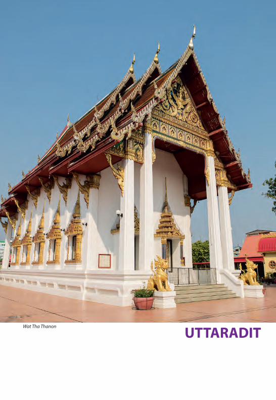
UTTARADITWat Tha Thanon
A province in the Lower North, Uttaradit has a long history going back to at least the Sukhothai period, which is around the 13th century. Today, it is most noted for the cultivation of ‘langsat’ fruit and for the major lake formed by the Sirikit Dam. The provincial capital is located 491 kms. from Bangkok and the province covers an area of 7,838 sq. kms. The original town, called Bang Pho Tha It, was located on the right bank of the Nan River. A flourishing port for regional trade, it was renamed Uttaradit, literally means the Port of the North, by King Rama V (1868-1910) and made a provincial capital. When the northern railway line was built in the early 20th century with a stop at Uttaradit, the town received a further boost. Unfortunately, the town centre was largely destroyed in a fire in 1967 and was rebuilt in a modern style.
CITY ATTRACTIONSWa t Tha mma Thipa ta i ( Wa t Ton Makham)At this temple, the door panels of the large and ancient wihan of Wat Phra Fang are kept. The wooden panels are 2.2 m. wide and 5.3 m. tall and are carved in the graceful style of the Late Ayutthaya Period. These door panels are only second to those of Wat Suthat in Bangkok.
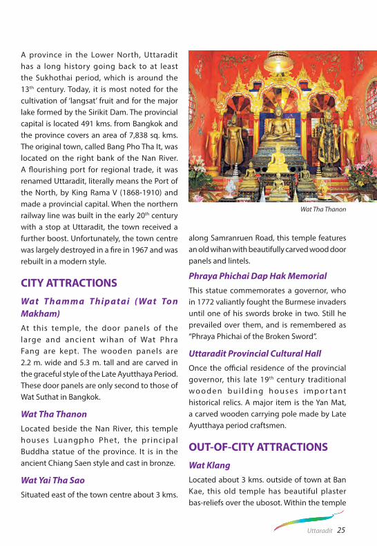
Wat Tha Thanon Located beside the Nan River, this temple houses Luangpho Phet, the pr incipal Buddha statue of the province. It is in the ancient Chiang Saen style and cast in bronze.
Wat Yai Tha SaoSituated east of the town centre about 3 kms.
along Samranruen Road, this temple features an old wihan with beautifully carved wood door panels and lintels.
Phraya Phichai Dap Hak MemorialThis statue commemorates a governor, who in 1772 valiantly fought the Burmese invaders until one of his swords broke in two. Still he prevailed over them, and is remembered as “Phraya Phichai of the Broken Sword”.
Uttaradit Provincial Cultural HallOnce the official residence of the provincial governor, this late 19th century traditional w o o d e n b u i l d i n g h o u s e s i m p o r t a n t historical relics. A major item is the Yan Mat, a carved wooden carrying pole made by Late Ayutthaya period craftsmen.
OUT-OF-CITY ATTRACTIONSWat KlangLocated about 3 kms. outside of town at Ban Kae, this old temple has beautiful plaster bas-reliefs over the ubosot. Within the temple
Wat Tha Thanon
25Uttaradit

are rare wall murals of the Early Rattanakosin period style depicting the Jataka and assemblage of celestial beings.
Wat Phra Boromathat Thung YangLocated about 3 kms. from town on Highway 102, this old temple, once called Wat Mahathat, has a large round Sri Lankan style chedi enshrining a holy relic.
Wat Phra Yuen Phutthabat YukhonSituated near Wat Phra Boromathat Thung Yang, this temple features a Chiang Saen-style mondop sheltering holy footprints. It also houses a bronze Sukhothai-style Buddha statue.
LaplaeAn ancient community dating from the Ayutthaya period, Laplae is an attractive place to visit with old wooden houses, hand-woven textiles and other craft specialties. It is also a major producer of langsat, the province’s famous fruit, as well as a local variety of durian called “long laplae”. It lies west of town via Highway 102 for 3 kms., then to the right along Highway
1041 for a further 6 kms.
Wat Phra Tan Sila - AsanaLocated near Laplae, this temple is believed to be of the Sukhothai Period. Its major feature is the base of a sermon platform built with laterite.
Namtok Mae Phun Located at Ban Ton Klua, about 20 kms. from town, the waterfall features multi-level cascades amid pleasant natural surroundings.
Sirikit DamSituated at Tha Pla some 68 kms. from town on the Uttaradit-Tha Pla Road, this is the country’s largest earthen dam. Stemming the Nan River, the dam is 800 m. wide. The large lake has beautiful scenery and during the cool season the landscape is covered in a profusion of colourful flowers and blooms. Accommodation and boating services are available.
Sak Yai Forest ParkThis park, located in Amphoe Nam Pat about 80 kms. from town on Highways 1045,
Wat Phra Boromathat Thung Yang Wat Phra Tan Sila - Asana
26 Uttaradit

1146 and 1047, features the largest teak tree in the world. It has a circumference of 9.87 m. and an age of about 1,500 years. Unfortunately, its top was broken off in a storm, cutting its height from 48.5 m. to 37 m., but it is still alive.
Bo Lek Nam PhiHere swords and other weapons were forged from high quality steel. There are two mines still in existence, whose ores are believed to have
been used to make only the king’s swords. This ancient site is reached by going to Thong Saen Khan (42 kms. southeast of town), then taking Highway 1245 for 14 kms.
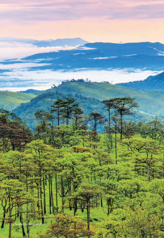
Phu Soi Dao National ParkHaving been dubbed as “the flower field amidst the pine forest”, Phu Soi Dao National Park features beautiful natural landscape and is one of the popular tourist attractions. Covering a vast area of Amphoe Ban Khok,
Namtok Mae Phun Sak Yai Forest Park
27Uttaradit
28 Uttaradit
Phu Soi Dao National Park

29Uttaradit
Amphoe Huai Mun, Amphoe Nam Pat of Uttaradit Province and Amphoe Chattrakan of Phitsanulok Province, the park’s office is located at Amphoe Nam Pat near Namtok Phu Soi Dao, which is the most prominent feature of this park. Namtok Phu Soi Dao is a magnificent 5-tiered waterfall, which can be easily accessed. A walking trail leads visitors to the top of the mountain, where sea of fog is clearly visible in the morning. Camping site is available at the park but please contact the Park officers in advance. For more information, please contact the Department of National Parks, Wildlife and Plant Conservation at Tel. +66 2561 0777 or visit portal.dnp.go.th.
SPECIAL EVENTSThe Tradition of Buddha Cremation 6th lunar month (Usually in May)A unique religious ritual is performed at Wat Phra Boromathat Thung Yang after the full moon day of the 6th lunar month. It features a re-enactment of the Buddha’s funeral ceremony.
Langsat Day Fair
Late September Langsat-growing has long been the main occupation of the local people, and Uttaradit organises this fair to celebrate the province’s famous fruit. The fair features exhibitions, contests and parades of floats decorated with fruits and flowers, as well as entertainment.
LOCAL PRODUCTSInteresting items include woven materials with lovely designs and colours, and preserved fruit; such as, the chewy ‘Kluai Kuan’ made from bananas.
HOW TO GET THEREBy Car1. From Bangkok, take Highway 1 (alter native: Highway 32 after Ayutthaya) to Nakhon Sawan, then Highway 117 to Phitsanulok, then Highways 12 and 11 to Uttaradit.
2. From Bangkok, take Highway 1 to Ayutthaya, then Highway 32 to In Buri, then Highway 11 to Uttaradit.
By BusAir-conditioned and non air-conditioned buses depart from Bangkok Bus Terminal on Kamphaeng Phet II Road for Uttaradit. For more information, call +66 2936 2852-66, Call Center 1490 or visit home.transport.co.th.
By RailTrains depart from Bangkok’s Hua Lamphong Station for Uttaradit everyday. Contact State Railway of Thailand at 1690 or visit www.railway.co.th for more information.
Namtok Phu Soi Dao
PHITSANULOKPhra Phuttha Chinnarat

A major province of the Lower North, Phisanulok is located where the Central Plains begin to rise into the Northern region. The provincial capital is 377 kms. north of Bangkok and boasts a nationally important temple. Most of the terrain is flat, contrasted by mountain ranges running along the east where waterfalls and national parks offer opportunities for nature treks. The town of Phitsanulok, situated on the banks of the Nan River, has been a major community since ancient Khmer times and enjoyed great prosperity during the Sukhothai and Ayutthaya periods. During 1463-1487, the city served as the royal capital as King Boromtrailokanat of Ayutthaya resided permanently in the province. Unfortunately, most of the city was destroyed by a fire, and today it is built in the modern style.
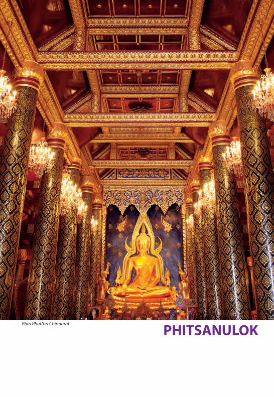
CITY ATTRACTIONSWat Phra Si Rattana MahathatThis nationally important temple, commonly called Wat Yai, has its origin dating back to the 14th century and is situated on the river’s east bank. The wihan houses what is regarded as the most beautiful and graceful Buddha statue in Thailand – the large bronze sitting statue of Phra Phuttha Chinnarat in the Sukhothai style, dating from the 14th century. A celebration honouring the Chinnarat Buddha image is held in late January. Other prominent features are the hall’s large pearl-inlaid doors made in 1756 by royal craftsmen and an 8-metre tall standing Buddha image called Phra Attharot. Phra Attharot, which was cast in the same period as the Chinnarat Buddha, was originally housed in a large hall which has now crumbled away. In the centre of the compound is a great Khmer-style
pagoda or prang. It is thought the structure was originally a lotus bud-shaped stupa of Sukhothai style, and was altered into a prang during the early Ayutthaya period.
Wat Nang PhayaWat Nang Phaya is located on the eastern bank of the Nan River, near Wat Phra Si Rattana Mahathat to the south. Both temples are assumed to be built when Phitsanulok City was ruled by King Boromtrailokanat, have linking compounds. Wat Nang Phaya features a wihan but there is no ubosot and it is known for the so-called “Phra Nang Phaya” votive tablet which is one of the famous 5 greatest auspicious amulets in Thailand.
Wat RatchaburanaSituated on the east bank of the Nan River and south of Wat Phra Si Rattana Mahathat, this temple also survived the fire. The ordination hall features a graceful three-headed Naga (mythical serpent) over its eaves and murals painted \in the early 19th century. It was built by King Boromtrailokanat who played
Wat Ratchaburana
31Phitsanulok

a major role in fostering Buddhism in the province.
Wat Chedi Yot ThongLocated on Phaya Sua Road, this temple has a 15th century lotus bud-shapedz chedi of the typical Sukhothai style, the only such structure left in the province.
Wat Chula ManiLocated on the east bank of the Nan River, about 5 kms. south of the town centre on the Boromtrailokanat Road, this temple was the site of the original town. King Boromtrailokanat,
accompanied by more than 2,000 followers, was ordained as a monk here in 1416. An important ancient structure in the temple is the hall containing a holy footprint and inscription stone built by King Narai the Great of Ayutthaya. There is also a Khmer-style pagoda (Prang) built with laterite, adorned with intricate swan designs.
King Naresuan the Great ShrineThe Shrine is located on the site of the former Chan Palace, the birthplace and residence of King Naresuan the Great who is a revered king famous for defending the nation from the Burmese. Located close to the river on the west bank, it features a statue of the King declaring independence from Burma.
Sergeant-Major Dr. Thawi-Pim Buranakhet’s Folklore MuseumThis museum on Wisutkasat Road is regarded as the folklore museum with the greatest collection of indigenous arts and utensils. A labour of love by Dr. Thawi, the museum displays pottery, kitchenware, agricultural tools and musical instruments, all reflecting the lifestyle and creativity of the traditional community. Open Tuesday to Sunday between 8.30 a.m. - 4.30 p.m.
Buddha - Casting FoundrySituated opposite the Folklore Museum and also created by Dr. Thawi, the Foundry specialises in casting bronze Buddha images and statues, mostly replicas of the Chinnarat Buddha in all sizes. It is open on Tuesday to Sunday between 8.30 a.m. - 4.30 p.m.
City Walls Originally made of clay like those of Sukhothai, the city walls were built during the Ayutthaya
Wat Chula Mani
32 Phitsanulok

period to deter raids from Lanna and Burma and the remnants can be seen to the north and east of town. Part of the old 12 m. wide city moat still exists to the west of town parallel to Phra Ruang Road. Located within the compound of Phitsanulok Phittayakhom School are the remains of Chan Palace, the birthplace of King Naresuan the Great, which are being excavated at present.
OUT-OF-CITY ATTRACTIONSHighway 12 Scenic RouteCutting through the eastern mountain ranges of Phitsanulok, the route offers a series of attractive forested areas and waterfalls within national parks. To visit these places, transport can be hired in town. One of the highlights is Namtok Wang Nok Aen, within the Sakunothayan Arboretum, which is 1 km. off the main highway at Km.33, with Kaeng Sai Rapids
locating nearby. At Km.45 lies Namtok Kaeng Song Waterfall. At Km.72 and a further 2 km. off the road is an extensive three-level waterfall called Namtok Kaeng Sopha, which runs over massive rock formations amongst lush vegetation. The best time to visit all waterfalls is from September to December when the water flows are at the maximum.
Thung Salaeng Luang National ParkThis protected area of mountain forests and grasslands covers 1,262 sq. kms. The park office, where information may be obtained and accommodation booked, is at Km.80 on Highway12. The grasslands are bright with flowers, particularly during the late rainy season (October). The mountain ranges are watersheds feeding several streams flowing into the Nan River. A good walking trail starts from the sub-office at Ban Nong Mae Na (Km.100) and leads alternately through forest and
Thung Salaeng Luang National Park
33Phitsanulok

Namtok Chat Trakan National Park
savanna. Thung Non Son, a grassy plateau in the heart of the park, abounds with wild flowers in October to December. From Ban Nong Mae Na, it takes 16 kms. by car and a further 15 kms. on foot to get to the park. For more information, please contact the Department of National Parks, Wildlife and Plant Conservation at Tel. +66 2561 0777 or visit portal.dnp.go.th.
Namtok Chat Trakan National ParkThis forest and waterfall park lies some 145 kms. from town. It is reached via Highway 12, turning left at Km.68 onto Highway 2013 to Nakhon Thai, and then taking Highway 1143 to Amphoe Chat Trakan. The water cascades down seven tiers to a wide pool with a beach. Some cliff faces carry traces of prehistoric carvings. Camping can be done at the park, but please contact the park officials in advance. For more information, please contact the Department of National Parks, Wildlife and Plant Conservation at Tel. +66 2561 0777,
or visit portal.dnp.go.th.
Phu Hin Rong Kla National ParkThis is an outstanding national park with unique scenic attractions and historical significance. Located where Phitsanulok, Phetchabun, and Loei provinces meet, Phu Hin Rong Kla is reached via Highway 12, turning right at Km.68 onto Highway 2013 and travelling 28 kms. to Nakhon Thai, then taking Highway 2331 for another 31 kms. The mountainous area was a communist guerilla base from 1967 to 1982 and many radical students fled here after the 1976 massacre of students in Bangkok. Reminders of the struggle are living quarters, schools, a hospital and other facilities. There are also beautiful waterfalls and strange rock formations with jagged boulders and deep crevices. The Park also provides accommodation, campsites and food facilities. For more information, please contact the Department of National Parks, Wildlife and Plant Conservation
34 Phitsanulok

at Tel. +66 2561 0777, or visit portal.dnp.go.th.
INTERESTING ACTIVITIESFlying VegetablesTouring Phitsanulok city by a tr icycle (called ‘sam-lo’) is recommended, particularly around the river banks where floating restaurants abound with theatrical cooks making “flying vegetables”. The specialty is a dish called ‘Phak Bung Loi Fa’, which attached
a big performance where the cooks toss fried morning glory to the sky to the server, in which the customers can also participate in trying to catch the morning glory on the plate.
Water-raftingEndowed with natural beauty and suitable terrain, Phitsanulok is a great place where adventure lovers would enjoy water-rafting in the river. The famous place for water-rafting trip is Lam Nam Khek, with several challenging
Pha Chu Thong, Phu Hin Rong Kla National Park
Lan Hin Pum, Phu Hin Rong Kla National Park
Namtok Kaeng Sopha
35Phitsanulok

Long Boat Races & Fair
rapids and an event called “Tasting Kaeng Song Coffee and Rafting on the Khek River” which takes place around July of every year. At this festival, visitors get to experience the excitement of rafting along the river, as well as to taste the Kaeng Song coffee, which is the local Arabica coffee.
SPECIAL EVENTLong Boat Races & Fair
October These races and fair are held when the Nan River is full at the peak of the rainy season. The Fair is held in front of Wat Phra Si Rattana Mahathat. Robes are placed over the Phra Phuttha Chinnarat, and there are contests of boat processions and boat races.
LOCAL PRODUCTS
Preserved food products are the specialty of Phitsanulok, notably Kluai Tak, which are dried bananas coated with honey. Also popular are items made from pork; such as, Naem (fermented pork sausage) and Mu Yo (pork sausage).
HOW TO GET THEREBy Car1. From Bangkok, take Highway 1 and 32 to Nakhon Sawan, then Highway 117 to Phitsanulok (total 337 kms.).
2. From Bangkok , take H ighway 1 to A y u t t h a y a , t h e n H i g h w a y 3 2 t o In Buri, then Highway 11 to Wang Thong, then Highway 12 to Phitsanulok (total of 450 kms.).
By BusBuses depart from Bangkok Bus Terminal on
36 Phitsanulok

Thung Salaeng Luang National Park
Kamphaeng Phet II Road. For more information,
call Tel. +66 2936 2852-66, Call Center 1490 or visit home.transport.co.th.
By RailTrains depart from Bangkok’s Hua Lamphong Railway Station for Phitsanulok. Contact State Railway of Thailand at 1690 or visit www.railway.
co.th for more information.
By AirNok Air operates daily flight from Don Mueang Airport in Bangkok to Phitsanulok. Call +66 2900 9955, 1318 or visit www.nokair.com for more information. Thai AirAsia, call +66 2515 9999 or visit www.airasia.com
37Phitsanulok

PHETCHABUNWat Pha Son Kaeo

39Phetchabun
Situated in the heart of Thailand, with its provincial capital some 346 kms. north of Bangkok, Phetchabun is the meeting place of three regions, the North, the Central Plains and the Northeast.
The province centres on the Pa Sak River basin with mountain ranges running along both the western and eastern reaches. Because of the fertility of the soil, Phetchabun has always been a productive area, and its name means “the land of crops and food”. The province has a long and prosperous history and rich tourism potential. Its climate is attractive due to the mountains and forests.
CITY ATTRACTIONSWat MahathatThis temple on Nikon Bamrung Road has several ancient chedis of the Sukhothai style. The main chedi, believed to be built around the Sukhothai period and was restored in 1967, houses the Lord Buddha’s relics.
Phetchabun City Pillar ShrineRelocated from the ancient town of Si Thep, this is considered one of the oldest city pillar shrines in Thailand. The pillar is made of stone and has the width of 30 centimetres, length of 15 centimetres and rises about 85 centimetres above the ground.
Wat Trai PhumThis temple on Phetcharat Road features a Buddha statue called Phra Phuttha Maha Thammaracha, which was casted in the ornamental Lop Buri style. The r itual bathing of the Buddha image is performed each September.
OUT-OF-CITY ATTRACTIONSHuai Pa Daeng DamConstructed for irrigation purposes, this dam with pleasant scenic view is located some 8 kms. west of town on Highway 2006.
Tat Mok National ParkThis forest park has a huge waterfall fed by streams flowing down mountain crevices, creating twelve beautiful tiers. To reach the park, drive east for some 15 kms. to Ban Chaliang Lap, then take a right turn onto Highway 2275, then a left fork, continuing for 20 kms. For more information, please contact the Department of National Parks, Wildlife and Plant Conservation at Tel. +66 2561 0777, or visit portal.dnp.go.th.
Si Thep Historical ParkSome 130 kms. south of Phetchabun on Highway 21, and another 9 kms. after a left turn, lie the ruins of Si Thep. An ancient town where many structures still remain indicative of its past prosperity during the 11th -12th Buddhist Centuries, Si Thep was the centre of contact between the Dvaravati Kingdom in the Central Plains and the Khmer Kingdom in the Northeast. Several remains of laterite buildings and ponds spread around the area. Artefacts found here include elaborate lintels, Sema stones (used to mark out the limits of Buddhist temples) and jewellery.
Khao KhoSituated to the northwest of town, Khao Kho is a 1,000-metre high mountain that once served as a base from which communist insurgents conducted their struggle from 1968 to1982. It is accessible via two routes, both of which wind through steep terrain: off Highway 12

40 Phetchabun
Phu Thap Boek
(Phitsanulok-Lom Sak) at Ban Camp Son, and off Highway 21 at Ban Na Ngua, about 13 kms. north of town. Interesting places include various viewing points, remains of guerrilla bases, a war memorial, a weapon museum, a stupa containing a holy relic, the Si Dit Falls and a royal palace. On the way to Khao Kho, visitors can visit the Hmong Market, which is where the Hmong hill-tribe people come to sell the hill- tribe handicraft and products from their farm.
Phu Thap BoekLocated at Tambon Wang Ban, Phu Thap Boek is the highest point of Phetchabun Province at around 1,768 metres above the sea level. Surrounded by fertile forests and beautiful mountain ranges, it possesses cool climate all year round, with the stunning sea of fog in the morning.
Phu Hin Rong KlaLocated in the mountains northwest of Lom Sak, in the north of the province, amidst exotic scenery, this was a communist guerrilla base in the 1970s and 1980s. See the Phitsanulok section for more information.
Nam Nao National ParkIts office located some 50 kms. east of Lom Sak along Highway 12, this is an immense tract of dry evergreen forest. Spread over rolling hills and including pineries and grasslands, it is the habitat of diverse animals, and more than 100 bird species. In December and January, the temperature can drop to as low as 2 degrees Celsius. Attractions reached by taking Highway 12 include: Tham Pha Hong with stalactites and stalagmites, located 300 m. north from Km.39; Ban Paek Pinery, reached by a 5 kms. walk from Km.49; Phu Khum Khao Pinery, 15 kms. from

41Phetchabun
Phu Hin Rong Kla
Km.53, covering an area of about 10 sq. kms., and Namtok Heo Sai and Namtok Sai Thong, located on the same trail, reached on foot, 1 km. and 1.5 km. respectively off the main road at Km.67. There are also attractions on Highway 2216 (Lom Kao-Huai Sanam Sai); such as, Pha Lom-Pha Kong which are 5 kms. from Km.40 and Tham Yai Nam Nao near Km.60. For more information, please contact the Department of National Parks, Wildlife and Plant Conservation at Tel. +66 2561 0777, or visit portal.dnp.go.th.
Khon Rak Pa Nong Mae Na Community GroupAwarded the outstanding performance for the Thailand Tourism Award in 2010, this community provides a fun-filled ecotourism activity by taking visitors on a rafting trip at Kaeng Bang Rachan. The best time of visit is
from January to May as it is the time where “freshwater jellyfish” is visible during daytime.
SPECIAL EVENTSSweet Tamarind Day
January-February
In front of the Phetchabun Provincial HallSweet tamarind is strongly associated with Phetchabun, as it is widely grown throughout the province and made into several products; such as, candies, drinks, and soaps. Phetchabun organises Sweet Tamarind Day to celebrate the harvest of this fruit and during the festival, farmers bring their sweet tamarinds to sell at reasonable prices where best crop contests are held. In addition, there is a variety of other entertainment; such as, the beauty pageant, and other cultural performance.

42 Phetchabun
Traditional Dance Performance
Um Phra Dam Nam Ceremony
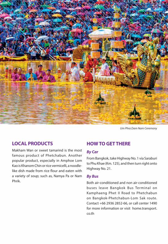
SeptemberHeld on the 15th day of the waning moon in the 10th lunar month, or Sat Thai Day, the day in which Thais make merit by offering Krayasat (sticky paste made from rice, bean, sesame and sugar) to monks. The festival honours Phra Phuttha Maha Thammaracha, a highly revered ancient Buddha image housing at Wat Trai Phum, which was found in the Pasak River by a group of farmers 400 years ago. The ritual of taking the Buddha image to be immersed in the Pasak River depicts the legend that the image twice wandered out of the temple and was later found in water. In the afternoon,
the image is carried around town and then put under a tent in Wat Trai Phum, so Buddhists can pay respect by applying gold leaf to the statue. In the evening, people gather at the temple to pray, as well as to enjoy various kinds of entertainment. The next morning, people make merit by offering food and other necessities to the monk, as it is Sat Thai Day. The Buddha image is then taken to be immersed in the Pasak River by the governor of Phetchabun and traditional dances are performed as a sign of respect. After the ceremony, the water in the river is regarded as sacred, so people swim in it or take the water to drink, and the festival concludes with the traditional long boat races.
43Phetchabun
LOCAL PRODUCTSMakham Wan or sweet tamarind is the most famous product of Phetchabun. Another popular product, especially in Amphoe Lom Kao is Khanom Chin or rice vermicelli, a noodle-like dish made from rice flour and eaten with a variety of soup; such as, Namya Pa or Nam Phrik.
HOW TO GET THEREBy CarFrom Bangkok, take Highway No. 1 via Saraburi to Phu Khae (Km. 125), and then turn right onto Highway No. 21.
By BusBoth air-conditioned and non air-conditioned buses leave Bangkok Bus Terminal on Kamphaeng Phet II Road to Phetchabun on Bangkok-Phetchabun-Lom Sak route. Contact +66 2936 2852-66, or call center 1490 for more information or visit home.transport. co.th
Um Phra Dam Nam Ceremony
Sukhothai Historical Park
Printed in Thailand by Promotional Material Production Division,Marketing Services Department,Tourism Authority of Thailand for free distribution.www.tourismthailand.org E/MAR 2020The contents of this publication are subject to change without notice.


