1 Assessment of Geoid Models off Western Australia Using In-Situ Measurements X. Deng School of Engineering, The University of Newcastle, Australia R. Coleman School of Geography and Environmental Studies, University of Tasmania, Australia K.R. Ridgway CSIRO Marine and Atmospheric Research , Australia
Transcript
1
Assessment of Geoid Models off Western Australia Using In-Situ Measurements
X. DengSchool of Engineering, The University of Newcastle, Australia
R. ColemanSchool of Geography and Environmental Studies, University of Tasmania, Australia
K.R. RidgwayCSIRO Marine and Atmospheric Research , Australia
2
Introduction
The Leeuwin Current (LC) in the Indian Ocean off Western Australia flows rapidly poleward.
It is a narrow and meandering current near the continental shelf break from 22°S.
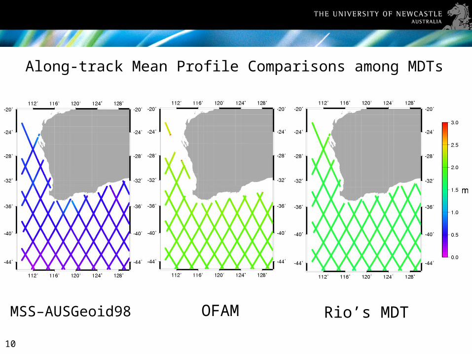
The spatial structure of the mean flow in the LC is influential down to the mesoscale. A full scale of mean ocean dynamic topography is needed in the LC.
3
Introduction (cont.)
To understand the ocean water flowing in the LC, it is crucial to know the following fundamental quantities:
–Marine geoid – a gravitational potential surface determined by the Earth’s gravity field.
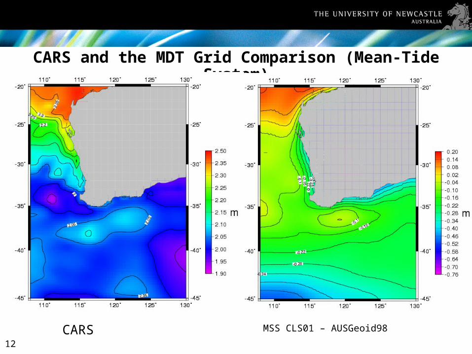
CARS and the MDT Grid Comparison (Mean-Tide System)
MSS CLS01 – AUSGeoid98CARS
13
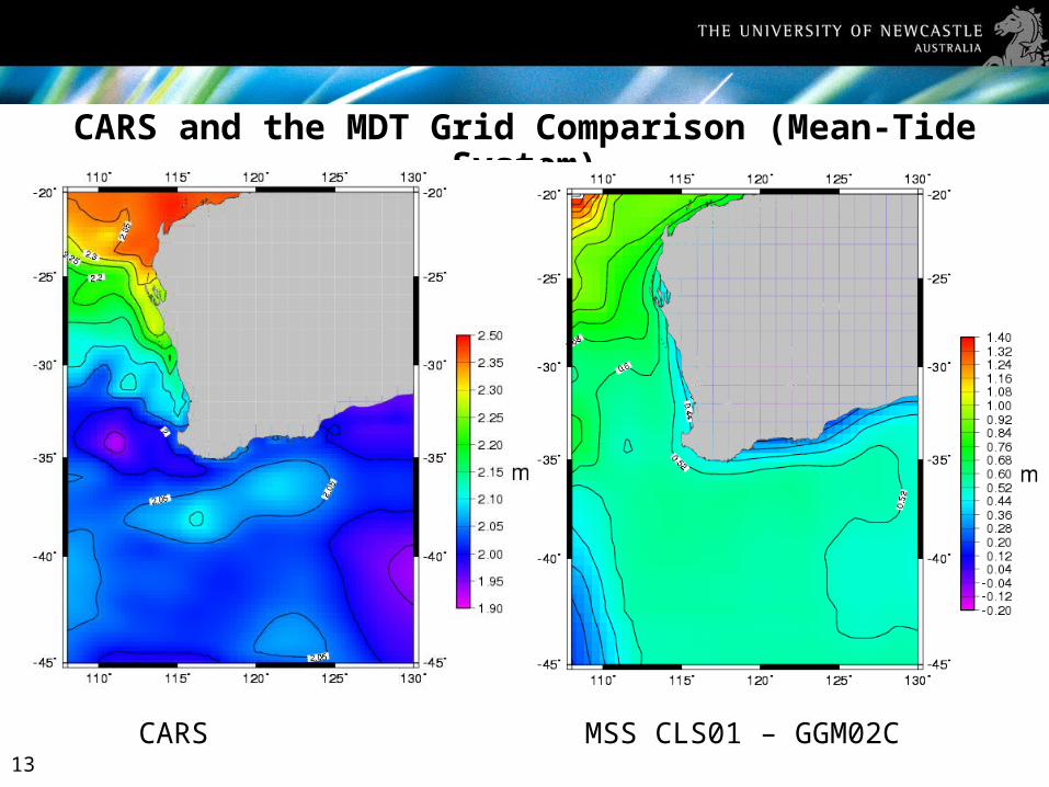
CARS and the MDT Grid Comparison (Mean-Tide System)
MSS CLS01 – GGM02CCARS
14
CARS - (CLS01-AUSGeoid98),
standard deviation:1.86 m
CARS - (CLS01-GGM02C),
standard deviation:1.23 m
15
ConclusionsWhen using CARS as an independent MDT around Western Australia, the MDTs computed from the CLS01 MSS and geoids (both regional and global) do not agree well and show larger standard deviations of 1.86 m and 1.23 m, respectively.
The MDT computed from the Topex along-track MSS and AUSGeoid98 shows a larger bias (or systematic error) ~1 m when compared to other MDTs.
The bias also exists between different MDTs.
When using recently geopotential model GGM02C, the omission error caused by the spatial filtering procedure is observed. Therefore, it is important to find an effective filter in coastal oceans.
The filtered geoid GGM02C at the spatial scales of ~330 km is still too coarse to describe the current characteristics of the LC
Further investigation of the accuracy of geoid models over a range of wavelengths, and improvement of the regional geoid are needed.