45
1 Global Connections: Forests of the World Activity 3 Mapping the World’s Forests
| Date post: | 24-Dec-2015 |
| Category: |
Documents |
| Upload: | hubert-pitts |
| View: | 220 times |
| Download: | 3 times |
1
Global Connections:
Forests of the World
Activity 3
Mapping the World’s Forests
2
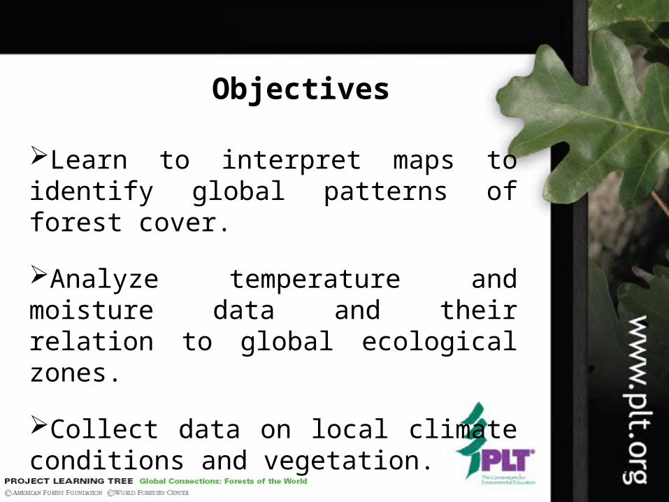
Objectives
Learn to interpret maps to identify global patterns of forest cover.
Analyze temperature and moisture data and their relation to global ecological zones.
Collect data on local climate conditions and vegetation.
3
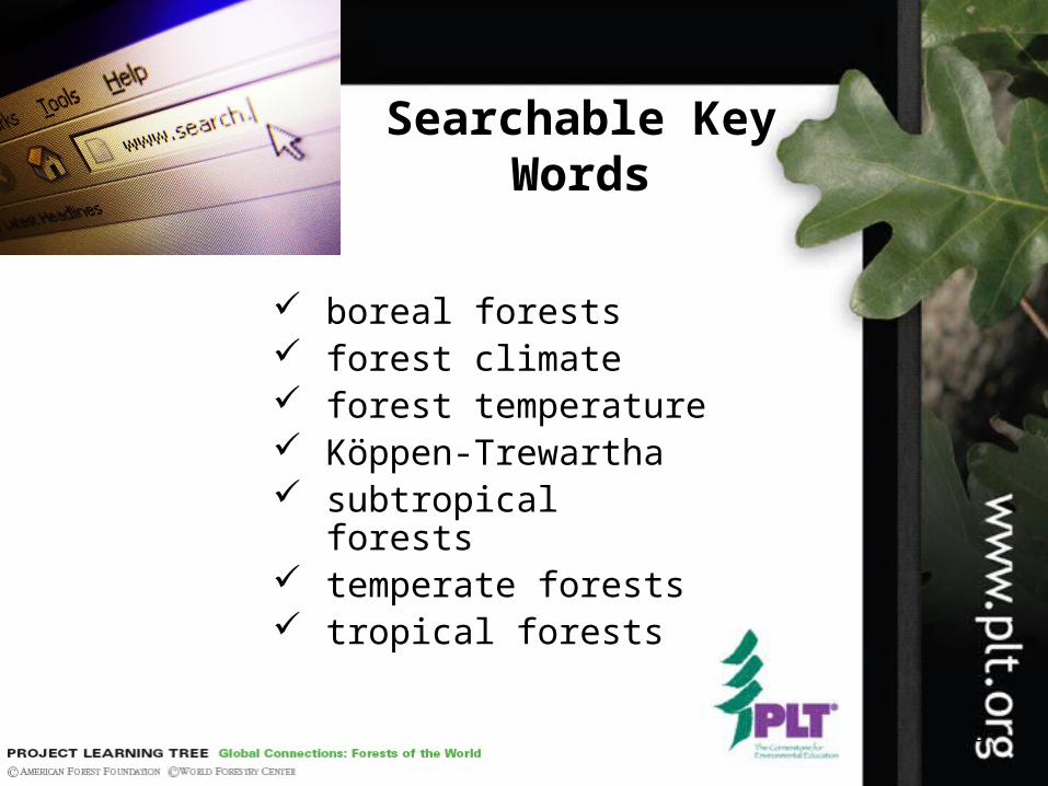
Searchable Key Words
boreal forests forest climate forest temperature Köppen-Trewartha subtropical forests temperate forests tropical forests

4
Background
Activity 3
5
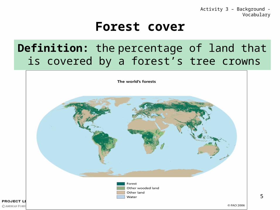
Forest cover
Definition: the percentage of land that is covered by a forest’s tree crowns
Activity 3 – Background - Vocabulary
6
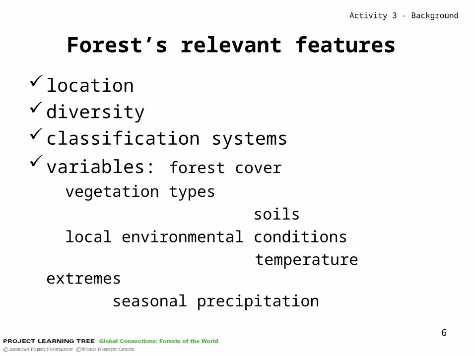
Forest’s relevant features
location diversityclassification systemsvariables: forest cover
vegetation types
soils
local environmental conditions
temperature extremes
seasonal precipitation
Activity 3 - Background
7
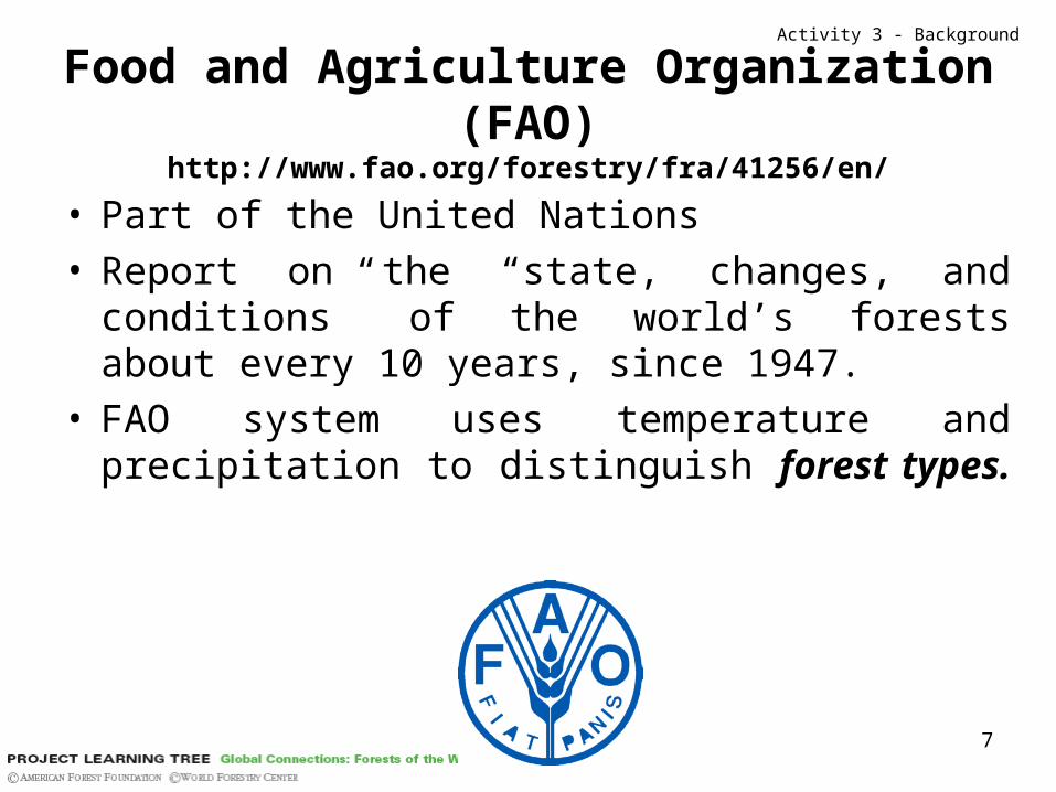
Food and Agriculture Organization (FAO)http://www.fao.org/forestry/fra/41256/en/
• Part of the United Nations• Report on the “state, changes, and conditions” of
the world’s forests about every 10 years, since 1947.
• FAO system uses temperature and precipitation to distinguish forest types.
Activity 3 - Background
8
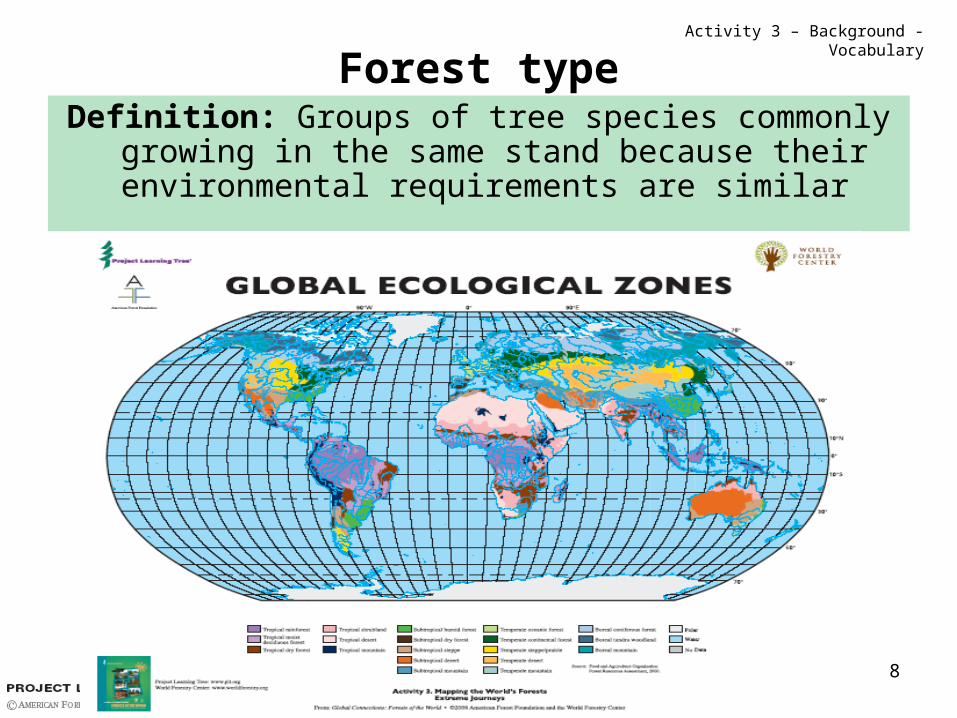
Forest typeDefinition: Groups of tree species commonly
growing in the same stand because their environmental requirements are similar
Activity 3 – Background - Vocabulary

9
Satellite Technologies and Remote Sensing…
…and the growing use of GIS (Geographic Information Systems): improved the quantity
and quality of data available about the world’s forests.
Activity 3 - Background
10
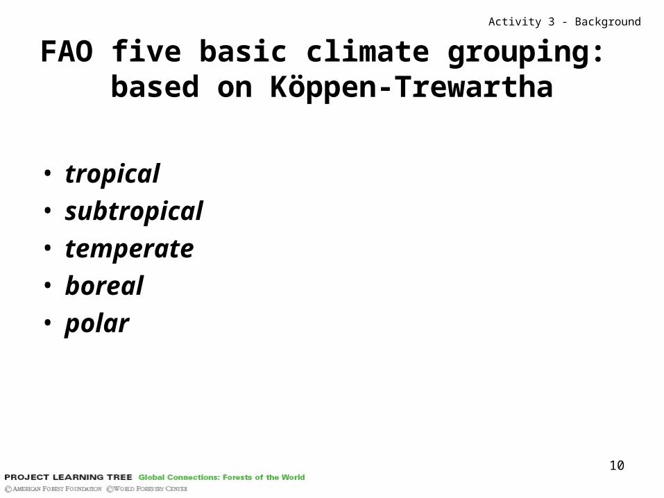
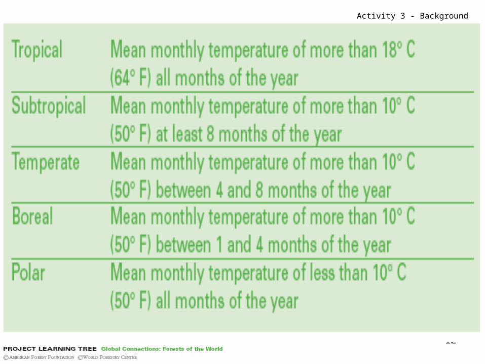
FAO five basic climate grouping: based on Köppen-Trewartha
• tropical• subtropical• temperate• boreal • polar
Activity 3 - Background
11
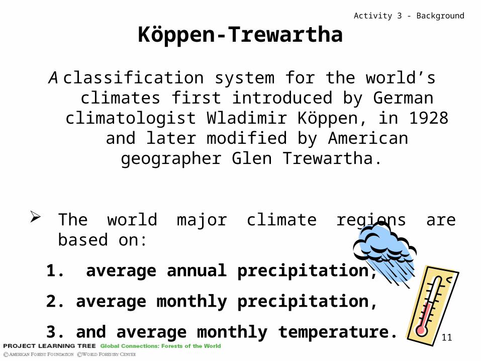
Köppen-Trewartha
A classification system for the world’s climates first introduced by German climatologist Wladimir
Köppen, in 1928 and later modified by American geographer Glen Trewartha.
The world major climate regions are based on:
1. average annual precipitation,
2. average monthly precipitation,
3. and average monthly temperature.
Activity 3 - Background
12
Activity 3 - Background
13
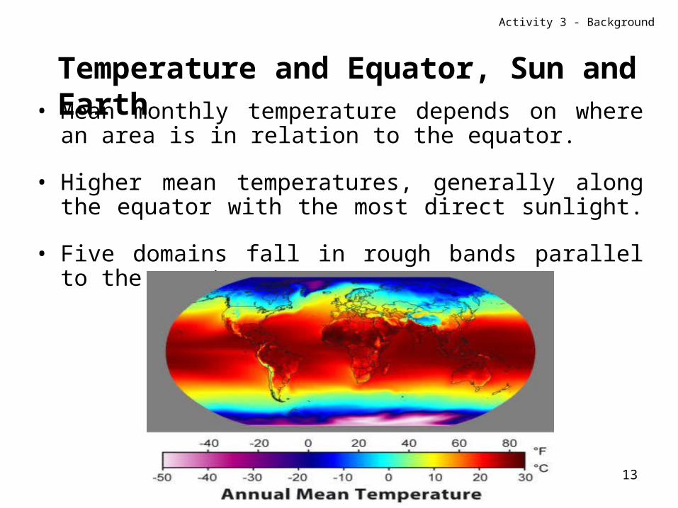
• Mean monthly temperature depends on where an area is in relation to the equator.
• Higher mean temperatures, generally along the equator with the most direct sunlight.
• Five domains fall in rough bands parallel to the equator.
Activity 3 - Background
Temperature and Equator, Sun and Earth
14
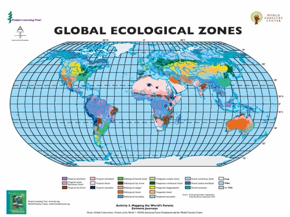
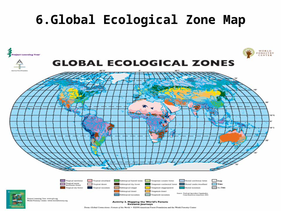
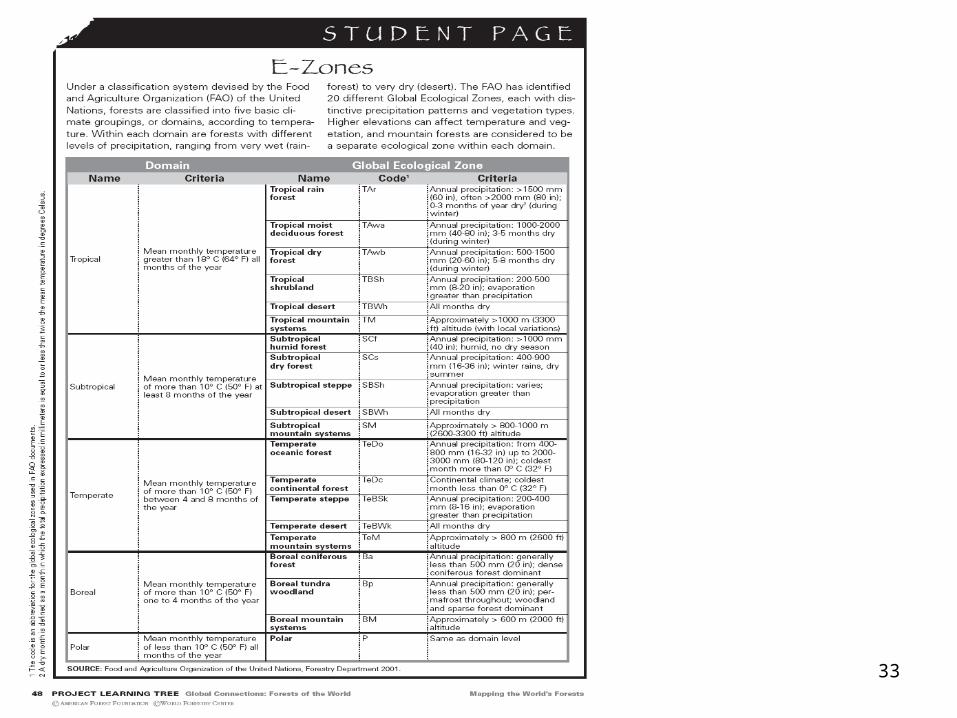
Global Ecological Zones
Within each of the domains, are forests with different levels of precipitation, ranging from desert to rainforest.
FAO: 20 global ecological zones (distinctive precipitation and vegetation each).
Activity 3 - Background
15
16
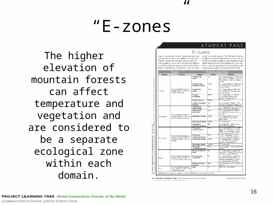
“E-zones”
The higher elevation of mountain forests can
affect temperature and vegetation and
are considered to be a separate ecological
zone within each domain.

17
The 5 domains…
Activity 3 - Background
18
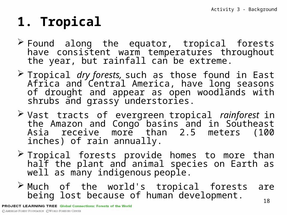
1. Tropical
Found along the equator, tropical forests have consistent warm temperatures throughout the year, but rainfall can be extreme.
Tropical dry forests, such as those found in East Africa and Central America, have long seasons of drought and appear as open woodlands with shrubs and grassy understories.
Vast tracts of evergreen tropical rainforest in the Amazon and Congo basins and in Southeast Asia receive more than 2.5 meters (100 inches) of rain annually.
Tropical forests provide homes to more than half the plant and animal species on Earth as well as many indigenous people.
Much of the world's tropical forests are being lost because of human development.
Activity 3 - Background

19
2. Subtropical Widely scattered north and south of the tropics (Africa, Asia,
Australia, Mexico, South America, and the southern United States).
At least 8 months of the year when the temperature is more than 10° C (50° F).
The seasonal rainfall can vary dramatically, creating flooded forests such as the Brazilian pantanal or sparsely wooded scrub landscapes.
Oak, eucalyptus, and pine are typical trees. The so-called mediterranean forests have moist, mild winters
and dry summers. Known as mallee in Australia, matoral in Chile, maquis in
Europe, fynbos in South Africa, and chaparral in the U.S. state of California, the trees often have leathery evergreen leaves to conserve moisture.
Much of the world’s subtropical forests have been converted to grazing lands, agricultural uses, or plantations, but patches of native forests remain in national parks and wildlife preserves.
Activity 3 - Background

20
3. Temperate
Having a generally moderate climate; the temperate zone is the region between the Tropic of Cancer and the Arctic Circle, or between the Tropic of Capricorn and the Antarctic Circle.
Dramatic seasonal changes and a mild, humid climate allow temperate forests of the middle latitudes to host a great variety of trees including beech, cedar, fir, hemlock, maple, oak, pine, and spruce.
Many of these forests have long been cut over, but advances in conservation, changes in fuel wood consumption, and improvements in agriculture have allowed some of those forests to recover in parts of Europe and North America.
Some of the world’s largest and oldest trees can be found in temperate forests.
Activity 3 - Background

21
4. Boreal A forest area of the northern and mountainous parts of the
Northern Hemisphere
Long, cold winters and short, cool summers shape the vast forests spreading across Canada, Russia, Scandinavia, and the U.S. state of Alaska.
By far the largest forests on Earth, boreal forests host aspen, birch, fir, larch, pine, spruce as typical tree species.
Millions of lakes, ponds, and wetlands – frozen for much of the year – create vast breeding grounds for many of the planet’s waterfowl and shorebirds.
These forests are also the world’s major source of commercial softwood, and global demand for that wood is expected to intensify.
Russians call their dense conifer forest taiga.
Activity 3 - Background
22
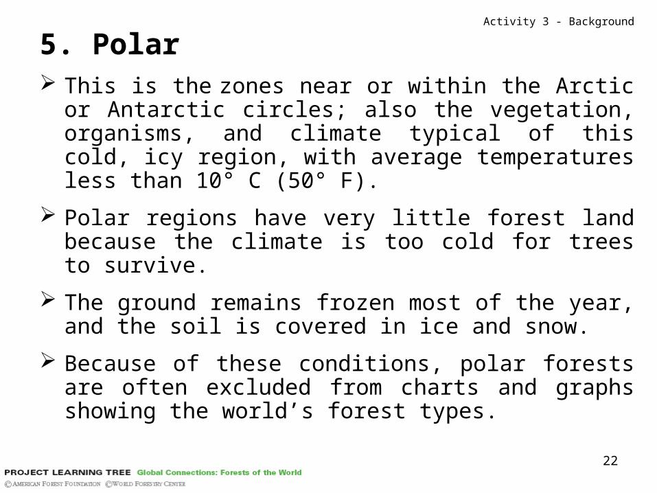
5. Polar This is the zones near or within the Arctic or Antarctic
circles; also the vegetation, organisms, and climate typical of this cold, icy region, with average temperatures less than 10° C (50° F).
Polar regions have very little forest land because the climate is too cold for trees to survive.
The ground remains frozen most of the year, and the soil is covered in ice and snow.
Because of these conditions, polar forests are often excluded from charts and graphs showing the world’s forest types.
Activity 3 - Background

23
PlantationActivity 3 – Background - Vocabulary
Definition: an area in which trees are grown as a crop, and which was established by sowing or
planting.

24
Doing the activity
Activity 3

25
Now, time to work!
1. Brainstorm a list of different types of forests you know either from first-hand experience or
from what you have heard or read.
Activity 3 – Doing the activity
26
2. With a partner…
a. Use your lists to choose two or three forest types to compare.
b. Identify as many features as you can that make the forests different from one another (such as the forest’s location, the dominant tree species found there, the rainfall, etc.).
c. Share with the class the differentiating features you identified.
Activity 3 – Doing the activity

27
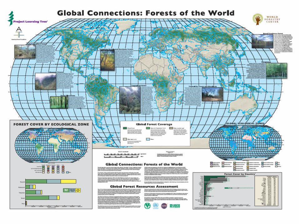
3. Look at the map and discuss
a. Where are the world’s forests?
b. What do you notice about their distribution over the planet?
c. What patterns do you see? How does this map represent our area?
d. How does our area compare with the areas around it?
e. Why might there be dense forests in the Amazon basin, but not in northern Africa?
f. What factors might influence where forests are found?
Activity 3 – Doing the activity
28
29
4. Look at the Equator and Tropics:
a. What do you notice about forest coverage in relation to these lines?
b. As you move away from the equator, how does temperature or climate change?
c. What causes this change?
d. How might forests change as you move away from the equator?
e. Tropical forests have an average temperature of more than 18° C (64° F) all months of the year. Where would you expect to find such forests?
f. Boreal forests have an average temperature of more than 10° C (50° F) for just 1 to 4 months of the year. Where would you expect to find such forests?
Activity 3 – Doing the activity

30
5. The 5 domains in forest classificationActivity 3 – Doing the activity
Indicate on the map where those broad domains would roughly be found
31
6.Global Ecological Zone Map
32
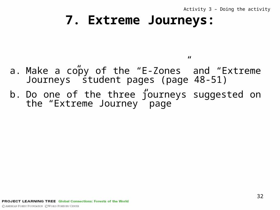
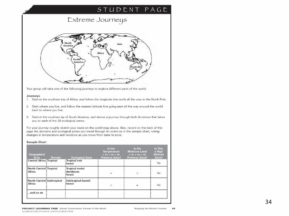
7. Extreme Journeys:
a. Make a copy of the “E-Zones” and “Extreme Journeys” student pages (page 48-51)
b. Do one of the three journeys suggested on the “Extreme Journey” page
Activity 3 – Doing the activity
33
34

35
36
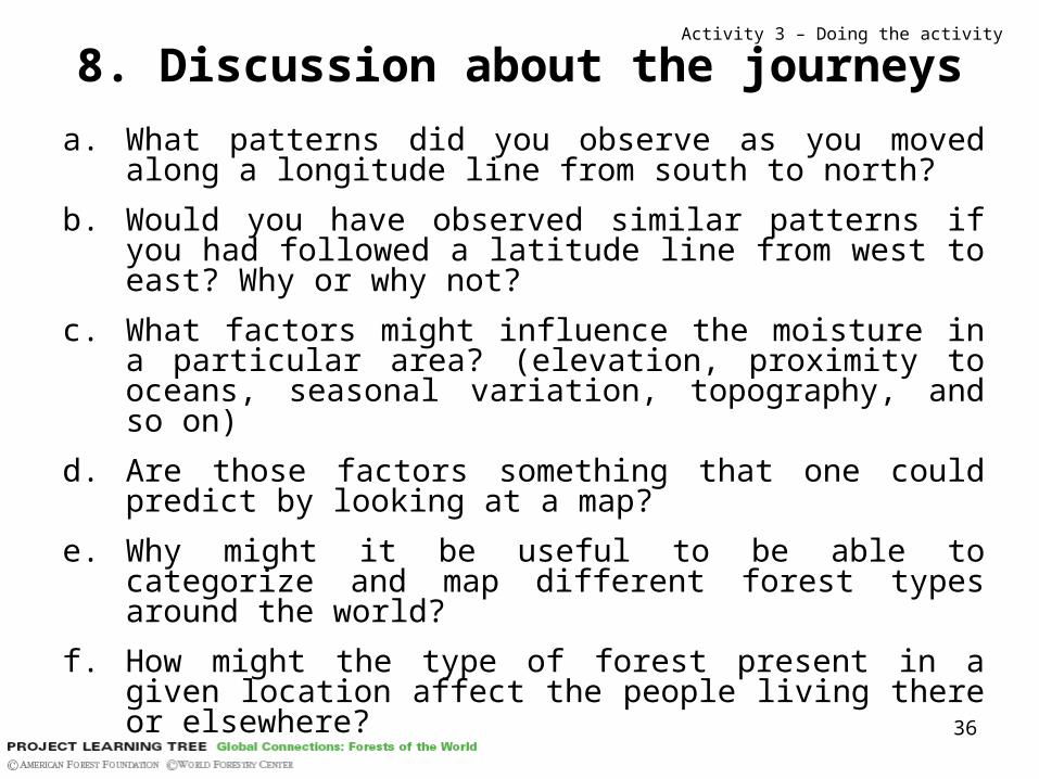
8. Discussion about the journeys
a. What patterns did you observe as you movedalong a longitude line from south to north?
b. Would you have observed similar patterns if you had followed a latitude line from west to east? Why or why not?
c. What factors might influence the moisture in a particular area? (elevation, proximity to oceans, seasonal variation, topography, and so on)
d. Are those factors something that one could predict by looking at a map?
e. Why might it be useful to be able to categorize and map different forest types around the world?
f. How might the type of forest present in a given location affect the people living there or elsewhere?
Activity 3 – Doing the activity

37
9. State or regional map
1. Look at the State or region map
2. Identify the types of forests
3. List factors that might cause a certain type of forest in one particular area, but not in another.
Activity 3 – Doing the activity

38
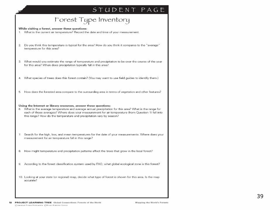
10. Nearby forested area tour
a. Use the “Forest Type Inventory” questions as a guide to your exploration.
b. Identify the dominant tree species.
c. Measure the air temperature.
d. Determine the average temperature and precipitation of the forest area for a 1–year and a 10–year period.
e. Make a profile or graph showing long-term climate trends of the forest area.
f. Determine whether the forest they observe matches what they would expect under the FAO classification system.
Activity 3 – Doing the activity
39

40
Assessment
Make a map of your state or region showing the global ecological zone (s) and depicting
the types and distribution of forests.
The map should include photos and descriptions of the different types of forests,
with information about temperature and moisture conditions.
Questions: “How might global climate change affect the forest in your area?”

41
Enrichment
Activity 3

42
Plan a road trip
Using a map of forests in your state or region,
plan a road trip that goes through as many different forest zones as
possible.
Activity 3 – Enrichment 1

43
Effect of temperature or moisturea. Design an experiment to see the effect of temperature or moisture on
different plants.
b. For example, put a conifer leaf (pine needle), a rhododendron leaf, and a lettuce leaf in the freezer (less than 0° C [32° F]) and then in the oven at a very low temperature (less than 125º C [200º F]).
c. Compare the leaves after a few minutes, or observe what happens to plants under various moisture and temperature conditions.
Activity 3 – Enrichment 2

44
Growth rates
Compare the growth rates of a given species of trees in different countries by looking for data tables on the internet
or in the library.
Activity 3 – Enrichment 3
45
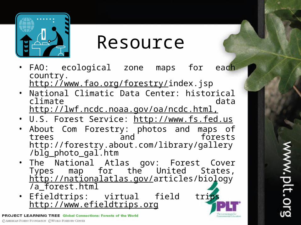
Resource• FAO: ecological zone maps for each country.
http://www.fao.org/forestry/index.jsp• National Climatic Data Center: historical climate data
http://lwf.ncdc.noaa.gov/oa/ncdc.html,• U.S. Forest Service: http://www.fs.fed.us• About Com Forestry: photos and maps of trees and
forests http://forestry.about.com/library/gallery/blg_photo_gal.htm
• The National Atlas gov: Forest Cover Types map for the United States, http://nationalatlas.gov/articles/biology/a_forest.html
• Efieldtrips: virtual field trips http://www.efieldtrips.org


