53
1 The Global Observing System Lars Peter Riishojgaard Director, JCSDA Chair, OPAG-IOS, WMO Commission for Basic Systems JCSDA Summer Colloquium, 07/26/2012
| Date post: | 29-Dec-2015 |
| Category: |
Documents |
| Upload: | bernice-wiggins |
| View: | 214 times |
| Download: | 0 times |

1
The Global Observing System
Lars Peter RiishojgaardDirector, JCSDA
Chair, OPAG-IOS, WMO Commission for Basic Systems
JCSDA Summer Colloquium, 07/26/2012
JCSDA Summer Colloquium, 07/26/2012 2
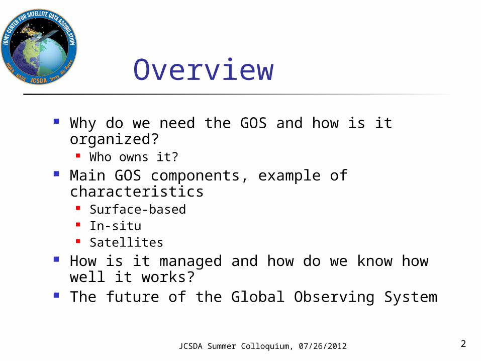
Overview
Why do we need the GOS and how is it organized?
Who owns it? Main GOS components, example of
characteristics Surface-based In-situ Satellites
How is it managed and how do we know how well it works?
The future of the Global Observing System

JCSDA Summer Colloquium, 07/26/2012 3
Ground rules Meteorology is an observation-based endeavor
Numerical weather prediction is to some extent an Initial Value Problem
The motion and physics of the atmosphere can be adequately described by known partial differential equations, discretized versions of which are solved on powerful computers
Initial conditions necessarily for finding solutions of these equations are established using observations

JCSDA Summer Colloquium, 07/26/2012 4
NWP requirements for upper-air data coverage

What does this mean? NWP beyond the two to three-day range is
a global problem, requiring a continuous supply of observational data from the entire global domain
No single nation or organization has the technical and financial wherewithal to acquire this on their own
Enter the World Meteorological Organization and the World Weather Watch (WWW)
JCSDA Summer Colloquium, 07/26/2012 5

JCSDA Summer Colloquium, 07/26/2012 6
Observational data needs for NWP
Regularly spaced measurements from the entire model domain, ideally at close to model resolution and taken at regular intervals in time, of the following quantities:
Temperature (3D) Horizontal winds (3D) Humidity (3D) Secondary constituents - e.g. ozone (3D) Surface pressure (2D) Lower boundary conditions; sea ice, sea surface
temperature, soil moisture, … (2D) We need this at low latency, i.e. data should be no older
than 1-2 hours by the time they are available to the end users

JCSDA Summer Colloquium, 07/26/2012 7
What do we actually get? A heterogeneous mix of measurements
at widely varying spatial and temporal resolutions of quantities that are mostly indirectly related to the predicted and analyzed variables
Data latencies varying from minutes to 8-10 hours or more
… herein lies part of the challenge in data assimilation!

World Meteorological Organization
Specialized technical agency under the UN system
Responsible for organizing and maintaining international collaboration on technical matters in meteorology, climatology and hydrology, including observations
UN authoritative voice on all matters related to meteorology, climatology and hydrology
JCSDA Summer Colloquium, 07/26/2012 8

JCSDA Summer Colloquium, 07/26/2012 9
World Weather Watch (WWW)
“ To predict the weather, modern meteorology depends upon near instantaneous exchange of weather information across the entire globe. Established in 1963, the World Weather Watch - the core of the WMO Programmes - combines observing systems, telecommunication facilities, and data-processing and forecasting centres - operated by Members - to make available meteorological and related environmental information needed to provide efficient services in all countries”

JCSDA Summer Colloquium, 07/26/2012 10
Main components of WWW
Global Observing System (GOS) Global Telecommunication System (GTS) and Radio Frequency Coordination (RFC) Global Data-processing and Forecasting System
(GDPFS) WMO Data Management, including WMO Codes Instruments and Methods of Observation Programme
(IMOP) Emergency Response Activities (ERA) Tropical Cyclone Programme (TCP) WMO Antarctic Activities
JCSDA Summer Colloquium, 07/26/2012 11
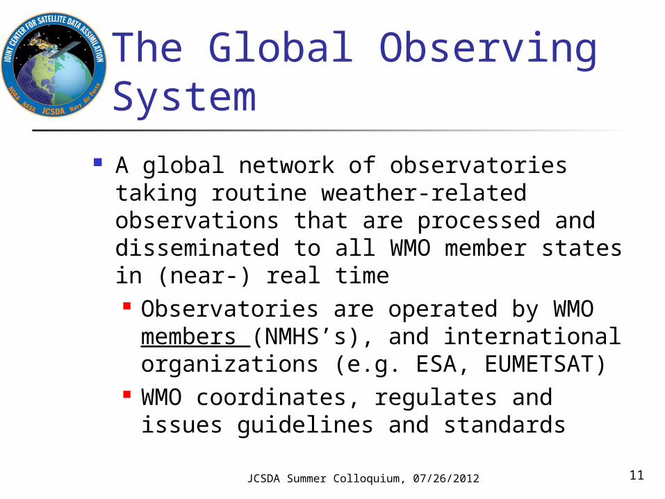
The Global Observing System
A global network of observatories taking routine weather-related observations that are processed and disseminated to all WMO member states in (near-) real time Observatories are operated by WMO
members (NMHS’s), and international organizations (e.g. ESA, EUMETSAT)
WMO coordinates, regulates and issues guidelines and standards

The Global Observing System (II)
The GOS represents the collective efforts of the ~190 WMO member states, associated territories and partner international organizations toward getting real-time meteorological observations
Total cost of running all components of the GOS estimated to be on the order of $10B/year
JCSDA Summer Colloquium, 07/26/2012 12
JCSDA Summer Colloquium, 07/26/2012 13
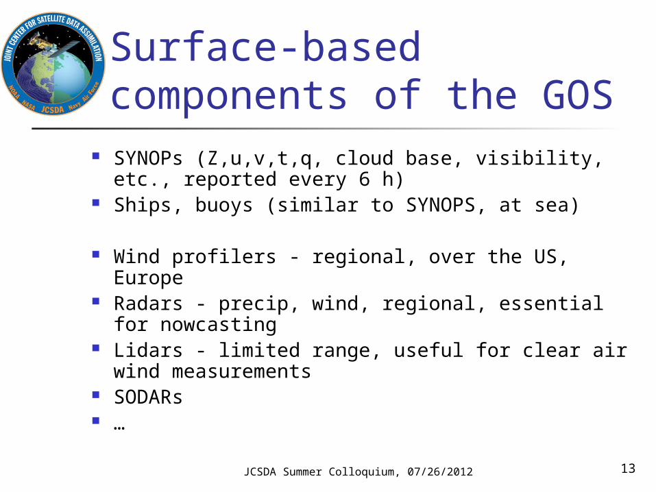
Surface-based components of the GOS
SYNOPs (Z,u,v,t,q, cloud base, visibility, etc., reported every 6 h)
Ships, buoys (similar to SYNOPS, at sea)
Wind profilers - regional, over the US, Europe Radars - precip, wind, regional, essential for
nowcasting Lidars - limited range, useful for clear air wind
measurements SODARs …

JCSDA Summer Colloquium, 07/26/2012 14
SYNOPS, SHIPS
Impact, issues•Models cannot function without these data
•Highly heterogeneous distribution
•Sparse in the Southern Hemisphere
•Observations over land difficult to use in terrain (mismatch between actual vs. model topography)

JCSDA Summer Colloquium, 07/26/2012 15
In situ measurements Ballon-borne radiosondes
TEMP - u, v, T, q at synoptic times (00 and 12 Z) at ~600 locations mostly over the densely populated regions in the NH
PILOT - u, v at synoptic times (6 and 18Z) at limited number of locations
Dropsondes (targeted) Aircraft measurements Research balloons ….
JCSDA Summer Colloquium, 07/26/2012 16
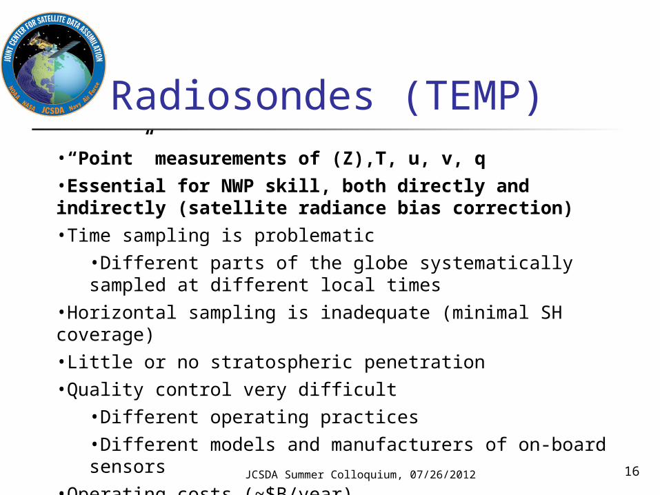
Radiosondes (TEMP)•“Point” measurements of (Z),T, u, v, q
•Essential for NWP skill, both directly and indirectly (satellite radiance bias correction)
•Time sampling is problematic
•Different parts of the globe systematically sampled at different local times
•Horizontal sampling is inadequate (minimal SH coverage)
•Little or no stratospheric penetration
•Quality control very difficult
•Different operating practices
•Different models and manufacturers of on-board sensors
•Operating costs (~$B/year)

JCSDA Summer Colloquium, 07/26/2012 17

JCSDA Summer Colloquium, 07/26/2012 18

JCSDA Summer Colloquium, 07/26/2012 19
Aircraft observations PIREP - human report, provided by both general and
commercial aviation; no longer widely used for NWP AIREP - human report, regular lat/lon intervals,
disseminated on WMO GTS AMDAR - automated observations of u,v,T
transmitted to ground via terrestrial or satellite radio, disseminated on GTS Both ascent/descent profiles and flight level
information widely used for NWP Pilot programs with on-board humidity sensors
both in Europe and the US (primarily for profiling)

JCSDA Summer Colloquium, 07/26/2012 20
AMDAR Large and growing NWP impact Anisotropic sampling both horizontally and vertically Flight level winds represent a biased sampling
(routing driven by fuel savings) Vertical profiles are sparse (ascent/descent near
major airports) Difficult QC problem
E.g. record does not include aircraft tail number
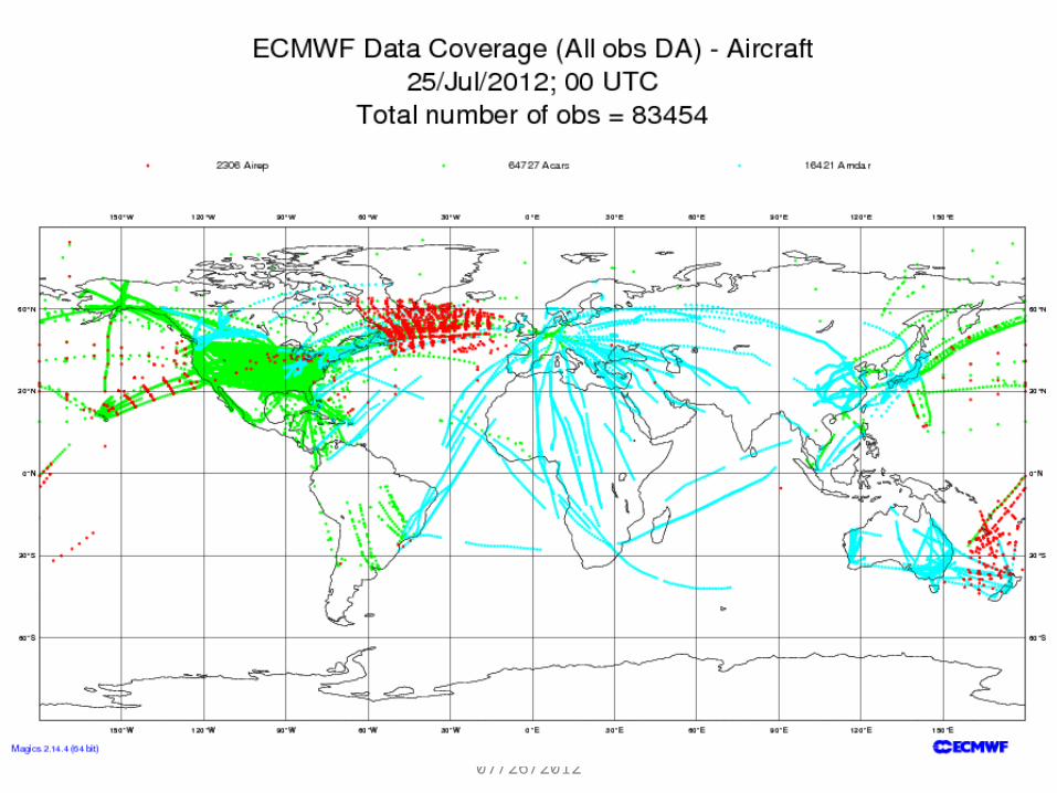
JCSDA Summer Colloquium, 07/26/2012 21

22

23

24

JCSDA Summer Colloquium, 07/26/2012 25
Space-based components of the GOS
Geostationary orbit Polar orbit
Sun-synchronous Other
MEO

JCSDA Summer Colloquium, 07/26/2012 26
Geostationary satellites
A constellation of ~6 operational satellites at 35,800 km altitude at fixed longitudes in the Earth’s equatorial plane High temporal resolution imaging from a ‘staring’
perspective Extremely valuable for monitoring and
nowcasting Data assimilation is often considered a secondary
application Upper middle and high latitudes not well covered

27JCSDA Summer Colloquium, 07/26/2012

JCSDA Summer Colloquium, 07/26/2012 28
AMV (SATWIND) Winds derived from tracking of features in cloud (or
WV) field in imagery from geostationary and polar platforms
Large and growing impact on NWP skill Single level coverage No operational high-latitude coverage
Experimental dataset available from MODIS Difficult quality control problem
Errors in assigned height can lead to negative impact
Errors in tracking can lead to gross errors
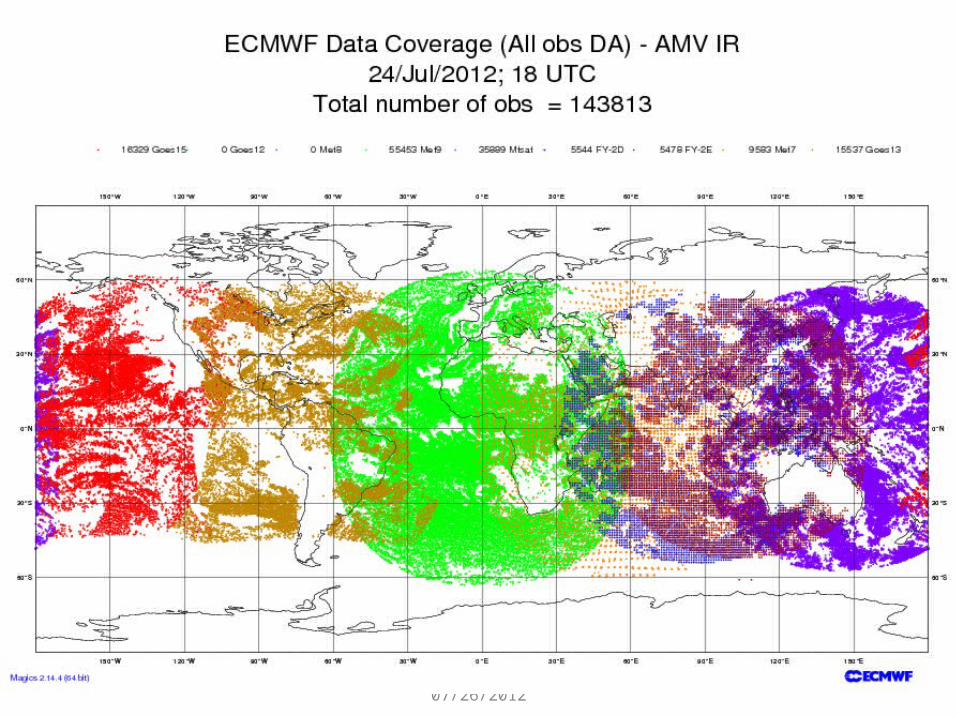
JCSDA Summer Colloquium, 07/26/2012 29

30

31

JCSDA Summer Colloquium, 07/26/2012 32
Polar orbiters Large fleet of research and operational
satellites in a variety of “polar” orbits (sun-synchronous or otherwise) Operational satellites operated by US DoD,
NOAA/NESDIS, EUMETSAT, China, … Research satellites operated by NASA, JAXA,
ESA, CSA, …

JCSDA Summer Colloquium, 07/26/2012 33
Polar orbiters (II) Observations are asynoptic by nature
Typical orbit height between 350 and 850 km; velocity relative to ground ~7 km/s
Global coverage is “patched” together over a period of 12 or 24 hours or longer
Data assimilation is the primary application for several polar orbiting sensors
Microwave sounders and hyperspectral IR sounders are among the most important data sources for NWP
JCSDA Summer Colloquium, 07/26/2012 34
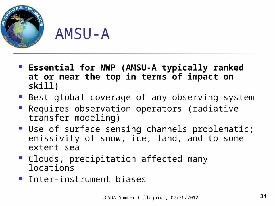
AMSU-A
Essential for NWP (AMSU-A typically ranked at or near the top in terms of impact on skill)
Best global coverage of any observing system Requires observation operators (radiative
transfer modeling) Use of surface sensing channels problematic;
emissivity of snow, ice, land, and to some extent sea
Clouds, precipitation affected many locations Inter-instrument biases

JCSDA Summer Colloquium, 07/26/2012 35

JCSDA Summer Colloquium, 07/26/2012 36
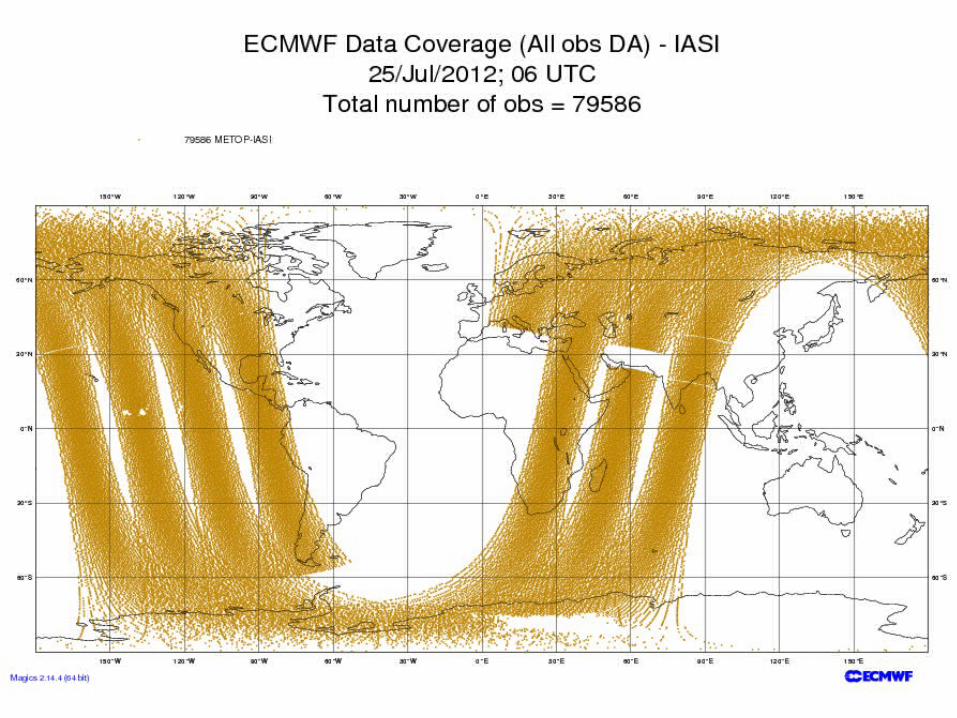
Hyperspectral IR sounders(AIRS, IASI, CrIS)
Typically ranked at or near the top in terms of impact on skill per instrument (three currently operating)
Prolific data source (billions of measurements per day) Only on the order of 1% of these used for NWP due to
difficulties with Clouds Model prediction (WV) Surface emissivity Correlated information Data volume

JCSDA Summer Colloquium, 07/26/2012 37
38

Slide from Cucurull
39JCSDA Summer Colloquium, 07/26/2012

JCSDA Summer Colloquium, 07/26/2012 40
GPSRO Medium/high impact on NWP skill
Large impact especially in the upper troposphere Free from calibration drift; can be used to calibrate
data from other observing systems Assimilation methodology still evolving: From T/q
to refractivity to bending angle to phase delay …. Unusual measurement geometry due to limb
approach Good global coverage can be obtained by
constellation approach

JCSDA Summer Colloquium, 07/26/2012 41

Other satellite sensors used for assimilation or validation of NWP
Scatterometers Microwave imagers VIS/IR imagers Precipitation radars Cloud radars Aerosol lidars UV imagers/spectrometers for atmospheric
composition … Future satellite systems addressed in Lecture 3
Friday
JCSDA Summer Colloquium, 07/26/2012 42

The GOS in summary
Critical piece of infrastructure for meteorology and NWP
Highly complex construct with many users, stakeholders and somewhat opaque management structure and decision-making processes
JCSDA Summer Colloquium, 07/26/2012 43
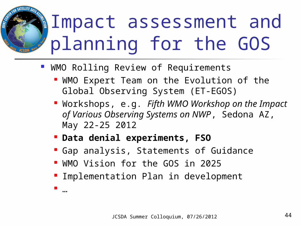
Impact assessment and planning for the GOS
WMO Rolling Review of Requirements WMO Expert Team on the Evolution of the Global
Observing System (ET-EGOS) Workshops, e.g. Fifth WMO Workshop on the
Impact of Various Observing Systems on NWP, Sedona AZ, May 22-25 2012
Data denial experiments, FSO Gap analysis, Statements of Guidance WMO Vision for the GOS in 2025 Implementation Plan in development …
JCSDA Summer Colloquium, 07/26/2012 44

Impact assessment (I)
Observing system simulation experiments (data denials) No additional development required Expensive to run Only bulk measure of impact Focusing on the medium range Many different measures of skill can be
studied for a given set of experiments
JCSDA Summer Colloquium, 07/26/2012 45

500 hPa Anomaly Correlations15 Aug – 30 Sep 2010
46
No Satellite / No Conventional Data
Northern Hemisphere
Southern Hemisphere
5th WMO Observing Systems Impact Workshop
Example of OSE diagnostics (J. Jung, 5th WMO Impact Workshop, Sedona 2012)

500 hPa Anomaly Correlations 15 Aug – 30 Sep 2010
47
No Rawinsondes / No Aircraft
Northern Hemisphere
Southern Hemisphere
5th WMO Observing Systems Impact Workshop
Example of OSE diagnostics (J. Jung, 5th WMO Impact Workshop, Sedona 2012)
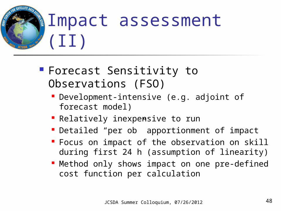
Impact assessment (II)
Forecast Sensitivity to Observations (FSO) Development-intensive (e.g. adjoint of
forecast model) Relatively inexpensive to run Detailed “per ob” apportionment of impact Focus on impact of the observation on skill
during first 24 h (assumption of linearity) Method only shows impact on one pre-defined
cost function per calculation
JCSDA Summer Colloquium, 07/26/2012 48

Forecast impact experiment from Dec. 2010 to Jan. 2011
Impact Impact / Obs. number
WMO Workshop on the Impact of Various Observing Systems on NWP Sedona – 22-25 May 2012
Example of FSO diagnostics (P. Moll, 5th WMO Impact Workshop, Sedona 2012)

50
Much larger relative impact of AMVs in Navy system
http://gmao.gsfc.nasa.gov/products/forecasts/systems/fp/obs_impact/
http://www.nrlmry.navy.mil/obsens/fnmoc/obsens_main_od.html
Example of FSO diagnostics (Gelaro, 5th WMO Impact Workshop, Sedona 2012)

The future of the GOS Recognizing that the mandates of most National
Meteorological and Hydrological Services are expanding, WMO has decided to implement WIGOS, the WMO Integrated Global Observing System
“GOS++”, or GOS with Observations (beyond those needed for weather
applications) of climate, atmospheric composition, oceans, land surface, hydrology parameters
RRR fully integrated for all components Quality Management Framework Disseminated via WIS (WMO Information System)
JCSDA Summer Colloquium, 07/26/2012 51

Summary and conclusions
Global (and indirectly also regional) NWP requires global observational data coverage
The GOS provides the framework for the ~190 WMO member states to exchange weather observations across national boundaries routinely in near-real time, and it has been a remarkably successful international collaboration for almost 50 years
JCSDA Summer Colloquium, 07/26/2012 52

Summary and conclusions (II)
In spite of its successes, the heterogeneity of the GOS poses an enormous challenge to the data assimilation/NWP community
Quality control Bias Observation operators (relationship between
observed and modeled variables) Data latency …
Data assimilation community can help define the GOS of the future (subject of lecture Friday)
JCSDA Summer Colloquium, 07/26/2012 53


