17
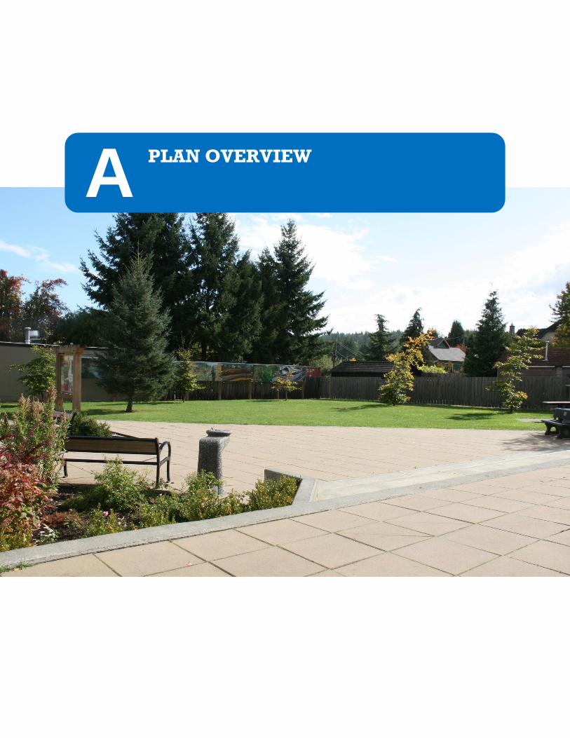
1.0 A PLAN OVERVIEW
1.0
A PLAN OVERVIEW

APPENDIX B | Maps

1.0 INTRODUCTION
1.1 PLAN OVERVIEW
With its origins in the coal mining past of the Comox Valley, Cumberland has many characteristics that
make it a great place to live, work and play. There is a palpable sense of community that resonates with
arts and culture, and the small village feel has attracted a growing younger generation to call
Cumberland home, contributing to a 26 percent increase in the local population since 2006.
Whether it’s a visit to a local coffee shop with neighbours or a bike ride through the extensive open
spaces, forests and natural amenities in the surrounding area, the Village provides a range of
opportunities for all ages and needs. A fundamental draw for this Village is its sense of history and
culture, which has attracted a diversity of people who enjoy a certain pace of life connected with nature,
community and the arts. The Village is near to skiing and water amenities, as well as minutes away from
other communities in the Comox Valley.
To support and build on this strong sense of community and growth, the Village has updated its Official
Community Plan (OCP or “the Plan”). This Plan provides vision, passion for community wellbeing and
health, and will be implemented through clear and measurable objectives and policies.
The Village of Cumberland (from here on referred to either as the “Village” or “Cumberland”) is located
approximately 10kilometres southwest of Courtenay in the Comox Valley (Figure 1).
1.2 PLAN ORGANIZATION
The OCP is divided into four parts:
PART A: PLAN OVERVIEW (Section 1 and 2) sets out the context for the plan, including its purpose and
scope, and linkages to other Village and Regional plans. It also highlights the existing demographics for
Cumberland along with the consultation process undertaken as part of the OCP review.
PART B: VISION AND GOALS (Sections 3 and 4) identifies the overarching vision, goals, and objectives
that articulate the long-term aspirations of the community and lay the foundation for the objectives and
policies that follow.
PART C: LAND USE POLICY DIRECTION (Sections 5 to 8) establishes the plan policies in 14 topic areas,
including: future land use; housing; growth management; heritage preservation; general municipal
infrastructure; transportation and connectivity; sand and gravel extraction; tourism; local food
production and urban farming; environmental preservation; views and landscape character; climate
change and adaptability; wildfire urban interface and recreation leisure and parks. Each section begins
with a brief overview of the topic context and broad approach articulated through the objectives and
policy statements that follow.

APPENDIX B | Maps
PART D: IMPLEMENTATION (Sections 9 to 11) defines the policies respecting plan implementation and
community engagement to ensure that strategies are in place to measure and report on how the Village
is meeting the goals and objectives of the OCP. This part also sets out the regulations associated with
the Development Permit Areas and Heritage Conservation Area.
APPENDIX A and B include a glossary of terms and associated maps.
1.3 PURPOSE
This Plan is a comprehensive reorganization and revision of the 2004 OCP. The purpose of the Plan is to
provide a broad framework of goals, objectives, and policies to guide decisions on future planning and
land management within Cumberland. Section 9 of the Plan provides direction on implementation and
actions to achieve the vision, goals, objectives, and policies.
Where the Village does not have jurisdiction on a matter, the Plan may only state broad objectives
related to that matter and the objectives and policies of this Plan are to be so interpreted.
1.4 PLAN AREA
The area covered by the Plan is the entirety of the area within the Village Municipal Boundary (Village
boundaries). The plan encompasses approximately 3,032hectares (Figure 1).
Figure 1: Regional Context and Village Municipal Boundary
Strathcona Provincial Park

Lands within the Plan area are within the Traditional Territory of the K’ómok’s First Nation (Figure 2).
This K’ómok’s First Nation continues to take a strong interest in their Traditional Territory and have
members residing within and adjoining the Plan area. There are four Reserves within the Traditional
Territory: K’ómoks, Salmon River, Goose Spit, and Puntledge.
Figure 2: K’ómoks First Nation Traditional Territory–Courtesy of K’ómoks First Nation)
1.5 SCOPE
The Plan is intended to guide future growth and to set policies to achieve goals and objectives.
However, there are other municipal bylaws related to zoning and subdivisions that are the primary tools
used to regulate development. In British Columbia, OCPs are municipal bylaws. They are prepared and
adopted within the statutory provisions of the Local Government Act1, (LGA) which prescribes the
general content of OCPs and also sets out a formal procedure for adopting such plans.
1 Unless otherwise stated, all legislative section references are to the Local Government Act, R.S.B.C. 1996 c.323 (LGA)
Strathcona Provincial Park

APPENDIX B | Maps
Under the LGA, an OCP must include policies on topics that are central to land use, like housing and
infrastructure, while related policy areas, such as community well-being and environmental protection,
are acceptable as broad objectives if not within the jurisdiction of the local government, but are not
compulsory. This OCP is broader in scope than the minimum legal requirements and includes a number
of new policy areas that were not previously included in the 2004 OCP, such as local food production
and community well-being.
The 2004 OCP was developed with extensive public consultation through the “Cumberland Symposium”
(a large public meeting) as well as more focused smaller groups. The Village initiated a review of its
current OCP in 2012. While there are many elements of the current plan that continue to reflect the
values of the community, the review was initiated in response to regional initiatives, such as the
Regional Growth Strategy, and a succession of amendments since 2004. These have triggered the need
to re-engage the community in the review and evolution of the OCP, ensuring it addresses new or
emerging challenges, opportunities and perceptions of the community at large, and the need to clarify
planning direction.
The Review and Revise process involved a range of engagement techniques over a period of 15 months
(January 2013 to May 2014) to capture the views of the public and interested parties.
1.5.1 SUCCESSES OF THE 2004 OCP
The 2004 OCP identified a number of actions and programs to be undertaken as part of achieving the
goals and objectives of the Plan. Those that have been completed are as follows:
Development Cost Charge Bylaw reviewed and updated in 2010.
Development Procedures and Fees Bylaw created in 2012, in which Heritage Alteration Permits are required for properties protected under a heritage designation bylaw.
Public participation in Village matters is actively encouraged through the re-launched Village website and other online forums.
Installation of new community amenities such as the Village Square (completed in May 2009)
The Village has also completed or collaborated on the following additional studies and plans since
adoption of the 2004 OCP:
Comox Valley Cycling Plan (2007)
Roads Master Plan (November 2007)
Water System Master Plan (January 2007)
Cumberland Enhancement Study (June 2008)
Sustainability Evaluation Statement (2009)
Comox Valley Sustainability Strategy (February 2010)
Sanitary Sewer Master Plan (July 2010)
Stormwater Drainage Management Plan (July 2010)
Long Range Water Supply Strategy (April 2011)
Comox Valley Regional Water Supply Strategy (April 2011)
Parks and Greenways Master Plan (July 2011)

Cumberland Water Conservation Plan (November 2011)
Floodplain Management Bylaw (2012)
Corporate Climate Action Plan (February 2013)
1.6 PLAN LINKAGES
The Village has a number of planning policy documents that guide municipal decision making at various
scales. The OCP provides the highest level of direction and foundation in the hierarchy of Village plans
and policies.
In addition to the planning documents listed above, the following owners have development
agreements with the Village:
Malaview Developments Ltd. (Slegg)
Comox Timber Ltd. (Trilogy)
634917 BC LTD. & W.D Edwards (Edwards Ministorage)
Coal Valley Estates Ltd.
Dale and Shirley Querin (Carlisle Lane)
Provincial legislation (LGA s.884) requires that works and services undertaken, and bylaws enacted after
adoption of the OCP must be consistent with the OCP. Relevant plans are summarized in Table 1 below.
Table 1: Plan Linkages
Plan Type Purpose Scale Timeframe
Corporate Strategic Plan
Guides the Village’s short and long term corporate management and decision making and to allocate appropriate staffing resources
Corporate Annual
Official Community Plan
Policy framework to move towards a sustainable community through planning and land use management
Local 30 years
Master Plans Comprehensive plans for Village-wide topics or service delivery areas such as the Roads Master Plan and Water System Master Plan
Local Varies
Strategies and Action Plans
Action oriented plans for defining policy areas such as climate change. For example, the Comox Valley Sustainability Strategy sets out leading approaches to sustainability for communities in the Comox Valley to influence policy making at the regional and local scale.
Regional/Local 30 years
Financial Plan Addresses funding sources, distribution of property taxes and the use of permissive taxes
Corporate 5 years

APPENDIX B | Maps
Table 1: Plan Linkages
Plan Type Purpose Scale Timeframe
Capital Projects Guided by goals and priorities set by Council members, municipal activities are prioritized over the year
Corporate Annual
Regulatory Bylaws Regulations that manage public and private activities within areas of municipal jurisdiction, including (but not limited to) land use, building subdivision and development
Varies Ongoing
The Village works collaboratively with regional government, provincial ministries and the federal
government. In order to promote ongoing coordination and collaboration, the OCP was referred to the
following agencies for review and comment prior to its adoption:
First Nations:
K’ómoks First Nation
Regional/Local government
City of Courtenay
Comox Valley Regional District
Town of Comox
Provincial agencies:
Agricultural Land Commission
Ministry of Community, Sport and Cultural Development
Ministry of Environment
Ministry of Forests, Lands and Natural Resource Operations
Ministry of Transportation and Infrastructure
School District No. 71 (Comox Valley)
1.7 REGIONAL CONTEXT STATEMENT
In 2010, the Village, along with other jurisdictions within the Comox Valley Regional District (CVRD),
partnered to prepare a Regional Growth Strategy (RGS). The purpose of a RGS is to establish broad
goals for a region. The vision in the RGS is that:
“The Comox Valley will continue to evolve as a region of distinct, well-connected and well-designed urban and rural communities. As stewards of the environment, local governments, the K’ómoks First Nation, public agencies, residents, businesses and community and non-governmental organizations will work collaboratively to conserve and enhance land,

water and energy resources and ensure a vibrant local economy and productive working landscapes.”2
2 Comox Valley Regional Growth Strategy, 2011, p.20

APPENDIX B | Maps
As part of the OCP, a Regional Context Statement (RCS) is required. The RCS is a part of the legislative
process by which a local government aligns an OCP with a RGS.
The OCP’s policies for housing, transportation, infrastructure, parks and natural areas, economic
development and reduction of regional greenhouse gas emissions should be consistent with the RGS.
Where there are any inconsistencies, the Village is required to indicate how the OCP will be made
consistent with the RGS over time. There are no inconsistencies noted for the OCP.
Table 2 outlines how the Revised Cumberland OCP aligns with the overall goals of the RGS.
Table 2: OCP Alignment with Comox Valley Regional Growth Strategy
RGS Goal Cumberland OCP Alignment OCP
Reference
Housing: Ensure a diversity of housing options to meet evolving demographics and needs.
The Plan includes a range of growth scenarios and assumptions on future housing mix based on recent trends.
Section 5
Section 9
Ecosystems, Natural Areas, and Parks: Protect, steward, and enhance the natural environment and ecological connections and systems.
Protection and stewardship of environmentally sensitive areas in and around the Village are key aspects of New Development Permit Areas and updated guidelines for aquatic, terrestrial, and connectivity protection and enhancement have been added, in addition to a new Environmental Protection Development Permit Area (DPA 1).
Section 7
Section 9
Section 10
Local Economic Development: Achieve a sustainable, resilient, and dynamic local economy that supports Comox Valley businesses and the region’s entrepreneurial spirit.
The OCP recognises and supports the arts and the natural environment as major sources of new economic opportunities.
Policies promoting a range of industries and services appropriate to the Village will help achieve a resilient and dynamic economy.
Policies facilitating location of federally licensed medical marijuana production facilities in underused industrial areas evidence the Village’s support of entrepreneurial ventures.
Section 6
Section 9

Table 2: OCP Alignment with Comox Valley Regional Growth Strategy
RGS Goal Cumberland OCP Alignment OCP
Reference
Transportation: Develop an accessible, efficient and affordable multi-modal transportation network that connects Core Settlement Areas and designated Town Centres, and links the Comox Valley to neighbouring communities and regions.
Longer term action item of the OCP includes the creation of an integrated Cumberland Transportation Master Plan that addresses all modes of transport.
OCP promotes collaboration with regional and provincial partners.
Support for Smart Growth principles (integrating transport and land uses) and higher densities will reduce the reliance on private transport and enable people to live work and shop closer to home.
Section 5
Section 9
Infrastructure: Provide affordable, effective and efficient services and infrastructure that conserves land, water and energy resources.
The OCP includes policies encouraging the integration of efficient infrastructure within all development and redevelopment.
Policies related to efficient infrastructure help to address current strains on services.
Management policies included to give priority to renewable energy alternatives.
Section 5
Section 7
Section 9
Food Systems: Support and enhance the agricultural and aquaculture sectors and increase local food security.
The OCP supports food production, and urban farming on private and public land (where appropriate) as well as the keeping of livestock within designated land uses.
Section 6
Section 9
Public Health and Safety:
Support a high quality of life through the protection and enhancement of community health, safety and well-being.
Promotion of best practice planning principles and traffic calming methods will improve the safety associated with infrastructure.
New policies included to address wildfire interface areas.
New section added to address community well-being including relevant safety policies.
Section 5
Section 7
Section 8
Section 9
Climate Change: Minimize regional greenhouse gas emissions and plan for adaptation.
New policy section included to set targets and address climate change. Policies added to encourage partnerships and education on being stewards for promoting the importance of climate issues within the Village.
Section 7
Section 9
With respect to land use, the RGS identifies areas of the CVRD which are appropriate for future urban
growth and infill. All of the properties in Cumberland are classified in the RGS as Municipal Areas within
the “Core Settlement Area.”

APPENDIX B | Maps
Under the Managing Growth section of the RGS, the following policies are noted for lands in the Core
Settlement Area designation:
The majority of growth within the Comox Valley will be directed to Core Settlement Areas, in order to promote the efficient use of land and public infrastructure, provide densities supportive of alternative transportation choices, and achieve environmental benefits resulting from compact growth.
Town Centres will be identified within all Core Settlement Areas. These Town Centres are to be developed as walkable and complete communities, providing for the broadest range of housing, employment and commercial uses. Town Centres should support transit‐oriented development through the establishment of minimum densities, in the range of 100–150 combined residents and jobs per hectare with a reduced minimum of 75 combined residents and jobs per hectare for ground orientated housing within the OCPs. For this OCP the Village Centre (Error! Reference source not found. in Part C Land Use Policy Direction) has been identified as the focus area for growth and development for this Plan.
Municipal Areas have considerable capacity to accommodate growth through both intensification (by means of secondary suites and infill development) and new compact development.
Cumberland is recognized by the RGS as having the greatest amount of designated lands to
accommodate new residential and employment growth. It is also noted as containing the largest supply
of vacant designated industrial land in the Comox Valley.
The OCP addresses the RGS policies for Core Settlement Areas noted above in the following ways:
Promoting new development and redevelopment to areas that currently have existing adequate infrastructure.
Protecting the environment thorough policy statements and development permit areas.
Promoting Cumberland as a pedestrian and bicycle friendly community.
Encouraging appropriate higher densities in and around the existing Village historic commercial core and surrounding residential areas
Supporting food security and small scale community gardening and urban farming efforts.
Providing infrastructure and services efficiently and effectively.
Given that there are Settlement Expansion Areas (SEAs) adjacent to the Village boundaries and that the
Regional Growth Strategy contains policies on how these SEAs are managed, the Village commits to
work with the Comox Valley Regional District to assess development proposal referrals within the SEAs.

2.0 CONTEXT
2.1 OVERVIEW
The issues that face Cumberland over the next 30 years, such as population change and environmental
issues, provide the context that shapes and informs the Plan’s goals, objectives and policies. This
section outlines the trends identified in the 2011 Census as well as the public engagement activities that
helped to inform the development of this Plan. The analysis from this section helped to inform the
future growth scenario projections as detailed in Part C Section 5.3.
2.2 DEMOGRAPHICS
2.2.1 EXISTING POPULATION
According to Census data, the Village had a population of 2,726 in 2006 and 3,398 in 2011, representing an
annual average increase of 4.24 percent. Comparing the following population graphs, it appears that
Cumberland is comprised of younger families than in other municipalities, in the Comox Valley and in
British Columbia (Figure 3):
The population of the Cumberland has a median age of 38.2 years old.
62 percent of the population over 20 years old is married or living with a common-law partner.
78 percent of people live in single-detached homes.
There are a total of 970 families in private households, with 950 children.
Figure 3: Age and Gender Profiles
British Columbia Median age: 41.9 Males per Females: 0.962
Comox Valley Median age: 53.9 Males per Females: 0.976
Cumberland Median age: 38.2 Males per Females: 0.965

APPENDIX B | Maps
2.2.2 ABORIGINAL POPULATION
Figure 4 below illustrates the moderate growth projection and the relationship between Aboriginal and
Non Aboriginal Growth within the Village3. This graph illustrates the growth rate of aboriginal
population with 6 percent aboriginal growth/3 percent general population growth. The higher annual
aboriginal growth rate is justified given the 39 percent compound annual growth rate (CAGR, between
the years 2001–2006.
Figure 4: Estimated Aboriginal Growth and Non Aboriginal Growth
Aboriginal populations are one of the fastest growing in Canada. A key consideration in this population
growth is that K’ómoks First nation is emerging as a significant participant and employer in the Comox
Valley economy4. With this is mind, there are clear policy directions (RGS Policy 3 A-2, 3A-5) within the
Comox Valley Regional Growth Strategy, that look to partnerships with First Nation economic
development.
2.2.3 EXISTING EMPLOYMENT
Employment data provides an insight into the industries that support Cumberland’s economy. The total
labour force in Cumberland in 2006 was 1,460 people. This compares to 1,315 in 2001 (an 11 percent
cumulative increase). According to Cumberland’s labour force participation, retail trade, health care and
social assistance, construction, and accommodation and food services were the top industry employers
in 2006. The industries with the largest increase from 2001 to 2006 included, wholesale and retail trade
3http://www12.statcan.ca/english/Profil01/CP01/Details/Page.cfm?Lang=E&Geo1=CSD&Code1=5925014&Geo2=PR&Code2=59&Data=Count&SearchText=cumberland&SearchType=Begins&SearchPR=01&B1=All&Custom= http://www12.statcan.ca/census-recensement/2006/dp-pd/prof/92-
4 Comox Valley Economic Development Society, Comox Valley Regional Economic Development Strategic Plan Update. April 2013 p.52
3,3
85
5,2
74
307
828
0
1,000
2,000
3,000
4,000
5,000
6,000
7,000 Mod. Growth Aboriginal vs Non-Aboriginal 2006–2030F
Moderate Growth Non-Aboriginal Moderate Growth Aboriginal

(100 percent), construction (71 percent), and health care and social assistance (55 percent). All of these
industry increases are indicative of direct and indirect services needed to support Cumberland’s growing
population.
Figure 5: Cumberland Labour Force, 20065
As noted in the Comox Valley Regional Economic Development Strategic Plan Update. April 2013, the
degree of economic integration between communities in the Comox Valley is well established. This is
evidenced by data that suggests that regionally only 40 percent of employed residents have a place of
work within their community. For Cumberland, this is an important factor for growth management.
Building on the increase on younger families choosing to live in Cumberland, there are clear
opportunities within the Village boundaries, based on current available lands, to create a compact
community in which residents can live, work and play. Based on data obtained through the BC Ministry
of Community Sport and Cultural Development outlined in the plan noted above, only 26 percent of
Cumberland Residents worked within the Municipality. Approximately 50 percent worked elsewhere in
the Comox valley, with 5 percent outside to Comox Valley and 19 percent had no fixed place of work
(construction or resource trades).6
5 Province of British Columbia, BC Stats, Village of Cumberland Community Facts, August 2012.
Note: Other services include fishing, hunting and trapping, professional, arts, recreation, financial, real estate, and non-applicable services. 6 Comox Valley Economic Development Society, Comox Valley Regional Economic Development Strategic Plan Update. April 2013 p.15 (Source:
2006 Data BC Ministry of Community Sport and Cultural Development.)
Other services 9%
Wholesale & retail trade 21%
Health care & social assistance
16% Manufacturing
8% Educational services
6%
Public administration
12%
Accommodation & food services
8%
Construction 8%
Transportation & warehousing
3%
Forestry 6%
Information & cultural
1%
Farms 2%

APPENDIX B | Maps
2.2.4 EXISTING PERMIT TRENDS
Building permits provide a good proxy for actual construction of buildings. As shown in Figure 6 below,
the value of building permits in Cumberland peaked in 2007, with the applications of large commercial
permits. However, there has been a general decline in the value of building permits post 2007, in part,
due to the general economic slowdown. Since 2003, most building permits have been for residential
construction. There have been few industrial permits (red). Institutional and government permits
(orange) are sparser in quantity, but likely represent higher values.
Figure 6: Value of Building Permits (2003 to 2011)7
As shown in Figure 7 below, since 2003, the majority of residential building permits have been for single
family housing (red), however the number of apartment units (blue) and row dwelling units (orange)
permits have been increasing over recent years. These trends suggest that over time there will be more
applications for multi-family units as there is a shift towards more compact urban forms as the
population ages in place.
Figure 7: Number of Residential Building Permits (2003–2011)8
7
Province of British Columbia, BC Stats, Building Permits, January 2013.
$0
$5,000
$10,000
$15,000
$20,000
2003 2004 2005 2006 2007 2008 2009 2010 2011
Val
ue
of
Bu
ildin
g P
erm
its
($ 0
00s)
Residential Industrial Commercial Institutional and Government
0
10
20
30
40
50
60
70
80
2003 2004 2005 2006 2007 2008 2009 2010 2011
No
. of
Re
sid
enti
al B
uild
ing
Per
mit
s
Single family units Apartment units Row dwelling units
2.3 CONSULTATION PROCESS
A key part of the 2013 Review and Revise process was to build upon the legacy of previous engagement
efforts, and to ensure that social, environmental, and economic commitments were met at both a local
and regional level. Inclusivity and transparency were essential principles of the engagement process,
which was developed and implemented in accordance with the International Association of Public
Participation’s (IAP2) best practices. The IAP2’s code of ethics guided the administration of all stages of
engagement throughout the process.
2.3.1 FIRST NATIONS ENGAGEMENT
Section 879 of the LGA requires that during the development, repeal or amendment of an OCP, the
proposing local government must provide one or more opportunities for consultation with persons,
organizations and authorities that it considers will be affected. As part of this, it must specifically
consider whether consultation is required with First Nations. This consultation requirement is in
addition to the public hearing requirements found in Section 882(3) (d) of the LGA.
The Village continues to respect and honour its relationship with First Nations who are an intrinsic part
of the region’s wellbeing and prosperity. It is the Village’s commitment that this relationship continues
to strengthen through transparency, good faith, inclusivity and right actions leading to lasting trust. It is
generally acknowledged by the Village, that there are pre-existing rights and interests of Aboriginal
Groups and that consultation with First Nations must be an ongoing and substantive relationship,
including reasonable accommodation of First Nation’s cultural and economic interests. The Village will
continue to seek guidance and direction from senior levels of government on appropriate levels of
consultation.
The OCP aims to:
Provide opportunities to those First Nation and Aboriginal Communities affected by a decision to be involved in the decision-making process.
Provide opportunities to contribute to the decision.
Promote sustainable decision making through recognition and communication of the needs and interests of First Nation and Aboriginal Communities to all participants including decision makers.
Seek out and facilitate the involvement of potentially affected First Nation and Aboriginal Communities through designing meaningful participation processes.
Communicate the outcome of the engagement process in a respectful and appropriate manner.
Develop and Implement a referral process with K’ómoks First Nation for consultative and informational matters.
8 Province of British Columbia, BC Stats, Building Permits, January 2013.


