49
14 Summer Training Course for Slope Land Disaster Reduction Olgert Jaupaj, Albania Brajesh Jaiswal, India
| Date post: | 12-Apr-2017 |
| Category: |
Documents |
| Upload: | brajesh-jaiswal |
| View: | 150 times |
| Download: | 0 times |
14 Summer Training Course
for Slope Land Disaster
Reduction
Olgert Jaupaj, Albania
Brajesh Jaiswal, India

In natural systems, landslides are recognized as one of the most significant “natural
hazards” in many areas throughout the world (Crozier and Glade, 2005). Landslide is a
general term used to describe the mass movement of soil and rock downslope under
gravitational influence.
Landslides annually destroy or damage industrial or residential developments,
forest and agricultural lands. They are often cause deaths, missing people,
injuries and homelessness. They affect settlements, roads and other
infrastructures, constituting a major problem worldwide.

In 2006 Philippines (Leyte) rockslides and debris avalanche triggered by
heavy rainfall killed 1100 people, 375 homes and a school were destroyed.
In 2008 China(Sichuan) an earthquake ( 8 magnitude) have been recorded a
total of 15.000 landslides, inducing 20.000 deaths
In 2008 in Egypt (East Cairo) a destabilization due to man-made
construction, a rockslide buried part of village destroying 150 houses, 107
deaths and 400 people missing.
In 2009 Xiolin landslide and debris flow triggered by typhoon Morakot killed
more the 400 people
In 2010 Uganda(Bududa) debris flows triggered by heavy rainfall killed
more than 400 people, and 200.000 displaced
In 2011 Brazil (Nova Friburgo RJ) with more than 1'000 landslides in a
radius of 50 km, killed more than 1'000 people, dozens of injured and at least
20'0000 persons homeless and destroyed
Examples of large landslides around the world
Some examples of large landslides that have occurred in
Albania in recent years
In 1977 Moglice (Korce) a huge landslide triggered by heavy rainfall destroyed more than 50 house
In 2008 Gjirokaster a destabilization due to man-made construction, a landslides killed 3 people, a building were destroyed
In 2009 Synei (Kavaje) landslides triggered by heavy rainfall , 8 houses ,roads and other infrastructures were destroyed were destroyed butfortunately no death
In 2013 in Ngarcia (Gjirokaster) triggered by heavy rainfall, 11 houses, roads and other infrastucture were destroid but fortunately no death

Number of great natural catostrophes & associated
economic losses worldwide 1950-2010

Landslide affected regions of India
1
2
3
1. Western Himalayas
(Uttarakhand, Himachal
Pradesh and Jammu &
Kashmir)
2. Eastern and N.E
Himalayas (West Bengal,
Sikkim and Arunachal
Pradesh) , Naga-Arakkan
Mountain belt (Nagaland,
Manipur, Mizoram and
Tripura)
3. Western Ghats including
Nilgiris (Maharashtra,
Goa, Karnataka, Kerala &
Tamil Nadu)

Landslide Facts
Landslides rank third in terms of number of
deaths due to natural disasters.
Landslides kill 1 person / 100 Km²/ yr.
Estimated average losses due to landslides in
Himalaya costs > Rs. 550 crores / yr. & > 200
deaths.

Konkan Railway Track Subsidence

Landslide blocks Konkan Railway Track

Malpa Landslide India

Varunavat Landslide
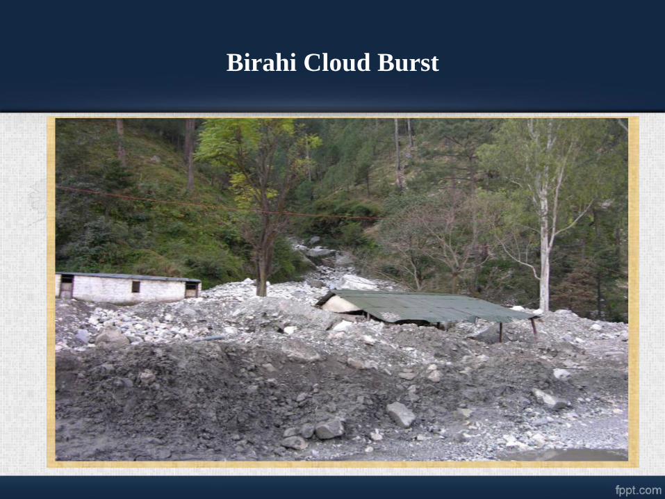
Birahi Cloud Burst

B2 Landslide
Sikkim (NH-39)
9th Mile Landslide
Sikkim (NH-39)Tangni Landslide
Uttaranchal (NH-58)
Kaliyasaur Landslide
Uttaranchal (NH-58)
Patalganga Landslide
Uttaranchal (NH-58)
Narendranagar Landslide
Uttaranchal (NH-58)

Year Place Death
1998 Malpa, Pithoragarh district 210
1998 Okhimath, Rudraprayag
district
107
2002 Ghansyali Tehsil, Tehri-
Garhwal
29
2004 Chamoli District 25
2014 Malin, Pune 150
Landslide of India

Landslide Assessment
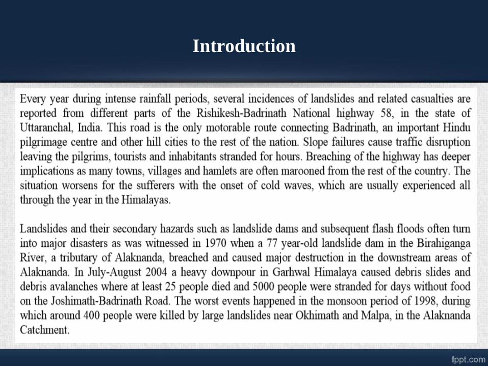
Introduction

Study Area
The study area is a part of
Alaknanada Bhagirathi and
Ganges basin which lies in
the state of Uttarakhand,
India extends with area of
1093.44 sq.km
Lat/Long extend from
30°1'53.56"N,
78°15'24.27"E to
30°35'5.74"N,
79°35'43.56"E

Field Photographs
Devprayag area as seen on satellite image.
A field view of overloading of hill slope at
Devprayag
A field view of overloaded slope by multi-
stored building at Devprayag.

Chamoli and surrounding area as viewed from
satellite image.
A field view
of rock fall
zone further
north of
Chamoli.
Joint
openings of
more than 8
cm are
visible.
A field view of active slide zone in the
immediate upslope of Birahi Ganga
Bridge.

A field view of cracks developed in houses due to
slow land subsidence in Saikot

Data and Software Used
– DATA USED
• ASTER 30m x 30m resolution DEM (Digital Elevation model)
• Lithology Map (1:50000)
• Weathering Map (1:50000)
• Road Map
– SOFTWARE USED
• The following given below software were used to process, create,
manipulate and analyse the data for our study:
• ArcGIS 10
• ERDAS IMAGINE 9.1
• Google Earth

Elevation Map And distribution of Landslides
A high elevation has high
potential energy and thus is a
causative factor for landslide.
Th landslides in the study area
ranges from 411m to 2843m
with mean elevation of
1015.67m.
Most of the large to medium
landslides were found to be
occurred at elevation higher
1000 m. A large number of
small landslides were found to
be occurred at mean elevation
of about 956 m.
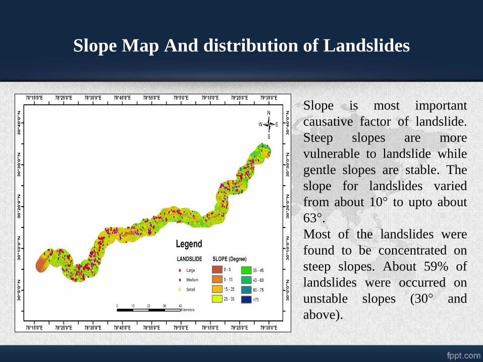
Slope Map And distribution of Landslides
Slope is most important
causative factor of landslide.
Steep slopes are more
vulnerable to landslide while
gentle slopes are stable. The
slope for landslides varied
from about 10° to upto about
63°.
Most of the landslides were
found to be concentrated on
steep slopes. About 59% of
landslides were occurred on
unstable slopes (30° and
above).

Lithology Map and distribution of Landslide
Study area has various
lithological units having
asymmetrical area
distributions. First five major
lithological units, covers most
of the study area. Landslides
number varied through these
lithological units. Most of
these landslides, about 74%,
were concentrated on three
major lithological units i.e to
dark grey phyllite with slate,
biotite schist with grey granite
gneiss and sandstone with
shale.

Distribution of Landslides on different Lithology
and mean slope of Landslides

Distribution of Landslides among different
Weathered zone
Weathering in the study area
varied from very high
weathering to nil weathering
and had five categories i.e
Very high, High, Moderate,
Low and Nil. 58% of the area
is low weathered while about
36% of the area is high to
moderately weathered. About
half of the landslides were
present in the low weathered
zone. High and moderate
weathered zone had about 45%
of landslides. Rest were
present in very high and Nil
weathered zone.

Landslide relation with weathering

Proximity of landslides to road
A significant correlation
between identified landslides
and proximity to road was
observed. Almost 94%
landslides were either on the
road side or near the road
(within 1km distance). It
showed that most of the
landslides were due to
anthropogenic activity i.e
due to road construction.
Only 6% of landslides were
occurred due to natural
processes.

Spatio-temporal change of Kaliyasur Landslide
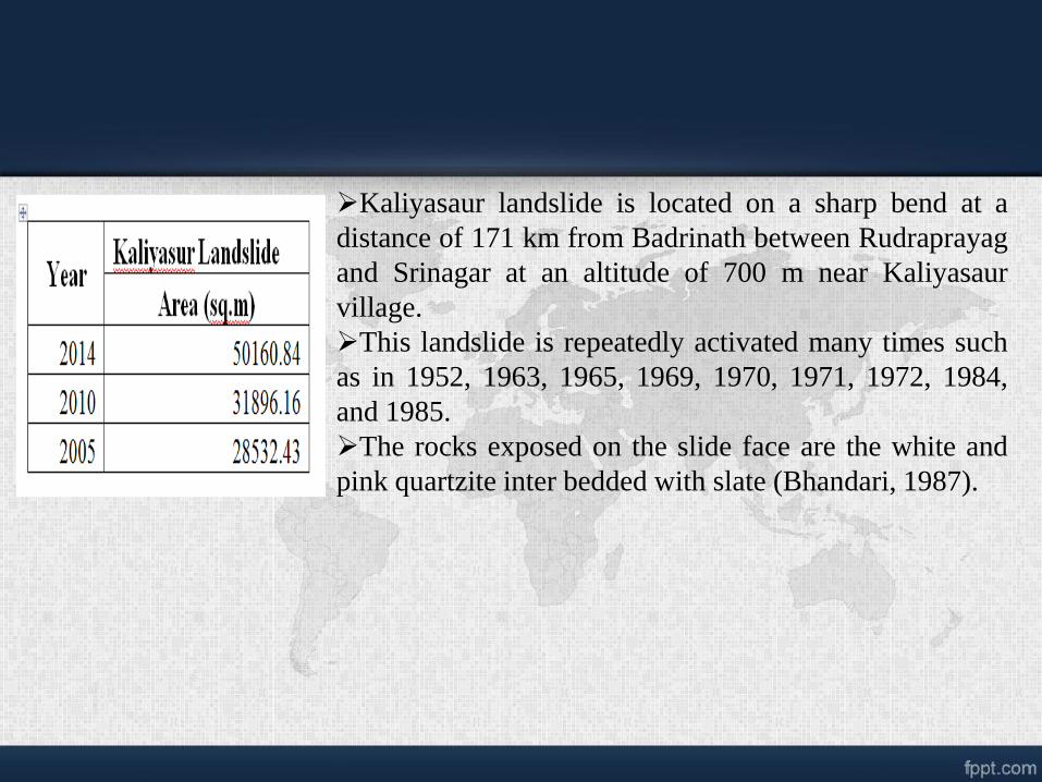
Kaliyasaur landslide is located on a sharp bend at a
distance of 171 km from Badrinath between Rudraprayag
and Srinagar at an altitude of 700 m near Kaliyasaur
village.
This landslide is repeatedly activated many times such
as in 1952, 1963, 1965, 1969, 1970, 1971, 1972, 1984,
and 1985.
The rocks exposed on the slide face are the white and
pink quartzite inter bedded with slate (Bhandari, 1987).

2003 2010
2011 2014

Increase in instability of slope is due to cutting slopes during road construction
and heavy rainfall are major cause of landslides in mountainous areas.
Three major lithological units found in the study area are fragile. Foliated
structure found in these lithologies has tendency to slide and slope cutting or
heavy rainfall could easily make slopes instable towards sliding.
Lineaments such as fracture, joints, faults present in the rock structure,
exhibits zone of weakness were present in large number in the study area.
Though, there were large numbers of landslides within the vicinity of these
lineaments, most of these landslides were along the roads.
Discussion

The study area is found to be highly prone to landslides. Weak lithologies, weak
lineament zones, varied degree of physical and chemical weathering and road
construction or widening are the major reasons behind the instability or
vulnerability of steep slopes towards landslides
Conclusion

FUTURE WORK

Instrumentation & Monitoring of Landslide
Rainguage
Control Station
Camra
Inclinometer
Piezometer
Wire Extensometers

Inclinometer Piezometer
Extensometer Rainguage
Monitoring Camra
Remote Control Station
REAL TIME DATA

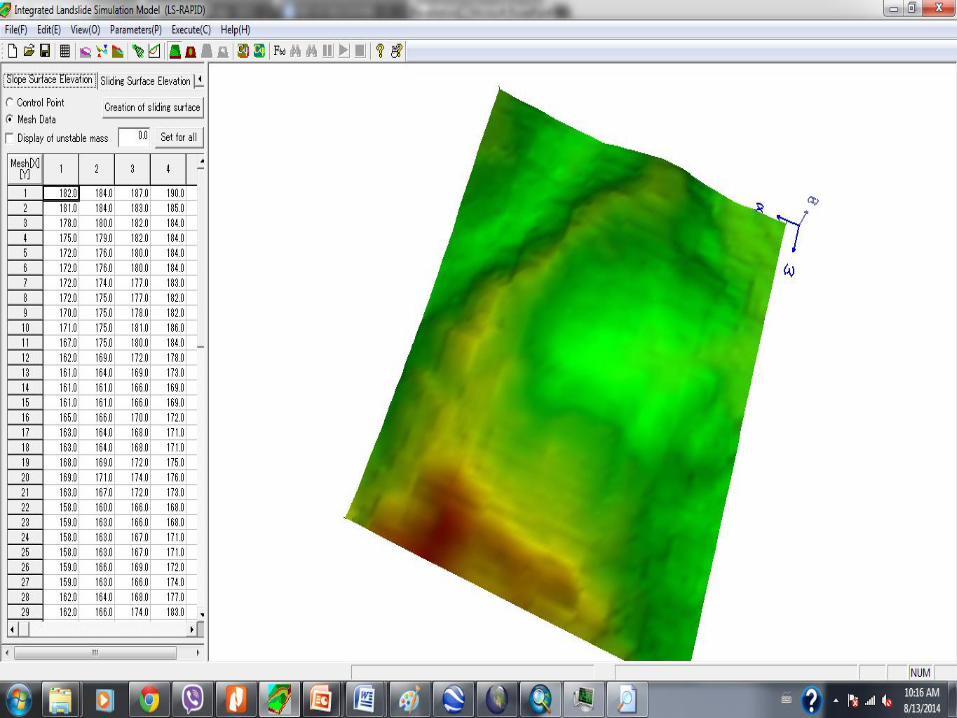
Landslide Gracia modelling using
Ls_Rapid

Ngarcia Landslide occur in 25, March
2013 in Gracia village triggered by
heavy rainfall, 11 houses, roads and
other infrastucture were destroid but
fortunately no death
Geographically, the LANDSLIDE is
located in south-western part of Albania
GEOGRAPHY OF
STUDY AREA


FOTO KU TE JEM EDHE UNE
NGA ATO FOTOT QE KEMI
BERE BASHKE
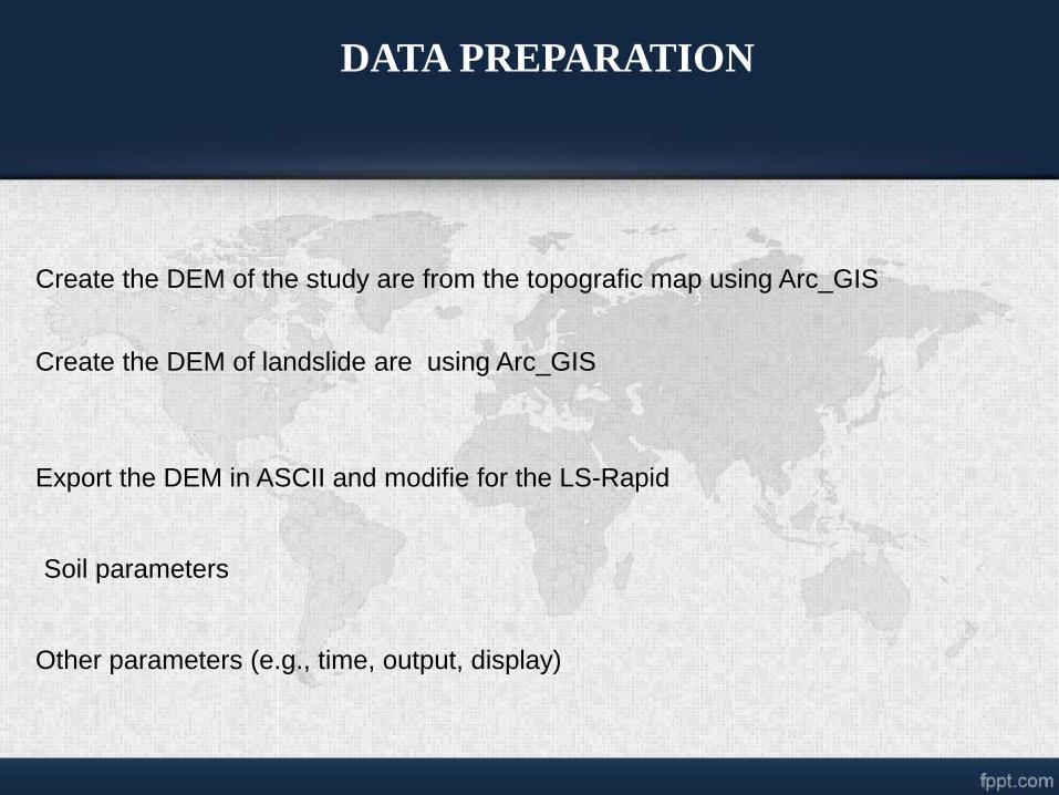
DATA PREPARATION
Create the DEM of the study are from the topografic map using Arc_GIS
Create the DEM of landslide are using Arc_GIS
Export the DEM in ASCII and modifie for the LS-Rapid
Soil parameters
Other parameters (e.g., time, output, display)


謝謝
“


