12
DOWNTOWN & RIVERFRONT MASTER PLAN 2-1

D O W N TO W N & R I V E R F R O N T M A S T E R P L A N2 - 1
CO M M U N I T Y V I S I O N 2 - 2
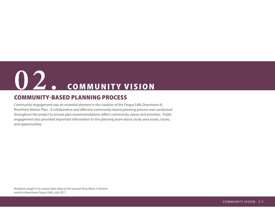
02. C O M M U N I T Y V I S I O NCOMMUNITY-BASED PLANNING PROCESSCommunity engagement was an essential element in the creation of the Fergus Falls Downtown & Riverfront Master Plan. A collaborative and effective community-based planning process was conducted throughout the project to ensure plan recommendations reflect community values and priorities. Public engagement also provided important information to the planning team about study area assets, issues, and opportunities.
Residents weigh in on master plan ideas at the annual Shop Move n’ Groove event in downtown Fergus Falls, July 2017

D O W N TO W N & R I V E R F R O N T M A S T E R P L A N2 - 3
The following is a brief summary of community engagement conducted during the planning process and common themes derived from community input:
PROJECT MANAGEMENT TEAM (PMT)The project was coordinated with and guided by the PMT, consisting of staff from the City of Fergus Falls. The PMT met monthly to review and comment on the project concepts, process and deliverables. A critical role of the PMT was to assist with the identification of key stakeholders and implementation of the community engagement plan.
COMMUNITY ADVISORY COMMITTEE (CAC)A Community Advisory Committee (CAC) consisting of residents, property owners, business owners, community advocates, arts organization representatives, students and other community stakeholders met regularly with members of the consultant team to assist in the development and review of master plan concepts, recommendations and deliverables. The CAC provided valuable insight, values and priorities that led to plan recommendations and implementation priorities.
STAKEHOLDER LISTENING SESSIONSThe planning process included a series of stakeholder listening sessions designed to solicit input regarding downtown and riverfront issues and opportunities. Stakeholders that participated in the listening sessions included major downtown employers, major riverfront property owners, major downtown development interest groups, and major downtown cultural and service groups.
Project Management Team conducting a kick-off tour
Workshop with the Project Management Team
Community Advisory Committee workshop
CO M M U N I T Y V I S I O N 2 - 4
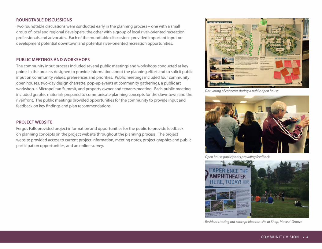
ROUNDTABLE DISCUSSIONSTwo roundtable discussions were conducted early in the planning process – one with a small group of local and regional developers, the other with a group of local river-oriented recreation professionals and advocates. Each of the roundtable discussions provided important input on development potential downtown and potential river-oriented recreation opportunities.
PUBLIC MEETINGS AND WORKSHOPSThe community input process included several public meetings and workshops conducted at key points in the process designed to provide information about the planning effort and to solicit public input on community values, preferences and priorities. Public meetings included four community open houses, two-day design charrette, pop-up events at community gatherings, a public art workshop, a Micropolitan Summit, and property owner and tenants meeting. Each public meeting included graphic materials prepared to communicate planning concepts for the downtown and the riverfront. The public meetings provided opportunities for the community to provide input and feedback on key findings and plan recommendations.
PROJECT WEBSITEFergus Falls provided project information and opportunities for the public to provide feedback on planning concepts on the project website throughout the planning process. The project website provided access to current project information, meeting notes, project graphics and public participation opportunities, and an online survey.
Dot-voting of concepts during a public open house
Open house participants providing feedback
Residents testing out concept ideas on-site at Shop, Move n’ Groove
D O W N TO W N & R I V E R F R O N T M A S T E R P L A N2 - 5
23 Wright Park Redesign - A Community-Based Process by and for the City of Fergus Falls
Site Master Plan
Otter Tail River
Otter Tail River
Accountant’s office
Railroad
Chapter 3: Preferred Trail Route 27Figure 3-1. Glacial Edge Trail Route Map
MILL CROSSING OPTION
FALLS CROSSING OTPION
WOODLAND OPTION
244TH ST OPTION
250TH ST OPTION
SOUTH SEGMENT
SPUR CONNECTION
CENTRAL SEGMENT
NORTH CENTRAL SEGMENT
FAR NORTH SEGMENT
CHAUTAUQUA ICE MARGIN LOOP
[0 0.5 10.25Miles
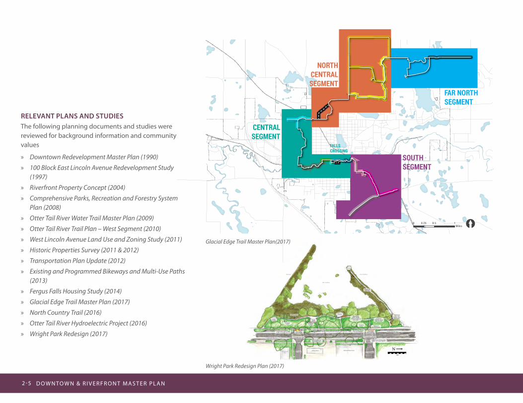
RELEVANT PLANS AND STUDIESThe following planning documents and studies were reviewed for background information and community values
» Downtown Redevelopment Master Plan (1990)
» 100 Block East Lincoln Avenue Redevelopment Study (1997)
» Riverfront Property Concept (2004)
» Comprehensive Parks, Recreation and Forestry System Plan (2008)
» Otter Tail River Water Trail Master Plan (2009)
» Otter Tail River Trail Plan – West Segment (2010)
» West Lincoln Avenue Land Use and Zoning Study (2011)
» Historic Properties Survey (2011 & 2012)
» Transportation Plan Update (2012)
» Existing and Programmed Bikeways and Multi-Use Paths (2013)
» Fergus Falls Housing Study (2014)
» Glacial Edge Trail Master Plan (2017)
» North Country Trail (2016)
» Otter Tail River Hydroelectric Project (2016)
» Wright Park Redesign (2017)
Wright Park Redesign Plan (2017)
Glacial Edge Trail Master Plan(2017)

CO M M U N I T Y V I S I O N 2 - 6
KEY TAKEAWAYS FROM RELEVANT PLANS AND STUDIES REVIEW: » Concentrate activity generators in the downtown area
» Enhance the gateway entries into the downtown area Capitalize on the “City of Parks” and the “Tree City USA” themes Fergus Falls is known for
» Enhance the “Winter City” aspects of Fergus Falls
» Create a “Community Focus” and direct new development toward the river
» Expand on the River Walk trail system
» Create a new Civic Center as an activity generator for downtown
» Expand or build a new Public Library for the Fergus Falls community
» Redevelop vacant and/or underutilized sites in the downtown and along the riverfront
» Respect and preserve the historic character of existing buildings
» Provide a range of housing opportunities for an aging and more diverse population
» Maintain and plant more trees along boulevards and downtown streets
» Provide bird watching and nature-oriented education activities along the river
» Connect walking and biking paths along the river to surrounding neighborhoods
» Expand park lands and recreational opportunities along the river
» Explore interest in an aquatic center
» Broaden recreational programs and activities for families and a growing elderly population
» Provide more river access for fishing, boating and other river-oriented activities
Precedent images of key ideas examined in past plans
D O W N TO W N & R I V E R F R O N T M A S T E R P L A N2 - 7
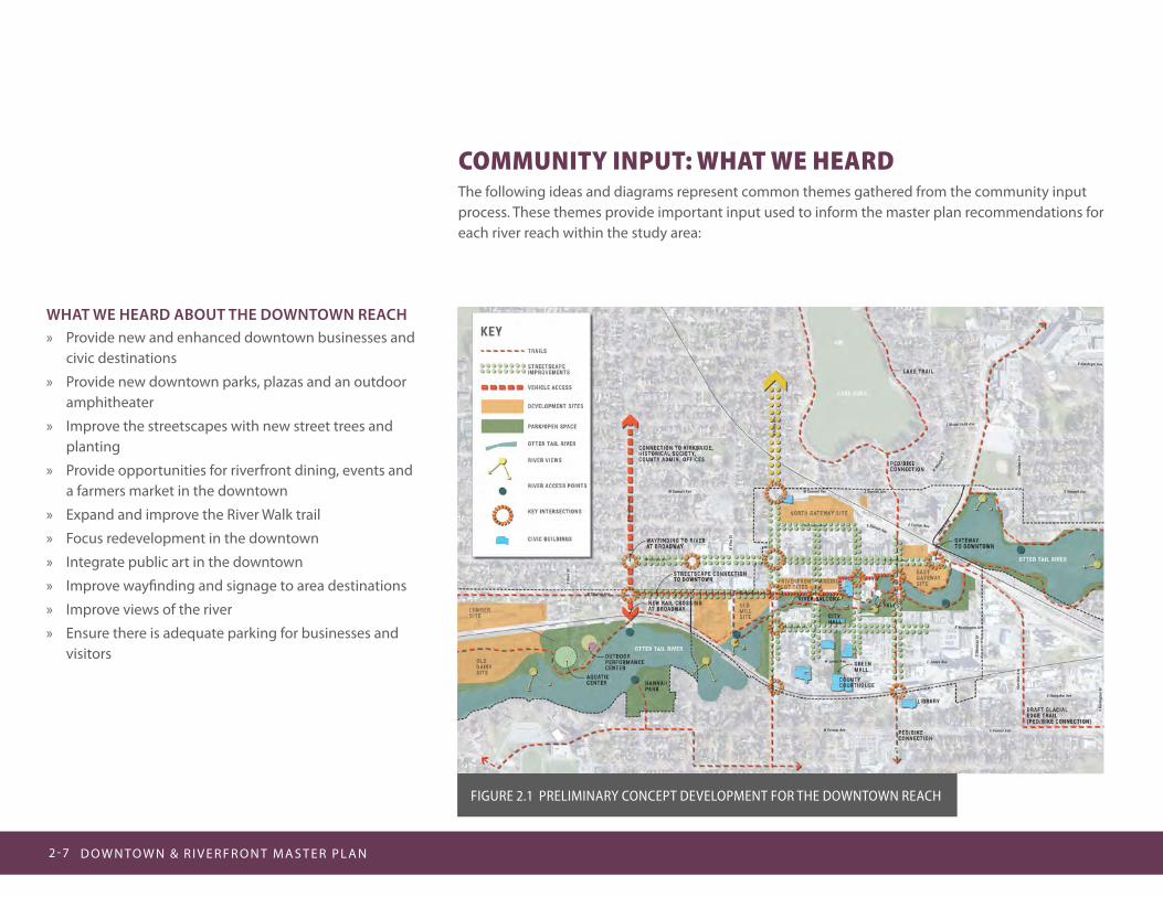
COMMUNITY INPUT: WHAT WE HEARDThe following ideas and diagrams represent common themes gathered from the community input process. These themes provide important input used to inform the master plan recommendations for each river reach within the study area:
WHAT WE HEARD ABOUT THE DOWNTOWN REACH » Provide new and enhanced downtown businesses and
civic destinations
» Provide new downtown parks, plazas and an outdoor amphitheater
» Improve the streetscapes with new street trees and planting
» Provide opportunities for riverfront dining, events and a farmers market in the downtown
» Expand and improve the River Walk trail
» Focus redevelopment in the downtown
» Integrate public art in the downtown
» Improve wayfinding and signage to area destinations
» Improve views of the river
» Ensure there is adequate parking for businesses and visitors
Figure 2.1 PreLiMiNArY CONCePT DeVeLOPMeNT FOr THe DOWNTOWN reACH

CO M M U N I T Y V I S I O N 2 - 8
WHAT WE HEARD ABOUT THE WEST RIVER REACH » Include a new riverfront trail
» Include opportunities for new river-oriented recreation
» Improve river access for river-oriented recreation (paddling, fishing, bird-watching)
» Include new parks and open spaces in the plan along the river
» Ensure there is public accessibility to the riverfront
» Provide opportunities for future redevelopment on the riverfront
» Integrate public art
» Improve wayfinding and signage
WHAT WE HEARD ABOUT THE EAST RIVER REACH » Improve river access for river-oriented recreation
(paddling, fishing, bird-watching)
» Include a new riverfront trail
» Include opportunities for new river-oriented recreation
» Provide opportunities for riverfront dining and events
» Ensure there is public accessibility to the riverfront
Figure 2.2 PreLiMiNArY CONCePT DeVeLOPMeNT FOr THe WeST riVer reACH
Figure 2.3 PreLiMiNArY CONCePT DeVeLOPMeNT FOr THe eAST riVer reACH
D O W N TO W N & R I V E R F R O N T M A S T E R P L A N2 - 9
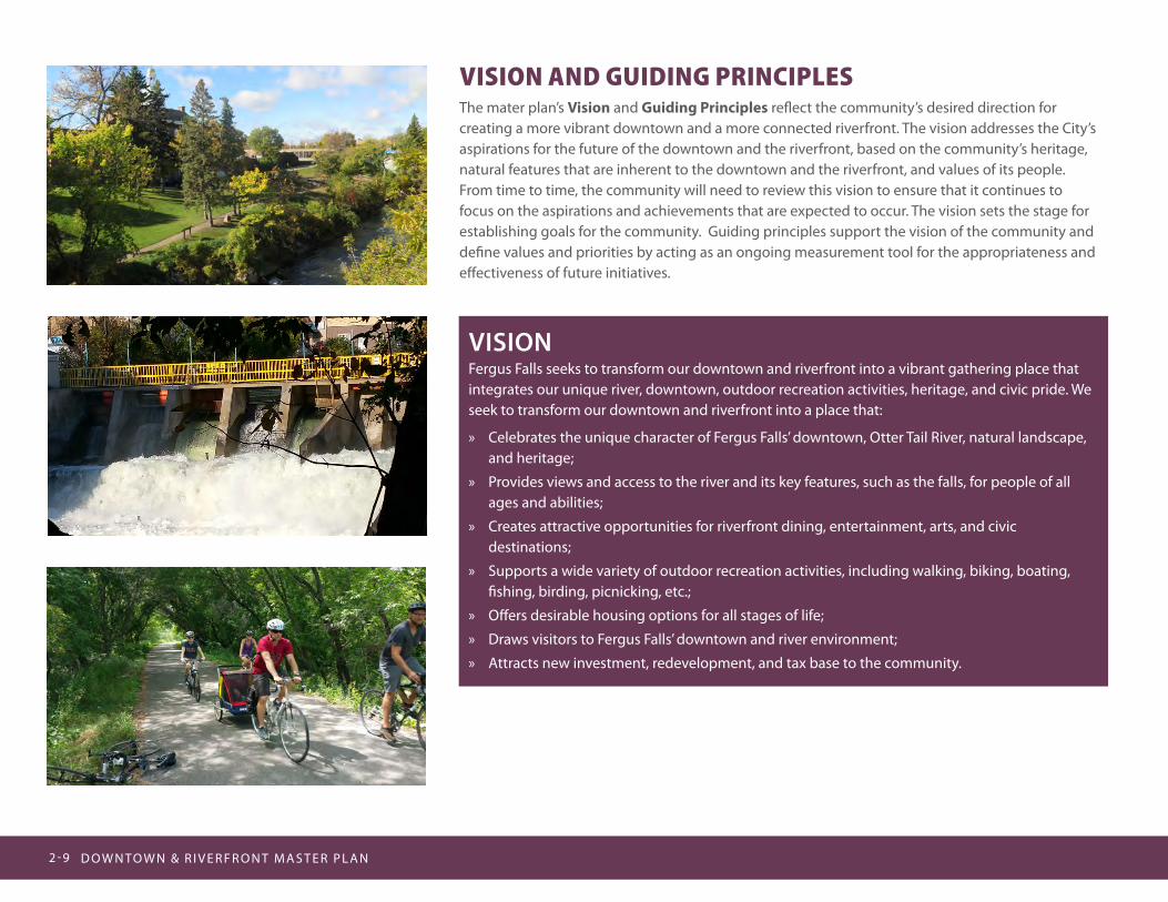
VISIONFergus Falls seeks to transform our downtown and riverfront into a vibrant gathering place that integrates our unique river, downtown, outdoor recreation activities, heritage, and civic pride. We seek to transform our downtown and riverfront into a place that:
» Celebrates the unique character of Fergus Falls’ downtown, Otter Tail River, natural landscape, and heritage;
» Provides views and access to the river and its key features, such as the falls, for people of all ages and abilities;
» Creates attractive opportunities for riverfront dining, entertainment, arts, and civic destinations;
» Supports a wide variety of outdoor recreation activities, including walking, biking, boating, fishing, birding, picnicking, etc.;
» Offers desirable housing options for all stages of life;
» Draws visitors to Fergus Falls’ downtown and river environment;
» Attracts new investment, redevelopment, and tax base to the community.
VISION AND GUIDING PRINCIPLESThe mater plan’s Vision and Guiding Principles reflect the community’s desired direction for creating a more vibrant downtown and a more connected riverfront. The vision addresses the City’s aspirations for the future of the downtown and the riverfront, based on the community’s heritage, natural features that are inherent to the downtown and the riverfront, and values of its people. From time to time, the community will need to review this vision to ensure that it continues to focus on the aspirations and achievements that are expected to occur. The vision sets the stage for establishing goals for the community. Guiding principles support the vision of the community and define values and priorities by acting as an ongoing measurement tool for the appropriateness and effectiveness of future initiatives.
CO M M U N I T Y V I S I O N 2-10
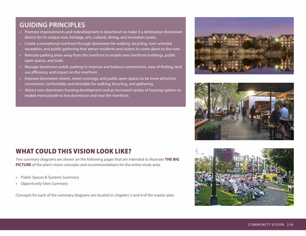
GUIDING PRINCIPLES » Promote improvements and redevelopment in downtown to make it a destination downtown
district for its unique river, heritage, arts, cultural, dining, and recreation assets.
» Create a recreational riverfront through downtown for walking, bicycling, river-oriented recreation, and public gathering that attract residents and visitors to come down to the river.
» Relocate parking areas away from the riverfront to enable new riverfront buildings, public open spaces, and trails.
» Manage downtown public parking to improve and balance convenience, ease of finding, land use efficiency, and impact on the riverfront.
» Improve downtown streets, street crossings, and public open spaces to be more attractive, convenient, comfortable, and desirable for walking, bicycling, and gathering.
» Attract new downtown housing development and an increased variety of housing options to enable more people to live downtown and near the riverfront.
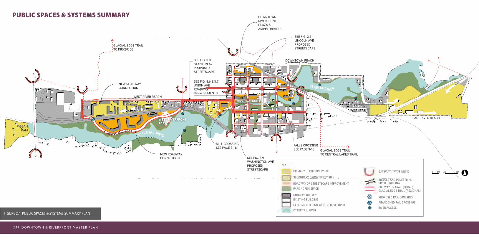
WHAT COULD THIS VISION LOOK LIKE?Two summary diagrams are shown on the following pages that are intended to illustrate THE BIG PICTURE of the plan’s vision concepts and recommendations for the entire study area:
» Public Spaces & Systems Summary
» Opportunity Sites Summary
Concepts for each of the summary diagrams are located in chapters 3 and 4 of the master plan.
2-11D O W N TO W N & R I V E R F R O N T M A S T E R P L A N2-11
Mill
St
N Un
ion
Ave
S Co
urt S
t
Public Rd
E Junius Ave
E Washington Ave
E Lincoln AveE Lincoln
Vine St
Ave
N Co
ncor
d St
Fribe
rg Av
e
W Washington Ave
S Sh
erm
an S
t
W Cavour Ave
W Summit Ave
E Riverside Ave
S Bu
se S
t
E Cavour Ave
W Junius Ave
E Summit Ave
Sher
idan
Ave
W Stanton Ave
E Cavour Ave
")1
St A
ndre
ws S
t
S To
wer R
d
Casc
ade
St
S Un
ion
Ave
°0 200 400 800
O
TTER TAIL RIVER
OTTER TAIL RIVER
PRIMARY OPPORTUNITY SITE
WEST RIVERFRONT PARK
SEE FIG. 3.6 & 3.7 UNION AVE ROADWAY IMPROVEMENTS
SEE FIG. 3.8 STANTON AVE PROPOSED STREETSCAPE
SEE FIG. 3.9 WASHINGTON AVE PROPOSED STREETSCAPE
SEE FIG. 3.5 LINCOLN AVE PROPOSED STREETSCAPE
DOWNTOWN RIVERFRONT PLAZA & AMPHITHEATER
NEW ROADWAY CONNECTION
NEW ROADWAY CONNECTION
WEST RIVER REACH
MILL CROSSING SEE PAGE 3-18
FALLS CROSSING SEE PAGE 3-18
RIVER BALCONY
GLACIAL EDGE TRAIL TO KIRKBRIDE
PISGAH DAM
KEY
GATEWAY / WAYFINDING
BICYCLE AND PEDESTRIAN RIVER CROSSINGBIKEWAY OR TRAIL (LOCAL)GLACIAL EDGE TRAIL (REGIONAL)
PROPOSED RAIL CROSSINGABANDONED RAIL CROSSING
RIVER ACCESS
SECONDARY OPPORTUNITY SITE
ROADWAY OR STREETSCAPE IMPROVEMENTPARK / OPEN SPACE
CONCEPT BUILDINGEXISTING BUILDING
EXISTING BUILDING TO BE REDEVELOPEDOTTER TAIL RIVER
PARKWAY AND TRAIL
DOWNTOWN REACH
EAST RIVER REACH
GLACIAL EDGE TRAIL TO CENTRAL LAKES TRAIL
PUBLIC SPACES & SYSTEMS SUMMARY
Figure 2.4 PuBLiC SPACeS & SYSTeMS SuMMArY PLAN

CO M M U N I T Y V I S I O N 2-12
Mill
St
N Un
ion
Ave
S Co
urt S
t
Public Rd
E Junius Ave
E Washington Ave
E Lincoln AveE Lincoln
Vine St
Ave
N Co
ncor
d St
Fribe
rg Av
e
W Washington Ave
S Sh
erm
an S
t
W Cavour Ave
W Summit Ave
E Riverside Ave
S Bu
se S
t
E Cavour Ave
W Junius Ave
E Summit Ave
Sher
idan
Ave
W Stanton Ave
E Cavour Ave
")1
St A
ndre
ws S
t
S To
wer R
d
Casc
ade
St
S Un
ion
Ave
°0 200 400 800
NO
RTH G
ATEWAY SEE FIG. 4.15 AND 4.16
EAST GATEWAY SEE FIG
. 4.13
EAST AND WEST RIVERFRON
T PARKIN
G LO
T SITES S
EE FIG
S. 4.3
TO 4
.7
CIVI
C M
ALL
/ W
ASH
INGTO
N AVE
SEE FIG. 4.18O
LD D
AIR
Y / L
UM
BER
SITE
S SEE FIG. 4.10 & 4.11
OPPORTUNITY SITES SUMMARY
Figure 2.5 OPPOrTuNiTY SiTeS SuMMArY PLAN
PRIMARY OPPORTUNITY SITE
KEY
SECONDARY OPPORTUNITY SITE
PARK / OPEN SPACE
CONCEPT BUILDING
EXISTING BUILDINGEXISTING BUILDING TO BE REDEVELOPED
OTTER TAIL RIVER
O
TTER TAIL RIVER
OTTER TAIL RIVER
WEST RIVERFRONT PARK
RIVER BALCONYOLD MILL SITE
WEST RIVER REACH
DOWNTOWN REACH
EAST RIVER REACH
DOWNTOWN RIVERFRONT PLAZA & AMPHITHEATER


