Point Peron “K” Battery Conservation Management Plan March 2016 201535 Page | 33 2.0 Documentary Evidence 2.1 Introduction The following documentation has been prepared using primary and secondary source material. Acknowledgment is extended to the authors of all secondary source material. It should be noted that a search of the National Archives of Australia was undertaken but revealed few relevant documents. The lack of documentation from the Commonwealth has been a source of frustration for previous researchers, notably Reg Kidd and Ray Neal in their book The ’Letter Batteries’ a valuable history of the factors leading to the construction and the operation of the batteries across Australia. It is the information provided by Robert K Glyde from his personal collection that provided the basis for the detail of the construction of “K” Battery at Point Peron. This history is not intended to be a comprehensive history of the site nor document every aspect of military life that occurred on the site during the period it functioned as a battery (1942-1944). That history is documented elsewhere most significantly the information collated by R.K. Glyde in ‘The Coast Defences of Western Australia 1826-1963’. The Royal Australian Artillery Historical Society of Western Australia (Inc.) have an active membership which publishes a newsletter with articles relevant to the current and former membership.
Transcript
Point Peron “K” Battery Conservation Management Plan March 2016
201535 Page | 33
2.0 Documentary Evidence
2.1 Introduction The following documentation has been prepared using primary and secondary source material. Acknowledgment is extended to the authors of all secondary source material.
It should be noted that a search of the National Archives of Australia was undertaken but revealed few relevant documents. The lack of documentation from the Commonwealth has been a source of frustration for previous researchers, notably Reg Kidd and Ray Neal in their book The ’Letter Batteries’ a valuable history of the factors leading to the construction and the operation of the batteries across Australia. It is the information provided by Robert K Glyde from his personal collection that provided the basis for the detail of the construction of “K” Battery at Point Peron.
This history is not intended to be a comprehensive history of the site nor document every aspect of military life that occurred on the site during the period it functioned as a battery (1942-1944). That history is documented elsewhere most significantly the information collated by R.K. Glyde in ‘The Coast Defences of Western Australia 1826-1963’. The Royal Australian Artillery Historical Society of Western Australia (Inc.) have an active membership which publishes a newsletter with articles relevant to the current and former membership.
Point Peron “K” Battery Conservation Management Plan March 2016
201535 Page | 34
Point Peron “K” Battery Conservation Management Plan March 2016
201535 Page | 35
2.2 Chronology of Development
The following events and decision have been selected for their impact on the development of Point Peron. Those items directly related to the Point Peron site are in bold text.
40,000 years BP Archaeological evidence of the Helena River Valley and Swan Coastal Plain indicates that Nyungar people have occupied the land for at least 40,000 years
12,000 years BP – present day
The current geological epoch, the Holocence, coincides with the rise in and stabilisation of sea levels around 12,000 years ago. Sea level rise drastically altered the landscape, as large areas were inundated, resulting in the present day Coast
1801 French scientific expedition led by Commandant Nicolas Baudin. Point and Cape Peron were named after the expedition’s chief zoologist, Francois Péron
1829 First Nyungar contact with non-Indigenous people when Captain James Stirling landed in Perth and established the British Swan River Colony
1831 Thomas Peel granted 250,000 acre over the Cockburn Sound area including Point Peron.
1860s Aboriginal people increasingly dislocated from the region.
1886 Aborigines Protection Act, 1886 established Aborigines Protection Board (APB). Officials, including Chief Protector, had increased power to regulate the employment and movement of Aboriginal people.
1905 The Aborigines Protection Act was introduced for the ‘protection, control and segregation of Aboriginal people’. The Act established an apartheid regime where Aboriginal people in Western Australia were discriminated agzainst and many civil liberties were denied.
1916 Cape Peron land, approximately 400 acres, acquired by the Commonwealth Government for the purposes of developing a naval base.
1920s-30s The waters off Cape Peron used for fishing and the headland is a popular tourist destination
1927 On 18 March, the Governor of Western Australia declared the City of Perth a prohibited area for Aboriginal people, under the Aborigines 1905 Act (WA)
1937 Japan invades China, an aggressive move in the war in the Pacific.
1939 3 September - World War II begins
1940 • 15 February – Hitler orders unrestricted submarine warfare • May/June – surrender of many European countries • 22 September - Japanese occupy Vietnam and French Indochina • 27 September – Japan signs Tripartite Pact with Germany and Italy
Point Peron “K” Battery Conservation Management Plan March 2016
201535 Page | 36
1941 • 19 November - HMAS Sydney sunk off the coast of WA • 8/9 December - Attack by Japanese on Pearl Harbour, Thailand, British Malaya,
Guam, Wake Island, Philliplippines, Hong Kong and Singapore.
1942 • 1/2 January – Japanese enter Manilla • 11/12 January – Japanese invade Dutch East Indies • 20 January – Japanese submarine sunk by HMAS Deloraine near Darwin and
Japanese invade Bali and Timor • 15 February - Fall of Singapore to Japanese • 17 February - Japanese submarines patrolling off the coast of WA • 19 February - Bombing of Darwin by Japanese • 3 March - First United States Submarines arrive in Fremantle • 3 March - Bombing of Broome by Japanese • 15 March – US Submarines arrive in Albany • 9 April – Japanese naval attacks on British Ceylon • 17 April – Dutch and British Forces in Sumatra surrender to Japanese and
General Douglas MacArthur arrives in Australia • 4-8 May - The Battle of the Coral Sea • 4-7 June – The Battle of Midway • 8 June - Japanese submarines shell Sydney and Newcastle, NSW • 20 July – Kokoda Track campaign begins in New Guinea • 7 August – Guadalcanal campaign begins • 26 August to 5 September – The Battle of Milne Bay is the first defeat of
Japanese land forces and lessens the threat to Australia. • October 1942 - ‘K’ Battery formed in New South Wales. • November 1942 – Battery personnel arrive in Fremantle and travel to Point
Peron.
1943 • 1 January - decline in numbers of submarines at Fremantle as many relocated to Brisbane
• January 1943 – Gun and searchlights arrive and are installed/emplaced at Point Peron ‘Peron Battery’.
• 28 January – Japanese bomb Port Gregory, north of Geraldton • 1/8 February – Japanese evacuate Guadalcanal • 6 May - US base at Exmouth declared operational • 27 May – Exmouth base downgraded to refuelling station after bombing
1944 • 6 June – Allied invasion of Normandy begins • 10 August – Japanese defeated in New Guinea • 4 September - British submarines arrive in Fremantle
1945 • 20 March US Navy transfers to Subic Bay, Phillipippines from Fremantle • 21 June – Japanese defeated at Okinawa • 4 July – Phillipippines liberated • 6 and 9 August – Atomic bombs destroy Hiroshima and Nagasaki • 14 August - Japan accepts surrender terms • 15 August – cease fire ordered transmitted to allies, VJ Day.
1946 • 15 December Point Peron Recreation Camp formally opened under guidance of the National Fitness Council and Department of Education.
1940s-1990s Former barracks used for Recreation Camp by school and community groups.
Point Peron “K” Battery Conservation Management Plan March 2016
201535 Page | 37
2.3 History and Context
2.1.1 Indigenous occupation and early explorers This section has been largely drawn from the Heritage Assessment of the area undertaken in 2011 by Brad Goode & Associates for developers Cedar Woods Pty Ltd and Landcorp.5
The South Western portion of Western Australia, an area to the west of a line roughly from Jurien Bay in the north to Esperance in the southeast is associated with the Bibbulmun Nyungar peoples. The Swan River area was inhabited by the “Whadjuk” who occupied the lands of the north and eastern tributary inland to Mt Helena at Kalamunda/Armadale to the Victoria Plains south of Toodyay, west to York and south along the coast to Pinjarra.6
5 Brad Goode & Associates Consulting Anthropologists & Archaeologists, ‘An Aboriginal Heritage Survey of a Proposed Marina and Tourism Precinct at Mangles Bay in Rockingham, Western Australia’ A report prepared for Cedar Woods Properties Ltd and Landcorp, June 2011.
6 Goode et al, op. cit. p. 12.
1972 Trigonometric reserve created around the Observation Post and the survey structure erected on the roof of the building
1971-1974 Construction of causeway to Garden Island
1992 Walkways constructed around the peninsular to provide access to the battery elements
c1997 Demolition of former barracks buildings
2015 • May and September volunteers dig out the sand accumulated in the bunkers • Conservation Management Plan prepared for the site.
Point Peron “K” Battery Conservation Management Plan March 2016
201535 Page | 38
The Rockingham area, was the ‘territory’ of the Beeliar Aboriginal group. The wetlands in this region were most intensively occupied, given the availability of fresh water and food resources (waterfowl, turtles, kangaroos etc).7 The more harsh coastal areas such as Point Peron (Moorli borlup) did not appear to be intensively occupied. Various researchers have recorded myths that relate to the creation of Cockburn Sound, Rottnest, Garden and Carnac Islands and the coast around Mangles Bay, what is now Rotary Park and adjacent wetlands. It is probable that there are myths relevant to the Point Peron locality but there are none currently recorded.
Figure 10: Map showing indigenous place names Courtesy www.derbelnara.org.au
The first recorded Europeans to visit the Perth and Rockingham areas were the Dutch explorer Willem de Vlamingh and his crew in January 1697. Vlamingh visited and re-named the uninhabited Rottnest Island after what the Dutch thought were large rats there, but which were actually marsupial quokkas. Rottnest’s Nyungar name was Wadjemup – island of the dead.
In 1801, a French scientific expedition had arrived, led by Commandant Nicolas Baudin. Point and Cape Peron were named after the expedition’s chief zoologist, Francois Péron. With the aid of the artist Charles Alexandre Lesueur, Péron was largely responsible for gathering about 100,000 zoological specimens. Although he died before he could fully study his specimens, Péron made a major contribution to the foundations of the natural sciences in Australia and was a prescient ecological thinker and a pioneer oceanographer. In the Rockingham area, however, most of the surveying and mapping was done by another expedition member, Louis de Freycinet.8
7 Goode et al, op. cit. p. 14. 8 Goode et al, op. cit. p. 14.
Point Peron “K” Battery Conservation Management Plan March 2016
201535 Page | 39
Captain James Stirling’s visit in HMS Success in 1827 to this part of the Western Australian coast was the direct cause of the colony being located at Swan River; Stirling’s crew also attempted to establish a garden on the island they named for that purpose, which Baudin’s crew had earlier called Ile Buache. Another Royal Navy officer, Captain Charles Fremantle, likewise explored Cockburn Sound and Garden Island, and had wells dug there before the newly appointed governor decided that the first British settlements should be adjacent to the Swan River; the port there was named in recognition of Fremantle’s efforts.9 The ships of American whalers based in Albany were also often seen; at anchor in what became known as Safety Bay in the early days of the colony.10
The first European settlers near the Rockingham area were on a 250,000 acre (about 101,000 ha) grant of land made to Thomas Peel, on the Cockburn coast at Woodman Point. Rockingham gained its name from a ship, which had brought some of Peel’s emigrants from England before being wrecked in Cockburn Sound during a storm during the winter of 1830. The southern and eastern boundaries of Peel’s grant were “in approximate accord with a tribal area of Aborigines whose leader was Galyute.11 With the commencement of European settlement, the rights of the Aboriginal inhabitants to their traditional lands were neither understood nor accepted.12
According to Goode et.al., the battle/massacre at Pinjarra had significant repercussions for the indigenous people of the Rockingham area. Indigenous people, including Galyute, became involved in a dispute with British settlers near Perth during visits to the Swan River area for ceremonial and other reasons. A raid followed retaliation by the settlers in April 1834 by up to 30 Nyungar men and women, led by Galyute, on William Shenton’s mill. George Shenton, William’s cousin, was threatened with spears and a large quantity of flour was stolen. Swan River Indigenous people identified Galyute and two others named Yedong and Monang as among the raid leaders; as a result, they were hunted down by armed police. Galyute was bayoneted and the two others suffered gunshot wounds when the police finally confronted them; all three were subsequently flogged, despite their wounds, with Galyute receiving 60 lashes and a short term of imprisonment.
The situation deteriorated in July 1834 when Galyute, Yedong and others killed one British soldier and wounded another in the Murray district; it was this which finally prompted Sir James Stirling, now governor, to assemble the party, which carried out the killings of Galyute’s clan members near Pinjarra in October that year. Galyute and Yedong escaped, but Galyute’s son and wife died because of the fighting. Yedong was shot dead by accident four years later, while Galyute was not heard of after 1840 and is thought to have survived into old age.
In 2011, one respondent who took part in an Indigenous heritage survey of the Rockingham area, said the “old people” used to say that Pinjarra had been a meeting ground and that Nyungar people had come back to the Rockingham area, after the white men broke it all up [at the Pinjarra battle in 1834].13 The veracity of this statement is hard to determine however such an event was no doubt a cataclysmic watershed in Indigenous relations with the European settlers.
9 Goode et al, op. cit. p. 15. 10 Goode et al, op. cit, p. 15. 11 Draper, R. Rockingham – The Visions Unfold: A history of the Rockingham District, City of Rockingham, 1997, p. 8; as quoted in
Goode, op cit, p. 15. Other versions include Calyoot, Galute, Kalyute or Wongir, see Goode et al, op. cit. p. 14. 12 Berson, M The Making of A Community, Town of Cockburn, 1978, p. 2; as quoted in Goode et al, op. cit. p. 15. 13 Goode, et al, op cit., p. 17.
Point Peron “K” Battery Conservation Management Plan March 2016
201535 Page | 40
An early visitor to the Rockingham area after the departure of Peel and his settlers to Mandurah was the explorer and surveyor-general John Septimus Roe. In a report to the governor in 1846, Roe mentioned a “small freshwater lake called Yadoba … and Richmond Lake, which is extensive, fresh and deep”. Yet none of the Indigenous inhabitants are mentioned in Roe’s reports, and for 150 years thereafter these people likewise remain conspicuously absent from the written history.14
In the 1840s and 1850s, it is likely that there were Aboriginal people still living in the Rockingham area. As elsewhere, the early settler practice of paying Aboriginal people with food, tea and tobacco was a major disruption to traditional life. Small amounts of flour or sugar were exchanged for services such as firewood collecting or fetching water. This source of ready food attracted the Aboriginal people into fringe dwelling camps; while they maintained their diet with bush foods and hunting, they became increasingly dependent on European foods.15 While still practising some aspects of their economies and culture, the fully traditional life of the Nyungar people had ended as early as the 1860s in some places, which almost certainly included the Rockingham area.16
During the Great Depression, the Aboriginal unemployed received a lower sustenance rate than their “white” counterparts, and the years 1936-1948 were a particularly oppressive period for Nyungar people as legislation caused children to be taken to designated reserves at places such as Moore River. Living more or less permanently in fringe camps, seeking out seasonal employment and supplementing their diet with game, fish and some “bush tucker” was a way of life which continued for many Aboriginal people until the 1960s, although by then many Nyungar people with links to the Rockingham area were living further away in other outer metropolitan or country areas.17
In relation to the Point Peron area, many Nyungars maintained they could not get in there because the white people would not allow it. There is no reason, however, to doubt that members of one family, recorded in a 2011 heritage survey, camped near Moorli borlup, on the Peron peninsula west of Lake Richmond, until the 1960s.18
The findings of the 2011 heritage survey concluded that if ceremonial activity did take place on Point Peron, then this must have ceased happening beyond living memory, in the 19th century.19
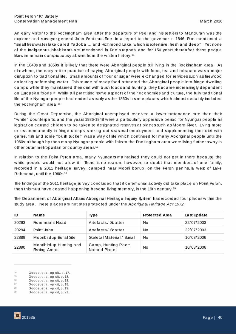
The Department of Aboriginal Affairs Aboriginal Heritage Inquiry System has recorded four places within the study area. These places are not sites protected under the Aboriginal Heritage Act 1972.
ID Name Type Protected Area Last Update
20293 Fisherman's Head Artefacts / Scatter No 22/07/2003
20294 Point John Artefacts / Scatter No 22/07/2003
22889 Mooribirdup Burial Site Skeletal Material / Burial No 10/08/2006
22890 Mooribirdup Hunting and Fishing Areas
Camp, Hunting Place, Named Place No 10/08/2006
14 Goode, et al, op cit., p. 17. 15 Goode, et al, op cit, p. 18. 16 Goode, et al, op cit, p. 18. 17 Goode, et al, op cit, p. 18. 18 Goode, et al, op cit, p. 19. 19 Goode, et al, op cit, p. 21..
Point Peron “K” Battery Conservation Management Plan March 2016
2.1.2 Pre World War One With the establishment of timber milling in Jarrahdale in the 1870s, a jetty was constructed in Mangles Bay at Rockingham in 1872 to export timber transported to Rockingham from Jarrahdale via a tramway completed in 1873. The establishment of the jetty led to the development and growth of public and commercial facilities in the Rockingham township on Mangles Bay, through the 1880s and 1890s. By the early 20th century however, the timber millers preferred exporting their product from Fremantle or Bunbury and there was a general downturn in the industry. Consequently, the fortunes of Rockingham townsite declined.20
At Point Peron there is little available evidence that there was any permanent settlements. One former resident Mrs Daisy May Hillbrick (nee Fisher) wrote in the 1970s when she was aged 85, that:
The only houses between Rockingham and Point Peron [before World War I] were two fishermen’s huts owned by Mr Dick Burkenshaw Cox and Mr Billy Willis respectively ... Just at Point
20 Place 2321 Rockingham Hotel, State Heritage Office Assessment Documentation.
Point Peron “K” Battery Conservation Management Plan March 2016
201535 Page | 42
Peron was a small group of Italian fishermen’s huts ... They sailed their catches to Fremantle for sale, but often brought fish to Rockingham also.21
The exact location of these fishermen’s huts has not been determined however a plan c1950 shows a collection of shacks on the northern boundary of Shoalwater Bay. It is probable that the earlier fisherman’s shacks were also located in this sheltered side of the point.
Figure 12: Illegally erected structures at Point Peron c1950 Courtesy SROWA item CD 1345, Cons 4912.
Apart from the professional fishermen there were enthusiastic amateurs who knew about the abundance of fish in the vicinity as a newspaper account by ‘Piscator’ from 1915 demonstrates.
Between Cape Peron and the south-west point of Garden Island, schnapper are usually plentiful at this time of the year, and on Saturday a party consisting of Messrs: Davidson, H. Harper, G. Munro and Archie Armstrong camped ashore at Careening Bay in order to make an early start next morning. They cruised about for a couple of hours trying several spots without success, and then they headed for Seal Islands. Hardly had lines been thrown out before a mighty tug
21 Hillbrick, Daisy ‘The Rockingham Historian’, Vol. 3, No. 3, August 2006, p. 4; as quoted in Goode, et al, op cit, p. 21. A search for information relating to Dick Burkenshaw Cox and Billy Willis was unsuccessful in determining any biographical detail.
Point Peron “K” Battery Conservation Management Plan March 2016
201535 Page | 43
announced a good bite, but the fish escaped. In less than a minute, however, a beautiful 14-pounder schnapper was hauled aboard, followed by five others in quick succession. After that there was a lull and a move was made back to Cape Peron. Three more schnapper and a couple of jewfish in addition to rock cod and large parrot fish were taken, before starting homewards. The aggregate weight of the fish caught was estimated at 1201b.22
2.1.3 World War One and the Inter-War Period The commencement of World War I had a profound impact on the Western Australian community. In the Rockingham district, many residents volunteered to serve in the AIF leaving families and the economy to cope in their absence. The implication for the Point Peron site was the transfer in 1916 of approximately 400 acres (161 Hectares) of land to the Commonwealth Government for the purpose of a naval base.23 This included all the land on the headland up to the present day Safety Bay Road to the east, and Boundary Road to the south. The proposed naval base did not proceed and it is one of the many government plans proposed for the site, which have not eventuated. It is not known if the Australian Government used the site during World War I.24
An interesting, if short lived, industry at Point Peron outside this study area, was the turtle factory located now within the grounds of the Mangles Bay Yacht Club. ‘Chelonia Ltd, was based in Glasgow and two local business men established the factory which transported turtles from the north of the state for the production of soup, conserves and turtle oil.25 The factory opened with great publicity in 1923, including a visit from the Premier but the business was not successful and ceased operating in 1932.26 The building was later used as a boarding house and from 1948 until 1973, was used as a convent school by the Sisters of Notre Dame des Missions.27
Until the 1920s and 1930s, Point Peron was a relatively remote location rarely accessed other than by locals. However, the increase in the number of private automobiles enabled many more individuals to access the site, which was promoted as being a worthy destination for tourists. In 1928, the RAC wrote in The Sunday Times a recommendation to visit Cape Peron when motoring to Rockingham and Mandurah.28
22 The Western Mail, 20 August 1915, p. 28-29. 23 Letter from Western Australian Crown Solicitor W. Renfrew to the Secretary of the Commonwealth Department of the Interior,
May 1968, folio 1977, NAA A463 1968-3201. 24 A search of the National Archives of Australia database provided no indication that any works were undertaken at the site.
Further research may determine more information about this period in relation to the site. 25 The West Australian, 10 October 1923, p. 7. 26 Information from Rockingham District Historical Society, February 2016. 27 Place record 3203 Turtle Factory, State Heritage Office database, InHerit. http://inherit.stateheritage.wa.gov.au/Public/ 28 The Sunday Times, 15 April 1928, p. 2.
Point Peron “K” Battery Conservation Management Plan March 2016
201535 Page | 44
Figure 13: An increasingly popular beach – tranquil and picturesque – at Cape Peron The Truth, 15 December 1929, p. 11.
Figure 14: Cape Peron near Rockingham Promotional image in The Western Mail The Western Mail,27 September 1923, p. 24
In c1924, local photographer Izzy Orloff, visited the site with a party and took several photographs, which give an indication that the landscape and flora have not changed considerably since that time until the present day [2015].
Point Peron “K” Battery Conservation Management Plan March 2016
201535 Page | 45
Figure 15: Fishing at Point Peron, c1924 Courtesy SLWA online image 012352d
Figure 16: Fishing at Point Peron, c1924 Courtesy SLWA online image 012355d
Point Peron “K” Battery Conservation Management Plan March 2016
201535 Page | 46
Figure 17: Point Peron, c1924 Courtesy SLWA online image 111975PD
Figure 18: Point Peron, c1924 Courtesy SLWA online image 111974PD
Point Peron “K” Battery Conservation Management Plan March 2016
201535 Page | 47
Figure 19: Outing to Point Peron, c1924. Mrs Rolf and party Courtesy SLWA online image 111982PD
Figure 20: Outing to Point Peron, c1924. Bowling Club Party Courtesy SLWA online image 111982PD
Point Peron “K” Battery Conservation Management Plan March 2016
201535 Page | 48
Figure 21: Outing to Point Peron, c1924. Bowling Club Party Courtesy SLWA online image 111979PD
Figure 22: Outing to Point Peron, c1924. Bowling party Courtesy SLWA online image 012354d
Point Peron “K” Battery Conservation Management Plan March 2016
201535 Page | 49
During the 1930s, Rockingham became a popular destination for residents of Perth and it is likely that many visited Point Peron during this period as the images above indicate.
The waters around Point Peron continued to be fished commercially by fishermen who lived in illegally built shacks. The location of the shacks has not been determined.29
In conjunction with the fishermen and tourists, the site was used by the military during this period for training as a detailed article in the local press in 1937 outlined the exercises.30
Point Peron, that narrow neck of land three miles from Rockingham, which runs out into the sea towards Garden Island, is showing signs of the battle which for the last two weeks has raged over its sandhills and beaches. Trenches, machine-gun emplacements and dug outs have scarred the slopes of the abrupt little mounds built up by the winds with out symmetry or order over the surface of the peninsula; the grass which, 14 days ago, made a green mantle for the hills and valleys has wilted beneath the feet of a thousand men; and the steel rimmed wheels of galloping limbers have churned the winding tracks into flying clouds of white powder. These are the fruits of war training. A week ago the 28th Battalion of the Militia Forces learnt valuable lessons in coastal defence. This week the 44th Battalion, the 13th Field Engineers and the Army Medical Corps carried on the work of teaching young Australians the art of defence. Next week artillery; signallers and supply and transport companies will continue the annual lesson.31
It appears that the training programs were an annual event that implies the senior officers in the military were familiar with the site, its location and accessibility.
With the outbreak of war in 1939, the Commonwealth Government began to reassess the use of this site particularly when Australia was subject to direct attacks in 1942.
2.1.4 World War Two – 1939-1945 – International context On 7th December 1941, while still technically at peace with Britain, its allies and the United States, Japan attacked the US naval base at Pearl Harbour, Hawaii, British Malaya, and military bases at Manila, Hong Kong and Shanghai. The United States was thus fully committed to the war in the Pacific, which in some measure had been underway since 1937 when Japan had invaded China.32
The sudden and devastating conquest by Japan of Hong Kong, Singapore, the Dutch East Indies and the Phillipippines, left Australia as the most suitable base for the development of an Allied counter offensive. The Japanese occupation of Timor and Rabaul threatened the USA-Australia lines of communication.33
The flow of troops and equipment from the USA to forward bases in Australia and Papua New Guinea indicated that these bases needed strengthening against possible sea attack. The large submarine bases to be established at Fremantle, Brisbane, Townsville and Cairns were of special importance.34
29 Draper, Richard (Victor Richard) Rockingham – The Visions Unfold: A history of the Rockingham District, 1997, p. 205. 30 The West Australian 14 October 1937, p. 22. See Appendix 8. 31 ibid. 32 Cairns, Lynne Secret Fleets, p. 45. 33 Kidd, Reg and Neal, Ray The ‘Letter’ Batteries the history of the ‘letter’ batteries in world war II self published, NSW, 1998, p. 7. 34 Kidd and Neal, The ‘Letter’ Batteries, op.cit. p. 7.
Point Peron “K” Battery Conservation Management Plan March 2016
201535 Page | 50
The allies chose Fremantle as a submarine base because of its close proximity to the territory to the north captured by the Japanese in early 1942, and; it was the closest viable port in Australia that had the infrastructure to cope with the submarine fleets and the associated infrastructure.35
On 3rd March 1942, the first United States submarines arrived in Fremantle escorted by tender USS Holland. The Fremantle submarine base was in operation until the war ended. During this period, 168 Allied submarines, together with their support vessels were hosted in Fremantle.36
General Douglas MacArthur arrived in Darwin on 17 March 1942 as Supreme Commander of the Allied Forces in the South West of the Pacific area. On 18 April, MacArthur assumed command over all Australian Forces in addition to all United States forces.37 MacArthur was able to draw on the resources of the United States military to secure additional equipment for the coastal defences.
The defence of the port of Fremantle included several strategies, which together became known colloquially as ‘Fremantle Fortress’.
2.1.5 Fremantle Fortress A review of the seacoast defences was held in April 1942 under the direction of Vice Admiral Herbert F. Leary and the following extract of the memo to Chief of Staff is included to demonstrate the extent of the works undertaken in and around Fremantle to defend the port.
SEACOAST DEFENSE PROJECT FREMANTLE- COCKBURN SOUND DEFENSIVE AREA
I. SITUATION: Fremantle is the main Naval repair and operating base in Western Australia. It is isolated from other Naval centres, hence wil require construction of repair shops for aircraft carriers, cruisers and smaller vessels. Facilities should be made for storage, erection, repair and operation of Naval aircraft. The port is the only one on the West Coast suitable for use by the Army as an expeditionary force embarkation port – (See Anti-aircraft Defense Plan)
II. EXISTING SEACOAST DEFENSES: ROTTNEST ISLAND 2 guns 9.2” range 29,000 yards 2 guns 6” range 18,500 yards ARTHUR’S HEAD 2 guns 6” range 14,500 yards SWANBOURNE 2 guns 6” range 14,500 yards
III. PROJECT The development of COCKBURN SOUND as a fleet anchorage will involve considerable improvement of the water channel. The line of reefs between ROTTNEST ISLAND and GARDEN ISLAND is, in general, impassable for large vessels. Ships of medium draft will require pilots and definite knowledge of the cross channels. The dredging of a north entrance to the COCKBURN SOUND base will permit control of the channel by submarine booms and other types of underwater protection. The South Passage can be blocked.
35 Cairns, Lynne Secret Fleets Fremantle’s World War II Submarine Base WA Museum, 2011, p. 15. 36 Cairns, Lynne Secret Fleets Fremantle’s World War II Submarine Base WA Museum, 2011, p. 15. 37 Kidd and Neal, The ‘Letter’ Batteries, op.cit. p. 7.
Point Peron “K” Battery Conservation Management Plan March 2016
201535 Page | 51
Destroyers and torpedo boats, however may strike at the flanks of the anchorage unless protection is provided. FREMANTLE HARBOR affords limited ship anchorage. The channel entrance may be blocked. The restricted harbor area prevents the massing of fleet units. This situation influences the development of COCKBURN SOUND which permits dispersion of individual fleet elements at anchor. All vessels are forced to enter and leave the area from the North. A South exit would be desirable in order to maintain direct communication with the ALBANY base but the nature of the channel bottom makes dredging impracticable. Additional installations in the FREMANTLE-ROTTNEST ISLAND-GARDEN ISLAND triangle will extend and intensify the existing defences. Batteries on ROTTNEST ISLAND and in the FREMANTLE vicinity provided protection at these points. Further development of the GARDEN ISLAND section will extend the defences. A low priority mine project is proposed. Indicator loops now installed are to be extended and anti-boat nets and guns are contemplated. Dredging activities are under way to provide with COCKBURN SOUND a five mile channel 25 feet deep and 300 feet wide. This channel is scheduled for completion by November 1942. It is planed to widen this channel to 600feet and deepen it subsequent to November. In addition to the Navy mine project the following seacoast equipment should be installed – 1 Battery 2 155mm guns on 360 degree semi permanent mount in the vicinity of ENTRANCE
POINT – GARDEN ISLAND 1 Battery 2 155mm guns on 360 degree semi permanent mount in the vicinity of CAPE PERON 2 Seacoast searchlights 60 inch for each of the positions referred to – a total of four search
lights. Fire control equipment, ammunition storage, troop housing etc. at each proposed emplacement. One anti-boat boom and eight anti-boat guns to be place on selected sites.
Location of batteries as indicated will provide high explosive artillery fire to cover all possible naval entrances to COCKBURN SOUND. The volume of fire in the GAGE ROADS – OWEN ANCHORAGE area will be increased thereby further improving the defense at the entrance to FREMANTLE HARBOR. The 155mm batteries will be mutually supporting against flank landing attacks by the enemy, although each will require its own infantry beach defense. Anti-aircraft defense will be required as follows – 5 guns stations each of four 3.7 inch guns
4 anti-aircraft searchlights The anti-aircraft gun batteries should be located in so far as possible to provide incidental gun defense against small boat landing sin the vicinity of the respective 155mm gun battery sites.38
Each of the other port areas; Albany, Adelaide, Port Phillip (Melbourne), Brisbane and Moreton Bay, Sydney, Townsville, Cairns, Thursday Island, Darwin, Port Moresby (New Guinea) and Hobart were discussed in equal depth which demonstrates how the Cockburn Sound defences fitted into to an integrated national plan.
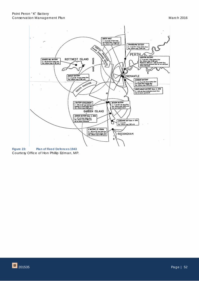
Plans at Figure 23 and Figure 24 demonstrate the extent and interconnectedness of the defences around Fremantle and Cockburn Sound.
38 Extract from Memo to Chief of Staff from General Headquarters Southwest Pacific Area, 18 May 1942; as quoted in Kidd and Neal, The ‘Letter’ Batteries, op.cit, p. 12-13.
Point Peron “K” Battery Conservation Management Plan March 2016
201535 Page | 52
Figure 23: Plan of Fixed Defences 1943 Courtesy Office of Hon Phillip Edman, MP.
Point Peron “K” Battery Conservation Management Plan March 2016
201535 Page | 53
Figure 24: Plan of Defences around port of Fremantle Courtesy The Letter Batteries, p.44.
The elements of the defences which were not visible were those which took place under the water surface. While submarines, aircraft carriers, merchant ships and battleships could access the security of Fremantle Harbour, the Garden Island naval base in Cockburn Sound was being expanded to cater for large ships up to the size of cruisers. This work involved three stages, dredging a shipping channel through the Parmelia and Success sandbanks and constructing defences spanning the northern and southern entrances of
Point Peron “K” Battery Conservation Management Plan March 2016
201535 Page | 54
Cockburn Sound.39 Five dredges were used throughout, four having to be brought across from Australia’s east coast. The crews lived aboard and worked fourteen hour shifts.
An anti-submarine boom defence was constructed at the northern approaches, and anti-boat scaffolding (hurdle defence) was constructed across the southern approaches, in the approximate area of the modern causeway bridge linking Point Peron with Garden Island. These constructions commenced in November 1943. The anti-submarine netting was completed in September 1944.
The northern approach boom defences spanned 30731 feet (9370m) from Second Head, Garden Island along a boomerang shaped route corresponding to the southern edge of the shallows of the Parmelia Bank, finishing at the northern side of Woodman Point.
Figure 25: Building anti boat scaffolding in Cockburn Sound, 1943. Courtesy Australian War Memorial, P04262.003
39 Carter, Matt and Anderson, Ross; Cockburn Sound’s World Wrr II anti-submarine boom net Historical background and site inspections. Report - Department of Maritime Archaeology, Western Australian Museum No.252 March 2010, p. 6.
Point Peron “K” Battery Conservation Management Plan March 2016
201535 Page | 55
Figure 26: Defence hurdles in Cockburn Sound, 1943. Courtesy Australian War Memorial, P04262.004
In July 1942, Allied Land Headquarters issued orders for the raising of the first eight of the coast artillery batteries. The term ‘Letter’ batteries arose from the distinguishing letters ‘A’ to ‘H’ allocated by the Land Headquarters. Subsequent batteries within the overall program of coastal defence were allocated a ‘letter’ to designate them. The last named battery ‘U’ was located on Bougainville.40
2.1.6 Peron ‘K’ Battery This section is largely drawn from the information provided by R K Glyde in his document on the ‘The Coast Defences of Western Australia 1826-1963’, 2000. Acknowledgement is extended to the author of that document.
In November 1942, planning was well in hand for the batteries to be constructed at Garden Island and Point Peron. A memo prepared at Swan Barracks, the Western Australian Headquarters of the Australian Military Forces, designated personnel required for the Point Peron battery were 4 officers and 76 service men.41
The Battery (or group of officers and soldiers assigned to the site) was raised in October 1942 and comprised personnel from NSW, Victoria and Queensland. The original officers comprised Battery Commander Major B Miller, Captain A Brooke, Lieutenants C. H. McPharlin and W. B. Jackson. Later in 1943, Major F. Vaughn assumed command of the battery.42
On 18 November, the command of the Fremantle Headquarters was advised that a US officer would be arriving shortly to assist in the installation of the guns. The next day, 19th November, the Battery personnel were transferred from Fremantle to Rockingham and accommodated there prior to the completion of the barracks.
40 Kidd and Neal, The ‘Letter’ Batteries, op.cit, p. 382. 41 Memo dated 23 November 1942, copy held by the office of Hon Phillip Edman. 42 Glyde, op.cit., unpaginated.
Point Peron “K” Battery Conservation Management Plan March 2016
201535 Page | 56
On 23 November 1942, official authority was received to proceed with the construction of the Battery. Construction appears to have gone smoothly as on 10 January 1943 the Battery was advised that two 18 pr Mk II guns were to be provided for the hurdle boom defence between Garden island and Point Perth. These guns were eventually replaced with larger 75mm guns. These were separated to the guns positioned on the mounts which were 155mm M1918 Coastal Field Guns.
The 155mm M1918 Coastal Field Guns guns were installed using a ‘Panama Mount’. This prepared concrete mounting allowed the gun to be anchored to a pivot block set in concrete. The trail ends rode on a concrete and a steel racer ring to enable the gun to be traversed rapidly through large angels to permit engagement of moving targets at sea.43
The following images at Figure 27 and Figure 28 illustration the construction as recommended by the US military.44
Figure 27: Plan showing construction of Panama Mount Courtesy Office of Phillip Edman, MP.
43 Glyde, R.K. op. cit. 44 Plans held by the office of Hon Phillip Edman, MP.
Point Peron “K” Battery Conservation Management Plan March 2016
201535 Page | 57
Figure 28: Detailed plan of construction of Panama Mount Courtesy Office of Hon Phillip Edman, MP.
The Battery made a request on 25 February 1943, to expend six rounds to ‘proof’ the guns and this was undertaken on 8th March 1943. Proof firing is the process of firing rounds to settle the gun into position prior to normal firing of live ammunition.45 A full calibre shoot was conducted on 29th March and there is a record of a further full calibre shoot on 16 July 1943.
On 14th April, a Bofor gun46 was delivered to the Battery for defence against aircraft attacking at low level and a shoot was conducted by this weapon in conjunction with a similar weapon on Garden Island.
The Operations Centre or Battery Plotting Room (BPR) was originally concealed in a thicket of scrub in a depression between the guns and the Battery Observation Post (BOP). The Operations Centre was completed on 9th May 1943 at the same time as the BOP. It was not until 10 August 1942, that the green painted camouflage was completed on the BOP and the BPR.
The Battery was officially notified that it was to be known as “K” heavy Battery on 7th July 1943.
45 Draper, Richard Rockingham – The Visions Unfold: A History of the Rockingham District, City of Rockingham, 1997, p. 205. 46 Bofors AB is a Swedish arms manufacturer still in operation today [2015]. The name Bofors is strongly associated with the 40
mm anti-aircraft gun used by both sides during World War II. This automatic cannon is often simply called the Bofors gun and saw service on both land and sea. It became so widely known that anti-aircraft guns in general were often referred to as Bofors guns.
Point Peron “K” Battery Conservation Management Plan March 2016
201535 Page | 58
Figure 29: Survey of Cape Peron prior to construction of “K” Battery Courtesy Office of Hon Phillip Edman, MP.
Two searchlights were part of the Battery components, one on John Point and the other at Mushroom Rocks. Communication between the elements of the Battery was generally by telephone.
Figure 30: Typical searchlights used on John Point and Mushroom Rocks Courtesy Robert Mitchell.
Point Peron “K” Battery Conservation Management Plan March 2016
201535 Page | 59
The barracks buildings appear to have been constructed in February to March 1943. A letter from the Works Director in Perth to the Assistant Director General of Allied Works in Melbourne in January 1943 refers to a plan to make the barracks buildings to appear like a holiday resort as a form of camouflage.
CAPE PERON CAMP
In connection with the above mentioned camp, requisition W.2/32/4 has been received from the Army Authorities for the construction of approximately nine camp buildings. A letter is also to hand requesting that “as the camouflage scheme devised for this site is to build it as a holiday resort, it will be necessary to alter the Administration and Store Huts to appear as cottages. Will you please amend these plans in accordance with sketches shown herewith.” The amendments consist of variations of the type “C” series plans and the Administration Hut has been shown with a pitched roof and sheeted with tiles.47
The above description is consistent with the memories of former Bombardier, Fred Warnett, whose recollections were recorded by author Richard Draper in his 1997 history of Rockingham. Fred Warnett arrived at Point Peron in 1943 and was billeted at the old Turtle Factory, which was located closer to Rockingham on the Point Peron Road because the barracks were not complete. Fred Warnett recalled the barracks were built to resemble a holiday and recreation establishment to avoid attracting attention from Japanese reconnaissance. The main building served as a mess, lecture theatre, occasionally as a dance hall, or as a venue for other entertainment acts.48 Fred Warnett recalled many details of his time at Point Peron which was characterised by long periods of boredom.
As a Bombardier, Mr Warnett worked in the Plotting Room … Everyday work on the battery was quite boring, … except on occasions when an inspection was imminent. The General Officer Commanding Western Command, Major General Robertson was notorious for his “sharp tongue for slackness”, so whenever it was thought he had left Headquarters, the units were always on “full alert”.49
The army food was also predictable and boring.
… typical army food, wholesome, but with no choice: “If it was rissoles or mince for the day that wa it and no returns”. Main meals consisted of:
Mutton in stews with Haricot beans Tinned bully beef – cold or cooked Mince in rissoles Camp pie – cold or cooked Potato pie with cheese and/or tomato on top Vegetables were dried; eggs powdered; and butter in tins. Porridge was provided for breakfast
and sweets were invariably dried apricots, prunes or rice, served with custard. Tea was available with meals and while on duty.50
A highlight for the troops were the occasions when they undertook target practice with the guns. The target was invariable an object towed out to sea by the Naval Motor Launch Wadjenup.51
47 Letter held by the office of Hon Phillip Edman MP. 48 Draper, Richard Rockingham – The Visions Unfold: A History of the Rockingham District, City of Rockingham, 1997, p. 205. 49 ibid, p. 206. 50 Ibid. 51 Ibid.
Point Peron “K” Battery Conservation Management Plan March 2016
201535 Page | 60
Figure 31: Peron Barracks, early 1940s Courtesy Point Peron Restoration program website.
On 24th November 1944, No 2 gun and No.17 searchlight were removed from their emplacement and on 1st December, the Battery ceased operational duties.52
Following the removal of artillery from the site in 1944 proposals for the future use of the site were put forward by various groups. One proposal outlined in the local press was the idea to use the former barracks as a rehabilitation centre for ex-servicemen who were ineligible for repatriation benefits. The Deputy Commissioner of Social Services J.R. Ashall outlined the proposal in December 1945, as follows.
Social Services Dept. is responsible for aftercare and welfare of discharged men whose disabilities are not war-caused, explained Mr Ashall. … In a number of cases, particularly men suffering from an anxiety state or lack of self confidence, all they need is somewhere similar to a convalescent depot.
We have this week been given approval to take over a suitable camp at Point Peron, … This is ideal.
Men will be able to recuperate and find renewed self confidence under the supervision of an occupational therapist, soon to be appointed.53
Plans for this future use of the camp proceeded swiftly and in February 1946 a camp manager was appointed.54
52 Glyde, R. K. The Coast Defences of Western Australia 1826-1963 A Study by R. K. Glyde for personal use, Printed 2000. It is not known when the other gun was removed from the site.
53 The Sunday Times, 16 December 1945, p. 5. 54 The Daily News 26 February 1946, p. 10.
Point Peron “K” Battery Conservation Management Plan March 2016
201535 Page | 61
Figure 32: The Daily News, 26 February 1946, p. 140.
It is not known why this program was ultimately rejected for this site however, it was not long before negotiations with the National Fitness Council secured a long term tenant for the place.
2.1.7 Point Peron Camp 1946-c1985 In May 1946, the National Fitness Council leased the former barracks site and the land extending to Point John for use as a holiday and recreation camp. In December 1948, the Council was granted a 21 year lease of this area for a rental of £1 per year.
The National Fitness movement in Australia emerged from a need to prepare Australians to fight in the Second World War. Following meetings of the National Coordinating Council for Physical Fitness, the Western Australian Council of Physical Fitness was formed as an incorporated body on 26 September 1939.55
The Western Australian Council of Physical Fitness was incorporated as the National Fitness Council on 19 February 1940. The Council operated under the chairmanship of the Minister for Health, Alexander Panton. In January 1944 the Premier disbanded the council and appointed a new council on the 23 March 1944 under the portfolio of the Minister for Education, John Tonkin. Due to limited funding the National Fitness Council depended heavily on voluntary workers and a series of committees.56
The National Fitness Act of Western Australia 1945 confirmed the Council as a statutory body. Its objectives were to coordinate and expand services and organisations concerned with physical fitness in Western Australia and to promote the value of physical fitness and cooperate with local authorities in provision of recreational and training facilities. Initially what began as a scheme to promote community physical fitness soon began concentrating on the 14 - 21 age group.57
55 The History of the Department, Department of Sport and Recreation website, http://www.dsr.wa.gov.au/about/history accessed December 2015.
Point Peron “K” Battery Conservation Management Plan March 2016
201535 Page | 62
The Point Peron Camp was one of the first camps in the greater metropolitan area and together with the Bickley Recreation Camp they provided supervised activities and accommodation for school and community groups.
The camp was formally opened on Sunday 15th December 1946 by the Minister for Education and Social Services, John Tonkin. The first group who stayed there were 80 children from the Wongon Hills area who were transported from their home school by train and bus.58 In a speech opening the camp the Director of Education, Murray Little, said that the idea to use the camp had its origins in a letter from a ‘Mr Ackland’ of Wongan Hills, who wrote to him in 1942 suggesting a camp for children from regional areas. With the onset of war the idea was shelved, however shortly after the end of the war Mr Ackland had been in touch again suggesting this venue for a camp. With the support of the National Fitness Council the proposal was able to proceed.59 On the opening day ‘Mr Ackland’ was present to share ‘the enthusiasm of the children [which] showed that the camp had filled a need and provided a portent of the success of the similar camps that it was planned to hold there in the future.’60 Mr Ackland, as part of the opening ceremony, planted a red hibiscus tree. (See Appendix 8)
The campsite was the venue for many school camps until the 1990s. In addition a range of community groups used the facilities. In the late 1940s the camp was well promoted in the local press accompanied by images of young people enjoying active outdoor activities as promoted by the National Fitness Council. (Refer to Appendix 8 for relevant articles)
An image from a 1948 camp organised by the Anglican Youth Movement indicates that the camouflage was still in place over the guns at that time.
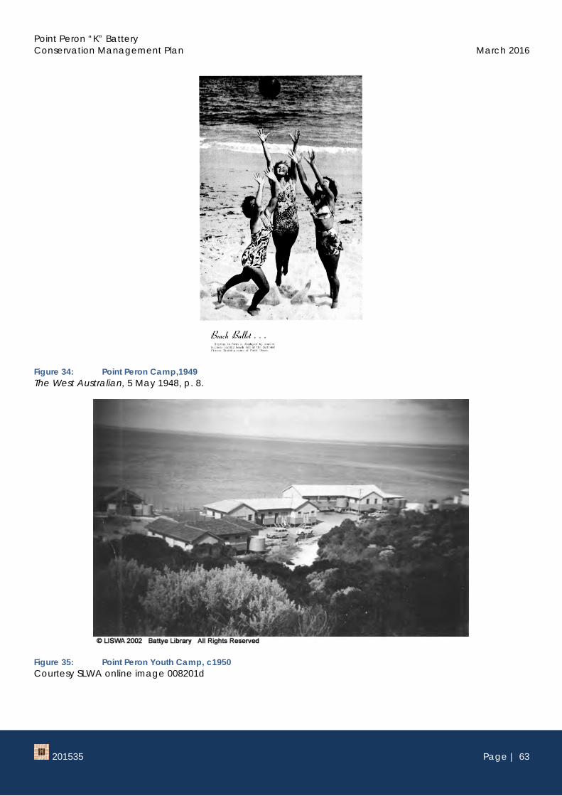
Figure 33: Point Peron Camp,1948 The West Australian, 5 May 1948, p. 8.
58 The West Australian, 14 December 1946, p. 19. 59 The West Australian, 17 December 1946, p. 14. 60 Ibid.
Point Peron “K” Battery Conservation Management Plan March 2016
201535 Page | 63
Figure 34: Point Peron Camp,1949 The West Australian, 5 May 1948, p. 8.
Point Peron “K” Battery Conservation Management Plan March 2016
201535 Page | 64
The buildings at Point Peron were converted for school groups and an on site manager was appointed to run and maintain the campsite. During the 1960s, the camp manager was Edwin Solin and his wife Alma Solin. Their son, Tony, grew up at the camp and recalls the battery structures being intact and a site for many games
Figure 36: Point Peron National Fitness Camp, 1940s-to 1950s Courtesy Tony Solin
Point Peron “K” Battery Conservation Management Plan March 2016
201535 Page | 65
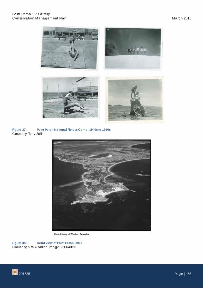
Figure 37: Point Peron National Fitness Camp, 1940s to 1950s Courtesy Tony Solin
Figure 38: Aeral view of Point Peron, 1967 Courtesy SLWA online image 260640PD
Point Peron “K” Battery Conservation Management Plan March 2016
201535 Page | 66
Figure 39: Mushroom Rock, c1967 Courtesy SLWA online image b3898905
In 1972, a small reserve of 10m2 was created around the observation post for the purpose of a trigonometric station. The tripod structure on the roof of the observation post was constructed for that function.61
This trigonometric position was undoubtedly valuable in the construction of the causeway connecting Garden Island to the mainland east of the headland begun in 1971 and completed in 1973. The causeway provided access to the Naval support facility on the Island which was completed in 1978 and formally commissioned as HMAS Stirling in the same year.
61 Reserve Enquiry 31488, Landgate.
Point Peron “K” Battery Conservation Management Plan March 2016
201535 Page | 67
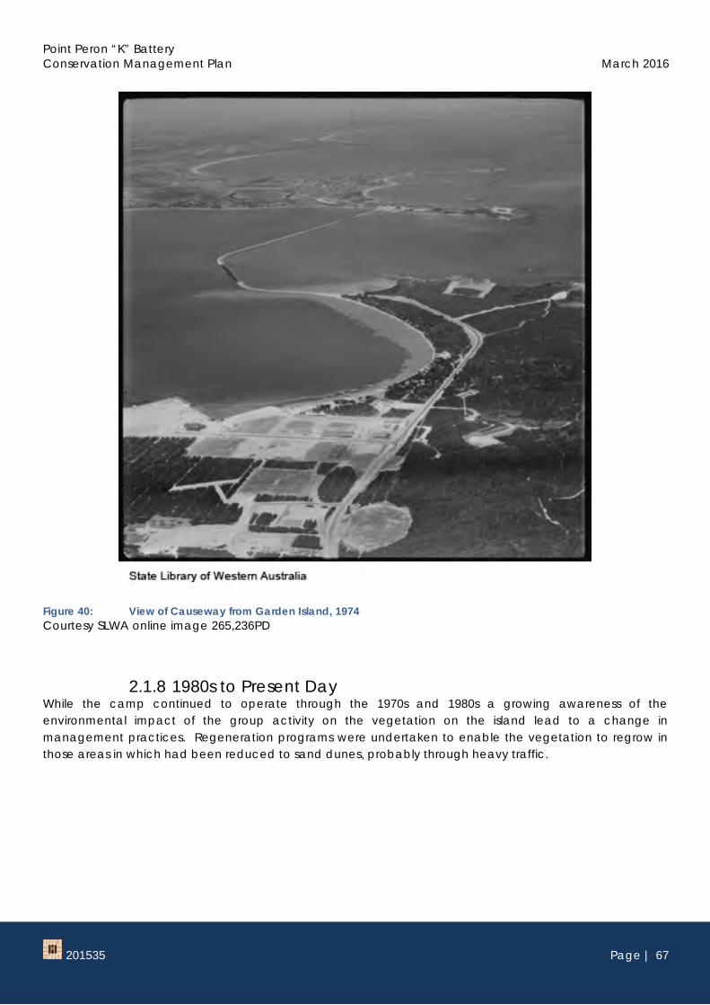
Figure 40: View of Causeway from Garden Island, 1974 Courtesy SLWA online image 265,236PD
2.1.8 1980s to Present Day While the camp continued to operate through the 1970s and 1980s a growing awareness of the environmental impact of the group activity on the vegetation on the island lead to a change in management practices. Regeneration programs were undertaken to enable the vegetation to regrow in those areas in which had been reduced to sand dunes, probably through heavy traffic.
Point Peron “K” Battery Conservation Management Plan March 2016
201535 Page | 68
Figure 41: Conservation programs at Point Peron, c1980 Courtesy Tony Solin
Figure 42: Conservation programs at Point Peron, c1980. Courtesy Tony Solin
The above image at Figure 42 shows how denuded the landscape was below the gun emplacement and is likely to have contributed to the destabilisation of the structure.
In c1992, pathways and fencing were constructed around the site to restrict traffic over the site and improve the opportunities for regeneration of vegetation.
Point Peron “K” Battery Conservation Management Plan March 2016
201535 Page | 69
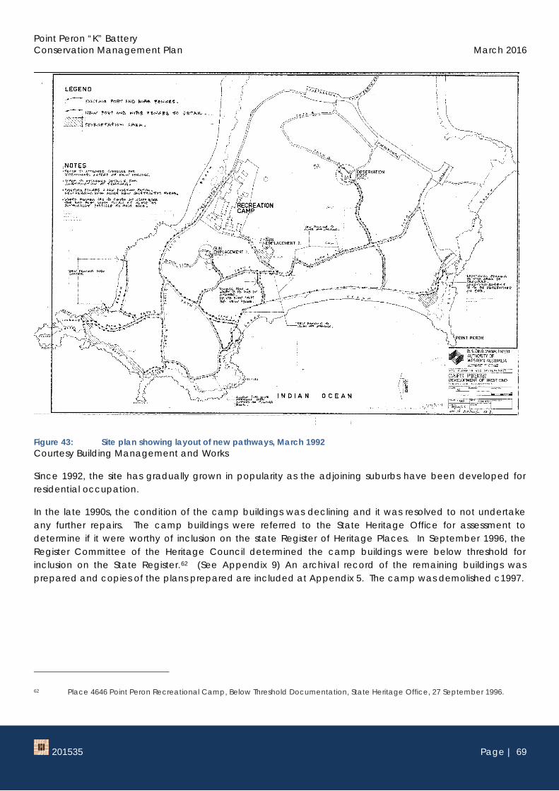
Figure 43: Site plan showing layout of new pathways, March 1992 Courtesy Building Management and Works
Since 1992, the site has gradually grown in popularity as the adjoining suburbs have been developed for residential occupation.
In the late 1990s, the condition of the camp buildings was declining and it was resolved to not undertake any further repairs. The camp buildings were referred to the State Heritage Office for assessment to determine if it were worthy of inclusion on the state Register of Heritage Places. In September 1996, the Register Committee of the Heritage Council determined the camp buildings were below threshold for inclusion on the State Register.62 (See Appendix 9) An archival record of the remaining buildings was prepared and copies of the plans prepared are included at Appendix 5. The camp was demolished c1997.
62 Place 4646 Point Peron Recreational Camp, Below Threshold Documentation, State Heritage Office, 27 September 1996.
Point Peron “K” Battery Conservation Management Plan March 2016
201535 Page | 70
Figure 44: Site plan of National Fitness Camp, 1997. Courtesy SLWA Q725.85 Point Peron Recreation Camp: Heritage Record and Building Management and Works
Erosion of the site continued to affect the headland from the late 1990s until the present day. Most significantly affected is the gun emplacement No 1 which has been structurally undermined.
The failing condition of the structures and the lack of awareness of the role of the Battery in defence of Western Australia was the instigation for the formation of the Point Peron Rehabilitation Committee (PPRC).
The PPRC was established in late 2014 by the Hon. Phil Edman MLC as a voluntary committee of stakeholders with an interest in rehabilitating the historic Point Peron Battery “K” structures built during World War II. The PPRC propose that a museum should be established on the site of the former Barracks/Recreation Camp in the norther part of the Point Peron headland, to recognise the important defence role of Point Peron as part of the “Fremantle Fortress” and to house safely valuable memorabilia and artefacts gathered to date.63
In May 2015, 20 Army reservists from the 11th/28th battalion volunteered to help clear out the structures of sand. Once the sand was cleared from the bunkers they were secured with metal grill gates to prevent
63 Point Peron Restoration Project, http://www.pprp.com.au/ accessed August 2015.
Point Peron “K” Battery Conservation Management Plan March 2016
201535 Page | 71
access to vandals. Graffiti and fires inside the structures had been an issue in recent decades. The project was a joint initiative of local MP Hon Phillip Edman and the Department of Parks and Wildlife.64
In the following September, the group returned and continued to remove sand from the structures on this occasion with the assistance of the Rockingham based 59 Army Cadet Unit, the Department of Parks and Wildlife and representatives from the Rockingham Chamber of Commerce, Phoenix Energy and members of the Brand Young Liberals.65
Figure 45: Members of the 11/28 Royal Western Australian Regiment and Operation Sandy Shovel Courtesy ABC News online, 3 May 2015
As part of the program to stabilise the battery complex and install interpretation at the site a significant number of items have been collected. The items relate specifically to the former function of Point Peron as a battery complex and the wider ‘Fremantle Fortress’ network of defences. This collection is currently held within the offices of Hon Phil Edman MP.
64 Diss, Kathryn and Strutt, Jessica Army reservists help restore WWII coastal defence battery at Point Peron 3 May 2015, ABC News online, http://www.abc.net.au/news/2015-05-03/wwii-coastal-protection-batteries-restoration/6440602
65 Media Release Restoration of the Point Peron Battery has begun, Liberal Party of Australia website, accessed October 2015. https://www.wa.liberal.org.au/media-release/restoration-point-peron-battery-has-begun
Point Peron “K” Battery Conservation Management Plan March 2016
201535 Page | 72
2.4 Current use Point Peron is an area of local interest and recreation. The pathways around the site are used for general access and exercise. The surrounding coastal waters are popular recreation areas providing water ski areas to the north and snorkel trails around the south and western coastlines.