+ All Categories
Home > Documents > 2020 PSAP VERIFICATION (PSAPV) - CENSUS TRACT CODE … · 2020-01-09 · Andersonville Natl Hist...

2020 PSAP VERIFICATION (PSAPV) - CENSUS TRACT CODE … · 2020-01-09 · Andersonville Natl Hist...

Date post: 03-Aug-2020
Category:
Upload: others
View: 1 times
Download: 0 times
Share this document with a friend
1
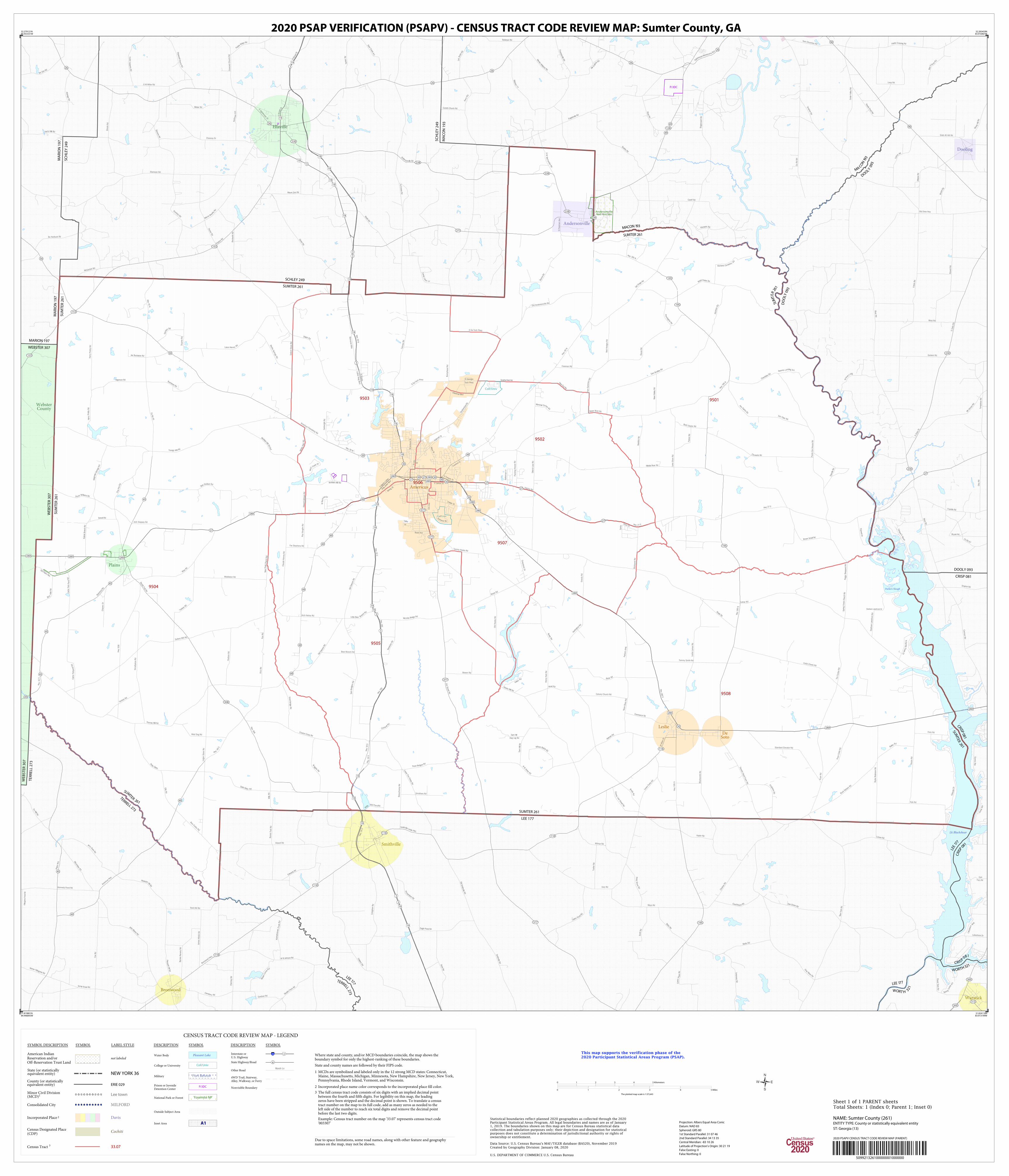
Andersonville Natl Hist Site P/JDC Coll/Univ Coll/Univ Parkers Slough Lk Blackshear 9502 9508 9503 9505 9501 9504 9506 9507 MACO N 1 93 SU M TER 26 1 MARION 197 WEBSTER 307 TERRELL 273 WEBSTER 307 T E R R E L L 2 7 3 L EE 1 7 7 MARION 197 SCHLEY 249 C R I S P 0 8 1 W O R T H 3 2 1 W OR T H 3 2 1 LEE 1 7 7 CRISP 081 DOOLY 093 SCHLEY 249 MACON 193 M A C O N 1 93 DO O L Y 0 93 SUMTER 261 WEBSTER 307 T E R R EL L 2 7 3 S U M TE R 2 61 MARION 197 SUMTER 261 C R I S P 0 8 1 L E E 1 77 SUMTER 261 LEE 177 C R I S P 0 8 1 S U M T E R 2 61 D O O L Y 0 93 SU M T E R 2 61 SCHLEY 249 SUMTER 261 Bronwood Warwick Webster County Smithville Ellaville Dooling Leslie Andersonville Plains De Soto Americus Dan Gre e n Rd Ebenezer Rd Deer Cr e e k R d Hom er Fillingame Rd H o p ew el l C hu r c h R d S t a g e c o a c h R d Drayton Rd L ak es h o r e W ay Kayl or Rd Popl ar Ri d g e Rd Cannon Rd Robi nson Rd l a C r o s s e R d C h e n n e y R d L a r a m ore R d Hwy 19 S W i n d y H i l l Rd Bronwood Hwy Ander s o n vi l l e Rd Kennedy Pond Rd Old Dixie Hwy S Oaks Rd C o x R d M u sl i m Farm Rd N Bro a d St L e s S m i t h R d Lakeshore Dr T e m p l e t on R d F o u nt a i nvill e Rd West Rd Americus Hwy Sm i thvi lle Rd Pre ston Rd F r a n k R o be r t s Rd I v y Mi l l Rd D r a y ton R d Concord Church Rd O g l e thorpe-Montezum a B y p Godwin Rd Fi el d s Crossi ng Rd C ork F erry Rd Usry Rd Bryant Rd M t Zion Rd F rankl i n Rd H a r ts Mi ll R d Scenic Rte Sceni c R t e C a rt e r Pl a c e R d N ew Y ork R d P l a i ns H w y Bonds Trail Rd H u n te r R d M t Vern o n Rd Fi l l i n g a m e P o n d R d Green R d S c rap I sra e l Rd W B Johnson Rd C e d a r V a l l e y R d C o Rd 9 7 Li v i ng s to n R d J o h n Marti n Rd R i c h a rdson Rd Engl i shvi l l e Rd Stubbs R d E Oglethorpe St J erry D unn Rd Heath Rd Cutoff R d Spri n g Cr e e k R d Hi l l E n g l i sh R d Gator P o nd Rd Marvi n M urphy Rd Shirah Rd Dozier Rd Ca n dy C a n e Ln Ri ver Rd Smi t h vi l l e Lesl i e Hwy A l d r i d g e R d Gardner Rd Batts Rd Grab All Hill Rd McGarrah Rd Larsen Rd S c o t t Rd Co urtho u s e Rd St e v ens Rd M a ss e e Ln P o w e r D a m R d Chancey Dr Childers R d He a d R d P eeds Pond Rd McLendon R d Gos a Rd S B r o a d St Mount Zion R d Batts Rd R i v e r R d Cori nth Churc h Rd Musl i n F a rms R d Pl easa n t H i l l Rd Bo Harbuck Rd C am p e r ' s H a v e n Thrill Hill Rd Loop Rd Mi nter R d J a l a p p a R d B o b V i ns o n R d Eagl e Pond Rd Cemeter y Rd E d wards Rd Airport Rd G ray Mo ss R d Ki tc hen s R d Merl an W i l l ia ms Rd F i r e t o w e r R d S Oaks St Goolsby Rd B r a n d Rd Ol d S mi th vi l l e Rd Beckwith Rd K i n ch a f o o n e e Cr e e k R d Twin Churches Rd James Webb Rd T u c k e r R d B a r n e s N u r s e r y R d Le s t e r Rd G r o v es L n d g Wilmar Rd Chokee Rd Co Rd 84 O W Miller Rd O tt o R d Pl e a s a nt H i l l Rd F o k e s R d Mays Rd Pi n e y G r o v e Rd Howell Rd P e r r y R d Rose Ave Bear Branch Rd Poole Gin House Rd M a y o St Fox Stephens Rd Chambl i ss Rd L a c r o s s R d Pryor Cobb Rd S Ga Tech Pkwy W Allen St H w y 1 9 5 Elm Ave Youngs M il l Rd Harry Priddy Rd F l i nt si d e D r I ndi a n R d B o b H a l e R d C o w Pe n R d H a r r y P r i d d y R d Lama r R d L ower Fi v e Points R d Logan Store Rd D a r d e n R d Myrtle Springs Rd E F orsyth S t Pa's Rd Packing House Rd Yankee Rd Ol d D a w son Rd I n dustri a l Bl vd Tommy Smith Rd McLi ttle Bri dge R d Middleton Rd B u chanan Rd Ol d Pl ai ns Hw y Old Hooks Rd M c Math M i l l Rd Exd Bumphead Rd Lane Store Rd Pe ggy S h e ppa r d R d H w y 1 9 S H w y 1 9 N Mi ddl e Ri ver Rd H w y 1 9 5 H wy 27 E F e r g u s o n R d J ames H a r t R d Wat e r mel on Rd Hagerson Rd Lower Forks Rd Tim Tucker Rd R e e v e s L a n di n g R d Hunti n gton R d Roy Vaughn Rd Cou n t y Line Snead Rd Memorial Mile Hw y 1 95 N P eri m e t er Rd P ar ke r ' s X i n g B one Rd Lasco Harv e y Rd Graystone Dr R W J ones R d Pecan Rd R a bbi t B r a n c h R d Hwy 1 95 N H w y 4 5 S Hw y 3 0 8 N Martin L u th er K i n g B l v d Bu c k D oster Rd Sam Hi l l Dog Leg Rd N e w P o i n t C h u rc h R d Calvary Church Rd S Martin L uther King J uni or Bl vd M a g n o l i a Spri ngs R d Wi l s on B att l e Rd Jack Slappey Rd N Spr i n g Creek Cir L e e S t reet Rd Li ttl e Bea r B ranch R d S p r i n g C re e k C h u r c h Rd Wel l s Mill P o n d Rd E Lamar St To m S u m m e r s Rd B rown Smal l Rd H w y 2 8 0 E Bottsford Rd M arshal l D y k e s R d J u ry Cl ar k Rd P a rk e r R d S t e e l B r i d g e R d W o l f Cre e k Dr M i l l s R d Statham Lakefront Dr Americus Friendship Rd Dowdy Rd Hwy 4 5 N D e v o e R d S t y l e s R o b i n s o n R d C o Rd 45 Tommy Hooks Rd Fish Rd J u ry Clarke Rd P e n n i ng ton Rd C roxton Cross Rd Cobb-Cheek Rd Buck Nelson Rd W R o c k h i l l D r Bail ey R d S ewel l Rd H w y 4 9 S Neon Bass Rd Smothers Rd H w y 1 9 S S Ga Tec h P k wy H o w a r d J o h n s o n R d Bon ds Trai l R d Corn w e l l R d Tho mas Mill R d E l l i s R d Sa m R o d ge rs Rd Ol d D awson Rd Dupree Rd Southerfi e l d Rd H w y 1 9 S W i ggi ns Rd Sa n t a Rosa Dr Arch Helms Rd M c Math Mi l l Rd Cart w r i g h t R d Pryor Rd Holma n R d J oe Buchanan Rd D el l a Glas s R d Tallent Store Rd N e w t B a i l e y R d Vienna Rd Boo Cosby Rd Ca r t e r F i s h P o n d Rd Val l ey Dr Shi l oh R d H e a d R d Brady Rd Mad Dog Rd Southerfi el d Rd G W M cC l e nd on Rd Brickyard Rd Salters Mill Rd H w y 2 7 E C h a v e r s D r Claude Harvey Rd D i s t r i c t L i n e R d H ooks Mi l l Rd Hudson Rd Neil Hodges Rd Sp ri ng St Henry Hart Rd S Georgia Tech Pkwy Da n vi l l e Rd Hwy 1 95 N New Era Rd B u t t e r c u p L n Hwy 308 Beaucham p Rd Hwy 30 W Standard Elevator Rd W ade Rd Ki tchens C e meter y R d Bob D o dson R d Old Andersonville Rd Burma Rd Mask Rd P o p w e l l D r Freeman Rd Smallpiece Rd S a m H i l l R d B r a d y R d D e l l a Gl ass Upp e r Ri v er Rd Leslie Lamar Rd S am B radl ey Rd K i t c hen s R d Blacksm ith Rd S Freeman Ave Bowen Rd Crawford St C om merce Rd Hwy 195 S N Lee St O s car W i l l i ams Rd Hwy 49 N Pas Rd Ferry Rd Yankee Rd Desoto Seed Farm Rd Fel d e r S t W i s e Rd N Jackson St C l e m ents Rd Statham Lakefront Rd Ra i l r o a d S t C a r t e r F i s h p o nd R d Ol d S tage Rd Three Bri dg e s Rd R e ne cker Rd H a w k i n s R d 118 118 45 49 30 153 230 195 271 228 45 49 49 49 49 377 195 300 300 27 30 90 49 26 26 26 45 27 3 3 3 27 128 153 45 3 230 313 26 118 90 49 30 30 26 3 3 377 45 27 49 30 153 49 377 308 228 3 49 118 195 228 118 49 377 27 49 3 30 195 26 30 27 45 228 49 30 3 49 27 19 19 19 280 280 280 280 280 280 19 19 19 19 19 280 280 19 19 19 19 19 19 280 19 19 19 280 19 19 19 280 280 19 19 280 19 509921326100000001000000 CENSUS TRACT CODE REVIEW MAP - LEGEND SYMBOL DESCRIPTION SYMBOL LABEL STYLE American Indian Reservation and/or Off-Reservation Trust Land not labeled Lee town Minor Civil Division (MCD) 1 Consolidated City MILFORD Davis Incorporated Place 2 Cochiti Census Designated Place (CDP) Census Tract 3 33.07 NEW YORK 36 State (or statistically equivalent entity) ERIE 029 County (or statistically equivalent entity) DESCRIPTION SYMBOL DESCRIPTION SYMBOL 3 Interstate or U.S. Highway 4 State Highway/Road 2 Marsh Ln Other Road 4WD Trail, Stairway, Alley, Walkway, or Ferry Nonvisible Boundary Pleasant Lake Water Body Coll/Univ College or University Fort Belvoir Military P/JDC Prison or Juvenile Detention Center Yosemite NP National Park or Forest Outside Subject Area A1 Inset Area Where state and county, and/or MCD boundaries coincide, the map shows the boundary symbol for only the highest-ranking of these boundaries. State and county names are followed by their FIPS code. 1 MCDs are symbolized and labeled only in the 12 strong MCD states: Connecticut, Maine, Massachusetts, Michigan, Minnesota, New Hampshire, New Jersey, New York, Pennsylvania, Rhode Island, Vermont, and Wisconsin. 2 Incorporated place name color corresponds to the incorporated place fill color. 3 The full census tract code consists of six digits with an implied decimal point between the fourth and fifth digits. For legibility on this map, the leading zeros have been stripped and the decimal point is shown. To translate a census tract number on the map to its full code, add as many zeros as needed to the left side of the number to reach six total digits and remove the decimal point before the last two digits. Example: Census tract number on the map '33.07' represents census tract code '003307' Due to space limitations, some road names, along with other feature and geography names on the map, may not be shown. 32.279121N 84.453331W 32.283459N 83.916967W 31.824118N 83.913199W 31.819801N 84.446843W Statistical boundaries reflect planned 2020 geographies as collected through the 2020 Participant Statistical Areas Program. All legal boundaries and names are as of January 1, 2019. The boundaries shown on this map are for Census Bureau statistical data collection and tabulation purposes only; their depiction and designation for statistical purposes does not constitute a determination of jurisdictional authority or rights of ownership or entitlement. U.S. DEPARTMENT OF COMMERCE U.S. Census Bureau Created by Geography Division: January 08, 2020 ENTITY TYPE: County or statistically equivalent entity NAME: Sumter County (261) Projection: Albers Equal Area Conic Datum: NAD 83 Spheroid: GRS 80 1st Standard Parallel: 31 07 46 2nd Standard Parallel: 34 13 35 Central Meridian: -83 10 26 Latitude of Projection's Origin: 30 21 19 False Easting: 0 False Northing: 0 This map supports the verification phase of the 2020 Participant Statistical Areas Program (PSAP). Data Source: U.S. Census Bureau's MAF/TIGER database (BAS20), November 2019 ST: Georgia (13) 0 1 2 3 4 5 Kilometers 0 1 2 3 4 5 Miles The plotted map scale is 1:57,643 2020 PSAP VERIFICATION (PSAPV) - CENSUS TRACT CODE REVIEW MAP: Sumter County, GA 2020 PSAPV CENSUS TRACT CODE REVIEW MAP (PARENT) Sheet 1 of 1 PARENT sheets Total Sheets: 1 (Index 0; Parent 1; Inset 0)
Transcript

AndersonvilleNatl Hist Site

P/JDC

Coll/Univ

Coll/Univ

Parkers Slough

Lk Blackshear

9502

9508

9503

9505

9501

9504

9506

9507

MACON 193

SUMTER 261

MARION 197

WEBSTER 307

TE

RR

ELL

27

3

WE

BS

TE

R 3

07

TERRELL 273

LEE 177

MA

RIO

N 1

97

SC

HLE

Y 2

49

CRISP

081

WORTH 321

WORT H 321

LEE 177

CRISP 081

DOOLY 093

SC

HLE

Y 2

49

MA

CO

N 1

93

MA CO

N 19

3

DOOLY 0

93

SU

MT

ER

26

1

WE

BS

TE

R 3

07

TERRELL 273

SUMTER 261

MA

RIO

N 1

97

SU

MT

ER

26

1

CRI

SP 0

81

LEE

177

SUMTER 261

LEE 177

CRISP 081

SUMTER

261

DO

OLY

093

SUM

TER

261

SCHLEY 249

SUMTER 261

Bronwood

Warwick

WebsterCounty

Smithville

Ellaville

Dooling

Leslie

Andersonville

Plains

DeSoto

Americus

Dan Green Rd

Ebenezer Rd

Deer C

reek R

d

Homer Fillingame Rd

Hopew

ell C

hurc

h R

d

Sta

gecoach R

d

Drayton Rd

Lakesh

ore

W

ay

Kaylor Rd

Popla

r Ridg

e Rd

Cannon R

d

Robinson Rd

la C

ross

e R

d

Chenney R

d

Lar a

more

Rd

Hw

y 19 S

Win

dy

Hill R

d

Bronwood H

wy

Andersonville Rd

Kennedy Pond Rd

Old Dixie Hwy

S O

aks R

d

Cox

Rd

Mus

lim F

arm R

d

N B

road

St

Les

Sm

ith R

d

Lakeshore Dr

Tem

ple

t on R

d

Founta

inville R

d

West Rd

Amer

icus

Hwy

Sm

ithville

Rd

Pres

ton

Rd

Fra

nk R

oberts

Rd

Ivy M

ill Rd

Drayto

n Rd

Concord

Churc

h R

d

O

gleth

orpe-Montezuma Byp

Godwin Rd

Fields Crossing Rd

Cork

Ferry Rd

Usry Rd

Bryant Rd

M t Zion

Rd

Franklin Rd

Harts Mill Rd

Scenic

Rte

Sce

nic R

te

Cart

er Pla

ce R

d

New

York

Rd

Pla

ins H

wy

Bonds T

rail R

d

Hunte

r Rd

M

t Ve

rnon

Rd

Fillin

gam

e P

ond R

d

Green R

d

Scrap Israel Rd

W B Johnson Rd

Cedar

Val le

y R

d

Co Rd 97

Liv

ingsto

n R

d

John Martin Rd

Ric

hardson Rd

Englishville

Rd

Stubbs Rd

E Oglethorpe S

t

Jerry Dunn R

d

Heath R

d

Cutoff Rd

Sprin

g C

reek

Rd

Hill

Englis

h Rd

Gator P

ond R

d

Marvin

M

urph

y Rd

Shirah R

d

Dozie

r Rd

Candy C

a

ne Ln

Rive

r Rd

Smithville Leslie Hwy

Ald

ridge R

d

Gardner Rd

Batts Rd

Grab All Hill Rd

McGarrah Rd

Larsen Rd

Scott

Rd

Courthous e Rd

Ste

vens R

d

Masse

e

Ln

Pow

er D

am

Rd

Chancey Dr

Childers R

d

Head R

d

Peeds P

ond Rd

McLendon R

d

Gosa R

d

S B

road

St

Mount Zion Rd

Batts Rd

Riv

er R

d

Corinth Church Rd

Mus

lin F

arms

Rd

Pleasant Hill Rd

Bo Harbuck Rd

Cam

per's H

aven

Thrill Hill Rd

Loop Rd

Minter Rd

Jala

ppa R

d

Bob V

ins

on R

d

Eagle Pond Rd

Cemeter y Rd

Edward

s Rd

Airport Rd

G

ray Moss Rd

Kitchens Rd

Merlan W

illiams Rd

Fireto

wer

Rd

S O

aks

St

Goolsby Rd

Bra

nd R

d

Old

Sm

ithville

Rd

Beckw

ith R

d

Kin

chafo

onee C

reek R

d

Twin Churches Rd

Jam

es W

ebb R

d

Tucker

Rd

Barn

es N

urs

er y

Rd

Lest

er Rd

Gro

ves Ln

dg

Wilmar Rd

Choke

e R

d

Co R

d 8

4

O W Miller Rd

Ott

o R

d

Ple

asant H

ill Rd

Fokes R

d

Mays Rd

Pin

ey G

rove R

d

How

ell R

d

Perr

y Rd

Rose Ave

Bear Branch Rd

Poole

Gin

House R

d

Mayo

St

Fox Stephens Rd

Chambliss

Rd

Lacro

ss R

d

Pry

or Cobb R

d

S Ga Tech Pkwy

W A

llen S

t

Hwy

195

Elm

Ave

Youngs Mill Rd

Harr

y P

riddy R

d

Flin

tsid

e D

r

Indian

Rd

Bo b H

ale

Rd

Cow

Pen R

d

Harr

y P

riddy R

d

Lamar Rd

Lower Five P

oints R

d

Logan S

tore

Rd

Dard

en Rd

Myrtle

Sprin

gs R

d

E Forsyth St

Pa's

Rd

Packin

g H

ouse R

d

Yank

ee R

d

Old D

awso

n Rd

Industrial Blvd

Tommy Smith Rd

McLittle Bridge Rd

Middleton Rd

Buchanan Rd

Old Plains Hwy

Old

Hooks R

d

McM

ath Mill R

d Exd

Bum

phead R

d

Lane S

tore

Rd

Peggy S

heppar d

Rd

Hw

y 1

9 S

Hw

y 19 N

Middle River Rd

Hw

y 1

95

Hwy 27 E

Ferguson R

d

Jam

es H

art

Rd

Watermelon Rd

Hagerson Rd

Lower

For

ks R

d

Tim

Tucker R

d

Reeves L anding R d

Huntin

gton

R

d

Roy V

aughn R

d

County

Line Snead R

d

Mem

oria

l Mile

Hwy 19

5

N

Perimeter Rd

Park

er's X

ing

Bone Rd

Lasco Harvey Rd

Gra

ysto

ne D

rR W

Jones Rd

Pecan R

d

Rabbit B

ranch R

d

Hwy 195 N

Hw

y 4

5 S

Hwy 3

08

N M

artin

Luth

er K

ing B

lvd

Buck Doster Rd

Sam Hill

Dog Leg Rd

New

Poin

t Churc

h R

d

Calvary Church Rd

S Martin

L

uthe

r

King

Junior

Blvd

Magnolia

Spring

s R

d

Wilson Battle Rd

Jack Slappey Rd

N S

prin

g C

reek C

ir

Lee S

treet R

d

Little Bear Branc

h Rd

Spring C

reek C

hurc

h R

d

Well

sMill PondRd

E Lamar St

Tom

Sum

mers

Rd

Brown Small Rd

Hw

y 2

80 E

Bottsfor

d Rd

Marshall Dykes Rd

Jury Clark Rd

Park

er

Rd

Ste

el B

r idge R

d

Wolf

Creek Dr

Mills R

d

Statham Lakefront Dr

Americus Friendship Rd

Dow

dy R

d

Hw

y 45 N

Devoe R

d

Sty

l es R

obi n

son R

d

Co R

d 4

5

Tommy Hooks Rd

Fish Rd

Jury Clarke Rd

Pennington R

d

Croxton Cross Rd

Cobb-Cheek Rd

Buck

Nelso

n Rd

W R

ockh

ill Dr

Bailey

Rd

Sewell Rd

Hwy 49 S

Neon B

ass R

d

Smothers Rd

Hw

y 19 S

S Ga T

ech Pkwy

How

ard

Johnson R

d

Bonds Trail R

d

Cornw ell R

dThomas Mill Rd

Ellis

Rd

Sam

Rodgers

Rd

Old

Dawso

n Rd

Dupre

e R

d

Sou

ther

field R

d

Hw

y 1

9 S

W

iggins Rd

Santa

Rosa Dr

Arch Helms Rd

McMath Mill Rd

Cart

wright

Rd

Pry

or

Rd

Holm

an R

d

Joe Buchanan Rd

Della Glass Rd

Tallent

Sto

re R

d

New

t Baile

y R

d

Vienna Rd

Boo Cosby Rd

Cart

er

Fis

h P

ond R

d

Valley

Dr

Shiloh Rd

Head Rd

Brady R

d

Mad Dog Rd

Southerfield Rd

G W

M

cC

lendon R

d

Brickyard

Rd

Salters Mill Rd

Hwy 27 E

Chavers

Dr

Cla

ude H

arv

ey R

d

Dis

t ric

t Lin

e R

d

Hooks Mill Rd

Hudson R

d

Neil H

odges R

d

Spring

St

Henry

Hart

Rd

S Georgia

Tech Pkwy

Dan

ville

Rd

Hw

y 195 N

New Era Rd

Butt

erc

up L

n

Hw

y 3

08

Beaucham

p R

d

Hwy 30 W

Standard Elevator Rd

Wade Rd

Kitchens Cemetery R

d

Bob Dodson Rd

Old Andersonville Rd

Bur

ma

Rd

Mask Rd

Popw

ell D

r

Freeman Rd

Sm

allpie

ce R

d

Sam

Hill R

d

Brady Rd

Della Glass

Upper River Rd

Leslie L

am

ar

Rd

Sam Bradley

Rd

Kitchens

Rd

Bla

cksm

ith R

d

S F

reem

an A

ve

Bowen Rd

Crawford

St

Commerce Rd

Hw

y 1

95

S

N L

ee

St

O scar Williams Rd

Hwy

49 N

Pas R

d

Ferry Rd

Yanke

e Rd

Deso

to S

eed F

arm

Rd

Felder St

Wise

R

d

NJa

ckson

St

Clements Rd

Sta

tham

Lakefront

Rd

Railro

ad St

Car t

er

Fi s

hp

ond R

d

Old S

tage

Rd

Three Bridges Rd

Rene

cker

Rd

Haw

kin

s R

d

118

118

45

49

30

153

230

195

271

228

45

49

49

49

49

377 195

300

300

27

30

90

49

2626

26

45

27

3

3

3

27

128

153

45

3

230

313

26

118

90

49

30

30

26

3

3

377

45

27

49

30

153

49

377

308

228

3

49

118

195

228

118

49

377

27

49

3

30

195

26

30

27

45

228

4930

3

4927

19

19

19

280

280

280

280280

280

19

19

19

19

19

280

280

19

19

19

19

19

19

280

19

19

19

280

19

19

19

280

280

19

19

280

19

509921326100000001000000

CENSUS TRACT CODE REVIEW MAP - LEGEND

SYMBOL DESCRIPTION SYMBOL LABEL STYLE

American IndianReservation and/orOff-Reservation Trust Land

not labeled

Lee townMinor Civil Division(MCD)1

Consolidated City MILFORD

DavisIncorporated Place 2

CochitiCensus Designated Place(CDP)

Census Tract 3 33.07

NEW YORK 36State (or statisticallyequivalent entity)

ERIE 029County (or statisticallyequivalent entity)

DESCRIPTION SYMBOL DESCRIPTION SYMBOL

3Interstate orU.S. Highway

4State Highway/Road

2

Marsh LnOther Road

4WD Trail, Stairway,Alley, Walkway, or Ferry

Nonvisible Boundary

Pleasant LakeWater Body

Coll/UnivCollege or University

Fort BelvoirMilitary

P/JDCPrison or JuvenileDetention Center

Yosemite NPNational Park or Forest

Outside Subject Area

A1Inset Area

Where state and county, and/or MCD boundaries coincide, the map shows theboundary symbol for only the highest-ranking of these boundaries.

State and county names are followed by their FIPS code. 1 MCDs are symbolized and labeled only in the 12 strong MCD states: Connecticut,

Maine, Massachusetts, Michigan, Minnesota, New Hampshire, New Jersey, New York,Pennsylvania, Rhode Island, Vermont, and Wisconsin.

2 Incorporated place name color corresponds to the incorporated place fill color.

3 The full census tract code consists of six digits with an implied decimal pointbetween the fourth and fifth digits. For legibility on this map, the leadingzeros have been stripped and the decimal point is shown. To translate a censustract number on the map to its full code, add as many zeros as needed to theleft side of the number to reach six total digits and remove the decimal pointbefore the last two digits.

Example: Census tract number on the map '33.07' represents census tract code'003307'

Due to space limitations, some road names, along with other feature and geographynames on the map, may not be shown.

32.279121N84.453331W

32.283459N83.916967W

31.824118N83.913199W

31.819801N84.446843W

Statistical boundaries reflect planned 2020 geographies as collected through the 2020Participant Statistical Areas Program. All legal boundaries and names are as of January1, 2019. The boundaries shown on this map are for Census Bureau statistical datacollection and tabulation purposes only; their depiction and designation for statisticalpurposes does not constitute a determination of jurisdictional authority or rights ofownership or entitlement.

U.S. DEPARTMENT OF COMMERCE U.S. Census Bureau

Created by Geography Division: January 08, 2020

ENTITY TYPE: County or statistically equivalent entity

NAME: Sumter County (261) Projection: Albers Equal Area Conic

Datum: NAD 83

Spheroid: GRS 80

1st Standard Parallel: 31 07 46

2nd Standard Parallel: 34 13 35

Central Meridian: -83 10 26

Latitude of Projection's Origin: 30 21 19

False Easting: 0

False Northing: 0

This map supports the verification phase of the2020 Participant Statistical Areas Program (PSAP).

Data Source: U.S. Census Bureau's MAF/TIGER database (BAS20), November 2019

ST: Georgia (13)

0 1 2 3 4 5 Kilometers

0 1 2 3 4 5 Miles

The plotted map scale is 1:57,643

2020 PSAP VERIFICATION (PSAPV) - CENSUS TRACT CODE REVIEW MAP: Sumter County, GA

2020 PSAPV CENSUS TRACT CODE REVIEW MAP (PARENT)

Sheet 1 of 1 PARENT sheetsTotal Sheets: 1 (Index 0; Parent 1; Inset 0)

Recommended