7
2.8 South Bunbury - Mangles

2.8 South Bunbury - Mangles
City Vision Strategy
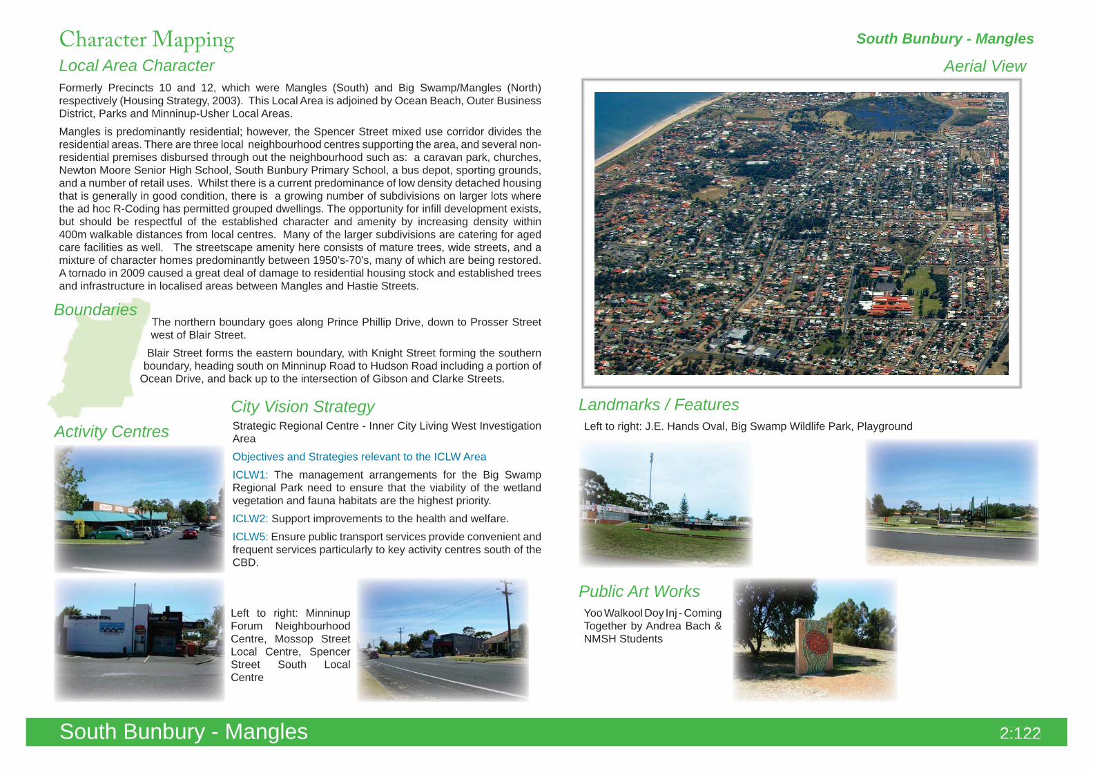
Aerial View
Boundaries
Local Area Character
Landmarks / FeaturesStrategic Regional Centre - Inner City Living West Investigation AreaObjectives and Strategies relevant to the ICLW AreaICLW1: The management arrangements for the Big Swamp Regional Park need to ensure that the viability of the wetland vegetation and fauna habitats are the highest priority.ICLW2: Support improvements to the health and welfare.ICLW5: Ensure public transport services provide convenient and frequent services particularly to key activity centres south of the CBD.
The northern boundary goes along Prince Phillip Drive, down to Prosser Street west of Blair Street.
Blair Street forms the eastern boundary, with Knight Street forming the southern boundary, heading south on Minninup Road to Hudson Road including a portion of
Ocean Drive, and back up to the intersection of Gibson and Clarke Streets.
Formerly Precincts 10 and 12, which were Mangles (South) and Big Swamp/Mangles (North) respectively (Housing Strategy, 2003). This Local Area is adjoined by Ocean Beach, Outer Business District, Parks and Minninup-Usher Local Areas.Mangles is predominantly residential; however, the Spencer Street mixed use corridor divides the residential areas. There are three local neighbourhood centres supporting the area, and several non-residential premises disbursed through out the neighbourhood such as: a caravan park, churches, Newton Moore Senior High School, South Bunbury Primary School, a bus depot, sporting grounds, and a number of retail uses. Whilst there is a current predominance of low density detached housing that is generally in good condition, there is a growing number of subdivisions on larger lots where the ad hoc R-Coding has permitted grouped dwellings. The opportunity for infill development exists, but should be respectful of the established character and amenity by increasing density within 400m walkable distances from local centres. Many of the larger subdivisions are catering for aged care facilities as well. The streetscape amenity here consists of mature trees, wide streets, and a mixture of character homes predominantly between 1950’s-70’s, many of which are being restored. A tornado in 2009 caused a great deal of damage to residential housing stock and established trees and infrastructure in localised areas between Mangles and Hastie Streets.
South Bunbury - Mangles
Left to right: J.E. Hands Oval, Big Swamp Wildlife Park, Playground
Public Art Works
Activity Centres
Left to right: Minninup Forum Neighbourhood Centre, Mossop Street Local Centre, Spencer Street South Local Centre
Yoo Walkool Doy Inj - Coming Together by Andrea Bach & NMSH Students
Character Mapping
2:122South Bunbury - Mangles

Road Layout
Topography, Views & Vistas
Street Trees & Verge Treatments
South Bunbury - Mangles
The topography of South Bunbury varies from low, flat palusplain in the east, rising up the undulating slope of the secondary dune towards the west.
Where South Bunbury meets the Ocean Beach Local Area, the land is higher, and the streets are steep and winding, affording the properties greater views of both the ocean or inland areas, depending on their location.
The views afforded from the higher ground of South Bunbury are mostly facing inland. The CBD is not visible from this area because the ridgeline of the secondary dune faces more to the north-east over the urban area all the way to the Inner Harbour, and the northern ridgeline at the south end of the CBD completely obscures any views further north.
The majority of South Bunbury is arranged in a modified grid layout, with Minninup Road running diagonally though the centre of the neighbourhood.Curvilinear streets line the southwest corner of the neighbourhood to accommodate the undulation of the landform.Some traffic calming measures have been put in place throughout the suburbs including school crossings, and speed humps.
Where steep curving streets exist, blind spots are created in the sight lines of vehicles, which compromises entry and exit manoeuvring of private accessways that are located around a bend in the road or over a ridgeline.Some speed humps already exist in the neighbourhood to help neutralise this problem.
South Bunbury has many established trees in the streetscape, and public open spaces. Where native species have reached maturity, they create a natural setting and contribute to the character of the area. In general there is a high number of tree species in good health and a widespread, consistent cover across the area. Retention of mature species is encouraged, and appropriate management of pruning is required to prevent permanent structural damage or increasing susceptibility to termite infestation.
As with much of the established neighbourhood tree stock in Bunbury, there are some instances of poor pruning of street trees, particularly around power lines, which can disfigure the canopy and limb formation and compromises the life span and future growth of the tree, as well as detracting from the streetscape.
Visual Diaries
2:123South Bunbury - Mangles
Pedestrian & Bicycle Pathways
Lighting, Signage & Furniture
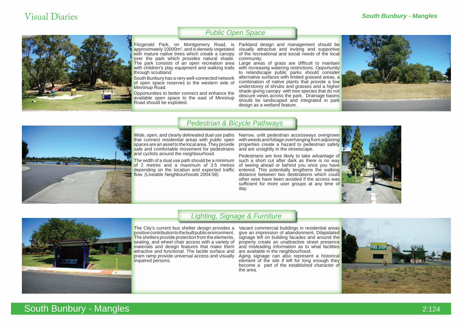
Public Open SpaceFitzgerald Park, on Montgomery Road, is approximately 10000m2, and is densely vegetated with mature native trees which create a canopy over the park which provides natural shade. The park consists of an open recreation area with children’s play equipment and walking trails through scrubland.South Bunbury has a very well-connected network of open space reserves to the western side of Minninup Road.Opportunities to better connect and enhance the available open space to the east of Minninup Road should be exploited.
Parkland design and management should be visually attractive and inviting and supportive of the recreational and social needs of the local community. Large areas of grass are difficult to maintain with increasing watering restrictions. Opportunity to relandscape public parks should consider alternative surfaces with limited grassed areas, a combination of native plants that provide a low understorey of shrubs and grasses and a higher shade giving canopy with tree species that do not obscure views across the park. Drainage basins should be landscaped and integrated in park design as a wetland feature.
Wide, open, and clearly delineated dual use paths that connect residential areas with public open spaces are an asset to the local area. They provide safe and comfortable movement for pedestrians and cyclists around the neighbourhood.The width of a dual use path should be a minimum of 2 metres and a maximum of 3.5 metres depending on the location and expected traffic flow. (Liveable Neighbourhoods 2004:58)
Narrow, unlit pedestrian accessways overgrown with weeds and foliage overhanging from adjoining properties create a hazard to pedestrian safety and are unsightly in the streetscape.Pedestrians are less likely to take advantage of such a short cut after dark as there is no way of seeing ahead or behind you once you have entered. This potentially lengthens the walking distance between two destinations which could other wise have been avoided if the access was sufficient for more user groups at any time of day.
The City’s current bus shelter design provides a positive contribution to the built public environment. The shelters provide protection from the elements, seating, and wheel chair access with a variety of materials and design features that make them attractive and functional. The tactile surface and pram ramp provide universal access and visually impaired persons.
Vacant commercial buildings in residential areas give an impression of abandonment. Dilapidated signage left on building facades and around the property create an unattractive street presence and misleading information as to what facilities are available in the neighbourhood.Aging signage can also represent a historical element of the site if left for long enough they become a part of the established character of the area.
South Bunbury - Mangles
South Bunbury - Mangles
Visual Diaries
South Bunbury - Mangles 2:124
Gardens & Landscaping
Boundaries & Retaining Walls
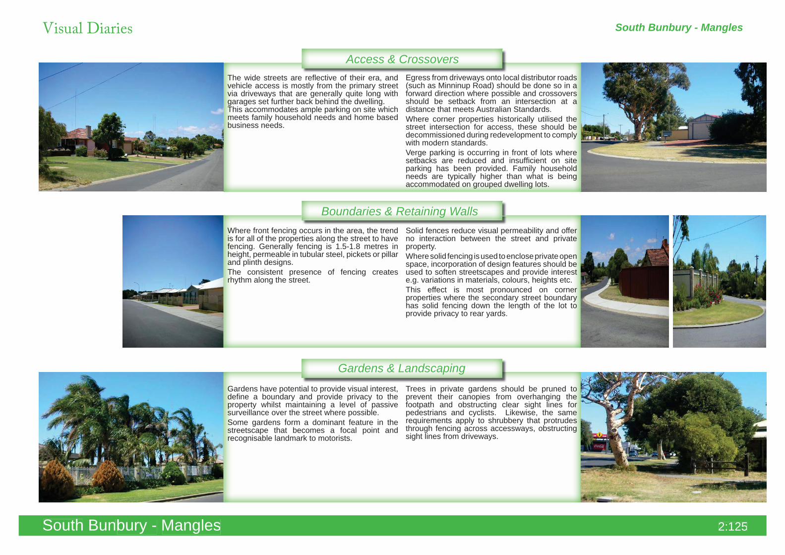
Access & CrossoversThe wide streets are reflective of their era, and vehicle access is mostly from the primary street via driveways that are generally quite long with garages set further back behind the dwelling. This accommodates ample parking on site which meets family household needs and home based business needs.
Egress from driveways onto local distributor roads (such as Minninup Road) should be done so in a forward direction where possible and crossovers should be setback from an intersection at a distance that meets Australian Standards.Where corner properties historically utilised the street intersection for access, these should be decommissioned during redevelopment to comply with modern standards.Verge parking is occurring in front of lots where setbacks are reduced and insufficient on site parking has been provided. Family household needs are typically higher than what is being accommodated on grouped dwelling lots.
Where front fencing occurs in the area, the trend is for all of the properties along the street to have fencing. Generally fencing is 1.5-1.8 metres in height, permeable in tubular steel, pickets or pillar and plinth designs. The consistent presence of fencing creates rhythm along the street.
Solid fences reduce visual permeability and offer no interaction between the street and private property.Where solid fencing is used to enclose private open space, incorporation of design features should be used to soften streetscapes and provide interest e.g. variations in materials, colours, heights etc.This effect is most pronounced on corner properties where the secondary street boundary has solid fencing down the length of the lot to provide privacy to rear yards.
Gardens have potential to provide visual interest, define a boundary and provide privacy to the property whilst maintaining a level of passive surveillance over the street where possible.Some gardens form a dominant feature in the streetscape that becomes a focal point and recognisable landmark to motorists.
Trees in private gardens should be pruned to prevent their canopies from overhanging the footpath and obstructing clear sight lines for pedestrians and cyclists. Likewise, the same requirements apply to shrubbery that protrudes through fencing across accessways, obstructing sight lines from driveways.
South Bunbury - Mangles
South Bunbury - Mangles
Visual Diaries
South Bunbury - Mangles 2:125
Building Materials & Construction
Building Style & Character
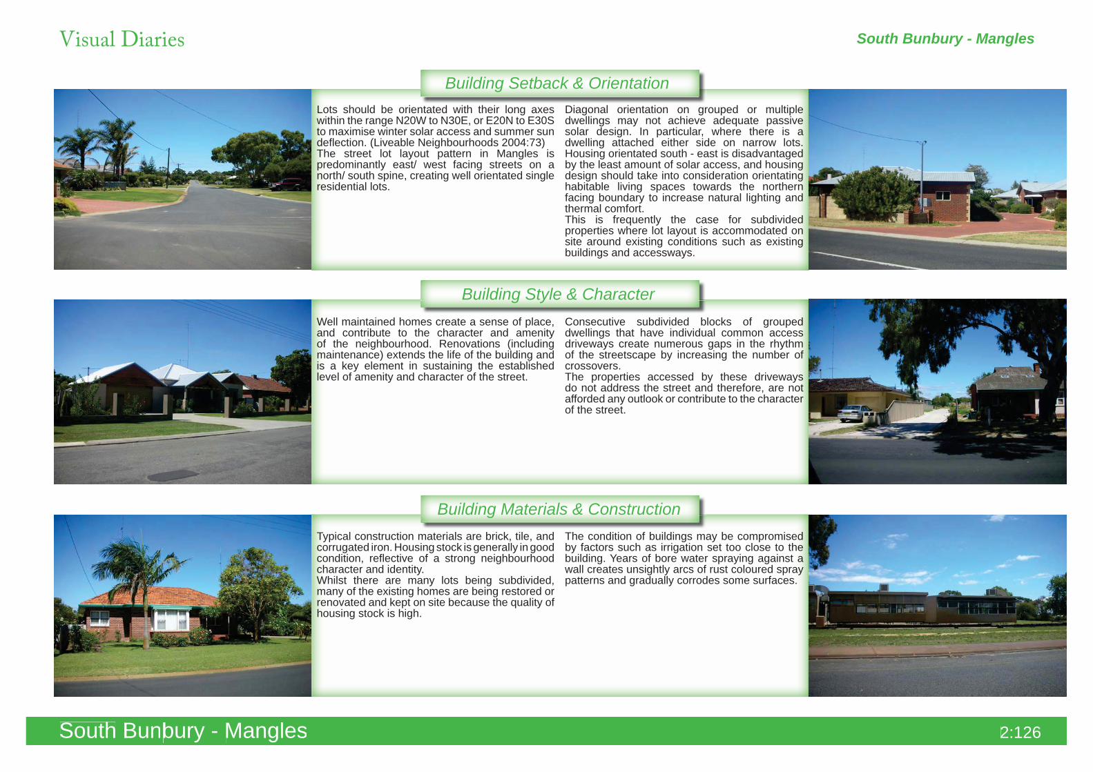
Building Setback & OrientationLots should be orientated with their long axes within the range N20W to N30E, or E20N to E30S to maximise winter solar access and summer sun deflection. (Liveable Neighbourhoods 2004:73)The street lot layout pattern in Mangles is predominantly east/ west facing streets on a north/ south spine, creating well orientated single residential lots.
Diagonal orientation on grouped or multiple dwellings may not achieve adequate passive solar design. In particular, where there is a dwelling attached either side on narrow lots. Housing orientated south - east is disadvantaged by the least amount of solar access, and housing design should take into consideration orientating habitable living spaces towards the northern facing boundary to increase natural lighting and thermal comfort. This is frequently the case for subdivided properties where lot layout is accommodated on site around existing conditions such as existing buildings and accessways.
Well maintained homes create a sense of place, and contribute to the character and amenity of the neighbourhood. Renovations (including maintenance) extends the life of the building and is a key element in sustaining the established level of amenity and character of the street.
Consecutive subdivided blocks of grouped dwellings that have individual common access driveways create numerous gaps in the rhythm of the streetscape by increasing the number of crossovers.The properties accessed by these driveways do not address the street and therefore, are not afforded any outlook or contribute to the character of the street.
Typical construction materials are brick, tile, and corrugated iron. Housing stock is generally in good condition, reflective of a strong neighbourhood character and identity.Whilst there are many lots being subdivided, many of the existing homes are being restored or renovated and kept on site because the quality of housing stock is high.
The condition of buildings may be compromised by factors such as irrigation set too close to the building. Years of bore water spraying against a wall creates unsightly arcs of rust coloured spray patterns and gradually corrodes some surfaces.
South Bunbury - Mangles
South Bunbury - Mangles
Visual Diaries
South Bunbury - Mangles 2:126
Strategic Planning South Bunbury - Mangles
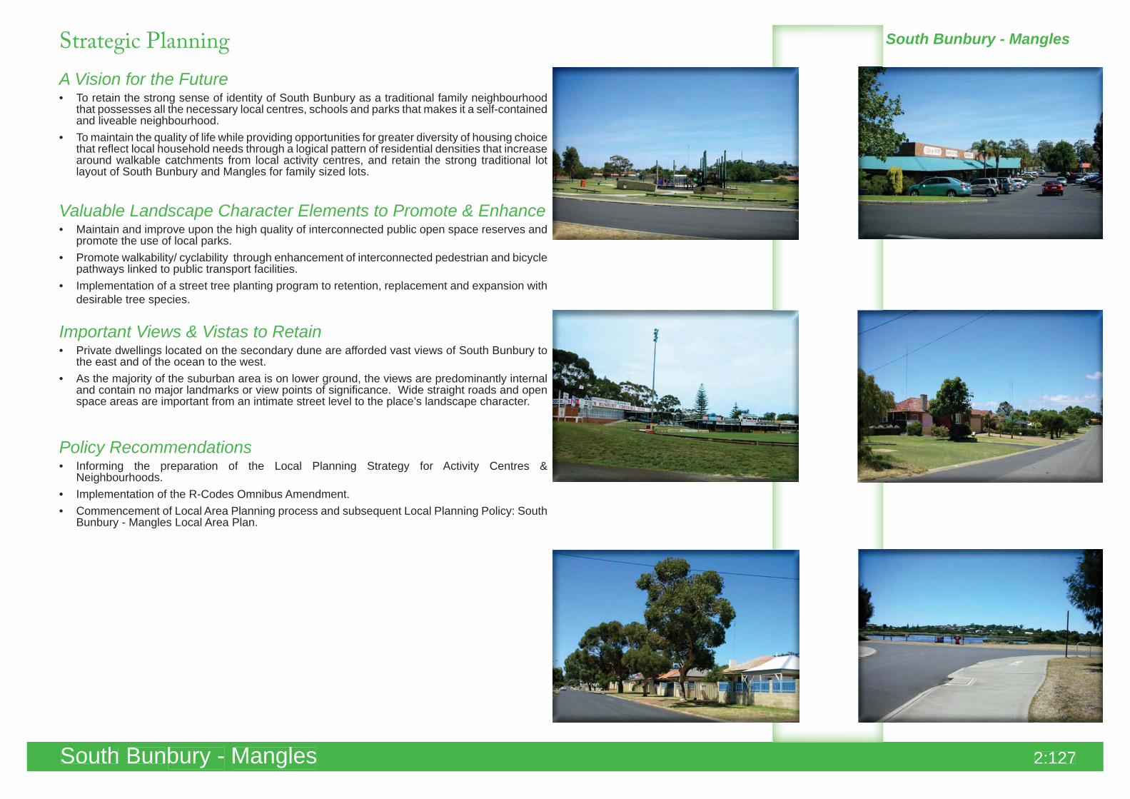
A Vision for the FutureTo retain the strong sense of identity of South Bunbury as a traditional family neighbourhood • that possesses all the necessary local centres, schools and parks that makes it a self-contained and liveable neighbourhood. To maintain the quality of life while providing opportunities for greater diversity of housing choice • that reflect local household needs through a logical pattern of residential densities that increase around walkable catchments from local activity centres, and retain the strong traditional lot layout of South Bunbury and Mangles for family sized lots.
Valuable Landscape Character Elements to Promote & EnhanceMaintain and improve upon the high quality of interconnected public open space reserves and • promote the use of local parks.Promote walkability/ cyclability through enhancement of interconnected pedestrian and bicycle • pathways linked to public transport facilities.Implementation of a street tree planting program to retention, replacement and expansion with • desirable tree species.
Important Views & Vistas to RetainPrivate dwellings located on the secondary dune are afforded vast views of South Bunbury to • the east and of the ocean to the west.As the majority of the suburban area is on lower ground, the views are predominantly internal • and contain no major landmarks or view points of significance. Wide straight roads and open space areas are important from an intimate street level to the place’s landscape character.
Policy RecommendationsInforming the preparation of the Local Planning Strategy for Activity Centres & • Neighbourhoods.Implementation of the R-Codes Omnibus Amendment.• Commencement of Local Area Planning process and subsequent Local Planning Policy: South • Bunbury - Mangles Local Area Plan.
South Bunbury - ManglesSouth Bunbury - Mangles 2:127


