LEGISLATIVE REFERENCE LIBRARY 3 0307 00052 3962 This document is made available electronically by the Minnesota Legislative Reference Library as part of an ongoing digital archiving project. http://www.leg.state.mn.us/lrl/lrl.asp
This document is made available electronically by the Minnesota Legislative Reference Library as part of an ongoing digital archiving project. http://www.leg.state.mn.us/lrl/lrl.asp
INTERPRETIVE PLAN FOR STATE TRAILS
Prepared by:
Trail Planning SectionTrails & Waterways Unit
Minnesota Department of Natural ResourcesSaint Paul, Minnesota 55155-1679
Principal Author:
Laurie YoungTrail Planner
Final DraftJuly, 1984
TABLE OF CONTENTS
INTRODUCTION • • .
Definition of Interpretation ...•••.••••.• ' ••
The Importance of Interpretation on State Trails . . • • • •
Purposes of the Plan • • • • • • . • . • • . • • • •
Inter-relationship With Other DNR Trail Planning Documents . • • •
HISTORY OF INTERPRETIVE EFFORTS ON STATE TRAILS
INTERPRETIVE THEMES
Purpose and Use of Interpretive Themes
Potential Theme Enhancement • • • • • • •
RECOMMENDATIONS FOR INITIAL, PRE-PLAN INTERPRETIVE EFFORTS
Information Boards at Major Parking Areas
Area Service Guides • • • • •
Interpretive Resources Printed on Trail Maps
Trail Users' Handbook ••
Landowners' Handbook
CHECKLIST FOR DEVELOPMENT OF INTERPRETIVE PLANS FOR STATE TRAILS • •
Checklist . e • • " • • e 0 Gl • • • e " Co .. .. • .. • • • • • •
TECHNICAL APPENDICES • • .. • • •
Alternatives for Monitoring and Evaluating Interpretive Efforts
Standardization of Printed Materials (Publications Manual)
Standardization of Facilities (Displays, Kiosks, Signs) •I
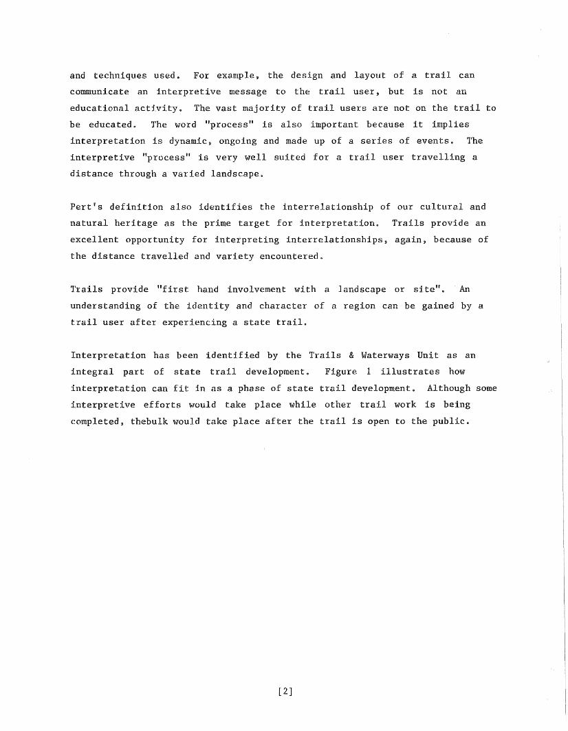
El. All of the abovedeveloped along entireauthorized length oftrail.
E2. All of the abovealong entire authorizedlength of trail.
E3. All of the abovedeveloped along entireauthorized length oftrail.
E4. All of above plusinterpretiveenhancements (e.g. onsite interpretationplaques, introductorycassette tapes) on
e continue ongoing marketing program
*Pnmltive or wilderness trails will require less refined orientation and interpretive development. Notes: (1) The progression of a trail thru the 5 phases is charted by use, in summary form in the master plansbUdgetS. (2) Maintenance and enforcement functions, while necessary to have in place throughout the 5 phases,are not included in the above chart. (3) Some work may have to begin in prior phases in order for it to beeffectively completed by the end of the phase for which it is "required" (e.g. vegetative management).
Another purpose of this plan is to facilitate coordination of interpretive
planning and implementation on a departmental level.
Finally, this plan is to provide guidance in the design, location and
development of state trails. An understanding of the interpretive theme and
interpretive goals has implications for trail design, location and development.
This plan is primarily intended for those developing interpretive plans for
trails and for regional trails & waterways coordinators and Saint Paul staff
supervising the process. It can also provide information useful to other
interpretive planners.
Inter-relationship With Other DNR Trail Planning Documents
Direction and background for interpretive planning on state trails is provided
by a number of documents. These include:o
o
o
o
o
o
The Outdoor Recreation Act (ORA) MN Stat. 86A.Ol to 86A.l1.
"Minnesota Trails Policy Plan."
DNR State Trail Policy.
"Guidelines for Developing Interpretive Plans for DNR State Trails."
"Minnesota DNR Trail Plan."
Individual master plans for State Trails.
These documents provide a historical perspective and context for this plan.
The interrelationship of these documents with this plan is discussed below.
- Outdoor Recreation Act
The Outdoor Recreation Act establishes • • •
"an outdoor recreation system which will; (1) preserve an accuraterepresentation of Minnesota's natural and historic heritage forpublic understanding and enjoyment; and, (2) provide an adequatesupply of scenic, accessible and usable lands and waters toaccommodate the outdoor recreation needs of Minnesota's citizens."
State trails are components of the outdoor recreation system.
Interpretation has a key role to play in fulfilling the mandate of the ORA.
It is through trail location, design and interpretation that the public will
come to understand, appreciate and enjoy the natural and historical heritage.
[6]
Interpretation also can play a role in the promotion of the outdoor recreation
system by providing information on opportunities available in the system.
lbe ORA establishes four criteria which must be met in order for a trail to be
authorized as a state trail.
Subd. 4. State trail; purpose resource and site qualifications;administration; designation. (a) A state trail shall be established toprovide a recreational travel route which connects units of theoutdoor recreation system or the national trail system, providesaccess to or passage through other areas which have significantscenic, historic, scientific, or recreational qualities orreestablishes or permits travel along an historically prominenttravel route or which provides commuter transportation.
(b) No unit shall be authorized as a state trail unless itsproposed location substantially satisfies the following criteria:
(1) Permits travel in an appropriate manner along a route whichprovides at least one of the following recreational opportunities:
(i) travel along a route which connects areas or points ofnatural, scientific, cultural, and historic interest;
(ii) travel through an area which possesses outstanding scenicbeauty;
(iii) travel over a route designed to enhance and utilize theunique qualities of a particular manner of travel in harmony with thenatural environment;
(iv) travel along a route which is historically significant as aroute of migration, commerce, or communication;
(v) travel between units of the state outdoor recreation systemor the national trail system; and
(2) Utilizes, to the greatest extent possible consistent withthe purposes of this subdivision, public lands, rights-of-way, andthe like; and
(3) Provides maximum potential for the appreciation,conservation, and enjoyment of significant scenic, historical,natural, or cultural qualities of the areas through which the trailmay pass; and
(4) Takes into consideration predicted public demand and futureuse
interpretation can help fulfill the legislative intent by making the
trail user more aware of, "the significant scenic, historical, natural or
cultural qualities of the areas through which the trail may pass" (criterion 3)
which contributes to the enjoyment and appreciation of the trail.
[ 7]
Another reference to interpretation can be found relating to trail waysides in
Subd. 4 (d).
(d) Facilities for the rest and comfort of trail users shall beprovided primarily within units of the outdoor recreation systemthrough which the trail passes. When additional facilities arerequired to ensure the rest and comfort of the traveler, the managingagency may develop such facilities along the trail and shalldesignate the facilities as trail waysides. In addition to theforegoing purpose, trail waysides shall be developed for thepreservation and interpretation of the trail's natural, historic, orscenic values, and may include facilities for primitive camping,picnicking, sanitation, and parking for access to the trail.
- Minnesota Trails Policy Plan
This plan was prepared by the Inter-Agency Trail Committee with representatives
from the Department of Natural Resources, State Planning Agency and Department
of Economic Development, (now within the Department of Energy and Economic
Development), Department of Transportation and Metropolitan Council. The
purpose of this plan was, "to create a process which will ensure that state
funded trails programs are coordinated and complementary".
"This plan establishes a planning process, criteria for evaluatingtrails proposals and policies to guide trail development andmanagement. The final section of the plan deals with implementationand defines a procedure for state agencies to meet and mutuallyreview each others proposals."
This plan identifies interpretation as a key component of a trail plan and thus
underscores the importance of 'interpretation on trails, but there are few
direct references to interpretation.
The plan states that site plans for each designated state trail should address
interpretation. Two policies in the recreation management section directly
relate to interpretation. They are:
"Orientation and interpretive materfals, including maps, will beavailable at trail waysides and other support facilities, both publicand privately owned, 80 that users may become acquainted with thetrail's resources, facilities and routes as well as users rights andresponsibilities" (p. 19, 113, a.).
[8]
"An interpretive program that is primari.ly self guiding will bedeveloped for each state trailo Interpretive techniques such asthose identified in the 1981 DNR report, Guidelines for Developing
will be implemented" (po 20,~-~~-----------------
- DNR State Trail Policy
The DNR interpreted the ORA by developing policies for units it administerso
In the Recreation Management section under general policy, two objectives apply
directly to interpretation.
"To provide interpretive and informational programs to enhance users'experiences and to promote an understanding of the natural andcultural resources" (p. 8, D).
"To develop and distribute informational and promotional material foreach state trail" (p. 8, E).
Policies in the Recreation Management section which relate to interpretation
are:
"A theme shall be established for each trail which determines whethercultural, historical, scenic or scientific attributes or acombination thereof, will be the primary consideration in traillayout" (p. 9, 1110).
"Facilities may be provided for the rest and comfort of trail userson the preservation and interpretation of a trail's natural,historical, or scenic values Such facilities shall be providedprimarily within other units of the outdoor ,recreation system throughwhich the trail passes. tillen additional facilities are required,they may be developed and designated as trail waysides" (p. 9, #13).
"Facility structures and construction materials will relate to atrail's theme as determined by the master plan" (p. 10, 1119).
"Interpretive programs shall relate to a trails theme and goal" (po10 1126).
"Informational and interpretive programs shall be developed toenhance users' appreciation, understanding, enjoyment and respect ofthe rights of adj acent landowners and the natural and culturalresources of the area through which the trail passes" (po 10, 1127).
"The Unit of Trails & Waterways, in cooperation with the Bureau ofInformation & Education, shall be responsible for the development anddistribution to the public of informational and promotional materialsfor each designated state trail. Such materials shall include, but
[9]
not be limited to, trail and vicinity maps and self guidingbrochures" (p. 10, 1/28).
- "Guidelines for Developing lnterpretive Plans for DNR State Trails"
This document establishes four goals to be used in developing an interpretive
plan for a trail and evaluating its effectiveness. These four goals should be
used as a basis for interpretation. They are:
To maximize the users enjoyment of the resources in the trail corridor.
To provide background information on major resource issues in the trail
corridor, region and state.
'1'0 improve public understanding and support of the DNR state trail program
and related DNR programs.
To assist managers in protecting natural, historic and cultural resources,
trail related development and adjacent property.
- Minnesota DNR Trail Plan
In an attempt to consolidate all aspects of the DNR's diverse trail program,
the Trails & Waterways Unit has developed the DNR Trail Plan. The plan calls
for development of a select number of high quality state trails that show off
natural and cultural diversity of Minnesota. Interpretation is proposed as a
key element in communicating this diversity to trail users. Recommendations
inelude:
"That interpretive plans be developed for each state trail.
That completed plans be reviewed and amended in light of statewidegoals.
That interpretive development on state trails be given a highpriority for completion.
That interpretive efforts be periodically monitored and modified toimprove program efficiency and effectiveness."
[10]
In addition, the plan recommends development of two brochures for each trail.
The trail users' handbook would in part strive to sensitize users to the needs
of landowners adjacent to state trails in the hope of encouraging
non-disruptive trail use. The landowners' handbook would alert those living
adjacent to trails to their rights and obligations with respect to trail users
and would contain phone numbers and other pertinent information to be used if
disruptive behavior occurs on or near their property.
- Master Plans for State Trails
The interpretive sections of the master plans have been brief and general
They recommend interpretive themes which provide important direction for
interpretive planning. The plans also provide information on the trails'
resources and users. Recommendations are made for the location of interpretive
facilities.
The interpretive plans developed for individual state trails will be addenda to
the trail master plans.
[11]
HISTORY OF INTERPRETIVE EFFORTS ON STATE TRAILS
HISTORY OF INTERPRETIVE EFFORTS ON STATE 'l'RAI LS
Several interpretive efforts have occurred relative to state trails. These
efforts were made as a result of the need for interpretation expressed by trail
users, field staff and Saint Paul staff. This expressed need served as an
impetus for the development of the "Interpretive Plan for State Trails," which
will refine and build on the interpretive accomplishments made thus far.
Heartland Trail
A series of kiosks or information boards were developed along the trail at
parking areas in Park Rapids, Dorset, Nevis and Akeley in 1982. A fifth kiosk
has been designed and is scheduled for construction at the parking lot in
Halker s The interpretive emphasis of these facilities is logging history.
Other information included on these boards is: other state trails, area
services, major plant communities, current land uses, railroad history, history
of adjacent communities, common plants, topography and geology, adjacent
trails, water resources, and how to determine the age of a tree.
A brochure entitled, "Along the Trail: A Guide to Nature on the Heartland",
was published. This brochure is primarily a guide to conunon plants along the
trail. These brochures can be obtained by request through the regional office
at Bemidji, at several stores in communities adjacent to the trail, Chambers of
Commerce in the area, and at the Nevis trail offices Copies were sent to area
schools as a reference
1m area services guide has also been developed for the Heartland. This
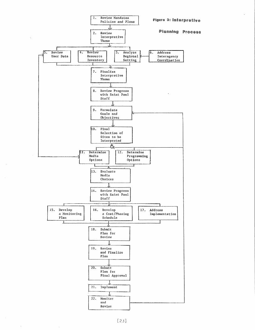
Review LegislativeMandates, TrailPolicies and TrailPlans
Purpose: Direction and background for interpretiveplanning on state trails is provided by a number ofdocuments. A thorough review of these documents willprovide a historical perspective and context for theinterpretive plan.
[ ] Review pages 9 through 14 which summarizes the relevant aspects and direct
references to interpretation found in legislative mandates, trail policies
and trail plans. Each of these documents is listed below and may be
reviewed in their entirety.
[ ] Review the Outdoor Recreation Act (ORA), MN Stat .. 86A .. Ol to 86A.ll. The
most pertinent portion of the law is Section 86A .. 05, Subd. 4.. State
trail; purpose; resource and site qualifications; administration;
designation. Interpretation can help fulfill the mandate of the ORA ..
[ ] Review the "Minnesota Trails Policy Plan". This document was prepared by
the Interagency Trail Committee with representatives from several state
agencies. The purpose of this plan was to create a process that will
ensure that state funded trails programs are coordinated and
complementary.
[ ] Review DNR State Trail Policy, approved April 23, 1982, as stated in the
"DNR Manual", 1.8-5, pages 1-10.
interpretation on state trails.
Several policies relate to
[ ] Review "Guidelines for Developing Interpretive Plans for DNR State
Trails". This document establishes four goals and 16 subgoals to be used
in developing an interpretive plan.. These goals should be used to guide
the interpretive planning effort.
[ ] Review the Minnesota Trail Plan. Many of the goals and
recommendations in the plan can be implemented through the interpretive
program. The plan also addresses interpretation and makes several general
recommendations.
[24]
[ ] Review the master plan for the trail. The master plan can serve as a
source of inventory data on trail users and resources. Recommendations
for interpretation provide some guidance.
Sources:
Copies of these documents can be obtained through the Regional Trails &Waterways Coordinators or the Trail Planning Section.
[25]
STEP 2
Review proposedinterpretive theme
Purpose: An understanding of the proposed theme willhelp focus and direct initial data gathering andresearch.
[ ] Review the interpretive theme section, pages 19 through 22. This section
defines interpretive theme and discusses how the theme relates to
interpretive development. An interpretive theme has been suggested for
each trail. This suggested theme is subject to modification based on
subsequent inventory and analysis.
[26]
STEP 3
Analyze RegionalSetting
Purpose: This analysis will provide an indication ofhow the trail relates to various regionalclassification schemes used by the DNR. This analysiswill also help to ensure that appropriate resourceswill be interpreted, duplication of interpretiveopportunities avoided, and coordination promoted.
[ ] Determine in which recreational landscape the trail is located.
o Is the trail representative of that landscape?
o Determine which resources can be interpreted in a way that would
provide the user with the knowledge and experience of the identity and
character of the landscape.
o Does another state trail represent this landscape better?
o Is this landscape being interpreted by another DNR division or bureau,
another agency or any other group?
[ ] Summarize your findings on the recreational landscape in a brief
narrative.
[ ] Determine which Recreational Opportunity Spectrum (ROS) classes the trail
is located in. lbis analysis will provide a framework for helping to
define the setting, activities, and experiences the public might desire
and how interpretation could provide them.
o Does the trail provide recreational opportunities consistent with that
setting?
o Does the ROS classification have implications for interpretive
facilities and programs on the trail Some areas of consideration
include facility design, amount of interpretation, media, theme and
impact on goals and objectives.
[ ] Summarize your findings on the ROS classifications in a brief narrative.
[ ] Identify the interpretive opportunities within close proximity of the
trail (25 miles approxima tely) Include state parks, state forests,
county and municipal facilities and private facilities. Look for
interpretive themes used, personal and non-personal media used and
attendance.
[27]
o Visit as many sites as possible and observe as many of the
opportunities as possible.
[ ] Summarize your findings on surrounding interpretive opportunities in a
brief narrative.
Sources:
Landscape Regions:
Department of Natural Resources, Trails & Waterways Unit. "Hinnesota'sRecreationaJ Landscapes for Trails."
"The Biocultural System," Interpretive Services Section, Minnesota Departmentof Natural Resources, Saint Paul, MN.
Lynch, Kevin, Managing the Sense of a Region. Massachusetts Institute ofTechnology, Cambri.dge, MA, 1976.
Kratz, Tim and Gerald Jensen, "Minnesota Landscape Regions" Natural AreasJournal, April, 1983.
Snyder, Gary. The Real Work, Interviews and Talks 1964-1979, New Directions,1980.
Recreational Opportunity Spectrum (ROS):
"ROS Users Guide" Forest Service, United States Department of Agriculture.
Land Resource and Management Plan Project, Recreation Component, Office ofPlanning, Minnesota Department of Natural Resources, Saint Pau1,MN ..
Facilities Inventory:
"State Comprehensive Outdoor Recreation Plan" (SCORP) Minnesota Department ofNatural Resources, Saint Paul, MN.
MN Division of Tourism publications.
Chambers of Commerce.
[28]
STEP 4
Review resourceinventoryinformationAugment as necessary
Purpose: The inventory will; 1) result in a thoroughunderstanding of the resource base, and 2) indicatewhich sites or resources should be interpreted.
[ ] Become familiar with the major plant communities along the trail. The
following questions might be useful in focusing the review.
o Which plant communities are representative of the recreational
landscape?
o Which plant communities are representative of present land use
practices?
o Wbich plant communities are a result of past land use practices
(agriculture, forestry, mining and fire)?
o Are there any rare or unique communities or plant species identified
as Elements by the Natural Heritage Program (NHP)? An Element is
defined by NHP as a species that has priority for protection.
o Are there any vegetation management practices of which trail users
should be made aware (prairie restoration and forestry management)?
[ ] Ideally~ a map of these communities should be developed if one is not
currently available.
[ ] Write a brief narrative summarizing the major plant communities including
answers to the relevant questions above or obtain documentation which
provides relavent information.
[ ] Identify sites or segments of trail that should be interpreted because
they contain communities, plant species~ or vegetation management
that contribute to an understanding of the interpretive theme.
[ ] other sites or segments of trail that should be interpreted for
other reasons and present the rationale for including them.
[29]
Sources:
Aerial Photography:
u.S. Department of Agriculture, Agricultural Stabilization and ConservationService (ASCS) color aerial slides. These are available for reprint atASCS offices.
Nine inch aerial photographs available from the MN/DNR-Bureau of Engineeringand Wilson Map Library, University of Minnesota, Minneapolis MN.
High altitude aerial photographs -- available through the ~1N Department ofTransportation and Wilson Map Library, University of Minnesota,Minneapolis, MN.
Books and Documents:
Fernald, M. L., Gray's Manual of Botany, Eighth ed., D. Van Nostrand Co.,NY, 1970.
Marschner, Francis J., The Original Vegetation of Minnesota, U.S. Departmentof Agriculture, 1930 (not published until 1978 by MN/DNR and USDA.
Gleason, H. A., and A. Cronquist, Manual of Vascular Plants of NortheasternU.S. and Adjacent Canada, Van Nostrand Reinhold Co., NY, 1963.
Morley, Thomas, Spring Flora of Minnesota, University of Minnesota Press,Minneapolis, MN, 1974.
Peterson, R. T. and M. McKenny, A Field Guide to Wildflowers, Houghton MifflinCo., Boston, MA, 1968.
Tryon, R. M., The Ferns and Fern Allies of Minnesota, University of MinnesoaPress, Minneapolis, MN, 1954.
Curtis, J. T., The Vegetation of Wisconsin, University of Wisconsin Press,Madison, WI, 1959.
General Land Office Survey Notes:
These are available at the office of the Secretary of State, State OfficeBuilding, Saint Paul, or on microfilm at Wilson Map Library, University ofMinnesota, Minneapolis, MN.
Phase II Forestry Inventory, MN/DNR-Division of Forestry.
Resource People:
MN/DNR-Natural Heritage Program
MN/DNR-Regional Naturalist
MN/DNR-Regional Resource Coordinator
Local colleges and universities
MN/DNR-Area Forester
[30]
Checklist
Geology
[ ] Review the geologic history of the area the trail passes through in order
to determine how the features of the present landscape were formed. It is
suggested that this review include a look at the geologic eras
(Precambrian, Paleozoic, Mesozisoc and Cenozoic). The Cenozoic was the
most recent period of glaciation and will often be the most important to
focus on. Keep in mind you want to tell the story so it can be easily
understood.
o Include a review of the bedrock geology.
o Include a review of the interrelationship of the geologic history with
existing plant communities and current land uses.
[ ] Write a brief narrative summarizing the major geologic events of the area
or obtain documentation that provides the information.
[ J Determine if there are visible evidences of the geologic history
[ J Identify sites or segments of trail that should be interpreted because
they contain geologic processes, events, or features that contribute to an
understanding of the theme.
[ ] Identify other sites or segments of trail that should be interpreted for
other reasons and present the rationale for including them.
Sources:
Bray, Edmund CoScience
Schwartz, G M. and G. A. Thiel, Minnesota Rocks and Waters, University ofMinnesota Press Minneapolis, MN, 1954.
[31]
Sims, P. K. and G. B. Morey, Geology of Minnesota, A Centennial Volume.Minnesota Geological Society, Minneapolis, MN, 1972.
Sansome, Constance J., Minnesota Underfoot a Field Guide to the State'sOutstanding Geologic Features, Voyageur Press, 1983.
Resource People:
MN/DNR-Natural Heritage Program
MN/DNR-Regional Naturalist
MN/DNR-Regional Resource Coordinator
Local colleges and universities
[32]
Checklist
Soils
[ ] Obtain a map and description of the soils adjacent to the trail.
o Review the history of their formation.
o Determine the interrelationship of existing soils with original plant
communities and land use history, including erosion problems and
current soil management.
[ ] Summarize your findings on soils in a narrative or obtain documentation of
the information.
[ ] Identify sites or segments of trail that should be interpreted because
they contain soils related concepts or soil management techniques that
contribute to an understanding of the interpretive theme.
[ ] Identify other sites or segments of trail that should be interpreted for
other reasons and present the rationale for including them.
Sources:
County Soil Surveys available through local u.S. Department of Agriculture,Soil Conservation Service (SCS) offices.
Soil Atlas Sheets available from:
Coffey Hall Bulletin RoomUniversity of MinnesotaSaint Paul Campus
[33]
Checklist
Wildlife and Fisheries
[ ] Obtain existing lists of the non-game and game mammals, birds and
reptiles and amphibians that are likely to be found along the trail.
o If possible and appropriate, obtain information on habitat and
relative abundance.
o Determine which species are rare, unique or of special interest. Use
the species identified as Elements by the MN/DNR-Natural Heritage
Program (NHP).
o Determine if there are any wildlife management activities occurring
along the trail.
o Determine interrelationships of wildlife with land use history.
[ ] Summarize your findings regarding the wildlife inventory in a narrative or
obtain documentation that provides the information.
[ ] Identify sites or segments of trail that should be interpreted because
they contain species, habitats, and/or wildlife management practices that
contribute to an understanding of the interpretive theme.
[ ] Identify other sites or segments of trail that should be interpreted for
other reasons and present the rationale for including them.
Sources:
Books:
Breckenridge, W. J., Reptiles and Amphibians of Minnesota, University ofMinnesota Press, Minneapolis, MN, 1970.
Green, Janet C. and Robert B. Janssen, Minnesota Birds, Where, When and HowMany, University of Minnesota Press, Minneapolis, MN, 1975.
Burt, William H. and Richard P. Grossenheider,Houghton Mifflin Co., Boston, MA, 1976.
Guide to the Mammals
Minnesota Department of Natural Resources, Section of Wildlife, "Breeding Birdsin Minnesota 1975-1979; Abundance, Distribution and Diversity,"Minneapolis, MN.
[34]
Minnesota Department of Natural Resources, Section of Wildlife, "Guide to theReptiles and Amphibians of Minnesota DNR Regions," Minneapolis, MN,
Minnesota Department of Natural Resources, Section of Wildlife, "Guide to theNon-game Mammals of Minnesota DNR Regions," Minneapolis, MN.
Eddy, S@ and J. C. Underhill, Northern Fishes, University of Minnesota Press,Minneapolis, MN, 1976.
DNR Biological Reconnaissance reports on various rivers: MN/DNR-Section ofFisheries, Third Floor Centennial Building, Saint Paul, MN.
Waters, Thomas F., The Streams and Rivers of Minnesota, University of MinnesotaPress, Minneapolis, MN, 1977.
Resource people:
MN/DNR-Natural Heritage Program
MN/DNR-Area Wildlife Manager
MN/DNR-Regional Naturalist
~rn/DNR-Regional Resource Coordinator
Local colleges and universities
[35]
Checklist
Water Resources
[ ] Identify the surface water resources visible from the trail.
o Identify these on USGS quads or other appropriate map.
o Review their geologic origin.
o Review their physical characteristics (size, depth, water quality
flooding history, etc.).
o Determine if there are any water resource management projects
occuring.
o Review any formal classifications associated with the water resource
(Wild and Scenic River, wetland type, fisheries classification, etc ).
o Determine interrelationship of the water resources with past and
current land use practices, such as draining of wetlands,
channelization of rivers, etc.
[ ] Summarize the water resources inventory in a brief narrative or obtain
documentation that provides the information.
[ ] Identify sites or segments of trail that should be interpreted because
they contain water resources that contribute to an understanding of the
interpretive theme.
[ ] Identify other sites or segments of trail that should be interpreted for
other reasons and present the rationale for including them.
Sources:
United States Geological Survey (USGS), Hydrologic Atlas Sheets, available fromSeventh Floor - Post Office Building, Kellogg Avenue, Saint Paul, MN.
MN/DNR-Division of Fish & Wildlife, Section of Fisheries
MN/DNR-Division of Waters
MN/DNR-Regional Hydrologist
[36]
Checklist
Historical Resources
[ ] Review the history of the area focusing on the major events
review include:
o Prehistorical Indians
o Indian history
o Fur trading
o Logging
o Settlement and development of communities
o Transportation (railroads, riverboats, oxcart)
o Farming
o Milling
o Industrial growth and development
o Immigration
Areas to
[ ] Summarize your review of the history of the area in a narrative or obtain
documentation that provides the information It is easy to spend a lot of
time in this review. It is important to limit yourself to the most
important events
[ ] Determine the existing historic sites adjacent to the trail that document
the history of the area$
o Map these sites
[ ] sites or segments of trail that should be interpreted because
contain historical resources that contribute to an understanding of
the themee
[ ] other sites or segments of trail which should be interpreted for
other reasons and the rationale for including them.
Sources:
Minnesota Historical Society,of Minnesota. Saint
[37]
Johnson, Eldon, lbe Prehistoric Peoples of Minnesota, Minnesota HistoricalSociety, Saint Paul, MN, 1969.
Minnesota Historical Society, National Register of Historic Places -(Historical Society Library, Saint Paul, MN).
Folwell, W. N., A History of Minnesota, 4 vols., Minnesota Historical Society,Saint Paul, MN, 1969.
Minnesota Historical Society Reference Library, Newspaper Collection,Saint Paul, ~m.
[38]
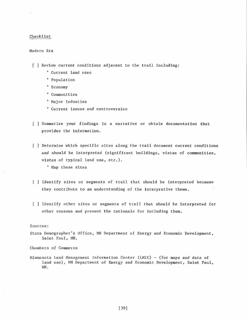
Modern Era
[ ] Review current conditions adjacent to the trail including:
o Current land uses
o Population
o Economy
o Communities
o Major inclusties
o Current issues and controversies
[ ] Summarize your findings in a narrative or obtain documentation that
provides the informatione
[ ] Determine which specific sites along the trail document current conditions
and should be interpreted (significant buildings, vistas of communities,
vistas of typical land use, etc.)e
o Map these sites
[ ] Identify sites or segments of trail that should be interpreted because
they contribute to an understanding of the interpretive themee
[ ] Identify other sites or segments of trail that should be interpreted for
other reasons and present the rationale for including theme
Sources:
State Demographer's Office, MN Department of Energy and Economic Development,Saint Paul, MNe
Chambers of Commerce
Minnesota Land Management Information Center (LMIC) - (for maps and data ofland MN Department of Energy and Economic Development, Saint Paul,MN
[39]
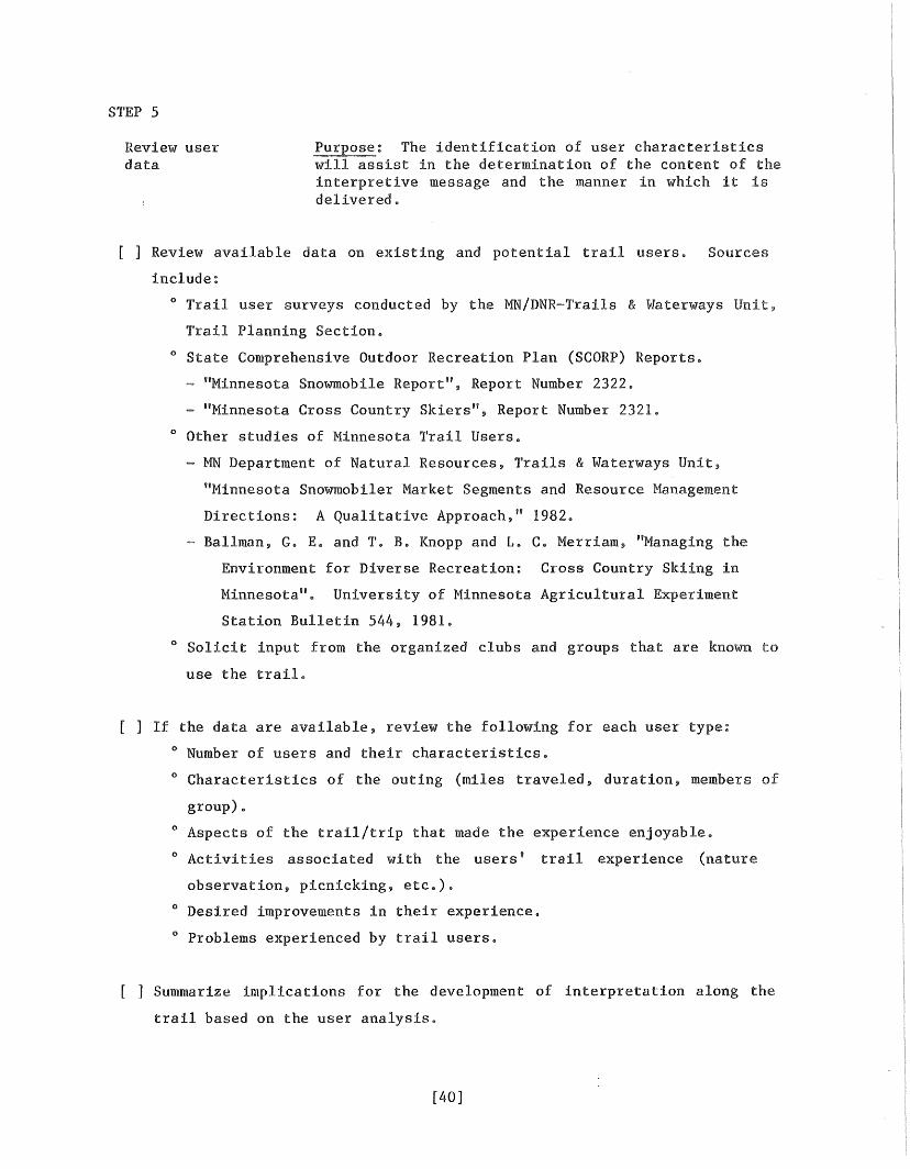
STEP 5
Review userdata
Purpose: The identification of user characteristicswill assist in the determination of the content of theinterpretive message and the manner in which it isdelivered.
[ ] Review available data on existing and potential trail users. Sources
include:
o Trail user surveys conducted by the MN/DNR-Trails & Waterways Unit,
Trail Planning Section.
o State Comprehensive Outdoor Recreation Plan (SCaRP) Reports.
- "Minnesota Snowmobile Report", Report Number 2322.
- "Minnesota Cross Country Skiers", Report Number 2321.
o Other studies of Minnesota Trail Users.
- MN Department of Natural Resources, Trails & Waterways Unit,
"Minnesota Snowmobiler Market Segments and Resource Management
Directions: A Qualitative Approach," 1982.
- Ballman, G. E. and T. B. Knopp and L. C. Merriam, "Managing the
Environment for Diverse Recreation: Cross Country Skiing in
Minnesota". University of Minnesota Agricultural Experiment
Station Bulletin 544, 1981.
o Solicit input from the organized clubs and groups that are known to
use the trail.
[ ] If the data are available, review the following for each user type:
o Number of users and their characteristics.
o Characteristics of the outing (miles traveled, duration, members of
group) •
o Aspects of the trail/trip that made the experience enjoyable.
o Activities associated with the users' trail experience (nature
observation, picnicking, etc.).
o Desired improvements in their experience.
o Problems experienced by trail users.
[ J Summarize implications for the development of interpretation along the
trail based on the user analysis.
[40]
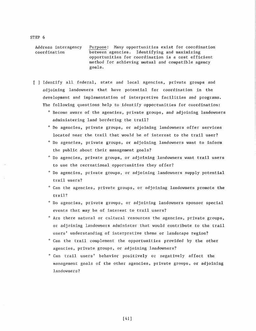
STEP 6
Address interagencycoordination
Purpose: Many opportunities exist for coordinationbetween agencies. Identifying and maximizingopportunities for coordination is a cost efficientmethod for achieving mutual and compatible agencygoals.
[ ] Identify all federal, state and local agencies, private groups and
adjoining landowners that have potential for coordination in the
development and implementation of interpretive facilities and programs.
The following questions help to identify opportunities for coordination:
o Become aware of the agencies, private groups, and adjoining landowners
administering land bordering the trail?
o Do agencies, private groups, or adjoining landowners offer services
located near the trail that would be of interest to the trail user?
o Do agencies, private groups, or adjoining landowners want to inform
the public about their management goals?
o Do agencies, private groups, or adjoining landowners want trail users
to use the recreational opportunities they offer?
o Do agencies, private groups, or adjoining landowners supply potential
trail users?
o Can the agencies, private groups, or adjoining landowners promote the
trail?
o Do agencies, private groups, or adjoining landowners sponsor special
events that may be of interest to trail users?
o Are there natural or cultural resources the agencies, private groups,
or adjoining landowners administer that would contribute to the trail
users' understanding of interpretive theme or landscape region?
o Can the trail complement the opportunities provided by the other
agencies, private groups, or adjoining landowners?
o Can trail users' behavior positively or negatively affect the
management goals of the other agencies, private groups, or adjoining
landowners?
[41]
[ ] Meet with appropriate staff from the agencies, or private groups, or the
adjoining landowners where potential for coordination exists.
o Identify their needs and concerns relative to the trail.
o Identify areas of potential coordination.
o Identify specifically how the coordination could occur (signing,
o Discuss any consensus reached regarding areas of coordination.
o Identify specifically how this coordination will be implemented.
[ ] Obtain a memorandum of agreement from the cooperating group or individual.
[42]
STEP 7
Finalizetheme
The interpretive theme identified in Step 2may require modification based on the informationobtained in the process thus fare
Because the concept of interpretive theme is abstract, it is difficult to
a checklist to aid in the determination of one. The analytical skills
and of the planner must be used in the development of an appropriate
theme@ The following questions will help in the determination of the theme and
provide a check as to whether the theme will accomplish its purposes.
[ ] If the proposed interpretive theme needs to be modified, write a new or
modified theme Does the new or modified theme answer the following
questions? :
() Does the theme explain the area's significance and reflect the
identity and character of the recreational landscapes?
() Does the theme give the trail a unique identity relative to other
state trails?
o Does it portray the sensory quality of the landscape?
() Does it help the user identify the resources that make the trail
unique?
() Does it reflect the experience the trail provides?
o Solicit opinions on the modified interpretive theme from the regional
staff and the Saint Paul staff
o Revise based on the above considerations
[43]
STEP 8
Review Progress withSaint Paul Staff
Purpose: An informal discussion at this point willfacilitate the planning process by allowing interestedand knowledgeable parties to comment and provide inputearly in the process. Areas where Saint Paul staff canprovide assistance can be identified.
[ ] Meet with representatives of the Trail Planning and Trails Operations
sections to discuss progress of the interpretive planning process
Regional Trails & Waterways coordinators, regional naturalists and other
parties involved in the process should also be included.
o Review progress and summarize findings.
o Identify roadblocks and problem areas.
o Identify areas where' Saint Paul staff can provide assistance and
outline what kind of assistance they could provide.
o Allow time for comment and input by those in attendance.
[44]
STEP 9
Formulate goalsand objectives
Purpose: The development of goals and objectives willdirect the interpretive planning effort by formallystating the purpose and desired outcomes ofinterpretation on state trails. This will help ensureall products and efforts will be purposefully directed.
[ ] State goals as set forth in "Guidelines for Developing Interpretive Plans
for DNR State Trails."
[ ] Write a brief, general paragraph as to how interpretation of the state
trail can contribute to the attainment of each goal. Use the SUBGOAL* and
QUESTIONS TO CONSIDER sections in "Guidelines for Developing Interpretive
Plans for State Trails" to assist in the development of this section.
[45]
STEP 10
Final selection ofsites to beinterpreted on atrailwide basis
Purpose: An organizing principle should be determinedwhich will provide an ordered story line or logicalsequencing of the sites. This will help make acohesive package that makes sense to the trail user.Also, the final number of sites needs to be determinedto ensure that too many sites aren't developed and thetrail isn't "overinterpreted".
[ ] Review the sequencing of sites to determine an organizing principle or
ordered storyline. The following questions might be useful in determining
the organizing principle.
o Does the sequencing of sites allow a historical progression (from
early logging to modern logging)?
o Can the sites be segmented according to subthemes which give each
segment a unique identity?
o Can you determine another organizing principle or way to organize the
sites?
[ ] Is the number of sites reasonable? Reduce the number if there are too
many.
It is difficult to state guidelines for determining the appropriate number
of sites. Keep in mind who the trail users are and how often it would be
reasonable for them to stop. Keep in mind you don't want the interpretive
facilities to intrude on the experience. Also, there should be
opportunities for the trail user to discover the trail. The trail
shouldn't be overinterpreted to the point it eliminates all sense of
discovery and mystery. Sometimes the best way to interpret is not to
interpret. Not everything should be interpreted.
[ ] Develop a goal and objectives for each site to be interpreted. A goal
should state the overall purpose of what the site should do. A goal can
be a fairly abstract statement. The objectives define how the goal can be
specifically accomplished. Objectives outline a course of action. They
can be attained and they are measurable. The objectives will be used to
evaluate whether or not the goal has been accomplished. The objectives
[46]
should be behaviorial;, that is, they can be measured by observing the
behavior of the trail user (such as response to questions).
An example of a goal and objectives for a site along a trail follows.
'1'0 interpret the wetland community which can be observed at this
site.
To provide information on how the wetland was formed.
To provide information on how a wetland such as this is a
typical feature of the landscape region and of its
importance and function in the region.
To provide information on the characteristic plan and animal
life After reading the display a user should be able to
name five characteristic bird species.
To provide information on the characteristic plan species of
the wetland. After reading the display the user should be
able to name five characteristic plant species.
To provide information on the inter-relatedness of the
components of wetland.
[ ] Select the final list of sites to be interpreted. Base this final
selection on the resource inventory and analysis, user analysis, regional
analysis, interpretive theme, and goals and objectives.
o Does each site contribute to an understanding of the interpretive
theme?
o Does each site contribute to an understanding of the landscape region?
o Is each site appropriate for the trail's user groups?
o Does each site contribute to the fulfillment of the goals and
objectives?
Sources:
Dustrude, James, "Trails: Environmental Symphonies for the Senses."Minnesota 1980, pp 46-47.
--------~-_.-
[47]
STEP 11
Determine mediaoptions
Purpose: This step will provide a systematicof the suitability and desirability of the variousmedia relative to each site.
[ ] Review the alternative interpretive med ia available and their advantages
and disadvantages.
[ ] The attached media matrix can be used to evaluate media relative to each
site and for the trail as a whole. It is a tool to be used in the
evaluation of media.
Using the matrix is beneficial in determining media options because it
provides an objective analysis relative to the site. However, in
three options are frequently the most advantageous relative to the
factors. They are signs, brochures, and kiosks/information boards
It is recommended that information boards be developed at major parking
areas and waysides as needed. lbe design for the modular unit is found
the appendix. Metal photo signs are recommended to be used to
specific resource sites along the trail. If more space is needed, a kiosk
or information board is warranted. Wood routed signs should be used when
a resource site is named.
[ ] List the interpretive sites and recommended media for each.
Sources:
Sharpe, Grant W., Interpreting the Environment, John Wiley & Sons, Inc,New York, NY, 1976, pp. 81-376.
Grater, Russell, K., The Interpreters Handbook, Methods, Skills andTechni~, Southwest Parks and Monuments Association, 1976.
Krumbein, William J., Jr. and Linda Leyva, The Interpreters Guide,California Department of Parks & Recreation, Sacramento, CA, 1977.
Mink, Larry and Marlene Schweinforth, The Interpreters' Manual, North DakotaParks & Recreation Department, Bismarck, ND, 1982.
Lewis, William J., Interpreting for Park Visitors, Eastern Acorn Press.,(Eastern National Park and Monument Association), 1980.
[48]
Media Matrix for Evaluation of Non-Personal Interpretive Media
This matrix has been designed to help the interpretive planner select media
that are most effective in conveying the interpretive message. It can be
to a particular site or the trail as a whole. The matrix is meant to
provide a framework for analysis. Factors other than those included in the
matrix may ultimately be decidinge
Factors affecting the suitability and desirability of media relative to a given
site are listed at the left margin. Each medium should be rated according to
whether or not it provides advantages or disadvantages relative to each factor.
The following point system should be used:
2 - Medium provides a big advantage relative to this factor
1 - Medium provides somewhat of an advantage
-1 - Medium provides somewhat of a disadvantage
-2 - Medium provides a large disadvantage
o - Not a consideration
The media that receive the highest total scores should receive the strongest
consideration.
[49]
MEDIA MATRIX FOR EVALUATION OF NON-PERSONAL INTERPRETIVE MEDIA
Factors to consider in the selection of ~interpretive media ~
SCORE: 2 - media provides a big advantage relative ~ 2fto this factor ~ t::
1 - media provides somewhat of an advantage ~ ~-1 - media provides somewhat of a disadvantage l; ~-2 - media provides a large disadvantage ~ 0o - not a consideration ~~
7~s
!:J(S~
Qj~
~%§ fS
::c: Nt;j 15
Q:; CJ
g ~f2 t;[] ~ OMMENTS
VloL-J
1. Initial development cost
2. Replacement cost
3. Routine maintenance costs
4. Potential for vandalism
5. Capability of attracting the attention of usergroup(s) interpretive message is intended for
6. Visual obtrusiveness of media on the site
7. Site or resource deterioration
8. Special effects needed to maximize impact ontrail user (sounds. illustrations)
9. Amount of information to be presented
10. Desirability of souvenir value or futurereference value of message
11. Effects of weather
12. Litter potential
13. Easily modified for future changes
14. Number of users per media unit
15. Ability to fulfill a temporary need
16. Ability to communicate desired message
17. Ability to allow visitor to participate
Other factors:
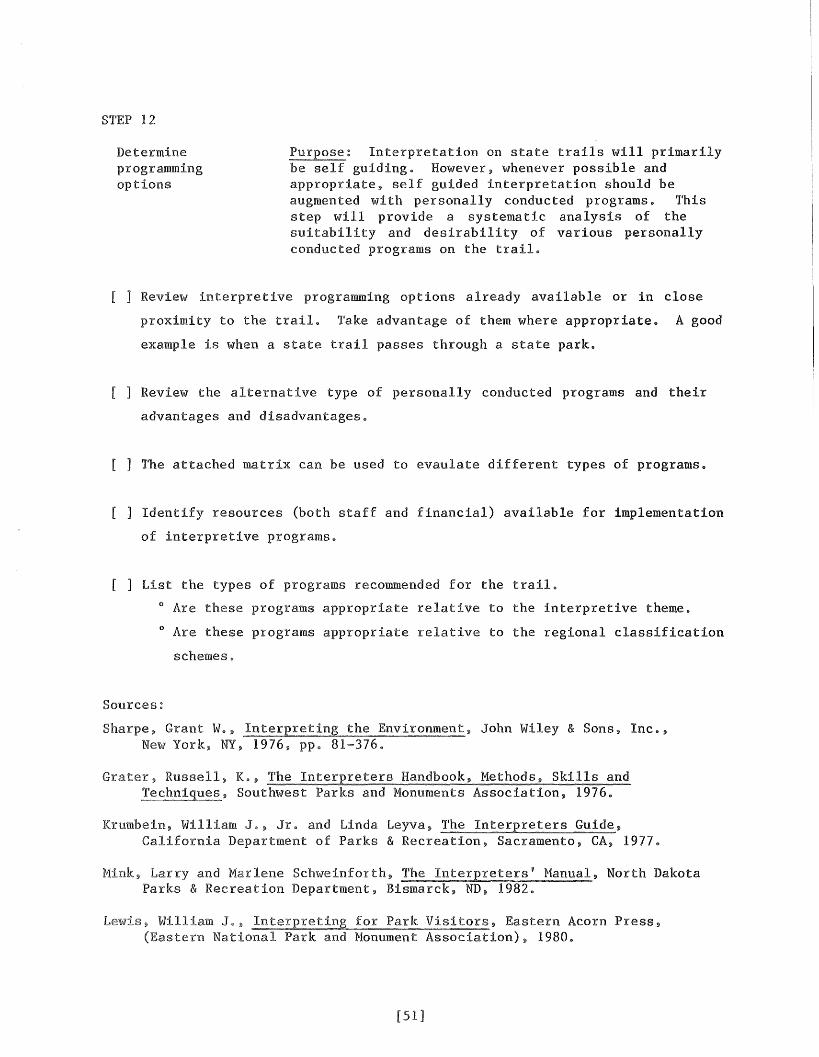
STEP 12
Determineprogrammingoptions
Purpose: Interpretation on state trails will primarilybe self guiding. However, whenever possible andappropriate, self guided interpretation should beaugmented with personally conducted programs. Thisstep will provide a systematic analysis of thesuitability and desirability of various personallyconducted programs on the trailo
[ ] Review interpretive programming options already available or in close
proximity to the trail. Take advantage of them where appropriate. A good
example is when a state trail passes through a state park.
[ ] Review the alternative type of personally conducted programs and their
advantages and disadvantages.
[ ] The attached matrix can be used to evaulate different types of programs.
[ ] Identify resources (both staff and financial) available for implementation
of interpretive programs.
[ ] List the types of programs recommended for the trail.
o Are these programs appropriate relative to the interpretive theme.
o Are these programs appropriate relative to the regional classification
schemes.
Sources:
Sharpe, Grant WeNew York, NY,
John Wiley & Sons, Inc.,
Grater, Russell, K., The Interpreters Handbook, Methods, Skills andSouthwest Parks and Monuments Association, 19760
Krumbein, William Je, Jre and Linda Leyva, The Interpreters Guide,California Department of Parks & Recreation, Sacramento, CA, 1977
Mink, and Marlene Schweinforth, The Interpreters' Manual, North DakotaParks & Recreation Department, Bismarck, ND, 1982.
Lewis
[51]
Press,
MEDIA MATRIX FOR EVALUATION OF INTERPRETIVE PROGRAMS REQUIRING STAFF ON SITE
Factors to consider in the selection of type of interpretive program for a trail
SCORE: 2 - program provides a large advantage1 - program provides somewhat of an
advantage-1 - program provides somewhat of a
disadvantage-2 - program provides a large disadvantageo - not a consideration
1. Number of potential participants
2. Characteristics of potential participants (typeof trail users and their characteristics)
----1 --+-- . _
ir-
-------+-1- +------- - ----
Need for explanation of DNR resource managementprograms along trail
Coordination with special events on the locallevel
Need for trail promotion on the local. regionalor state level
3. Manpower available to'conduct programs
5. Special equipment needs; are they available?
7.
8.
9.
4. Funding available to conduct programs
6.I I I ---+_-
-U_--T-! I
~---
INeed for education of trail users in order to I I I - :.1·- -- - --·1---1promote appropriate use of the trail and its I I I
::: ::::U::::::::::::::::::::::1~:l::::U::::t; I I---- --·....-1-----1---==1-----------------------------number of participants I 1
\Jlf\)'---.J
12. Potential for coordination with other DNRdivisions
ornER:
STEP 13
Evaluate mediachoices on a trailwide basis
Purpose: An analysis of media on a trail wide basiswill provide the opportunity to develop a coordinated,consistent media package which can be efficientlyimplemented and maintained. This analysis will ensurethat the selected media are compatible in a trail widecontext.
[ ] Determine the final mix of media by considering the following questions:
o Which are most appropriate with regard to the interpretive theme?
o Which are most with regard to the regional analysis?
o Which are most appropriate with regard to the mix of users?
o Do the media work well together to create a coordinated, easily
identifiable, cohesive system of media on a trailwide basis?
[ ] Make any necessary adjustments to the list of interpretive sites and
recommended media made in Step 11.
[53]
STEP 14
Review Progress withSaint Paul Staff
Purpose: An informal discussion at this point willfacilitate the planning process by allowing interestedand knowledgeable parties to comment and provideearly in the process. Areas where Saint Paul staffprovide assistance can be identified.
[ ] Meet with representatives of the Trail Planning and Trails
sections to discuss progress of the interpretive planning process
Regional Trails & Waterways coordinators, regional naturalists and
parties involved in the process should also be included.
o Review progress and summarize your findings.
o Identify roadblocks and problem areas.
o Identify areas where Saint Paul staff can provide assistance and
outline what kind of assistance they could provide.
o Allow time for comment and input by those in attendance.
[54]
STEP 15
Develop a monitoring Purpose: Monitoring use and satisfaction will provideinformation necessary for modification of interpretivefacilities and programs.. Monitoring and subsequentmodifications will help ensure that the interpretiveprogram will fulfill its goals and objectives ..
[ ] Review alternatives for monitoring use and satisfaction with interpretive
facilities and programs and their advantages and disadvantages as reviewed
in the "Technical Appendices".
[ ] Review the current monitoring efforts of overall trail use.
o Can the necessary information relative to the attainment of the goals
and objectives of the interpretive program be obtained from current
monitoring efforts?
o Can current monitoring efforts be modified to obtain the necessary
information?
[ ] Recommend a monitoring method or methods that are appropriate for the
trail and identify at what stages of interpretive development each should
be implemented 0
Sources
See the monitoring section in the Technical Appendices of the "InterpretivePlan for State Trails,,"
[55]
STEP 16
Develop acost/phasingschedule
Purpose: The development of interpretive facilitiesand programs will be prioritized and cost estimatesgenerated to facilitate implementation.
[ ] List each site to be interpreted with a breakdown of proj ects which
comprise the total interpretive package of that site.
[ ] Generate cost estimates for each project.
[ ] Complete a cost/phasing schedule for all recommended facilities and
programs. Use the following format.
[56]
STEP 17
Addressimplementation
Identifying who will be responsible andaccountable for the development, operations andmaintenance of interpretive development will facilitateimplementation.
[ ] Identify key actors who will have major roles in implementing the plan and
briefly discuss what their responsibilities are as defined by current
operational proceduree
[ ] Identify any additional staffing needs. Include amount of time required,
job responsibilities, classification and cost.
[57]
STEP 18
Submit plan forreview
Purpose: The review process will provide anopportunity for additional input and comment by thosewith expertise and experience on the resourcesinventory analysis, user analysis and finalrecommendations.
[ ] Submit a copy of the plan to the following and allow at least two weeks
for response:
o Special Assistant to the Commissioner, Trails & Waterways Unit.
o Supervisor, Trail Planning Section, Trails & Waterways Unit.
o Supervisor, Trails Operations Section, Trails & Waterways Unit.
o Regional Naturalist.
o Regional Trails & Waterways Coordinator.
o Interpretive Services Coordinator, Division of Parks & Recreation.
o Other DNR Divisions and Bureaus, if the trail borders land they
administer and coordination of interpretive efforts is planned.
[ ] Revise plan if any major issues or problems arose during the review.
[ ] Submit a copy of the revised plan to the following if they have been
actively interested in or contributed to the development of the plan.
o User group representatives.
o Local historical society.
o Local units of government.
o Resource specialists from local colleges and universities.
o Minnesota Historical Society.
o Administrators of other interpretive areas nearby.