Chapter 4. Refuge Management Direction: Goals, Objectives, and Strategies Trinity River NWR Comprehensive Conservation Plan and Environmental Assessment 4-1 4. Refuge Management Direction: Goals, Objectives, and Strategies The following goals, objectives, and strategies are the Service’s response to the issues and concerns expressed by the planning team and the public; unless otherwise noted in the text, they are expected to be implemented throughout the 15-year term of this CCP. Because the CCP is a working document, modifications to the following objectives and strategies are anticipated. Goals and objectives are the unifying elements of successful refuge management. They identify and focus management priorities, provide a context for resolving issues, guide specific projects, provide rationale for decisions, and offer a defensible link among management actions, refuge purpose(s), Service policy, and the National Wildlife Refuge System mission. Goals define general targets in support of the vision, followed by objectives that direct effort into incremental and measurable steps toward achieving those goals. Finally, strategies identify specific tools or actions to accomplish objectives. The goals are organized into four broad categories: habitat, wildlife, visitor services, and facilities. Planning Horizon: 15 Years Short-Term Objectives: 1 to 7 years Long-Term Objectives: by end of 15-year period 4.1 Wildlife and Habitat Management Goal 1: Habitat Conservation (Protection and Restoration): To acquire, restore, enhance, and manage healthy bottomland hardwood forests and associated habitat in order to support a natural diversity of plant and animal species that will foster the ecological integrity of the lower Trinity River floodplain ecosystem. Objective 1: Land Acquisition Throughout the life of the CCP, increase land acquisition and conservation easement efforts within the approved 80,000-acre refuge boundary to 3,500 acres per year, while updating the 1999 Preliminary Project Proposal (PPP) to add approximately 20,000 acres to acquisition and conservation easement efforts. Rationale: Since the completion and approval of the Lower Trinity River Floodplain Habitat Stewardship Plan in 1999, the refuge has acquired an average of nearly 2,000 acres per year of bottomland hardwood forest and associated habitat from willing sellers. Annually, the refuge purchases more land than almost all other refuges in Region 2. If that pace were to continue, it still would take more than 27 years to complete refuge acquisition. The number of willing sellers in this Bat tower erected on refuge. USFWS
Transcript
Chapter 4. Refuge Management Direction: Goals, Objectives, and Strategies
Trinity River NWR Comprehensive Conservation Plan and Environmental Assessment 4-1
4. Refuge Management Direction: Goals, Objectives, and Strategies
The following goals, objectives, and strategies are the Service’s response to the issues and concerns expressed by the planning team and the public; unless otherwise noted in the text, they are expected to be implemented throughout the 15-year term of this CCP. Because the CCP is a working document, modifications to the following objectives and strategies are anticipated.
Goals and objectives are the unifying elements of successful refuge management. They identify and focus management priorities, provide a context for resolving issues, guide specific projects, provide rationale for decisions, and offer a defensible link among management actions, refuge purpose(s), Service policy, and the National Wildlife Refuge System mission. Goals define general targets in support of the vision, followed by objectives that direct effort into incremental and measurable steps toward achieving those goals. Finally, strategies identify specific tools or actions to accomplish objectives. The goals are organized into four broad categories: habitat, wildlife, visitor services, and facilities.
Planning Horizon: 15 Years
Short-Term Objectives: 1 to 7 years
Long-Term Objectives: by end of 15-year period
4.1 Wildlife and Habitat Management Goal 1: Habitat Conservation (Protection and Restoration): To acquire, restore, enhance, and manage healthy bottomland hardwood forests and associated habitat in order to support a natural diversity of plant and animal species that will foster the ecological integrity of the lower Trinity River floodplain ecosystem.
Objective 1: Land Acquisition Throughout the life of the CCP, increase land acquisition and conservation easement efforts within the approved 80,000-acre refuge boundary to 3,500 acres per year, while updating the 1999 Preliminary Project Proposal (PPP) to add approximately 20,000 acres to acquisition and conservation easement efforts.
Rationale: Since the completion and approval of the Lower Trinity River Floodplain Habitat Stewardship Plan in 1999, the refuge has acquired an average of nearly 2,000 acres per year of bottomland hardwood forest and associated habitat from willing sellers. Annually, the refuge purchases more land than almost all other refuges in Region 2. If that pace were to continue, it still would take more than 27 years to complete refuge acquisition. The number of willing sellers in this
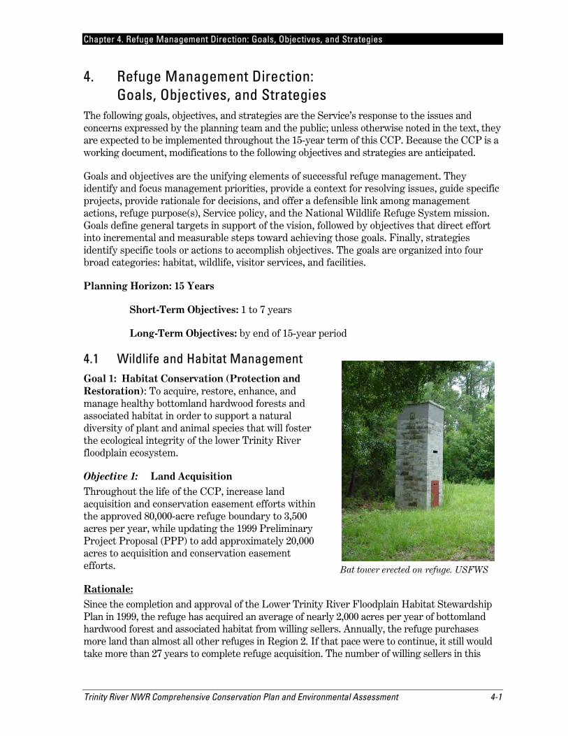
Bat tower erected on refuge. USFWS
Chapter 4. Refuge Management Direction: Goals, Objectives, and Strategies
4-2 Trinity River NWR Comprehensive Conservation Plan and Environmental Assessment
area is greater than the ability for Service Realty Specialists to handle the acquisition deals. Additionally, the number of private property owners just outside the approved acquisition boundary wishing to sell their bottomland hardwood forest and associated wetlands has increased since the 1999 plan. An updated PPP taking these additional areas under consideration needs to be developed. No conservation easements have been attained yet, but negotiations continue with at least one landowner.
The bottomland forests are critical for migratory songbirds and native wildlife (Barrow et al. 2000). They store large amounts of carbon in their foliage, roots, and soil, and they offer opportunities for carbon offsets with local industry (Delaney et al. 2002). Natural bottomland forests buffer flooding related to heavy rainfall common on the Texas coast, protecting human communities.
Strategy 1: Assign on-site regional level Service Realty Specialist to the refuge.
Strategy 2: Develop a systematic approach to identify appropriate lands available for acquisition within the area approved for acquisition.
Strategy 3: Develop updated PPP, increasing and redefining refuge acquisition boundary by approximately 20,000 acres.
Strategy 4: Maximize various funding opportunities needed to acquire lands, including Land and Water Conservation Funds, Migratory Bird Funds (duck stamps), mitigation funds, donations, grants, and possible land swaps.
Strategy 5: Enter into formal agreements, at the localized level for funding or acquisition assistance with NGOs such as The Conservation Fund, Trust for Public Lands, and land trusts.
Strategy 6: Strengthen and establish additional partnerships with an ecoregional approach to wildlife conservation/management with nearby State and Federal land management agencies. Two State parks, one national preserve, one national forest, one State river authority, and one Corps of Engineers lake project area, totaling over 380,000 acres, are located within 15–20 miles of the refuge.
Chapter 4. Refuge Management Direction: Goals, Objectives, and Strategies
Trinity River NWR Comprehensive Conservation Plan and Environmental Assessment 4-3
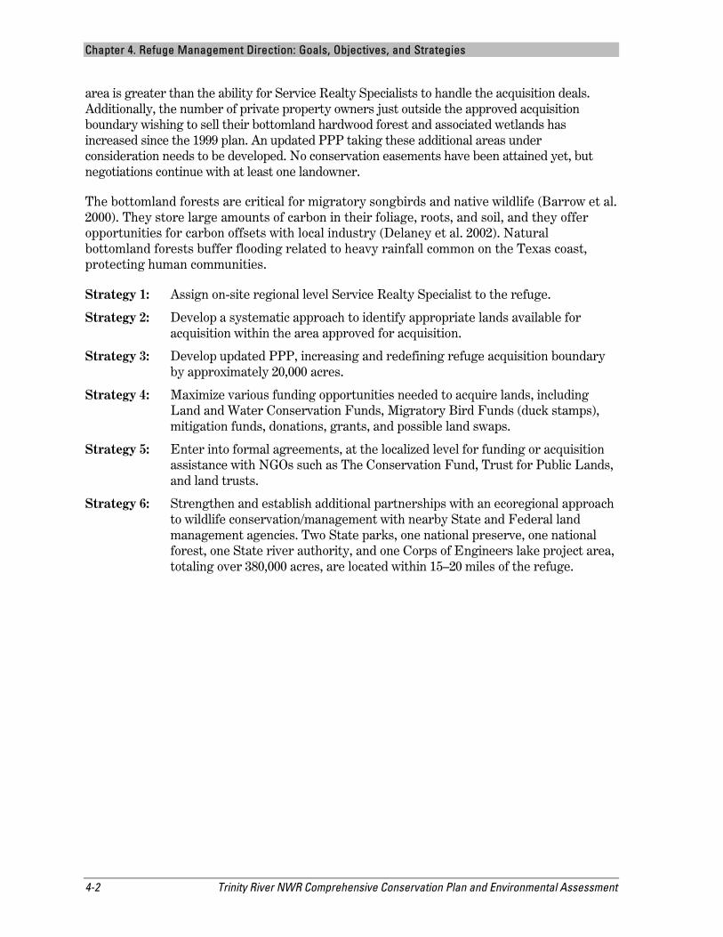
Biologist Laurie on right looking at exotic fern samples. USFWS
Objective 2: Invasive Floral Monitoring and Management Treat and monitor approximately 450 acres annually (short-term 300 acres; long-term 600 acres) of bottomland hardwood forests and associated habitats for encroachment of exotic vegetative species to achieve a 90 percent kill rate with herbicides approved for use by the Service.
Rationale: Preventing the introduction and spread of invasive species is an ongoing and serious threat to native habitat. Executive Order 13112 requires that Federal agencies use relevant programs, authorities, and funds to monitor for, prevent, and control the spread of invasive species. The refuge treats 100–200 acres of invasive species annually. Although the refuge has treated more than a dozen species, the predominant invasive species are Chinese tallow tree, Chinaberry tree, trifoliate orange, and water hyacinth. Various and time consuming eradication methods are used depending on target species (Langeland and Stocker 1997).
Strategy 1: Develop an Integrated Pest Management Plan.
Strategy 2: Monitor for and map “hotspots” of invasive/exotic species.
Strategy 3: Develop a systematic approach to target and treat units annually followed by monitoring for and proactive spot treatments of new plants.
Strategy 4: Treat exotic species with basal bark, foliar, or aerial application methods.
Chapter 4. Refuge Management Direction: Goals, Objectives, and Strategies
4-4 Trinity River NWR Comprehensive Conservation Plan and Environmental Assessment
Strategy 5: Initiate invasive species strike team.
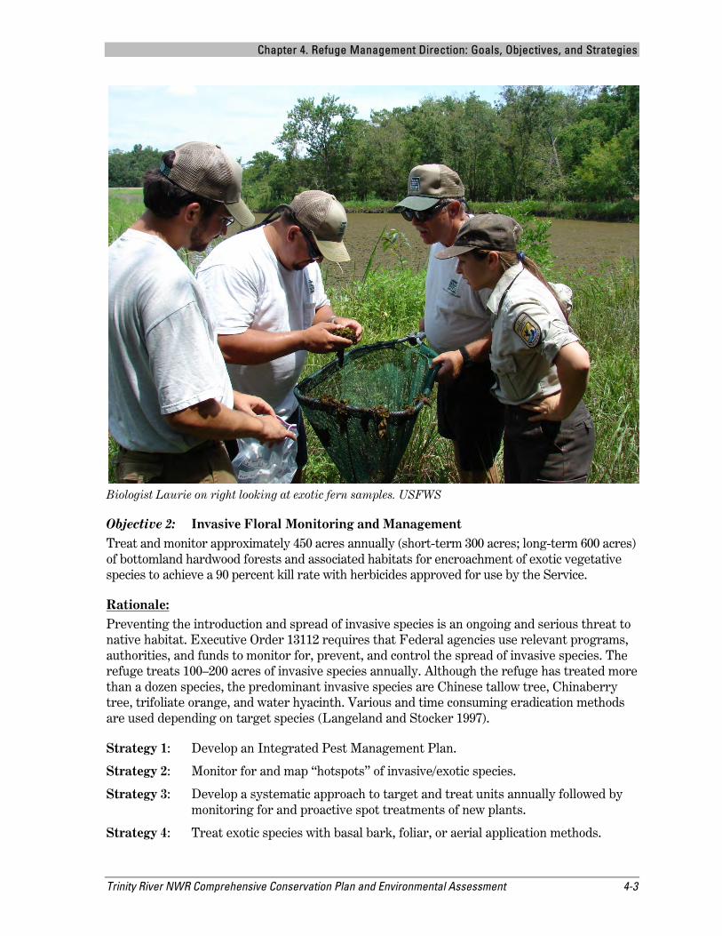
Objective 3: Invasive Faunal Monitoring and Management Throughout the life of the CCP, improve invasive species management of feral hogs and nutria by trapping for up to 200 nights per year for feral hogs and as needed for nutria, while increasing opportunities for the public to hunt feral hogs.
Nutra on Ander’s Pond. USFWS
Rationale: Preventing the introduction and spread of exotic wildlife species is an ongoing and serious threat to wildlife and native habitat. The greatest non-native wildlife species posing habitat challenges to the refuge is the feral hog. Feral hogs tend to move throughout the “bottoms” and pose a threat by eating all forms of native fauna ranging from grubs, snakes, and ground-nesting birds to newborn deer (Taylor 1991). They also host a variety of zoonotic diseases. While hogs can “root up” levee embankments, nutria can burrow through levees, creating safety issues. The refuge traps 20–30 feral hogs and small numbers of nutria annually with an average of 50 trap-nights annually. These permanent or mobile traps will rotate over 3–4 units per year depending on observed areas of destruction. An increase in trap nights and additional hunting opportunities will increase annual harvest, decreasing some destruction caused by feral hogs.
Strategy 1: Develop a Hog Management Plan.
Strategy 2: Trap and remove all nutria and as many hogs as possible in partnership with the USDA Animal Damage Control via approved methods.
Strategy 3: Develop a systematic approach to trap in units targeted for treatment annually followed by monitoring and proactive spot trapping as needed.
Strategy 4: Increase recreational hunt opportunities focusing on feral hogs.
Chapter 4. Refuge Management Direction: Goals, Objectives, and Strategies
Trinity River NWR Comprehensive Conservation Plan and Environmental Assessment 4-5
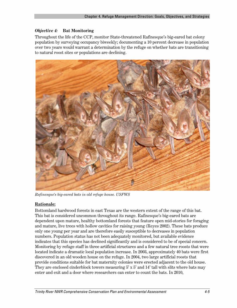
Objective 4: Bat Monitoring Throughout the life of the CCP, monitor State-threatened Rafinesque’s big-eared bat colony population by surveying occupancy biweekly; documenting a 10 percent decrease in population over two years would warrant a determination by the refuge on whether bats are transitioning to natural roost sites or populations are declining.
Rafinesque's big-eared bats in old refuge house. USFWS
Rationale: Bottomland hardwood forests in east Texas are the western extent of the range of this bat. This bat is considered uncommon throughout its range. Rafinesque’s big-eared bats are dependent upon mature, healthy bottomland forests that feature open mid-stories for foraging and mature, live trees with hollow cavities for raising young (Reyes 2002). These bats produce only one young per year and are therefore easily susceptible to decreases in population numbers. Population status has not been adequately monitored, but available evidence indicates that this species has declined significantly and is considered to be of special concern. Monitoring by refuge staff in three artificial structures and a few natural tree roosts that were located indicate a dramatic local population increase. In 2003, approximately 40 bats were first discovered in an old wooden house on the refuge. In 2004, two large artificial roosts that provide conditions suitable for bat maternity colonies were erected adjacent to the old house. They are enclosed cinderblock towers measuring 5’ x 5’ and 14’ tall with slits where bats may enter and exit and a door where researchers can enter to count the bats. In 2010,
Chapter 4. Refuge Management Direction: Goals, Objectives, and Strategies
4-6 Trinity River NWR Comprehensive Conservation Plan and Environmental Assessment
approximately 100 bats were using all three structures. Based on current population growth rates in the artificial structures, it is estimated they could support approximately 150 roosting bats over the life of this CCP. Refuge radio tagging has shown that bats in the artificial structures also use numerous mature trees in the immediate area. Over time, as more refuge trees are left to mature and form natural hollow cavities, bats will become less dependent upon artificial roost sites. Population of the bat colony is measured by counting bats in the known artificial and natural roost sites. The refuge does not plan to erect any other artificial roosting structures but will attempt to identify natural roost sites in the vicinity to document the difference between transitioning to natural sites versus a true reduction in the population. This species is recognized as a Category II Species of Concern by the Service.
Strategy 1: Maintain, monitor, and protect current natural and artificial roost sites for any changes or damages.
Strategy 2: Monitor population by counting roost occupancy every two weeks.
Strategy 3: Continue with no logging activities in the refuge to allow existing forests to mature, thus increasing natural roosting habitat for bats in the future.
Strategy 4: Initiate adaptive management practices if a drop of population numbers by 10 percent over two sequential years occurs to prevent further population decline.
Chapter 4. Refuge Management Direction: Goals, Objectives, and Strategies
Trinity River NWR Comprehensive Conservation Plan and Environmental Assessment 4-7
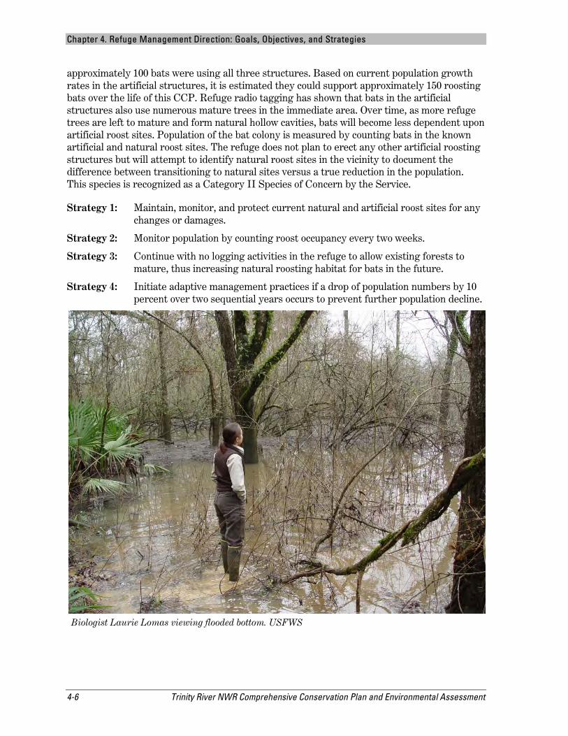
Objective 5: Habitat Inventory and Monitoring Within two years of the CCP’s approval, gather baseline inventory and monitoring data of the composition of vegetative species at 40 surveys points within a 1,500-acre parcel, representing approximately 60 percent of the refuge, to determine best management practices for providing high quality habitat for birds, mammals, reptiles, and amphibians.
Refuge trail. USFWS
Rationale: Trinity River NWR plays an important role in contributing to the conservation of wildlife at the local, regional, and ecosystem levels, as well as the overall biological diversity of the Refuge System. The refuge must maintain or improve the biological integrity and diversity of the habitat upon which the wildlife depend for forage and shelter to ensure the conservation of wildlife species.
The refuge will gather baseline inventory data on the composition of vegetative species on a 1,500-acre parcel representing approximately 60 percent of the refuge. The other 40 percent of refuge land is influenced by tidal flow, has slight differences in elevation, has been logged within the last 30 years, or has a pine ridge or severely altered habitats. The 1,500-acre parcel is, for the most part, indicative of a mature bottomland hardwood forest with a closed canopy.
The refuge will use a standard-random design of 40 sample points using a forest bird habitat monitoring protocol such as a modified James and Shugart (1970) vegetation sample
Chapter 4. Refuge Management Direction: Goals, Objectives, and Strategies
4-8 Trinity River NWR Comprehensive Conservation Plan and Environmental Assessment
methodology to gather measurements of plant species diversity and density of forbs, shrubs, and trees. This methodology may be used to compare samplings within the refuge and with other agencies also associated with bottomland hardwood habitat inventory and monitoring. The sample points will be re-sampled every five years to determine if any actions are needed to improve the habitat. Data acquired from this monitoring effort may be used to corroborate habitat is suitable for birds, mammals, reptiles, and amphibians, and to assess adaptive management techniques.
To clarify its role, the refuge will develop a step-down Habitat Management Plan (HMP) that develops priorities among species and species groups; it will be used to guide the development of appropriate strategies to achieve habitat objectives. The HMP will provide a process whereby refuge staff use key historical refuge data, scientific literature, expert opinion, and staff expertise to make habitat management decisions. The HMP will be a dynamic document, providing a decision-making process and guidance for the management of refuge habitat.
Strategy 1: Complete a detailed vegetation map for the entire refuge to establish an overall baseline to monitor future changes in management direction and changes related to climate change.
Strategy 2: Develop habitat monitoring programs in bottomland and riparian areas to document results of management actions; evaluate these in terms of habitats objectives, focusing on bottomland hardwood species composition changes over time.
Strategy 3: Complete a step-down HMP for the refuge (short-term). The HMP further helps define how the refuge can best contribute to maintaining biological diversity and determine biodiversity objectives within the context of the ecoregions that are part of the refuge.
Strategy 4: Develop habitat monitoring techniques for all areas undergoing active management. Document results of management actions, and evaluate these in terms of habitat objectives. Identify factors that limit the refuge’s ability to meet objectives and to amend habitat management plans when monitoring and evaluation data support adjustments.
Strategy 5: Develop a monitoring program and database to evaluate wetlands in terms of key habitat components, such as numbers and types of invertebrates, wildlife use, water quality, and vegetation response to water management.
Strategy 6: Develop small scale hydrological projects to maintain or improve water flow and levee structures.
Objective 6: Climate Change Monitoring Within two years of the CCP’s approval, gather baseline inventory and monitoring data of refuge resources at 40 surveys points within a 1,500-acre parcel, representing approximately 60 percent of the refuge, to determine the effects on refuge resources (long-term) related to changes in climate.
Rationale: Secretarial Order 3226 states that “there is a consensus in the international community that global climate change is occurring and that it should be addressed in governmental decision
Chapter 4. Refuge Management Direction: Goals, Objectives, and Strategies
Trinity River NWR Comprehensive Conservation Plan and Environmental Assessment 4-9
making…This Order ensures that climate change impacts are taken into account in connection with Departmental planning and decision making…Each bureau and office of the Department will consider and analyze potential climate change impacts when undertaking long-range planning exercises, when setting priorities for scientific research and investigations, when developing multi-year management plans, and/or when making major decisions regarding the potential utilization of resources under the Department’s purview. Departmental activities covered by this Order include, but are not limited to, programmatic and long-term environmental reviews undertaken by the Department, management plans and activities developed for public lands, planning and management activities associated with oil, gas and mineral development on public lands, and planning and management activities for water projects and water resources” (US Secretary of Interior 2009). Secretarial Order 3226 applies to Comprehensive Conservation Plans and step-down management plans such as habitat management plans.
Regional modeling of how long-term climate change patterns might emerge in the U.S. suggests that future climates along the Texas Gulf Coast could be very different than those of the past. Climate researchers used unique state-of-the art high resolution nested climate simulation models to explore the importance of fine scale processes in determining climate change hotspots in the continental United States and Mexico (Diffenbaugh et al. 2008).
The refuge will gather baseline inventory data on the possible effects of climate change on a 1,500-acre parcel representing approximately 60 percent of the refuge. The other 40 percent of refuge land is influenced by tidal flow, has slight differences in elevation, has been logged within the last 30 years, or has a pine ridge or severely altered habitats. The 1,500-acre parcel is, for the most part, indicative of a mature bottomland hardwood forest with a closed canopy.
Strategy 1: Continue to restore native habitat to sequester carbon by allowing forests to mature and reforesting pastures as needed.
Strategy 2: Introduce soil chemistry monitoring devices at 40 standardized sampling points to measure possible changes in physical environment and compare with weather data to explain possible shifts in vegetation composition.
Strategy 3: Monitor native and non-native plant and animal species range shift at 40 standardized points (i.e., black-bellied whistling duck nesting) for changes related to climate change.
Strategy 4: Utilize best available science to manage resources within ecosystems.
Strategy 5: Support research from partners and contribute to scientific information benefiting the ecoregion, such as Land Conservation Cooperatives (LCCs).
Strategy 6: Support land conservation efforts of partners through coordination of opportunities and resources.
Chapter 4. Refuge Management Direction: Goals, Objectives, and Strategies
4-10 Trinity River NWR Comprehensive Conservation Plan and Environmental Assessment
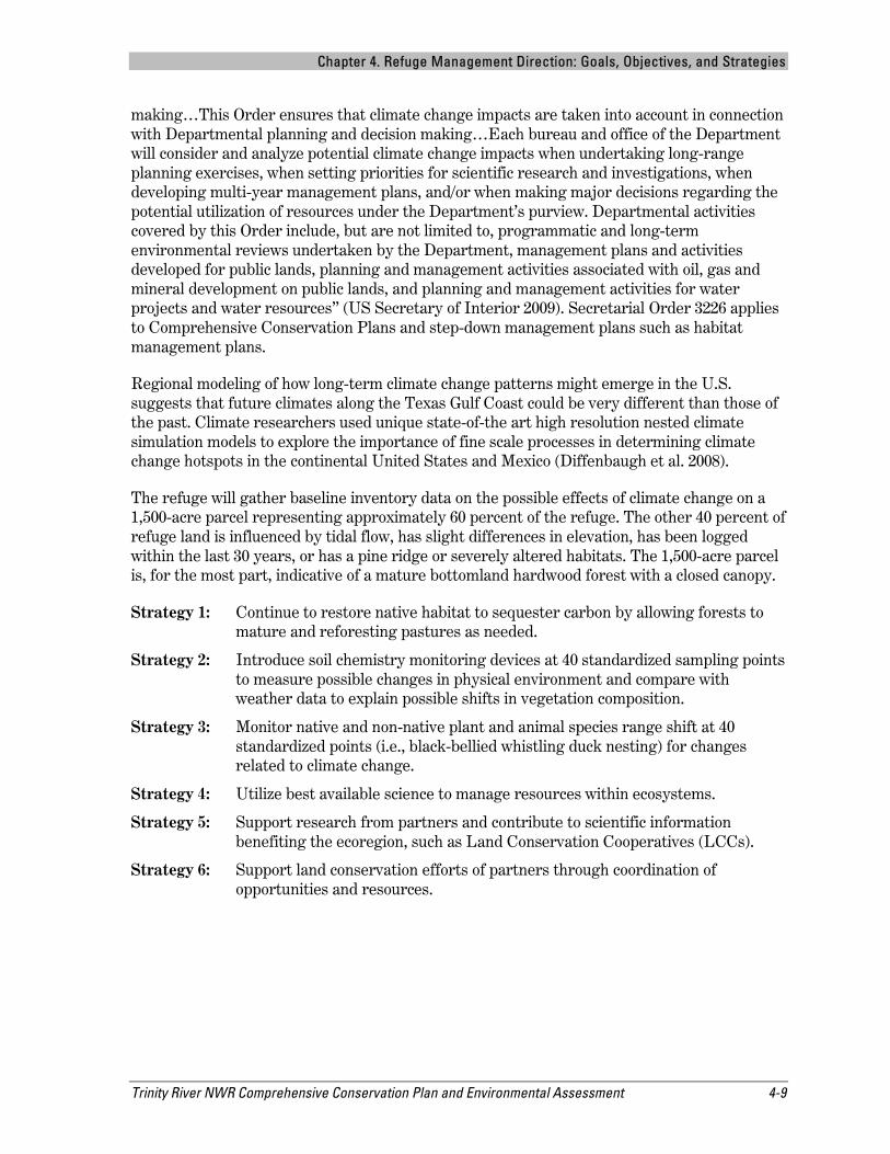
4olunteers building Purple Martin boxes for use around refuge. USFWS
Objective 7: Bird Inventory and Monitoring Upon the CCP’s approval, initiate semiannual surveys to gather baseline inventory and monitoring data of refuge bird species at 40 surveys points within a 1,500-acre parcel representing approximately 60 percent of the refuge to determine the effects on bird populations (long-term).
Rationale: The Trinity River NWR was established by the Emergency Wetlands Resources Act of 1986 on January 4, 1994 for “…the conservation of the wetlands of the Nation in order to maintain the public benefits they provide and to help fulfill international obligations contained in various migratory birds treaties and conventions….”
Conservation and restoration of bottomland hardwood and associated habitats (ponds, bayous, ridges, right-of-ways, etc.) will result in a mosaic of microhabitat types that support a variety of resident and migratory birds found in this area. For example, Swainson’s warblers nest in habitats featuring high stem densities with heavy concentrations of small trees (Lanham and Miller 2006) or giant cane (Arundinaria, gigantia) or beneath vine tangles with a non-vegetated leaf litter below (Graves 2002). Conversely, prothonotary warblers are cavity nesters that select snags in flooded areas and frequently forage in the forest mid-story (Petit 1999), while acadian flycatchers are found in greatest densities in unlogged forests with all layers intact (Twedt and Somershoe 2009). For migrating songbirds, it appears that birds probably settle in response to
Chapter 4. Refuge Management Direction: Goals, Objectives, and Strategies
Trinity River NWR Comprehensive Conservation Plan and Environmental Assessment 4-11
gross habitat features such as vegetation density or stratification and then search for resources based on other factors (Moore and Aborn 2000). Nesting raptors typically found on the refuge (i.e., swallow-tailed kite, red-shouldered hawk, Cooper’s hawk) generally require larger diameter and taller trees (Bent 1937, Portnoy and Dodge 1979, Brown et al. 1997). The refuge is home to six woodpecker species that require older and larger trees (Shackelford and Conner 1997). Various nesting herons and egrets inhabit “rookeries” located throughout the refuge from March to June. Refuge studies show nesting densities and locations vary yearly due to factors primarily related to water depth and availability.
The refuge will gather baseline inventory data regarding occupancy, range shifts, and population trends of bird species climate change on a 1,500-acre parcel representing approximately 60 percent of the refuge. Data will be analyzed with habitat characteristics collected from vegetative surveys to assess adaptive management efforts, as a change may be related to changes in climate. Data will be measured through point count surveys at 40 standardized points on a semiannual basis. At each point, presence/absence of the indicator forest breeding bird species (Swainson’s, prothonotary and hooded warblers; acadian flycatcher; red-shouldered hawk; downy woodpecker; white-eyed vireo; northern parula; summer tanager; and Carolina wren) will be noted. All other bird species heard or seen will also be recorded, including flyovers. If our studies indicate the presence of 8 of these 10 indicator species, then we will be meeting our habitat management objectives for forest breeding bird species throughout the refuge.
Colonial waterbirds will be surveyed once a year in May in accordance with the colonial waterbird surveys collected by the State of Texas. Colonial waterbird rookeries can usually be found in the same places every year; however, they can move due to habitat conditions such as shallow water depths or encroachment of waterweeds. Bird species, pairs, nests, eggs, nestlings, and stages of nestling growth are recorded as a part of the surveys. Rookeries with populations of up to 10,000 birds comprised of up to 10 species have been located on the refuge on several occasions. These surveys will also be analyzed with habitat characteristics measured using standard methodologies used by James and Shugart (1970) to assess adaptive management, as a change may be related to changes in climate.
Strategy 1: Continue to acquire a variety of bottomland habitats that provide corridors for wildlife movement, including the migration of large numbers of migratory birds.
Strategy 2: Locate nesting territories of bald eagles and swallow-tailed kites. Consider these locations a priority in conservation activities.
Strategy 3: Create a research protocol using point counts to gather information on specific bird nesting (Swainson’s warbler) in forested habitats.
Strategy 4: Within one year, develop a forest bird habitat monitoring protocol such as a modified James and Shugart (1970) vegetation sampling paired with Landbird Monitoring Protocols.
Strategy 5: Continue Colonial Waterbird Census efforts with added vegetation sampling.
Strategy 6: Increase invasive exotic control of floral and faunal species within the bottomland hardwood forest that affect bird species.
Chapter 4. Refuge Management Direction: Goals, Objectives, and Strategies
4-12 Trinity River NWR Comprehensive Conservation Plan and Environmental Assessment
Objective 8: Reptiles and Amphibians Inventory and Monitoring Within three years of the CCP’s approval, initiate semiannual surveys to gather baseline inventory and monitoring data of refuge reptile and amphibian species at 40 surveys points within a 1,500-acre parcel, representing approximately 60 percent of the refuge, to determine the effects on populations (long-term).
Rationale: Reptile and amphibian populations across the refuge have not been well documented, but many populations of reptile and amphibians have declined due to habitat loss and exploitation of species throughout their range (TPWD 2005b). Assessing reptile and amphibian population status and trends may aid in establishing priorities for conservation of minimal unit size and corridors between units to sustain existing populations, as a change may relate to changes in climate.
Strategy 1: Within three years of the approval of the CCP, develop an inventory and monitoring protocol for reptiles and amphibians across refuge habitats, including wetlands.
Strategy 2: Continue to support research on reptile and amphibian populations in association with education and non-profit organizations.
Objective 9: Mammals Within four years of the CCP’s approval, initiate semiannual surveys to gather baseline inventory and monitoring data of refuge mammal species at 40 surveys points within a 1,500-acre parcel, representing approximately 60 percent of the refuge, to determine the effects on populations (long-term).
Rationale: Mammal populations are difficult to monitor, thereby populations across the ecoregion are not known. Monitoring the mammal populations on the refuge is essential in determining the status of population throughout the area. To protect refuge populations, information on population status on and around the refuge is necessary. Aside from bat management (see Objective 4), the refuge has no information on small mammals and minimal data on white-tailed deer and exotic feral hogs. Assessing mammal population status and trends may aid in establishing priorities for conservation of minimal unit size and corridors between units to sustain existing populations, as a change may relate to changes in climate.
Current data, by way of refuge browse surveys, anecdotal information, and personal observation, indicate that deer, feral hog, squirrel, and rabbit populations are remaining stable or increasing—even with the level of hunting currently allowed on the refuge (USFWS 2011).
Strategy 1: Within four years, set up an inventory and monitoring program for small mammals using live-trap lines and conduct additional surveys for deer.
Strategy 2: Coordinate with educational institutions, Federal and State agencies, and other organizations to conduct research and monitoring of specific species.
Chapter 4. Refuge Management Direction: Goals, Objectives, and Strategies
Trinity River NWR Comprehensive Conservation Plan and Environmental Assessment 4-13
Objective 10: Fish Rationale: The refuge, in conjunction with Texas A&M University, has conducted fish surveys throughout the refuge to establish a species list and determine management options to maximize production throughout the refuge. Fish survey techniques have incorporated electroshocking, seining, cast netting, and traditional rod and pole fishing.
Many areas tend to have dissolved oxygen issues and may completely dry out during a drought. Fish from Order Cyprinodontiformes can be found in all size of bodies of water, from leftover flooded puddles to large open bodies of water that do not dry out. Fish from Order Lepisosteiformes (gars) and Amiiformes (bowfins) have shown the most resiliency and survival in the refuge swamps and waterways. They are adapted to survive in low dissolved oxygen conditions. The fish in Order Siluriformes (catfishes) are also quite resilient to low dissolved oxygen conditions, as they can “mouth-breath” when dissolved oxygen conditions become too lethal to other fish, such as those in the Order Perciformes (basses, sunfishes, drums, and mullet).
Champion Lake is the main public use area for fishing. Fish kills commonly occur during the hottest portions of drought seasons. Most fish, with the exception of bowfin and gar species, are asphyxiated as oxygen levels in the water decline to fatally low levels.
Because of unpredictable drought events and the refuge not owning any water rights from the Trinity River, management actions to benefit fisheries are limited. The refuge is striving to document species surviving low dissolved oxygen levels and species diversity once drainages, ponds, and lakes are recharged with average precipitation levels and flooding events.
Strategy 1: Throughout the life of the CCP, coordinate with researchers to establish presence/absence while continuing to update the refuge species list.
Strategy 2: Throughout the life of the CCP, utilize best management practices to benefit fisheries throughout the refuge, based on fish surveys and data resulting from the ongoing monitoring.
Chapter 4. Refuge Management Direction: Goals, Objectives, and Strategies
4-14 Trinity River NWR Comprehensive Conservation Plan and Environmental Assessment
4.2 Public Use A Visitors Services Plan, in Table 5-6, will be established to help identify an approach to implement all objectives and strategies under Goal 2. The Visitors Services Plan is designed to increase visitation by improving and enhancing the quality of all wildlife-dependent recreational opportunities on and off the refuge.
Goal 2: Public Use: To provide the public with opportunities for quality wildlife-dependent recreation and access that will lead to a greater understanding and enjoyment of fish, wildlife, and their habitats on the refuge and throughout the National Wildlife Refuge System.
Chapter 4. Refuge Management Direction: Goals, Objectives, and Strategies
Trinity River NWR Comprehensive Conservation Plan and Environmental Assessment 4-15
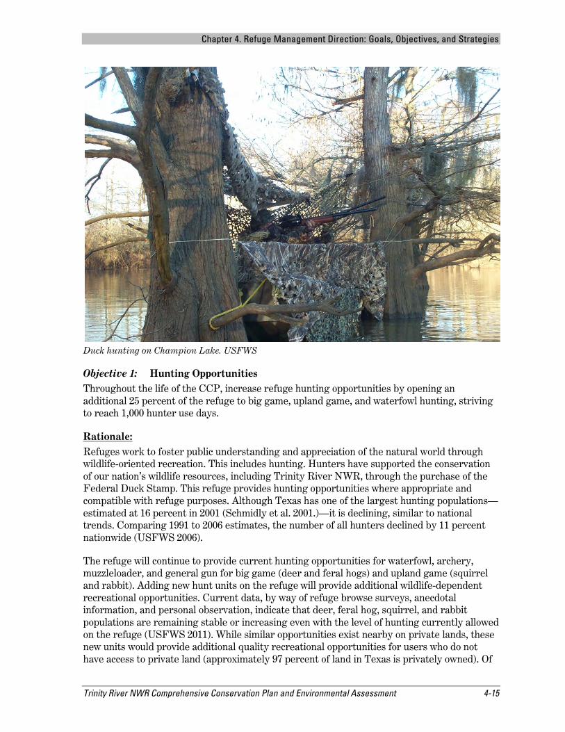
Duck hunting on Champion Lake. USFWS
Objective 1: Hunting Opportunities Throughout the life of the CCP, increase refuge hunting opportunities by opening an additional 25 percent of the refuge to big game, upland game, and waterfowl hunting, striving to reach 1,000 hunter use days.
Rationale: Refuges work to foster public understanding and appreciation of the natural world through wildlife-oriented recreation. This includes hunting. Hunters have supported the conservation of our nation’s wildlife resources, including Trinity River NWR, through the purchase of the Federal Duck Stamp. This refuge provides hunting opportunities where appropriate and compatible with refuge purposes. Although Texas has one of the largest hunting populations—estimated at 16 percent in 2001 (Schmidly et al. 2001.)—it is declining, similar to national trends. Comparing 1991 to 2006 estimates, the number of all hunters declined by 11 percent nationwide (USFWS 2006).
The refuge will continue to provide current hunting opportunities for waterfowl, archery, muzzleloader, and general gun for big game (deer and feral hogs) and upland game (squirrel and rabbit). Adding new hunt units on the refuge will provide additional wildlife-dependent recreational opportunities. Current data, by way of refuge browse surveys, anecdotal information, and personal observation, indicate that deer, feral hog, squirrel, and rabbit populations are remaining stable or increasing even with the level of hunting currently allowed on the refuge (USFWS 2011). While similar opportunities exist nearby on private lands, these new units would provide additional quality recreational opportunities for users who do not have access to private land (approximately 97 percent of land in Texas is privately owned). Of
Chapter 4. Refuge Management Direction: Goals, Objectives, and Strategies
4-16 Trinity River NWR Comprehensive Conservation Plan and Environmental Assessment
the approximately 22,000 refuge visitor use days a year, about four percent (700) come for an opportunity to hunt on the refuge. The proposed increase in hunting opportunities on the refuge would provide approximately 1,000 hunter use days. By conducting hunts on the refuge, we are encouraging family oriented outdoor recreation while supporting the tradition of hunting.
Strategy 1: Through a Refuge Operating Needs (RONS ID FY08-1985, FY08-2031, FY08-2049, FY08-2096) assessment, hire additional staff to initiate and manage a larger hunt program for the refuge.
Strategy 2: Implement recommendations outlined in Refuge Hunt Plan for additional recreational opportunities to include new units, youth hunters, and persons with disabilities (USFWS 2011).
Strategy 3: Promote hunter compliance with Federal and State regulations and encourage good sportsmanship, ethical hunting behavior, and understanding of the refuge and its purposes through law enforcement visibility and effective wording in informational brochures with high quality maps, and on signs and posts on the refuge website.
Objective 2: Fishing Opportunities Throughout the life of the CCP, expand refuge fishing opportunities by opening three additional ponds to public fishing (one pond short-term and two additional ponds long-term), striving to increase from 18,000 visitor use days to 25,000 visitor use days.
Rationale: Fishing is a traditional use of the area’s lakes and bayous that adjoin and are within the refuge. TPWD (2001) estimated 38 percent of Texans participate in fishing as a recreational activity. With the expected continued growth in the Houston Metropolitan Area, the number of fishing visits is likely to increase. Currently, refuge visitation is approximately 22,000 visitors per year, with approximately 85 percent (18,000) of the visitation is related to fishing. Trinity River NWR has more than doubled in acreage since fishing was allowed at the Champion Lake unit in 2001, yet acreages open to the public for fishing have remained the same since 2001. Fishing provides opportunities to connect many people, particularly children, with nature. By providing safe and accessible fishing opportunities to the public, the refuge will continue to meet public needs while protecting resources.
Strategy 1: Through a Refuge Operating Needs (RONS ID FY08-1985, FY08-2049, FY08-2096) assessment, hire additional staff to manage a larger fishing program for the refuge.
Strategy 2: Update the refuge’s 2000 Fishing Plan (USFWS 2000 [Trinity River NWR Fishing Plan]).
Strategy 3: Continue to provide a variety of fishing opportunities, including bank fishing and canoe, kayak, and motorboat access areas.
Strategy 4: Maintain and construct additional accessible facilities at public fishing areas.
Strategy 5: Promote angler compliance with Federal and State regulations and encourage good sportsmanship, conservation practices, and understanding of the refuge
Chapter 4. Refuge Management Direction: Goals, Objectives, and Strategies
Trinity River NWR Comprehensive Conservation Plan and Environmental Assessment 4-17
and its purposes through law enforcement visibility and effective wording in informational brochures with high quality maps, and on signs and on the refuge website.
Objective 3: Wildlife Observation Opportunities Throughout the life of the CCP, expand refuge wildlife observation opportunities by opening 10 additional miles of trails in the short-term and 20 additional miles in the long-term striving, to increase from 1,000 visitor use days to 3,000 visitor use days.
Rationale: Currently, refuge visitation is approximately 22,000 visitors per year. Visitation is expected to continue rising based on yearly informal surveys along with the refuge becoming more well-known. Most visitors to the refuge are hunters and anglers who observe wildlife while they hunt and fish. This refuge objective would target to increase visitor use days of guests who visit to watch birds and butterflies, seek wildflowers, and observe wildlife during opportunities not related to hunting or fishing.
Approximately 40 miles of trails are currently located on the eight units. Most trails are closed temporarily during short refuge hunt seasons; however, some trails are open for wildlife observation year-round. Additional trails would be located at Champion Lake South and Palmetto units, in close proximity to the surrounding communities of Dayton and Liberty, Texas. Trails promote an appreciation for biological diversity while providing safe and accessible wildlife observation opportunities to the public.
Strategy 1: Through a Refuge Operating Needs (RONS ID FY08-1985, FY08-1982, FY08-2096) assessment, hire additional staff to manage a larger wildlife observation program for the refuge.
Strategy 2: Partner with local Chamber of Commerce, gaining support for refuge programs and promoting the refuge as a Great Texas Coastal Birding Trail designated site.
Strategy 3: Establish scheduled programs for wildlife-viewing such as interpretive tours, guided bird and wildflower/butterfly walks.
Strategy 4: Maintain all viewing areas on the refuge, including walking trails, viewing areas, decks, and boardwalks.
Strategy 5: Continue to evaluate existing facilities for accessibility requirements every three years and make necessary improvements to these facilities as resources allow.
Strategy 6: Provide social media outlets, including maintaining the refuge websites and working with the Friends group to obtain and then post the latest information on wildlife observation opportunities such as bird sightings, optimal viewing times, and links to other important wildlife observation websites.
Strategy 7: Open additional area at Champion Lake South unit within two years.
Strategy 8: Open an additional area at Palmetto unit within four years.
Chapter 4. Refuge Management Direction: Goals, Objectives, and Strategies
4-18 Trinity River NWR Comprehensive Conservation Plan and Environmental Assessment
Objective 4: Wildlife Photography Opportunities Throughout the life of the CCP, expand wildlife photography opportunities by constructing two additional photo blinds (long-term) striving to increase from 100 visitor use days to 300 visitor use days.
Rationale: The refuge is a destination for professional and novice wildlife photographers wishing to get that perfect shot of wildlife or Texas bottomland hardwood scenery. The refuge only has one photo blind (Silver Lake unit). Currently, refuge visitation is approximately 22,000 visitors per year, of which approximately 100 visitors come for serious photography.
Recreational wildlife photography programs will promote understanding and appreciation of natural resources and their management on all lands and waters in the Refuge System (General Guidelines for Wildlife Dependent Recreation 605 FW 1).
Strategy 1: Facilitate nature photography on the refuge in partnership with local schools or other organizations for children and adults by initiating photo contests.
Strategy 2: Establish photo blind at Brierwood along Gaylor Lake within eight years.
Strategy 3: Establish photo blind at McGuire unit within five years.
Objective 5: Interpretation Opportunities Throughout the life of the CCP, expand on- and off-site interpretation opportunities by installing six additional on-site kiosks and ten additional off-site events, striving to reach 2,000 visitor use days and 10,000 off-site contacts, respectively.
Chapter 4. Refuge Management Direction: Goals, Objectives, and Strategies
Trinity River NWR Comprehensive Conservation Plan and Environmental Assessment 4-19
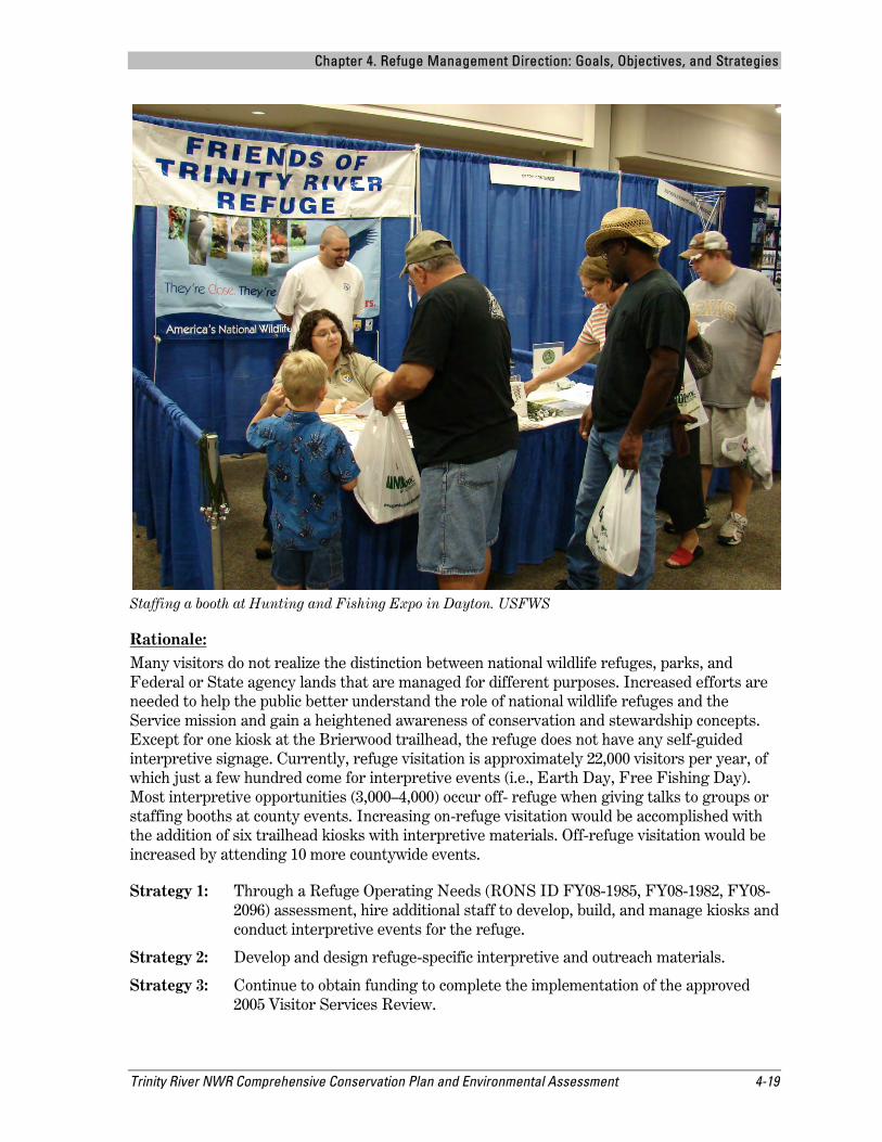
Staffing a booth at Hunting and Fishing Expo in Dayton. USFWS
Rationale: Many visitors do not realize the distinction between national wildlife refuges, parks, and Federal or State agency lands that are managed for different purposes. Increased efforts are needed to help the public better understand the role of national wildlife refuges and the Service mission and gain a heightened awareness of conservation and stewardship concepts. Except for one kiosk at the Brierwood trailhead, the refuge does not have any self-guided interpretive signage. Currently, refuge visitation is approximately 22,000 visitors per year, of which just a few hundred come for interpretive events (i.e., Earth Day, Free Fishing Day). Most interpretive opportunities (3,000–4,000) occur off- refuge when giving talks to groups or staffing booths at county events. Increasing on-refuge visitation would be accomplished with the addition of six trailhead kiosks with interpretive materials. Off-refuge visitation would be increased by attending 10 more countywide events.
Strategy 1: Through a Refuge Operating Needs (RONS ID FY08-1985, FY08-1982, FY08-2096) assessment, hire additional staff to develop, build, and manage kiosks and conduct interpretive events for the refuge.
Strategy 2: Develop and design refuge-specific interpretive and outreach materials.
Strategy 3: Continue to obtain funding to complete the implementation of the approved 2005 Visitor Services Review.
Chapter 4. Refuge Management Direction: Goals, Objectives, and Strategies
4-20 Trinity River NWR Comprehensive Conservation Plan and Environmental Assessment
Strategy 4: Develop an updated Visitor Services Plan that evaluates existing public use facilities, identifies additional facilities needed to provide high-quality compatible wildlife-dependent recreation, and identifies sources of funding for development and maintenance of facilities.
Strategy 5: Throughout the life of this CCP, provide social media outlets, including maintaining the refuge websites and working with the Friends group to obtain and then post the latest information on wildlife observation opportunities such as bird sightings, optimal viewing times, and links to other important wildlife observation websites.
Strategy 6: Throughout the life of this CCP, update all informational and interpretive materials to improve accuracy, consistency, quality, and availability. Revise and make some brochures available to local visitors in Spanish.
Strategy 7: Within two years, build additional two kiosks at Hirsch and Page units and four others throughout the life of this CCP.
Objective 6: Environmental Education Opportunities Within three years of the CCP’s approval, develop and implement the environmental education (EE) program, striving to meet State of Texas education standards for approximately 50 percent of all third graders in Liberty County.
Rationale: Environmental education is a critical first step in providing visitors with an awareness of the refuge and Refuge System and should ultimately translate into support for the refuge and the Refuge System mission. EE includes a broad range of teaching methods, topics, audiences, and educators (Monroe et al. 2007). EE provides a way for people to connect with nature through a “hands on” approach and provides educational experiences that are not easily gained in a classroom. The refuge does not currently have any formal EE programs or infrastructure available to the public, although parts of the refuge could be used as an outdoor classroom. In 2011, Hardin Independent School District came to the refuge with a general outline of what they would like to do using the refuge as an outdoor lab site. Although this program is in preliminary stages, it could be used as a template for other local school districts.
All EE activities both on- and off-refuge will comply with Service policy (605 FW 6), which is aligned with State and national environmental educational criteria.
Strategy 1: Through a Refuge Operating Needs (RONS ID FY08-1982) assessment, hire additional staff to implement and manage an EE program for the refuge.
Strategy 2: Within three years of this CCP, develop and design refuge-specific educational and outreach materials.
Strategy 3: Recruit, enlist, and train a cadre of volunteers that will assist staff in conducting age-appropriate EE programs on a weekly basis.
Strategy 4: Provide learning trunks and resource materials for the EE program to use on-site and take it off-site for programs. These trunks include materials for topics such as wetlands, wildlife, plants, conservation, and endangered species.
Chapter 4. Refuge Management Direction: Goals, Objectives, and Strategies
Trinity River NWR Comprehensive Conservation Plan and Environmental Assessment 4-21
Strategy 5: Develop and maintain a multi-faceted EE resource library comprised of books, videos, posters, field trip guides, specific topic packets, and pertinent written materials. These would be available for use in refuge educational programs and by educators.
Strategy 6: Update all educational materials to improve accuracy, consistency, quality, and availability.
Strategy 7: Develop EE programs in conjunction with rehabilitation of the 1940s-era lodge as an educational facility at the Champion Lake Public Use Area.
Objective 7: Law Enforcement and Visitor Safety Throughout the life of the CCP, expand law enforcement presence by 50 percent to protect natural resources, facilities, and people, and provide visitor safety and emergency response.
Rationale: Currently, the refuge is limited to one full-time law enforcement officer to cover 25,000 acres spread out over 50 units. The refuge is about 45 miles from the northernmost unit to the southernmost unit spread out on two sides of the Trinity River. There is currently inadequate law enforcement presence on many parts of the refuge. Building strong partnerships and liaisons with Federal, State, and local law enforcement agencies somewhat improves our ability to provide a 24/7 presence to some parts of the refuge. As a general rule, most local law enforcement officers would be unable to assist the refuge officer in off-road situations.
Strategy 1: Provide visitor safety, protect resources, and ensure compliance with Federal, State, and refuge-specific regulations by hiring an additional law enforcement officer.
Strategy 2: Continue to build strong partnerships to increase law enforcement coverage, enhance visitor safety, and emergency response. Continue to work cooperatively, developing good relations and radio communications with local law enforcement offices of the Liberty County Sheriff’s Department, two local police departments, TPWD Law Enforcement, Texas Department of Public Safety, and the Service Law Enforcement Office in Houston to enforce Federal, State, and refuge-specific hunting and fishing regulations.
Strategy 3: Maintain a good working relationship with Emergency Medical Services of Liberty County and local volunteer fire departments to provide immediate emergency response as needed.
Strategy 4: Annually review and revise refuge-specific visitor regulations for consistency and compatibility.
Strategy 5: Maintain current law enforcement and emergency equipment and provide, as necessary, any patrol vehicles to meet applicable Federal and State emergency vehicle standards.
Strategy 6: Increase the public’s knowledge of refuge regulations and boundaries on refuge lands via updated website, maps, boundary posting, and brochures.
Chapter 4. Refuge Management Direction: Goals, Objectives, and Strategies
4-22 Trinity River NWR Comprehensive Conservation Plan and Environmental Assessment
4.3 Facilities Goal 3: Visitor Services: To provide additional access to administrative and public use facilities to accomplish the refuge's purposes, goals, and objectives.
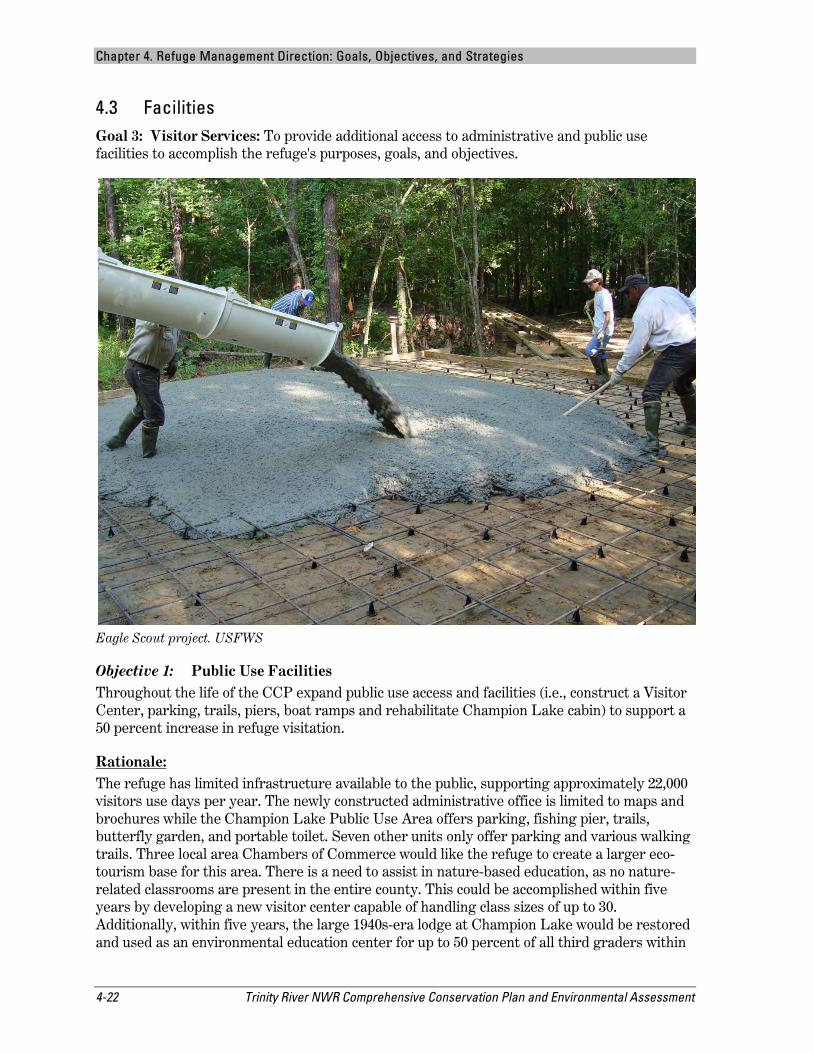
Eagle Scout project. USFWS
Objective 1: Public Use Facilities Throughout the life of the CCP expand public use access and facilities (i.e., construct a Visitor Center, parking, trails, piers, boat ramps and rehabilitate Champion Lake cabin) to support a 50 percent increase in refuge visitation.
Rationale: The refuge has limited infrastructure available to the public, supporting approximately 22,000 visitors use days per year. The newly constructed administrative office is limited to maps and brochures while the Champion Lake Public Use Area offers parking, fishing pier, trails, butterfly garden, and portable toilet. Seven other units only offer parking and various walking trails. Three local area Chambers of Commerce would like the refuge to create a larger eco-tourism base for this area. There is a need to assist in nature-based education, as no nature-related classrooms are present in the entire county. This could be accomplished within five years by developing a new visitor center capable of handling class sizes of up to 30. Additionally, within five years, the large 1940s-era lodge at Champion Lake would be restored and used as an environmental education center for up to 50 percent of all third graders within
Chapter 4. Refuge Management Direction: Goals, Objectives, and Strategies
Trinity River NWR Comprehensive Conservation Plan and Environmental Assessment 4-23
Liberty County. The visitor center and log cabin would allow a segment of the population to experience the diversity of a bottomland hardwood forest ecosystem even if they were unable to walk a trail. Local schools and the community would have a place to enjoy and gain a better understanding of the refuge.
Strategy 1: Through a Refuge Operating Needs (RONS ID FY10-1082, FY10-1080) assessment, rehabilitate the large 1940s-era lodge for use as an interpretive and/or environmental education building at Champion Lake.
Strategy 2: Through new construction funding sources, build a visitor center adjacent to the administrative office.
Strategy 3: Pave the dirt road into the Champion Lake Public Use Area along with construction of restroom facilities (see Strategy 4).
Strategy 4: Through a Refuge Operating Needs (RONS ID FY10-1081) assessment, construct public use restroom facilities at the Champion Lake Public Use Area.
Strategy 5: Through a Refuge Operating Needs (RONS ID FY08-1982) assessment, hire additional staff to implement and manage visitor services for the refuge.
Strategy 6: Continue to seek funding to complete the implementation of the approved 2005 Visitor Services Review.
Strategy 7: Recruit, enlist, and train naturalists and volunteers to assist in providing interpretive and EE programs at these facilities.
Strategy 8: Construct fishing piers at Brierwood, Silver Lake, and McGuire units, a kayak launch site at Brierwood, and open a trail system for Champion Lake South to expand public use access opportunities.
Objective 2: Administrative Facilities Throughout the life of the CCP, expand staff and volunteer facilities to foster productive environments for staff and volunteers (short-term) by rehabilitating the small log cabin for office space.
Rationale: Since 1994 (refuge establishment), only a storage building (30’ x 30’), open pole shed (50’ x 100’), three RV pads sites, and the recently completed administrative headquarters office and storage/maintenance building have been built. These limited facilities have restricted the amount of on-site volunteers needed to support administrative, maintenance, biological, and management programs. Expanding administrative, maintenance, and storage facilities are critical for protecting government-owned equipment and staff essential to completing the refuge’s mission.
Strategy 1: Rehabilitate the smaller log cabin at the Champion Lake Public Use Area for two staff offices.
Strategy 2: Construct maintenance shop facility at Champion Lake equipment area.
Chapter 4. Refuge Management Direction: Goals, Objectives, and Strategies
4-24 Trinity River NWR Comprehensive Conservation Plan and Environmental Assessment