1
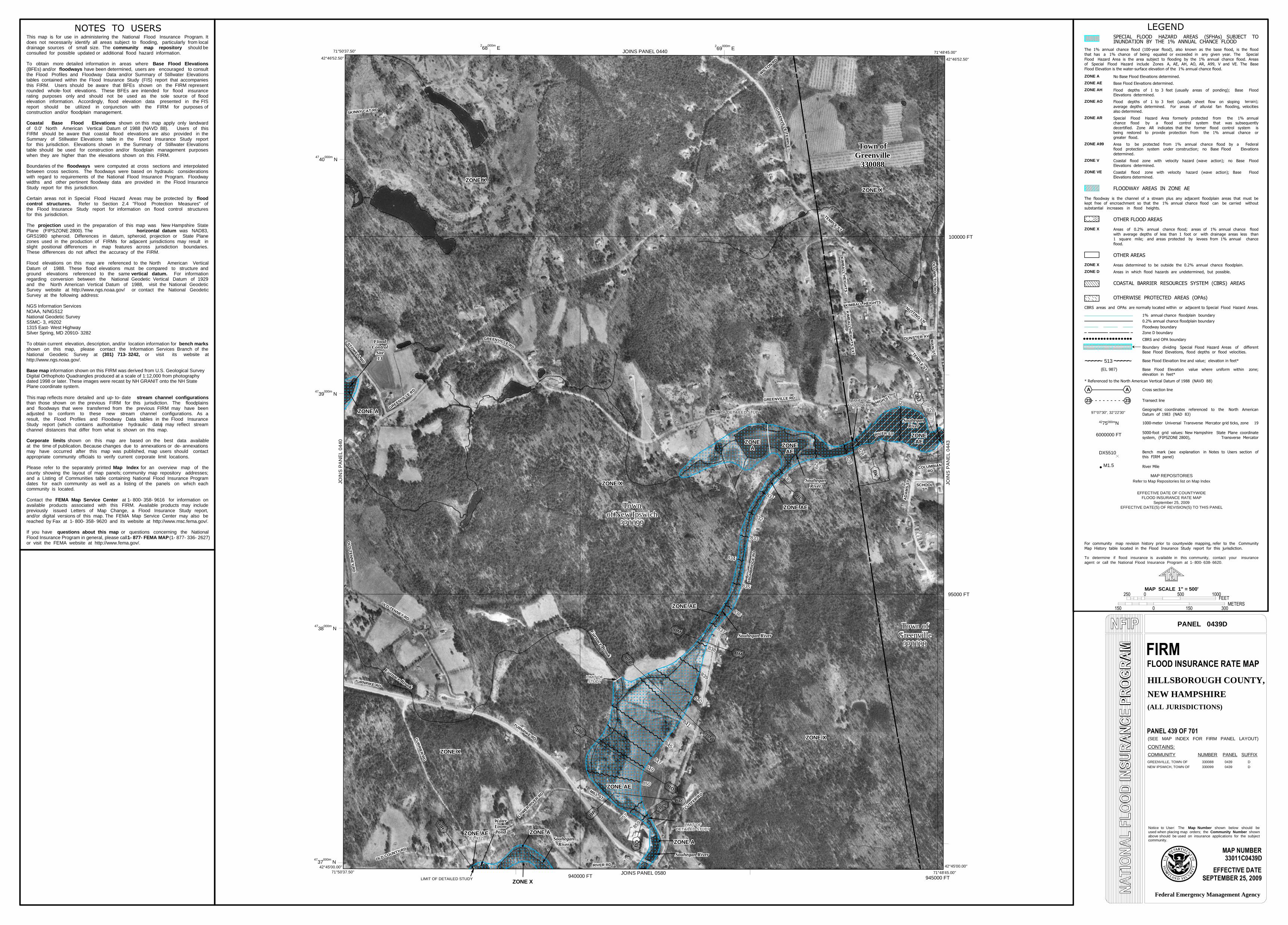
828 828 BO BO ZONE AE ZONE AE Water Water Loom Loom Pond Pond TU R NP I KE RD TU R NP I KE RD H I G H B R I D GE R D H I G H B R I D GE R D K I M BA L L H E I G H T S K I M BA L L H E I G H T S R IV E R S T R IV E R S T OLD COUNTY RD OLD COUNTY RD HIGH S T HIGH S T ZONE AE ZONE AE (EL 932) (EL 932) 828 828 STOWELL RD STOWELL RD RIVER RD RIVER RD 835 835 LOWER RIVER RD LOWER RIVER RD KIM BALL HEIGHTS KIM BALL HEIGHTS TE MP LE S T TE MP LE S T COLUMBIAN RD COLUMBIAN RD LIMIT OF DETAILED STUDY LIMIT OF DETAILED STUDY BP BP 831 831 ZONE ZONE AE AE BJ BJ G R E E N V I L LE R D G R E E N V I L LE R D LIMIT OF DETAILED STUDY LIMIT OF DETAILED STUDY ZONE X ZONE X 841 841 838 838 ZONE A ZONE A LIMIT OF LIMIT OF STUDY STUDY 840 840 BN BN BK BK BP BP LIMIT OF LIMIT OF DETAILED STUDY DETAILED STUDY Town of Greenville 330088 Town of Greenville 330088 857 857 BM BM Souhegan River Souhegan River 830 830 Souhegan Souhegan River River ZONE X ZONE X M A IN S T M A IN S T CURRIER RD CURRIER RD 832 832 Furnace Brook Furnace Brook CURRIER RD CURRIER RD LIMIT OF FLOODWAY LIMIT OF FLOODWAY 850 850 WILT O N R D WILT O N R D 828 828 NUTTING LN NUTTING LN BO BO A DA M S S T A DA M S S T 849 849 Souhegan Souhegan River River 828 828 MILL ST MILL ST CU TT E R R D CU TT E R R D G RE E N V IL L E R D G RE E N V IL L E R D K I M B A L L H EI G H T S EX T K I M B A L L H EI G H T S EX T T E MP LE ST T E MP LE ST 829 829 D U NSTER A V D U NSTER A V Furnace Brook Furnace Brook 839 839 BN BN ZONE X ZONE X O L D W I LT O N R D O L D W I LT O N R D OLD COUNTY RD OLD COUNTY RD ZONE X ZONE X 847 847 G R E E N V I L L E T E M P L E G R E E N V I L L E T E M P L E SK INNY CA T R D SK INNY CA T R D Town Town of New Ipswich of New Ipswich 330099 330099 SCHOOL ST SCHOOL ST 836 836 833 833 ZONE X ZONE X 834 834 ZONE AE ZONE AE ZONE ZONE A A Town of Greenville 330088 Town of Greenville 330088 ZONE A ZONE A ZONE AE ZONE AE RIVER RD RIVER RD Souhegan Souhegan River River O L D T E N N EY R D O L D T E N N EY R D BQ BQ O L D TE NNE Y RD O L D TE NNE Y RD Souhegan River Souhegan River Flood Flood Control Control Site Site 13 13 BM BM TURNPIKE RD TURNPIKE RD 837 837 G R E EN VI LLE R D G R E EN VI LLE R D BR BR ZONE A ZONE A BL BL BQ BQ ZONE ZONE AE AE 859 859 845 845 ZONE X ZONE X MILL ST MILL ST 95000 FT 100000 FT 940000 FT 945000 FT 2 68 000m E 2 69 000m E 47 37 000m N 47 38 000m N 47 39 000m N 47 40 000m N 71°50'37.50" 42°46'52.50" 71°50'37.50" 42°45'00.00" 71°48'45.00" 42°45'00.00" 71°48'45.00" 42°46'52.50" JOINS PANEL 0443 JOINS PANEL 0580 JOINS PANEL 0440 JOINS PANEL 0440 ZONE A ZONE AE ZONE AH ZONE AO ZONE AR ZONE A99 ZONE V ZONE VE ZONE X ZONE X ZONE D ~ ~ ~ ~ ~ ~ ~ ~ ~ ~ 513 (EL 987) A A --------- 23 23 97°07'30", 32°22'30" 42 75 000m N 6000000 FT DX5510 M1.5 MAP REPOSITORIES To determine if flood insurance is available in this community, contact your insurance agent or call the National Flood Insurance Program at 1- 800- 638- 6620. Refer to Map Repositories list on Map Index EFFECTIVE DATE OF COUNTYWIDE FLOOD INSURANCE RATE MAP September 25, 2009 EFFECTIVE DATE(S) OF REVISION(S) TO THIS PANEL MAP SCALE 1" = 500' PANEL 0439D Notice to User: The shown below should be used when placing map orders; the Community Number shown above should be used on insurance applications for the subject community. Map Number CONTAINS: COMMUNITY NUMBER PANEL SUFFIX Federal Emergency Management Agency HILLSBOROUGH COUNTY, NEW HAMPSHIRE (ALL JURISDICTIONS) GREENVILLE, TOWN OF 330088 0439 D NEW IPSWICH, TOWN OF 330099 0439 D (SEE MAP INDEX FOR FIRM PANEL LAYOUT) This map is for use in administering the National Flood Insurance Program. It does not necessarily identify all areas subject to flooding, particularly from local community map repository drainage sources of small size. The shouldbe consulted for possible updated or additional flood hazard information. Base Flood Elevations To obtain more detailed information in areas where floodways (BFEs) and/or have been determined, users are encouraged to consult the Flood Profiles and Floodway Data and/or Summary of Stillwater Elevations tables contained within the Flood Insurance Study (FIS) report that accompanies this FIRM. Users should be aware that BFEs shown on the FIRM represent rounded whole- foot elevations. These BFEs are intended for flood insurance rating purposes only and should not be used as the sole source of flood elevation information. Accordingly, flood elevation data presented in the FIS report should be utilized in conjunction with the FIRM for purposes of construction and/or floodplain management. Coastal Base Flood Elevations shown on this map apply only landward North American Vertical Datum of 1988 (NAVD 88). of 0.0' Users of this FIRM should be aware that coastal flood elevations are also provided in the Summary of Stillwater Elevations table in the Flood Insurance Study report for this jurisdiction. Elevations shown in the Summary of Stillwater Elevations table should be used for construction and/or floodplain management purposes when they are higher than the elevations shown on this FIRM. floodways Boundaries of the were computed at cross sections and interpolated between cross sections. The floodways were based on hydraulic considerations with regard to requirements of the National Flood Insurance Program. Floodway widths and other pertinent floodway data are provided in the Flood Insurance Study report for this jurisdiction. Certain areas not in Special Flood Hazard Areas may be protected by flood control structures. Refer to Section 2.4 "Flood Protection Measures" of the Flood Insurance Study report for information on flood control structures for this jurisdiction. projection The used in the preparation of this map was New Hampshire State horizontal datum Plane (FIPSZONE 2800). The was NAD83, GRS1980 spheroid. Differences in datum, spheroid, projection or State Plane zones used in the production of FIRMs for adjacent jurisdictions may result in slight positional differences in map features across jurisdiction boundaries. These differences do not affect the accuracy of the FIRM. Flood elevations on this map are referenced to the North American Vertical Datum of 1988. These flood elevations must be compared to structure and vertical datum. ground elevations referenced to the same For information regarding conversion between the National Geodetic Vertical Datum of 1929 and the North American Vertical Datum of 1988, visit the National Geodetic http://www.ngs.noaa.gov/ Survey website at or contact the National Geodetic Survey at the following address: NGS Information Services NOAA, N/NGS12 National Geodetic Survey SSMC- 3, #9202 1315 East- West Highway Silver Spring, MD 20910- 3282 To obtain current elevation, description, and/or location information for bench marks shown on this map, please contact the Information Services Branch of the (301) 713- 3242, National Geodetic Survey at or visit its website at http://www.ngs.noaa.gov/. Base map information shown on this FIRM was derived from U.S. Geological Survey Digital Orthophoto Quadrangles produced at a scale of 1:12,000 from photography dated 1998 or later. These images were recast by NH GRANIT onto the NH State Plane coordinate system. This map reflects more detailed and up- to- date stream channel configurations than those shown on the previous FIRM for this jurisdiction. The floodplains and floodways that were transferred from the previous FIRM may have been adjusted to conform to these new stream channel configurations. As a result, the Flood Profiles and Floodway Data tables in the Flood Insurance Study report (which contains authoritative hydraulic data ) may reflect stream channel distances that differ from what is shown on this map. Corporate limits shown on this map are based on the best data available at the time of publication. Because changes due to annexations or de- annexations may have occurred after this map was published, map users should contact appropriate community officials to verify current corporate limit locations. Map Index Please refer to the separately printed for an overview map of the county showing the layout of map panels; community map repository addresses; and a Listing of Communities table containing National Flood Insurance Program dates for each community as well as a listing of the panels on which each community is located. Contact the FEMA Map Service Center at 1- 800- 358- 9616 for information on available products associated with this FIRM. Available products may include previously issued Letters of Map Change, a Flood Insurance Study report, and/or digital versions of this map. The FEMA Map Service Center may also be reached by Fax at 1- 800- 358- 9620 and its website at http://www.msc.fema.gov/. If you have questions about this map or questions concerning the National Flood Insurance Program in general, please call 1- 877- FEMA MAP (1- 877- 336- 2627) or visit the FEMA website at http://www.fema.gov/.