A 35-Year Analysis of Global Daily Precipitation for Improved Hydroclimate Monitoring and Modeling P. Xie 1) , H.-T. Lee 2) ,J. Meng 3) , K.Mo 1) , and M. Ek 3) 1) NOAA/NCEP Climate Prediction Center 2) ESSIC / Univ. of Maryland 3) NOAA/NCEP Environmental Modeling Center Acknowledgements This work is supported by NCDC Climate Data Record Program and CPO Climate Monitoring and Observation Program
Transcript
A 35-Year Analysis of Global Daily Precipitation for Improved Hydroclimate Monitoring and Modeling
P. Xie1), H.-T. Lee2),J. Meng3), K.Mo1), and M. Ek3)
1) NOAA/NCEP Climate Prediction Center 2) ESSIC / Univ. of Maryland
3) NOAA/NCEP Environmental Modeling Center
Acknowledgements This work is supported by NCDC Climate Data Record Program
and CPO Climate Monitoring and Observation Program
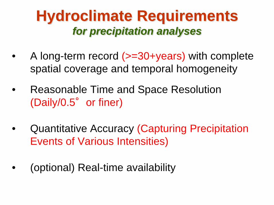
Hydroclimate Requirements for precipitation analyses
• A long-term record (>=30+years) with complete spatial coverage and temporal homogeneity
• Reasonable Time and Space Resolution (Daily/0.5°or finer)
• Quantitative Accuracy (Capturing Precipitation Events of Various Intensities)
• (optional) Real-time availability
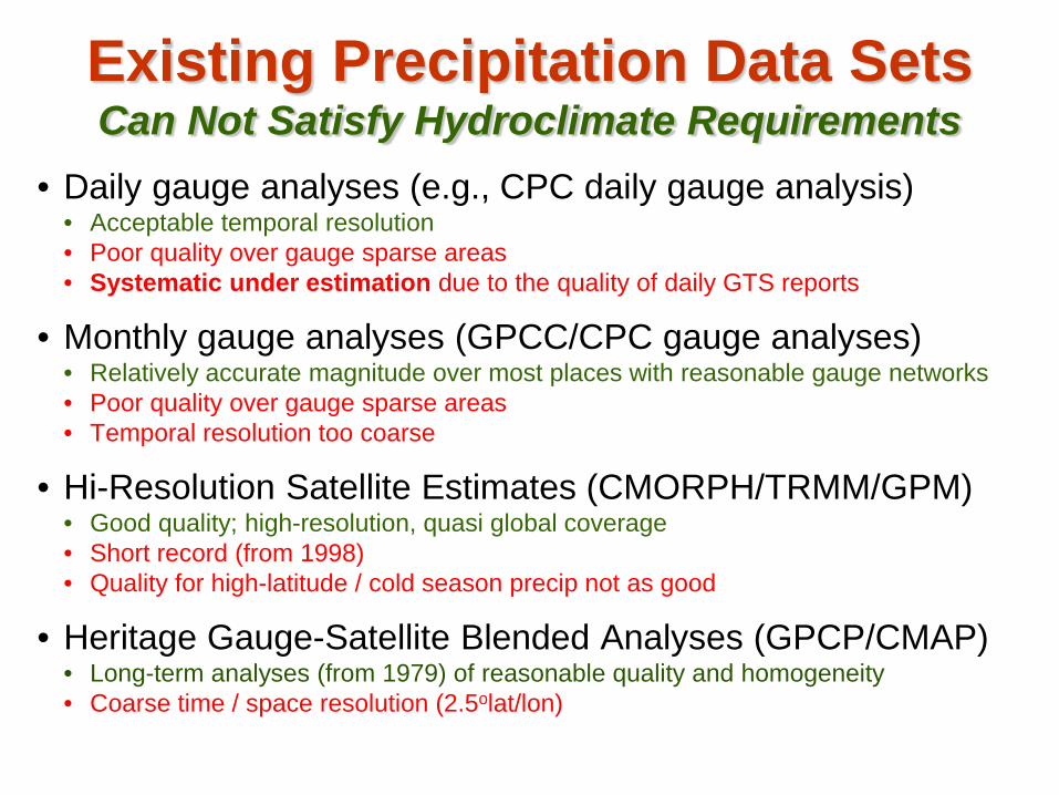
Existing Precipitation Data Sets Can Not Satisfy Hydroclimate Requirements
• Daily gauge analyses (e.g., CPC daily gauge analysis) • Acceptable temporal resolution • Poor quality over gauge sparse areas • Systematic under estimation due to the quality of daily GTS reports
• Monthly gauge analyses (GPCC/CPC gauge analyses) • Relatively accurate magnitude over most places with reasonable gauge networks • Poor quality over gauge sparse areas • Temporal resolution too coarse
• Hi-Resolution Satellite Estimates (CMORPH/TRMM/GPM) • Good quality; high-resolution, quasi global coverage • Short record (from 1998) • Quality for high-latitude / cold season precip not as good
• Heritage Gauge-Satellite Blended Analyses (GPCP/CMAP) • Long-term analyses (from 1979) of reasonable quality and homogeneity • Coarse time / space resolution (2.5olat/lon)
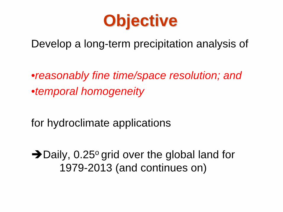
Objective Develop a long-term precipitation analysis of
•reasonably fine time/space resolution; and •temporal homogeneity for hydroclimate applications Daily, 0.25o grid over the global land for 1979-2013 (and continues on)
Strategy Combine information from the four individual sources including CPC daily gauge analysis, GPCC monthly gauge analysis, CMORPH high-resolution integrated satellite precipitation estimates, and the HIRS OLR data in a three-step approach:
1.Adjusting daily gauge analysis against monthly GPCC gauge data
2.Deriving precipitation estimates from satellite observed OLR, and
3.Blending the adjusted daily gauge analysis with satellite-based estimates;
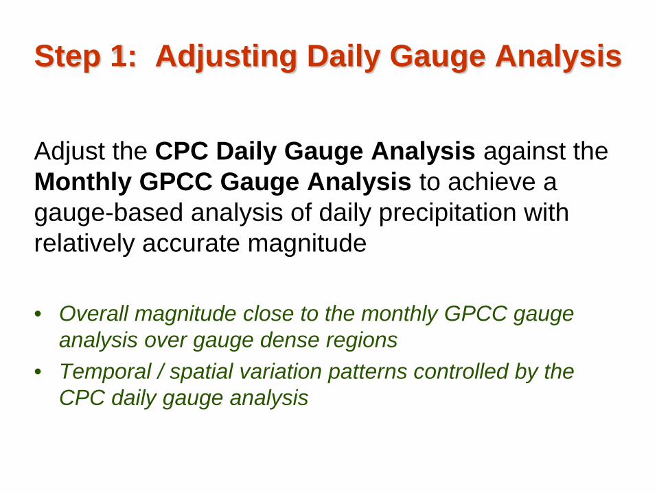
Step 1: Adjusting Daily Gauge Analysis
Adjust the CPC Daily Gauge Analysis against the Monthly GPCC Gauge Analysis to achieve a gauge-based analysis of daily precipitation with relatively accurate magnitude • Overall magnitude close to the monthly GPCC gauge
analysis over gauge dense regions • Temporal / spatial variation patterns controlled by the
CPC daily gauge analysis
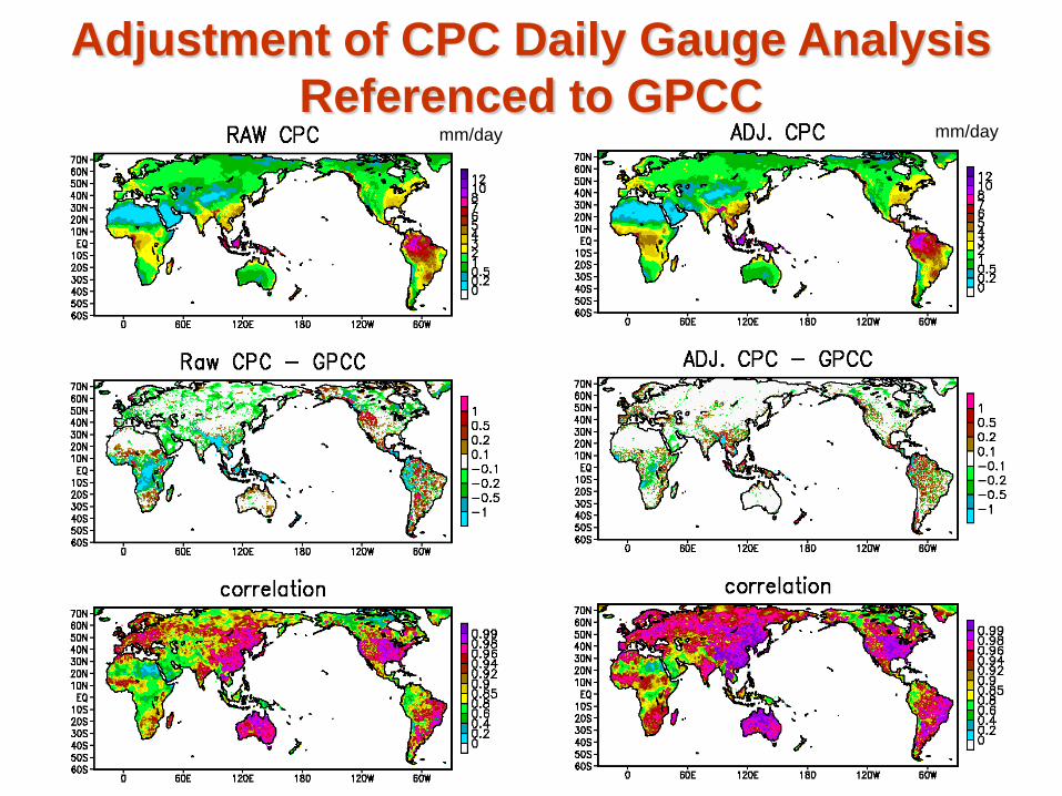
Adjustment of CPC Daily Gauge Analysis Referenced to GPCC
mm/day mm/day
July 1, 2010
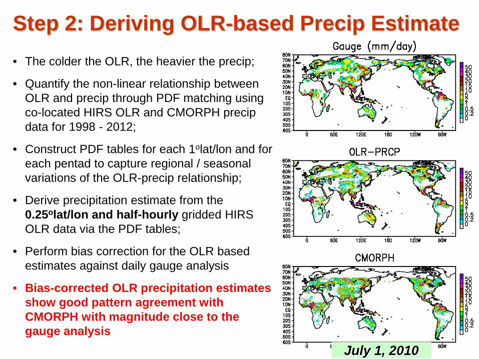
• The colder the OLR, the heavier the precip;
• Quantify the non-linear relationship between OLR and precip through PDF matching using co-located HIRS OLR and CMORPH precip data for 1998 - 2012;
• Construct PDF tables for each 1olat/lon and for each pentad to capture regional / seasonal variations of the OLR-precip relationship;
• Derive precipitation estimate from the 0.25olat/lon and half-hourly gridded HIRS OLR data via the PDF tables;
• Perform bias correction for the OLR based estimates against daily gauge analysis
• Bias-corrected OLR precipitation estimates show good pattern agreement with CMORPH with magnitude close to the gauge analysis
Step 2: Deriving OLR-based Precip Estimate
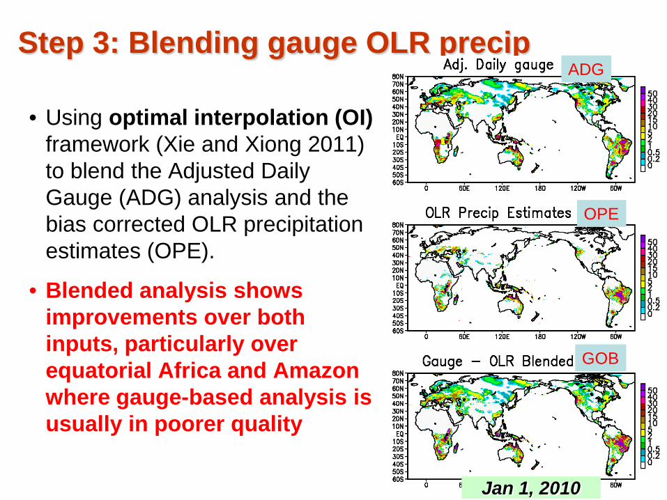
Step 3: Blending gauge OLR precip
• Using optimal interpolation (OI) framework (Xie and Xiong 2011) to blend the Adjusted Daily Gauge (ADG) analysis and the bias corrected OLR precipitation estimates (OPE).
• Blended analysis shows improvements over both inputs, particularly over equatorial Africa and Amazon where gauge-based analysis is usually in poorer quality
Jan 1, 2010
GOB
OPE
ADG
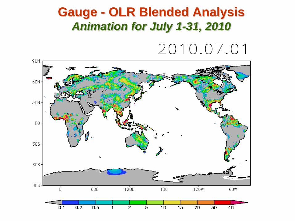
Gauge - OLR Blended Analysis Animation for July 1-31, 2010
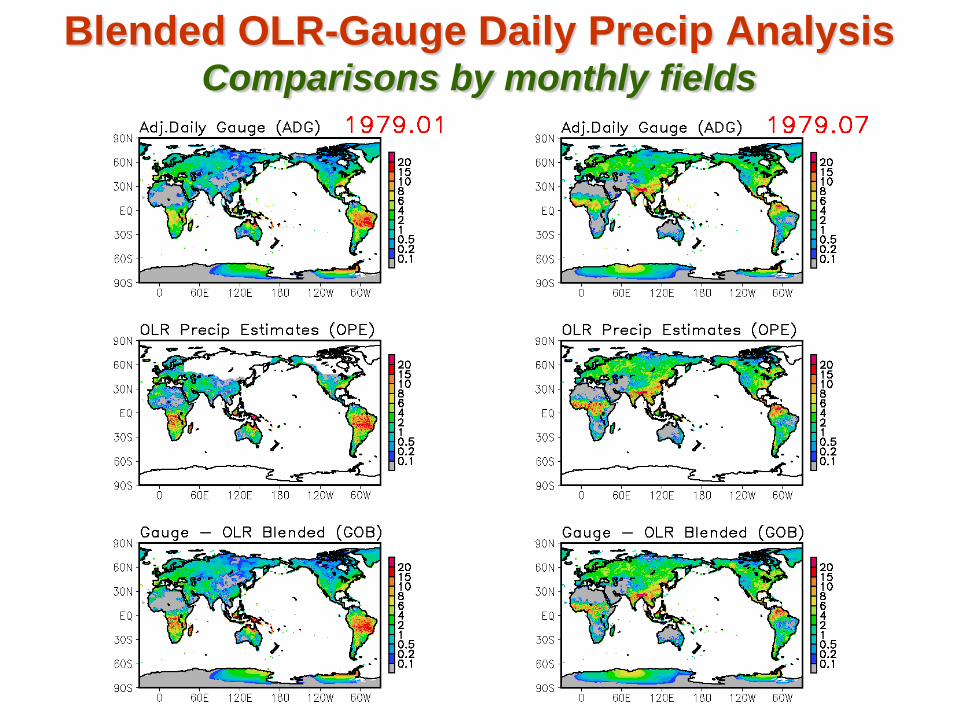
Blended OLR-Gauge Daily Precip Analysis Comparisons by monthly fields
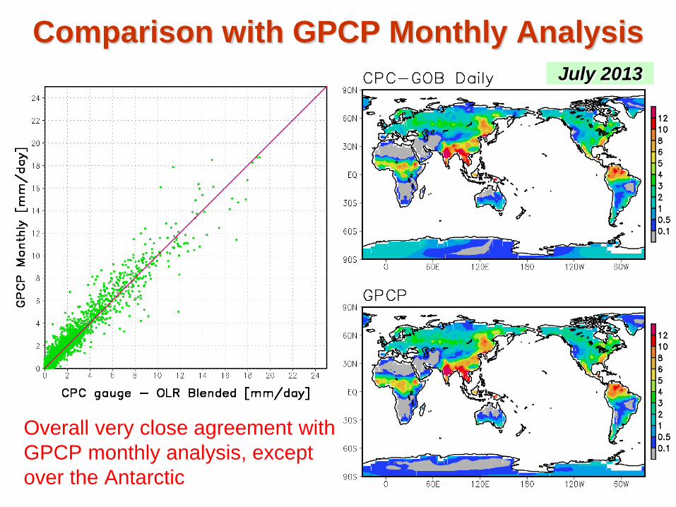
Comparison with GPCP Monthly Analysis
Overall very close agreement with GPCP monthly analysis, except over the Antarctic
July 2013
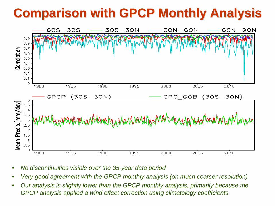
Comparison with GPCP Monthly Analysis
• No discontinuities visible over the 35-year data period • Very good agreement with the GPCP monthly analysis (on much coarser resolution) • Our analysis is slightly lower than the GPCP monthly analysis, primarily because the
GPCP analysis applied a wind effect correction using climatology coefficients
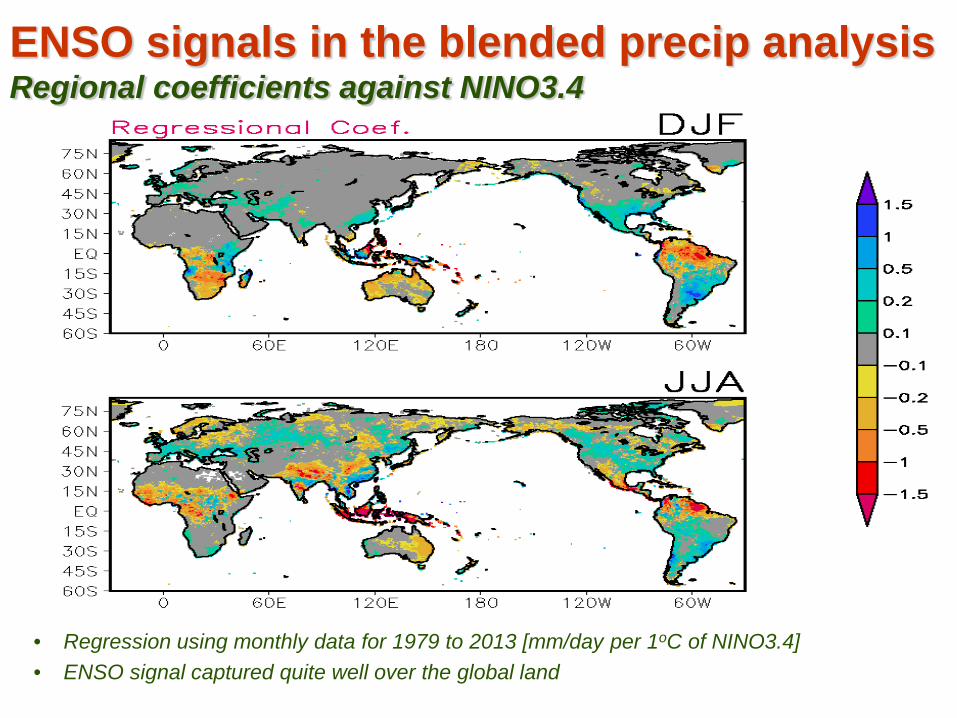
ENSO signals in the blended precip analysis Regional coefficients against NINO3.4
• Regression using monthly data for 1979 to 2013 [mm/day per 1oC of NINO3.4] • ENSO signal captured quite well over the global land
Summary • A test version daily gauge analysis is developed for a 35-
year period from 1979-2013 on a 0.25olat/lon grid over the global land
• This analysis was generated through combining information from four sources: CPC daily gauge analysis, GPCC monthly gauge analysis, HIRS OLR data, and the CMORPH high-resolution satellite estimates
• The analysis shows reasonable quality and temporal homogeneity throughout the data period
• Further work underway to perform comprehensive examinations and to examine the performance of this data set in forcing a land-surface model