1 1 ArcGIS ArcGIS A Complete Geographic Information System A Complete Geographic Information System . . . For Authoring, Serving & Using Geographic Knowledge . . . For Authoring, Serving & Using Geographic Knowledge SERVER SERVER ONLINE ONLINE DESKTOP DESKTOP MOBILE MOBILE WEB WEB EXPLORER EXPLORER
Transcript
11
ArcGISArcGISA Complete Geographic Information SystemA Complete Geographic Information System
. . . For Authoring, Serving & Using Geographic Knowledge. . . For Authoring, Serving & Using Geographic Knowledge
Making GIS Knowledge Available To Anyone . . . Making GIS Knowledge Available To Anyone . . . . . . Integrates With Other Systems Via Standards. . . Integrates With Other Systems Via Standards
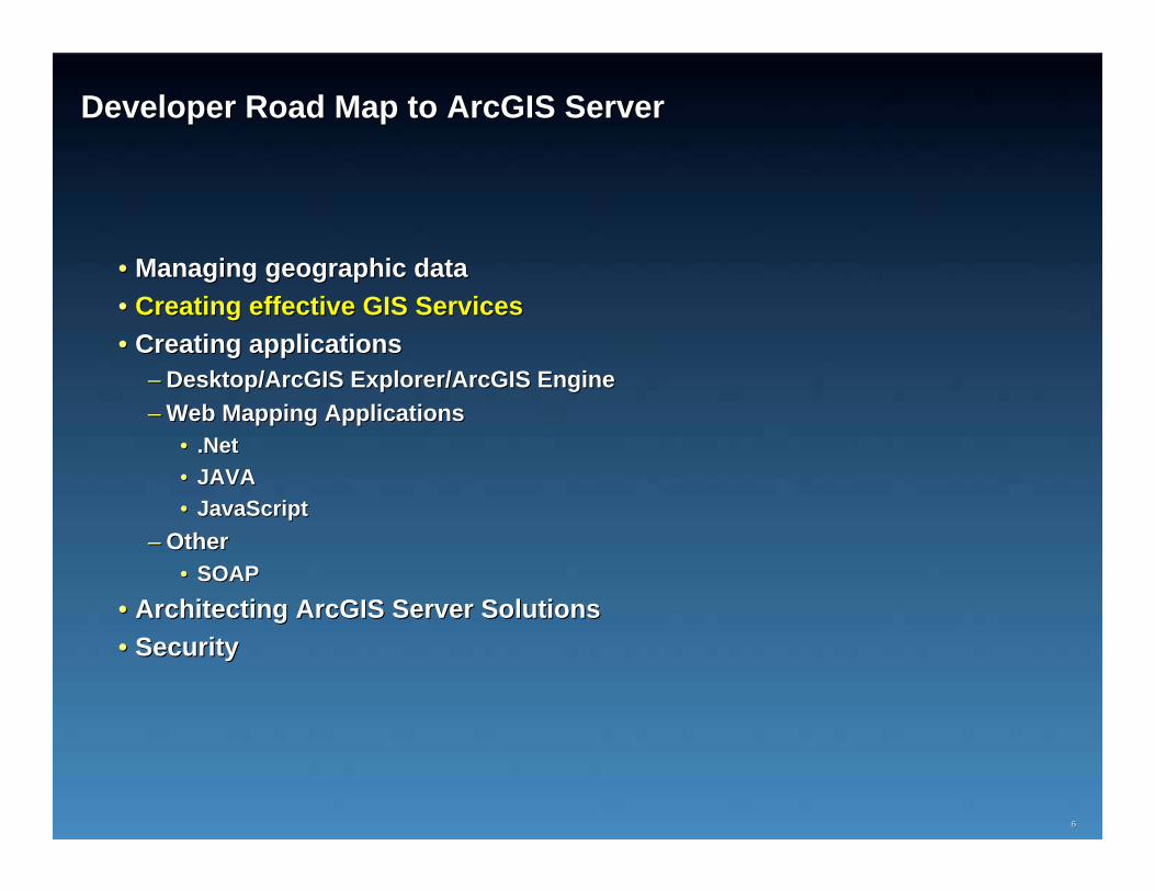
•• Architecting ArcGIS Server SolutionsArchitecting ArcGIS Server Solutions•• SecuritySecurity
44
ArcGIS Server Manages GeodatabasesArcGIS Server Manages GeodatabasesSupporting All Types of Geographic Data in Scalable Storage EnviSupporting All Types of Geographic Data in Scalable Storage Environmentsronments
FileFile
PersonalPersonal
Work GroupWork Group
EnterpriseEnterprise
ArcGISArcGISServerServer
Geographic Data
NetworksNetworks
SurveysSurveys
AddressesAddresses
AnnotationAnnotation
VectorsVectors
3D3D ObjectsObjects
TopologyTopology
DimensionsDimensions
ImagesImages
TerrainTerrain
AttributeAttribute
CartographyCartography
CadastralCadastral
SchematicsSchematics
Adding Support ForAdding Support For•• PostgreSQLPostgreSQL•• Oracle ExpressOracle Express•• DB2 (z/OS)DB2 (z/OS)
•• Architecting ArcGIS Server SolutionsArchitecting ArcGIS Server Solutions•• SecuritySecurity
77BPC 2008BPC 2008 77
AuthorAuthor
ServeServe
UseUse
ArcGIS Server
ArcGIS Desktop
Making GIS Knowledge Available To Anyone . . . Making GIS Knowledge Available To Anyone . . .
88
Optimizing ArcGIS Server Map Cache
Building and Optimizing Geoprocessing services
99
1010
A different way to publish imageryA different way to publish imagery
OrthoOrtho--RectificationRectification
MosaicingMosaicing
Pan SharpeningPan Sharpening
ArcGISArcGISServerServer
GIS Desktop
Browser
Imaging Clients
ReducingReducingTimeTime
RawRawFilesFiles
ImageServer
EnterpriseData
ServerServer--side on the fly Processingside on the fly Processing
. . . Exploiting Multi. . . Exploiting Multi--Resolution,Resolution,MultiMulti--Spectral, and Temporal Aspects of ImagerySpectral, and Temporal Aspects of Imagery
Image ServerImage ServerProviding a better framework to publish and manage imagery Providing a better framework to publish and manage imagery
1111
Using and Managing Raster Data in Server Applications
1212
1313
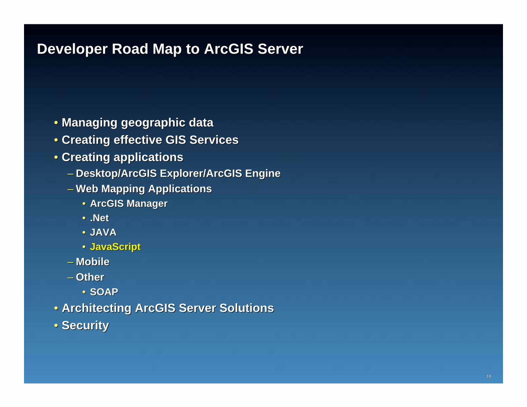
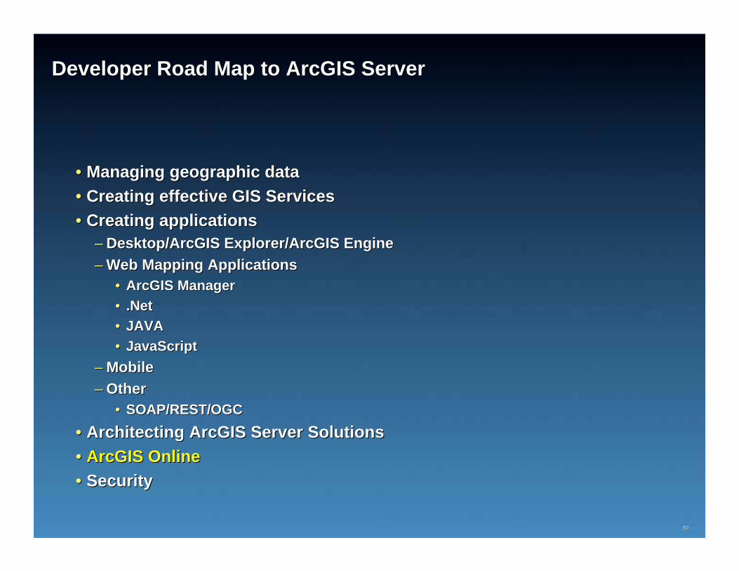
Developer Road Map to ArcGIS ServerDeveloper Road Map to ArcGIS Server
•• SOAPSOAP•• Architecting ArcGIS Server SolutionsArchitecting ArcGIS Server Solutions•• SecuritySecurity
1919
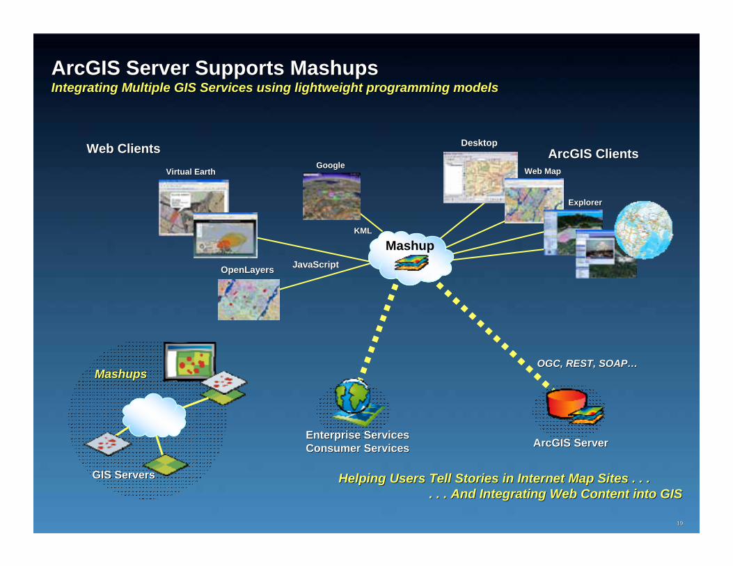
ArcGIS Server Supports MashupsArcGIS Server Supports MashupsIntegrating Multiple GIS Services using lightweight programming Integrating Multiple GIS Services using lightweight programming modelsmodels
Helping Users Tell Stories in Internet Map Sites . . . Helping Users Tell Stories in Internet Map Sites . . . . . . And Integrating Web Content into GIS. . . And Integrating Web Content into GIS
•• SOAPSOAP•• Architecting ArcGIS Server SolutionsArchitecting ArcGIS Server Solutions•• SecuritySecurity
2323
Creating Mobile Application Creating Mobile Application –– ArcGIS MobileArcGIS MobileA Lightweight Client for the Field/Use Powered by ArcGIS ServerA Lightweight Client for the Field/Use Powered by ArcGIS Server
. . . Synchronized with Geodatabase. . . Synchronized with Geodatabase