100
BLM LIBRARY BUREAl 88000467 LMLirUhNIA A Cultural Resource Management Plan for the Fossil Falls/ Little Lake Locality by Alan P. Garfinkel cultural resources publications archaeology

BLM LIBRARY
BUREAl88000467
LMLirUhNIA
A Cultural Resource Management
Plan for the Fossil Falls/ Little
Lake Localityby
Alan P. Garfinkel
cultural resources publications
archaeology

The cover figure depicts a petroglyph in the shape of a bighornsheep ( Ovis canadensis ) . This rock art style is typical of theCoso Range, fifteen miles north of Fossil Falls.

It-.CJ4
A Cultural Resource Management Plan
for the Fossil Falls/Little Lake Locality
by:
Alan P. GarfinkelAugust, 1976
Bakers field District OfficeBureau of Land ManagementBakersfield, California
Reprinted 1980
Bureau of Land ManagementLibrary
Bldg. 50, Denver Federal CenterDenver, CO 80225

\
FOREWARD
The research conducted at the Fossil Falls/Little Lake localityby Alan P. Garfinkel in 1976 represents an intensive three monthinvestigation of a unique geological area containing some of thefew subsurface occupational remains of the "Pinto" or "LittleLake" period, dating from at least 3000 B.C. Additional culturalmaterial found in stratigraphic context in this area may date toas early as 8000 B.C., suggesting affiliation with the "LakeMojave" complex.
Projectile point forms recovered from both surface and subsurfacecontexts represent the entire Great Basin temporal series, datingfrom 8000 B.C. to at least A.D. 1200. The location of thesearchaeological sites near one of the few freshwater lakes in theMojave Desert, their proximity to a known source of high qualityobsidian, and their association with Pleistocene river channelscontribute to their unique characteristics which distinguish themfrom other archaeological sites in the Mojave Desert. The uniquequalities of the Fossil Falls/Little Lake locality resulted inits listing on the National Register of Historic Places in Julyof 1980 as the "Fossil Falls Archaeological District." In addition,most of the management recommendations in this report weresuccessfully implemented in 1978 and 1979, providing protectionto critical resources while also enabling the public to enjoy them.
The Bureau of Land Management, Bakersfield District, is pleasedto reprint this 1976 monograph as one of the reports in theCalifornia "Cultural Resources Publications" series.
Eric Montizambert
,
District Archaeologist

Contents
Illustrations iii
Acknowledgements 1
Introduction 2
Definitions 5
Section 1 - Environmental History
Hydrology 7
Geology 10
Present Climate 13
Vegetation 13
Environmental Change . 14
Section 2 - History and Ethnology
History 16
Ethnographic Sketch 21
Section 3 - Archaeology
Previous Archaeological Investigations 27
Cultural Sequence 30
Archaeological Inventory 41
Section 4 - Management Recommendations
Roads and Trails 43
Protection 45
Protective Barriers 45
Mitigative Excavation and Mapping Program 51
Recreation 53
Lands 54
Interpretation 55
Research Opportunities 64
Conclusion 66
Appendices
Appendix 1 - Private Collections 67
Appendix 2 - Wildlife 69
Appendix 3 - Vegetation 71
Appendix 4 - Site Records See Separate Volume
Bibliography 79
n

Illustrations
Plates Page
1 Aerial view of Fossil Falls/Little Lake Locality .... 3
2 Fossil Falls showing scoured boulders 9
3 Red Hill Cindercone and Little Lake 11
4 Sugarloaf Mountain 11
5 1919 Photo of Little Lake Area and Old Highway 395 .. .18
6 Historic glyph above Little Lake Stage Station 18
7 Little Lake Hotel under construction, 1919 20
8 The town of Little Lake - 1923 20
9 The Fossil Falls Archaeological Site 29
10 Location for Barrier 1 48
11 Western terminus for Barrier 2 48
12 View across Barrier 2 49
13 Barrier 3 49
14 Barrier 4 50
Figures
1 Resource Procurement Schedule 22
2 Projectile Point Series - Lake Mojave, Pinto, Gypsum Caveand Elko 32
3 Projectile Point Series Rose Spring, Eastgate, Cotton-wood, and Desert Side-Notched 34
Maps
1 Outline Map showing situation of Fossil Falls and
Little Lake 4
2 Relict hydrology 8
m

Maps (Continued)
3 Roads and Trails 44
4 Roads and Trails with Barriers 46
Table
1 Fossil Falls/Little Lake Cultural Sequence 31
IV

Acknowledgements
I would like to thank the following people for their assistance and
cooperation during the course of this study. A special thanks is duethe community of Little Lake for allowing me to pick their brains andgenerally make a nuisance of myself during a month long excursion into
the history and prehistory of the area.
Larry and Irene ArmstrongDanny and Milly ArmstrongPeter ArmstrongRobert BadarraccoTilly BarlingKristin BerryStan BerrymanBruce BowenHelen CloughEmma Lou DavisLynn DeuerlingWendell DuffieldJon EricsonDave EvansVerna Evans
Matthew HallHerrick HanksGlenn HarrisJeff HarrisRon and Mary Ann HenryRuth Henry
Elvis and Pat HulseyKenneth HulseyCharles IrwinDebby Levi
Warren LongwellJoanne MacGregor - HanifanGene OwensCarol PanlaquiBob PattersonKen PringleEmerson and Fay RayBob RayNancy RidgwayEric RitterCharles RozaireSally SalzmanRuth SimpsonDon SnyderEd and Jane ThomannTom TurellDave WorleyAlan Wright
-1-


Introduction
This study was completed for the Bureau of Land Management as an intern-
ship program while the author was engaged in graduate studies at theUniversity of California, Davis. The report represents the culminationof a three month effort to characterize the cultural resources of theFossil Falls/Little Lake archaeological locality.
The areal focus for this study was concentrated on the National ResourceLands adjacent to the geological site known as Fossil Falls (Plate 1).
However, it was found by this researcher, the prehistory of the areawould best be served by a more general examination. Since the action of
the pluvial Owens River and the relative fluctuations of the spring fed
basin known as Little Lake are so intimately tied together, the actualstudy area incorporated these features as a unit.
The area of concern is located in the southernmost section of OwensValley, the area known as Rose Valley. It is flanked on the westernedge by the Sierra Nevada Mountains and on the east by the volcanics ofthe Coso Range. The northern edge of the study area is arbitrarily setas the prominent cinder cone known as Red Hill, and the southern boundaryis the point of greatest constriction between the Coso Range and theSierra Nevadas (Map 1).
The intent of this study is to provide information pertinent to themanagement of cultural resources. The author will supply backgroundinformation on the environmental setting in order to acquaint the readerwith the general physiography of the area. Subsequently availablehistorical, ethnological and archaeological data will be discussed.Lastly, management recommendations (based on a general survey of visitorpreference and local informant interviews) will be set forth. A furtherobjective is to synthesize previously unrelated information on the areaand to point out opportunities for further research.
-2-

o-.>>
»» •
4
' /ST/ 5
-X**--m*
Plate 1. Aerial view of Fossil Falls/Little Lake Locality, looking
north. Lava flow east of lake, pleistocene river channel at north
end. A, Fossil Falls; B, Little Lake; C, the town of Little Lake.
-3-

t/>
&**>
Bishop
Wj,
,. ,^
'>. x
^ V-* f-—
£
<L
^
Independence
^t*
^^
'/S-v^Z
Lone Pine
I
-N-
r\N
0- OWEINl|
\ JVlake^
^
1%O ^
«/£
fossil£falls
., little* lake
SEARLES.
LAKE I
>C Vs*^
Map 1
Location of Fossil Falls/Little Lake Area
-4-

Definitions
Since some of the terms used in this report will not be familiar to the
reader or are subject to various interpretations, they will be defined
here for clarification.
Anthropology : A social science, having as its general objective the
explanation of human behavior, i.e. why we think, perceive, evolve and
change as we do.
Archaeology : The study of the behavior of human groups that have become
extinct or of the past behavior of living groups through the systematic
interpretation of material remains.
B. P. : "Before the Present." Conventionally, years B.P. are calculated
from a standard "present" of A.D. 1950, but for general shorthandpurposes the "present" is conceived of as A.D. 2000.
C-14 or Radiocarbon : An isotope of carbon which disintegrates at a more
or less fixed and measureable rate of speed. The relative amount of C-14remaining in a piece of organic material is, within limits, a functionof the material's age. The C-14 or radiocarbon method is the technicalmeans of approximate age determination through the measurement of C-14content.
Culture : Broadly, the system of behavior, beliefs, institutions and
objects that human groups use to cope with their environment.
Culture History : The synthesis of archaeological data with the intentof determining an historical sequence for an area. The culture historianseeks to reconstruct the sequence of cultures or of cultural changesthat occured in his area of study.
Cultural Resources : Any property including sites, structures, buildings,etc., whose study can provide useful information about history or pre-history, or in which the public has some sort of actual or potentialcultural interest.
Ethnography : The study and description of living human groups or ofgroups that have lived recently enough that living people retain trans-mittable memories of them. Ethnography is a method of anthropology.
Endogamy : Marriage within a social unit. If one may only marry a
member of one's own group, the society is said to be endogamous.
Historic : Historic sites are those sites which reflect human activitiesthat occurred after the advent of written records in the area up until,roughly, the present.
Holocene : The period since the end of the Pleistocene, roughly the last10,000 years.
-5-
Mano : The hand-sized, loaf-shaped stone used to grind seeds on a
metate.
Metate : A flat stone slab upon which hard seeds were ground. They are
called bedrock metates or grinding slicks when ground directly into
bedrock.
Midden : Decomposed refuse or other discarded materials that (usually)have darkened or otherwise discolored soil, often containing bone
fragments and/or cultural debris. Midden is a common element of pre-
historic sites.
Negative Marriage Rule : A cultural rule stating who one may not marry.(This is usually one or several categories of persons.)
Mortar : A stone bowl used for grinding softer, pulpier plant or animal
materials than are readily processable with a metate and mano. In theCalifornia Desert, mortars often are ground directly into bedrock slabs
and are called bedrock mortars .
Pestle : The elongate cobble used to grind things in a mortar; It is
usually simply a long cobble with signs of battering and wear on one or
more ends.
Pleistocene : The glacial era or "ice age," when the northern part of
the continent and many mountain ranges were glaciated.
Pluvial : Pertaining to a period of moister climate.
Point or Projectile Point : A point is the flaked stone tip of a projectilespear, dart, or arrow.
Pothunter : One who digs up or otherwise damages an archeological sitein order to get objects (for sale or for oneself) or in order to findout about the site without the archeological training to do so properly.
Prehistoric : Pertaining to a period before written history.
Shelter or Rockshelter : Many archaeological sites at Fossil Falls arein rockshelters in the natural lava. Overhanging rocks were used as
shelter from the elements.
Vandalism : The destruction of archaeological sites. Pothunting is a
form of vandalism. Defacement of rock art is another.
-6-


ENVIRONMENTAL HISTORY
Hydrology
On the basis of hydrological studies it has been determined that the
Little Lake area is part of a larger drainage system which was at its
greatest extent during the latter half of the Wisconsin glaciation until
about 10,000 years ago (Blanc and Cleveland 1961:2-5). This continuousinternal drainage system initiated with the development of a series of
large lakes in four basins in Eastern California (see Map 2). Thefirst of these, Owens Lake, accumulated from water in the Owens ValleyBasin and fed into Indian Wells and Salt Wells Valleys in a series ofsuccessive overflows, forming China Lake and Searles Lake. Searles Lakeoverflowed to form Panamint Lake which in turn was filled and formedManly Lake, the final lake in this internal drainage system.
The overflow from Owens Lake created a pluvial river. This river createdthe geological site known as Fossil Falls (Plate 2). The Falls consistof a dry waterfall with deep pot holes and stream polished surfaces.The drop itself is approximately 40 feet. The rock surfaces are notablesince they have been scoured, smoothed, and fluted by the fast flowingwaters of the pluvial Owens River. The potholes were cut into the lavaby fixed vortices within the stream. It has been suggested that thefeatures one now observes were formed probably as recently as 10-15,000years ago (Sharp 1972:130-134).
Little Lake is located a mile south of the falls, within the channel ofthe Pluvial Owens River. The lake was formed by resistant graniticrocks, covered in part and protected from erosion by basalts whichflowed into the valley (Mehringer and Sheppard ND:4). The lake is
nourished by several seepage springs, and is dammed at its southern endby alluvium from both sides of the canyon.
Recent studies by Mehringer and Sheppard (ND) have demonstrated that theLittle Lake basin was occupied by a shallow lake or marsh for at leastthe past 5000 years. Dated sediments and fossil pollen have been inter-preted as representing a salt grass meadow and marsh deposit from 5,000to 3,000 years B.P. Since 3000 B.P. a shallow lake has existed which is
inferred to have been no fresher nor deeper than during the past fewyears.
-7-

L10 25 miles
Scale
§= i^>
to
rn te- 9 <* '••)--<S> I* /^
jrr a / =^ — \* &?
$? J.y/^1 *^.
f .y' $>
C^- \fr °>^ f
1tr
^, -.' ^~ *\ %^ = " V /Dry Falls
r^ ^ *°\l_ittle Lake
CD §1. f
%»
Map 2
Map of pluvial lakes fed by SierraNevada runoff.
after Sharp 1972:57
-8-

5^6
Plate 2. Looking up towards the head of Fossil
Falls. Foreground rock surfaces were scoured,polished and potholed by the fast flowing watersof the Pluvial Owens River.
-9-

Geology
The sites of Little Lake and Fossil Falls are situated within an area
where active vulcanism ceased only several thousand years ago. Numerous
cinder cones and lava flows are found within the study area. The cinder
cones are basaltic or rhyolitic in composition and are associated with
the lava flows that form the Coso Range (Chesterman 1956:62-67).
Recent work by Duffield and Bacon (1976) has illuminated the local
geology of the area. Specifically a mapping program, undertaken by the
United States Geological Survey, has established the relative ages for
the various periods of vulcanism and the composition of the cinderconesand flows. Red Hill cindercone, dominating the skyline to the north,has been identified as an asymetrical cone composed of vesicular basalt(Plate 3). It dates to the late Pleistocene - early Holocene period andpostdates the contiguous flow of basalt of the upper Little Lake Ranch.
These two geological units meet, and are cut by Fossil Falls gorge. The
basalt of Red Hill actually follows the Pleistocene Owen's River channeland can be noted at least 15 km. downstream.
The most recent period of vulcanism was noted as that associated withVolcano Peak 5 miles to the east. Duffield (1976) has suggested thatits well-preserved flows and channels may be associated with a date as
recent as 10,000 years B.P. or later.
Carl Austin (1971), research geologist for the China Lake Naval Weapon'sCenter, has suggested that the entire area from Little Lake to Coso Peak
and from Wildhorse Mesa to Cactus Flats represents a collapsed caldera,the product of extensive faulting and a process called magmatic stopping.Magmatic stopping is a process of igneous intrusion in which molten rockgradually eats its way upwards, breaking off blocks of the native rockand causing them to sink downward. This geological feature has beencalled the Coso Ring Fracture and is the site of active heat cells andpotential geothermal energy.
The Coso Range, itself, is composed of a central core of granitic and
metamorphic rocks which is overlain in sequence by 1) alluvial gravels2) tuffs and lake beds and 3) andesitic and basaltic flows. Pumicedeposits within the tuffs are exposed on the north, west, and southflanks of the range. The basaltic lava flows range from 50 to 100 feetin thickness. Postdating the basaltic flows, andesitic and rhyoliticintrusions occured. In some spots these later flows are covered with a
shallow mantle of ash and volcanic tuff (Fraser et. al . 1943).
Rock overhangs and caves found within the basaltic lava flows werecreated by the collapse of lava tubes and the deflation of lava blisters.These were subsequently important as occupation sites for the prehistoricinhabitants of the area. Another geological resource important toaboriginal inhabitants was the local occurrence of obsidian. Six milesto the northeast of Fossil Falls is located a prominent dome-shapedmountain with a hummocked appearance (Plate 4). Sugarloaf mountain
-10-

Plate 3. Red Hill Cinder Cone in center. Little Lake in foregroundUpper Little Lake Ranch basalt flow wraps around lake on the righthand side of the photo.
Plate 4. Hummocked dome of Sugarloaf Mountain. Black scar in thecenter of the dome is part of a mile long exposure of obsidian.
11

termed a perl
i
tic dome, is the locus for an extensive high qualitysource of obsidian. Here, obsidian was quarried along the length of a
mile long exposure.
The geological resources of the area are still found to be economicallyuseful. Pumice deposits and cindercones have been mined. Notably, Red
Hill Cindercone has been actively mined since 1948 primarily as an
aggregate for concrete. Other uses include decorative rock for plantermixture, and for use on road beds. Examination for potential uraniumsources has recently been carried on at Red Hill playa, and the potentialfor geothermal energy is currently being evaluated by the Federalgovernment.
-12-

Present Climate
The Mojave Desert, including that portion constituting the Little Lake
area, is typical of an arid desert environment. The region receivesless than five inches of mean annual precipitation in its lower valleys,
such as Rose Valley. Most moisture comes in the form of winter rainstormsswept in from the Gulf Coast or over the crest of the Sierra Nevadasfrom the Pacific Ocean. Also, during the months of April throughOctober, small amounts of rain may occur in the form of thundershowersor flashfloods. Strong westerly winds usually occur during the spring.Normal temperatures range from highs in excess of 100 F in the summer to
below freezing temperatures in the winter.
Vegetation
The present vegetation of Fossil Falls is characterized by a dominantcreosote bush community with a saltbush understory. North towards Red
Hill Cindercone saltbush becomes dominant, and on the north side of Red
Hill Joshua trees can be noted.
The Fossil Falls area exhibits quite spectacular annual wild flowerdisplays. The author accompanied Mary Ann Henry, plant taxononist, on
two visits to the study area during this period of wildflower display.The plant lists resulting from these two visits are included as Appendix3.
-13-

Environmental Change
The desert environment has formed a dynamic backdrop for the inhabitants
of the Little Lake area. Changes in temperature and climate would have
had dramatic effects on plants and animals which served as basic sub-
sistence resources for the hunting and gathering peoples of the region.
Studies of playa lakes, relict plant communities, and woodrat middenshave provided some basis for projecting the gross changes in the Cali-
fornia desert during the past 30,000 years.
There is substantial lack of agreement on detail for the climatic sequenceof the Great Basin (see King 1975). But, there does seem to be some
consensus on the gross events that transpired. Beginning in the 1920'sAntevs (various) described a sequence of general trends in climaticfluctuation in Neothermal or post-Pleistocene times. Antevs tripartitescheme is divided into the Anathermal , dating from 8000-5000 B.C. and
characterized by a wetter and cooler condition than prevails currently;the Altithermal, from 5000 to 2500 B.C., a period of extreme dessication,far drier than currently, and the Medithermal, from 2500 B.C. to thepresent, where conditions generally became milder and the climate morelike that found currently. Summarizing the work of Blackwelder andEllsworth (1936), Martin (1964), Wells and Jorgensen (1964), Wells andBerger (1967), Ore and Warren (1971) and his own research in the LucerneValley, T. J. King (in Mortland 1974, and with revisions as cited in T.
F. King 1975:17) suggests the following periods:
Period 1: Cool, moist climate ca. 30,000 to 28,000 B.P.
Period 2: Arid, warm climate ca. 28,500 B.P.
Period 3: Cool, moist climate ca. 28,500 to 16,500 B.P.
Period 4: Warm, dry climate 16,500 to 14,500 B.P.
Period 5: Cool, moist climate 14,500 to 7,500 B.P., turningwarmer and drier toward end of period.
Period 6: Hot, arid climate 7,500 to 5,500 B.P.
Period 7: Warm, moist climate 5,500 to 3,000 B.P. (uncertain)
Period 8: Warm, dry climate 3,000 to 1,000 B.P. (uncertain).
Period 9: Hot, arid climate 1,000 B.P. to the present.
(After T. J. King 1975:17)
The sequence by and large follows Antev's general scheme.
Period 5 closely corresponds to the Anathermal, Period 6, the Altilhermaland Periods 7-9 the Medithermal. Period 7 represents what cl imatologistshave termed the little Pluvial. Conditions prevailed which were wetter
-14-

than currently, but not as moist as during the Anathermal period. It is
during this period, Harrington (1957) suggests, that the archaeologicalmaterials dating to the Pinto period at Little Lake and Fossil Fallsoccured.
Given that there were periods in the past where today's weather patternsdid not exist or were relatively different, what could we expect in
terms of changes in the local hydrology and vegetation?
During the Anathermal we have evidence that a pluvial river existed andits traces are left in the old river courses and dry falls in the Fossil
Falls area. Dry lake beds and ephemeral playas are found to the northand east which were most probably filled during this period. During the"little" Pluvial we have evidence that Little Lake became deeper (Mehringerand Sheppard ND: 1 5) and a major change from marsh to lake depositionoccured.
Moister conditions would result in rather different distributions ofeconomically important plants. Specifically, it might be suggested thata larger pinyon - juniper woodland community and a more extensive ripariancommunity would exist.
Environmental change is an important variable in the study of arid landsprehistory. Even though our current understanding of these changes maybe simple minded, it would be naive to overlook such an importantfactor in prehistoric man-land relationships.
-15-


HISTORY AND ETHNOLOGY
History of the Little Lake Area: 1863 - Present
Acknowledgements
Most of the information for this historical narrative comes from
the comprehensive manuscript of Jane Thomann. Mrs. Thomann has
worked ten years to compile extensive information on the local
history of Little Lake and Indian Wells Valley. I would like to
acknowledge her large contribution to my efforts at developing an
historical background for my work at Little Lake.
Negotiations have now been initiated with the Eastern California
Museum in Independence for the publication of her manuscript.Hopefully, in the near future, we will all be able to profit from
the work of this dedicated local historian.
Little Lake has served as a natural oasis for travelers in route to
points both north and south. For those journeying north to the OwensValley it is a natural watering hole between Mojave and Bishop (Plate
5).
The Midland Trail or Three Flags Trail, as it is alternatively known,
passed by Little Lake, where there was a stage station from 1863 to 1875
(Plate 6). In 1863 three Visalian proprietors, James C. White, CharlesRice and Charles M. Schleigh began operating the Owens River Stage Line
and Express, connecting Visalia, in the Central Valley, with Independence.The stage line was prompted by the necessity of bringing gold bullionfrom Cerro Gordo Mine in the Owens Valley to Southern California for
eventual shipment to San Francisco for refinement. The two hundred mileroad went through Little Lake past a rock walled outpost originallydesignated as Little Owens Lake. Mexican miners passing the outpostnamed the place "Lagunita". The English translation, Little Lake, wasthe name used after the 1860's (Robertson 1965:10).
During its short period as a stage station Little Lake was robbed onlyonce. This is exceptional since the notorious gang of bandits led byCleovara Chavez, having in its company the likes of Tuburcio Vasquez,were creating quite a bit of havoc in the locale. It is said that thereason for Little Lake's undisturbed peace was that the owner of thestage line had once saved Vasquez 's life and was receiving repayment.This streak of good luck ended for the stage station just seven daysafter Vasquez was hung, when the Lieutenant Cleovara Chavez robbed theLittle Lake stage station.
The event was described in the Inyo Independent three days later asfollows:
-16-

Chavez Again on the Road
On Thursday morning last, as the stage from Indian Wells came up to
the Little Lake station, the passengers (one of whom, Mr. I. N.
Choynski, to whom we are indebted for the information) were aston-
ished to learn that on the evening previous Chavez and four of his
banditti had gagged the proprietor of the station, together withthree of his men, and after helping himself to all that he consi-dered valuable, loaded four of the stage horses and went his way.The stage passengers were detained some time owing to the scarcityof horses, but finally went on their journey with some misgivingsas to their fate, and their was a hasty concealment of watches,jewelry, and coin, but Chavez and his gang did not put in an
appearance, though they met several persons who came from Pas-
smare's who testified, with much feeling, that they had been robbedby the highwaymen. (Inyo Independent, Saturday, March 27, 1875)
Nadeau (1948) adds a bit more to our description of the events thattranspired. He states that after procuring fresh horses the bandits"jogged nonchalantly up the road" and camped near the lake that night,heading north at 10 a.m. the next morning.
The stage line ran weekly from Los Angeles to the Owens Valley. Twostage lines competed for passengers to Cerro Gordo itself. After Aprilof 1875, in order to include Darwin, the main stage line avoided LittleLake, and went through Indian Wells. Whether some other sort of servicewas set up for Little Lake after this time is unclear.
In October of 1898 Charles W. Whittock filed a deed for his homestead at
Little Lake. He had a ranch house, small post office (not officiallyestablished by the U.S. Government), store, and cafe. Chalfant (1922)mentions that the merchants Hobart and Reed established the store atLittle Lake. Whether this occured in conjunction with the homestead or
at a later date is uncertain. In any case, Whittock 's original adobewas expanded sometime during the period from 1898-1900 and the LittleLake Hotel was started.
Several years later, in 1908, an easement was sold to the Nevada -
California Railroad and a depot established. In order to lay the railsacross the tule swamps of Little Lake, a trestle was built, the remainsof which can still be seen just west of present highway 395.
The first official postal service for the Little Lake area was initiatedin the summer of 1909. The official station, run by postmaster CharlesR. Richards, was located just south of Little Lake at a place calledNarka.
Just a year later Whittock sold his property to a man named Shuttock. It
was during Shuttock's ownership that the post office was officiallymoved to the Little Lake Hotel, where it currently remains. After
-17-

Plate 5. Little Lake as it appeared ca, 1919. Old highway 395runs north-south in the foreground. The Midland trail essen-tially followed this same route.
I
Plate 6. Patinated granite boulder on the cliff face abovesite of old stage station.
-18-

owning the property for only a few years, Shuttock sold it to William W.
Bramlette. The Bramlette family owned and operated the lake, hotel,
store and gas station for many years.
After Bramlette had the hotel for several years, he decided a new struc-ture should be built. Construction of the present hotel was started in
1919 and completed in 1923 (Plates 7 and 8). Along with other changesthe Bramlettes decided to turn Little Lake into a real lake instead ofthe tule marsh which had existed. They dammed the lake and importedmuskrats from Colorado. After the muskrats ate all the tules, they ateeach other and eventually died off.
After the new hotel was completed, it was decided there was no need foran old hotel and the structure was burned down one night. Anotherinnovation by the Bramlettes was the sponsorship of a duck club on thelake. This has continued and today two duck clubs exist, one at theupper, the other at the lower portion of the lake. When Bramlettefinally sold his property some time ago, it was divided among severalowners. Currently the Lower Little Lake, Upper Little Lake and hotel
are all owned separately.
It is local knowledge that the hotel at times has served as a house ofprostitution, especially when it was initially sold to some Hindu Indians
after the Bramlettes owned it. There have been not less than twokillings and several shootings at the Little Lake Bar and another colorfulchapter in its history is still being made every Friday or Saturdaynight. The owner of the Lower Little Lake Ranch, Jack Morhart, is
negotiating with the Fish and Wildlife Department in order to make thatarea a game refuge or wildlife conservation district. Currently muchwork has been put into stocking the lakes (several smaller ponds havebeen built) with crappie and bass. The lake is now home for many typesof waterfowl especially ducks, grebes, and coots. Planting has beendone in the area in conjunction with the Soil Conservation Service totest the viability of several types of economic plants in the desertarea, given the availability of fresh water.
Interest in the area continues. The prospect for geothermal energy in
the vicinity has attracted geologists and supporting specialists.Loggers, truckers, and travelers still stay at the hotel, and thecommunity at Little Lake is still a viable economic entity.
-19-

Plate 7. The new hotel under construction. The first hotel
and original structure is in the center of the photo. Photoca. 1919.
Plate 8. New hotel completed, ca. 1923,
-20-

Ethnographic Sketch
The available ethnographic information on the Little Lake region comesfrom Kroeber (1925) and Steward (1938).
The Little Lake region is part of the Shoshone district of Kuhwiji made
up of four loosely interelated villages. The district comprises the
Little Lake area, Rose Valley and the southern shores of Owens Lake
centering in the Coso Mountains, and totals about 1,000 square miles.
The Little Lake village was thought by Steward's informant to containfrom 50 to 60 persons in 1870. Steward indicates (Fig. 7) that 10
single families resided around Little Lake. The other three villagesin the district were located at Olancha, near Darwin, and at Coso Hot
Springs. As is typical in the Great Basin, these villages were occupiedlargely during the winter.
The seasonal round followed was not routinized. Variable procurementstrategies were afforded by the resources surrounding this area. Stewardwas able to give us a sketch of seasonal activities from the view of hisinformants at the Coso Hot Springs village. This sketch is probablyapplicable to the groups at Little Lake (Figure 1).
During the winter subsistence was mainly based on stored foodstuffs -
parti cularily seeds. These were supplemented with meat from rabbits.In April some families moved to Ha i wee Springs to gather greens, and in
June these families usually went to Cold Spring (south of Darwin), andsometimes wintered there, hunting rabbits.
In April, or sometimes later, a communal antelope hunt was organized.Antelope were most abundant in Indian Wells Valley about ten miles southof Little Lake and families would travel to this area to participate in
the hunt. Antelope could also be procured just south of Owens Lake andat the northern end of Saline Valley.
In midsummer families might go to either Saline or Death Valley to
gather mesquite. In July through September families gathered plantfoods in the Coso Mountains, but remained as near to their wintervillages as possible, in order that their trips to cache seeds wouldnot be overly long. However, if certain seeds were especially abundantthey would travel several days distance from their base camps.
In September or October, pine nuts were gathered in the Coso Mountains,with people aggregated under the auspices of a village chief. Dependingon the year's harvest some families might go instead to the PanamintMountains to collect.
In the fall, some families went to Owens Lake in order to hunt ducks.Rabbit drives most often occurred at this time as well. Families whohappened to be in the area would cooperate in large drives. The maindrives occured at Little Lake, Rose Valley, Darwin Wash, Olancha, andnear Cold Springs.
-21-
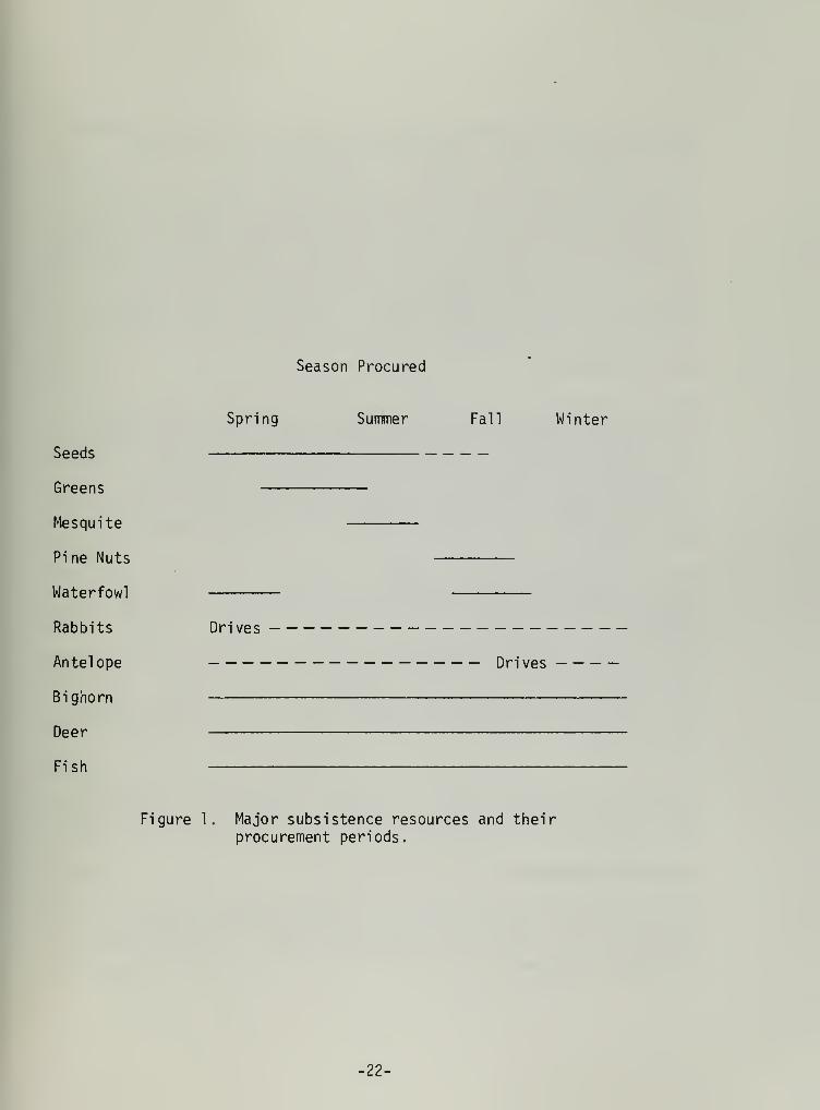
Season Procured
Seeds
Greens
Me squite
Pine Nuts
Waterfowl
Rabbits
Antelope
Bighorn
Deer
Fish
Spring Summer Fall Winter
Drives
Drives
Figure 1. Major subsistence resources and theirprocurement periods.
-22-

Additional food procurement practices included the hunting of mountain
sheep in the Cosos and/or Sierra Nevadas and of deer in the SierraNevadas, and fishing in Rose Valley or Little Lake.
Vegetal foods appear much more important than meat to the diet of the
Little Lake Shoshone. Indeed, this is characteristic of most hunter-gatherers for which we have ethnographic information. Food stuffs whichsupplemented their diet were larvae procured in Owens Lake and caterpillarsgathered from the grounds around Coso Springs, Little Lake, and otherareas. Other minor food sources were bears, badgers, chuckwallas,gophers, mice, woodrats , doves, eagles, hawks, crows, snakes, bobcats,and mountain lions. Further, acorns were sometimes procured from theeastern skirt of the Sierras.
Social Organization
Social organization for the Great Basin groups in general, and as exemp-lified at Little Lake specifically, focused at two levels, the nuclearfamily and the village. The nuclear family performed almost as a self-sufficient economic unit; food production was nearly autonomous, as weredecisions regarding settlement locations. The village served as a
cooperative unit. Headmen, sort of village chiefs, were the onlypermanent leaders. Their positions were inherited from male relativesand they directed all communal activities, i.e. antelope drives and
rabbit hunts.
Marriage practices seem to be somewhat unstructured. A negative mar-riage rule existed whereby an individual could not marry anyone who wasrelated to him in any manner within several generations. Villageendogamy was not prohibited, if the couple were unrelated. Since re-
sidence was so flexible, villages would usually consist of families whowere unrelated. Parents arranged for the marriage of their children andassociated with this practice was a form of reciprocal exchange. Themale's parents would present shell money and the girl's parents wouldreturn the gift with buckskins and food. Intertribal marriages occuredand were noted with Anglo-Americans, Tubatulabal, Kawaiisu and OwensValley Paiute.
Post-marital residence followed a developmental cycle. Residence wouldbe matrilocal until the birth of the couple's first child. Subsequently,the couple might set up a household of its own (neolocal) or (preferably)they would move to the husband's home territory.
Hunting and Gathering
As discussed above, the movements of the Little Lake Shoshone were a
response to the differential ripening of the major vegetal resourceswithin their area. Hunting was a secondary, albeit important adjunct,to vegetal procurement.
-23-

Gathering
The most important staple plant food for the Little Lake Shoshone was
the pinon pine nut (Pinus monophylla ). Pinon pine occurs in areas
between 6,000 and 8,000 feet, on the upper slopes of the Coso Mountains.These nuts were harvested in early autumn and formed the basis for the
winter diet (Steward 1938:82). Dutcher (1893:377-380) has described the
process by which these nuts were collected by the Shoshone in the Pana-
mint Valley. The pine nut camps were located within the pinon groves
and consisted of several brush and wood windbreaks. The nuts werecollected by women, who knocked the cones from the tree by means of a
long pole with a hook at one end. The cones were collected and trans-ported to the camp in large conical baskets. At the base camp the cones
were placed on a large slow-burning brush fire which dried the pitchfrom the cones and released the seeds by forcing the cone scales to
open.
The second most important plant food was bunch grass seeds, also knownas Indian rice grass (Oryzopsis hymenoides ). This important seed was
gathered in late spring or early summer for storage (Steward 1938:26).The grass grew on the alluvial fans, valley bottoms, and in flat areas,
with some soil development, in the Cosos. The harvest period for theseseeds was limited to an average of ten days during which a particularstand would ripen and fall. The sucessful collection of these cropsthen depended on knowledge of local conditions and proper scheduling ofvegetal procurement. The seeds were usually collected by women usingseed beaters and collecting trays. In order to remove the chaff, seedswere subsequently winnowed and sifted through wicker - work sieves.Before cooking the seeds were ground and again winnowed. (Steward 1933:239;Coville 1892:353).
Other plants listed by Steward (1938:21-30) which his Little Lakeinformants identified as useful were:
Anisocoma acaulis - greens covered with hot rocks in small hole andcooked all day.
Calochortus gunnisonii - abundant in the Coso Mountains
Chrysothamnus - rabbit brush
Ephedra spp. - used for tea
Hookera sp. - abundant in the Coso Mountains - may be Broadiaea capitata
Lye i urn andersonii - a small red berry
Mentyelia dispersa - no further information
Poa nevadensis - bluegrass
-24-

Prosopis sp. - mesquite
Quercus sp. - oaks
Salvia columbariae - chia, seeds eaten
Sitanion hystrix - seeds eaten
Hunting
Antelope and Jackrabbit . It was a common practice for both of theseanimals to be taken by communal drives.
Antelope (Antilocapra americana ), because of their exceptional speed and
keen eyesight could not be effectively hunted by individuals or small
groups of hunters but because of their herding tendency and excessivecuriosity they could be lured into corrals. Hunters would usually chasethe antelope into a box canyon, where a corral trap had already beenconstructed. The barrier was constructed of brush and logs of moderateheight which impounded the animals because of their poor jumping ability.
Jackrabbits (Lepus cal ifornicus ) , live in forbs above the ground. Theywere hunted in large numbers by beating the brush and so scaring theanimals into a U-shaped enclosure which was formed by a net set in theground by means of poles. The net could be anywhere from 100 to 200feet long. The rabbits would become tangled in the net or run in a
circle and either be clubbed, or shot with an arrow.
Deer and Sheep . Deer (Odocoileus hemionus) probably did not occur in
large numbers within the territory of the Little Lake Shoshone. Theycould be taken by a lone hunter or small stalking party either in theCoso Mountains or the Sierra Nevadas.
Bighorn sheep (Ovis canadensis) were probably of more dietary importanceand were also more ceremonially significant (Grant et al . 1968) thanmule deer. Weighting up to 300 pounds, the bighorn sheep of the CosoMountains probably provided a sizeable meat source prehistorically. If
the quantity of rock art depicting them is any indication of theirimportance, the bighorn sheep must have been very central to the huntersof the Coso Mountains. Grant has suggested that the hunters may havebeen responsible for the disappearance of the bighorn population fromthe Coso Mountains. He proposes that excessive hunting by means ofambush and possibly drive techniques led to overkill and eventual aban-donment of the area by the bighorn sheep.
Cottontails and Small Rodents . Cottontails (Syvilagus spp. ) and othersmall rodents occur in many areas around Little Lake, principally in
brushy areas and rocky slopes. They are most easily taken with traps orsnares. Sometimes they are hunted with bow and arrow. These animalsserved as a supplementary food supply and became more important inperiods of scarcity of other resources.
25-

Fish . Little Lake, since it was part of the Pleistocene Owens Riverdrainage, probably contained similar sorts of resources. Bettinger(1975) notes that sucker and chub may be found in large numbers in the
Owens River during spring. Species were probably netted or spearedthroughout the year, particularly in the summer.
Waterfowl . During the spring and fall waterfowl could be found both at
Little Lake and Owens Lake. Bettinger (1975) indicates that the mostcommon of these are Canadian geese, teal, and mallard.
-26-


ARCHAEOLOGY
Previous Archaeological Investigations
The earliest reported work in the Little Lake region was conducted by M.
R. Harrington of the Southwest Museum. From 1948 through 1951 extensiveexcavations were conducted at the Stahl Site (Harrington 1948, 1949,1950, 1951, 1957; Simpson 1949). The results revealed a substantialstratified subsurface deposit of material attributed to the Pinto period.Of further significance was the discovery of numerous house remains(seven in total) marked by a circular or eliptical patterning of post-holes. These house remains are among the most ancient yet discovered in
North America. In association with his work at the Stahl site, a cavewas excavated by S. M. Wheeler (Harrington 1953). The remains identifiedconsisted of an upper stratum associated with a late prehistoric occupa-tion, typified by Desert Side-Notched arrow points, European trade beadsof red and blue glass, and other items of recent age; and a secondstratum attributed to the 'Basketmaker' culture which was in fact pro-bably of Elko period. Pinto points were found below the second stratumas were points similar to those found at Gypsum Cave (Harrington 1933).A badly decayed burial associated with a Pinto and Silver Lake typepoint was also found below the second stratum.
Further excavations in the area were limited to a midden site an eighthof a mile north of Fossil Falls (Harrington 1952). The Fossil Falls
Site, (Plate 8), as it was called, revealed a significant deposit fourfeet in depth. The site contained two strata separated by a sterilelens. Apparently the earlier deposit dates to a period when a pluvialriver ran through the now-dry channel. It was suggested that thisdeposit may be in excess of 10,000 years in age.
Lanning (1963) has reported on work conducted at Rose Spring, approxi-mately 15 miles north of Little Lake. Rose Springs shows evidence ofconsistent occupation, dating to a slightly later period than the Stahl
Site. Lanning suggested habitation initiating in Early Rose Springtimes (ca. 1500 B.C.) and continuing through to the late prehistoric.Farmer (1937) and Harrington (1951) have reported on the obsidian quarryassociated with Sugarloaf Mountain, a perlitic dome located on the Naval
Weapons Center. This high grade obsidian source, only some five milesfrom Fossil Falls, served as the locus for quarrying activities prior to
the transport of raw material or preforms to base camps and villages.
Recently, the rock art of the region has been the focus for intensivestudy (Grant et. al . 1968). Research aimed at determining a relativechronology for the drawings and at functional interpretations drew closeattention to the concentration of rock art in the Coso Range. Minorlocalities noted included those at Little Lake and would be subsumedunder the peculiarly unique Coso style.
-27-

Of current significance is the work of Emma Lou Davis at China Lake
(Davis 1974, 1975). Her surface survey and detailed mapping program has
presented us with exemplary field techniques and timely presentation of
results. Her work has included a detailed surface survey and mappingprogram of the archaeological remains surrounding the lakeshores ofpleistocene China Lake.
As yet unpublished research has been carried on at Little Lake, aimedat obtaining geochronological controls from coring and sediment studies(Mehringer and Sheppard ND) . Mostly recently, Stan Berryman, a graduatestudent at San Diego State University, is excavating a site in a covenear the Upper Little Lake ranch, in conjunction with Emma Lou Davis.
Preliminary work suggests occupation from Pinto times to the lateprehistoric period (Berryman personal communication).
28-

Excavations at the Fossil Falls Site
Plate 9. The Fossil Falls site as it appeared ca. 1950 and as it
appears presently. Mark R. Harrington on back dirt mound in upperpicture, archaeologist and excavator of the site. Elvis Hulsey,
manager of Lower Little Lake Ranch in lower photo.
29-

Cultural Sequence
Introduction
Recently, archaeology has undergone a period of re-examination. Some
would say a theoretical revolution has occurred, causing a reorientation
of our goals (Leone 1972). These changes, whether seen as an abruptdemarcation or a gradual development, have caused a transformation in
our priorities from the traditional task of developing culture historyto a concentration on questions of a more processual nature. Some have
gone so far as to divorce the more traditional line of research from the
task of developing processual explanations based on cultural similaritiesand differences (Binford 1962, 1964, 1965, 1968a, 1968b; Deetz 1970:115;Watson et. al . 1971). It has been argued, that in order for archaeologiststo deal with questions of a processual nature, accurate historicalreconstructions must be established. (Sabloff and Wi 11 ey 1967; Flannery1967; Thompson 1972). If we are to accomplish our goal of accuratelyexplaning prehistoric human behavior, the most profitable method will be
an integration of recent innovations in method and theory with establishedpractices. It is with this orientation in mind, that the informationbelow, which falls into the category of culture history, is presented.
This data is provided in order that further research questions may beframed in the context of an established cultural sequence. The temporalcontext should serve as a baseline for future work and further researchpossibilities.
A cultural sequence fully appropriate for the Little Lake Locality has
yet to be written, but drawing on work by researchers in the Little Lakearea itself (Harrington 1948a, 1948b, 1951a, 1951b, 1952, 1953, 1957;Warren and Renere 1968) and from the adjacent environs (Canning 1963;Hillebrand 1972; Davis 1974, 1975; Bettinger 1975), one may be tentativelyconstructed.
Projectile points will serve as the basis for these temporal periods,since they have been shown by archaeological researchers to have valueas temporal diagnostics. The projectile point styles noted are illu-strated in Figures 2 and 3. The period names will largely followBettinger and Taylor (1974), cf. Hall and Barker 1975. Table 1 de-lineates the periods mentioned, and indicates their chronologicalplacement as correlated with Antev's climatic sequence.
Fluted Point Tradition
The earliest documented evidence for human habitation at Little Lakecomes in the form of several fluted points noted by Warren and Renere(1968). These artifacts are typological ly similar to Clovis and Folsompoints. The presumed antiquity of these finds lies in their assumedcontemporaneity with points of similar style in the Southwest and GreatPlain. This would place them in a period ca. 10,000 B.C. As yet this
-30-

Table 1
Fossil Falls/Little Lake Cultural Sequence
Antev '
s
CI imaticStages
(a fter Bettinger and Taylor, 1975)Projectile Point Series
Named Period Lanninq (1963)
C<
ADBC
3 1850
1500
1000
500
500
1000
1500
2000
2500
3000
3500
4000
4500
5000
6000
7000
8000
9000
10000
Marana (Cottonwood andDesert Side-Notched)
Cottonwood
n3
E
Haiwee (Rose Spring andEastgate)
Late RoseSpring
S-
Newberry (Elko and Gypsum)
QJ
+->
•i
—
Middle Rose Spring
QJ21
Early Rose Spring
Little Lake(Pinto)
Little Lake
ES-
QJ
+->
+->
5Lake Mojave
(Lake Mojave and Silver Lake)
Lake Mojave
E
Lanceolate Points
QJJZ
ro
Fluted Point Tradition(Clovis-like and Folsom-
"1 ike)
-31-

Figure 2*
Lake Mojave
a - Lake Mojave, CaliforniaAfter Warren and Renere, 1968, Fig. 3, d.
b - Lake Mojave, CaliforniaAfter Warren and Renere, 1968, Fig. 3, e.
Pinto
c, d, e - Stahl Site at Little Lake; from Harrington, 1957:50.
Gypsum Cave
f - Gypsum Cave, Harrington, 1933:44.
Elko
g - NV CH 15, 1-17567 After Hester and Heizer 1973:21 Fig. 3, e.
h - Field catalog S-28, NV E, 11 after Hester and Heizer 1973:21
Fig. 3, f.
*i iLine drawings after Hester and Heizer, 1973
-32-

a
o 5 cm
-iO cm
-.cm
1
•5 cm
-33-

Figure 3*
Rose Spring
a - 1-65382; NV Ch. 15
b - 1-65606; NV Ch. 15
c - 1-18814; NV Ch. 15
a, b, and c - After Hester and Heizer 1973:23; Fig. 4, c, d, e.
Eastgate
d, e, f - After Hester and Heizer 1973:23; Fig. 4 o, p, g from siteNV Ch. 15.
Cottonwood
g, h, i, j - After Hester and Heizer 1973:23; Fig. 4, g, h, i, j, fromsite NV Ch. 15.
Desert Side-Notched
k, 1, m - After Hester and Heizer 1973:25; Fig. 5, d, e, f, from siteNV Ch. 15.
*l_ine drawings after Hester and Heizer, 1973.
-34-

Im
-35-1 5 cm

temporal placement has not been documented in the Far West and, in fact,
association with later-dated material is a possibility. A further
problem with the interpretation of these finds is the controversy sur-
rounding an associated 'big-game hunting complex'. The argument re-
volves around whether these early point forms are actually associated
with the procurement of extinct megafauna in the Great Basin, as they
are in other regions. This has yet to be adequately demonstrated in a
strati graphic context, but tantalizing evidence is now being gathered on
material at China Lake, 15 miles to the southeast. Davis (1974, 1975)
has now suggested that, indeed, such an association may be indicatedfrom surface finds. Both fluted points and extinct megafauna have beenfound on the shores of ancient China Lake, but the association has not
yet been firmly established.
Western Pluvial Lakes Tradition
This tradition, first defined by Bedwell (1970:231), is associated witha general adaptation towards the exploitation of Pleistocene lakeshorehabitats. At Lake Mojave, near the present town of Baker, in theeastern Mojave Desert, the Campbells (1937) have defined a complex basedon the presence of highly sand blasted implements and points. Thesesand blasted artifacts occur on the shorelines of fossil Lake Mojave andin an area essentially equivalent with the outlet channel of Silver Lake
at its northern end. This complex is characterized by the absence ofmilling equipment, and the presence of rough percussion flaked tools,hammers, crescentic stones, unifacial and bi-facial tools, choppers,scrapers, knives, drills, blades, and the diagnostic Silver Lake andLake Mojave points. These remains have been interpreted as representinga predominantly hunting based economy with little emphasis on seedgrinding or fishing, although this has yet to be substantiated in a
stratgraphic context. Although there has been much debate over thechronological placement for this complex, it is currently generallyaccepted at ca. 6,000-8,000 B.C. (Warren and True 1961; Wallace 1962;Warren 1967).
Silver Lake and Lake Mojave type points have been reported by Harrington(1948, 1952) for the Little Lake area. Further, the author has reviewedseveral local collections which contain Silver Lake and Lake Mojave typepoints. It is assumed that this period of occupation would date to theoverflow of Pleistocene Owens Lake via Owens River and the subsequentfilling of Little Lake and China Lake. Recently work has been under-taken in order to date this event and further elucidate the chronologyof the archaeological sites associated with the lake (Mehringer andSheppard, ND). As yet, the earliest date reported for the associatedsites is approximately 5,000 years B.P., but work to be undertaken maypush back this date.
It has been suggested (Harrington 1957:70-73) that Silver Lake and LakeMojave points at Little Lake might date later than their counterparts atthe type site of Lake Mojave. Since both these point types are found instratigraphic association with Pinto points dating to a later period,possibly these projectile point style had a greater duration in theLittle Lake locality than at its counterpart in the eastern Mojave.
-36-

Lake Mojave and Silver Lake points have been recorded as surface finds
by a local collector on the west side of Red Hill Playa. This type of
surface find may suggest more ancient date, contemporaneous with the
overflow of Owens Lake.
The Altithermal
It has been suggested (Wallace 1962:175; Kowta 1969; Hillebrand 1972;
Hester 1973) that a considerable length of time may separate the mani-
festations of Lake Mojave and those of the subsequent Pinto Period.
Hester and Heizer (1973) noted the absence of radiocarbon determinationsfor the period from 6 - 4,000 B.C. This time span correlates withAntev's Altithermal climatic period. This period of hot and dry climate,distinctly more intense than that of the present, is the subject for
present discussion. Under debate is the significance of this period ofdessication for man. Current archaeological and chronological evidencecan not substantiate whether or not this period of dessication resultedin an occupational hiatus. It is interesting to note however, that Lake
Mojave and Pinto points seem to be found in stratigraphic association atthe Stahl Site and that no break in the chronological sequence is
inferred (Harrington 1957).
Pinto Period
The Pinto period was originally defined by Campbell and Campbell (1935)on the basis of materials recovered from a series of sites located in
the Pinto Basin in Riverside County. Points similar to those found by
the Campbells were recovered by Harrington at the Fossil Falls site(Harrington 1952) and at the Stahl site (Harrington 1957). It has been
suggested that the points retrieved bear such striking typologicalsimilarity to the Campbell's Pinto specimens that there is no doubt that
they are one and the same (Harrington 1957:49). Others (Lanning 1963:
250-251) have preferred to use the term "Little Lake" to refer to"Pinto" points at the Stahl and Rose Spring sites.
Other investigators have noted that the term "Pinto" is rather looselyapplied and broadly defined (Layton 1970; O'Connel 1971). Bettinger andTaylor (1974) have suggested that there is stylistic variation betweenthe points from Little Lake and those from Pinto Basin. The former areless massive and more finely flaked and have characteristic deep basalnotch, while the latter are thick and percussion-flaked, without thedeep basal notch. Hester and Heizer (1973), in contrast with otherresearchers, see remarkable similarities between the two series and feel
that the Pinto series still appears to posess cultural-historicalsignificance, though they do agree that the Pinto series is in need ofanalysis and refinement. Hester and Heizer (1973), drawing on a set ofradiocarbon dates, estimate the Pinto series to extend from ca 3,000B.C. - 700 B.C. Bettinger and Taylor (1974) note a determination of anearlier date in Nevada, and put the terminal date at an earlier period.They suggest the Pinto period begins ca. 4,000 B.C. and ends about 1,200B.C. Both these chronological estimates would bridge the waning periodof the altithermal and the initiation of the moister medi thermal peiods.
-37-

Newberry
The Newberry period is characterized by two projectile point forms,
Gypsum Cave and Elko. The Elko series was originally defined by Heizerand Baumhoff (1961). The Gypsum Cave form is named after its type site,
excavated by M. R. Harrington (1933) in Southern Nevada. Both forms
have been described for the study area (Harrington 1952, 1957). Bettingerand Taylor (1974) set dates for this period at 1200 B.C. to A.D. 600.
Besides these distinctive projectile point styles, an abrupt increase in
population and the initiation or enhancement of the stone tool assem-blages for plant processing characterizes the period. Milling stonesbecome more dominant in the tool assemblages manifesting this change.
Bettinger (1975) notes another change during this period. He suggests a
shift in the location of occupation sites from typically riverinelocalities to desert scrub zones. Pointing to the sites at Little Lake(Harrington 1957) and Rose Spring (Lanning 1963), Bettinger sees theStahl site as representative of the early use of riparian resources nearto the sites, while at the later dated Rose Spring site, the setting andassemblage appear to be more representative of the use of dry land
plants. This change is said to have taken place between the Clyde phase(4500 B.C. - 1500 B.C.) and the Cowhorn phase (1500 B.C. - A.D. 600).
Haiwee
This period is set apart from previous complexes on the basis thatprojectile points of the Rose Spring and Eastgate series represent theintroduction of the bow and arrow into the Great Basin (Lanning 1963:268)Rose Spring was named by Lanning (1963) and Eastgate by Heizer andBaumhoff (1961).
The Rose Spring site is just 13 miles north of Little Lake and numerouspoints of the Rose Spring type have been found and described in thestudy area (Harrington 1952, 1957). Eastgate points seem to have a
distribution mainly restricted to central and western Nevada. Harrington(1952, 1957) notes Eastgate expanding-stem points in the Little Lakearea, although he refers to these as Basketmaker.
Radiocarbon determinations from a wide variety of sites containing thesetwo forms suggest an initial date of ca. A.D. 500 and a terminating datesomewhere near A.D. 1300 (Bettinger and Taylor 1974).
With respect to subsistence patterns during this period there is noconclusive evidence that the introduction of the bow and arrow broughtabout any significant economic changes. However, it has been hypothe-sized that the bow and arrow increased the efficiency of bighorn sheephunters in the Coso Mountains and ultimately, caused wide scale decima-tion of the sheep (Grant et. al . 1968:112-115). The presumed adverseeffects the bow and arrow may have had on animal populations may corre-late with lexicostatistical information indicating a population shiftout of the northern Mojave desert, ca. A.D. 900-1000.
-38-

Bettinger (1975) has indicated that his studies of the settlement -
subsistence system within the Owens Valley document the inception of
pinon - collection between A.D. 600 and A.D. 1000. If this inferenceapplies to the most southerly part of the valley, Rose Valley or theLittle Lake area, we might find a similar inception within the studyarea. This has yet to be documented.
Marana
In the late prehistoric or Marana period we see the introduction ofceramics, Desert Side-Notched and Cottonwood projectile points, and theadvent of Paiute and Shoshonean peoples. Linquistic information sug-
gests (Lamb 1958) that ca A.D. 950 these groups distributed themselvesfrom southeastern California (in the vicinity of Death Valley) into the
Great Basin. Other linguists date this migration at A.D. 1000 (Hale1958:107) and A.D. 1450 (Goss 1966:272). These Numic speaking peoples,it is suggested, were originally related but spoke mutually unintelligibledialects; Northern Pauite, Shoshoni -Comanche, and Ute-Southern Pauite-Comanche. Lamb suggests that the division into these dialects occurredsome 2,000 years ago.
Desert Side-Notched points were originally defined by Baumhoff and Bryne(1959). The Cottonwood forms were first identified by Lanning (1963).The point styles are fully contemporaneous and are present into historictimes. Radiocarbon determinations indicate that Desert Side-Notchedpoints appear ca A.D. 1100-1200 and Cottonwood points begin ca. A.D.
1300.
Late prehistoric materials found within the study area include bothprojectile point series (Harrington 1952, 1957). Further Marana periodtime markers appearing in the study area include Owens Valley Brownwarepottery, ceramics, Olivella Wall beads and European blue and red glasstrade beads, identified by this author from private collections.
Economic pursuits continued much the same during-this period, althoughBettinger (1975) identifies a sharp decrease in hunting of large game in
his study of the Owens Valley. Evidence indicates that after A.D. 1000most hunting which required long trips and the use of temporary campsceased. This resource-use change has yet to be documented for the studyarea.
Aboriginal activity in the study area continued up till the disruptionof native subsistence practices ca. 1900. Steward's ethnographic work(Steward 1938) attests to the occupation of the area, as does an inter-esting historic cache of aboriginal artifacts dating to the 1870
' s foundsome three miles south of Little Lake (McCown 1957).
Summary
From the works of Harrington in the study area, and from data availablefrom adjacent locales, an occupational history for man in the Little
-39-

Lake area has been tentatively developed. Man probably initiated occu-
pation in that area ca. 10,000 B.C. although evidence attesting to his
activities is scant. During the period from 10-6,000 B.C. his activitieswere probably largely confined to lakeshore adaptations. Either lacus-trine or megafaunal food sources served as primary foci for subsistenceactivities.
Between 6,000 and 4,000 B.C. a period of dessication and marginal
occupation has been delineated. Partial abandonment of low-lying areasin pursuit of more attractive resources at higher elevations is a
possibility. By 4 - 3,000 B.C. a basic foraging adaptation had beenadopted. The appearance of ground stone implements such as manos,metates, mortars and pestles attests to an increase in vegetal processingand use. The bow and arrow seem to have been introduced ca. A.D. 500as evidenced by the appearance of smaller and lighter projectile points.An expanded development of bow and arrow technology, and the advent ofpottery mark the late prehistoric period.
-40-

Archaeological Inventory
In conjunction with the preparation of a management plan for the Fossil
Falls area, a systematic archaeological inventory was conducted. Fortynine (49) archaeological sites and site complexes were recorded during a
month of intensive field work. Most of these sites are located withinthe boundaries of an area less than 160 acres in size.
This reconnaisance was conducted by means of a one-man on-the-groundsurvey. All sites located were recorded on the Bureau of Land Manage-ment, Bakersfield District Archaeological Site Survey Form. This typeof record documents site type, size, constituents, features, and envi-ronmental associations.
Most sites recorded were on National Resource Lands. Other sites in
adjacent localities which appeared significant to an overall interpre-tation of land use patterns and site densities were inventoried, as weresites located with the aid of local informants, regardless of theirsignificance or land ownership.
The site record form utilized by the author is the same as that used bythe Desert Plan Staff and this data will be included in the DesertPlan's computerized data-storage-and-retrieval system. Most sites werephotographically documented and all have been mapped on an enlargedversion of the USGS aerial photo dated September 30, 1948, flight lineGS-HG 1-106. (See Appendix 4 for site records and map.)
Methodology
Surface reconnaissance and site recording initially focused on thepluvial river channels of the Owens River northwest of Fossil Fallswhere there is the greatest density of sites in the area. Subsequentlysites were recorded above the gorge below Fossil Falls both on the eastand west sides. Lastly a cursory examination of other areas includingthe alluvial fan east of Red Hill cinder cone, the edge of Red Hillplaya, a north-south strip running across an area of discontinuous lavaflows and isolated boulders (directly north of Fossil Falls to thecinder mine road), and other areas locally known to contain archaeologicalresources, was conducted.
This survey obviously can not be regarded as thorough or all-inclusive.A single observer can not adequately record every archaeological site in
an area as large as that being considered here, but an effort has beenmade to give a fair representation of the relative densities of archaeo-logical remains in the area and of the associated environmental corre-lates. The results, give a fairly realistic picture of the areal
densities and site types found in the Fossil Falls locality.
-41-

Patterning
During my inventory several land use patterns became apparent. These are
detailed here in order to assist in management decisions and in the
prediction of site locations in the future.
1. The greatest density of archaeological remains occurs in thevicinity of the Pleistocene river channels northwest of Fossil
Falls. These sites are among the largest in areal extent and
include surface scatters, open-air midden sites, rock shelters,caves, rock rings and milling features.
2. On the flats above the gorge below Fossil Falls, within easy reachof the pluvial river below them, are found caves, rock shelters,and open-air midden sites. These do not appear in as great a
profusion as those previously noted.
3. Red Hill Playa is ringed with sparse but consistently distributedsurface remains including isolated stone tools, chipping circles,milling features, sparse flake scatters, and isolated finds.
4. The area of boulders and discontinuous lava flows running fromimmediately north of Fossil Falls, north-south to Cinder Mine Road
contains ephemeral, playa-related, temporary sites, usually unim-pacted and in pristine condition. These indicate temporary occupa-tion, probably related to lacustrian vegetal use.
5. Almost anywhere in the study area one can locate isolated orsparse scatters of obsidian flakes and/or milling equipment. Thisindicates the use of the entire area for vegetal procurementand/or processing.
6. There is a marked tendency for use of easterly oriented lava clifffaces either for camping spots at the' feet of these rock faces orin natural shelters. This extensive use may be due to two factors.First, wind, which is yery frequently quite strong, can usually be
broken by such rocks and, second, the easterly orientation allowsthe shelters to catch the morning sun's warmth.
7. Known rock art sites in the area occur, for the most part, in
association with water sources or near natural hunting areas (i.e.,above gorges or in steep walled canyons). Survey conducted onNational Resource Lands inventoried only three small sites with a
total of less than 20 elements.
The larger rock art sites (one with 25+ elements, others with 100+elements) occur outside of those lands supervised by the Bureau ofLand Management, but within short distances of these lands, in oneinstance an eighth of a mile (DA 32), and in others, several miles(DA 17, 18, 19, 33, 48).
-42-

Management Recommendations
Roads and Trail
s
The area within the Fossil Falls locality is marked by a system of dirt
roads (See Map 3). The most easily defined access and that most used by
visitors is the paved road to the east of highway 395 north of LittleLake. It is prominently marked with a highway sign designated CinderMine Road. This form of access should be maintained and some form of
prominent directional sign indicating that this is the access into
Fossil Falls should be placed below the Cinder Mine Road sign for bothvehicle routes along the highway.
The first spur to the right, deeply marked by much vehicle use, leads
to the Fossil Falls parking lot. The size of this lot seems adequateand should be maintained as is. A bright-orange-marked foot trail leads
to Fossil Falls. It is recommended that this trail be improved in
several ways:
1. An appropriate name for the trail is essential for clarity. Thename "Fossil Falls Trail" is recommended. This title should be
embossed on a sign and placed at the initiating point of the trail.
2. A comfortable walking grade, not more than 10 percent is importantfor ease in travel. The trail should be made wide enough for two
people to walk along side by side.
The existing trail is inadequate given these considerations. It is
recommended that the trail be improved to meet these conditions.
Access to Fossil Falls can also be gained by vehicle. Vehicle accessshould be detered as delineated in the following section on 'ProtectiveBarriers'. The Cinder Mine Road now permits access across Red HillPlaya to Little Fossil Falls and to Fossil Falls proper. These roadswill most likely still be the general access routes for foot traffic in
and around Fossil Falls.
-43-

MAP 3
II Playa
MANAGEMENT RECOMMENDATIONS
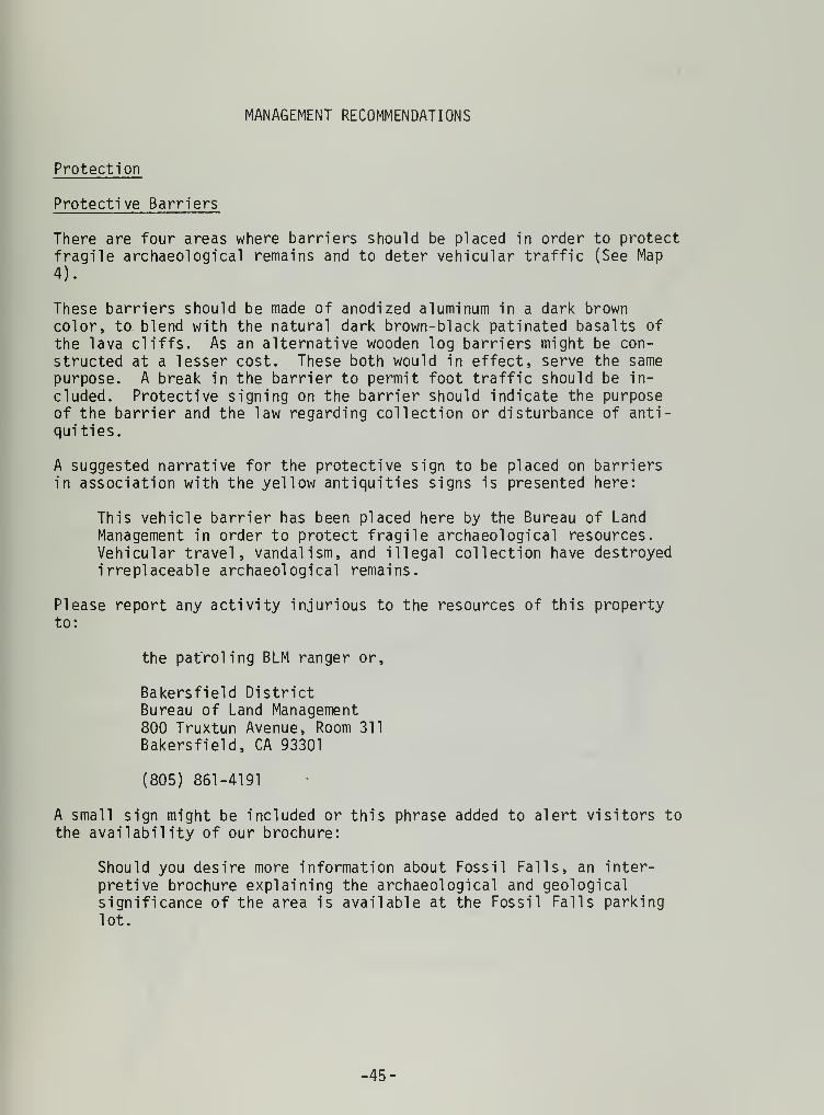
Protection
Protective Barriers
There are four areas where barriers should be placed in order to protectfragile archaeological remains and to deter vehicular traffic (See Map
4).
These barriers should be made of anodized aluminum in a dark browncolor, to. blend with the natural dark brown-black patinated basalts of
the lava cliffs. As an alternative wooden log barriers might be con-
structed at a lesser cost. These both would in effect, serve the samepurpose. A break in the barrier to permit foot traffic should be in-
cluded. Protective signing on the barrier should indicate the purposeof the barrier and the law regarding collection or disturbance of anti-quities.
A suggested narrative for the protective sign to be placed on barriersin association with the yellow antiquities signs is presented here:
This vehicle barrier has been placed here by the Bureau of Land
Management in order to protect fragile archaeological resources.Vehicular travel, vandalism, and illegal collection have destroyedirreplaceable archaeological remains.
Please report any activity injurious to the resources of this propertyto:
the patrol ing BLM ranger or,
Bakers field DistrictBureau of Land Management800 Truxtun Avenue, Room 311
Bakersfield, CA 93301
(805) 861-4191
A small sign might be included or this phrase added to alert visitors to
the availability of our brochure:
Should you desire more information about Fossil Falls, an inter-
pretive brochure explaining the archaeological and geologicalsignificance of the area is available at the Fossil Falls parkinglot.
-45-

MAP 4
Red Hill Playa

Barrier 1
It is recommended that Barrier 1 be placed at the mouth of the Pleistoceneriver channel leading to Little Fossil Falls. A dirt road follows thischannel originating as the north fork of the road running off of Red
Hill Playa, which starts as a spur off of Cinder Mine Road. The barrierwould connect the two sides of the river channel, bounded by lava cliffs(Plate 10). This barrier would measure approximately 63 feet in length.
The barrier would deter access to Little Fossil Falls and the largesites directly adjacent to the north and south.
Barrier 2
Barrier 2 should be placed at the mouth of the river channel, whichmeanders to an area below Little Fossil Falls. The dirt road whichfollows the ancient river course is the only vehicular access directlyto Fossil Falls proper. A yellow antiquities sign has alreadly beenplaced at the western terminus for the proposed barrier (Plate 11). Thebarrier would run in an east-west diagonal, crossing the present road,
and connecting to a prominent lava hill. The barrier would measureapproximately 250 feet in length (Plate 12).
Barrier 3
Although a road does not presently exist in this area, the terrain is
such that access could be gained to the dirt road going to Fossil Falls
proper by circumventing Barrier 2 and traveling cross-country from thesouthern portion of Red Hill Playa across the flat area of Atriplex. In
order to ensure protection against this possibility, Barrier 3 is
necessitated (Plate 13). This would again block access to the main road
into Fossil Falls itself, an area of great arcaheological site density.This barrier would measure approximately 150 feet in length.
Barrier 4
Access is currently being gained onto private land and national resourcelands by means of travel along a powerline road. Pothunting has beenvery heavy at the Stahl site, near the mouth of Fossil Falls Gorge. In
order to preserve this significant site and protect archaeological re-
sources on national resource lands, a locked gate should be placed at
the point where the dirt road branches off the access into the Fossil
Falls parking lot (Plate 14). The dirt road is marked by a yellow signstating "Not a Through Road." Permission would most probably have to be
obtained from the power company involved and a key system instituted.
-47-

Plate 10. Barrier 1 blocking access to LittleFossil Falls.
Plate 11. Yellow Antiquities sign presently atwestern terminus of Barrier 2.
48-

7". -SPP«*^rr-
. A.^*Tv
J*.fifcjr* ~
•*^^B^^W '
1"*
p*-~ .
Plate 12. View west across Barrier 2
iASfliHH^HHBHHHHHHHI
*-
:««*
Plate 13. Barrier 3.
-49-

7 I
'
l U l MJ'™^S^'
- Sim
Plate 14. Barrier 4.
-50-

Mitigative Excavation and Mapping Program
Fragile archaeological resources at Fossil Falls are now in the processof being destroyed. Local collectors have removed many of the temporallydiagnostic artifacts from the surface i.e., projectile points and shellbeads. More avid pothunters have been "mining" the area to unearthartifacts buried beneath the surface. These individuals in some casesare quite systematic. Their looting includes the excavation of largehand dug units and screening with one-eighth inch mesh hardware cloth.
In order to prevent the loss of further information some form of mitiga-tive excavation is necessary. The information could then be retrievedthrough scientific methods, and subsequently curated and stored in a
recognized educational institution or museum. This would make theinformation available for further interpretation and preserve it forfuture scholars.
The most heavily impacted areas in order of intensity are:
1. Little Fossil Falls South (DA 35) - This site complex contains openair sites with substantial midden accumulation (up to four feetdeep), rock shelters, caves, rock rings, and surface flake and tool
scatters. The complex has been severely impacted, but the degreeof severity has not been determined. Future work should evaluatethe extent of damage to the resource, by answering the followingquestions:
How deep have the pothunters excavated?
How much of the site area has been disturbed?
Is there significant subsurface deposit, substantial enough to makefuture work profitable?
In order to answer these questions, a systematic mapping programshould be initiated, to inventory and record in detail the existingarchaeological resources and the extent of damage to these areas.Associated with this test excavations should be undertaken to
determine the depth, quantity, and area! extent of deposits.
2. 'Bad Potting Area' (DA 11) and Harrington's Fossil Falls Site (DA
12) -These two contiguous areas located at the base of the lava
flow on the west side of the dirt road running to Fossil Fallsproper, have been heavily impacted. Harrington (1952) has indi-
cated that the Fossil Falls site contained a subsurface deposit in
excess of four feet. If this is indeed the case, it is most likelythat the potholes of recent vandals have not tapped the true extentof these subsurface remains. But the extent of damage since 1952is not known with any certainty.
It is recommended that;
-51-

a. Test excavation be initiated to determine the extent of damage
to the subsurface deposit.
b. Test excavation be further oriented towards the end of deter-
mining the depth, quantity, and areal extent of subsurface
remains.
3. Little Fossil Falls North (DA 28) - This site area is much less
severely impacted than neighboring Little Fossil Falls South (DA
35). In order to protect fragile archaeological resources fromfurther destruction, some form of mitigative excavation, and a
mapping program is necessitated. A small scale test excavation is
recommended, for the purpose of preserving a small sample of the
archaeological data available. A mapping program, undertaken con-
currently with the excavations, to record damaged versus pristinearchaeological resources, is also deemed important.
4. Rock Ring Village (DA 3) and Fossil Falls Shelter (DA 4) - On thetablelands above Fossil Falls gorge, at the head of the falls, are
preserved several rock rings, and a rock shelter.
According to visitors to the Falls many more rock rings were visible,in the past which through the years, have been tumbled, scattered,and obliterated. It is recommended that the existing structures be
completely mapped and recorded before they too are destroyed.
Fossil Falls Shelter has also been potted, but considerable middenaccumulation still remains. It is recommended that some form of
mitigative excavation be initiated, and a detailed map of the siteand vicinity be prepared.
5. Archaeological Resources at the Fossil Falls Locality - In total,the Fossil Falls area presents an abundance of archaeologicalremains, ranging from isolated finds of stone tools to extensiveopen-air midden accumulations. These fragile resources are in
danger of destruction through collection and 'pothunting' . A
systematic mapping program is recommended in order to preserve thevital contextual information so easily destroyed by casual collec-tion.
This mapping program would provide detailed information regardingthe relationships of sites and site complexes, the degree of impact
to, and the areal extent of each. This information is necessaryand pertinent to further management decisions regarding the Fossil
Falls archaeological locality.
52-

Recreation
From the author's month of field work and observation and from numerouscontacts at Little Lake and with visitors to Fossil Falls, visitor use
in the area has been discerned to be quite variable. Substantial visita-tion usually begins after Easter and continues throughout the summer.Most weekends during the year see heavy visitation although, from myexperience, this seems to be mostly in the nature of organized groups(i.e., geology classes, historical societies, rescue teams, rock andmineral clubs, etc.). Although weekends see the heaviest use of thearea, it is quite possible on any particular weekend to find few, if any,
visitors. During the week, at least one or two vehicles can be noteddaily. These will usually represent lone individuals who come to thearea for solitude and may stay the night to camp.
In discussing various options with locals and visitors to the area,it was generally agreed that the area should "stay like it is" or haveas minimal an amount of change as possible. I tend to agree with this
general preference and suggest only those changes necessary for a lowlevel of management.
Recommendations
1. A minimal day use facility should be established in a location wherethe most minimal alteration possible to the natural features of thelandscape need occur. Day visitation should be encouraged; over-night camping facilities should not be established. However, over-night camping should not be prohibited.
2. Graffiti in the form of spray-painted designs in the parking lot
area should be eradicated, either with paint of the same color as
the natural rock or through sandblasting.
3. Ranger patrol or an on-site ranger station (trailer ?) should be
instituted during weekends and peak visitor-use periods. One of the
duties of rangers should be to lead guided tours of the area.
Rangers should be acquainted with pertinent archaeological, ethnological,
historical, and environmental information about the area.
4. Subsequent to the implementation of recommendation number three,several trash containers, picnic tables and rest room facilities,
in the form of portable toilets should be imported to the area.
•53-

Lands
It is recommended that the Bureau of Land Management acquire the 80
acre parcel below Fossil Falls (T. 23 S. , R. 38 E., lh NE% Section 6,
MDM.
This privately owned parcel contains significant cultural resourcesincluding the Stahl site and cave (DA 19). This site dates to as earlyas 3-5,000 years B.P. and contains some of the earliest recorded house
remains in North America. The archaeological resources located in this
parcel are directly related to those noted above the dry falls. This
parcel should be acquired for continuity in management actions.
The original owner of the parcel containing the Stahl site, Jack Mohrhart,has indicated that the current owners would most probably be amenable to
some sort of agreement with the Bureau of Land Management. If purchaseor exchange is infeasible, possibly some sort of compromise could bearranged, in which the Bureau could manage the noteworthy resourcesof the property. Management might include protection and/or interpreta-tion of the significant cultural resources found within the parcel.
The current owner of the lot is:
D. 0. P. Investment Company923 Bay Blvd.
Newport, Oregon, 97365
-54-

Interpretation
Three forms of interpretation are recommended to enhance the culturalresources found at Fossil Falls and to increase their educationalvalues. They are:
1. A brochure will be prepared dealing with the natural history of thearea and pointing out significant features of the landscape,including those pertaining to archaeology, vegetation, wildlife,and relict hydrology.
2. A free standing interpretive display (Kiosk) will be placed withinthe parking lot area at Fossil Falls. The display will include a
map of the general area delineating points of interest and existingtrails.
3. Rangers will serve as guides for interpretive walks within theconfines of the Fossil Falls archaeological district.
Talks might focus on such topics as:
a. The prehistory of the Fossil Falls/Little Lake area.
b. The preculiarly unique rock art style of the Coso Range -
pointing out the Fossil Falls/Little Lake area as a peripheralone within the major complex, (visual aid Five Bighorn RockShelter)
c. Relict hydrological features in the Fossil Falls area.
d. Past periods of active vulcanism at Fossil Falls.
e. The fauna and flora at Fossil Falls.
55-

Brochure
The brochure should be made available at the Fossil Falls parking lot,
at the entrance to the trail leading to Fossil Falls. A metal dispensercould be placed in association with the free-standing interpretivedisplay.
Other literature could be made available as well including the "GraveRobbers" pamphlet and possibly the notice entitled "Public - No. 209".
The following narrative has been developed and is suggested for use in
the interpretive brochure.
Fossil Falls
The Fossil Falls geological site is a spectacular dry waterfall formedsome 10,000 years ago by the fast moving waters of the glacial Owens River.
The former river cut through a lava flow and formed a gorge which dropsapproximately 45 feet. At the head of the falls one can see deep potholes and stream polished rock surfaces. Some fluted forms go completelythrough the lava boulders to form hollow tubes.
Name
Fossil Falls was named by archaeologist Mark Raymond Harrington whiledoing fieldwork for the Southwest Museum in the early 1950's.
The significance of the site became apparent when he discovered sub-stantial remains of prehistoric man along the old river courses above
the Falls and at the area below near Little Lake.
Vulcanism
The rugged and primitive features of Fossil Falls are the product ofvolcanic activity. This area has seen an intense and recent period ofactive 'vulcanism'. Lava flows have erupted from fissures within theearth and volcanoes have poured forth molten rock and rock foam. Theblack rock you see is basalt formed slowly from liquid rock turnedsolid. The prominent red hill dominating the skyline to the north wasformed more violently. The structure is known by geologists as a cindercone. It is created when gases are trapped in rock and collect. Even-tually this gas blows outward from the vent and turns into rock foamwhich settles to form the cone. The red porous rock is called scoria.The cone has been mined since 1948 for cinders and 'light weight aggregate'The material is used as an additive for cement, as decorative rock, as
building blocks, and for many other commercial purposes. Anothervolcanic feature is the dome shaped mountain to the northwest (knownlocally as Sugarloaf Mountain). Geologists call this a perlitic dome,it has a characteristic hummocked appearance. Associated with themineral perlite is the volcanic glass obsidian. The black scar you seein the center of the dome is part of a mile long seam of obsidian.
•56-

Obsidian was used by the native inhabitants of the area to chip theirstone tools and implements. Many 'flakes' of this material can be seenon the surface of the ground in the vicinity of Fossil Falls.
Prehistory
Indians began living in the vicinity of Fossil Falls more than 10,000years ago. At that time the dry lakes and river courses one now seeswere filled with water, and the vegetation and climate were somewhatdifferent.
A system of inland water-ways existed and large lakes filled China Basinas well as Panamint, Searles and Death Valleys. Man adapted to the useof animals and plants associated with these lakeshore environments.
Glacial changes caused the climate to change and there was a period ofaridity, drier than the present from 6 - 4,000 B.C. Since this periodthe climate has been similar to that which now exists.
The native inhabitants of the area have been called 'Koso', an Indianword meaning fire. The Koso were characterized by a hunting and gatheringway of life which continued throughout the entire span of time that theFossil Falls area was occupied.
Small but significant changes took place in the culture of the Kosoduring this time. When lakeshore environments were no longer available,subsistence persuits changed to an emphasis on desert plants and animals.A heavier emphasis on plants increased the use of milling tools to
process this food. Earlier, large dart points were affixed to spears.Later, about 500 A. D. , the bow and arrow was introduced and small lightweight arrow points began to be used. Recent research suggests thatabout this same time a new plant resource, the pinon (pine) nut, beganto be systematically collected. In the late prehistoric period, potterybegan to be used and the variety of storage containers increased.
Foraging
Hunting and gathering served as the basis for the economy of the nativeinhabitants of this area for over 10,000 years. The habits of theseIndians were largely determined by the seasonal availability of wildplant foods. Village locations and movement tended to coincide with theripening of different economic plants. The recent native inhabitants of
the area, the Shoshone, maintained a winter village at Little Lake.
During the spring, women would gather greens and seeds while men huntedrabbits and sometimes large game. A communal antelope hunt was under-taken at this time, usually in the area of Brown (ten miles to thesouth). In the summer, most families gathered seeds in the Coso Moun-tains. Some families might go to either Death Valley or Saline Valleyand gather mesquite beans at this time. During the fall, pine nutswould be collected and stored for winter use.
-57-

'Rabbit drives' were also held during this season. The drives were held
in places where rabbits were numerous and several families cooperated in
the hunt. Nets were used, each about two feet high and perhaps 100 feet
long. Individuals would beat the brush, scaring the rabbits and drivingthem towards the nets, where they would be ensnared and shot with bowand arrow or clubbed.
Bighorn sheep and mule deer were also hunted.
Also eaten was smaller game including most rodents, many insects andseveral types of lizards and snakes.
Archaeological Features
Numerous remains from the lengthy perhistoric occupation of Fossil Falls
may be noted in many places within the archaeological district.
Types of sites one may see include:
Flakes Scatters : Areas where one may see bits of obsidian and otherstone material chipped by the native inhabitants to make their tools and
stone arrow and dart points.
Milling stations : Indications of places where plant processing wasconducted. One may see an isolated round fist sized cobble used as a
hand stone called a 'mano' or a flat hard rock slab where the materialto be ground was placed. These are called 'metates'.
Concave depressions of lighter color found on flat surfaces of thedarker volcanic bedrock are also 'metates'. These are sometimes called'grinding slicks' .
Utilized shelters and caves : Sheltered from the wind, natural rockopenings and overhangs were used by the Koso for occupation areas. Manyof these may be seen within the lava flows and at their bases. Some-times rock walls were added to help break the wind.
Rock rings : Circles of lava boulders used as the bases for brushsuperstructures can be seen in many places within the archaeologicaldistrict. Some have well-defined entrances, usually facing to the east.This eastern orientation could have served to warm the house by catchingthe morning rays of the sun.
'Midden' areas : Sites where intensive camping activities took place are
marked by a discoloration in the local soils. This darkened soil is
what archaeologists call 'midden'. It is the product of an addition oforganic remains, the decaying product of refuse, to the soil.
Petroglyphs : Designs and pictures pecked, etched, or incised into thevolcanic rocks are called 'petroglyphs'. The surface of these volcanicrocks are shiny and dark with desert varnish. Pecking through thisweathered surface reveals the lighter colored rock beneath and allowsthe production of rock pictures.
-58-

Wildlife
A suprising number of animals live within the Fossil Falls area. Notably
a great number of lizards may be seen. These include the Desert HornedLizard, Collard Lizard, Western Whiptail, Zebra-tailed Lizard, Side-Blotched Lizard, Desert Spiny Lizard, Desert Iguana, and Chuckwalla.Most unusual perhaps is the Chuckwalla (Sauromalus obesus ). It is
California's largest native lizard and full-grown individuals may reach
a length of eighteen inches and have a body four inches wide. They maybe noted mainly on sunny days during the spring and summer basking on
rocks sillohuetted against the sky. In the winter they hibernate.
Other animals which can be seen include the jack rabbit (Lepus cal ifornicus )
cottontail (Syvilagus audabonii ), woodrat (Neotoma lepida ), and antelopeground squirrel (Ammospermophilus leucurus )
.
Plants
The desert is not as devoid of vegetation as one might think. Here at
Fossil Falls a great number of plants may be seen. The most commonshrub is saltbush (Atrip! ex sp. ) . Saltbushes inhabit alkaline soilsthroughout the Mojave Desert and are often tolerant of very dry soils.The creosote bush (Larrea divaricata ) is also a common form. It is
probably the most dominant and widespread shrub in the Mojave Desert.Its root system spreads out to some distance close to the surface in
order to absorb whatever moisture is available after rains. Anotherinteresting shrub is Anderson's thornbush ( Lye i urn andersonii ). Duringthe spring it produces small red berries, that resemble miniature toma-toes. The plant is in the same family as the tomatoe, Solanaceae.Indians would pick these berries in great numbers and eat them.
If winter rains are adequate a good display of wildflowers can be seenin the spring. Flowers which can be noted include Mojave aster (Machaes-anthera torti folia ), Desert Mallow (Sphaeralcea ambigua ), and ThistleSage (Salvia carduacea )
.
Preservation and Protection
All objects within the district including Indian artifacts, rocks,wildflowers, and animals - must be left in place undisturbed so thatothers may enjoy them. This protection is a matter of law, it alsoconserves resources and shows consideration for others. The Bureau ofLand Management is working to control the destruction of archaeologicalremains, as well as prevent new disturbances from taking place. Barriershave been constructed within the Fossil Falls area to prevent vehicleaccess which would further damage fragile archaeological remains.
If you see anyone engaged in activity which you feel is injurious to thenatural resources of this property or is engaged in any illegal activityincluding collection or excavation of Indian remains, please report thisto:
-59-

Bakers field District800 Truxtun Avenue, Room 311
Bakers field, CA 93301
(805) 861-4191
or the patrol ing BLM ranger.
Your cooperation in preventing further destruction of our nationalresources is urgently needed.
Administration
Fossil Falls is administered by the Bakersfield District, Bureau ofLand Management, U. S. Department of the Interior. This agency is res-
ponsible for the multiple-use management of the 450 million acres ofnational resource lands, encompassing such renewable resources as timber,forage, and wildlife and such non-renewable resources as archaeologicalsites and minerals. BLM manages some 16 million acres in California,of which 12 million are in the California Desert.
For additional information contact:
State DirectorBureau of Land Management2800 Cottage Way, Room E-2841Sacramento, CA 95825(916) 484-4724
-60-

Interpretive Display
In this section specific recommendations and suggested narrative for an
interpretive kiosk will be detailed.
1. First, a map should be provided orienting visitors to the locationof Fossil Falls within the general area of the Northern MojaveDesert in California. This map might also illustrate an example of
the Pleistocene lake system, like that shown in Map 1 in the bodyof this report.
Narrative :
Fossil Falls is located in the southernmost section of OwensValley, in the area known as Rose Valley. The valley is flanked on
the western edge by the Sierra Nevada Mountains and by the vol-canics of the Coso Range on the east. Fossil Falls lies within thechannel of glacial Owens River, which was formed when Owens Lakeoverflowed during the Pleistocene age, over 10,000 years ago.
Other lakes (now dry) which were filled during this period includeSearles Lake, China Lake, Panamint Lake and Manly Lake.
2. An enlarged aerial photograph for the area translated into map formshould be keyed to points of interest. Each point of interestshould be illustrated with an appropriate photograph in order to
give the reader some idea of what to look for. Points of interestssuggested for highlighting and descriptive narrative follow:
A. Fossil Falls - Some 10 to 15,000 years ago the fast movingwaters of the glacial Owens River cut through a lava flow
forming this spectacular now - dry waterfall, which dropsapproximately 45 feet.
B. Little Fossil Falls - Lava boulders have been potholed and
eroded into fascinating shapes and forms in this smaller (15
foot) drop of the same glacial river.
C. Red Hill Playa - Within the ancient channel of the OwensRiver, this now dry lake was full during the Pleistocene age,
over 10,000 years ago.
D. Red Hill Cindercone - An extinct volcano whose violent forma-tion resulted when gases collecting in liquid rock finallyblew the rock outward turning it into rock foam. The foamsettled forming the cone. Its red color is due to the presenceof iron in the rocks.
E. Old River Channels - The channels of the glacial Owens Rivercut through the lava flows in the vicinity of Fossil Falls.
Numerous archaeological sites can be noted on the banksbetween which the river once flowed.
-61-

F. Five Bighorn Rockshelter - One of the few 'petroglyph' sites
in the immediate vicinity, this Indian rock drawing depicts
five bighorn sheep and a 'medicine bag' motif. These designs
are of the Coso Rock Art style. Major concentrations of rock
art of this style lie within the confines of the China Lake
Naval Weapons Center.
G. Fossil Falls Archaeological Site - Mark R. Harrington, archaeo-
logist at the Southwest Museum, excavated this site in the
late 1940's. Evidence that occupation of this site dates to a
period about 10,000 years ago was found. Later periods of
occupation are also noted at this site.
Archaeological features will be included as another subject for
display. Five by seven inch photographs should depict first an
ethnographic example of the function of the feature described. A
second photo, should depict a local example of the archaeological
feature described.
Descriptive narrative and photo suggestions for each feature follows:
A. Flake Scatters - The initial photo could show a native Californianeither manufacturing a projectile point or using percussion on
a large cobble. Second photo would show a flake scatter or
'chipping circle 1
.
Narrative: Flake scatters are the material remains of stone
tool manufacture. Bits of obsidian and other stone werefashioned into tools. A flake scatter represents the wasteproducts of stone tool manufacture.
B. House Features - Three photos could be used here.
The first would show an excavated house site at the Stahl site
(Harrington 1957). This photo would depict the post holepattern left beneath the ground for archaeologists. I wouldsuggest using Figure 26, page 33 from Harrington's manuscript.
A second photo showing one of the 'house rings' at Fossil
Falls would do well for comparative purposes.
A third photo showing an ethnogrpahic example of this featurewould put the sequence in perspective. One such photo is
found in the Journal of California Anthropology, summer 1975,page 52, figure 14.
Narrative: The remains of house structures can be seen on thesurface of the ground, as represented by rock rings (Photo 2),or beneath the ground as represented by a circular patterningof post holes (Photo 1). House structures at Fossil Falls mayhave resembled that shown in Photo 3.
-62-

C. Bedrock 'Metates' - Two photos the first showing a woman usinga grinding slab, the second depicting a grinding slick can beused.
Narrative: Concave depressions on flat surfaces of the vol-canic bedrock were used to grind hard seeds. Vegetal foodsprocessed in this manner included pinon pine nuts, Indian ricegrass seeds, and chia seeds. Portable grinding slabs werealso used, as seen in the first photo.
D. Rock shelters and Caves - Two photos, one showing a typicalexample of a rock shelter, another showing a cave could beused.
Narrative - Rock shelters and caves provided protection fromthe elements for the prehistoric inhabitants of Fossil Falls.
Many such shelters have an easterly orientation providingprotection from the strong westerly gales and allowing therays of the morning sun to warm the shelter.
4. A general statement set in bold-face lettering should be highlightedon the kiosk. This statement would serve as an overview of thearea's resources.
Narrative :
The history of the geological site known as 'Fossil Falls' is a
story of the struggle between molten rock and fast moving riverwaters.
A major river carrying water southward from Owens Lake has inter-mittently flowed through a narrow trough between the Sierra Nevadasand the Coso Range. Molten rock from volcanic eruptions has invadedthe area several times as recently as 20,000 years ago. This lavaintermittently clogged the river channel and erosion has carved thechannels one can now see. The dry falls you see display the charac-teristic features of this erosion, including potholes formed throughthe scouring effects of sand and boulders churning and grindingaway at the rock.
Prehistoric man found the banks of the river courses pleasantplaces to live. The physical remains of 10,000 years of occupationare manifested in the many different types of archaeological sitesone can see at Fossil Falls.
Enjoy your visit to Fossil Falls and remember to protect the re-
sources of the area. All objects including Indian artifacts,rocks, plants, and animals must be left in place undisturbed so
that others may enjoy them.
-63-

Research Opportunities
Up to this date, a very limited amount of archaeological research has
been conducted within the study area. As yet we know only the general
outlines of the prehistory for this area. Given this general outlineperhaps we can focus on those questions most pertinent in terms offuture research opportunities.
Since the Fossil Falls locality has been occupied for at least 10,000years, many interesting changes have undoubtedly taken place over thespan of occupation. We know that a considerable amount of environmentalchange has taken place during this period. The occurance of severaltechnological breakthroughs over the time span (i.e, the use of millingtools, the replacement of the spear and atlatl with the bow and arrow,and the inception of pinon nut gathering) is evidenced. It is believedthat substantial population shifts have occured, most recently thatindicated by the dispersal of peoples related to the Shoshonean languagefamily. This general information suggests certain processual questionsas bases for research.
Specifically, in the study area, we have a cultural manifestation termed
the Pinto or Little Lake complex. How different this expression is fromthat found at the type site at Pinto Basin has yet to be detailed.Further, researchers have not yet firmly established the temporal place-ment for this complex at Little Lake. Obsidian hydration research as
yet unpublished by Jon Ericson accomplished in conjunction with his
dissertation research at the Universtiy of California, Los Angeles,could provide the key to absolute chronological controls for the area.Since the Coso obisdian quarry is such a short distance from the LittleLake area it is quite likely most of the obsidian used can be related to
this source. Once sourcing is accomplished, a hydration rate can be
established, if indeed one has not already been detailed through Ericson'sefforts. The Little Lake remains could the,n be dated by using themethod of obsidian hydration.
Further clarification of the Pinto complex would entail the developmentof operational criteria for identification of specimens belonging to thePinto projectile point series (See Thomas, 1970). As stated previously(see cultural sequence section) this particular series is especially in
need of refinement. Such refinement might be gained by the use ofstatistical tests based on polythetic criteria evaluating the validityof this type concept. Correlative with this study would be an evaluatonbased on similarities and differences in specimens, with stratigraphiccontrols. Such a study could most easily be carried out using the sub-stantial subsurface deposits found at Fossil Falls and Little Lake, orif possible by a detailed reworking of Harrington's material.
In another vein, the Fossil Falls archaeological locality might be usedin a test of Campbell Grant's model of bighorn sheep decimation by theCoso hunters as suggested by his study of rock art. Grant has stated:
-64-

In the Early Period, the Coso hunters armed with the relativelyinefficient atlatl, used rock pictures as an important psycho-logical or hunting-magic aid. The evidence of early Spanishexplorers shows that the numbers of bighorn in the Great Basin and
in the Southwest were enormous and well able to withstand suchhunting pressure as the Coso atlatl hunters could bring to bear.
With the introduction of the bow, a great step forward was taken in
the art of killing game. With the bow as prime weapon and the
development of large communal hunts, the kill rate must have goneup sharply. . .
The use of dogs, beaters, and dummy hunters along the cliffs, and
especially ambushing on the migration routes through canyons,helped make a large harvest of sheep possible . . .
A point of maximum killing, we believe, was reached in the LatePeriod and brought on the development of a sheep cult, a periodwhen the rock pictures suggest the animal was revered as an objectof worship and veneration. It is probable that with the improvedhunting techniques, hunting magic was no longer the main motivationfor the pictures. Somewhere along the line however, the point of
overkill and insupportable harassment of the bighorn was reached,causing them to abandon the area.
(Grant, et. al. 1968:41-42)
The study area lies within the stylistic boundaries of Coso Range rockart style, and during the author's brief reconnaisance of the area it
was noted that all three periods of rock art style are wel 1 -represented.Given the time depth apparent in the study area, investigation of sub-sistence change through time and the effects of the bow on prehistoricpopulations could be most advantageously studied. Further investigationwould seem to dictate close attention should be paid to the reconstructionof faunal assemblages for the periods under examination.
Other studies, of course, could be detailed, and these suggestions are not
meant to limit the range of possibilities. The author has intended simplyto mention a few plausible and interesting possibilities for future research,
-65-

Conclusion
This report has been an attempt to succinctly characterize the cultural
resources of the Fossil Falls/Little Lake locality. The author has
endeavored to describe completed work in the area and to provide rele-vant contextual information in order to understand its significance.This is the first step in the development of a protective plan for theFossil Falls area. The series of recommendations made should be opera-tional ized by a practical plan of step by step implementation. It is
with the hope of protecting these resources that the author submits thisreport, laying the ground work for such developments.
-66-

Appendix I
Col lections
A number of private collections pertinent to the study area have come to
light during this investigation. The owners of these collections arelisted here for future reference purposes.
These collections have not been adequately photographed and a detailedinventory of each has not been made.
1
.
Elvis and Pat HulseyManagers Lower Little Lake RanchP. 0. Box 22Little Lake, CA 93542
Collection from Little Lake area: Approximately 125 specimens
Three Pinto projectile points - 1 obsidian, 1 basalt, 1 silicifiedmedi sediment (?).
One Elko projectile point - obsidian
Five plus Rose Spring projectile points - all obsidian.
Several Desert Side-Notched - all obsidian.
Several Cottonwood Triangular - all obsidian.
One large white Chalcedony Biface. Several soapstone beads, and01 i veil a wall beads
2. Verna EvansP. 0. Box 12
Little Lake, CA 93542
Collection for Little Lake area and adjoining vicinity.
Number of specimens - unknown.
One specimen is a large drill with a characteristic Pinto base,material obsidian.
3. Ed and Jane ThomannBox 503Lone Pine, CA 93542
Ed and Jane currently live in a trailer at Lake Diaz. Ed works forthe Department of Parks and Recreation.
-67-
Their collection numbers in the thousands of specimens. It in-
cludes Silver Lake, Lake Mojave, Pinto, Elko, Eastgate, Rose
Spring, Desert Side-Notched, and Cottonwood series projectilepoints. These were all collected during the period when Ed managedthe Lower Little Lake Ranch. Other items include 01 i veil a shell
beads, European red and blue glass trade beads, large obsidianbi faces and T-shaped drills.
4. Jackie BramletteOld Benton, CA
Jackie runs the Benton Hot Springs general store and post office.While a child she lived at Little Lake with her parents who ori-ginally owned much of the property in the area. Their collection,numbering hundreds of specimens, is housed at the store in a glasscase. The prospect for either photographing or inventorying thiscollection is slim. Jackie will not cooperate with any such study.
-68-

Appendix 2
Wildlife
This report was submitted to me by Bruce Bowen, Wildlife Bioligist on
the Inyokern Resource Area staff. The list was compiled during a day'sexcursion around Fossil Falls and vicintity on May 28, 1976.
The following is a list of species frequently observed near Little Lake,
California in the Fossil Falls archaeological locality. Observationtime was brief and this list is therefore incomplete.
Mammals
A. Fully-protected species - non-observed
B. Game Species
1. Black-tailed jackrabbit (Lepus cal ifornicus )
2. Cottontail rabbit (Sylvilagus audobonii )
3. Bob cat (Lynx rufus ssp.)
C. Other Species
1. Coyote (Canis latrans ssp. )
2. Antelope Ground Squirrel (Ammos permophilus leucurus )
Birds
A. Fully-protected by California State Law
1. Great horned owl (Bubo virginianus ssp.)2. Red-tailed hawk (Buteo jaimacensis )
3. Common raven (Corvus corax )
B. Game Species
1. Western Mourning dove (Zenaida macroura marginella )
2. Chuckar Partridge (Alectoris graeca )
C. Other Species :
1
.
Rock wren (Salpinetes obsoletus )
2. White throated swift (Aeronautes saxatalis )
3. Horned lark (Eremophila alpestris )
Reptiles
A. Fully-protected - non-observed
^69-

B. Game Species
1. Desert Horned lizard (Phrynosoma platyrhinos )
2. Chuckwalla (Sauromalus obesus )
3. Col lard lizard (Crotaphytus collaris )
C. Other Species :
1.
2.
3.
4.
5.
6.
Invertebrates
Western Whiptail (Cnemidophorus tigris )
Zebra tailed lizard (Callisaurus draconoides )
Side-blotched lizard (Uta stansburiana )
Desert Spiny lizard (Sceloporus magister )
Desert iguana (Diptosauros dorsal is )
Side-winder rattlesnake (Crotalus cerastes)
A. Crustaceans
1. Tadpole shrimp ( Order Notostraca )
B. Insects
Comments
1
.
Monarch Butterfly2. Red Dragonfly3. Sand Wasp
(Danaus plexippus )
(Family Libel lul idae)
(Family Shecidae)
Fossil Falls has an unusually high density of the above mentioned lizards.
It is recommended that in conjunction with archaeological interpretativedisplays, that reptile displays also be considered. If visitor usebecomes high, it may be necessary to close the area to hunting and
shooting for visitor protection and to maintain populations of observablewildlife.
-70-

Appendix 3
Plants noted at Fossil Falls, Inyo County CaliforniaMay 1, 1976: by Mary Ann Henry
Ephedra Family
Ephedra nevadensis
Amaryllis Family
Dichelostemma pulchella var. pauci flora(Brodiaea capitata var. pauci flora )
Buckwheat Family
Eroigonum pus ill urn
E_. inflatumE_. gracill imumE_. nidulariumE_. fasciculatum poli foliumChorizanthe brevicornuPterostegia drymarioides
Pigweed Family
Atrip! ex canescensA. polycarpaEurotia lanataGray i a spinosa
Four O'clock Family
Mirabil is bigelovii retrorsa
Crowfoot Family
Delphinium pari s hi
i
Poppy Family
Eschscholzia mi nuti flora var. darwinensis
Mustard Family
Caulanthus coo periDescurania pinnataLepidium flavumLepidium fremontiiStreptanthella longirostris
Mormon Tea
Desert Hyacinth
Yellow TurbansDesert TrumpetSlender Stemmed BuckwheatWhisk BroomRosemary EriogonumBrittle Spine FlowerPterostegia
Four Winged SaltbushCattle SpinachWinter Fat
Spiny Hop-Sage
Wishbone Bush
Parish Larkspur
Little Gold Poppy
Cooper CaulanthusTansy MustardYellow Pepper GrassDesert AlyssumTwist Flower
-71-
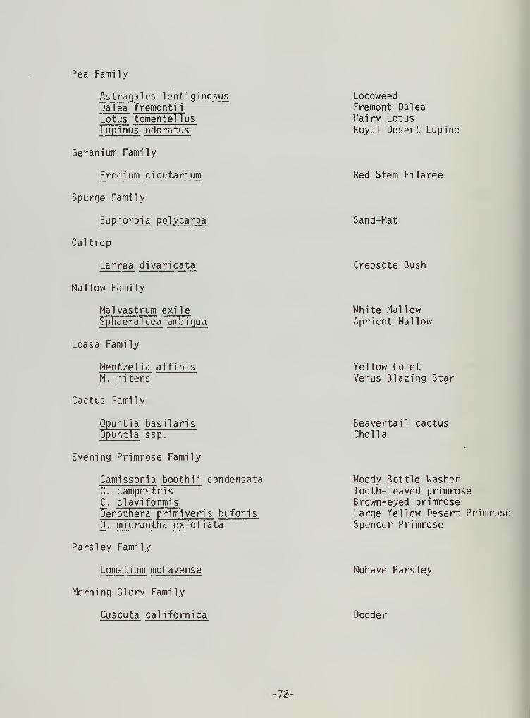
Pea Family
Astragalus lentiginosisDalea fremonti
i
Lotus tomentellusLupinus odoratus
Geranium Family
Erodium cicutarium
Spurge Family
Euphorbia polycarpa
Caltrop
Larrea divaricata
Mallow Family
Mai vastrum exi 1
e
Sphaeralcea ambigua
Loasa Family
Mentzel ia affinisM. nitens
Cactus Family
Opuntia basilarisOpuntia ssp.
Evening Primrose Family
Camissonia booth ii condensataC^. campestrisC^. claviformisOenothera primiveris bufonis
0^. micrantha exfol iata
Parsley Family
Lomatium mohavense
Morning Glory Family
Cuscuta californica
LocoweedFremont DaleaHairy LotusRoyal Desert Lupine
Red Stem Filaree
Sand-Mat
Creosote Bush
White MallowApricot Mallow
Yellow CometVenus Blazing Star
Beavertail cactusChoi la
Woody Bottle WasherTooth-leaved primroseBrown-eyed primroseLarge Yellow Desert PrimroseSpencer Primrose
Mohave Parsley
Dodder
72-

Phlox Family
Gilia latifloraLinanthus Parryae
Watherleaf Family
Phacel ia distans_P . fremonti i
Phacel ia rotundifol ia
Phol istoma membranaceumNama demissumEucrypta chrysanthemifol ia bipinnatifida
Mint Family
Salvia carduaceaSalvia columbariaeSalazaria mexicana
Compos itae
Stephanomera pauci flora
Borage Family
Amsinckia tessellataCryptantha circumscissaC. intermediaC_. pterocaryaPlagiobothrys arizonicus
Potatoe Family
Lye i urn andersoniiLycium cooperi
Figwort Family
Orthocarpus purpurascens ornatus
Sunflower Family
Brickellia argutaB_. desertorumHaplopappus cooperiAcamptopappus sphaerocephalusChrysothamnus teretifoliusC_. nauseosusMachaeranthera torti folia
Davy Gil ia
Parry Gilia
Wild HeliotropeFremont Phacel i
a
Round Leafed Phacel ia
Fiesta FlowerPurple MatTorrey Eucrypta
Thistle SageChi a
Paper Bag Bush
Checker FiddleneckWestern ForgetmenotScented ForgetmenotWing-nut ForgetmenotPop-corn Flower
Anderson ThornbushCooper's Thornbush
Mojave Owl Clover
Spear Leaved BrickelliaDesert BrickelliaCooper's GoldenburhGoldenheadTerete-leaved Rabbit BrushMojave RabbitbushMojave Aster
-73-

Ambrosia dumosaHymenoclea salsolaCoreopsis bigeloviiEriophyllum WallaceiEriophyllum ambiguumOhaenactis stevioides var. brachypappaTetradymia stenolepsisRafinesquia neo-mexicanaStephanomeria ssp.
Malacothrix coulteriMalacothrix glabrataGlyptopleura setulosaMonoptilon bell idi forme
Grass Family
Bromus tectorumStipa speciosaBromus rubensSchismus arabicus
BurrobushCheese Bush
Bigelow CoreopsisWallace EriophyllumYellow FrocksPincushionFelt ThornDesert ChicoryDesert StrawSnake's HeadDesert DandelionKeysiaDesert Star
Desert StipaIndian Rice GrassFoxtail BromeArabian Schismus
Crustose Lichens
Caloplaca ssp.
Acaraspora ssp.
Lecanora ssp.??????
Puff-ball
Tylostoma ssp.
Reddish-brown, rust colorYellow-green colorBlue-gray colorBlack lichens
Puff-ball
74-

Plants noted at area NE of Red Cinder Cone;3400' elevation, May 26, 1976
by Mary Ann Henry
Ephedra Family
Ephedra nevadensis
Agave Family
Yucca brevi folia
Buckwheat Family
Eriogonum nidulariumEriogonum gracillimumE_. pus ill urn
E_. inflatumE_. maculatumChorizanthe brevi cornuC. perfol iata
C. rigida
Pigweed Family
Atriplex confertifol ia
Gray i a spinosaErotia lanata
Four O'clock Family
Abronia pogonanthaMirabilis bigelovii
Poppy Family
Eschscholtzia mi nuti flora
Mustard Family
Dithyrea californicaLepidium flavum
Pea Family
Da lea fremontii
Mormon Tea
Joshua Tree
Lupinus odoratusAstragalus mohavenseA. lentiginosus
Slender-stem Buckwheat
Spine FlowerPunctured BractSpiny chorizanthe
ShadscaleSpiny Hop SageWinter Fat
Sand VerbenaWish Bone Bush
Little Gold Poppy
Spectacle Pod
Yellow Pepper Grass
Fremont DaleaRoyal Desert Lupine
Locoweed
-75-

Geranium Family
E rod i urn cicutarium
Spurge Family
Euphorbia albomarginata
Mallow Family
Mai vastrum exileSphaeralcea ambigua
Loasa Family
Mentzel ia affinisMentzelia nitens
Cactus Family
Opuntia ssp.
Evening Primrose Family
Camissonia campestrisCamissonia clavaeformis
£. booth ii condensataOenothera primiveris
Parsley Family
Lomatium mohavense
Morning Glory
Cuscuta cal ifornica
Milkweed Family
Asceplepias erosa
Phlox Family
Langloisia Matthews ii
Linanthus aureusEriastrum eremicaumGi 1 ia leptomaria
Waterleaf Family
Phacel ia fremonti i
Phacel ia distansNama demissum
Red Stem Filaree
Sand-Mat
White MallowApricot Mallow
Yellow CometVenus Blazing Star
Choi la
Brown Eyed PrimroseBottle WasherYellow Dune Primrose
Mohave Parsley
Dodder
Desert Milkweed
Desert CalicoGolden Gil i
a
Eriastrum
Fremont Phacel ia
Wild HeliotropePurple Mat
•76-

Mint Family
Salvia carduacea
Borage Family
Cryptantha circumscissaColdenia plicata
Potatoe Family
Lycium andersonii
Figwort Family
Orthocarpus purpuracens ornatus
Grass Family
Oryzopsis hymenoidesStipa speciosaBromus tectorumBromus rubensSchismus ssp.
Bell flower Family
Nemacladus rubescens
Sunflower Family
Eriophyllum wallaceiMalacoxbrix glabrataHymenoclea salsolaTetradymia stenolepisMonoptilon bellififormeHaplopappus cooperichaenactis fremonti i
C_. carphocliniaAmbrosia dumosaLayia glandulosaCoreopsis bigeloviiMachaeranthera tortifol ia
Stephanomera pauci floraS_. Parryi
Anisocoma acaulisGlyptopleura setulosaArtemesia spinescensAcamptopappus sphaerocephalus
Thistle Sage
Plicate Coldenia (pleated)
Anderson Thorn Bush(red Tomatoes)
Owl 's Clover
Indian Rice GrassDesert Stipa
Foxtail Brome
Thread Plant
Desert Star
Mojave AsterDesert StrawParry Rock Pink
Bud Sage BrushGoldenhead
-77-


Appendix 4
Due to the confidential nature of site location information, Appendix
4; site records, locations, and photographic documentation, has beendeleted from copies of this manuscript to be circulated outside theinternal offices of the Bureau of Land Management. Appendix 4 will bepermanently stored in the library facilities of the Bureau of LandManagement, Bakersfield District. Interested researchers are urgedto consult these when needed as this information, of course, will be
available to all qualified researchers.
Copies of site records will also be forwarded to the State of Californiafor assignment of permanent numbers and will be available from thisfacility as well
.
-78-


Literature Cited
Antevs, Ernst1925 On the Pleistocene History of the Great Basin. In Quaternary
Climates. Carnegie Institution of Washington PublicationNo. 352, pp. 51-114. Washington.
1937 Climate and Early Man in North America. In Early Man,George B. MacCurdy (ed.), pp. 125-132. J.B. LippincottCompany. Philadephia.
Austin, Carl F-. , Ward H. Austin Jr and G. W. Leonard1971 Geothermal Science and Technology, a National Program.
Naval Weapons Center, China Lake, California. Sept. 1971
Baumhoff, Martin A. and J. S. Bryne1959 Desert Side-Notched Points as a Time Marker in California.
Universtiy of California Archaeological Survey, Reports48:32-65.
Bedwell , Stephen F.
1970 Prehistory and Environment of the Pluvial Fort Rock LakeArea of South Central Oregon. Ph.D. Dissertation, Universityof Oregon, Eugene.
Bettinger, Robert L.
1975 The Surface Archaeology of Owens Valley, Eastern California,Prehistoric Man-Land Relationships in the Great Basin.
Unpublished Doctoral Dissertation. University of California,Riverside.
Bettinger, Robert and R. E. Taylor1974 Suggested Revisions in Archaeological Sequences of the
Great Basin in Interior Southern California. NevadaArchaeological Survey, Research Paper 5:1-26.
Binford, Lewis R.
1962 Archaeology as Anthropology. American Antiquity 28(2) :217-
225.
1964 A Consideration of Archaeological Research Design.
American Antiquity 29(4) :425-441
.
1965 Archaeological Systematics and the Study of CultureProcess. American Antiquity 31 (2) : 203-21 0.
1968a Archaeological Perspectives. In New Perspectives in
Archaeology, S. R. Binford and L. R. Binford, Eds.
Chicago: Aldine. pp. 5-32.
79-

1968b Some Comments on Historical versus Processual Archaeology.Southwestern Journal of Anthropology 24:267-275.
Blackwelder, E. and E. W. Ellsworth1936 Pleistocene Lakes of the Afton Basin, California.
American Journal of Science 31.
Campbell, Elizabeth W. C. et. al
1937 The Archaeology of Pleistocene Lake Mohave. SouthwestMuseum, Papers 11
.
Campbell, Elizabeth W. C. and William H. Campbell1935 The Pinto Basin Site. Southwest Museum, Papers 9.
Chalfant, W. A.
1922 The Story of Inyo. Bishop: Pinon Book Store
Chesterman, Charles W.
1956 Pumice, Pumicite, and Volcanic cinders in California.Bulletin 174. State of California Department of NaturalResources. Divison of Mines. San Francisco.
Coville, Frederick V.
1892 The Panamint Indians of California. American Anthropologist5:351-361.
Davis, Emma L.
1974 Paleo-Indian Land Use Patterns at China Lake, California.Pacific Coast Archaeological Society Quarterly 10:2.
1975 The "Exposed Archaeology" of China Lake, California.American Antiquity 40 (l):39-53.
Deetz , James F.
1970 Archaeology as a Social Science. Current Directions in
Anthropology 3(2):
"1 1 5-1 25.
Duffield, Wendell A.
1976 Struggle between Pleistocene Lava Flows and Owens Rivernear Little Lake, California. Manuscript on file BLM,Bakersfield District, Bakersfield, CA.
Duffield, Wendell A. and Charles R. Bacon1976 Preliminary Geological Map of the Coso Rhyolitic Domes
and Adjacent Areas, Inyo County, California. U. S.
Geological Survey Open File Map 76-238. Menlo Park.
Dutcher, B. H.
1893 Pinon Gathering Among the Panamint Indians. AmericanAnthropologist 6:377-380.
-80-

Farmer, Malcolm F.
1937 An Obsidian Quarry near Coso Hot Springs. MasterkeyVol. 11 No. 1 pp. 7-9.
Flannery, Kent V.
1967 Culture History vs. Cultural Process: A Debate in AmericanArchaeology. Scientific American 21 7(2) :1 19-1 22.
Frazer, H. T. , H.B.D. Wilson, and N. W. Hendry1943 Hot Springs Deposits of the Coso Mountains California.
Journal of Mines Geology. Vol. 28, pp. 223-242.
Goss, James A.
1968 Culture-Historical Inference from Utaztekan LinquisticEvidence. Idaho State Universtiy Museum, OccasionalPapers 22:1-42.
Grant, Campbell, James W. Baird and J. Kenneth Pringle1968 Rock Drawings of the Coso Range, Inyo County, California.
China Lake: Maturango Museum Publication 4.
Hale, Kenneth1958 Internal Diversity in Uto-Aztecan: I. International
Journal of American Linguistics 24(2) : 101 -1 07.
Hall, Mathew C. and James P. Barker, et.al.1975 Background to Prehistory of the El Paso/Red Mountain Desert
Region. Prepared for the United States, Department ofthe Interior, Bureau of Land Management (CaliforniaDesert Planning Program). Riverside, California.
Harrington, Mark R.
1933 Gypsum Cave, Nevada. Southwest Museum, Papers 8.
1948a A New Pinto Site. Southwest Museum, Masterkey 22 Vol.
4 pp. 116-118.
1948b America's Oldest Dwelling. Southwest Museum, Masterkey,Vol. 20 No. 5 pp. 148-52.
1949 A New Old House at Little Lake. Southwest Museum, Masterkey,Vol. 23 No. 5 pp. 135-6.
1950 Pinto man at Little Lake. Desert Magazine. Vol. 13 Mo.
11 pp. 22-4. Los Angeles.
1951a A Colossal Quarry. Southwest Museum, Masterkey, Vol. 25
No. 1 pp. 15-18 Los Angeles.
1951b Latest from Little Lake. Southwest Museum, Masterkey,Vol. 25 No. 6 pp. 188-91.
-81-

1952
1953
1957
The Fossil Falls Site. Southwest Museum, Masterkey,Vol. 26, pp. 191-195.
A Cave near Little Lake. Southwest Museum, MasterkeyVol. 27, pp. 77-82.
A Pinto Site at Little Lake, California,Museum, Papers 17.
Southwest
Heizer, Robert F. and Martin A. Baumhoff1961 Wagon Jack Shelter. In The Archaeology of Two Sites at
Eastgate, Churchill County, Nevada. University ofCalifornia, Anthropological Records 20(4) : 1 1 9-1 38.
Hester, Thomas R.
1973 Chronological Ordering of Great Basin Prehistory. Universityof California Archaeological Research Facility, Contributions17.
Hester, Thomas1973
R. and Robert F. HeizerReview and Discussion of Great Basin Projectile Points:Forms and Chronology. Berkeley: Archaeological ResearchFacility, Department of Anthropology, University ofCalifornia.
Hillebrand, Timothy S.
1972 The Archaeology of the Coso Locality of the NorthernMojave Region of California. Ph.D. Dissertation,University of California, Santa Barbara.
King T. F.
1975
King, T. J
1975
Kowta, Ma koto1969
Fifty years of Archaeology in the California Desert. An
Archaeological Overview of Joshua Tree National Monument.The Western Archaeological Center, National Park Service,Tucson, Arizona.
Late Pleistocene-Early Holocene History of ConiferousWoodlands in the Lucerne Valley Region, Mohave Desert,California. Paper presented to the Society for CaliforniaArchaeology at its Annual Meeting, Santa Cruz.
The Sayles Complex: A Late Milling Stone Assemblage fromCajon Pass and the Ecological Implications of its ScraperPlanes. University of California, Publications in
Anthropolgy 6.
Kroeber, Alfred L.
1925 Handbook of the Indians of California,Ethnology, Bulletin 78.
Bureau of American
82-

Lamb, Sydney M.
1958 Linguistic Prehistory in the Great Basin. InternationalJournal of American Linguistics 24(2) :95-100.
Lanning, Edward P.
1963 Archaeology of the Rose Spring Site, Iny-372University of California Press.
Berkeley:
Layton, T. N.
1970
Leone, Mark P
1972
McCown, B. E,
1957
Martin, P,
1964
High Rock Archaeology. An Interpretation of the Prehistoryof the Northwestern Great Basin. Unpublished Ph. D.
Dissertation, Harvard University, Cambridge.
Issues in Anthropological Archaeology. In ContemporaryArchaeology, M. P. Leone, Ed. Carbondale: SouthernIllinois University Press, pp. 14-27.
A Strange Cache in the Lava. Southwest Museum, MasterkeyVol. 31 No. 1 pp. 24-31 Los Angeles.
Pollen Analysis and the Full -Glacial Landscape. In theReconsturction of Past Environments. Fort Burgwin Re-
search Center Publication 3.
Mehringer,ND
Mortland,1974
J. and J. C. SheppardHolocene History of Little Lake, Mojave Desert, CaliforniaIn Press, Contributions to the Los Angeles County Museumof Natural History.
C. A.
Archaeological Impact Evaluation: Southern CaliforniaEdison Proposed Generating Station in Upper JohnsonValley and Associated Transmission, Gas and Fuel Routes.Manuscript. Archaeological Research Unit, University ofCalifornia at Riverside.
Nadeau, Remi
1965 The City Makers. Trans-Anglo Books. Los Angeles.
O'Connell , James F.
1971 The Archaeology and Cultural Ecology of Surprise Valley,Northeast California. Ph. D. Dissertation, University ofCalifornia, Berkeley.
Ore, H. T. and C. N. Warren1971 Late Pleistocene-Early Holocene Geomorphic History of
Lake Mohave, California. Geological Society of AmericanBulletin 82:2553-62.
Robertson, Dorothy1965 Little Lake's Big Fun. Desert Magazine Vol. 28 No. 6 dd
10-11.
-83-

Sabloff, Jeremy, and Gordon R. Willey1967 The Collapse of Maya Civilization in the Southern Low-
lands: a Consideration of History and Process. South-western Journal of Anthropology 23:311-36.
Simpson, Ruth D.
1949 The Plot Thickens at Little Lake. Masterkey Vol. 23 No.
1 p. 19.
Steward, Julian H.
1938 Basin-Plateau Aboriginal Sociopolitical Groups. Bureauof American Ethnology, Buletin 120.
Thomas, David H.
1970 Archaeology's Operational Imperative: Great Basin Pro-
jectile Points as a Test Case. University of CaliforniaArchaeological Survey Report, 1970 Vol. 12, pp 27-60.
Los Angeles.
Thompson, Raymond H.
1972 Interpretive Trends and Linear Models in American Archaeology.In Contemporary Archaeology, M. P. Leone, Ed. Carbondale:Southern Illinois University Press, pp. 34-38.
Wallace, William J.
1962 Prehistoric Cultural Development in the Southern CaliforniaDeserts. American Antiquity 28(2) : 172-180.
Warren, Claude N.
1967 The San Dieguito Complex: A Review and Hypothesis.American Antiquity 32(4) :168-185.
Warren, Claude N. and A. J. Ranere1968 Outside Danger Cave: A View of Early Man in the Great
Basin. Eastern New Mexico University, Contributions in
Anthropology 1(4):6-18.
Warren, Claude N. and Delbert L. True
1961 The San Dieguito Complex and Its Place in CaliforniaPrehistory. University of California ArcaheologicalSurvey, Annual Report 1960-61:246-338.
Watson, Patty J, Steven A. LeBlanc and Charles L. Redman1971 Explanation in Archaeology, An Explicity Scientific
Approach. Columbia University Press. New York.
Wells, P. V. and R. Berger1967 Pleistocene History of Coniferous Woodland in the Mohave
Desert. Science 155:1640-1647.
Wells, P. V. and C. D. Jorgensen1964 Pleistocene Woodrat Middens and Climatic Change in the
Mojave Desert - Record of Juniper Woodlands. Science143:1171-74.
-84-

Bureau of Land ManagementLibrary
Sidg. 50f Denver Federal Center
9§nver, CO 80225


