Abstract The main purpose of this research was to intro-duce a method for planning forest road network by combininggeographical information system (GIS) and analytic hierar-chy process (AHP) in a form that environmental factors suchas ground stability were incorporated in the planning process.After collection of data and building the necessary maps ofstudy area, the effective factors in forest road allocation wereidentified and forest potential to road construction was deter-mined and classified. After that, the maps of slope, volumeper hectare, aspect, altitude, forest type, and ground stabilitywere prepared. In the next step, concerning the importanceand the role of the mentioned elements in the road construc-tion cost, prepared maps were rated using AHP to determinethe weight of both the effective factors and their categories.Then, forest potential map of road construction was preparedby overlaying the weighted maps of the mentioned factors.The later map was categorized to three classes including high,moderate and low capability. The results of this study showedthat about 88 % of the proposed roads were located in theregions with high and moderate road construction capability;as well, it provided an accessibility of 80 % for the plan area.Results also showed that using of a GIS–AHP method couldimprove the accessibility to the district and could ensure thatrouts will pass from stable regions. The introduced methodcan be used as a useful method for planning of forest roadnetwork in mountain areas.
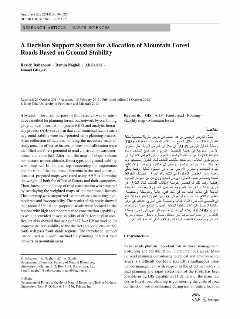
R. Babapour · R. Naghdi (B) · A. SalehiDepartment of Forestry, Faculty of Natural Resources,University of Guilan, P. O. Box 1144, Somehsara, Irane-mail: [email protected]; [email protected]
I. GhajarDepartment of Forestry, Faculty of Natural Resources, Tarbiat ModaresUniversity, Noor, P. O. Box 64414-356, Tehran, Iran
Forest roads play an important role in forest management,protection and rehabilitation in mountainous areas. Man-ual road planning considering technical and environmentalissues is a difficult job. More recently, simultaneous infor-mation management with respect to the effective factors inroad planning and rapid assessment of the roads has beenpossible using GIS capabilities [1,2]. One of the main fac-tors in forest road planning is considering the costs of roadconstruction and maintenance during initial route allocation
123
200 Arab J Sci Eng (2014) 39:199–205
in the field. There is a close relationship between the costs ofroad construction and maintenance and stability characteris-tics (soil and bedrock stability), it is necessary to locate theroads on more stable grounds to reduce the total cost of roadconstruction and maintenance.
As a convention “passing the roads through low to mod-erate slopes and areas with a high level of ground stability,reduces the costs of excavation, earth filling, land stabiliza-tion, excavation gable roofs and earth filling, and thus reducesconstruction costs” [3]. Many attempts have been made touse GIS in the road planning process [2,4–6]. GIS presentedthe different functions in the previous researches; however, inmany of them, it has been used to include the effective factorsin environmental impact assessment resulted from construc-tion of any potential variant. Gumus [7] applied the AHP [8]to rate and classify 13 effective factors in evaluation of theforest roads. In the other recent studies, technical issues androad geometric principles have been considered in combina-tion with other factors in the selection optimal forest roadsincluding slope, aspect, soil, volume of trees per hectare aswell as ecological considerations using GIS [9–13].
Rogers [14] developed the Pegger software to assist in ini-tial road planning by automating the road pegging process.Pegger is a powerful tool for rapid analyzing of various roadalternatives; and acts based on the percentage of road grade,which is determined by the planner. Using pegger, many alter-natives can be quickly analyzed for alignment, slope stability,grades and construction cost using standard GIS functionally[13]. Ahmadi et al. [15] evaluated some factors, includinggeology, erosion, soil (soil texture and grading), slope, landuse, water streams, faults and altitude based on question-naires and in a relative manner.
The results of Zaitchik and Van ES [16] demonstrated theimportance of slope stability and choosing the safe and sta-ble regions for locating the road. Session et al. [17] haveexamined the effects of slope stability on choosing of roadnetwork by using GIS and stated that regions with averageslope-areas and camber-form areas are more stable. Musaand Mohamed [18] implemented the forest road planningusing GIS. They compared the GIS-based road planning toother methods, including field based; office based planning,and the best road’s analysis for a forest road network. Hos-seini [19] in mountain forest in the north of Iran showed thatthe road network designed using GIS was more suitable andbetter than the existing road network based on the accessi-bility, skidding distances, environmental damages, costs ofconstruction and excavation.
1.1 Research Problem
The major motivation towards the problem studied in thisresearch is to present a simplified approach for forest roadplanning mainly focus on the terrain stability. In fact, the
main goal of the study is to evaluate if the terrain stabilityestimation could result in a more reliable forest roads. Asa rule in executive branches of forest management in Iran,the assigned maintenance cost for forest road networks isequal to 0.2 of its construction cost per period (10 years). Toreduce this heavy cost generating the useful frameworks andapproaches, which help forest managers to plan forest roadsin stable areas are needed. Heralt [20] mentioned that thecriteria of costs, local distribution of existing forest roads,hydrology, soil properties, and landscape pattern must betaken into road network design when developing a road net-work. Since the forest road planning is a multi-criteria prob-lem, a decision support system is very helpful to solve it.In this regard, application of Analytical Hierarchy Process(AHP) in GIS environment provides the possibility of com-bination and merging of different types of information withdifferent scales. Manual performance of such analysis notonly is very difficult but also is required to spend much time.Unlike the manual road planning, AHP makes it possible touse the ideas of different experts and calculating incompati-bility coefficient as well as using quantitative and qualitativecriteria. The accurate choice of the characteristics and theirweights is the main case in AHP method that the accuracy ofthe results mostly depends on them.
The present study has taken into consideration various fac-tors, including the slope, soil type and texture, and soil stabil-ity conditions using AHP to present a GIS–AHP method forplanning of the forest road network in northern mountainousforests of Iran and to compare the result of this approach withthe existing road network.
2 Materials and Methods
The study was carried out in a mountain temperate forestdistrict covering approximately 1,742 ha of Guilan province-northern Iran. The area is located between 48◦44′36′′–48◦49′58′′ of Longitude, and 37◦37′23′′–37◦42′31′′ of lat-itude. The altitude ranges between 250 and 1,150 m abovesea level.
Ground skidding systems, cut-to-length and tree-lengthmethods are respectively the dominant system and methodsof harvesting and accounts for approximately 60 % of thesemountainous uneven aged hardwood forests since machinerywas first introduced to forest management in Iran. Timberjack 450c, HSM 904, Zetor and Taf E655 are the popularskidders used in the Caspian forests. The animal skiddingsystem is common in the steep terrain, where machinery is noteconomically viable and skid road planning or constructionis not practical.
Regarding to dominant harvesting system in the studyarea, the important factors in road construction, which shouldbe considered in the planning phase, include slope and
123
Arab J Sci Eng (2014) 39:199–205 201
aspect. In addition, the factors concerning the ground sta-bility mainly include factors such as slope, altitude, aspect,soil texture, and bedrock. Land classification based on thesoil stability and considering it for road planning in order tomaximize road coverage (appropriate road density) on themost stable soils requires mapping the associated attributes.Thus, the mentioned factors were mapped using Arc GIS ver.9.3 and were used in road network planning of the district.To plan routes based on the soil stability and considering thetechnical and economic principles, the following procedureswere carried out:
– Identifying the effective factors in the planning of forestroad network and preparing the ground stability map.
– Rating the effective factors using AHP method to producethe map of forest potential to road construction (FPRC).
– Planning the forest road variants.– Comparing and evaluating different road variants and
then choosing the most appropriate forest road network.
2.1 Identifying the Effective Factors and Preparingthe Ground Stability Map
The efficacious factors, which could be considered for pro-ducing FPRC and ground stability maps, were specified byfield trips and the study of existing maps. Then using DigitalElevation Model (DEM), the map corresponding to each ofdesired factors was produced. Using of DEM, the classifiedslope, aspect, and elevation maps were produced. The mapsof forest type and volume of stand per hectare were preparedbased on the inventory data.
To produce soil texture and bedrock maps, informationrelated to landform was needed, which was provided by over-lapping the maps of slope, aspect and altitude of the studyarea. In each landform unit, soil texture and petrography ofbedrock were studied by digging of soil profile and sam-pling of bedrock, respectively. Soil texture was determined bythe Bouyoucos hydrometer method [21] and petrography ofeach rock sample was distinguished by supplying of thin sec-tion from each sample and using of polarizing microscope.Therefore, the soil texture and as well the bedrock maps wereyielded after transferring the soil texture and bedrock results
in each type of landform units to the same units. In this study,Nilsen method [22] was used for producing the ground sta-bility map of study area. This method is based on slope andbedrock maps. The slope map was supplied in three classesincluding <5, 5–15 and >15 %. By overlaying of soil textureand bedrock maps, the ground stability map was prepared.
2.2 Rating Effective Factors
In the next step, concerning the importance of their cate-gories, prepared map with regard to mentioned affecting fac-tors, using of Analytical Hierarchy Process, maps were ratingto determine their weight.
The analytic hierarchy process (AHP), as a powerful econ-omy of thought, brings all the factors together in a hierar-chical decomposition of the system, with the objectives andfunctions represented in the higher levels, and structure rep-resented in the lower levels [8]. AHP assigned and developedpriorities for alternatives, and the criteria used to judge thealternatives. The criteria are usually measured on differentscales that cannot be directly integrated. The AHP is basi-cally designed to (i) set priorities for the elements in eachlevel of the hierarchy according to their impact on the crite-ria or objectives of the next higher level; (ii) structural multi-person, multi-criteria, and multi-period problems with uncer-tainty and risk hierarchically [23]. To apply AHP method, thequestionnaire was used to ask the forest engineering expertsto obtain the relative weight for each criterion. Each question-naire included the questions regarding the importance andpreference of each factor influencing on road planning underthe stable conditions of the ground. The collected data wereanalyzed using AHP method by Expert Choice software.
By overlaying the weighted maps of affecting factors(Table 1) of initial route location within GIS framework, thefinal map of forest potential for road construction (FPRC)was prepared. The various input layers are presented in Fig. 1.
2.3 Planning the Forest Road Variants
Route location projected automatically using Pegger pro-gram [13] within GIS framework. To do this, FPRC and
Table 1 Input factors for generation of the FPRC map
Fig. 1 GIS layers used to determine forest potential for road construc-tion
hydrographic maps were considered together. Totally, 18 dif-ferent variants were planned, and the best one were chosen forcomparison with the existing road variant. Since the ground-based skidding system in combination with animal skiddingsystem are supposed for the study area, as a rule of thumb inthis level of road planning, a road space about 800–1,000 mis tried to be considered by the experts which will result inabout 12 m/ha road density. This density is a general goal inthe expert manual road planning with respect to efficiency ofharvesting system in practice, not based on an optimizationprocess. To compare the existing road network and the GIS-based network, the percentage of their crossing from stableareas due to the stability map was used as the judgment cri-terion.
2.4 Comparison and Evaluation of Road Variants
In this step, the map of both existing and planned forest roadsnetwork were overlapped with FPRC map and percentageof passage of each variant (i.e., existing and GIS proposedvariants) through the five potential classes of stability wascalculated. The classes were namely high, moderate to high,moderate, low, and very low. Therefore, a road network thatwould have passed through very good, good and mediumpotential classes was environmentally creditable. To deter-mine the significant difference between both existing andplanned forest road network in terms of passing the classesof FPRC map, chi-square test was used. So, on the map ofboth existing and planned forest road networks 30 points in1cm systematic spacing were specified randomly. Then thesepoints were located on the ground using GPS and the data cor-responding to all layers were recorded concerning the valuesin each layer. Therefore, with the use of these data, the poten-tial of each location was determined for road construction.The degree of accessibility of both variants were computedby Backmund’s method [24]. Evaluation of road variants inthis method is based on a theoretical skidding distance fromroad. Road density was calculated by following formula:
RD = L/T (m/ha)
where RD is road density, L is total length of the variant, andT is total utilizable area. Average distance between parallelroads was calculated by
RS = 10,000/RD(m)
which RS is the road spacing. The maximum skidding dis-tance for hypothesized roads is the half of RS. Therefore, thecovered (opened) area and its accessibility for supposed roadvariant were calculated as follows respectively:
C = RS × LA = C/T × 100
3 Results
From the viewpoint of slope, 74 % of the region has the slopeof less than 70 %, so the road planning could be performedat a high assurance. The results of present procedure in map-ping the terrain stability showed that 1,015 ha (54 % of thetotal area) were covered by stable areas. By overlaying ofslope and bedrock maps, the stability map was produced infive classes. These classes were included high stability, mod-erate to high stability, moderate stability, and low stabilityand unstable (Fig. 2). The results of pairwise comparisonsof incorporated criteria in the planning process are shown inthe Fig. 3.
Fig. 2 The ground stability map of study area
Fig. 3 Weighting of the criteria for forest road planning (InconsistencyRatio = 0.09)
123
Arab J Sci Eng (2014) 39:199–205 203
Fig. 4 Location of planned and existing roads network on forest poten-tial to road construction map
By overlaying weighted maps of affecting factors (slope,stability, stand volume (m3/ha), aspect, altitude and foresttype) the map of forest potential for road construction wasproduced. The later map showed three classes included: high,moderate, and low road construction compatibility (Fig. 4).
This figure also shows that planned road covers the highpotential areas for road construction. The results of compar-ison of the planned and the existing road networks concern-ing effective parameters in planning forest road network areshown in the Table 2.
The results of chi-square test showed that there was signif-icant differences between existing and planned forest roadsnetwork in terms of passing different classes of forest poten-tial to road construction (P = 0.0012, α < 0.05).
4 Discussion
The slope evaluation results showed that the study area gen-erally had a suitable condition for road planning. Similarly,the ground stability map provides the possibility of road plan-ning with a desired stability.
The result from valuating factors with 0.09 incompatibil-ity coefficients showed that the terrain slope and the ground
stability by having the greatest coefficients had the highestimportance in the forest road planning. The type of tree withsmallest coefficient had the lowest importance on road plan-ning (Fig. 3). As shown in Fig. 4, planned road network over-lays some sections of the existing roads. With the presentprocedure, the roads were planned in the regions with highaccessibility and stable ground. According to the results,the planned road network was located on the stable areamore than the existing network. More passing the high andmoderate classes of FPRC mapand alsohigher accessibilityof proposed network could lead to more efficiency and netprofit of the roads. Passing more on the stable regions andbasalt bedrock could mean less failure along the proposedroads. Sandy soils are very suitable road location due to theirappropriate drainage conditions. From this point of view, theplanned network had more preference than the existing net-work too. The results shown in the Table 2 and chi-squaretest indicated that the road planner could expect to reducethe construction and maintenance cost of forest road net-work significantly by applying the procedure proposed inthe research.
The results of accessibilityaccessibility and the length ofthe two evaluated variants shows that the planned road net-work is economically superior to existing roads network,because it achieved the 80 % acceptable accessibility withless road length (Table 2). Therefore, the cost in wood trans-portation is expected to remain approximately constant [25].Hosseini et al. [26] indicated that GIS-based layout of for-est road network decreased the length of skid trails whichdecreased the cost of primary transportation. Results alsoshowed that the existing road network is disadvantaged interms of the environmental parameters compared to plannedroad network. Musa and Mohamed [17] showed that appli-cation of GIS in the analysis of forest roads path leads to anefficient forest road placement and provides a helpful toolfor forest managers.
Using a GIS in designing and evaluating the forest roadvariants is very efficient [27]. It causes first, the simplicity ofusing AHP method and second, it can be a good help in com-puting and analyzing and is proposed as a good method in
Table 2 Comparison of planned and existing roads network concerning effective parameters in planning forest roads network
Estimated parameters Existing roadsnetwork
GIS plannedroads network
Length of roads (km) 52 35.9
Road density (m/ha) 29.4 20.3
Percentage of roads length that are located in regions with high andmoderate forest potential to road construction (%)
76 88
Percentage of roads length that are located in high stability regions (%) 37 48
Percentage of roads length that are located in regions with tuff and basalt bedrock (%) 57 67
Percentage of roads length that are located in regions with the ground slope of <45 % (%) 49 52
Accessibility for the harvesting planning area (Accessible areas for harvesting)/total areas*100 (%) 80 80
123
204 Arab J Sci Eng (2014) 39:199–205
forest road network allocation. Raafatnia et al. [28] showedthat the feasible road network for interested land use suchas tourism and forest areas could be planned using of GIS.One of the points, which have been considered in the presentresearch, was considering allowable slopesof forest roads(maximum longitudinal slope of 8 % and locating in more sta-ble terrains). According to Kunwoo’s studies [3] in the moun-tainous forest roads, routing from low-slopes will causes adecrease in excavation and creating smaller trenches result-ing in diminishing the costs. In this study, it has been triedthat planning of forest roads would be done by following thepermissible slopes and optimum accessibility for appropri-ate covering forest in the areas with high potential and valuesimilar to the studies of Audery [29] and Tan [5].
5 Conclusions
The implementation of a Decision Support Systemwas foundto be very helpful in engineering problems in natural resourcemanagement. The principle of the presented approach forforest road planning is to pay attention to soil and bedrockcharacteristics, stock volume per hectare, forest type, slope,aspect, and altitude simultaneously. The obtained results con-firm that a combined use of AHP and GIS could efficientlyhelp the planers to improve the layout of forest roads in termsof the accessibility and passing the stable and rich areas. Itmakes possible to plan a network with less road density andthe same accessibility. This study has considered only a sin-gle road planning using AHP–GIS based method;however,the next research can combines the present approach withoptimization techniques such as network analysis to opti-mize the road spacing using a heuristic and locate the bestplace for the single roads.
References
1. Pentek, T.; Picman, D.; Potocnik, I.; Dvorscak, P.; Nevecerel, H.:Analysis of an existing forest road network. Croat. J. For. Eng.26(1), 39–50 (2005)
2. Gumus, S.; Hulusi Acar, H.; Toksoy, D.: Functional forest road net-work planning by consideration of environmental impact assess-ment for wood harvesting. Environ. Monit. Assess. 8 pp (2007)
3. Kunwoo, C.: Studies on forest road construction in mountain for-est, Kangwoon national university. Res. Bul. Exp. F. 16, 109–131(1990)
4. Dean, J.D.: Finding optimal routes for networks of harvest siteaccess roads using GIS_based techniques. Can. J. F. Res. 27,11–22 (1997)
5. Tan, J.: Locating forest roads by a special and heuristic procedure,using GIS and linear programming. ITC J. 2, 172–177 (1999)
6. Najafi, A.; Sobhani, H.; Saeed, A.; Makhdum, M.; Mohajer, M.M.:Planning and assessment and skidding networks. Croati. J. F. Eng.29(1), 63–73 (2008)
7. Gumus, S.: Constitution of the forest road evaluation form for Turk-ish forestry. Afr. J. Biotechnol. 8(20), 5389–5394 (2009)
8. Saaty, T.L.: The Analytical Hierarchy Process. McGraw-Hill Inc,New York (1980)
9. Ariel, E.; Lugo, H.G.: Function, effects, and management of forestroads, appropriately. For. Ecol. Manag. 133, 249–262 (2000)
10. Akay, A.E.; Karas, I.R.; Sessions, J.; Yuksel, A.; Bozali, N.;Gundogan, R.: Using high-resolution digital elevation model forcomputer-aided forest road design. Geo-Imagery Bridging Conti-nents, Istanbul, Turkey. The International Society for Photogram-metry and Remote Sensing (2004)
11. Akay, A.E.; Sessions, J.: Applying the decision support system,TRACER, to forest road design. West. J. Appl. For. 20(3), 184–191 (2005)
12. Aruga, K.; Sessions, J.; Miyata, E.S.: Forest road design with soilsediment evaluation using a high-resolution DEM. J. For. Res.10(6), 471–479 (2005)
13. Stuckelberger, J.A.; Heinimann, H.R.; Chung, W.: Improved roadnetwork design models with the consideration of various link pat-terns and road design elements. Can. J. For. Res. 37(11), 2281–2298(2007)
14. Rogers, W.L.: Automating Contour Based Route Projection for Pre-liminary Forestry. Road Design, Using GIS. MSc. Thesis, Wash-ington State University, Collage of Forest Resources, 59 pp (2005)
15. Ahmadi, H.; Darvishsafat, A.; Makhdom, M.; Abolghasemi, S.:Designing of road based on environmental issues using GIS. In:Proceedings of the Geomathic congress, Tehran, Iran, 8 pp (2005)
16. Zaitchik, B.F.; Van E, H.M.: Applying a GIS slope-stability model,site-specific landslide prevention in Honduras. J. Soil Water Con-serv 58(1), 45–53 (2003)
17. Sessions, J.; Wing, A.; Coulter, E.D.: Developing a decision supportsystem to improve transportation. Silva Fennica 40(1), 143–160(2001)
18. Musa, M.K.; Mohamed, A.N.: Alignment locating forest road net-work by best-path modeling method, In: proceedings of 23rd Asianconference on remote sensing, Nepal, 6 pp (2002)
19. Hosseini, S.A.: Planning of Forest Roads Network Using GIS, Khi-roudkenar Forest. Ph.D. thesis, TarbiatModares University, Tehran,Iran, 145 pp (2003)
20. Heralt, L.: Using the road system to design an optimum forest roadvariant aimed at the minimization of negative impacts on the naturalenvironment. J. For. Sci 48(8), 361–365 (2002)
21. Memarian, H.: Engineering Geology and Geotechnics. Tehran Uni-versity Press, Tehran, Iran (1994)
22. Bouyoucos, G.J.: Hydrometer method improved for making parti-cle size analysis of soils. Agron. J. 56, 464–465 (1962)
23. Nilsen, T.H.; Wright, R.H.; Vlasic, T.C.; Spangle, W.E.: Relativeslope stability and land-use planning in the San Francisco Bayregion, California. U.S. Geological Survey Professional Paper 944,96 pp (1979)
24. Shiba, M.: Analytic hierarchy process (AHP)—based multi-attribute benefit structure analysis of road network systems inmountainous rural areas of Japan. J. For. Eng. 7, 41–50 (1995)
25. Backmund, F.: Indices for the degree of accessibility of forest dis-tricts via roads. Schweizerishe, ZeitschriftFuerForstwesen (SZF)119(11), 445–452 (1968)
26. Murat, D.; Tolga, O.: A research on forest road planning and pro-jecting by inroads software in a region of Turkey. Am. J. Appl. Sci.1(4), 295–301 (2004)
27. Hosseini, S.A.; Mazrae, M.R.; Lotfalian, M.; Parsakhoo, A.:Designing an optimal forest road network by consideration of envi-ronmental impacts in GIS. 20(1), 58–66 (2012)
28. Majnounian, B.; Abdi, E.; Darvishsefat, A.A.: Planning and tech-nical evaluating of forest road networks from accessibility point ofview using GIS (Case study: Namkhane district, Kheyroud forest).Iran. J. Nat. Res. 60(3), 907–919 (2007)
123
Arab J Sci Eng (2014) 39:199–205 205
29. Raafatnia, N.; Abdi, O.; Shataee, S.: Determining proper methodof preliminary forecasting of mountain and forest roads using GIS.Iran. J. For. Poplar Res. 14(3), 244–257 (2006)
30. Audrey, M.M.: Development of Environmental Routing Strategiesfor the Management of Forest Access Roads using GIS and GPS.PhD thesis, National University of Ireland, Dublin, 74 pp (2001)