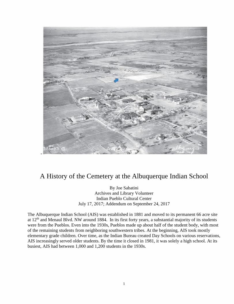
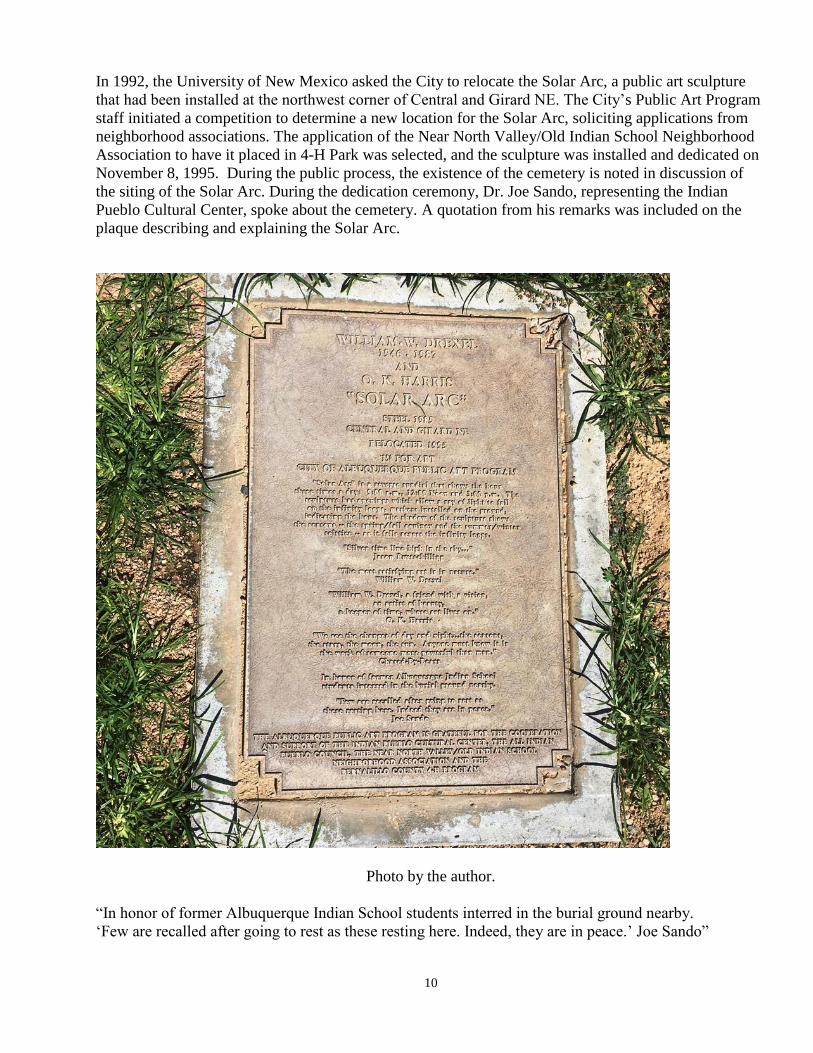
1 - A History of the Cemetery at the Albuquerque Indian School By Joe Sabatini Archives and Library Volunteer Indian Pueblo Cultural Center July 17, 2017; Addendum on September 24, 2017 The Albuquerque Indian School (AIS) was established in 1881 and moved to its permanent 66 acre site at 12 th and Menaul Blvd. NW around 1884. In its first forty years, a substantial majority of its students were from the Pueblos. Even into the 1930s, Pueblos made up about half of the student body, with most of the remaining students from neighboring southwestern tribes. At the beginning, AIS took mostly elementary grade children. Over time, as the Indian Bureau created Day Schools on various reservations, AIS increasingly served older students. By the time it closed in 1981, it was solely a high school. At its busiest, AIS had between 1,000 and 1,200 students in the 1930s.
Transcript
1
-
A History of the Cemetery at the Albuquerque Indian School
By Joe Sabatini
Archives and Library Volunteer
Indian Pueblo Cultural Center
July 17, 2017; Addendum on September 24, 2017
The Albuquerque Indian School (AIS) was established in 1881 and moved to its permanent 66 acre site
at 12th and Menaul Blvd. NW around 1884. In its first forty years, a substantial majority of its students
were from the Pueblos. Even into the 1930s, Pueblos made up about half of the student body, with most
of the remaining students from neighboring southwestern tribes. At the beginning, AIS took mostly
elementary grade children. Over time, as the Indian Bureau created Day Schools on various reservations,
AIS increasingly served older students. By the time it closed in 1981, it was solely a high school. At its
busiest, AIS had between 1,000 and 1,200 students in the 1930s.
2
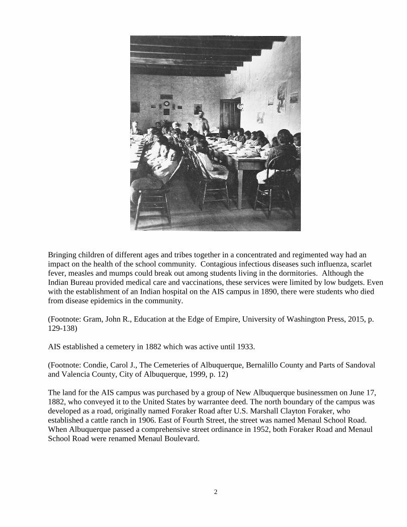
Bringing children of different ages and tribes together in a concentrated and regimented way had an
impact on the health of the school community. Contagious infectious diseases such influenza, scarlet
fever, measles and mumps could break out among students living in the dormitories. Although the
Indian Bureau provided medical care and vaccinations, these services were limited by low budgets. Even
with the establishment of an Indian hospital on the AIS campus in 1890, there were students who died
from disease epidemics in the community.
(Footnote: Gram, John R., Education at the Edge of Empire, University of Washington Press, 2015, p.
129-138)
AIS established a cemetery in 1882 which was active until 1933.
(Footnote: Condie, Carol J., The Cemeteries of Albuquerque, Bernalillo County and Parts of Sandoval
and Valencia County, City of Albuquerque, 1999, p. 12)
The land for the AIS campus was purchased by a group of New Albuquerque businessmen on June 17,
1882, who conveyed it to the United States by warrantee deed. The north boundary of the campus was
developed as a road, originally named Foraker Road after U.S. Marshall Clayton Foraker, who
established a cattle ranch in 1906. East of Fourth Street, the street was named Menaul School Road.
When Albuquerque passed a comprehensive street ordinance in 1952, both Foraker Road and Menaul
School Road were renamed Menaul Boulevard.
3
4
5
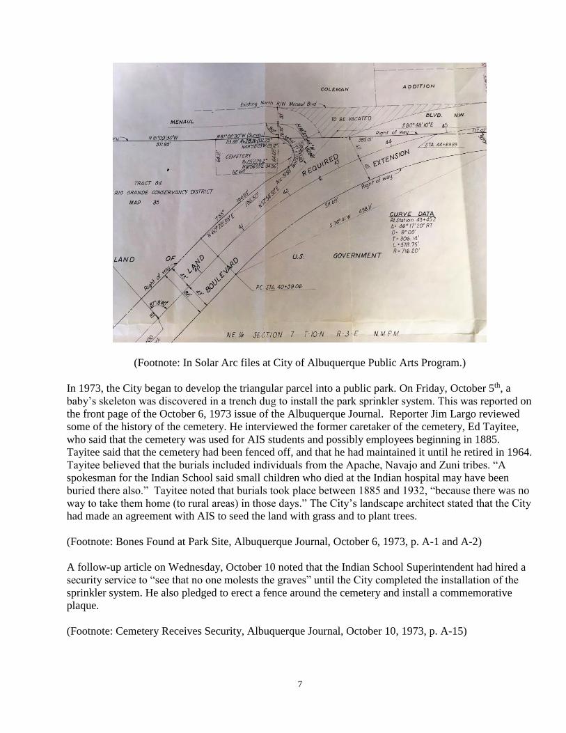
(Footnote: State of New Mexico Property Map, Middle Rio Grande Conservancy District Bernalillo
County Maps 035 and 036, 1927. In MRGCD Historical Archives)
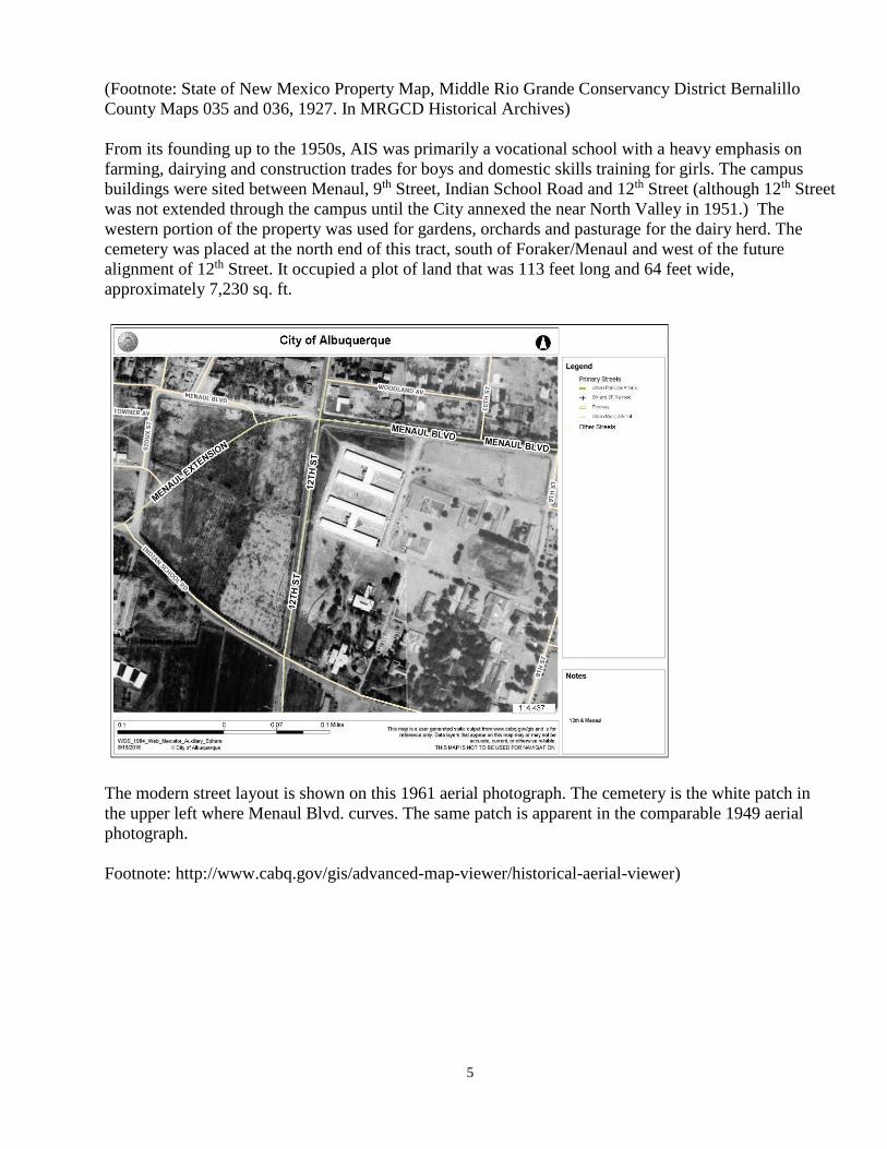
From its founding up to the 1950s, AIS was primarily a vocational school with a heavy emphasis on
farming, dairying and construction trades for boys and domestic skills training for girls. The campus
buildings were sited between Menaul, 9th Street, Indian School Road and 12th Street (although 12th Street
was not extended through the campus until the City annexed the near North Valley in 1951.) The
western portion of the property was used for gardens, orchards and pasturage for the dairy herd. The
cemetery was placed at the north end of this tract, south of Foraker/Menaul and west of the future
alignment of 12th Street. It occupied a plot of land that was 113 feet long and 64 feet wide,
approximately 7,230 sq. ft.
The modern street layout is shown on this 1961 aerial photograph. The cemetery is the white patch in
the upper left where Menaul Blvd. curves. The same patch is apparent in the comparable 1949 aerial