26

Dear Friends:
When ESRI was founded in 1969, we felt an almost limitless enthusiasm for the possibilities
of geographic information system (GIS) technology. We understood even then that this new
GIS technology could bring about a better future.
Our confidence in GIS is built on the belief that geography matters. It fundamentally
influences and connects our many cultures, societies, and ways of life. In this brochure, you
will find abundant evidence of the important contributions that GIS technology can make in
improving our quality of life and supporting more analytical decision making.
Our technology helps route emergency vehicles, find promising sites for fast-growing
companies, target markets for commerce, rebuild cities around the world, study behavioral
habits of wildlife species, monitor optimal land use planning, locate outages for utilities, and
perform countless other vital tasks every day.
GIS technology must constantly evolve to meet the changing needs of government, business,
natural resources, conservation, science, and education. We are ready for these changes.
Today, ESRI has more than 2,750 skilled employees worldwide who work with hundreds of
business partners and tens of thousands of users. Each one makes a unique contribution to
this remarkable technology. Each one makes a difference.
Thank you for taking the time to learn about our company. Hopefully, the stories you read in
this brochure will inspire you to consider joining the community of GIS users who use their
skills for creating a better world.
Warm regards,
Jack Dangermond
A Message From Our President
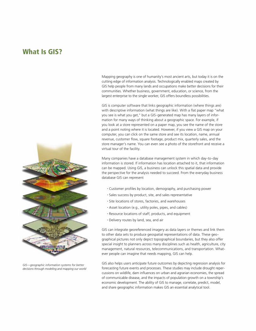
Mapping geography is one of humanity’s most ancient arts, but today it is on the cutting edge of information analysis. Technologically enabled maps created by GIS help people from many lands and occupations make better decisions for their communities. Whether business, government, education, or science, from the largest enterprise to the single worker, GIS offers boundless possibilities.
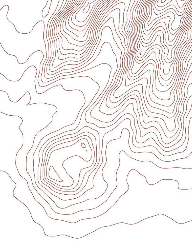
GIS is computer software that links geographic information (where things are) with descriptive information (what things are like). With a flat paper map “what you see is what you get,” but a GIS-generated map has many layers of infor-mation for many ways of thinking about a geographic space. For example, if you look at a store represented on a paper map, you see the name of the store and a point noting where it is located. However, if you view a GIS map on your computer, you can click on the same store and see its location, name, annual revenue, customer flow, square footage, product mix, quarterly sales, and the store manager’s name. You can even see a photo of the storefront and receive a virtual tour of the facility.
Many companies have a database management system in which day-to-day information is stored. If information has location attached to it, that information can be mapped. Using GIS, a business can unlock this spatial data and provide the perspective for the analysis needed to succeed. From the everyday business database GIS can represent
• Customer profiles by location, demography, and purchasing power
• Sales success by product, site, and sales representative
• Site locations of stores, factories, and warehouses
• Asset location (e.g., utility poles, pipes, and cables)
• Resource locations of staff, products, and equipment
• Delivery routes by land, sea, and air
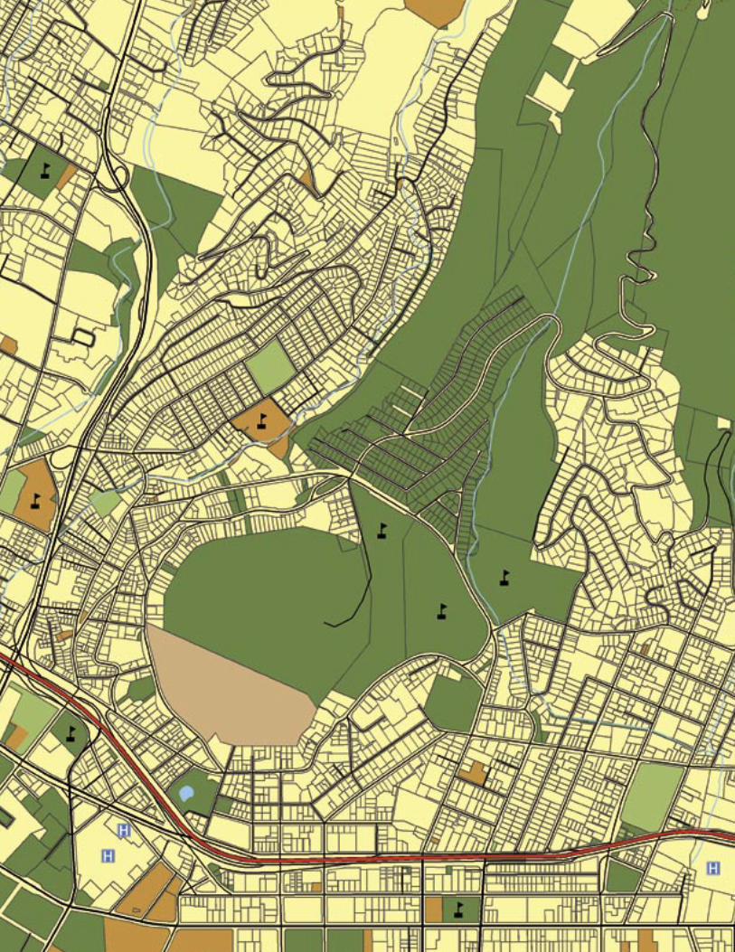
GIS can integrate georeferenced imagery as data layers or themes and link them to other data sets to produce geospatial representations of data. These geo-graphical pictures not only depict topographical boundaries, but they also offer special insight to planners across many disciplines such as health, agriculture, city management, natural resources, telecommunications, and transportation. What-ever people can imagine that needs mapping, GIS can help.
GIS also helps users anticipate future outcomes by depicting regression analysis for forecasting future events and processes. These studies may include drought reper-cussions on wildlife, dam influences on urban and agrarian economies, the spread of communicable disease, and the impacts of population growth on a township’s economic development. The ability of GIS to manage, correlate, predict, model, and share geographic information makes GIS an essential analytical tool.
What Is GIS?
GIS—geographic information systems for better decisions through modeling and mapping our world
GIS for a Better World
National, State, and Local Government
Employed by decision makers in a multitude of industries in thousands of ways, GIS software allows its users to intelligently manage and manipulate their data. Analysts can see the patterns and processes of projects that work and do not work. Policy makers are in a position to create the foundation for ensuring the longevity of thriving communities, commerce, and government as well as the longevity of the earth’s resources.
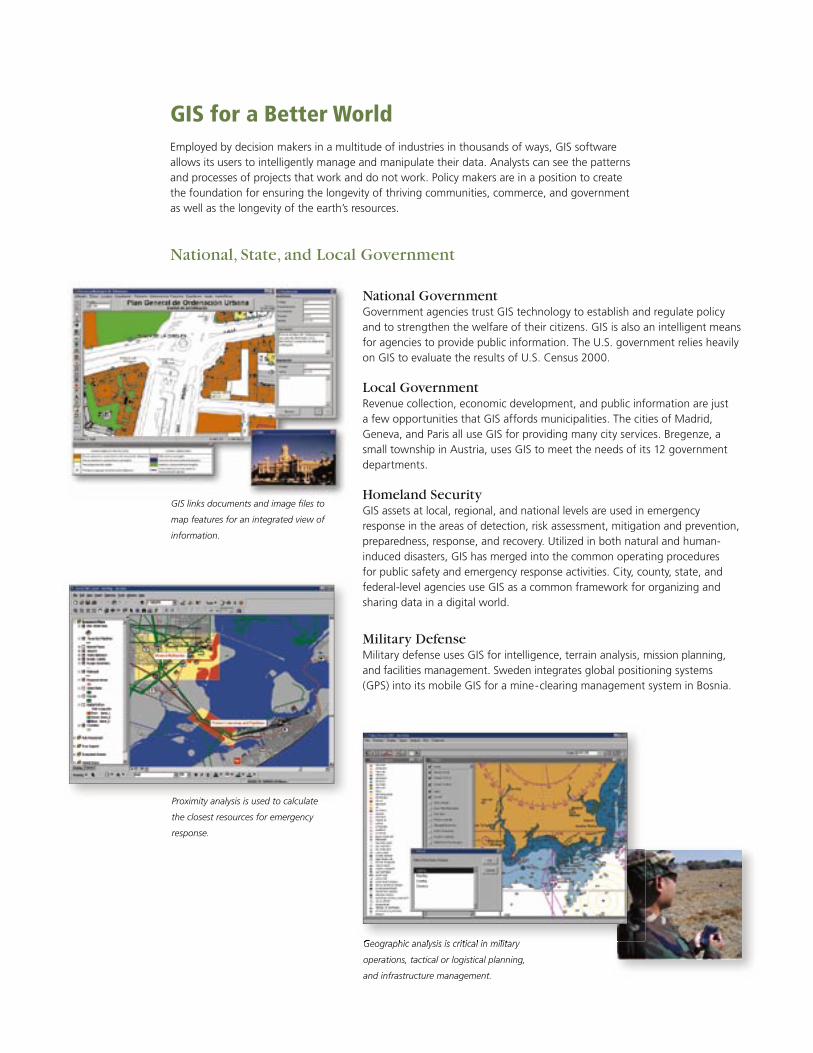
National GovernmentGovernment agencies trust GIS technology to establish and regulate policy and to strengthen the welfare of their citizens. GIS is also an intelligent means for agencies to provide public information. The U.S. government relies heavily on GIS to evaluate the results of U.S. Census 2000.
Local GovernmentRevenue collection, economic development, and public information are just a few opportunities that GIS affords municipalities. The cities of Madrid, Geneva, and Paris all use GIS for providing many city services. Bregenze, a small township in Austria, uses GIS to meet the needs of its 12 government departments.
Homeland SecurityGIS assets at local, regional, and national levels are used in emergency response in the areas of detection, risk assessment, mitigation and prevention, preparedness, response, and recovery. Utilized in both natural and human-induced disasters, GIS has merged into the common operating procedures for public safety and emergency response activities. City, county, state, and federal-level agencies use GIS as a common framework for organizing and sharing data in a digital world.
Military DefenseMilitary defense uses GIS for intelligence, terrain analysis, mission planning, and facilities management. Sweden integrates global positioning systems (GPS) into its mobile GIS for a mine-clearing management system in Bosnia.
GIS links documents and image fi les to
map features for an integrated view of
information.
Proximity analysis is used to calculate
the closest resources for emergency
response.
Geographic analysis is critical in military
operations, tactical or logistical planning,
and infrastructure management.
Geographic analysis is critical in military
Fire/Emergency Medical Services/DisasterGIS allows public safety personnel to effectively plan for emergency response, determine mitigation priorities, analyze historical events, and predict future events. Wilson Fire/Rescue Services in Wilson, North Carolina, uses GIS to get critical information to incident responders upon dispatch or while en route to an emergency to assist in tactical planning.
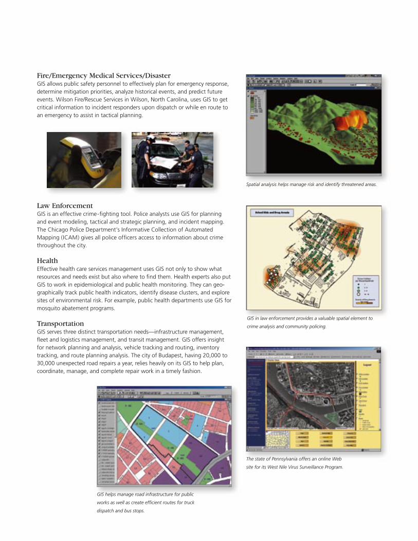
Law EnforcementGIS is an effective crime-fi ghting tool. Police analysts use GIS for planning and event modeling, tactical and strategic planning, and incident mapping. The Chicago Police Department’s Informative Collection of Automated Mapping (ICAM) gives all police offi cers access to information about crime throughout the city.
HealthEffective health care services management uses GIS not only to show what resources and needs exist but also where to fi nd them. Health experts also put GIS to work in epidemiological and public health monitoring. They can geo-graphically track public health indicators, identify disease clusters, and explore sites of environmental risk. For example, public health departments use GIS for mosquito abatement programs.
TransportationGIS serves three distinct transportation needs—infrastructure management, fl eet and logistics management, and transit management. GIS offers insight for network planning and analysis, vehicle tracking and routing, inventory tracking, and route planning analysis. The city of Budapest, having 20,000 to 30,000 unexpected road repairs a year, relies heavily on its GIS to help plan, coordinate, manage, and complete repair work in a timely fashion.
Spatial analysis helps manage risk and identify threatened areas.
The state of Pennsylvania offers an online Web
site for its West Nile Virus Surveillance Program.
GIS in law enforcement provides a valuable spatial element to
crime analysis and community policing.
GIS helps manage road infrastructure for public
works as well as create effi cient routes for truck
dispatch and bus stops.
Business
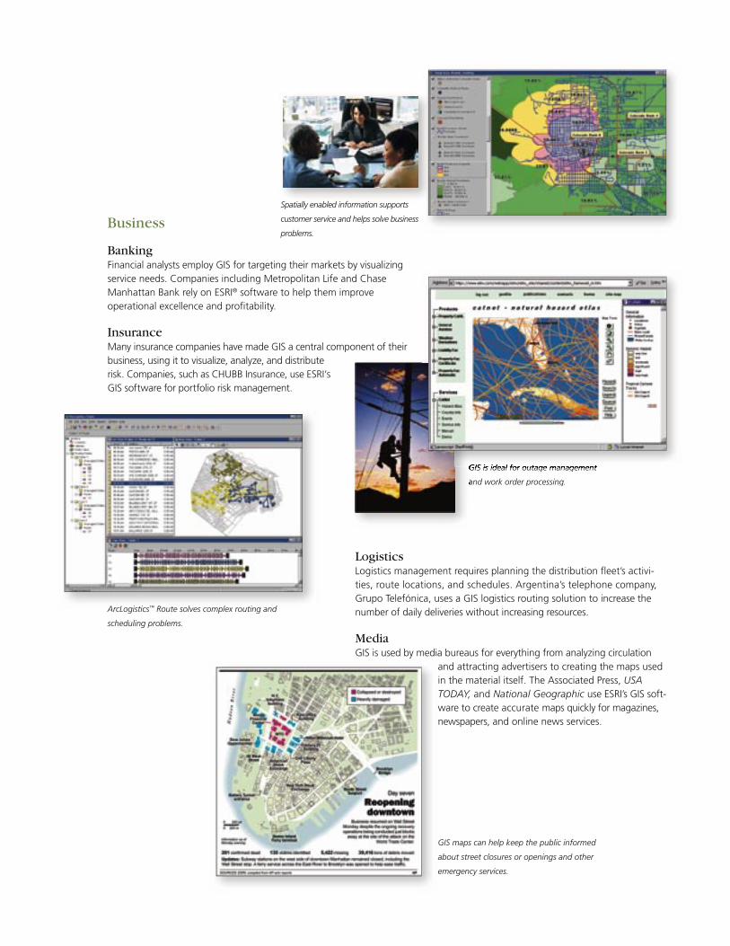
BankingFinancial analysts employ GIS for targeting their markets by visualizing service needs. Companies including Metropolitan Life and Chase Manhattan Bank rely on ESRI® software to help them improve operational excellence and profi tability.
InsuranceMany insurance companies have made GIS a central component of their business, using it to visualize, analyze, and distribute risk. Companies, such as CHUBB Insurance, use ESRI’s GIS software for portfolio risk management.
LogisticsLogistics management requires planning the distribution fl eet’s activi-ties, route locations, and schedules. Argentina’s telephone company, Grupo Telefónica, uses a GIS logistics routing solution to increase the number of daily deliveries without increasing resources.
MediaGIS is used by media bureaus for everything from analyzing circulation
and attracting advertisers to creating the maps used in the material itself. The Associated Press, USA TODAY, and National Geographic use ESRI’s GIS soft-ware to create accurate maps quickly for magazines, newspapers, and online news services.
ArcLogistics™ Route solves complex routing and
scheduling problems.
Spatially enabled information supports
customer service and helps solve business
problems.
GIS is ideal for outage management
and work order processing.
GIS maps can help keep the public informed
about street closures or openings and other
emergency services.
GIS is ideal for outage management
and work order processing.
GIS is ideal for outage management GIS is ideal for outage management
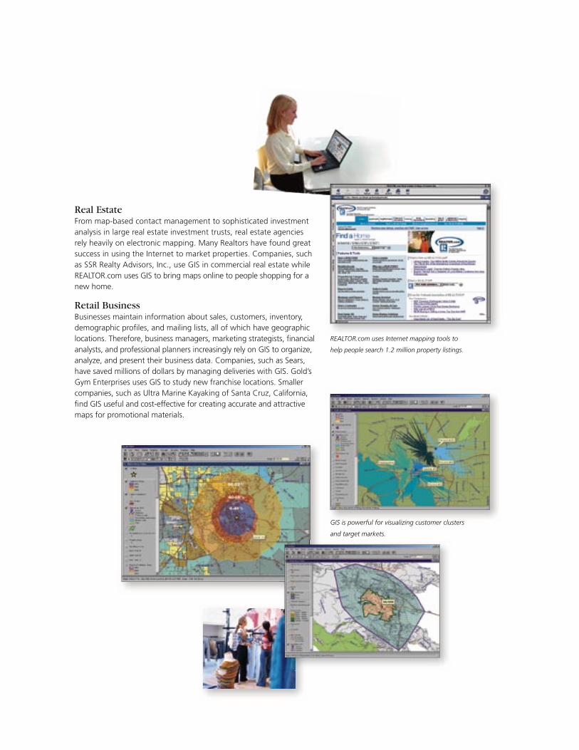
Real EstateFrom map-based contact management to sophisticated investment analysis in large real estate investment trusts, real estate agencies rely heavily on electronic mapping. Many Realtors have found great success in using the Internet to market properties. Companies, such as SSR Realty Advisors, Inc., use GIS in commercial real estate while REALTOR.com uses GIS to bring maps online to people shopping for a new home.
Retail BusinessBusinesses maintain information about sales, customers, inventory, demographic profi les, and mailing lists, all of which have geographic locations. Therefore, business managers, marketing strategists, fi nancial analysts, and professional planners increasingly rely on GIS to organize, analyze, and present their business data. Companies, such as Sears, have saved millions of dollars by managing deliveries with GIS. Gold’s Gym Enterprises uses GIS to study new franchise locations. Smaller companies, such as Ultra Marine Kayaking of Santa Cruz, California, fi nd GIS useful and cost-effective for creating accurate and attractive maps for promotional materials.
REALTOR.com uses Internet mapping tools to
help people search 1.2 million property listings.
GIS is powerful for visualizing customer clusters
and target markets.
Utilities
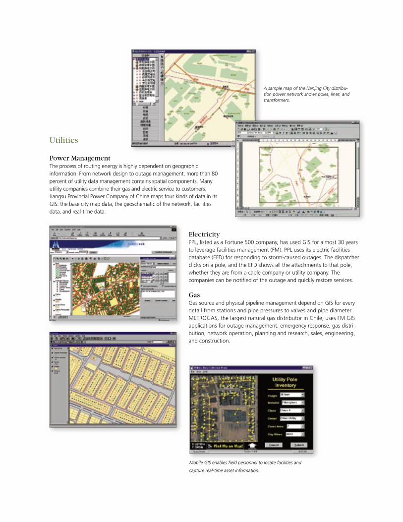
Power ManagementThe process of routing energy is highly dependent on geographic information. From network design to outage management, more than 80 percent of utility data management contains spatial components. Many utility companies combine their gas and electric service to customers. Jiangsu Provincial Power Company of China maps four kinds of data in its GIS: the base city map data, the geoschematic of the network, facilities data, and real-time data.
A sample map of the Nanjing City distribu-tion power network shows poles, lines, and transformers.
ElectricityPPL, listed as a Fortune 500 company, has used GIS for almost 30 years to leverage facilities management (FM). PPL uses its electric facilities database (EFD) for responding to storm-caused outages. The dispatcher clicks on a pole, and the EFD shows all the attachments to that pole, whether they are from a cable company or utility company. The companies can be notifi ed of the outage and quickly restore services.
GasGas source and physical pipeline management depend on GIS for every detail from stations and pipe pressures to valves and pipe diameter. METROGAS, the largest natural gas distributor in Chile, uses FM GIS applications for outage management, emergency response, gas distri-bution, network operation, planning and research, sales, engineering, and construction.
Mobile GIS enables fi eld personnel to locate facilities and
capture real-time asset information.
Ground orthophoto of Sand Creek Pumpstation
(ERDAS IMAGINE)
Raw water distribution reservoirs just downstream of Nichols Reservoir. These
reservoirs are used to store and capture water for distribution to water treat-
ment plants. (Photo: CSUWRD)
Raw water distribution reservoirs just downstream of Nichols Reservoir. These
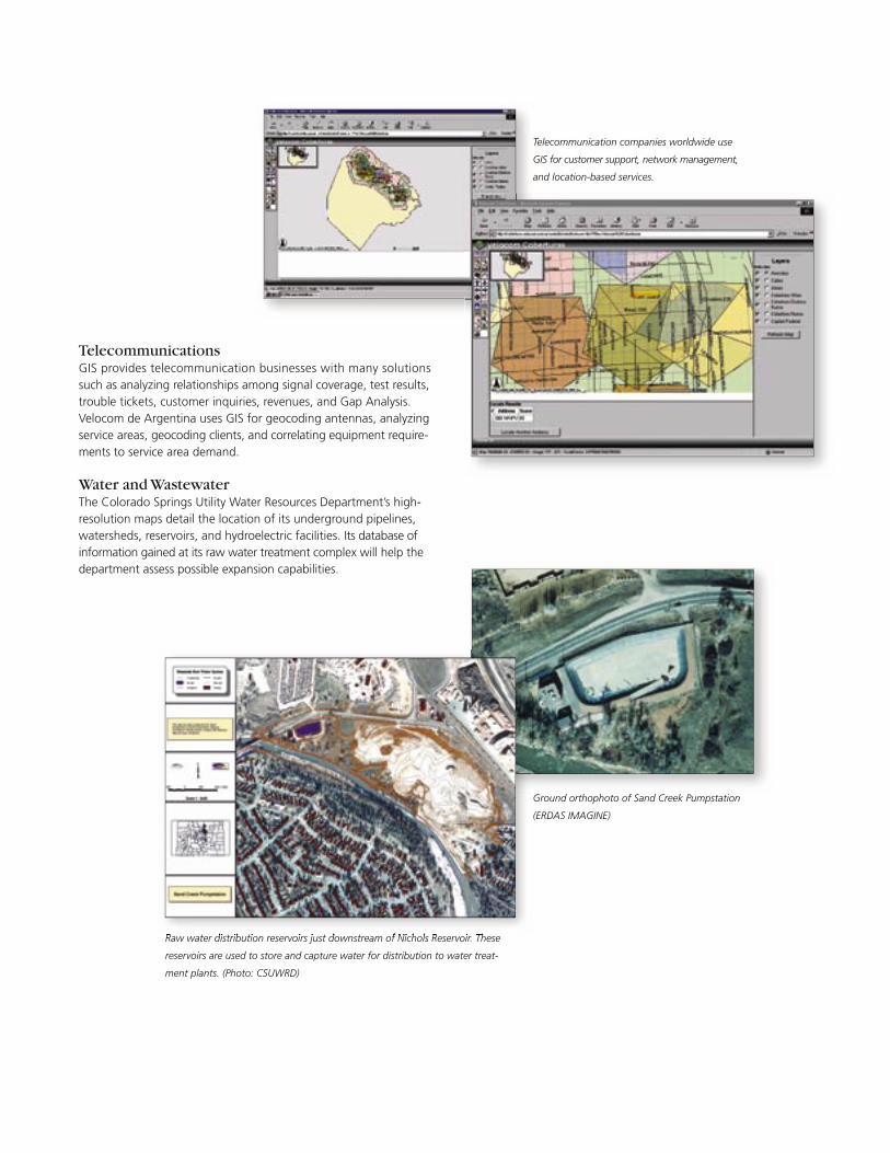
TelecommunicationsGIS provides telecommunication businesses with many solutions such as analyzing relationships among signal coverage, test results, trouble tickets, customer inquiries, revenues, and Gap Analysis. Velocom de Argentina uses GIS for geocoding antennas, analyzing service areas, geocoding clients, and correlating equipment require-ments to service area demand.
Water and WastewaterThe Colorado Springs Utility Water Resources Department’s high-resolution maps detail the location of its underground pipelines, watersheds, reservoirs, and hydroelectric facilities. Its database of information gained at its raw water treatment complex will help the department assess possible expansion capabilities.
Telecommunication companies worldwide use
GIS for customer support, network management,
and location-based services.
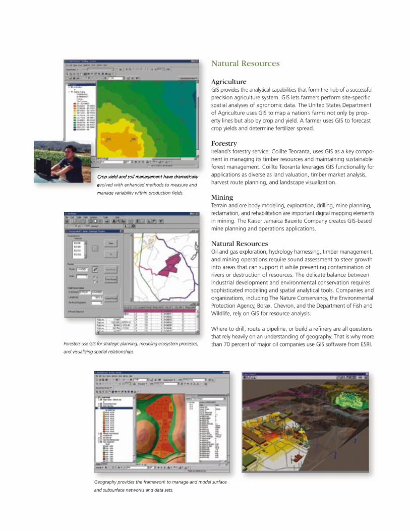
AgricultureGIS provides the analytical capabilities that form the hub of a successful precision agriculture system. GIS lets farmers perform site-specifi c spatial analyses of agronomic data. The United States Department of Agriculture uses GIS to map a nation’s farms not only by prop-erty lines but also by crop and yield. A farmer uses GIS to forecast crop yields and determine fertilizer spread.
ForestryIreland’s forestry service, Coillte Teoranta, uses GIS as a key compo-nent in managing its timber resources and maintaining sustainable forest management. Coillte Teoranta leverages GIS functionality for applications as diverse as land valuation, timber market analysis, harvest route planning, and landscape visualization.
MiningTerrain and ore body modeling, exploration, drilling, mine planning, reclamation, and rehabilitation are important digital mapping elements in mining. The Kaiser Jamaica Bauxite Company creates GIS-based mine planning and operations applications.
Natural ResourcesOil and gas exploration, hydrology harnessing, timber management, and mining operations require sound assessment to steer growth into areas that can support it while preventing contamination of rivers or destruction of resources. The delicate balance between industrial development and environmental conservation requires sophisticated modeling and spatial analytical tools. Companies and organizations, including The Nature Conservancy, the Environmental Protection Agency, Borax, Chevron, and the Department of Fish and Wildlife, rely on GIS for resource analysis.
Where to drill, route a pipeline, or build a refi nery are all questions that rely heavily on an understanding of geography. That is why more than 70 percent of major oil companies use GIS software from ESRI.
Natural Resources
Foresters use GIS for strategic planning, modeling ecosystem processes,
and visualizing spatial relationships.
Crop yield and soil management have dramatically Crop yield and soil management have dramatically
evolved with enhanced methods to measure and
manage variability within production fi elds.
Geography provides the framework to manage and model surface
and subsurface networks and data sets.
Crop yield and soil management have dramatically Crop yield and soil management have dramatically
evolved with enhanced methods to measure and
manage variability within production fi elds.
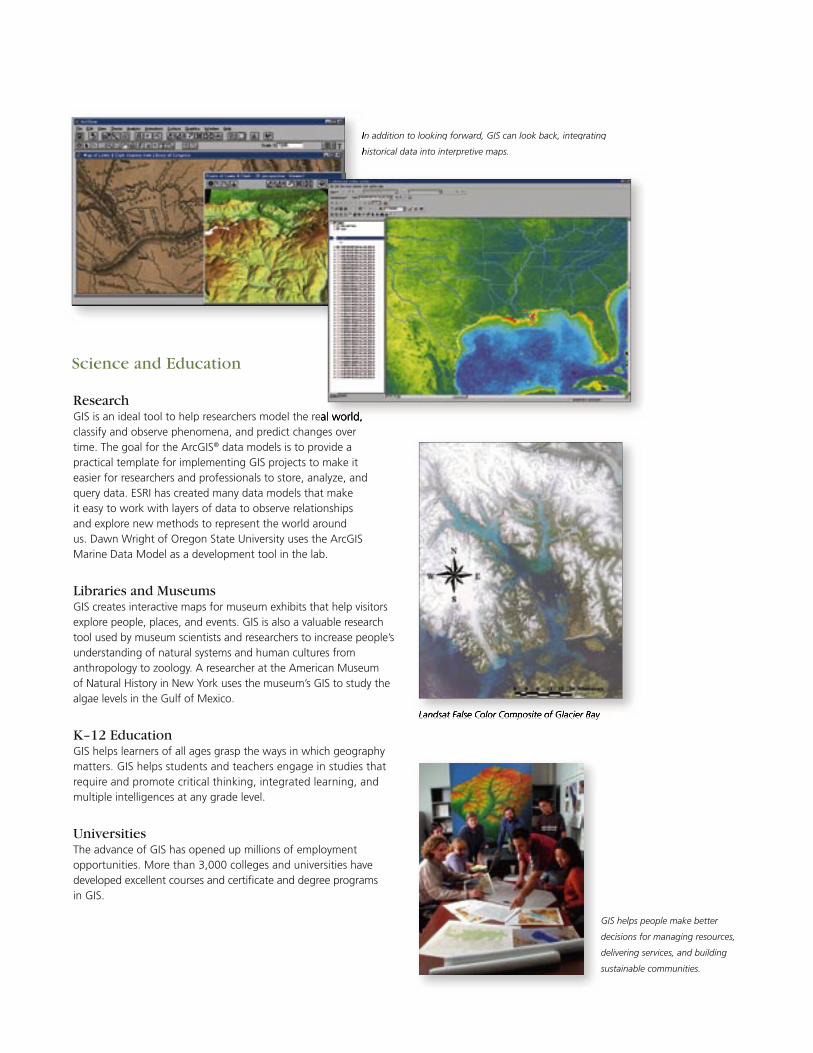
ResearchGIS is an ideal tool to help researchers model the real world, classify and observe phenomena, and predict changes over time. The goal for the ArcGIS® data models is to provide a practical template for implementing GIS projects to make it easier for researchers and professionals to store, analyze, and query data. ESRI has created many data models that make it easy to work with layers of data to observe relationships and explore new methods to represent the world around us. Dawn Wright of Oregon State University uses the ArcGIS Marine Data Model as a development tool in the lab.
Libraries and MuseumsGIS creates interactive maps for museum exhibits that help visitors explore people, places, and events. GIS is also a valuable research tool used by museum scientists and researchers to increase people’s understanding of natural systems and human cultures from anthropology to zoology. A researcher at the American Museum of Natural History in New York uses the museum’s GIS to study the algae levels in the Gulf of Mexico.
K–12 EducationGIS helps learners of all ages grasp the ways in which geography matters. GIS helps students and teachers engage in studies that require and promote critical thinking, integrated learning, and multiple intelligences at any grade level.
UniversitiesThe advance of GIS has opened up millions of employment opportunities. More than 3,000 colleges and universities have developed excellent courses and certifi cate and degree programs in GIS.
Science and Education
In addition to looking forward, GIS can look back, integrating
historical data into interpretive maps.
Landsat False Color Composite of Glacier Bay
In addition to looking forward, GIS can look back, integrating
historical data into interpretive maps.
GIS is an ideal tool to help researchers model the real world,
Landsat False Color Composite of Glacier Bay
GIS helps people make better
decisions for managing resources,
delivering services, and building
sustainable communities.
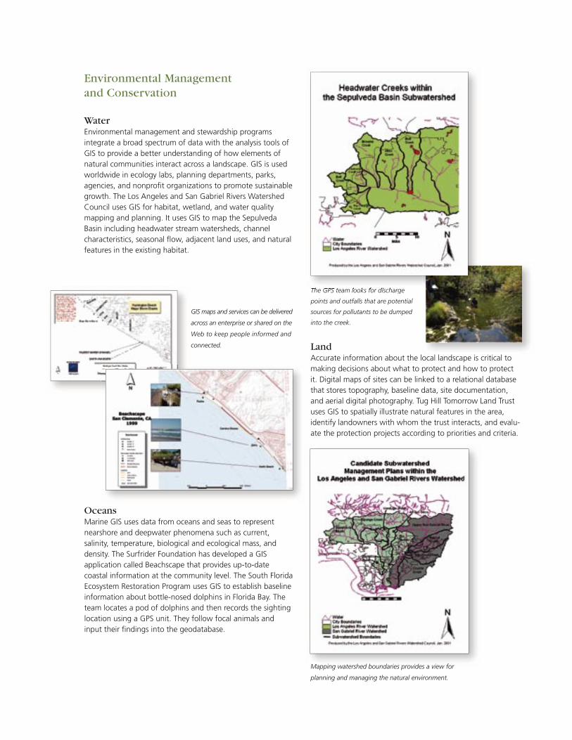
Water Environmental management and stewardship programs integrate a broad spectrum of data with the analysis tools of GIS to provide a better understanding of how elements of natural communities interact across a landscape. GIS is used worldwide in ecology labs, planning departments, parks, agencies, and nonprofi t organizations to promote sustainable growth. The Los Angeles and San Gabriel Rivers Watershed Council uses GIS for habitat, wetland, and water quality mapping and planning. It uses GIS to map the Sepulveda Basin including headwater stream watersheds, channel characteristics, seasonal fl ow, adjacent land uses, and natural features in the existing habitat.
The GPS team looks for discharge
points and outfalls that are potential
sources for pollutants to be dumped
into the creek.
Environmental Management and Conservation
OceansMarine GIS uses data from oceans and seas to represent nearshore and deepwater phenomena such as current, salinity, temperature, biological and ecological mass, and density. The Surfrider Foundation has developed a GIS application called Beachscape that provides up-to-date coastal information at the community level. The South Florida Ecosystem Restoration Program uses GIS to establish baseline information about bottle-nosed dolphins in Florida Bay. The team locates a pod of dolphins and then records the sighting location using a GPS unit. They follow focal animals and input their fi ndings into the geodatabase.
LandAccurate information about the local landscape is critical to making decisions about what to protect and how to protect it. Digital maps of sites can be linked to a relational database that stores topography, baseline data, site documentation, and aerial digital photography. Tug Hill Tomorrow Land Trust uses GIS to spatially illustrate natural features in the area, identify landowners with whom the trust interacts, and evalu-ate the protection projects according to priorities and criteria.
GIS maps and services can be delivered
across an enterprise or shared on the
Web to keep people informed and
connected.
Mapping watershed boundaries provides a view for
planning and managing the natural environment.
The GPS team looks for discharge
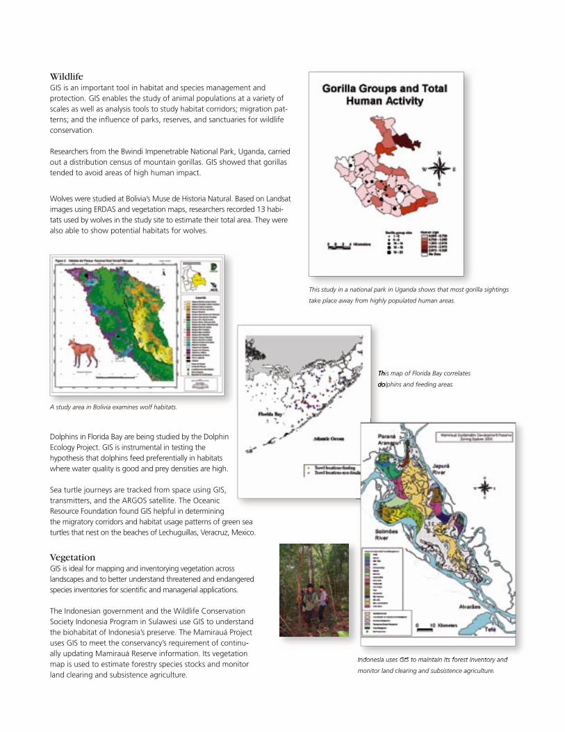
WildlifeGIS is an important tool in habitat and species management and protection. GIS enables the study of animal populations at a variety of scales as well as analysis tools to study habitat corridors; migration pat-terns; and the infl uence of parks, reserves, and sanctuaries for wildlife conservation.
Researchers from the Bwindi Impenetrable National Park, Uganda, carried out a distribution census of mountain gorillas. GIS showed that gorillas tended to avoid areas of high human impact.
Wolves were studied at Bolivia’s Muse de Historia Natural. Based on Landsat images using ERDAS and vegetation maps, researchers recorded 13 habi-tats used by wolves in the study site to estimate their total area. They were also able to show potential habitats for wolves.
Dolphins in Florida Bay are being studied by the Dolphin Ecology Project. GIS is instrumental in testing the hypothesis that dolphins feed preferentially in habitats where water quality is good and prey densities are high.
Sea turtle journeys are tracked from space using GIS, transmitters, and the ARGOS satellite. The Oceanic Resource Foundation found GIS helpful in determiningthe migratory corridors and habitat usage patterns of green sea turtles that nest on the beaches of Lechuguillas, Veracruz, Mexico.
VegetationGIS is ideal for mapping and inventorying vegetation across landscapes and to better understand threatened and endangered species inventories for scientifi c and managerial applications.
The Indonesian government and the Wildlife Conservation Society Indonesia Program in Sulawesi use GIS to understand the biohabitat of Indonesia’s preserve. The Mamirauá Project uses GIS to meet the conservancy’s requirement of continu-ally updating Mamirauá Reserve information. Its vegetation map is used to estimate forestry species stocks and monitor land clearing and subsistence agriculture.
This study in a national park in Uganda shows that most gorilla sightings
take place away from highly populated human areas.
A study area in Bolivia examines wolf habitats.
This map of Florida Bay correlates
dolphins and feeding areas.
This map of Florida Bay correlates
dolphins and feeding areas.
Indonesia uses GIS to maintain its forest inventory and
monitor land clearing and subsistence agriculture.
Indonesia uses GIS to maintain its forest inventory and
A Comprehensive Family of ProductsESRI is the only GIS software developer offering tightly integrated solutions that span the full spectrum of GIS requirements from small applications designed for casual users to sophisticated multiuser enterprisewide systems. As your GIS requirements grow, ESRI soft-ware solutions grow with you. Because ESRI software is designed as an integrated system, you can create your own GIS confi guration by selecting appropriate software from our comprehensive product family.
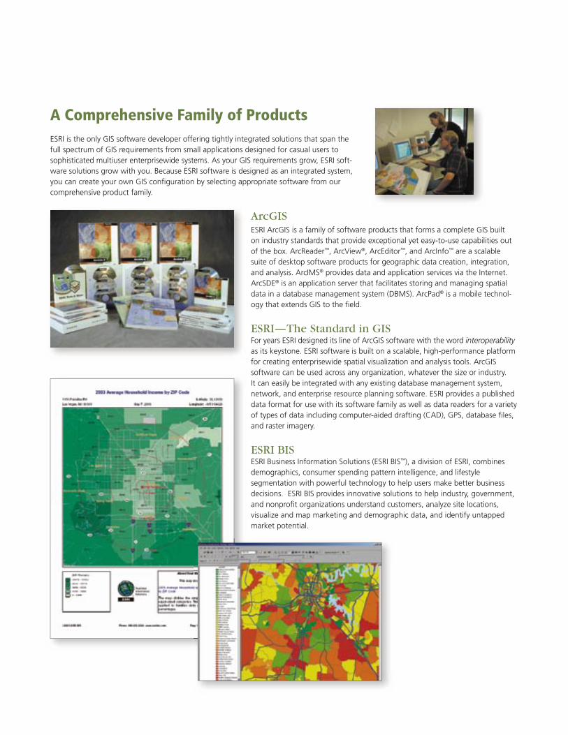
ArcGIS ESRI ArcGIS is a family of software products that forms a complete GIS built on industry standards that provide exceptional yet easy-to-use capabilities out of the box. ArcReader™, ArcView®, ArcEditor™, and ArcInfo™ are a scalable suite of desktop software products for geographic data creation, integration, and analysis. ArcIMS® provides data and application services via the Internet. ArcSDE® is an application server that facilitates storing and managing spatial data in a database management system (DBMS). ArcPad® is a mobile technol-ogy that extends GIS to the fi eld.
ESRI—The Standard in GISFor years ESRI designed its line of ArcGIS software with the word interoperability as its keystone. ESRI software is built on a scalable, high-performance platform for creating enterprisewide spatial visualization and analysis tools. ArcGIS software can be used across any organization, whatever the size or industry. It can easily be integrated with any existing database management system, network, and enterprise resource planning software. ESRI provides a published data format for use with its software family as well as data readers for a variety of types of data including computer-aided drafting (CAD), GPS, database fi les, and raster imagery.
ESRI BISESRI Business Information Solutions (ESRI BIS™), a division of ESRI, combines demographics, consumer spending pattern intelligence, and lifestyle segmentation with powerful technology to help users make better business decisions. ESRI BIS provides innovative solutions to help industry, government, and nonprofi t organizations understand customers, analyze site locations, visualize and map marketing and demographic data, and identify untapped market potential.
ServicesA successful GIS is more than software; it also requires people who can develop and manage the system. Because we want you to succeed, ESRI offers many opportunities to help you take full advantage of your GIS.
• Professional Services Division: GIS professionals offer consulting, design, programming, and implementation services as well as database design and assistance in data publishing.
• Training: ESRI’s instructor-led courses are offered at ESRI facilities and client sites around the world. ESRI’s Virtual Campus (campus.esri.com) is a leader in GIS education on the Web, making GIS courses and a global GIS learning community accessible to anyone with an Internet connection.
• Publications: ESRI Press books and workbooks on GIScience, GIS technology, and GIS applications are used in formal university and corporate training programs everywhere. Publications help the fi rst time learner as well as the professional user. Publications are available through major booksellers and from ESRI.
• Technical Support: ESRI offers a rich array of technical support, and user community resources are available to help you meet your GIS challenges. From 24/7 technical support to user groups online and free resources available to the community, ESRI has the tools to make you successful.
Learn More About ESRI and Its UsersTo learn more about ESRI, GIS, and the ESRI family of products and how they are used, visit the ESRI Web site at www.esri.com.
Expanding Your GIS CommunityESRI strongly supports the GIS user community’s efforts to create a better world. Therefore, we have initiated some important GIS community services to promote the welfare of GIS user groups worldwide.
GIS.com is an Internet portal intended to educate anyone interested in geo-graphic information and spatial referencing (including first time users) on the value that GIS technology brings to their day-to-day activities. www.gis.com
The Geography NetworkSM is a global community of government and commer-cial data providers who are committed to making geographic content easily accessible online. www.geographynetwork.com
GIS Day™ is a global event for which users of GIS technology open their doors to schools, businesses, and the general public to showcase real-world applica-tions of this exciting technology. www.gisday.com
Special interest groups, either by region or industry, meet to share challenges and lessons learned in their GIS experiences. ESRI supports special interest groups through event planning, staff support, publications, and consultation.
The ESRI International User Conference is held annually to host the world’s largest gathering of GIS users who discuss innovations, technology, and applications. www.esri.com/uc
Business Partners Offer Successful SolutionsEach year ESRI and its more than 1,600 business partners continue to grow the success of GIS and solve business problems with new software applica-tions, data, and value-added services. ESRI draws on the talents and skills of its business partners to expand end user knowledge and capabilities of GIS. www.esri.com/partners
ESRI is widely recognized as the technical and market leader in GIS, pioneering
innovative solutions for working with spatial data on the desktop, across the
enterprise, in the field, and on the Web. ESRI has the largest GIS software install
base in the world with more than one million users in more than one hundred
thousand organizations. With annual sales of more than $490 million, ESRI is
the fourth largest privately held software company in the world. Its mission is to
help people use GIS tools to manage and share geographic knowledge to make
better decisions, keep communities safe, and create a more sustainable world.

Copyright © 2004 ESRI. All rights reserved. ESRI, the ESRI globe logo, ArcEditor, ArcGIS, ArcIMS, ArcInfo, ArcLogistics, ArcMap, ArcPad, ArcReader, ArcSDE, ArcView, Geography Network, www.geographynetwork.com, GIS Day, www.gisday.com, www.esri.com, and @esri.com are trademarks, registered trademarks, or service marks of ESRI in the United States, the European Community, or certain other jurisdictions. Other companies and products mentioned herein are trademarks or registered trademarks of their respective trademark owners.
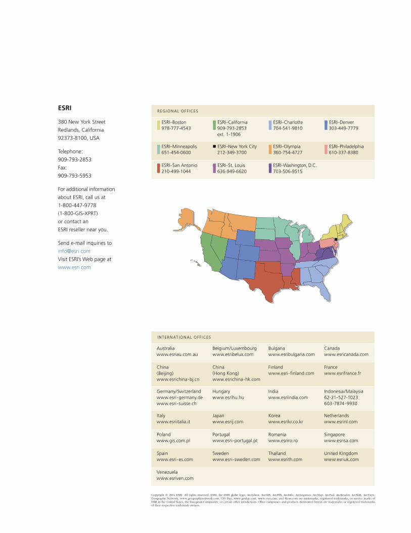
Australiawww.esriau.com.au
Belgium/Luxembourgwww.esribelux.com
Bulgariawww.esribulgaria.com
Canadawww.esricanada.com
China(Beijing)www.esrichina-bj.cn
China(Hong Kong)www.esrichina-hk.com
Finlandwww.esri-finland.com
Francewww.esrifrance.fr
Germany/Switzerlandwww.esri-germany.dewww.esri-suisse.ch
Hungarywww.esrihu.hu
Indiawww.esriindia.com
Indonesia/Malaysia62-21-527-1023603-7874-9930
Italywww.esriitalia.it
Japanwww.esrij.com
Koreawww.esrikr.co.kr
Netherlandswww.esrinl.com
Polandwww.gis.com.pl
Portugalwww.esri-portugal.pt
Romaniawww.esriro.ro
Singaporewww.esrisa.com
Spainwww.esri-es.com
Swedenwww.esri-sweden.com
Thailandwww.esrith.com
United Kingdomwww.esriuk.com
Venezuelawww.esriven.com
INTERNAT IONAL OFF ICES
n ESRI–Boston 978-777-4543
n ESRI–California909-793-2853 ext. 1-1906
n ESRI–Charlotte704-541-9810
n ESRI–Denver 303-449-7779
n ESRI–Minneapolis 651-454-0600
n ESRI–New York City212-349-3700
n ESRI–Olympia360-754-4727
n ESRI–Philadelphia 610-337-8380
n ESRI–San Antonio 210-499-1044
n ESRI–St. Louis 636-949-6620
n ESRI–Washington, D.C.703-506-9515
REGIONAL OFF ICESESRI
380 New York Street
Redlands, California
92373-8100, USA
Telephone:
909-793-2853
Fax:
909-793-5953
For additional information
about ESRI, call us at
1-800-447-9778
(1-800-GIS-XPRT)
or contact an
ESRI reseller near you.
Send e-mail inquiries to
Visit ESRI’s Web page at
www.esri.com


96713CRWN25M2/04sp


