Page 1
INFORMATICS ENGINEERING (07 T)
A NEURAL NETWORK APPROACH TO
PREDICT MARINE TRAFFIC
Andrius Daranda
October 2016
Technical Report MII-DS-07T-16-9-16
VU Institute of Mathematics and Informatics, Akademijos str. 4, Vilnius LT-08663,
Lithuania
www.mii.lt
Vilnius University
INSTITUTE OF MATHEMATICS AND
INFORMATICS
L I T H U A N I A
Page 2
MII-DS-07T-16-9-16 2
Abstract
The marine traffic has been significantly rising fast during the last period of time. One
of the most important problems for prediction of the marine traffic is to find certain
patterns movements of vessels. Even the modern navigation devices could not ensure
full maritime picture in narrow waterways because of geographical structures and
various disturbances. Moreover, all vessels have could not use autopilot in straits for
these reasons; they have to operated manually according to rules. The vessels turning
points could be used to predict of marine traffic.
Keywords: Maritime traffic, AIS, Artificial neural network, DBSCAN algorithm,
prediction
Page 3
MII-DS-07T-16-9-16 3
Contents
1 Introduction ............................................................................................................ 4 2 Marine traffic monitoring challenges ..................................................................... 5 3 Marine Background of AIS .................................................................................... 6 4 DBSCAN: density-based clustering algorithm ...................................................... 8
5 Artificial Neural Network ...................................................................................... 9 5.1 Artificial Neural Network development for marine traffic prediction .......... 10 5.2 ANN training ................................................................................................. 12
6 Proposed model development .............................................................................. 14 6.1 Block diagram of proposed model ................................................................ 17
7 Prediction marine traffic with proposed model ................................................... 18 8 Clustering results ................................................................................................. 20
9 Artificial Neural Network results ......................................................................... 22 10 Conclusions .......................................................................................................... 22 References .................................................................................................................... 24
Page 4
MII-DS-07T-16-9-16 4
1 Introduction
The increased demand for marine traffic safety and security issues become more
important to predict maritime traffic. The establishment of intelligent monitoring and
predicting systems for marine traffic is becomes more essentially due to vessels
congested zones. The main issue of such intelligent maritime traffic monitoring and
prediction system is to predict vessel route for all her journey (Fig. 1). For this
purpose could be used information from vessel’s Automatic Identification system
(AIS). Otherwise this system holds essential information about port of destination for
prediction of route but not about turning regions. So we need predict all turning
regions of route and it could dramatically decrease the risk of marine transportation.
Fig. 1 The route to the same port [1]
The EU Directive 2002/59 is further structured in the following subdivisions to
incorporate the intelligent maritime traffic monitoring tasks and to improve maritime
safety and security capabilities:
1. development of the SafeSeaNet project that consists of a pan-European
electronic information system for ocean navigation and cargo handling;
2. collaboration among the EU member states and the respective maritime
authorities to face maritime issues and challenges;
3. coordination of maritime activities around the EU coastline f or the vessels in
distress;
4. development on the long distance automatic identification system (AIS) with
the International Maritime Organization (IMO) [1] and the International
Association of Marine Aids to Navigation and Lighthouse Authorities;
Page 5
MII-DS-07T-16-9-16 5
5. Development on the shore-based traffic monitoring infrastructure database
system with the IMO.
Therefore, despite the considerable amount of intelligent features developed for air
[3] and land transportation [4] systems to improve the navigation safety and security,
those facilities are still under developed for vessel navigation systems. However, the
maritime surveillance systems have many challenges [5].
In this paper is proposed the model of intelligent maritime traffic predicting
system. This system mission is tracking and predicting vessel’s turning points. This
solution will be originated by clustering turning regions and find route certain patterns
with Artificial Neural Network.
To achieve these goals, the model of intelligent prediction for marine traffic will be
created. This model has been supported by a huge amount of real data.
2 Marine traffic monitoring challenges
The marine traffic is controlled by Vessel Traffic Services (VTS) (Fig. 2). VTS
works of securing the navigation of vessels passing traffic separation schemes and
warning them against any possible collision and accident. Conventional VTS are
equipped with several marine surveillance mechanisms for the same purpose: radars,
automatic plotting aid (ARPA), AIS and long-range identification and tracking
(LRIT) systems. Moreover, lasers, sonar and infrared detection could be used too.
Furthermore, more information-based navigation aids are used – the Global
Positioning System (GPS), electronic charts, satellite tracking and others.
Fig. 2 Marine traffic in the Baltic Sea [1]
Page 6
MII-DS-07T-16-9-16 6
However, the marine traffic is controlled by using the traditional hardware of
navigation aids – lights, buoys, channel markers. The authority is always seeking new
ways to attain the maximum benefit from information technology [6].
Otherwise, there are many challenges faced by such maritime surveillance systems
[7]:
1. Huge amount of surveillance territory;
2. Large number of targets;
3. Multi target observations;
4. Noisy signal and geographical structures;
5. Propagation of radio waves.
Moreover, the marine traffic congestion zones are biggest challenge for such systems.
These zones usually are in harbors, straits and channels. The reasons of marine traffic
congestion can be declared as:
• The vessels with low sailing velocity and speeding up and down frequently,
• The vessels with disorder navigation,
• Overcrowded straits and channels.
Furthermore, these challenges raise the level of risk of accidents at sea. This risk level
can be quantified by Eq, (1)
𝑃(𝑥 ≥ 𝑁|𝑁 ≥ 1) = 𝑓𝑁 =∑ 𝑃(𝑓𝑎𝑡𝑎𝑙𝑖𝑡𝑦)𝑚𝑎𝑥
𝑁
∑ 𝑃(𝑓𝑎𝑡𝑎𝑙𝑖𝑡𝑦)𝑚𝑎𝑥1
(1)
Where N is the number of expected number of deaths and f_N is the probability that
the number of deaths resulting from an accident will be more than N.
Therefore, these challenges could be overcome by exploiting artificial neural network.
Further developments of intelligent marine traffic monitoring and predicting systems
are fundamental and essential to the marine traffic management automation.
Moreover, the maritime surveillance systems incorporated with intelligent can analyze
information fusion, prediction of danger situations, traffic flow estimation and etc. It
is especially important for traffic safety, navigation efficiency and for future
developments.
3 Marine Background of AIS
The AIS is vessel tracking system is used on vessels and by authorities – VTS, Naval.
International Maritime Organization's International Convention for the Safety of Life
at Sea requires AIS to be fitted aboard international voyaging ships with gross
Page 7
MII-DS-07T-16-9-16 7
tonnage (GT) of 300 or more tons, and all passenger ships regardless of size. This
system is identifying and locating vessels in the sea. VHF is used for periodically
broadcast vessels data (International Maritime Organization number, position, course,
speed and etc.) by electronic messages. AIS integrate with positioning systems (GPS)
and with navigation sensors, such as a gyrocompass and rate of turn indicator (Fig.
3). These messages are transmitted directly to AIS receivers which are in vessels and
VTS Base stations. Received messages could be displayed on ECDIS or on Radar
monitor. Moreover, vessels which have AIS transmitter could be tracked by VTS
along coast line. Typically AIS transmitters range is 20-30 nautical miles it is depends
on VHF radio range. When the vessels are out of range vessel could be tracked with
special satellites that are fitted with AIS receivers [8]. The implementation plan and
requirements for AIS are outlined in Subparagraph 2.4 of Regulation 19 of Chapter V
of the International Convention for the Safety of Life at Sea (SOLAS) [9]. The system
has been mandatory on all new ships in international traffic since 1 July 2002, and
ended on 2004 include all passenger ships, tankers and other ships of 300 tons
engaged in international voyages. Fully implemented in 2008, the system will also
cover all ships of 500 tons or more in national voyages. The requirements state that:
“AIS shall:
Provide automatically to appropriately equipped shore stations, other ships and
aircraft information, including the ship’s identity, type, position, course, speed,
navigational status and other safety-related information (Fig. 3);
Receive automatically such information from similarly fitted ships;
Monitor and track ships;
Exchange data with shore-based facilities.
AIS shall be operated taking into account the guide-lines adopted by the Organization.
Ships fitted with AIS shall maintain AIS in operation at all times except where
international agreements, rules or standards provide for the protection of navigational
information.” Ships covered by regulation 19 are defined as SOLAS Class A ships,
and a mobile AIS station is mandatory on these ships. Work is also under way at IEC
to develop an equipment recommendation for SOLAS Class B ships [8], but AIS on
these ships is at present not mandatory. The two frequencies used for AIS worldwide
are 161.975 and 162.025 MHz (channels 87B and 88B, or AIS1 and AIS2) [10].
Page 8
MII-DS-07T-16-9-16 8
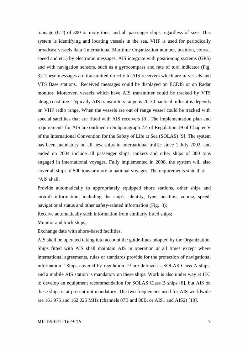
Fig. 3 AIS data types
The kinematic data are transmitted at frequent intervals of approximately 3-10 s.
Therefore, some important parameters for collision avoidance can be calculated:
1. The closest point of approach (CPA);
2. Time to closest point of approach (TCPA);
These two indicators most widely are used to avoid collision at sea. Correspondingly,
the AIS are providing data which is especially important for traffic safety, navigation
efficiency.
4 DBSCAN: density-based clustering algorithm
(Density-Based Spatial Clustering of Applications with Noise) is a density based
clustering algorithm [14]. The algorithm grows regions with sufficiently high density
into clusters and discovers clusters of arbitrary shape in spatial databases with noise.
Density-based clustering defines cluster as region, the objects of the region are dense.
The clusters are separated from one another by low-density regions [15]. The reason
we choose density-based clustering is that it has significant advantages over
partitioned and hierarchical clustering algorithms. It can discover clusters of arbitrary
shapes. The computational complexity can be reduced to O (n⁄lgn) by building some
special data structures. In addition it is able to effectively identify noise points (Fig.
5) [16].
Page 9
MII-DS-07T-16-9-16 9
Fig. 3 DBSCAN clustering algorithm
But density-based clustering algorithms easily lead to memory problem when facing
large databases. Some researches show that current density-based clustering
algorithms often have difficulties with complex data sets in which the clusters are
different densities [17]. As a kind of density-based clustering, the DBSCAN algorithm
was first introduced by Ester, et al. Some basic concepts related with DBSCAN are as
follow [18]:
𝑑(𝑥𝑖 , 𝑥𝑗) = (∑ (𝑥𝑖𝑘 − 𝑥𝑗𝑘)2𝑚
𝑘=1 )
1
2 (2)
The key idea in DBSCAN is that for each data object of a cluster, the neighborhood of
a given radius (ε) has to contain at least a minimum number (MinPts) of objects
[19][18].
5 Artificial Neural Network
Artificial Neural Networks (ANN) simulates the processes of the human brain (Fig.
6). The ANN makes associations between varieties of the information. The ANN
realizes as intuitive reasoning rather than the logical reasoning normally executed by
machine. The main advantage of ANN is to incorporate uncertainty as well as data
which is dynamic character has led to a number of studies to establish its applicability
to predict marine traffic.
Page 10
MII-DS-07T-16-9-16 10
Fig. 4 Artificial Neural Network
𝑦 = 𝐹(∑ 𝑥𝑖 ∗ 𝜔𝑖 − 𝜃𝑛𝑖=1 ); (3)
One of the ANN scheme is the back-propagation (BP) network [20]. The back-
propagation neural network architecture is designed by fully interconnected layers or
rows of processing units. The inter connections are called weights, and provide the
means for the ANN to save knowledge, the process of A learning B. Also, the errors
are calculated during this process. These errors are used to back-propagated from the
output neurons to all the hidden neurons; so all the weights are adjusted by the errors.
This learning process continues till the error is reduced to specified minimum values.
After that the weights are saved as ANN knowledge. The weights are used to perform
information processing operation by back-propagation algorithm. The ANN may have
as large numbers of neurons as it needed. Likewise, the number of layer is
exchangeable. The ANN behavior depends on the simple activation function which
could be a linear or a non-linear. The ANN knowledge is training by pre-mined data
and weights are saved. Moreover, The ANN has the capability to learn with any
complex structure of data. So, the ANN is capable to implement a learning algorithm
and made decision support ability of marine traffic prediction.
5.1 Artificial Neural Network development for marine traffic prediction
A three-layer neural network model (Fig. 7) was developed to predict the turning
regions of vessels in marine traffic. The ANN inputs were vessels:
1. Latitude of turning regions;
Page 11
MII-DS-07T-16-9-16 11
2. Longitude of turning regions;
3. speed;
4. course;
5. MMSI number;
6. Dimension (length & width);
7. Type of vessel.
The ANN outputs were used to predict the next turning regions. The ANN outputs:
1. Latitude of next turning region;
2. Longitude of next turning region;
The ANN was fully connected and every neuron connected to second layer neuron
[21].
Fig. 5 Artificial Neural network for marine traffic
The output of each neuron was calculated by an activation function. All the inputs
were summed by neurons with threshold. To develop the ANN, the pre-mined data
was divided into two parts: 90% of turning points were used to train the ANN and the
rest of observations were used for validation. All data was normalized to common
interval of [-1, 1].
The algorithm was solved by python 2.7 (used the implementation of [22]) with
neuron package [23]. The relationship between the output (𝑦𝑡) and the inputs
(𝑦𝑡−1,…,𝑦𝑡−𝑝) has following mathematical representation:
𝑦𝑡 = 𝑤0 + ∑ 𝑤𝑗𝑔 (𝑤0𝑗 + ∑ 𝑤𝑖𝑗𝑦𝑡−1𝑝𝑖=1 ) + 𝑒𝑡
𝑄𝑗=1 , (4)
Where𝑤 𝑖,𝑗( 𝑖 = 0, 1, 2, … , 𝑃, 𝑗 = 1, 2, … , 𝑄) and 𝑤𝑗(𝑗 = 0, 1, 2, … , 𝑄)are model
parameters often called connection weights; P is the number of input nodes; is the
Page 12
MII-DS-07T-16-9-16 12
number of hidden nodes; – is the residual of model at time t, and g is the transfer
function. The activation function is often used as the hidden layer transfer function.
That is,
Sig(x) =1
1+exp (−x); (5)
Once a network structure (P, Q) is specified, the network is ready for training, a
process of parameter estimation. The parameters are estimated such that the cost
function of neural network is minimized. Cost functions an overall accuracy criterion
such as the following mean squared error:
E =1
N∑ (ej)
2Nn=1 =
1
N∑ (yt − (w0 + ∑ wjg(w0j + ∑ wijyt−1
pi=1 )Q
j=1 ))Nn=1 (6)
Where N is the number of error terms. This minimization is done with some
efficient nonlinear optimization algorithms other than the basic propagation (Figure
3.) training algorithm.
After the artificial neuron network receives the inputs, it will propagate them from
the input layer (Fig. 6) through the hidden layers to the output layer, where the
responses are obtained.
Fig. 6 Artificial neuron network layers
This artificial neuron network learning process deals with speed of convergence
and the local minima.
5.2 ANN training
The data used for training the ANN was collected from marinetraffic.com website
and was stored in MySQL database. These data covered whole Baltic Sea, so mean
count of vessels was 3000 on a time step of 180 seconds.
Page 13
MII-DS-07T-16-9-16 13
The data was filtered by change of course to calculate vessel turning regions and
vessel’s speed. If vessel’s course was changed more than 4° it is turning point of
vessel’s route. Likewise, vessel’s which have less than 4 knots of speed weren’t
monitored. Monitoring lasted 10 days. More than 300,000 turning points, 30,000
vessels and 6,000 destinations were stored during this period.
So, turning points data like latitude and longitude, vessel’s type, course, speed,
size and MMSI was stored in database (Fig. 7). These data used to train the Artificial
Neural Networks. The trained ANN has been used to predict next position of turning
point (latitude & longitude). Moreover, the trained ANN has been used to predict
whole route of vessel to port of destination. All stored data considered to decide
model structure and used for training of ANN.
Fig. 7 Turning points on the vessel’s route [1]
The sampling stored period of 180 seconds was chosen because of maneuver
performance of vessels. In this respect, three-minute-ahead positions are predicted by
utilizing past data of vessel. The following ANN model has been trained and analyzed
for the best performance.
Page 14
MII-DS-07T-16-9-16 14
In the neural network architecture, one hidden layer with sigmoid activation
function has been used. The numbers of hidden neurons and hidden layers have been
found by trial and error using collected data to obtain the best performance. Training
and prediction processes are realized at 4 steps as explained below:
1. Collecting data for training;
2. Determination of Neural Network architecture and models;
3. Training of Neural Network;
4. Testing the trained Neural Network.
6 Proposed model development
The proposed model has two main parts:
1. Clustering turning regions by DBSCAN algorithm;
2. The ANN learning clustered turning points;
Clustering data was implemented by Scikit-learn's [24] python library. This library
requires the input of a distance matrix showing pairwise distances between all turning
regions in the dataset. So, the DBSCAN algorithm requires two parameters: ε
(epsilon) and the minimum number of points required to form a cluster (minPts).
Parameter ε depends on radius of cluster. It could not be equal for whole route
because of narrow channel, harbors and etc. (Fig. 8).
Fig. 8 clustering turning regions with the some ε parameter
Therefore, the parameter ε is different for open seas, harbors, straits and channels
(Fig. 8). In order to get optimal clusters the proposed model calculates different
parameter ε four times. It calculates ε from biggest possible value and reduced on
every cycle to minimize possible error (Fig. 11).
Page 15
MII-DS-07T-16-9-16 15
Fig. 9 Clustered turning regions with minimized ε
So the aim of this study is to identify turning point zones by investigating the
marine traffic turning points.
As a second part of model is the ANN (Fig. 10). The model was created by the
three- layer neural network structure with a sufficient number of neurons in the hidden
layer and enough learning time can theoretically model any nonlinear functions at any
accuracy. However, the questions in practical implementation are the selection of
training algorithm, number of hidden neurons, learning rate, and momentum, to
guarantee that the error converges to a desired value.
Page 16
MII-DS-07T-16-9-16 16
Fig. 10 Model of ANN
The learning rate was chosen by trial and error to be 0.0009. If the learning
rate was too large, oscillation or divergence occurred, whereas a small learning rate
resulted in a slow training process without improvement in the accuracy of the
proposed model. The training process was terminated when the half-sum of the
squared error reached a threshold value of 23. This threshold corresponded to
prediction accuracies above 99% for the training data-set.
For the three-layer neural network model, the number of input neurons was
determined by five environmental factors that affect survival and growth, and the
number of output neurons was set by the two classifications (i.e. survival/death and
growth/no-growth). The numbers of neurons in the hidden layer can be selected with
flexibility but the number determines how well a data-set is trained. Too many hidden
neurons lead to a data-set-specific relationship between inputs and outputs, or an
‘‘over-fitting’’ problem. With smaller numbers of hidden neurons, the network may
Page 17
MII-DS-07T-16-9-16 17
not have adequate power to learn the patterns with satisfactory accuracy, resulting in
an ‘‘under-fitting’’ problem.
6.1 Block diagram of proposed model
Fig. 11, describes the proposed approach for clustering turning points (a part) and
learning the ANN by clusters.
Fig. 11 Block diagram of proposed model
As shown in Fig. 11, the proposed model consists from two main parts:
1. Clustering points of route;
2. Learning the ANN by clusters.
Page 18
MII-DS-07T-16-9-16 18
The proposed model begins from reading turning points information from
database. This information is used to clustering all turning points by DBSCAN
algorithm.
The ANN starts learning by clusters. The ANN after training was completed
neurons weights are saving by clusters. These neuron weights are used to predict next
turning points by clusters.
7 Prediction marine traffic with proposed model
The ANN after training was completed; input-output vectors have been modified
as explained above for prediction step with ANN model, as shown in Fig. 12.
Fig. 12 proposed model for prediction vessel’s route
The proposed ANN model for prediction of turning points are using calculated
weights by neurons. These could be done by geeting current position of vessel. Next
Page 19
MII-DS-07T-16-9-16 19
step would be calculate nearest turning point. It clould be done by calculating distance
(7, 8, 9,10) to nearest cluster.
𝑎 = 𝑠𝑖𝑛2 (∆𝜑
2) + cos(𝜑1) ∗ cos(𝜑2) ∗ 𝑠𝑖𝑛2 (
∆𝜆
2) (7)
𝑐 = 2 ∗ 𝑎𝑡𝑎𝑛2(√𝑎, √(1 − 𝑎)); (8)
𝑑 = 𝑅 ∗ 𝑐 (9)
𝜃 = 𝑎𝑡𝑎𝑛2(sin(∆𝜆) ∗ cos(𝜑2) , cos(𝜑1) ∗ sin(𝜑2) − sin(𝜑1) ∗ cos(𝜑2) ∗
cos (∆𝜆)); (10)
This uses the ‘haversine’ formula to calculate the great-circle distance between two
points – that is, the shortest distance over the earth’s surface – giving an ‘as-the-crow-
flies’ distance between the points. Midpoints of cluster are used to find nearest cluster
and current vessel position. Midpoint is calculated by:
𝐵𝑥 = cos(𝜑2) ∗ cos (∆𝜆); (11)
𝐵𝑦 = cos(𝜑2) ∗ sin (∆𝜆); (12)
𝜑𝑚 = 𝑎𝑡𝑎𝑛2(sin(𝜑1) + sin(𝜑2) , √((cos(𝜑1) + 𝐵𝑥)2 + 𝐵𝑦2); (15)
𝜆𝑚 = 𝜆1 + 𝑎𝑡𝑎𝑛2(𝐵𝑦, cos(𝜑1) + 𝐵𝑥); (13)
Where φ is latitude, λ is longitude, R is earth’s radius (mean radius = 6,371km);
Moreover, course must coincide with bearing (11,12,13) to calculated nearest
cluster. Determinated cluster are used to load the ANN for calculation. Therefore,
every cluster have own ANN with calculated weights. The ANN loaded with vessel
parameters (current position, course, speed, MMSI number, vessel type & vessel
particulars) predict next turning point (latitude & longitude).
Usually, the vessel route consists of many turning points. The method has
particularly been formed for prediction of points of turning but the same way could be
used for predicting all route of vessel. As shown in Fig. 13, the ANN used as many
times as it needed.
Page 20
MII-DS-07T-16-9-16 20
Fig. 13 Vessel’s route prediction by clusters
So, the ANN could use predicted turning point for predict next turning point (Fig.
14) and repeat this to port of destination.
Fig. 14 Route prediction
As shown in Fig. 14 the route could be divided by turning regions. This
region is different for vessels but it could be united by clusters.
8 Clustering results
A large amount of traffic flow information was used. This information obtained
from marinetraffic.com by collection equipment such as AIS, are recorded and
accumulated in the database of proposed model. However, the data was filtered by
turning points (4° change of vessel course). Data preprocessed to sort by port of
destination. After this procedures have got data set for proposed model. Test data in
this paper contains turning point by port of destination as shown in Fig. 15.
Page 21
MII-DS-07T-16-9-16 21
Fig. 15 Number of turning regions by port of destination
This data set was clustered by DBSCAN algorithm. As a result we got clusters
sorted by port of destination as shown in Fig. 16. Rotterdam as most popular port
have largest amount of clusters.
Fig. 16 Number of clusters by port of destination
Number of turning points depends on DBSCAN clustering parameter ε. A cluster size
depends on turning points count.
Page 22
MII-DS-07T-16-9-16 22
9 Artificial Neural Network results
The neural network model correctly predict vessel route. The precision of ANN
prediction depends on cluster size and it directly depends on DBSCAN algorithm
parameter ε. The distance between real turning point and predicted turning point do
not exceed cluster diameter (parameter ε) (Fig. 17).
Fig. 17 Precision of turning points
Therefore, the ANN could predict turning point with different precision in narrow
channel or open seas. The precision could be increase by adjusting parameter ε.
10 Conclusions
The proposed prediction model by using DBSCAN algorithm and Artificial Neural
Network can prove the effectiveness to predict marine traffic. This model could be
used for early warning and guidance system before any dangerous situations occurs.
As in this study; data file of the vessel has been updated and Neural Networks have
been trained in 180 seconds sampling period and then turning points predicted with
trained Neural Network.
As another possible way to use such proposed model for marine traffic and
environmental conditions. Moreover, such proposed model could be used for any
specific vessel to predict her movement.
The prediction performance was found to be successful on the turning regions.
Route prediction is shown in Fig 20 and Fig. 21.
Page 23
MII-DS-07T-16-9-16 23
Fig. 18 Real and predicted route of vessel for 24 hours
Also need use all data from marine traffic because got 300,000 points, but used
only 100,000. Moreover, some turning regions are the same for different ports of
destination for example the route from North Baltic Sea to the North Sea will be same
for all ships.
Fig. 19 Real and predicted route of vessel for 24 hours
The proposed model was developed and demonstrated to show its prosperous aspects.
Conclusions can be drawn as follows.
Page 24
MII-DS-07T-16-9-16 24
1. The marine traffic prediction model is proposed and developed to
demonstrate its effectiveness.
2. Marine traffic can be statistically analyzed and used for prediction.
3. The proposed model could be used for traffic flow estimation.
The proposed model can easily to predict future marine traffic situation. The system
can be utilized to plan VTS and on-land AIS stations and to assess the influence of
various waterway-area development projects.
References
[1] MarineTraffic [Online]. Available: http://www.marinetraffic.org;
[2] Int. Maritime Org . [Online]. Available: http://www.IMO.org;
[3] M. Prandini, L. Piroddi, S. Puechmorel, and S. L. B rázdilová, “Toward air traffic
complexity assessment in new generation air traffic management systems,” IEEE
Trans. I ntell. Transp. Syst., vol. 12, no. 3, pp. 809–818, Sep. 2011, DOI:
10.1109/TITS.2011.2113175.
[4] U. Franke and S. Heinrich, “Fast obstacle detection f or urban traffic situations,”
IEEE Trans. I ntell. Transp. Syst., vol. 3, no. 3, pp. 186–197, Sep. 2002
[5] D. L. Hall and J. Llinas, “An introduction to multisensor data fusion,” Proc. I EEE
, vol. 85, no. 1, pp. 6–23, Jan. 1997.
[6] Tsz Leung Yip, Port traffic risks – A study of accidents in Hong Kong waters.
[7] Lokukaluge P. Perera, Paulo Oliveira, Senior Member, IEEE , a nd C. Guedes
Soares, “Maritime Traffic Monitoring Based on Vessel Detection, Tracking, State
Estimation, and Trajectory Prediction,”.
[8] Meland, Narheim, HZye, Eriksen, Feasibility Study On Space Based AIS For
Large-Area Surveillance Of Norwegian Waters, FFI/RAPPORT-2004/01190
(Restricted), 2004.
[9] IMO, International convention for the Safety of Life at Sea (SOLAS), Chapter V
Safety of Navigation, Regulation 19, 1974/1980
[10] IEC, IEC 62287 Ed. 1.0: Maritime navigation and radio communication
equipment and systems—Class B Shipborne installation of the universal automatic
identification system (AIS) using VHF TDMA techniques.
Page 25
MII-DS-07T-16-9-16 25
[11] Güngör, Z., & Ünler, A. (2007). K-harmonic means data clustering with
simulated annealing heuristic. Applied Mathmatics and Computation, 184, 199–
209.
[12] Güngör, Z., & Ünler, A. (2008). K-harmonic means data clustering with tabu-
search method. Applied Mathematical Modelling, 32, 1115–1125.
[13] Xu, R., & Wunshc, D. (2005). Survey of Clustering Algorithms. IEEE
Transactions on Neural Networks, 16, 645–678
[14] Han J., Kamber M., Data Mining: Concepts and Techniques, second edition,
Morgan Kaufmann, 2006.
[15] Thanh, N. Tran, Wehrens, Ron, & Lutgarde, M. C. (2006). Buydens KNN-
Kernel density-based clustering for high-dimensional multivariate data.
Computational Statistics and Data Analysis, 51, 513–525.
[16] Cao, F., Ester, M., Qian, W., & Zhou, A. (2006). Desity-based clustering over
an evolving data stream with noise. In 2006 SIAM conference on data mining,
Bethesda (pp. 328–339).
[17] Comaniciu, D., & Meer, P. (1999). Distribution free decomposition of
multivariate data. Pattern Analysis, 2, 22–30.
[18] Zhou, A., Zhou, S. G., Cao, J., Fan, Y., & Hu, Y. F. (2000). Approaches for
Scaling DBSCAN Algorithm to Large Spatial Databases. Journal of Computer
Science and Technology, 15(6).
[19] Ester, M., Kriegel, H.P., Sander, J., & Xu, X. (1996). A density-based
algorithm for discovering clusters in large spatial databases with noise. In
Proceedings of 2nd
International Conference on Knowledge Discovery and Data
Mining. Porland; Oregon.
[20] Haykin, S., 1999. Neural Networks: A Comprehensive Foundation, second ed.
Prentice-Hall, Englewood Cliffs, NJ.
[21] Mehdi Khashei, Mehdi BijariAn, artificial neural network (p, d, q) model for
timeseries forecasting
[22] E. Jones, T. Oliphant, P. Peterson et al., SciPy: Open source scientific tools for
Python, 2001, software available at http://www.scipy.org/.
[23] W. M., Feed-forward neural network for python, Technical University of Lodz
(Poland), Department of Civil Engineer-ing, Architecture and Environmental
Engineering, software available at http://ffnet.sourceforge.net/.
Page 26
MII-DS-07T-16-9-16 26
[24] Scikit-learn: Machine Learning in Python, Pedregosa et al., JMLR 12, pp.
2825-2830, 2011.