C.Inglés CSJ 2011 http://www.csj.org.uk/CamIngles2011A4-doc.doc A Pilgrim Guide to The Camino Inglés John Walker The Confraternity of Saint James in the United Kingdom The Confraternity of Saint James in the UK is the largest and oldest English speaking association of pilgrims. The Confraternity promotes the pilgrimage to Santiago de Compostela and provides support and services to pilgrims. Amongst these services are: Practical Pilgrim Days, where around the country they provide an opportunity for potential pilgrims to learn more; a regular members’ bulletin; a bookshop and library. The Confraternity also promotes research and provides a bursary to young people undertaking research into the movement around St James and they also offer help to elderly, frail or disabled people who might otherwise be unable to undertake the pilgrimage. The Confraternity publishes guides to many of the routes to Santiago and also runs two refuges for pilgrims at Gaucelmo (on the Camino Francés) and Miraz (on the Camino del Norte). See more at www.csj.org.uk. The CSJ can also provide a Pilgrim Record for members - www.csj.org.uk/how-to-get-a-credencial. This Guide The first Guide to the Camino Inglés was written by Francis Davey and Pat Quaife and published in 2000. Since then the route has changed and there is much clearer waymarking. This new Guide is part of a series of guides to the shorter Camino routes published online and in print by the Confraternity of St James http://www.csj.org.uk/guides-online.htm. These guides are available to download for a donation and are regularly kept up to date as pilgrims send comments to the authors. Source: Xacobeo
Transcript
C.Inglés CSJ 2011
http://www.csj.org.uk/CamIngles2011A4-doc.doc
A Pilgrim Guide to The Camino Inglés
John Walker
The Confraternity of Saint James in the United Kingdom
The Confraternity of Saint James in the UK is the largest and oldest English speaking association ofpilgrims.
The Confraternity promotes the pilgrimage to Santiago de Compostela and provides support andservices to pilgrims.
Amongst these services are: Practical Pilgrim Days, where around the country they provide anopportunity for potential pilgrims to learn more; a regular members’ bulletin; a bookshop and library.The Confraternity also promotes research and provides a bursary to young people undertakingresearch into the movement around St James and they also offer help to elderly, frail or disabledpeople who might otherwise be unable to undertake the pilgrimage.
The Confraternity publishes guides to many of the routes to Santiago and also runs two refuges forpilgrims at Gaucelmo (on the Camino Francés) and Miraz (on the Camino del Norte). See more atwww.csj.org.uk.
The CSJ can also provide a Pilgrim Record for members - www.csj.org.uk/how-to-get-a-credencial.
This Guide
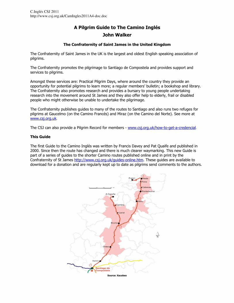
The first Guide to the Camino Inglés was written by Francis Davey and Pat Quaife and published in2000. Since then the route has changed and there is much clearer waymarking. This new Guide ispart of a series of guides to the shorter Camino routes published online and in print by theConfraternity of St James http://www.csj.org.uk/guides-online.htm. These guides are available todownload for a donation and are regularly kept up to date as pilgrims send comments to the authors.
Source: Xacobeo
Introduction
“The pilgrimage way to Compostela enjoyed widespread fame throughout medieval Europe. Land andsea alike were furrowed with routes rich in spirituality leading to Santiago de Compostela. Themaritime routes drew pilgrims from Scandinavia, Flanders, England, Scotland and Ireland on their wayto destinations such as Ribadeo, Viveiro, Ferrol and A Coruña. Blessed by an exceptionally strategiclocation, the latter two coastal enclaves are the starting points forthe two alternative itineraries that make up the English Way.” (Source: The Xacobeo guide to the CaminoInglés)
Departure points
This Guide describes the routes from A Coruña and Ferrol. The route from A Coruña to Santiago deCompostela is approximately 72 kms in length and therefore those travelling this arm of the CaminoInglés are not entitled to receive a Compostela, for which a journey of 100 kms is required. The routefrom Ferrol is approximately 118 kms.
Both routes meet at Hospital de Bruma – 32 kms from A Coruña and 74 kms from Ferrol.
For an overall map of routes in Galicia:http://www.turgalicia.es/mapasgalicia/mapasgcs.asp?cidi=G&menu=12&subMenu_1=3
(Source: La Oficina de Acogida al Peregrino of Santiago de Compostela)
Internet resources
A number of Camino related internet sites offer useful information about the Camino Inglés. Thefollowing list is not exhaustive:
• http://www.csj.org.uk/route-camino-ingles.htmThe Confraternity of Saint James is worth joining to support this, the oldest English languageassociation run by pilgrimsfor pilgrims. It is the principal source of information on Camino related matters.
• http://www.caminodesantiago.me/With the largest English speaking interactive pilgrims’ forum.
• http://www.santiago-compostela.net/ingles/index_ci_en.htmlFor photographs of the route.
• http://www.xacobeo.es/2006/adjuntos/descargas/25_The_English_Way.pdfFor a very well presented downloadable general guide to the route in English – not worth printing ifcalling at the Tourist Office in Ferrol – see below.
• http://www.caminoingles.comFor strip maps, photographs and general information.
• http://www.mundicamino.com/With much information and graphic profiles.
• www.turgalicia.esGo to publications – Mapas de Galicia – Mapas Camiños de Santiago – for a map of the routes inGalicia.
Go to publications – and then Aloxamentos 2008 – for a list of registered hotels and hostales – theindex covers the main points on the route.
• http://www.ign.es/ign/en/IGN/cartoteca_MapTopo.jspFor map enthusiasts there is a complete set of IGN 1:50,000 maps of Spain available for download asPDF files.
Albergues
On the Ferrol arm of the route there are albergues in Neda, Miño and Hospital de Bruma - these havebeen established through the enthusiasm of local Amigos Associations rather than an overall plan ofaccommodation needs on this route. There were other sleeping facilities provided in temporaryaccommodation during the Holy Year 2010 - notable in Ferrol and Pontedeume. At this time it is notknown how long these will be open beyond 2010. More information is requested. Therefore most usethe following stages using hostal or hotel accommodation at each stage or either hostalaccommodation or the excellent albergue at Hospital de Bruma:
Ferrol – Pontedeume 25 kmsPontedeume – Betanzos 20 kmsBetanzos – Hospital de Bruma 29 kmsHospital de Bruma – Sigüeiro 24 kmsSigüeiro – Santiago de Compostela 16 kms
For those wishing to use albergues:Ferrol – Neda 11 kmsNeda – Miño 27 kmsBetanzos 9 kms from Miño - from 2010Miño – Hospital de Bruma 38 kms
New albergues planned:
Local authorities in the area have been meeting to discuss extending the network of municipalalbergues along the Camino Inglés. New albergues are planned for Betanzos, Sigüeiro and Carral - thelatter being on the A Coruña arm - but work on these seems to have been halted for the moment. Anyfurther information on accommodation available would be appreciated.
How to get there
Fly to A Coruña with Veuling or Iberia from London and walk from there to Santiago or take a bus toFerrol:
• http://www.vueling.com/EN/
• http://www.iberia.com/flight-offers/La-Coruna/
• http://www.coruna-ya.com/transporte-interurbano/marina-lucense/ferrol.htmlThe airport bus from A Coruña costs around 1 euro. It stops at the bus station if you wish immediateonward travel to Ferrol.
Or
Fly to Santiago with Ryanair and get a bus to Ferrol or A Coruña:• http://www.ryanair.com
There is a bus every half hour or so to the Estación Central de Autobuses, from which there areseveral buses each day to Ferrol.
Once in the bus station at Ferrol, you need to walk the only obvious way into the city streets, then inthe first big plaza you come to, take the major right-hand street which leads (after a kilometre or so)to the starting point in Ferrol Harbour. The Tourist Office where you can obtain a credencial and sellois in this square as described below.
From Oviedo and Asturias: Getting to Ferrol from Oviedo: The narrow-gauge FEVE train leaves Oviedoat 07.47 or 14.47; the scenic journey takes 7 hrs. (see www.feve.es)
How to find a place to stay
The internet is now a rich source of information on accommodation: www.turgalicia.es is particularlyrecommended, as it gives contact and location details for all types of bookable accommodation. So toois the local Tourist Office, which will have a list of accommodation of different prices - and they mayalso express an opinion on the most suitable. Whilst many pilgrims want to book in advance to besure of a bed and to avoid trailing around hostales with a rucksack at the end of a hard day’s walking,there are bargains to be had arranging at the last moment. If you are going to do this however makesure you avoid any local fiestas.
You should check out in advance how to get to the Tourist Office or town centre from your point ofarrival at the airport/bus station.
Travelling by bus or taxi on the Camino
All of the bars along the route have telephone numbers for local taxis and information about buses.
Throughout the A Coruña arm, and from Bruma/Meson do Vento on the joint route, it is not toodifficult to leave the Camino and walk to the parallel main N550 road (A Coruña to Santiago) wherethere are buses in both directions. These are at hourly and sometimes 2 hourly intervals with the lastbus being at 7pm, except on a Friday.
There are hotels and hostales along the road at Meson do Vento, Ordenes and Sigüeiro that provideuseful and inexpensive alternatives for meals and lodgings.
Language – what to do if you think you are lost
Spanish and Gallego, which is closer to Portuguese in many ways, have equal status in Galicia. Mostpeople in towns speak both languages, but in the countryside Gallego is more commonly used. Place-names on sign-posts may be in either language, for example Ordenes (Spanish) or Ordes (Gallego),although Gallego is now more common.
Whilst along the Camino Inglés you will not encounter many local people who can speak English, theyare becoming more used to pilgrims from outside Spain. If you make an effort to talk to them they willgo out of their way to be helpful. Those who do not speak Spanish can still make this journey butcould take a phrase book and/or learn some phrases such as how to ask directions or book a room.
The route from both A Coruña and Ferrol and is well marked with granite waymarks and yellowarrows on lamp-posts, trees, walls, on the ground etc. This guide gives very specific directions. It isvery unlikely that you will get lost. However if you feel that you may have lost your way a rule ofthumb is that, unless otherwise indicated in this Guide, if you have not encountered an arrow orwaymark for 1 km (or roughly 15 mins walking) you should:
a) Go back to the last arrow and check that you followed the direction correctly; orb) Ask directions from a local person.
Asking directions can be daunting if you do not speak Spanish but local people will recognise you area pilgrim and will try to be helpful. If there is no one around and you are near houses then knock on adoor or stop a passing car. Keep your communication simple. Often pointing at where you want to get
to in the guide book will be sufficient. Also useful are the words “donde” (pronounced donday)meaning “where” or “donde esta” meaning “where is” plus an indication of where you want to go willbe sufficient. Other key words are “El Camino” and “La Ruta”.
For example: “Donde esta el camino?” or “donde esta la ruta?” – “where is the camino?” or “where isthe route?”
Another tip is to look slightly ahead in the guidebook to identify where you are heading next – forexample, if the guidebook says “follow the road ahead until you come to the bus station” simply asksomeone “donde esta la Estación Central de Autobuses” or simply say “donde” and point at the phrase“Estación Central de Autobuses” in the Guidebook.
Definitions used in this guide:
KSO – keep straight onFuente – a drinking water fountainLavadero – a communal place for washing clothesCruceiro – a stone cross, usually with figures carved on each side, often placed at parish boundaries
A Coruña
Where to stay
As a coastal resort popular with the Spanish there is a full range of hotels and hostales at all prices.
All accommodation is listed here:
www.turgalicia.es
The website is available in English and you can search for lists of accommodation in the main pointson the route.
Tourist OfficeOficina de Turismo de A CoruñaDársena de La Marina, s/nPostcode: 15001E-mail: [email protected]: 981 221 822 | Fax: 981 221 822
A Coruña Tourist Office, dependent on La Xunta de Galicia, keeps open all year with the followingworking hours:Monday to Friday: from 10:00 am to 2:00 pm and from 4:00 pm to 7:00 pm.Saturdays: from 11:00 am to 2:00 pm.Sundays and bank holidays: from 11:00 am to 2:00 pm.
Credenciales and information about the local Amigos Association
Available for 0.5 € from the Church of Santiago in the Rúa Santiago, near the harbour and mainsquare. This is the starting point of the route. The church is the oldest in A Coruña and has beenrestored.
Masses: Daily at 12 noon and 8pm Sundays and Feasts at 10.30, 11.30, 12.30 and 8pm
A Coruña – Hospital de Bruma (Albergue) 32kms or +2kms to Meson do Vento (Hostales)
Strong and experienced walkers may walk the route from A Coruña to Hospital de Bruma in one day.
Others may prefer to walk part of the route on day one to have a shorter distance to walk thefollowing day.
There are various options:
Walk to the 2 star hotel A’ Marisqueira, approximately 8 kms from the start of the route.
Walk to the Hostal La Paz, approximately 10.5 kms from the start of the route.
Walk to the Hostal Meson Vasco, approximately 12 kms from the start of the route.
At each of these points you can return to A Coruna by bus/taxi, or stay overnight continuing on thenext morning.
A Coruña – Hospital de Bruma approximately 32 kms (+2 kms to Meson do Vento)
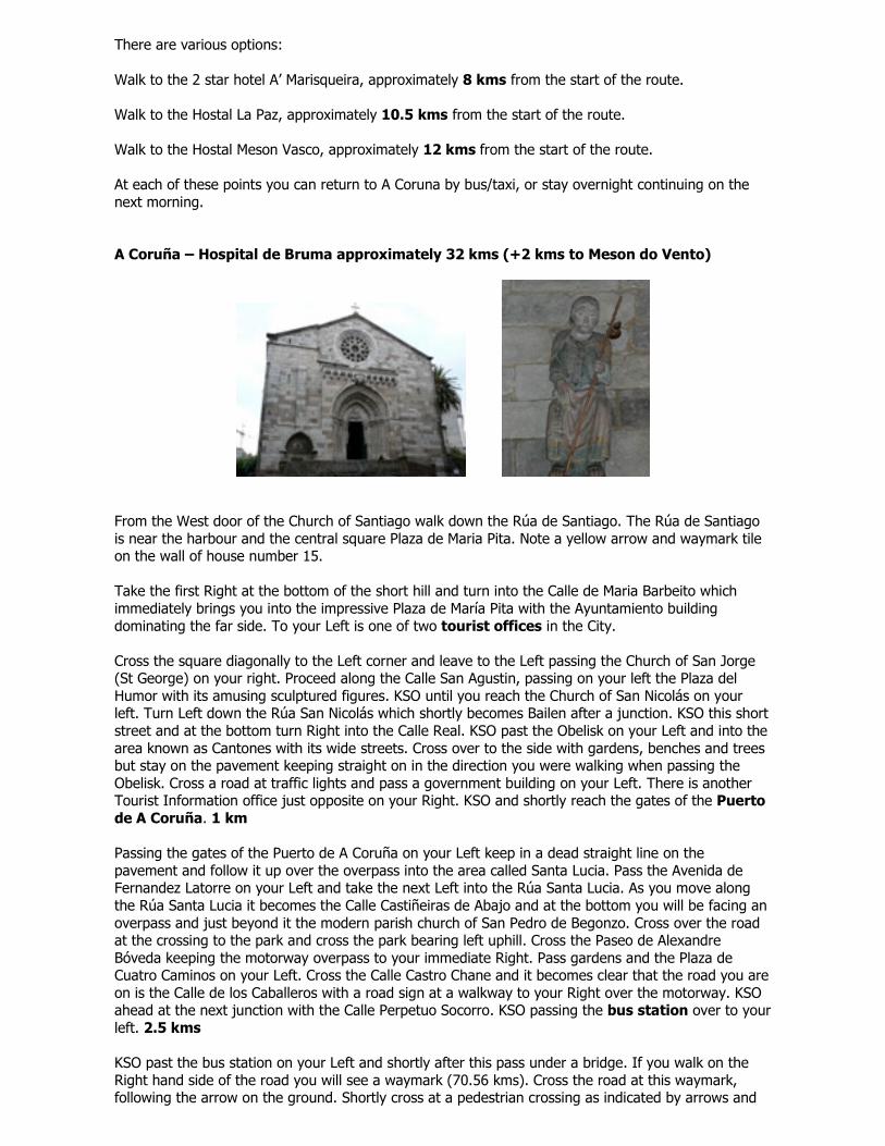
From the West door of the Church of Santiago walk down the Rúa de Santiago. The Rúa de Santiagois near the harbour and the central square Plaza de Maria Pita. Note a yellow arrow and waymark tileon the wall of house number 15.
Take the first Right at the bottom of the short hill and turn into the Calle de Maria Barbeito whichimmediately brings you into the impressive Plaza de María Pita with the Ayuntamiento buildingdominating the far side. To your Left is one of two tourist offices in the City.
Cross the square diagonally to the Left corner and leave to the Left passing the Church of San Jorge(St George) on your right. Proceed along the Calle San Agustin, passing on your left the Plaza delHumor with its amusing sculptured figures. KSO until you reach the Church of San Nicolás on yourleft. Turn Left down the Rúa San Nicolás which shortly becomes Bailen after a junction. KSO this shortstreet and at the bottom turn Right into the Calle Real. KSO past the Obelisk on your Left and into thearea known as Cantones with its wide streets. Cross over to the side with gardens, benches and treesbut stay on the pavement keeping straight on in the direction you were walking when passing theObelisk. Cross a road at traffic lights and pass a government building on your Left. There is anotherTourist Information office just opposite on your Right. KSO and shortly reach the gates of the Puertode A Coruña. 1 km
Passing the gates of the Puerto de A Coruña on your Left keep in a dead straight line on thepavement and follow it up over the overpass into the area called Santa Lucia. Pass the Avenida deFernandez Latorre on your Left and take the next Left into the Rúa Santa Lucia. As you move alongthe Rúa Santa Lucia it becomes the Calle Castiñeiras de Abajo and at the bottom you will be facing anoverpass and just beyond it the modern parish church of San Pedro de Begonzo. Cross over the roadat the crossing to the park and cross the park bearing left uphill. Cross the Paseo de AlexandreBóveda keeping the motorway overpass to your immediate Right. Pass gardens and the Plaza deCuatro Caminos on your Left. Cross the Calle Castro Chane and it becomes clear that the road you areon is the Calle de los Caballeros with a road sign at a walkway to your Right over the motorway. KSOahead at the next junction with the Calle Perpetuo Socorro. KSO passing the bus station over to yourleft. 2.5 kms
KSO past the bus station on your Left and shortly after this pass under a bridge. If you walk on theRight hand side of the road you will see a waymark (70.56 kms). Cross the road at this waymark,following the arrow on the ground. Shortly cross at a pedestrian crossing as indicated by arrows and
keep straight ahead up the Avenida de Molenos, with blocks of flats on either side. There is no streetsign immediately obvious but keep going straight up hill. As you cross the Calle Rafael Dieste look toyour Left and see the Church of Santa María de Oza.
KSO at the junction with the Calle de Vicente Aleixandre and also cross the next junction on your Left.Keep on the pavement veering left at a large junction with a roundabout and shortly cross over thejunction with the Calle Jerónimo Vázquez Franco and KSO uphill the Avenida Molenos. Near the top ofthe hill at House Number 8 on the Right hand side of the road there is a waymark and a yellow arrowtaking you off to the Right down a lane. 4 kms
KSO and shortly, at House Number 6, there is a fuente on your Right – the water is NOT drinkable.KSO and at House Number 18 veer Left. At the next 4 way junction KSO ahead following arrows onthe ground and ahead. As the lane rises up turn Left following the arrows then Right past HouseNumber 3. Shortly, at House Number 7, turn Right. KSO a dirt track then veer Left onto a tarmac lane.You can see the next place you will walk through, Portazgo, off to your Right. KSO eventuallycoming out onto the main road at the end of the lane. Note the fuente on your Left. Facing you on thewall opposite is a waymark. Follow this Right. Move over to the Left hand side of the road and followthe arrows across the bridge over the motorway to passing the Centro Commercial Alcampo on yourRight in Portazgo.
(Alternatively at House Number 6 above you could KSO the road passing on your Left the CentroOncológico. You will see to your Left the distinctive spires of the Capilla Labaca, the chapel of thehospital which was formerly named Hospital Labaca. KSO until you cross over the motorway to enterPortazgo, passing on your Right the Centro Commercial Alcampo, then a petrol station and the signfor Portazgo.)
KSO through Portazgo and at House Number 36 on the Right Hand side turn Left down a clearlywaymarked lane. KSO and shortly turn Right following arrows on the ground. KSO and at the bottomof this road, the Rúa Eduardo Blanco Amor, turn Left following the waymark (67.388) on thepavement opposite. It may be obscured by parked cars. Follow the Rúa Jorge Gullién to the bottomand cross over, veering slightly Left following the arrows. Shortly follow the arrows Right at a floralroundabout and KSO with the railway to your Right and the river to your Left. There is a granitewaymark pointing Right along the promenade. KSO until the very end of the promenade inapproximately 4 kms. There are no further arrows until you reach the end. This is a lovely walkand there are benches and tables if you wish to have a picnic lunch.
At the end of the promenade go up some steps and you will see the next waymark on the pavementopposite indicating that you turn Right. If you cross to this waymark you will see adjacent to it (Left)an information board, seats and a fuente facing the Bridge of Burgo. This strategically placed bridgewas the objective of the last mission of Sir John Moore’s Reserve Troops engaged in action at theBattle of A Coruña, one of the battles of the Peninsular War. During this battle Sir John Moore wasmortally wounded and was buried in A Coruña.
The 2 star hotel A’ Marisqueira is to the Right 800 yards across the bridge cross the bridge:http://www.hotelamarisqueira.com
Otherwise follow the waymark and arrows slightly uphill and shortly pass the Church of Santiago de OBurgo with gates in the shape of a scallop shell. 8pm Mass. Sello available. KSO ahead and soon theroute veers Left at a junction with a Cruceiro. Note that a few steps to the Right there are two 2**Hostales: the O Meson and the Casa Julio.
Hostal El Meson Casa Julio 2** Avenida Da Coruña, 25 Avenida da Coruña, 19 15670 Culleredo 15670 Culleredo Telephone: (+34) 981 660 065 Telephone (+34) 981 660 089
KSO following the arrows and soon at the next junction with a small roundabout turn Left. KSO passing under the motorway. A little after this veer Right up the Rúa Pelamios following the direction of the waymark and arrows. Just after House Number 7 veer Right. KSO Right at House Number 5. At the top of the incline at the STOP sign turn Right. KSO uphill passing on your Left the Parish Church of San Julian de Almeiras. Pass on your Right a statue of the
Caballero of Almeiras and an Information Board. KSO. If you look back you will see views of the river and to your Right is the long runway and buildings of A Coruña airport. KSO passing the Municipal Sports Centre and a football ground on your Left. KSO following the road downhill. Turn Left at House 16 up the Rúa Arcebispo Xelmírez. KSO along this minor road through trees and then downhill turning Right at a Camino sign. KSO Right at the roundabout and veer Left at the next junction. KSO downhill passing a restaurant and the 2** Pension La Paz on your Right:
Pensión La Paz Cuesta de Alvedro, 41 Culleredo 15180 Telephone (+34) 981 650 101
KSO downhill following frequent signs and at the bottom turn Left. After a little turn Right across the road. Cross a small bridge and KSO uphill with the Restaurante Casa German on your Right. Come out onto a road. The route carries on straight across the road but turn Left here if you wish to go to the 2** Hostal Meson Vasco which is 1/3 of a kilometer along the road. It is clearly signposted:
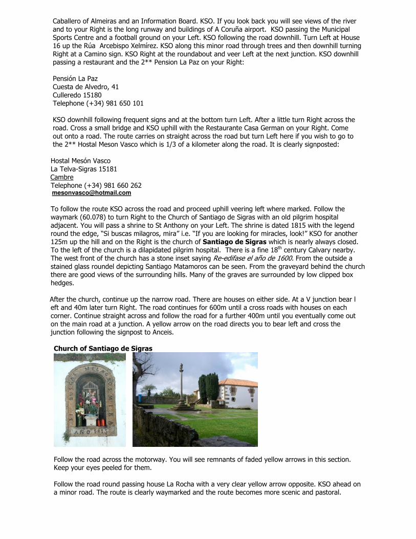
To follow the route KSO across the road and proceed uphill veering left where marked. Follow the waymark (60.078) to turn Right to the Church of Santiago de Sigras with an old pilgrim hospital adjacent. You will pass a shrine to St Anthony on your Left. The shrine is dated 1815 with the legend round the edge, “Si buscas milagros, mira” i.e. “If you are looking for miracles, look!” KSO for another 125m up the hill and on the Right is the church of Santiago de Sigras which is nearly always closed. To the left of the church is a dilapidated pilgrim hospital. There is a fine 18th century Calvary nearby. The west front of the church has a stone inset saying Re-edifase el año de 1600. From the outside a stained glass roundel depicting Santiago Matamoros can be seen. From the graveyard behind the church there are good views of the surrounding hills. Many of the graves are surrounded by low clipped box hedges.
After the church, continue up the narrow road. There are houses on either side. At a V junction bear l eft and 40m later turn Right. The road continues for 600m until a cross roads with houses on each corner. Continue straight across and follow the road for a further 400m until you eventually come out on the main road at a junction. A yellow arrow on the road directs you to bear left and cross the junction following the signpost to Anceis.
Church of Santiago de Sigras
Follow the road across the motorway. You will see remnants of faded yellow arrows in this section.Keep your eyes peeled for them.
Follow the road round passing house La Rocha with a very clear yellow arrow opposite. KSO ahead ona minor road. The route is clearly waymarked and the route becomes more scenic and pastoral.
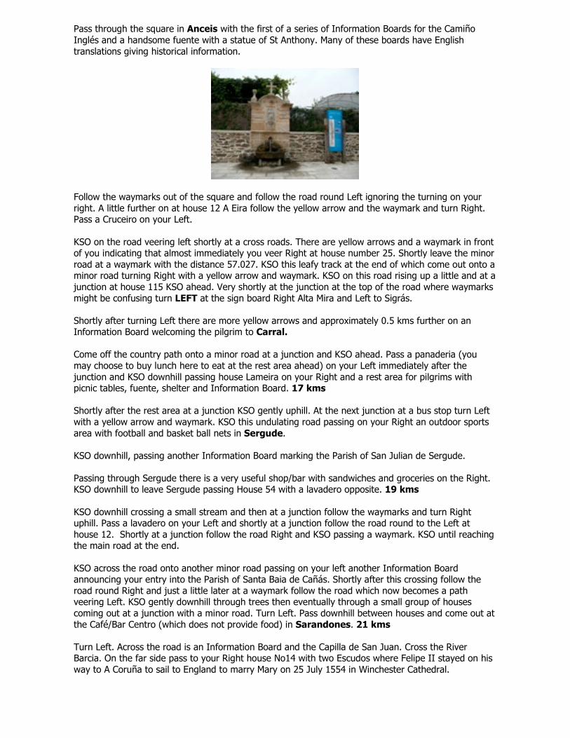
Pass through the square in Anceis with the first of a series of Information Boards for the CamiñoInglés and a handsome fuente with a statue of St Anthony. Many of these boards have Englishtranslations giving historical information.
Follow the waymarks out of the square and follow the road round Left ignoring the turning on yourright. A little further on at house 12 A Eira follow the yellow arrow and the waymark and turn Right.Pass a Cruceiro on your Left.
KSO on the road veering left shortly at a cross roads. There are yellow arrows and a waymark in frontof you indicating that almost immediately you veer Right at house number 25. Shortly leave the minorroad at a waymark with the distance 57.027. KSO this leafy track at the end of which come out onto aminor road turning Right with a yellow arrow and waymark. KSO on this road rising up a little and at ajunction at house 115 KSO ahead. Very shortly at the junction at the top of the road where waymarksmight be confusing turn LEFT at the sign board Right Alta Mira and Left to Sigrás.
Shortly after turning Left there are more yellow arrows and approximately 0.5 kms further on anInformation Board welcoming the pilgrim to Carral.
Come off the country path onto a minor road at a junction and KSO ahead. Pass a panaderia (youmay choose to buy lunch here to eat at the rest area ahead) on your Left immediately after thejunction and KSO downhill passing house Lameira on your Right and a rest area for pilgrims withpicnic tables, fuente, shelter and Information Board. 17 kms
Shortly after the rest area at a junction KSO gently uphill. At the next junction at a bus stop turn Leftwith a yellow arrow and waymark. KSO this undulating road passing on your Right an outdoor sportsarea with football and basket ball nets in Sergude.
KSO downhill, passing another Information Board marking the Parish of San Julian de Sergude.
Passing through Sergude there is a very useful shop/bar with sandwiches and groceries on the Right.KSO downhill to leave Sergude passing House 54 with a lavadero opposite. 19 kms
KSO downhill crossing a small stream and then at a junction follow the waymarks and turn Rightuphill. Pass a lavadero on your Left and shortly at a junction follow the road round to the Left athouse 12. Shortly at a junction follow the road Right and KSO passing a waymark. KSO until reachingthe main road at the end.
KSO across the road onto another minor road passing on your left another Information Boardannouncing your entry into the Parish of Santa Baia de Cañás. Shortly after this crossing follow theroad round Right and just a little later at a waymark follow the road which now becomes a pathveering Left. KSO gently downhill through trees then eventually through a small group of housescoming out at a junction with a minor road. Turn Left. Pass downhill between houses and come out atthe Café/Bar Centro (which does not provide food) in Sarandones. 21 kms
Turn Left. Across the road is an Information Board and the Capilla de San Juan. Cross the RiverBarcia. On the far side pass to your Right house No14 with two Escudos where Felipe II stayed on hisway to A Coruña to sail to England to marry Mary on 25 July 1554 in Winchester Cathedral.
KSO through the village slightly uphill and at the end of the village just before the road veers Leftthere is the Café/Bar Quintanas which sells hot and cold drinks and provisions and will make freshsandwiches. As the road veers Left the route goes off to the Right up a minor road. Shortly passhouse number 7 Orueiro and KSO ignoring the turn to the Right. KSO gently uphill veering Right athouse number 23. Pass a house with a small factory building adjacent on your Left and shortly amodern terracotta painted house on your right. KSO gently uphill and after a further 1 km pass house38 on your Left.
KSO uphill and in approximately 1 km more reach the top of this section of the ascent. There is busstop on your Left and follow the road round to a junction at Cruz de Veira. 24 kms
The arrows indicate that the route continues across the road but if you turn Left almost immediatelyyou will find a very handy bar. However it may not be open out of high season.
Veer right on the road if you are not going to the Bar and almost immediately Left at an InformationBoard and a waymark. KSO uphill on this minor road for a further 0.5 km and at a stone housenumber 2 KSO the road you are on veering to the Right. KSO uphill and the road shortly becomes awide track. After 2 kms the path levels out and you pass farm buildings on your Right and off to theLeft a telecommunications mast.
KSO following the track as it winds round passing the mast on your Left. Come onto a road at anInformation Board at As Travesas. 27 kms
This is the highest point on the route at over 450 metres above sea level.
At this point especially in inclement weather you could simply turn Right onto the road and KSO untilyou reach Meson Do Vento before which there are yellow arrows off to the Left indicating a roadturning to Hospital de Bruma.
To follow the waymarked route turn Right onto the road then immediately Left and then immediatelyRight to pass behind houses on a path parallel to the road.
KSO on the path with very faded yellow arrows on telegraph poles on your left. After 250 metres turnRight at a waymark with the distance 45.074. Follow the shady grassy track straight ahead throughthe trees. This may be heavy going in wet conditions. After approximately 800 meters come out on tothe road and turn Left. 29kms
KSO the road passing House Number 22 with the road to the Right signposted Herves. KSO past theCasa Avelina which is a useful bar on your Right. KSO following the arrows with a large electricitystation ahead on your Right. Ignore any arrows indicating a Left turn at this point and KSO forapproximately 0.5 km and when you are at the end of the electricity station there is a clearly markedLeft turn onto a farm road. If going to Meson do Vento you can KSO on here for another 2 kms. Tofollow the route turn Left as indicated and KSO this road for approximately 750 meters and turn Rightat a granite waymark. This waymark has an arrow on each side and is the point where the route fromFerrol joins shortly before Hospital de Bruma.
Follow this track with farm buildings to the Right and at the end veer Left. Follow this path turningright at the waymark then crossing a small stream with stepping stones continuing straight aheadpass a sign saying 1 km to the Albergue. A little after the stream three paths converge keep on the
right hand path following the waymark straight ahead. On passing a hórreo at a house on the corneremerge into Hospital de Bruma.
Turn Left to pass down the road to reach the albergue or Right to go to Meson do Vento. 32 kms
The description of the route from Hospital de Bruma to Santiago starts on Page 43.
Ferrol
Where to stay:
Name Rating Address Telephone/fax E mailBarcelóAlmirante
Tourist Office:Edificio Administrativo da Xunta de GaliciaPraza Camilo José Cela s/nTele: (+34) 981 311 [email protected]
OpenJuly and AugustMonday to Friday: 9:00 to 14:00 and 17:30 to 19:30 h.
Saturday: 10:00 to 12:30 and 17:30 to 19:30 h.Sunday: 10:00 to 12:30 h.Other months of the yearMonday to Friday: 9:00 to 14:00 and 16:00 a 18:00 h.Saturday: 10:00 to 12:30 h.The Tourist Office is on the first floor of a modern office block tucked into the left hand side of thePlaza España (if facing the direction of the port).
They provide pilgrims with:• Credencial• Sello• Map of the route (showing 2 alternatives) from the city to the outskirts• A copy of the Xunta Guide in English• A schematic of the distances and elevations on the route (which isn’t terribly accurate!)• A Gallego phrasebook (which is perhaps too heavy to carry)
And…they have good toilets if setting off immediately from there!
NB. It is important that you obtain a sello in Ferrol to demonstrate to the Pilgrims’ Officein Santiago that you have walked more than 100 kms in order to qualify for theCompostela. There is no requirement for that sello to be from the Tourist Office and youmay have your Credencial stamped in your hostal etc.
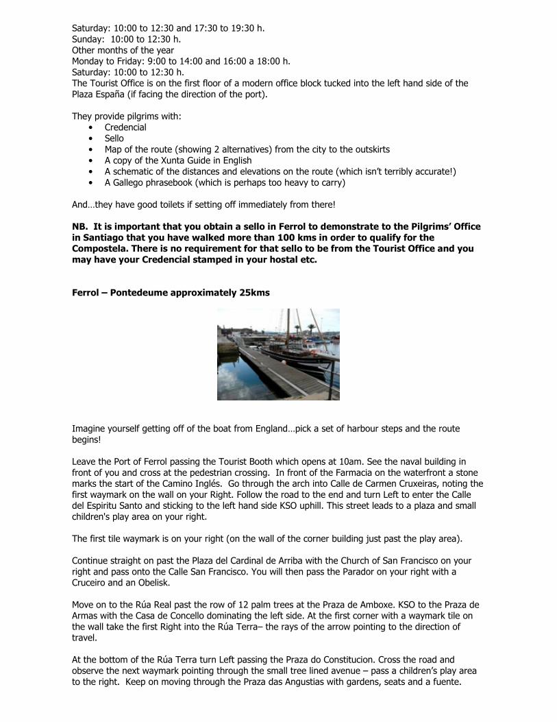
Ferrol – Pontedeume approximately 25kms
Imagine yourself getting off of the boat from England…pick a set of harbour steps and the routebegins!
Leave the Port of Ferrol passing the Tourist Booth which opens at 10am. See the naval building infront of you and cross at the pedestrian crossing. In front of the Farmacia on the waterfront a stonemarks the start of the Camino Inglés. Go through the arch into Calle de Carmen Cruxeiras, noting thefirst waymark on the wall on your Right. Follow the road to the end and turn Left to enter the Calledel Espiritu Santo and sticking to the left hand side KSO uphill. This street leads to a plaza and smallchildren's play area on your right.
The first tile waymark is on your right (on the wall of the corner building just past the play area).
Continue straight on past the Plaza del Cardinal de Arriba with the Church of San Francisco on yourright and pass onto the Calle San Francisco. You will then pass the Parador on your right with aCruceiro and an Obelisk.
Move on to the Rúa Real past the row of 12 palm trees at the Praza de Amboxe. KSO to the Praza deArmas with the Casa de Concello dominating the left side. At the first corner with a waymark tile onthe wall take the first Right into the Rúa Terra– the rays of the arrow pointing to the direction oftravel.
At the bottom of the Rúa Terra turn Left passing the Praza do Constitucion. Cross the road andobserve the next waymark pointing through the small tree lined avenue – pass a children’s play areato the right. Keep on moving through the Praza das Angustias with gardens, seats and a fuente.
At the main road cross over to the helpfully named Café Bar Taxonera and move up the RúaTaxonera. There are many bars open early on this stretch – ideal for pilgrims leaving early in themorning.
The Rúa Taxonera becomes Rúa McMahon and at this point you will see the first yellow arrows onlamp posts. The signs indicate that across the road to your right is a Zona Militar.
KSO following the Avenida Mc Mahon. Pass a football pitch to your right and follow the road to the leftas indicated by the waymark tile on the column of the wall on your right hand side. Follow the roaddown Estrada de Caranza following it right where it joins the Avenida Esteiro and proceed to theroundabout (you have now travelled approximately 3 kms). Turn Right following the arrows and KSOuntil you reach a roundabout with a sculpture and a sign indicating the Avenida do Mar to your right.
From here, there is a choice of two routes (see ‘Alternative Route’ below). As the map provided bythe Tourist Office indicates, one choice would be to turn Left onto the Rúa Marques de Santa Cruz,crossing the motorway on a bridge, at the end of which you turn Right and then immediately Left(arrow) to walk down Canaval past a football ground, then Right onto the Avenida Nicasio Perez(routemarked), passing a McDonald’s café (which, however un-pilgrim-like, makes a very handy toiletstop – also the tea’s not bad), then follow the waymarks Left in front of the Lidl Shop, then Right ontothe next road and then meeting up again with the alternative route beside the Renault showroom.
Alternative route - recommended
Another slightly longer but much more scenic route is to follow the Avenida do Mar keeping the sea toyour right hand side all of the way to the end. At points you can move down to walk closer to the seamoving back up later. Also, in 2008 there was a public toilet on this stretch.
Towards the end pass a multicoloured sports centre and a football pitch on your left.
As you pass the road sign you will see a yellow arrow on the lamp post in front of you indicating aturn to the Left – go under the motorway and straight across the road to the right hand side. Proceeddown to the Lidl Shop and just before it turn Right. 5.5 kms. Follow the arrows down the right handside of the Lidl store and turn Right turning Right again after a short distance at the waymark tile onthe post opposite the Renault showroom.
(end of alternative route)
Carry straight on with the bay on your right hand side and factories on your left. There are seats anda fuente on this stretch.
In the following section, ignore red and white arrows, fluorescent yellow arrows mark the routeaccurately.
At the end of this track at the road turn Right and proceed to the roundabout and turn Left. Go to thesign “A Faisca” and turn Right to cross the motorway (ignoring a yellow arrow to the right, whichleads to a dangerous informal level-crossing before rejoining the route described below) and thencrossing over the railway. About 100 meters beyond the railway, turn hard Left and follow the roaddown to the railway line and KSO with the rail tracks to your right. Pass under the bridge follow theroad as it bends left then take a Right turn with the waymark Rúa de Pena.
Good waymarking will take you through a pleasant area of peri-urban farmland and suburbanhousing. Very shortly you will pass under the motorway, bearing left and following a narrow paththough a pleasant patch of scrub woodland, emerging onto a modern suburban street, taking theright-hand option, following an arrow on the road surface. At the end of this street, turn Right anddescend gently to the beautiful Parish Church of San Martin de Xubia, which is derived from a 12th
Century Benedictine monastery.
A Cruceiro and large modern statue of the Sacred Heart of Jesus make a nice resting place here, inthe shade of trees, with an interesting Information Board about another Camino (that of San Adrés deTeixido, which starts hereabouts and goes to the northern coast of Galicia – this explains the red andwhite arrows). A few steps uphill (left) from the Sacred Heart statue you will see a waymark to the
right, and follow the road until it branches right. Follow the arrows straight ahead on a forest pathwhich you follow Right under the motorway. KSO until the track branches right onto a tarmac road -ignore the Left turn under the road and KSO passing a large pedestrian bridge over the motorway. Donot cross – pass underneath following arrows to the right and KSO veering Right at pylons onto to atarmac minor road. KSO and at the next pedestrian bridge turn hard Right to cross over it.
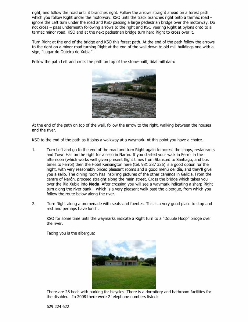
Turn Right at the end of the bridge and KSO this forest path. At the end of the path follow the arrowsto the right on a minor road turning Right at the end of the wall down to old mill buildings one with asign, “Lugar do Outeiro de Xubia” .
Follow the path Left and cross the path on top of the stone-built, tidal mill dam:
At the end of the path on top of the wall, follow the arrow to the right, walking between the housesand the river.
KSO to the end of the path as it joins a walkway at a waymark. At this point you have a choice.
1. Turn Left and go to the end of the road and turn Right again to access the shops, restaurantsand Town Hall on the right for a sello in Narón. If you started your walk in Ferrol in theafternoon (which works well given present flight times from Stansted to Santiago, and bustimes to Ferrol) then the Hotel Kensington here (tel. 981 387 326) is a good option for thenight, with very reasonably priced pleasant rooms and a good menú del día, and they’ll giveyou a sello. The dining room has inspiring pictures of the other caminos in Galicia. From thecentre of Narón, proceed straight along the main street. Cross the bridge which takes youover the Ría Xubia into Neda. After crossing you will see a waymark indicating a sharp Rightturn along the river bank – which is a very pleasant walk past the albergue, from which youfollow the route below along the river.
2. Turn Right along a promenade with seats and fuentes. This is a very good place to stop andrest and perhaps have lunch.
KSO for some time until the waymarks indicate a Right turn to a “Double Hoop” bridge overthe river.
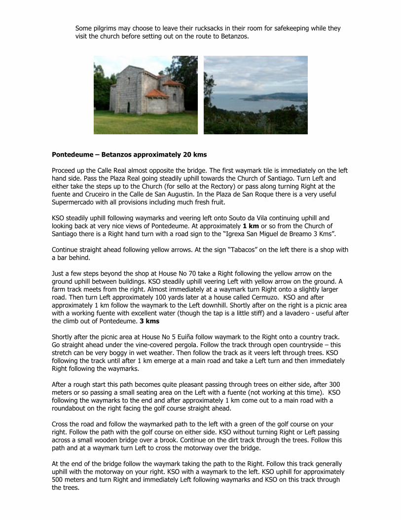
Facing you is the albergue:
There are 28 beds with parking for bicycles. There is a dormitory and bathroom facilities forthe disabled. In 2008 there were 2 telephone numbers listed:
629 224 622
981 390 233
This albergue is a short distance out of town and lone pilgrims should exercise caution. 12kms
If you came via Narón (1 above) you KSO along the river bank. If you came via route 2 (over thebridge), you turn Right along the riverbank. KSO along the riverbank following the obvious route withsufficient reassuring waymarks. The walk is very pleasant. After some time a yellow arrow will mark aLeft turn taking the path you are on onto a minor road. KSO passing a cemetery on the right and atthe end of the small road turn Right onto the main Road.
Almost immediately turn Right to go anti-clockwise round the Iglesia de Santa Maria which has aplaque:
“Dedicated to the pilgrims who visit this site on their way to Saint James of Compostela”.Asociación O Camiño Inglés Año Santo 2004 Holy Year. 13 kms
The church is usually closed. If you find it open you will see in the upper register of the reredosbehind the main altar a striking “English Gothic” statue of Christ in chains. It is believed that thisstatue was brought from England in the first part of the 16th century by an Englishman, John Dutton.
The Parish Office is across the car park beside the cemetery. If it is open it may be possible to get thekey of the church. Sello available.
Moving round the church cross through a children’s play area across a small bridge and betweenhouses following the waymarks. KSO with a walled garden on your left and you will reach paradise –i.e. a street called Paraíso. There is an old house on Paraíso where you join it, dated 1792, with theinscription ‘HIS’ – which likely identifies it as a Jesuit foundation. Turn Right along Paraíso, which intime becomes the Rúa Real.
When you arrive at an old building with a clock tower on your left you have reached the mediaevalHospice of the Holy Spirit, which was run by a hospitaller order to help pilgrims. This building hasnow been restored and modernized for use by the local council (ayuntamiento or concello). To theright of the stairs leading up to the small plaza by the tower is a lone conifer, which is known locallyas “El Arbol de Los Ingleses”, or the tree of the English; reportedly it was planted by members of theConfraternity of St James in the 2004 Holy Year. Although the Camino carries on straight along theRúa Real, it is worth the brief diversion of going up these stairs, then turning Right along the mainroad to visit the Casa da Cultura, which is on the left a short way down the road. On the first floorare some spotless toilets and a very helpful visitor information office, which will provide a sello, aswell as abundant information on the Camino and places to stay all the way along it. They areextremely friendly and delighted to welcome pilgrims. To get back to the Camino, walk down thealley between two houses opposite the Casa de Cultura (stone paved alley, house on the right iscurrently painted green) and turn Left into the Rúa Real.
Continue along the Rúa Real with 17th and 18th century houses, as far as Rúa do Castro. Notice house66 on the right with the inscription “Año de 1786” above the window.
At number 84 is a useful shop for provisions. Opening hours are irregular. If you need supplies, gouphill to the main road which has bars and a shop.
At the junction beside house number 92 Rúa Real turn Left and KSO passing a cemetery on your right.KSO then veer Left at building number 29 following the arrows.
Divert briefly to the right to visit the interesting church of San Nicolás with its splendid Cruceiro, oneof the oldest in Galicia. (If closed, the key to the church is always kept in the Bar next door Casa Rios,which is also a grocery shop.) Inside the church there is a fine monument to the Andrade family, themost powerful in the area in the Middle Ages. Then Neda was one of the minor ports ofdisembarkation for pilgrims. Go back to the Rúa Real to pick up yellow arrows again.
Cross the main road and the KSO the Camino do Regueiro. At the end of the road, a waymarked turnto the left takes you uphill on a track below a retaining wall supporting the motorway. At the main
road at the top of the hill go Right. Note the waymark across the road at the bus shelter and crossover. This is a good place to rest on a hot day before the further climb ahead.
A couple of hundred metres after the bus shelter a waymark indicates a turn to the Left and follow thearrows uphill. Soon two roads turn to the right. Take the second, larger road, and shortly cross themotorway. KSO.
There is a brief climb and at the top of the hill at Silva turn Right. KSO with beautiful views graduallygoing downhill until a waymarked Left turn at a sign for Conces. KSO following arrows and on the leftof the road at the corner just before Conces Arriba sign there is a lavadero with a shaded picnic area.The locals say the water is drinkable and it is deliciously cold.
From the lavadero KSO, with great views across the Ferrol estuary, and to the nearby Navantiashipyard in Fené. KSO following waymarks, ignoring a turnoff on the left into the hamlet ofCasanova. Follow the waymarks straight on, going slightly downhill to reach another lavadero,marked 1916, with a shelter and seating area. Locals arrive regularly to fill water containers fordrinking, so it’s also safe to fill bottles here.
The road winds down then gently uphill to the left, well waymarked, and past another lavaderomarked 1957 on your left. Proceed down to the main road.
Go straight across passing the Cafetería Lembranza with the Café Bar A Ponte on the left and almostimmediately pass the Casa do Concello of Fene on your right. Sello available on the first floor. 17.5kms
Go to the end of the road and turn Left. Almost immediately turn Right. Keep straight on left at house21 then KSO through the hamlets of Perlio and Mundin (or Chamoso, according to the Gallego graffition the sign), and bear Left at a lavadero. Then KSO on uphill. As the road veers left take thewaymarked forest path, which is a beautiful shaded section.
KSO uphill and veer left at fork keeping to the forest path. At the top, turn Right down a grassy pathparallel to and slightly below the road. On the right is a spectacularly large camino symbol, pointing inthe right direction, sprayed on the end of a cylindrical tank in a garden. KSO following the path underthe Viaduct Romariz, veer Left after passing under the road, and veer Right when you can see thesign for Fene Ferrol N-652 turnoff on adjacent motorway. At the end of the path turn Right onto aminor road. Keep straight on the road Right and at the end of the lane cross the road carefully andtake up the path almost opposite to the Right. Follow this up to the main road at Cafeteria Vilar doColo 3 kms from Fene. The Cafeteria is a typical motorway service station place, which won’t servefood until 1pm. Although not especially friendly, the menu is cheap, the toilets handy and the shop agood place to stock up on provisions. To follow the camino, though, do not walk towards theCafeteria, but instead, turn sharp Left across the road following yellow marks on the pavement,turning Left again on the opposite pavement, and then at the roundabout followPontedeume/Betanzos N-651 sign – yellow arrow to the right on the ground. 20 kms
KSO keeping a sharp lookout for arrows on the ground indicating a Right turn before a bend in theroad. Turn on to a delightful off-road track through the trees. KSO crossing a minor road and take upthe path opposite. KSO until reaching a minor road with an arrow indicating a Right turn. Almostimmediately cross over the motorway. At the end of the bridge turn Left onto a track then turn Rightfollowing the arrows onto a forest path. KSO and at the end turn Left and immediately Right. Godownhill and turn Left at a sign for Lodeiro. Halfway down this hill follow a waymark turning Right,and at the end turn Left. Follow the road downhill looking for the Right turn at the bottom.
KSO following waymarks downhill. A damp path heading into trees leads to an ancient stone-slabbridge, crossing a small stream which you then follow with the stream on your right. You come out tothe road by a striking ancient millhouse and barn, apparently still inhabited. Turn left where you meetthe road, making a steep but short climb upwards before the road levels out, then continue downhill,crossing the main road and going down the steps, turning immediate Left and going down and underthe railway bridge. Then enter Cabañas. 24 kms
KSO with the beautiful sandy beach to your right, with lots of cafés and the odd potable water tap forre-filling bottles amongst the trees, and follow the road round Left at roundabout at waymarks tocross the bridge into Pontedeume.
This famous bridge at one time had 116 arches, with a chapel at arches 21 and 22. Take it to crossthe River Eume and enter Pontedeume. 25 kms
Pontedeume
Where to stay
Ask at the local tourist office:
La Oficina de Turismo is situated on the first floor (1 planta) del Torreon de Los Andrade – the groundfloor of the Andrade Tower, where there is a museum upstairs and a fine view of the bridge and thetown from the top of the tower. They will have a list of recommended hotels and hostales – or consultthe website www.turgalicia.es – or just wander around until you find somewhere – on the front is thereasonably expensive Hotel Eumesa.
After the bridge at the roundabout take the first exit and then first Right to the Calle San Augustinwhere there are three very reasonably priced establishments: The Hospedaje North - Telephone: 981
434 527; the Bar Louis with rooms (12 Euros per person) - Telephone: 981 430 235; and the Allegue 2star Pension - Telephone: 981 430 035. 1 km outside of town on the road to A Coruña is a RetreatHouse - the Casa de Ejercicios de Pontedeume – Telephone: 981 430 142 or 981 430 335. If all 30rooms are not in use with retreats or courses they may be available to pilgrims. 20 Euros singleincluding breakfast, which is not served until 8.30 am. Mass and sellos
There is a Mass at 8pm in the Church of Santiago and the sello is available in the Priest’s house, “theRectory”, immediately opposite. A sello is available also at the Confradia de Pescadores, fifty meterson your right as you come off the bridge on arrival in Pontedeume.
Detour to the Church of San Miguel de Breamo
High above Pontedeume lies the solitary Romanesque 12th Century Church of San Miguel de Breamo.It is rarely open.
There are two ways of visiting the church:
1. Go up to the church of Santiago behind which is a notice board illustrating the way to getthere through the forest. It is advisable to sketch it on a piece of paper to take with you aswaymarking has faded. Go up the steps behind the notice board and proceed up the Rúa deFonta Nova to house number 8. Turn Right and continue up...up...up… then you reach thechurch. If you follow this all the way you will not have the clear vistas of the bay of A Coruñawhich you get on the road so it is possible after the first stretch up the steps through thetrees to turn Right onto the road and descend either by the road or the forest route.
2. Follow the yellow arrows up the Rúa Real for about 1 km then follow the road sign marked3 km to the church of San Miguel de Breamo.
Some pilgrims may choose to leave their rucksacks in their room for safekeeping while theyvisit the church before setting out on the route to Betanzos.
Pontedeume – Betanzos approximately 20 kms
Proceed up the Calle Real almost opposite the bridge. The first waymark tile is immediately on the lefthand side. Pass the Plaza Real going steadily uphill towards the Church of Santiago. Turn Left andeither take the steps up to the Church (for sello at the Rectory) or pass along turning Right at thefuente and Cruceiro in the Calle de San Augustin. In the Plaza de San Roque there is a very usefulSupermercado with all provisions including much fresh fruit.
KSO steadily uphill following waymarks and veering left onto Souto da Vila continuing uphill andlooking back at very nice views of Pontedeume. At approximately 1 km or so from the Church ofSantiago there is a Right hand turn with a road sign to the “Igrexa San Miguel de Breamo 3 Kms”.
Continue straight ahead following yellow arrows. At the sign “Tabacos” on the left there is a shop witha bar behind.
Just a few steps beyond the shop at House No 70 take a Right following the yellow arrow on theground uphill between buildings. KSO steadily uphill veering Left with yellow arrow on the ground. Afarm track meets from the right. Almost immediately at a waymark turn Right onto a slightly largerroad. Then turn Left approximately 100 yards later at a house called Cermuzo. KSO and afterapproximately 1 km follow the waymark to the Left downhill. Shortly after on the right is a picnic areawith a working fuente with excellent water (though the tap is a little stiff) and a lavadero - useful afterthe climb out of Pontedeume. 3 kms
Shortly after the picnic area at House No 5 Euiña follow waymark to the Right onto a country track.Go straight ahead under the vine-covered pergola. Follow the track through open countryside – thisstretch can be very boggy in wet weather. Then follow the track as it veers left through trees. KSOfollowing the track until after 1 km emerge at a main road and take a Left turn and then immediatelyRight following the waymarks.
After a rough start this path becomes quite pleasant passing through trees on either side, after 300meters or so passing a small seating area on the Left with a fuente (not working at this time). KSOfollowing the waymarks to the end and after approximately 1 km come out to a main road with aroundabout on the right facing the golf course straight ahead.
Cross the road and follow the waymarked path to the left with a green of the golf course on yourright. Follow the path with the golf course on either side. KSO without turning Right or Left passingacross a small wooden bridge over a brook. Continue on the dirt track through the trees. Follow thispath and at a waymark turn Left to cross the motorway over the bridge.
At the end of the bridge follow the waymark taking the path to the Right. Follow this track generallyuphill with the motorway on your right. KSO with a waymark to the left. KSO uphill for approximately500 meters and turn Right and immediately Left following waymarks and KSO on this track throughthe trees.
At the end of the track where it meets a road follow waymarks to the Left. At the junction with aSTOP sign turn Right into Viadeiro. 7 kms KSO through the village following the waymarks. At theend of the village follow the waymarked fork to the Left. Follow the road downhill to a STOP sign andfollow waymarks and yellow arrows to the Right onto another minor road continuing gently downhill.
At the next junction follow the waymark and turn Left again continuing downhill. At the bottom of theroad turn Right and on the left approximately 9 kms from Pontedeume at the village of Bañobre isthe Guntín concrete works with a picnic area opposite beside the river with a fuente. This is a mostwelcome place to rest.
Leave picnic area across the Ponte Baxoi and turn Right along the track with the river on your right.Pass under the bridge following the yellow arrows and at a Y junction at the end of the track followthe arrows marked on the tree to the right. Pass under the motorway high above following the path.KSO following the path under three motorway flyovers. Follow the track up passing a toll building onyour left and walk parallel to the motorway (motorway 60 sign on your left) for a little. Follow thepath to the end and turn Right as indicated by the tile and yellow arrow on the wall opposite. Followthis minor road downhill and enter Miño following the tile waymark along the Rúa Fonte. 11 kms(27 kms from albergue at Neda)
Keep on the Rúa Fonte passing on your right a modern building of flats named the “Edificio CaminoInglés”. Come out onto a plaza and immediately opposite is a sign to the Albergue de Peregrinos 1 kmwith an arrow to the Left. Pass through the square to the far Left hand corner and follow the yellowarrows out of the plaza. The road ahead forks – take the Left-hand fork (onto the Rúa Pardiñeira); theleft hand fork is not particularly well marked, but markers are seen again further on.
At the top of the street at Number 5 is a shop selling snacks and ice creams which may be verywelcome on a hot day.
At the top of the climb the Camino Inglés continues straight across the main road. For those going tothe albergue there is a sign pointing to the Right. A few steps to the left here will bring you to themain shopping streets of Miño, which has a good selection of pharmacies, banks, restaurants andshops.
If going to the Albergue in Miño
Turn Right at the top of the Rua Pardiñeira and continue downhill on the main road passing a modernblock of flats on the left hand side with gardens and front followed by a children’s play area. Pass 3restaurants on the right hand side which may also be useful for both those continuing on the CaminoInglés and those going to the albergue.
Cross the road bridge over the railway line and follow the sign at the end turning immediately Right.Follow this round reaching the Rúa Telle. Turn Left following the sign for the albergue.
At the bottom of the Rúa Telle pass a children’s play area on the right hand side and follow the roadround with the motorway flyover on your right. KSO to the albergue 1 km from the turning at the RúaPardiñeira and 12 kms from Pontedeume.
Albergue de Miño – Opened 1999
Tel 981 784 254
Hours: 1pm – 3pm and 4pm – 9pm
Closes at 11pm – Pilgrims must leave by 10 am
Cost 3 euros
To continue on the Camino Inglés out of Miño
Pilgrims staying at the albergue retrace their steps to the point where the Camino crosses the mainroad at the junction with the Rúa Pardiñeira and turn Right at the waymark sign.
Others – simply cross the road KSO ahead slightly left – see the waymark on the wall.
KSO between buildings and immediately come to a useful supermarket on your right. Shortly after onthe left is the unpromising-looking Bar A Buchaca, which does very good food for about €8 perperson. Continue up this street past the Bar Vidal on the left and through the buildings on your rightcatch a glimpse of the estuary.
KSO ahead along the Rúa a Barrosa passing at Number 30 the Edificio Camiño de Santiago.
At a pedestrian crossing with the sign leaving Miño there is a sign down to the Right. Cross over andwalk downhill Right to the bridge over the railway in front of you.
Follow the waymark over the bridge and at the end turn sharp Right and follow this road right to thebottom to walk along it parallel to the beach. Shortly pass an area with car parking and showers forbathers. Just past this is the Café Bar “A Ría” with a pleasant garden area – a nice quiet place to stopfor a drink or snack.
Towards the end of the road pass the Bar Restaurant Almeda which serves meals.
Follow the waymarks and arrows to the Right. Cross the bridge over the river and turn Left at HouseNumber 2 following waymark. Follow this road uphill to the top, gradually rising level with and thenabove the motorway you could see from the bottom high above. The climb is approximately 100 mover a distance of about 500 metres.
At the top fortunately there is a children’s play area with picnic tables and seats (though with noshade) for a well earned rest. 13 kms
At the end of the picnic area take a sharp Left turn and go downhill following the waymark.
Follow this minor road twisting and turning gradually going downhill. 700 meters further on reach theend of this peaceful and shaded road – there is a yellow arrow on the ground and a granite waymarkopposite with the tile missing indicating a Right turn.
Continue uphill passing a lavadero (unusable) on the left marked Año 1933. 14 kms Shortly beyondturn Left at the building in front of you with a yellow arrow and tile. KSO following the arrows intoViñas passing the cemetery and the Iglesia San Pantaleón das Viñas. There is a water tap in theunlocked, gated courtyard to the right of the church entrance.
At the end of the village turn Left passing along beside the school on your left. To the right a view ofthe estuary below.
At house number 19 KSO following the arrow and waymarks. Continue on following the road down tothe right with a road joining from the left. KSO ignoring Right turn. A little later look carefully forarrows (faint at this time) indicating a Right turn at the second road on the right. Pass House number17 close to a hórreo. Come out between houses at the end of this road and turn Right. There is a roadsign pointing to Porto.
Pass on the Left a house with a sign O Barreiro.
Follow the road with arrows as it winds its way downhill. At the end of the road at the bottom with theCafé Navedo (closed) opposite turn immediate Left with a waymark on the opposite side of the road
and arrows on the left hand side of the road. Just before the sign leaving Viñas follow the waymarkedLeft turn. Follow the arrows round at the side of a house with a tile on the wall. Follow this road as itwinds its way uphill.
KSO uphill past house 76 A Canteira. Keep a look out at the Y junction for the yellow arrow pointing tothe Right. Follow this road round to the bus shelter – a good stopping place on a hot afternoon.
From the bus shelter follow the waymarks up a grassy path to the Right. At the top turn Left onto aminor road and almost immediately turn Right following the waymarks. Follow this road steeply uphillfor 200 m or so, then more gently downhill, before undulating onwards with good views of the Ría deBetanzos opening out on the right. After a further kilometre or so, pass a sign saying “P. de Souto.Gas”, then a little further on find a fuente marked 1884 (with deliciously cold potable water) at theside of the road. This is a great resting place.
A little after the fuente pass a house to your right with the word Gas on a tile on the wall. Follow theyellow arrows to the Right and KSO until the sign for Arua and at the waymark with a well placedbench in the shade turn right.
Follow the road downhill ignoring right turns – follow the arrows straight ahead and then uphillcontinuing on to enter San Paio. 17 kms
KSO and just beyond the hamlet at the bottom of the hill there are steps on the Right down toanother fuente. Continue up this road passing a house to the Left and continue 400 meters more tothe end at the Church of San Martiño do Tiobre.
At the end of the wall at the church take a Left and then an immediate Right following the waymarks.Pass a children’s play area on your Left and continue downhill passing through O Barrall. At this pointBetanzos is clearly in sight in front of you.
At the junction at the bottom of the hill follow the arrows and the waymark taking the road to theRight. Near the bottom of the hill pass a lavadero on the left and a few meters ahead KSO (DO NOTturn Right) down past a modern red house. Continue on this road more steeply downhill. At thebottom cross a small bridge over a stream and turn Left.
Follow the waymarks Right slightly uphill and at the main road cross over and KSO the track ahead.
At the end of the road entering Betanzos at house number 34 turn Right. Shortly at the end of theroad go Left and continue down to cross the Río Mandeo into Betanzos. 20 kms
You can pass through the arch in front of you - which is a remnant of the mediaeval town walls of thischarming old town - turning Left and right to make your way up to the main square with the TouristOffice on the right hand side of the square.
Betanzos
Where to stayOficina de Tourismo BetanzosPraza de GaliciaTele 981 776 666http://[email protected]
Winter openingMonday to Friday: 10:00 to 14:00 and 16:30 to 19:30 h.Saturdays: 10:30 to 13:00 h.Summer openingMonday to Friday: 10:00 to 14:00 and 17:00 to 20:00 h.The Tourist Office can provide maps of the city and a list of hotels and hostales near the centre.These are as follows in 2008:
Name Address Telephone No of rooms PriceBetanzosChocolateria
Pintor SeijoRubio, 1
(+34) 981 774 495 9 30 euros
Cheiño Rúa Venezuela (+34) 981 773 128 5 15 euros
These hostales are given in the order in which they were recommended – the rooms in the BetanzosChocolateria are in an apartment in a separate building to the bar which may be an issue for lonepilgrims.
Mass and sellos
The Church of Santiago appears only to have a 1pm mass on Festivos but the Church of SanFrancisco, easily found in the Old Town and served by Franciscan Nuns and Friars who are pilgrimfriendly, has a 6.30 pm Mass each day – there is a sign in each Church listing Mass times in Betanzos.The list is also available in the Tourist Office.
Sello available at other times from the convent office at Church of San Francisco, the sacristy of theChurch of Santiago, with a picture of Santiago on horseback and from the Ayuntamiento next-door tothe Tourist Office.
Visits
The main churches of Santa Maria, Santiago and San Francisco.
The O Pasatempo. A sort of rural Spanish Victorian theme park erected in 1893 by a couple of localmen who made their fortune in South America and came home to share the wealth and culturalexcitement with their home town. It is built into a hillside, with mosaic grottoes a la Gaudi, agreenhouse of exotic plants, sculptures of wonders like airplanes, lions, pyramids, and a monumentalrelief map of the Panama Canal. It is still very well-used and beloved of the townspeople, nowincorporated into a park with a topiary labyrinth and playgrounds. It is wonderfully weird and old-fashioned, and it is free!
Betanzos – Hospital de Bruma approximately 29 kms (+2 kms to hostal at Meson doVento)
There are sections of the stage today which some may find demanding. There are opportunities to topup on water on the way but in very hot weather it may be advisable to carry more than usual. Foodmay be available at the Bar Julia if it is open some 18 kms from Betanzos or in Vizoño 4kms later, butyou may wish to carry some with you. You should also carry some energy food such as dried fruit andnuts or energy bars.
Whilst there are stretches walking uphill the rewards of this stage are many and you will encounterbeautiful scenes and vistas.
…………………………………
Leave the main plaza of Betanzos by taking the Rúa de Rollo on the left of the far side of the plaza. Inthis stretch there are Bars open from 7.30am.
At the top of the hill where there is a small roundabout. KSO observing the first yellow arrow on theground.
Follow the road downhill and at the bottom pass on the Right El Bar Rincon (closed at this time).Cross a small bridge then KSO across the main road passing in front of a shop and follow the Leftturning at house number 38 indicated by the yellow arrow on the wall.
Follow this minor road steadily uphill turning Right at the tile on the wall and a sign O Coto. KSO at ajunction with a house named Picheira climbing steadily out of Betanzos. At a fork in the road take theLeft hand fork indicated by the waymark. KSO heading uphill on this pleasant road through trees.When it levels out at a junction KSO ahead passing a modern small wooden building to the left.
At this time the arrows are few and faded on this stretch. Shortly after passing the small woodenbuilding cross the bridge over the railway line. KSO gently uphill.
After a little the road levels out and you come to a junction with a road coming from the right – turnLeft following waymarks. KSO to cross the bridge passing over the motorway.
At the other side of the bridge turn hard Right at the waymark and the sign Xanrozo. Proceed downhilland after a little way take the second waymark turn on the Left and then pass a house on the Rightmarked Juan Rozo. Just past Juan Rozo there is a lavadero down on the Right hand side. Just pastthe lavadero KSO at 2 waymarked junctions one shortly after the other. KSO crossing another roadcoming round a bend from the right and follow the waymark at the junction. KSO up this road past ahouse on the left forking Right as indicated by the waymark.
Follow this road to the top and at the STOP sign turn Left onto a more major road – there is a yellowarrow nailed to a lamp post across the road.
Immediately pass a house on the right called Rex Urdir. Shortly after passing this house there are twowaymarks and a yellow arrow indicating a turn to the Right onto a more minor road with a bench onthe left hand side.
Follow the road gradually downhill following the waymarks and avoiding Left or Right turns until yourreach the football pitch at Limiñón. Cross over to the first Information Board about the Camino Inglésplaced at junctions in this area. KSO on a country path going downhill with the football pitch to yourleft. KSO, the path is well waymarked at all junctions. At a waymarked junction at the bottom turnRight onto a minor road. Almost immediately cross a bridge over the river and proceed into Cos. 6kms
After the sign for Cos follow the waymark taking the road gently downhill to the left. KSO on this road,wooded on each side, passing on the left an Engas installation. 7 kms KSO ahead following the roaduphill to the church of San Estéban de Cos with a small cemetery and a Cruceiro in front. NB there isa working tap on the left hand wall of the church.
Just past the church follow the waymarks turning to the Right passing the Centro Social de Cos and atthe end of this short road at the STOP sign with a bus stop opposite follow the yellow arrow on theground and turn Left. Cross the road to the pavement and KSO. After a little come to the first turningon the Right with a waymark.
After a little follow the waymark to turn Left at house Number 2 with a sign Carballal. At the end ofthis short road at the STOP sign follow the yellow arrows on the ground and turn Left. Cross the roadbeyond the bend and take the first turning on the Right which is waymarked at the corner. The roadsign indicated this is in the direction of Cesuras. Follow this road gently uphill into the trees.
Follow the path into the trees and after a few steps take the right hand fork which is waymarked.Follow this shaded forest path to the bottom crossing a small brook and then rise up turning Left at
the waymark onto a minor road. Follow this road to the top at a T junction and following the yellowarrow on the ground turn Right onto another minor road. Shortly after take a waymarked turn Left.Follow this road round to the Right at the next T junction and continue uphill following the waymarkto the next junction at house number 2 and follow the road and yellow arrows to the Left. This sectionremains well waymarked and look out for yellow arrows also on the ground at junctions. Pass a redhouse to your left hand side moving gradually uphill. After a waymarked turn to the Right the roadmoves downhill and at the bottom at a STOP sign turn Right and a few short steps later turn Left. Atthe end of this road at house Number 4 on your left KSO a country path as waymarked. Follow thepath round passing through a tree lined section. KSO path with faint yellow arrows on the trees and atthe end turn Left to join a minor road as indicated by the waymark. At the bottom of the road at theSTOP sign turn Right onto a more major road at a sign Presedo. 12 kms
Cross the Presedo bridge. Proceed uphill on this main road being vigilant for occasional but fast traffic.As the road turns see the waymark sign taking a path off to the Left.
Follow this path going gently then more steadily meandering uphill through the trees for 300 metersemerging at some buildings onto a small road. KSO crossing a minor road taking up the path on theother side again at the waymark. After a very short section at another waymark at a fork in the pathturn Right. Keep on this level section until it meets a minor road coming from the right – there is anarrow on a stone to the left marking – turn Left. KSO this road to a small ruined cottage covered invegetation and at the end turn Left with a yellow arrow on a fence post opposite.
KSO to the end of the road at the waymark turn Right continuing uphill to the shelter at the end ofthe road and turn Left. As you turn Left you can see the next waymark indicating a Right turn at asmall brick building. Follow the path through the trees turning Left onto a minor road at a waymark.KSO passing on your left an Information Board indicating you have arrived at Leiro at a large coveredseated recreation area useful in wet weather. Pass the parish church of Leiro with a Cruceiro. Crossthe road to the waymark taking turns Left and Right following the directions of the waymarks. Followthe path round a large field to the bottom where there is a waymark indicating a Right turn. Followthis lovely forest path all the way until it rises gently emerging beside a house and shortly thereafter aminor road – turn Left.
Follow the road and at the end follow the waymark Left turning. As the road turns to the left crosscarefully and turn Right at the waymark onto a grassy path. Follow the path along a quiet section withthe river bubbling to the left below. Follow this path until it rises away from the river with a yellowarrow on a tree indicating that you fork up to the Right. Emerge out onto another path turning Rightat a house which you pass on your left hand side…shortly along this road keep your eyes open for ayellow arrow on the ground indicating a Left turn. Take the path to the Left immediately passing ahouse on the right hand side and turning Right downhill at this house. Almost immediately join theroad with yellow arrows on the ground and a way mark opposite. Follow the road down and shortlyyou will see the Casa Julia/Bar Julia on the right hand side. 18 kms
The opening hours are erratic but if open this is a useful stopping point for food. If closed, the nextbar is in 4 kms at Vizoño. Shortly after the Bar Julia at the bottom of the road is a fountain. A noticeposted here in 2010 declared the water no longer fit for human consumption.
A significant climb lies ahead, amounting to about 350 meters in 3 kms. From the fountain, proceedup the hill past the modern church of San Tomé de Vilacoba, then follow the road round until awaymark indicates a hard Left turn and you move more steeply uphill. At the end of the tarmac roadat a house there is an opportunity to look back at vistas across the valley. Continue up a pleasantforest path all the way until it turns Right at the top at the waymark. 21 kms
At the top of the steep section follow the path to the Right. KSO and after a short distance come outbetween farm building with pasture to the right. Turn Left up a short incline and enter the smallhamlet of Fontela. KSO ignoring turns to the left passing a pink house, Vila Fatima, on the corner.KSO the road ahead. Pass a very well placed shaded seated area with fuente and an InformationBoard indicating you have now reached Vizoño.
KSO the road and after a little way see a sign indicating that there is a Bar 100 meters to the Left. 22kms This is the Café Bar Vizoño which may also prove to be a helpful place to stop.
Follow the waymarks ahead and carry straight on up the path. Follow this path as it meanders gentlyuphill between trees and shortly encounter a waymark, turn Left and keep going gently uphill. Pass aCruceiro in a clearing with a forest path coming from the left. Follow the direction of the arrow on theCruceiro and take the Right hand path.
Follow the path round as it moves parallel to the motorway below on the right hand side and thenfollow the path down to the Left away from the motorway. Follow the path down to join a roadwaymarked opposite. Turn Right, effectively doubling back heading back towards to the motorway.Shortly after follow the waymark to turn up Right at the sign which says As Travesas and after a shortdistance cross the motorway over a bridge.
After the bridge follow the road as it winds its way uphill and then follow a waymark to a Left handturn. See farm building to the right but keep on the road you are on veering to the Left. The roadlevels out at farm buildings.
KSO passing farm buildings to the right hand side and after 800 meters there is a yellow arrowpointing straight ahead and immediately see a waymark with path going off to the Left. Follow thisdirt track watching out for arrows and on a small power pylon ahead there is an arrow pointing to theright. When this track joins a minor road follow the waymark and turn Right.
Follow arrows through a small hamlet – pass a red house number 1, A Rivela, and at the junctionimmediately following the house follow the waymark and turn Right.
Come to the end of this road at a junction with a larger road and straight across the road to the left isa waymark. Follow along the track straight ahead turning when waymarked. Having gone downhillgradually at the bottom of the grassy path you are now on you will find a large path or road beingformed on the left. Continue downhill to the Right. At this time there are no yellow arrowsimmediately after the Right turn. Continue on downhill taking stepping stones over a small brook andcontinue straight ahead on the other side. Eventually spot a faint yellow arrow on the ground.
Come out at some farm buildings at a T junction and follow the arrows to the Right. After a little at awaymark turn Left.
Follow this track with farm buildings to the right and at the end veer Left. Follow this path turningRight at the waymark then crossing a small stream with stepping stones continuing straight aheadpass a sign saying 1 Km to the Albergue. A little after the stream three paths converge, keep on theright hand path following the waymark straight ahead. On passing a hórreo at a house on the corneremerge into Hospital de Bruma. 29 kms (38 kms from Albergue in Miño).
For those staying in Meson do Vento:
1. Turn Right and go up to the top of the road taking the Left hand fork then proceeding Leftalong the main road walking on the hard shoulder. KSO until you approach a roundabout at aTV Mast see the sign for the Hotel Canaima Restaurante in front of you.
OR
2. Turn Left on entering Bruma and follow the waymark sign to the left and walk down to thealbergue. Just before the albergue turn Right at a children’s play area and KSO this quieterroad to Meson do Vento following RED arrows painted by the hospitalero. These aresomewhat faded now. After the children’s play area the road becomes a dirt track – KSO leftat the first two junctions then turn Right at the Stop sign where a tarmac road runs across thetrack left to right. After 2 kms turn Right for the hostales and garage.
Turn left to go into Meson do Vento. There are at least four or five cafe-bars, two grocerystores, and two ATMs, a farmacia and the local parish church of St Andrew.
At Meson do Vento you have a choice of accommodation on each side of the road:
Hotel Canaima - Tele: 981 681 401. 28 euros for individuals, 56 euros for 2 people sharing and 40euros for a room with a double bed. Comedor with Menu del Día opening 9pm or 9.30pm. Not alwaysopen for breakfast.
Pension** O Meson Novo - Tele : 981 692 776 or 981 696 808. 18 euros per person whether in asingle room or sharing. Rooms are en suite, elegant and very comfortable. This hostal is cleaner,newer and better appointed than the Hotel Canaima, although cheaper. The staff are very welcoming.Highly recommended. No Menu del Día but excellent tapas and raciones available all the time.Possible to phone ahead and ask for meals to be prepared. Breakfast from 7am.
Note that if you are staying at O Meson Novo or Hotel Canaima, you rejoin the Camino the next daysimply by taking the first road on the left past the Meson do Vento and following this (ignoring theright-hand turn signposted to Buscas) for a kilometre or so to a t-junction, where you will pick up theyellow markers again.
For those staying at the albergue
On entering Bruma follow the waymark tile opposite to the Left and walk down into the village. Thealbergue with 25 beds is at the bottom with a most helpful hospitalera and her husband, Carmen andBenino. They live nearby in the village.
Tele: 981 692 921
There is a small cooker and pots for cooking in the albergue and there is the option to walk to Mesondo Vento to one of the bars – a round trip of 4 kms. Often the hospitalero will drive pilgrims to asupermarket for provisions and there is also a delivery service to the albergue:Menu del Día + sandwiches etc delivered to the albergue from: La Bar Ruta Tele: 981 692 754.
If the Albergue is full, you might be offered the opportunity of sleeping in the ‘polideportivo’ (sportshall) a few hundred metres from Meson do Vento. Those who have taken this option reportuncomfortable conditions, unless you’re indifferent to mildew and spiders.
Hospital de Bruma as mentioned in the introduction was an important junction of the two arms ofthe Camino Inglés and has many interesting buildings still. The medieval church of San Lourenzo(normally closed) is at the far end of the village on the Left. The original nave is now the villagechurch. The arch between the original nave and chancel has been filled in to form the east wall of thepresent church. On the outer side of this blocked arch the former chancel has been taken down toshoulder height. Part of the medieval hospice is incorporated in the farm cottage next door to thechurch.
For those leaving the albergue there is a helpful notice: “Bar Novo 8 kms”. Also note that the BarCruceiro 13 kms from Bruma serves sandwiches and will prepare lunch if you telephone ahead. Tel:626 311 199. Carolina the owner, and her father, speak English fluently.
Hospital de Bruma – Sigüeiro approximately 24 kms
The route today is very straightforward and well waymarked.
Follow the arrows out of Bruma and KSO for 1 km to Seixo. KSO to Cabeza de Lobo with the churchof San Pedro and a Cruceiro. A little further on there is a Café/Bar Porto and the current owners speakEnglish having worked in London for some years. However it seems to keep irregular opening hours.3 kms
Just past the Café Bar O Porto, on the right, is a 6m-tall grey granite statue of Santiago in his pilgrimguise, which was erected in the 2010 Holy Year. It’s a great spot for a group photo. Nearby are somerather more bizarre sculptures.
Follow the waymarks through the hamlets of Carreira and Mámoas. Just before reachingCarballeira there is a comfortable bench on the right by a fuente – though in 2010 this had a signsaying it was not fit for drinking. Just past Carballeira, look out for a stone marker on the right whichheralds a welcome departure from the tarmac, onto a newly-constructed, off-road section of theCamino, smoothly surfaced with crushed granite and passing amongst shady hedgerows. This finallyends at a clearly marked Left turn, which you follow to a Right turn back onto a minor road in APereira, from where you continue into the village of A Rúa, in the parish of Buscas. 8 kms
The Bar Novo is on the left and provides sandwiches. Opposite is the Casa Rural, Dona Maria,Telephone 981 681 430. The church of San Paio is close to the road on the right and a Cruceiro. Thechurch has a small 18th Century statue of San Paio, a child martyr, on the outer wall. There is anotherbar on the right, the Bar La Rúa.
Proceed out of Buscas following the waymarks. After 2.5 kms after leaving Buscas when the routepasses under the road, cross the road and pass a house on the left. Follow the route to the Leftsigned by a waymark and on your right is a Casa Rural, the Antón Veiras, Telephone 981 682 302.Shortly after this you will see the Parish Church of San Xulian de Poulo off to your right.
KSO into Calle de Poulo. 13 kms At the Cruceiro on the left is the Café-Bar O Cruceiro. This is thelast stop for food and drink before Sigueiro. Carolina the owner is happy to fill water bottles withfresh, cold spring water.
At the junction there is a road off to the Right with a sign Ordes 3 kms where there is a goodselection of accommodation etc. The Hostal Louro is recommended: down the steps from the mainsquare at José Antonio 19. Tele: 981 680 831.
If going on to Sigüeiro from the Cruceiro at the Bar follow the arrows past the Church, Capilla de NSde la Mercedes and follow signs to Pereira. Having followed the arrows for approximately 2 kmsfollowing a forest path section come to a junction and KSO following a kerb of granite blocks on theleft of the path and after a short distance you will see the next waymark. Further on at a left turn at awaymarked crossroads on the forest track there is an Information Board about the Camiño Real. Alittle further on cross a main road with a bus stop which is useful for a rest on a hot day this isopposite a sign Husquarnh and a road sign to A Burata. 18 kms
Cross over, passing the bus stop on your right, and proceed down and under the motorway follow thearrows and shortly turn on to a long straight broad track and KSO for approximately 4 kms until youcome to another bus stop. 22 kms
KSO past the bus stop passing on your right a series of industrial buildings dominated by the Televésbuilding. KSO down this road and at the bottom ignore the road to the left and follow the road roundRight. KSO until you come to a waymark leading you off to the Left through a very well waymarkedpath until you emerge at the local swimming pool. Pass around the swimming pool Left and pass thefinal waymark pointing the way over waste ground into Sigüeiro.
At a modern sculpture dedicated to the Camino Inglés opposite the Centro Cultural turn Rightfollowing the Rúa Lengűelle and take the second turn on the Left - see a waymark tile high on acolumn at this turning. Proceed up this street, the Rúa do Tambre, to the main road with a Farmaciaat the top. At the top on the street turn Right and walk down to the bottom. On your right is theHostal Miras and on your left is the bridge over the Río Tambre. 24 kms
Where to stay?
There are two options in Sigüeiro:
1 By permission of the Ayuntamiento it is possible for pilgrims to sleep in the local sports centreor polideportivo but you may only arrive after 5pm and by arrangement – Tele: 981 691 478or 616 408 598 or 659 975 171 or check with the hospitalera in Bruma. There are mattressesand showers. The polideportivo is close by the swimming pool you pass on your way intoSigüeiro - you go up out of the waste land to the left towards some flats and then turn Leftinto a lane. Very basic.
2 The Hostal Miras – Tele: 981 694 508. 15 Euros for a room – very basic but with excellent andreasonably priced home made food.
There are regular buses into Santiago and there is a taxi stand opposite the bar of the Hostal Miras.
Mass and sello
Both available at the Church of Barciela dedicated to St Andrew. Mass at 7.30 pm. Sello available inthe sacristy. The Church is just across the bridge from the Hostal Miras and is on the route toSantiago.
Alternative to staying in Sigüeiro - Deixebre
At the bus stop at the 18 km mark in the preceding account, instead of continuing on to go beneaththe motorway, it is possible to turn Right along the main road and follow this for about one kilometreinto Deixebre. At the T-junction in Deixebre, which adjoins the parish church, there are two optionsfor accommodation: straight ahead is the Hotel Os Carballos (though this was closed in 2010); to theleft, past the large petrol station, is Parilladas a Reventar, a steak house with small but reasonablypriced en suite rooms upstairs. Their main clientele is truckers rather than pilgrims, but they will giveyou a sello. Deixebre also has a decent little grocery store, which can be found by turning right at theT-junction and walking a couple of hundred metres. If you stay here, the best way to re-join thewaymarked camino is to cross the main road, take one of the minor roads which head straight ahead,and then after a few hundred metres turn Left on to a quiet rural road which parallels the main roadto Sigüeiro. After about three kilometers you will see the road ahead reaching a right hand bend.Take the next Left and go over a small bridge into Sigüeiro, turning Left at the T-junction, then Rightalong the main road, where you’ll pick up the waymarks again, passing cafés such as Café Che, thatare handy for breakfast.
Sigüeiro – Santiago de Compostela approximately 16 kms
Cross the bridge over the River Tambre and at the end of the bridge follow the waymark to the Left.There is a slight discrepancy between the mileage on the waymarks from here and those given in thisGuide. This is due to changes to the route. The overall difference is only around 0.5 km. Go up thelane and veer to the Right passing the Church on one side and a bandstand on the other.
There is a water tap on the wall behind the church, next to the cemetery gate. If your bottles are notfull, this is your last chance until the outskirts of Santiago.
Go up the incline in front of you with the parish cemetery to your left. KSO a forest path. Afterapproximately 1 km the path emerges onto a minor road. Turn Right following the waymark. Followthis road to the STOP sign and cross the main road taking up a forest path opposite with the waymarksign on the right hand side. Ignore the immediate Left turn at a house KSO up the path going steadilyuphill.
Stay on this path on a fairly long straight stretch to a T junction at the end with a waymark indicatinga Left turn.
Keep on this path downhill a short distance to a crossroads and follow the waymark turning Right.After a short distance rising gently on this path follow the waymark and turn Right. Follow this pathalong and then gently downhill close to and parallel to the motorway. Veering gently left to astaggered cross roads carry on straight ahead following the waymark.
Follow this path round as it skirts to the left hand side of a large field with trees on your left. As youpass the field on your Right avoid the left turn following the waymark straight ahead. Proceeddownhill on the path and KSO through a tunnel under the motorway. 3.5 kms
Shortly after the tunnel follow the waymark sign and turn Left. Soon at a junction on the road carryon straight ahead and follow the arrows along a wide path between trees. Follow the path as it windsits way eventually down to the road but shortly before then follow the waymark sign and turn Left.KSO gently downhill and straight ahead at the next crossroads. KSO at the next crossroads see thewaymark sign on the wall of a pink house on the left. Shortly after which is a Cruceiro with picnic areaand children’s play area to the Left. 5 kms
KSO passing a church on your left and KSO to the end of the road between the houses and turn Leftat the waymark. Shortly follow the yellow arrows and walk along the left hand hard shoulder of the N550 keeping close to the barrier. Then veer Left and pass over a gravel path in front of a house andcross the road and go downhill to turn Right into a tunnel below the N550. Pass under the road andshortly afterwards walking up a gentle incline follow the waymark to the Left along a path. At the endof this section as you reach a minor road at a farm building follow the waymark Left.
Follow this road up to the STOP sign at the main road and turn Right at the waymark to pass abuilding on your Left with a picnic area to the side. KSO the lane in front of you.
After turning to the Left KSO following the yellow arrow on the wall. Keep on this small road veeringto the Left at the waymark at the stone house on the right. At the STOP sign at the end of this sectionturn hard Right onto a small road which passes alongside but below the main road. Pass on your left alarge Camino de Santiago sign.
At the end of this section go up a small path to the Left passing behind the crash barrier then cross aconcrete bridge over a small river and KSO to the bus stop. At the bus stop move out Left to walkbeside the crash barrier on the right hand side of the road alongside the bus lane. Very shortly pass ahórreo and a building on the other side of the road with the sign “Ferreteria Cruz”. At the nextjunction turning to the Right you will see the yellow arrow on the ground and on the lamp postopposite. Follow this road to the Right. Just past house number 4 opposite a small Telefónica buildingturn up Left.
Proceed through a concrete tunnel under the railway. 8 kms
KSO uphill and at a junction with a house on your left follow the waymark to the Left up a paththrough the trees. As you move up the incline realise that this is the last major cardio vascularexercise you will do for any sustained amount of time on the Camino Inglés! Another cause forcelebration is that you are now less than 10 kms from Santiago.
At the top of the incline at the waymark turn Left onto another path. At the top follow this path up toa junction and veer Left. Having turned Left KSO and eventually come upon an electricity pylon with avery faded but reassuring yellow arrow. KSO. As you pass a larger electricity pylon on your right thepath goes through an area shaded by trees and as you emerge out at the road with stone building tothe right happily there is a waymark indicating that you turn Right.
Pass along the front of the house along the hard shoulder of the main road. Pass a white electricityjunction station with a tiled roof. KSO passing house 52 on the other side of the road. And anotherbrick house and at an 80 km speed limit sign turn Right passing house 30 Casa de Andrea on theright. Go gently uphill then at an old factory or farm building follow the waymark to the Left taking thepath gently downhill.
KSO this path through the woods following waymarks and as you emerge at the end of the forest pathto a small road running parallel to the N550 follow the waymark to the Right.
KSO this minor road parallel to the main road for 1 km eventually veering Right at the top and comingout onto to a small road with a waymark. Turn Right.
KSO downhill passing factory units on the left and head uphill (steep at first but not for too long), on apurpose-made stretch of off-road Camino, smoothly surfaced with crushed granite) into the trees.Follow this path and a waymark turning to the Left. KSO ahead. At the end of this section at a factoryfollow the waymark on the wall and turn slightly downhill to the Right. Then reach a modern officebuilding occupied by Telsís on your left with a waymark in front of you. Turn Left. 12 kms
You are now in the industrial outskirts of Santiago and on the final stage of your journey. Unlike otherroutes to Santiago, such as the Camino Francés and the Via de la Plata, the pilgrim’s entrance into thecity on the Camino Inglés is not heralded with far off views of the spires of the Cathedral which getcloser. Unless you glance just the right way at just the right moment, you will not see the Cathedraluntil you are almost upon it. For those who have not walked into Santiago before that wonder has yetto come.
KSO passing the café bar Poligono on the right. KSO across two roundabouts then pass to the Right ofa large walled cemetery and leave the industrial estate behind and come to a house number 66 on theleft with a waymark tile. 13 kms
KSO the road as it moves between houses. After 300 meters pass the Café Bar Mero on the left. Atthe STOP sign immediately after the bar follow waymarks to the Left and pass in front of the Café BarAndega Bello. A little further on observe the yellow arrow on lamp post and pavement and follow theroad Right – KSO until at house number 59 Rúa do Tambre in Meixonfrio notice a waymarked turningto the Right. 14 kms
Follow the road downhill slightly passing a lavadero on your left then rising up to the top of the roadto the trees with a waymark opposite indicating a Left turn.
KSO along this street passing on your left the Centro Libredón at number 94 with scallop shelldecorations on the window grills. At house number 58 KSO ahead, passing an office called“Contabilidad José Luís Rey” on the right. The road swings down to the left, and if you look aheadhere, you will get a glimpse of the Cathedral spires. The road comes to a junction with a Left handturning marked by a pillar indicating only 1.635 km to go …! 15 kms. Turn Left and follow the roadround to the left and at the Café Bar Garcia Lorca - note the yellow arrow on the kerb opposite with awaymark and cross over and down into a small park taking the first Right path with arches on yourLeft. Walk up to the statue of Pablo Iglesias after whom the park in named and using the pedestriancrossings cross to the diagonal opposite of where you are now to the Rúa da Pastoriza. On theroundabout behind you there is a large modern sculpture of a pilgrim. Walk along the Rúa daPastoriza away from the sculpture. You are now heading for the old town of Santiago and theCathedral. Look for the towers of the Cathedral appearing above the rooftops.
Shortly, at the Church on the left, the road becomes the Rúa dos Basquiños. KSO until you come to agovernment building dealing with emigration on the left at which point cross over and proceed down alower road on the right hand side the Rúa Santa Clara past the Convento del Carmen.
You are now entering the old town of Santiago. For those who have not visited before the medievalcity with all of its streets, plazas and lanes can be at first confusing. The final stages of the CaminoInglés are simple – you should keep straight on ahead all the way along the Rúa Santa Clara,becoming the Rúa dos Loureiros, the Porta da Pena, the Rúa da Troia and when the road narrowswith buildings on either side come to the end and turn Right. KSO ignoring the left turn and passdown into the Plaza Immaculada with the Cathedral rising above you on the left. KSO ahead down thesteps under the arch in front of you and reach the monumental Plaza del Obradoiro in Santiago deCompostela. 16 kms
Congratulations!!You’ve arrived
On arriving in Santiago
The Pillar, the Hug and the Tomb
Each day pilgrims arrive at the Cathedral Square but their journey is not at an end, they still havethings to do.
Entering the Cathedral each pilgrim first touches the Pillar depicting the Tree of Jesse where now youcan actually put your fingers into grooves marked by centuries of hands. (closed for restoration in2008)
Then to the back of the high altar to rise behind the statue of St James to give him the traditional"abrazo" - a warm hug in gratitude for a journey well made.
Then descending to the tomb of the Saint to gives thanks for all that has been encountered on thelong journey here.
Seal of approval - The Compostela
Pilgrims to Santiago de Compostela carry a Pilgrim Passport (Pilgrim record/Credencial) with them.They have these stamped everywhere they stop on the way. This document gives access to thenetwork of refuges provided along the routes.
Beside the Cathedral is the Pilgrims’ Office, at 1 Rúa do Vilar. It is just like Passport Control! There thePilgrim Passport receives the final seal of the Cathedral of Santiago. Those pilgrims who have walkedat least the final 100 kms, or traveled by bicycle at least the final 200 kms, with a spiritual or religiousmotive will have their name written in Latin on the Compostela, the certificate attesting to theirpilgrimage.
Those travelling from Ferrol may receive the Compostela and those travelling from A Coruña willreceive the stamp of the Cathedral.
Pilgrim Mass
Each morning around 11 am everyone starts to make their way to the Cathedral. It fills quickly and bynoon it is standing room only. Rucksack bearing pilgrims mingle with camera toting tourists.
At the stroke of Noon, the cantor intones an entrance antiphon such as: "Laudate Dominum, OmnesGentes, Alleluia" and 1000 voices repeat "All people praise the Lord, Alleluia". The procession ofpriests enters, many still wearing their walking boots under their vestments. A long list is readdetailing the countries from which pilgrims have arrived in the last 24 hours.
The Mass which follows is deeply moving, with different accents and languages contributing and fromthe Pilgrims a profound sense of thankful relief and celebration that the journey has ended.
For them perhaps... but even during Mass still they come...rising behind the altar and hugging thestatue of St James.
Holy Smoke - The Botafumeiro
The Botafumeiro is the world’s largest thurible weighing 80 kgs. Some say it was used as a medievaldeodorant when the Cathedral was full of pilgrims who hadn’t washed for the duration of theirjourney. Others say that the billows of incense it produces symbolise the prayers of the pilgrims.Nowadays the Botafumeiro is swung at the end of some of the pilgrim masses when a team of eight“tiraboleiros” operate a huge medieval mechanism to swing the Botafumeiro the height and length ofthe transept of the Cathedral.
Day is done
During many months of the year there is an Evening Service in the Cathedral from 9 – 10pm only forpilgrims who have travelled to Santiago by foot, bicycle or on horseback.
THIS GUIDE IS ALSO GIVEN ON THE STRICT UNDERSTANDING THAT PILGRIMS USING ITWILL SEND COMMENTS HELPFUL TO FUTURE PILGRIMS TO [email protected]