DESIGN RESEARCH IN SUPPORTS THE Submitted in Partial F International Master P Gradu (In Collaboration between Sriw FACULTY OF T S N MATHEMATICS EDUCATION: MAP R E DEVELOPMENT OF SPATIAL ABILIT A THESIS Fulfilment of the Requirements for the Degree Master of Science (M.Sc) in Program on Mathematics Education (IMPoM uate School Sriwijaya University wijaya University and Utrecht University) By: Elika Kurniadi NIM. 20112812002 Universiteit Utrecht TEACHER TRAINING AND EDUCATIO SRIWIJAYA UNIVERSITY JUNE 2013 READING TY e of ME) ON
Transcript
DESIGN RESEARCH INSUPPORTS THE DEVELOPMENT OF SPATIAL ABILITY
Submitted in Partial Fulfilment
International Master ProgramGraduate
(In Collaboration between Sriwijaya
FACULTY OF TEACHER
SRIWIJAYA
N MATHEMATICS EDUCATION: MAP READING THE DEVELOPMENT OF SPATIAL ABILITY
A THESIS
Fulfilment of the Requirements for the DegreeMaster of Science (M.Sc)
inProgram on Mathematics Education (IMPoME)
Graduate School Sriwijaya UniversitySriwijaya University and Utrecht University)
By:
Elika Kurniadi NIM. 20112812002
Universiteit Utrecht
TEACHER TRAINING AND EDUCATION
SRIWIJAYA UNIVERSITY
JUNE 2013
MAP READING THE DEVELOPMENT OF SPATIAL ABILITY
Degree of
(IMPoME)
EDUCATION
1
CHAPTER I
INTRODUCTION
Most people frequently face spatial problems in their daily life. Spatial forms can
be represented in pictures or diagrams which are useful for communicating ideas.
A picture is a kind of representation of spatial ideas such as a geometrical
drawing, maps, plans, etc. Young children have many spatial experiences with
their environment, especially through the sense of sight and touch (Dickson,
1984). The spatial experience starts before the development of language. Spatial
matters are involved in learning and teaching mathematics as a representation of
the real world. Lowrie (2010) suggested that students need spatial ability that
allows them to consider all the elements of a task, including specific features of a
graph and the surrounding text, when solving a mathematical task.
Clarke (2003) stated that maps are the main source of spatial information and
spatial ability which is required to decode maps because of the spatial relation
among visual elements. Many tools and instructional devices can help children to
develop and organize their own thinking in map understanding. A map is such a
kind of representation in graphic form. Therefore, a map can be a bridge between
the real world and abstract world. In addition, it might help children to understand
the other graphs in mathematics and science. Liben (2008) asserted that students
in elementary school have a basic understanding of maps.
Developing map understanding is important to increase the spatial ability in
reading maps because there is a positive relation between map understanding and
2
spatial ability. For instance, persons with better spatial visualization can interpret
map content properly. Moreover, persons with better spatial orientation are able to
compare map content to the surrounding environment (Rusch, 2008). However,
according to the result of Diezman & Lowrie’s study (2007) reported that 10-13
year old children have difficulty to understand the information in maps. Therefore,
it is necessary to bring the students in the class into the map reading activities
Likewise, many educators do not give attention to map understanding and
sometimes high jump to an abstract level in mapmaking and map reading.
Drawing is a process that allows children to figure out the representation
emotionally in their thinking (Sobel, 1998). Children can start the reading and
writing process by telling stories, drawing a picture of the story, and writing the
story in their own words. It is important for children to draw in the beginning of
the process of mapmaking.
In recent years, many studies were conducted that consider the spatial ability
and map literacy. Realistic Mathematics Education in geometry makes extensive
use of interesting spatial and map tasks (Gravemeijer, 1990), but unfortunately,
research on the effects of this specific strand is lacking. Moreover, there is a few
of research for this domain in Indonesia (Mariana, 2010; Revina, et.al.2011).
Realizing the importance of spatial ability and map literacy, we will design a
learning sequence by using maps as a tool to support the development of spatial
ability. Therefore, the purpose of this study is to contribute the local instruction
theory of spatial ability particularly map reading. Consequently, the study is
3
guided by the research question: How can map activities support the development
of spatial ability particularly map reading?
4
CHAPTER II
BACKGROUND AND RESEARCH QUESTION
2.1 Spatial Ability
A Spatial ability is an ability that consist of declarative and perceptual forms of
knowledge to transform, manipulate, combine and operate information presented
in a visual, diagrammatic or symbolic form (Lohman, et al, 1987; Hegarty &
Kozhevnikov, 1999). Spatial ability can be used in particular representation and
reasoning include diagrams, drawings, maps, and models. The three important
elements of spatial ability are concept of space, tools of representation, and
process of reasoning (National Research Council, 2006, p.12-13).
Table 2.1A general description of spatial abilityAspect of spatial ability
Abstract concept
Space - The relationship among units of measurement (e.g., kilometers versus miles)- Different ways of calculating distance (e.g., miles and time)- The basis of coordinate systems (e.g., Cartesian versus polar coordinate)- The nature of spaces (e.g., 2-dimensional versus 3-dimensional)
Representation - The relationships among views (e.g., orthogonal versus perspective maps)- The effect of projections (e.g., area map projections)- The principles of graphic design (e.g., organization in reading graph or map)
Reasoning - The different ways of thinking about shortest distance (e.g., route distance in a rectangular street grid)- The ability to extrapolate and interpolate (e.g., estimating the slope of a hillside from a map)- Making decisions (e.g. selecting an alternative route)
5
Grattoni (2007) found that students’ practice spatial abilities would improve
their math ability. Although, that study was in small participant, the finding is
similar to another study (Hegarty & Kozhevnikov, 1999) that showed spatial
representation could promote problem solving success. It seems that spatial skills
play an important role in solving certain kinds of mathematical problem solving.
For example, the problem from calculus and geometry often explore the relation
between time and area.
Lowrie (2010) suggest that students need to get spatial ability that allow them
to consider all the elements of a task, including specific features of a graphic and
the surrounding text, when solving mathematical task. Elementary students’
spatial thinking improves more over the school year (Newcombe, 2010). A recent
meta-analysis showed substantial improvements in spatial skill from wide variety
of interventions, including academic coursework, task-specific practice, and
playing computer games that need spatial thinking. Clarke (2003) stated that maps
are the main source of spatial information and spatial ability is required to decode
maps because of the spatial relation among visual elements. Therefore, the present
study has intention to develop children’s spatial ability through learning by using
a map.
2.2 The Development of Spatial Ability
Piaget and Inhelder (1967) defined three stages in the development of spatial
ability: (1) Preoperational stage is started from egocentric children to locate
objects in their environment with respect to themselves. Children in this stage
During preliminary teaching experiment in small group, the selected
fragment from video recording and interview with students was
transcribed and analyzed to consider the content of HLT. The reflection
after the preliminary teaching experiment led to adapting the conjectures
and the teaching sequence, which became the starting point for a teaching
experiment in the second cycle. This cyclic process aimed both at
empirically grounded answers to hypothesis concerning the research
question and at a conjectures local instruction theory. Changes in HLT are
purposed to create optimal condition in the second cycle. In addition, the
pre-test and post-test that is given in the first cycle were analyzed to know
students’ thinking and achievement in quantitative and qualitative
analysis. Therefore, the results of first cycle were used to revise the HLT
since it shapes the idea about activities, the level of students and the
possibilities of the education setting in HLT.
21
3.3.3 Teaching experiment (second cycle)
The data collection during the teaching experiments varied. The researcher
collected students’ work, field notes, and video recording of every lesson.
The researcher analyzed the data of pre-test and post-test in the second
cycle. Moreover, some interesting students’ work was selected to figure
out how students solve the problem and to be used for testing the
conjectures in HLT. The field notes are written up into lesson reports
which identify the important episodes from classroom discussion to the
particular students in the learning process of all lessons. In addition, the
researcher watched the video registrations of each lesson and transcribed
the transcript of the interesting fragment video. It is used to describe the
group discussion or the classroom discussion and to analyze the students’
contribution. The results of the analysis were regarded to draw the
conclusions, to answer the research question and to revise the HLT.
3.3.4 Post-test
The researcher need to analyze the result of pre-test to investigate what
extent students had reached the learning goal after the teaching
experiment. The result of post-test was analyzed in quantitative and
qualitative analysis. The researcher will compare the result between the
post-test and pre-test.
22
3.3.5 Validity and reliability
During retrospective analysis phase, the researcher discussed with
supervisors. The discussion can support the validity and reliability of the
data analysis.
a. Internal validity: the different source of data which is data
triangulation was used in data analysis. During the analysis, the
researcher tested conjectures that are generated at specific episode
from different data material such as fields’ notes, tests, and students’
works.
b. External validity concerns to the results of HLT on generalizability of
the conclusion presented in such a way that other researcher can adjust
them to their own local settings.
c. Internal reliability refers to the discussion with others to interpret the
data and draw the conclusions.
d. External reliability emphasis on the track ability. The teaching
experiments and data analysis were guided by the conjectures of HLT.
The researcher describe this process systematically in such a way it
offered other researchers the possibility to replicate the learning
process and draw the same conclusion through the cycles of teaching
experiments and data analysis.
23
Chapter IV
Hypothetical Learning Trajectory
A HLT is a framework of learning activity that consists of learning goal, starting
point, mathematical learning, and conjecture of students’ thinking. In this chapter,
we elaborated HLT that involve 5 activities in a learning sequence of map
understanding related to the spatial thinking particularly spatial orientation.
Spatial orientation is one of the main component of spatial ability that allows
children to learn about orientating themselves, to take different perspective, to
describe routes, to understand the shape/figure and realize the spatial relationship
between objects (van Nes & de Lange, 2007).These activity emphasize the three
mathematical question that is related to the map problem (Clements & Samara,
2009) are (1) Which way? (direction), (2) Where? (location), and (3)What
objects? (Identification). The development of the children’s thinking is started
from map reading to map making followed by communication in using a map.
Therefore, the first activity is about map reading of school map and the last
activity is map making from a miniature zoo.
4.1 Lesson 1 : Read a school map
Learning goal
Students understand their own school map
Students can read their school map
24
Students can realize the position of others room according to the school
map.
Starting point
Students recognize the shape square as a room on the map.
Students realize position of their class on the map.
Classroom culture
1. Teacher asks students to raise their hand if students want to ask question.
2. Teacher encourages students to tell their opinion.
3. Teacher will raise her hand as a sign to silent.
4. Students should work in team work.
Description activity
This activity offers the experience of map reading for students to do activity by
using a school map to find the certain room on it. Students should realize the
position of the room on the map and follow the path. Also, this activity provide
opportunity for students to understand the symbol or pictorial figure on the map
1. Introduce the school map and tell the problem
Figure 4.1 The school map
25
The problem: A pupil fell and she injured. Therefore, a teacher asks students to
go from Kelas II to UKS (School health program) room for taking the first aid
box. They will find that room based on the given map.
Students’ conjecture
Students will use a school map to find UKS room.
They will work in group of 4 to discuss about what they understand and
interpret the map. For example, where is their position on the map? Or the
meaning of pictorial figures on the map.
Later, they will discuss about the way to go UKS room.
A few groups might have different way to find the way of UKS room.
2. Teacher generates the discussion about:
a. Is it easy to find UKS room?
b. How do students understand about the map?
c. How do students find the UKS room?
d. What are the rooms that they pass during the way to UKS?
3. Teacher compares which group is the fastest and the slowest group that find
UKS room.
4. The fastest and the slowest group talk their experience by using a map.
Students’ conjecture
Students can read a map easily because they recognize the position of the
object in the map to the real condition.
Students who can read a map easily will follow the path in the map to find
the room.
26
Students understand the pictorial figures on the map.
Students have difficulty to realize the position in the starting point.
Students get lost when they follow the school map to find the room.
5. Closing the lesson
Teacher reflects the lesson by asking some questions:
What do we learn?
What is the important to learn about read a map?
What is your strategy to read a map easily?
4.2 Lesson 2 : Left Versus Right
Learning goal
Students understand about the term of orientation, such as forward, go
back, left and right.
Students are able to distinguish between left and right.
Students can find the position of certain object by using orientation term.
Starting point
Students have already heard about the term of orientation.
Students have already known the position of objects.
Description activity
In the previous activity, students have already experience outside about finding
the room. They realize the position of the rooms in the school map. In this
activity, students know the position of their friend according the classroom map.
27
Also, they find the position of students sitting based on the instruction that using
term of orientation. Therefore, this activity encourage student to realize about the
orientation.
Before discuss about classroom map, students have a little experience to move
their body by simple instruction of orientation.
1. Classroom experience
In the beginning activity, teacher asks students about the term of
orientation:
Have you ever heard about go forward/go back/turn the left/turn
the right?
Can you give me the example of direction sentence of certain
object?
Where does student A sit?
In this activity, students do it outside the class. Students have experience by
moving their body according the instruction from the teacher, such as:
a. Turn the left
b. Turn the right
c. Go forward 3 steps
d. Go back 2 steps
This activity be held for all students in the class during 5 minutes.
Students’ conjecture:
1. Some students move correctly based on the instruction, especially go
forward and go back.
28
2. Some students have difficulty to turn the left and the right.
Teacher’s Action
Teacher tells the students who have difficulty to follow their friend’s
movement in turning the left or right.
2. Classroom discussion
There is a classroom discussion after they have experience on moving their
body. Topic discussion:
1. Why can some students not distinguish between left and right?
2. How do students distinguish between left and right?
3. Can you tell your way to do it?
Student’s conjecture:
a. Some students consider their hand as the sign, such as right hand to
write, so another hand is left hand.
b. Use the position of object, such as a watch is on the left hand side.
3. Work about classroom map in group
Teacher said that she needs students’ help to make a classroom map to
know the position of the students.
29
Figure 4.2 Classroom map
4. After they finish work on classroom map, teacher asks students to look the
classroom map that they have done and realize the position of some
students, here are some question about students’ position on the classroom
map such as
a. Who does sit on the right of student A?
b. Who does sit on the left of student B?
c. Who does sit behind of student C?
d. Who does sit in front of student D?
e. Who does sit on the two steps to the right of student E?
f. Who does sit on the three steps to the left of student F?
g. Who does sit on the two steps to the forward of the student G?
h. Who does sit on the two steps behind of student H?
i. Who does sit on the three steps to the right and two steps forward of
students I?
30
Students’ conjecture:
Students answer in the paper A4 for each question and show the answer. It
can generate the classroom discussion whether students answer correctly
or not about how they answer the question according to the instruction on
the question.
5. Closing the lesson
Teacher reflects the lesson by asking some questions:
What do we learn?
What is the important to learn about directional term such as left,
right, forward, and go back?
What is your strategy to distinguish left side and right side?
4.3 Lesson 3 : The map of palace
Learning goal
Students get better understanding about direction.
Students learn about simple navigation.
Starting point
Student are able to use and distinguish the left and the right side.
Description activity:
In the previous activity, students have already learned and about the term of
orientation, such as left, right, etc. Those terms are used in this navigational game
31
that uses the map of palace. When, they play this game, students use such of
puppet to help them follow the direction.
Story: The king will tell you the room of palace. However, there is a blank map
and you have to fill the name of the room. By using the puppet, you will enter the
palace and give the name of the room on the map.
Figure 4.3 The map of palace
1. Students play a navigational game. In this game, teacher gives
direction for the students to fill the name of the room on the map
of palace
Door
The map of palace
32
Figure 4.4. The instruction
2. Students put their map of the palace on the white board.
The Answer:
Figure 4.5 The answer
3. Students look the others’ map and find the differences. Then,
teacher can generate classroom discussion:
Is there a different map?
Fill the name of the rooms
Follow this instruction!!!1. The living room is near the door.2. The lounge is in the left of the living room.3. The king’s room is in the left of the lounge.4. The dining room is in front of the king’s room.5. The study room is in the right of the dining room6. The music room is in the right of the living room.7. The prince’s room is in the right of the music room.8. The kitchen is in front of the prince’s room.
33
What is the difference?
Why is it different?
4. Classroom discussion
Students’ conjecture:
a. There is a different map because students write the name of
the room in the wrong place. It is caused of wrong
orientation (i.e. left and right).
b. It must be consistent with the direction.
c. It must be in the same direction view.
Teacher’s action:
Teacher asks about the possibility to have a such condition:
(Lounge is in the left of living room).
Lounge Living
room
Lounge
4.4 Lesson 4 : The Puzzle of Map
Learning goal
Students get better understanding about identification.
Students make a simple route in finding the way.
Starting point
Students understand about direction.
34
Description activity:
In the previous activity, students are able to understand the direction by using the
orientation term. For this activity, students identify the object by realizing the
position of animal whether it is on the left or right side. Students use such a
puppet for help them to imagine the real situation in the previous activity, but in
this activity, students do not use puppet, so they have to keep hold the left side
and the right side of the turtle.
In the beginning of activity, students work on the puzzle. They have a little
discussion about how to arrange the puzzle. Indeed, students need to identify the
pieces of puzzle in arranging the puzzle.
1. Teacher tells the story about the sea world.
2. Teacher introduce the problem
The first problem: What are the sea animal on the puzzle?
3. Students must arrange the puzzle to answer the first problem.
Figure 4.6 The puzzle
35
4. After students answer question about the animals on the puzzle. Teacher
asks students How they arrange and finish the puzzle.
Students’ conjecture:
a. Students do it by trial and error.
b. Students consider imperfect picture on the edge for the each part of the
puzzle.
c. Students find the corner part of the whole puzzle to start the arranging
of puzzle.
5. Next, Teacher tells the story of the turtle on the puzzle.
The second problem: Help the turtle to find his friends?
6. Students work in the group to draw the route of the turtle.
Students’ response:
a. Students make the way that is only passed by the turtle
Figure 4.7 Students’ response 1
b. Students make all the bend of the way although it is not passed by the
turtle
not pass
Figure 4.8 Students’ response 2
36
7. Students write the name of the animals that is met by turtle during his way
to find his friend. It will encourage students to consider about the other
objects on the path and put them in the proper location.
Figure 4.9 Students’ response 3
8. Students will determine the position of the other animal according to the
left and right side of the turtle. Based on the second and third activity,
students are able to recognize the position of the certain object through
considering the left and right side.
Students’ conjecture:
a. Students will answer correctly
On the left side On the right side
Crab Sea star
Zebra fish Anemone
Angel fish Clown fish
b. Students will answer in reverse way which is incorrect answer.
On the right side On the left side
Crab Sea star
Zebra fish Anemone
Angel fish Clown fish
Angel fish
crab
Sea star
Clown fish
anemone
Zebra fish
37
4.5 Lesson 5 : The zoo map
Learning goal
Students realize the position of the objects.
Students can communicate and give the direction to find certain
object
Students make a simple map
Starting point
Students understand about orientation and direction.
Description activity:
In the beginning of activity, students will create the miniature zoo. This zoo be
used as a representation of the place that will be explored .In the previous activity,
students have ability about orientation and direction. In this activity, students are
encouraged to communicate the idea of orientation and direction through guiding
their friend in finding the way of animal in the zoo.
1. Teacher asks students to have a role play as an owner of the new zoo.
Students will make a good arrangement of some animals, pond, and parks
in the zoo.
2. Students work in group. Students arrange the miniature of the zoo on the
board which is an area of the zoo.
38
Figure 4.10 The board
Figure 4.11 The stuff for miniature
3. Students come up with different arrangement of miniature zoo.
4. Students can explore their miniature zoo.
Students’ conjecture:
Students explain the arrangement of their own zoo.
Students can start to illustrate the position of the animals from the
gate of zoo. For example, the position of tiger is on the right side of
lion
ParkPond
39
Students use the direction and orientation knowledge from the
previous lesson to figure out the position of the objects. It means
that students have to communicate by giving the correct direction.
5. The miniature of zoo is a kind of representation 3-dimensional place. Next,
students deal with 2-dimensional place.
6. Students take the animals and other stuffs from the board and just write
down those things on the board. For instance,
Figure 4.12 Students’ answer
7. Next, teacher tells to the students that as an owner of the zoo, they have to
make a map for the visitors in the zoo. Students will make a simple map of
their zoo on the worksheet.
8. Students explain their map to other friend (as the visitor) who has different
arrangement. Students should communicate their map clearly.
Tiger
Cow
Park
Horse
Pond
Gate
Lion
Giraffe
Elephant
40
CHAPTER V
TESTING HLT
In this chapter, we analyzed the whole data that were collected from preparation
phase until teaching experiment. The teaching experiment in the first and second
cycle was accomplished in Madrasah Ibtidaiyah Negeri 2 Model Palembang. To
investigate and explain students’ thinking about the map activities in supporting
the development of spatial ability, the hypothetical learning trajectory is used as a
guideline in the retrospective analysis. Thereafter, the analysis process is focused
in detail with attention to research question and how the design works.
5.1 Analysis of the teaching experiment for the first cycle
In this phase, the researcher worked with 5 students as participants who have
different level thinking in mathematics. They are the high achiever students
(Bagus and Bima), the average students (Farhan) , and the low achiever students
(Fadli and Farraz ). The response of students in the first cycle of teaching
experiment would give us feedback to improve the hypothetical learning
trajectory for teaching experiment in the second cycle.
5.1.1 Pre Test
The purpose of the pre test is to know the prior knowledge of students about the
map understanding which are map reading and map making. There are two kinds
of question for the pre test, namely written and oral test. The written test consists
41
of 4 questions meanwhile the oral test is only one question about students’
communication which is asking students to tell their own map to other friends.
For the first question in the written test, it is purposed to know how
student can memorize the position and location of the object from the certain map
(Figure 5.1). However, some students are not patient to open the next page, and
start to answer the question or open again the previous page to see the location
object so it seemed that they do not memorize the position and location of the
object while it is the purpose of this question. Therefore, all of students could
answer the question correctly. The result of this question could not use to be
analyzed in understanding the prior knowledge of students about memorizing the
location of object.
Figure 5.1. The first question of pre test
The second question is to know how students can distinguish left and right
hand through identifying those pictures (Figure 5.2).
42
Figure 5.2. The second question of pre test
Some of students use their hand to answer the question. They attempted to
compare between the figure of the hand and their hand directly. The result shows
that some students can answer it correctly and only a few of them cannot
distinguish that picture whether it is left or right hand.
The purpose of the third question is to know how students determine the
location of particular object after it moves according to the direction. For the last
sub question about description of an object, all of students did not have an idea
and misunderstanding about that question so the students cannot answer properly.
In addition, some of students could not get the right perspective of the object in
the question. Therefore, this question should be revised. It is necessary to put the
perspective sign in this question.
Beside the written test above, the researcher also asked students to make a
map from their house to the school. Students drew the map in 5 minutes. They
drew it on the paper A4. All of students could draw the route from house to school
even it is the simple route. It shows that students can imagine the route and
identify some objects that are met during the way from house to school for
43
instance, students draw shop, office, or trees. The purpose of the question in this
part is not only asking students to make a simple map but also students have to
communicate their map to their friend. They attempted to give the direction and
shown the map to their friend. Only Bagus and Farhan can communicate their
map fluently. It seems that other students still struggle to give direction and
communicate their map for others.
Table 5.1
The result of the pre test in the first cycle
No Name Question
Number 1 Number 2 Number 3
1 2 3 1 2 3 4 5 6 1 2 3 4
1. Farhan - -
2. Bima - - - - -
3. Fadil - - - -
4. Farrraz - - - - - -
5. Bagus -
According to the table above, we can see that some students still did
mistake for the question number 1 about memorizing the location of the object on
the map. Two students got fail to memorize 4 objects on the map. For the second
question, it is about distinguishing the left and right side. Only two students could
answer correctly the entire sub-question. However, two other student who are not
answer correctly the entire sub-question, they just did one or two mistake. Bima is
the only one student who can answer 1 question correctly. For the last question, it
44
is about direction. The result show that some students still did mistake even one or
two sub-question.
5.1.2 Activity 1: The school map
The main purpose of the first activity in this lesson sequence is to provide an
experience in reading a school map. According to the initial HLT in the chapter 4,
there is a problem about finding the UKS (School health program) room and
taking the first aid box there. The school map is given as a tool to find out that
room. However, in the pilot experiment, the UKS room is near to students’ class.
It seems that students do not need a map to find it because they have already
known the position of UKS. Then, the researcher changed the problem into
finding a star in a certain place and students have to read a map to know the
location of the star.
In this activity, students worked in pair. At the beginning, students were
asked about their understanding and interpretation of the given map which is their
own school map. Students could explain the position of the room on that map. For
instance, students pointed out the room on the map and gave the description and
direction about that location. It seems that students realize the position of certain
object in school map, such as teacher room, toilet, etc. The students’
understanding about the position of the object is related to the mathematical
question on the map that is where (location). In this pilot experiment, it shows that
students in low grade have the ability to understand the location on the map.
45
In addition, related to another mathematical question on the map about
what object (identification), students could explain the pictorial figure on the map,
such as rectangle as a representation of the class. Understanding the pictorial
figure and location of the objects on the map leads students to generate the
different way in finding the star (Figure 5.3.) since they can realize the meaning of
those figure on the map.
Figure 5.3 Student draws the different route
The ability to identify object in reading a map is important because it is
helpful for interpreting the map correctly. Students in low grade have this kind of
ability. The following transcript showed it.
1 Researcher : How do you find the star? Can you tell me the route?2 3
Fadil : First, pass this way and turn and turn again, then just go straight forward.
46
4 Researcher : How many ways do you find to get the star?5 Fadil : Two ways6 Researcher : are you sure?7 Fadil : Yes, this is another ways (Show the route)8 Researcher : Why do you take this way?9 10
Fadil : Hmm, because I know that there is a path between those rooms and we can walk there.
Transcript 1.
When student gave the direction (line 2 & 3), students attempted to orient
their body and explain the meaning of the line which is representation of the route
to find the hidden object. Besides, it shows that student realized the path as an
object between those rooms (line 9). Moreover, they recognized the location of
objects there. Hence, students can understand and read a map to find a star.
Furthermore, they could find the different way to find the star (line 7). However,
considering the group discussion in this small group, students are still less
discussion with their pair. Students tend to work individually. The role of teacher
to encourage student in group work and discussion is important.
5.1.3 Activity 2 : Left versus Right
The second activity is aimed to give an understanding the term of direction such
as left and right. Firstly, students moved their body by following the instruction
for instance turn the left or turn the right. A few students did a mistake, but they
saw their friend and followed them. According to the observation in this small
group, two students still struggled to follow the direction in moving their body in
which turn the left or turn the right. It seems that those students still cannot
47
distinguish between left and right. Then, the researcher asked students who
moved properly based on the direction.
1 Researcher : How do you move correctly?2 Farhan : Um, Just turn the left and right3 Researcher : What do you mean?4 5
Farhan : I see my hand, if it is turn the left, I look at my left hand and if I turn the right, I look at my right hand
Transcript 2
This strategy to distinguish is suitable with the conjecture in HLT.
Students use their hand which one is left and right hand in order to follow the
instruction in moving their body (line 4 and 5). On the other hand, the other
students could not tell the different way to know the left and right side. This
activity could leads students to be able in understanding the direction such as turn
the left and right.
After they had an experience and insight about left and right side, the
researcher gave the classroom map. According to the HLT, students have to write
down the name of their classmate in the blank classroom map. The aim of giving
the blank classroom map is to stimulate students and to realize the basic idea of
the position. Nevertheless, that activity could be not accomplished because the
researcher only involved 5 students and undertook the lesson in the library.
Therefore, it is not relevant with the situation and condition of the small group in
the first cycle. Then, the researcher just gave the classroom map that is not a blank
classroom.
The researcher asked student to answer the question related to the moving
a certain objects in classroom map. In the beginning, students were encouraged to
realize the position of the objects on that map such finding the position of student
48
in the classroom map. Subsequently, the questions are about the new position of
the object after it moves based on the given direction. All of students have no
difficulty to answer this question about students’ position in the classroom map.
Students looked the position of the students on the classroom map and used their
finger to point out the position of the objet. Likewise, to follow the given
direction, students still used their finger to deal with it. This finding shows that
the students has already known about the position and its moving which is related
to the fundamental knowledge in spatial orientation. Spatial orientation considers
the point of view to know and determine the position of the object.
5.1.4 Activity 3 : The map of palace
In the previous activity, students have already learned to distinguish left and right
side. The next activity is that student played a simple navigational game. In this
activity, students worked in a group consisting of 2 students. They were asked to
fill the name of room on the map palace based on the instruction. Almost students
could answer it correctly. It seems that the students did not face the difficulty to
play this navigational game since the students have already deal with the direction
in the prior activity. It shows that there is continuity among activities.
At the end of activity, the researcher asked two students to tell again and
explain about the room in the map of palace by using their own sentence. By
using their own sentence, students required the understanding to navigate the
position of object in every step they take in explaining the room on the map of
palace. It shows that students started to develop the spatial orientation.
49
1 2
Researcher : can anyone tell again about the position of the room in the map palace?
3 Fadil : I can4 Researcher : Yes, let’s go. The king enter the palace then ..5 6 7 8
Fadil :The king enter the palace, go straight forward, it is a living room, turn the left is lounge, and left again is king’s room. In front of king’s room, there is a dining room, then turn, it is study room.
9 Farhan : Turn the left or turn the right?10 11 12
Fadil : Turn the right, it is study room. Turn the right of study room, there is a kitchen. The right side of living room is music room and princess’ room.
Transcript 3.
The transcript above shows that Fadil is able to describe the position of the
room by using the direction term, for instance turn the left and right (line 5 to 8).
The navigational game provides the opportunity for students to enhance the basic
ability in spatial orientation since students will be able to orient spatially with
respect to a given object or scene. Students could realize their position Therefore,
students still require more opportunity to improve and support the development of
spatial ability based on the level age.
5.1.5 Activity 4 : The puzzle of map
The lesson was started by playing the puzzle of the turtle. The purpose of
puzzle game is to engage students in identifying the piece of puzzle and arranging
them become a proper picture. However, in actual learning of pilot experiment,
students had difficulties in arranging the pieces of puzzle. The researcher
observed that the most difficulty is to find the piece on the corner of the whole
figure. Some students need a long time to do it. Some of student accomplished
through trial and error strategy. They attempted to figure out finding the correct
50
piece to get the complete figure. The fastest student who could finish the puzzle
needs 15 minutes. Whereas the researcher conjectured that the maximum time to
do it is only 10 minutes.
After they finished the task of puzzle, students need to find and draw the
way of turtle’s problem. The aimed of this problem is to stimulate and to consider
the aspect of mathematical questions in solving the problem about the map which
are what object (identification), which way (direction), and where (location).
Students were asked about the way to find his friend based on the given map. It
can prompt students to consider about direction. Two of three groups could
answer properly, but one group just wrote all the way in the map. These responses
are suitable in students’ response of our HLT. Next, students had to deal with the
question about locating the object in students’ drawing that is fit to the correct
location on the given map. Entire groups have already recognized the location of
object from the given map.
Identification object is accomplished through the question about what
object that turtle meet during his journey and make a group of animal based on the
position whether it is on the left or right side. Students required the orientation
during the turtle’s route to classify the position of object. Likewise, they need to
keep the point of perspective.
1 Researcher : Can you tell me the route?
2 3 4
Farhan : go straight, turn the left, go straight, turn the left, go straight, turn the right, go straight. Turn the right, turn the left, and turn the left
Transcript 4
51
From the students’ explanation, it seems that student has already known
the route and could give the appropriate direction. Farhan imagined the movement
of turtle along the route. This ability is necessary to build the mental imagery and
orientation of students. The mental imagery and orientation refers to anything and
everything that happens inside when students are thinking, considering and
reflecting the orientation from the given map.
5.1.6 Activity 5 : The zoo map
The last activity of the learning sequence is intended to know students
understanding about arrangement the location of object and make a simple map
from that arrangement. The context for this activity is about making your own
zoo. Students were given a large paper as a board of zoo and some miniature of
animal and pond, Students put that stuff on the board of zoo. After that, students
played giving the direction to reach the position of animal. They give the direction
from the gate to the animal cage. The knowledge of direction and orientation that
they have gotten from the previous activity is encouraged to be used for this game.
According to the observation, students could not communicate and give
the direction properly. They still struggled to differ whether they have to turn the
left or turn the right. Likewise, the arrangement of miniature animal did not
support students to give direction well. It seems that students have difficulty to put
the miniature on the board zoo in the proper position so that they cannot navigate
to give the correct direction.
At the end of the activity, students took the miniature animal and just write
down the name of animal on the board zoo. Later, students are asked to make that
zoo map on another paper (Figure 5.4). That zoo map shows the arrangement of
animal on the board zoo.
5.1.7 Post Test
The post test was given to know t
learning sequence. The question of post test is similar to the question of pre test.
Overall, the result shows that there is the difference between the pre test and post
test. For the first question, students can
At the end of the activity, students took the miniature animal and just write
down the name of animal on the board zoo. Later, students are asked to make that
zoo map on another paper (Figure 5.4). That zoo map shows the arrangement of
animal on the board zoo.
Figure 5.4. Zoo map
The post test was given to know the development of spatial ability after the
learning sequence. The question of post test is similar to the question of pre test.
Overall, the result shows that there is the difference between the pre test and post
test. For the first question, students can do it better than pre test. Students could
52
At the end of the activity, students took the miniature animal and just write
down the name of animal on the board zoo. Later, students are asked to make that
zoo map on another paper (Figure 5.4). That zoo map shows the arrangement of
he development of spatial ability after the
learning sequence. The question of post test is similar to the question of pre test.
Overall, the result shows that there is the difference between the pre test and post
do it better than pre test. Students could
53
memorize the location of object from the given map. Similarly, for the second and
third question, students have already could distinguish the left and right side.
Nevertheless, the response student for the question of making a map from the
house to school is not good. They said that they have already made the map before
so they did not make a map better than before.
5.2 Conclusion for the preliminary experiment (first cycle)
From the implementation of the design in the small group, the researcher did
reflection and concluded for each activity as follow:
1. Activity 1 : The school map
In this activity, the problem is about taking the aid box in healthy room by
looking in the school map. However, this room is easy to find. The
purpose of the first activity is to give the experience for students by
solving the problem related to the school map so students can read and
understand the school map. Therefore, it is necessary to change the
problem in this activity. Based on the discussion between teacher and
researcher, we would ask students to find some stars that are spread out in
the school. Students will be given a map that shows the location of the
stars.
2. Activity 2 : Left versus Right
As my conjectures, there are students who are able and unable to
distinguish left and right side. However, students cannot tell their strategy
54
to distinguish left and right side. They have difficulty to communicate
their reason so teacher should encourage students through scaffolding
question in order to say their thinking. Therefore, the teacher should
encourage students to tell their thinking.
3. Activity 3 : The map of palace
In the previous activity, students have already known about direction, such
as left and right side. Therefore, there is no problem with the third activity.
Students can follow the simple navigation to fill the name of room in the
palace according to the instruction.
4. Activity 4 : The puzzle of map
Puzzle is one of the games that support the spatial ability. However, puzzle
is not necessary to this learning sequence because it wastes the time so
students do not have enough time to discuss the goal of this activity that is
identifying the object and making a simple route. Therefore, the researcher
will not use puzzle for this activity in the teaching experiment.
5. Activity 5 : The zoo map
Students cannot work well with the zoo context. It seems that zoo context
that has been created is inappropriate problem for students to achieve the
goal of activity: (a) realize the position of object, (b) communicate and
give the direction to find certain object, and (c) make a simple map. So,
the researcher needs to create the appropriate problem which is related to
the previous activity.
55
6. Pre test and Post test
In this cycle, the researcher intended to give the same question between
pre and post test. However, students give the response that is not good
when they did the post test. It is caused by their mind set that they have
already worked with the same question in the pre test. Therefore, the
researcher need to change the question but it still has similar purpose for
each question.
Some of the activities in the learning sequence should be revised by considering
the response of the student in the pilot experiment. In addition, the question
between pre test and post test should be different even though it still has same
purpose for the each question.
5.3 The refined Hypothetical Learning Trajectory
5.3.1 Activity 1 : Read a school map
Learning goal
Students understand their own school map
Students can read their school map
Students can realize the position of others room according to the school
map.
Starting point
Students recognize the shape square as a room on the map.
Students realize position of their class on the map.
56
Description activity
This activity is aimed as the experience of map reading for students to do activity
by using a school map to find some stars in the some certain location in the
school. Students should realize the position of the room on the map and follow the
path. Likewise, this activity provide opportunity for students to understand the
symbol or pictorial figure on the map
1. Introduce the school map and tell the problem
Figure 5.5 The school map
The problem: Students has a role as a detective that has to find 7 stars in the
hidden place of the school. The school map is a tool as guide to find those stars.
Students must take stars in 15 minutes. Students will work in group. How is the
fastest group to find 7 stars?
57
Students’ conjecture:
Students will use a school map to find 7 stars.
They will work in group of 4 to discuss about what they understand and
interpret the map. For example, where is their position on the map? Or the
meaning of pictorial figures on the map.
Students will understand and interpret the map by realizing the position of
the classroom and the star.
Later, they will discuss about the way to find the star.
A few groups might have different way to find the way of the star.
2. Teacher will generate the discussion about:
a. Is it easy to find the star?
b. How do students understand about the map?
c. How do students find the star?
d. What are the rooms that they pass during the way to first star that they
get?
3. Teacher will compare which group is the fastest and the slowest group that
collect the star.
4. The fastest and slowest group will talk their experience by using a map.
Students’ conjecture:
Students can read a map easily because they recognize the position of the
object in the map to the real condition.
Students who can read a map easily will follow the path in the map to find
the room.
58
Students understand the pictorial figures on the map.
Students have difficulty to realize the position in the starting point.
Students get lost when they follow the school map to find the room.
5. Closing the lesson
Teacher reflects the lesson by asking some questions:
What do we learn?
What is the important to learn about read a map?
What is your strategy to read a map easily?
5.3.2 Activity 2 : Left Versus Right
Learning goal
Students understand about the term of orientation, such as forward, go
back, left and right.
Students are able to distinguish between left and right.
Students can find the position of certain object by using orientation term.
Starting point
Students have already heard about the term of orientation.
Students have already known the position of objects.
Description activity
59
In the previous activity, students have already experience outside about finding
the star. They realized the position of the rooms in the school map. In this activity,
students know the position of their friend according the classroom map. Also, they
find the position of students sitting based on the instruction that using term of
orientation. Therefore, this activity will encourage student to realize about the
orientation.
Before discuss about classroom map, students will have a little experience to
move their body by simple instruction of orientation.
a. Classroom experience
In the beginning activity, teacher will ask students about the term of orientation:
Have you ever heard about go forward/go back/turn the left/turn
the right?
Can you give me the example of direction sentence of certain
object?
Show me your right hand?
In this activity, students will do it outside the class. Students will have experience
by moving their body according the instruction from the teacher, such as:
a. Turn the left
b. Turn the right
c. Go forward 3 steps
d. Go back 2 steps
This activity will be held for all students in the class during 5 minutes.
60
Students’ conjecture:
1. Some students will move correctly based on the instruction, especially
go forward and go back.
2. Some students will have difficulty to turn the left and the right.
Teacher’s Action
Teacher tells the students who have difficulty to follow their friend’s
movement in turning the left or right.
b. Classroom discussion
There will be a classroom discussion after they have experience on moving
their body. Topic discussion:
1. Why can some students not distinguish between left and right?
2. How do students distinguish between left and right?
3. Can you tell your way to do it?
Student’s conjecture:
a. Some students consider their hand as the sign, such as right hand to
write, so another hand is left hand.
b. Use the position of object, such as a watch is on the left hand side.
c. Work about classroom map in group
Teacher said that she needs students’ help to make a classroom map to
know the position of the students.
61
After they finish work on classroom map, teacher asks students to look the
classroom map that they have done and realize the position of some students, here
are some question about students’ position on the classroom map such as
a. Who does sit on the right of student A?
b. Who does sit on the left of student B?
c. Who does sit behind of student C?
d. Who does sit in front of student D?
e. Who does sit on the two steps to the right of student E?
f. Who does sit on the three steps to the left of student F?
g. Who does sit on the two steps to the forward of the student G?
h. Who does sit on the two steps behind of student H?
i. Who does sit on the three steps to the right and two steps
forward of students I?
Students’ conjecture:
Students will answer in the paper A4 for each question and show the
answer. It can generate the classroom discussion whether students answer
62
correctly or not about how they answer the question according to the
instruction on the question.
d. Closing the lesson
Teacher reflects the lesson by asking some questions:
What do we learn?
What is the important to learn about directional term such as left,
right, forward, and go back?
What is your strategy to distinguish left side and right side?
5.3.3 Activity 3 : The map of palace
Learning goal:
Students will get better understanding about direction.
Students will learn about simple navigation.
Starting point
Student are able to use and distinguish the left and the right side.
Description activity:
In the previous activity, students have already learned and about the term of
orientation, such as left, right, etc. Those terms will be used in this navigational
game that uses the map of palace. When, they play this game, students will use
such of puppet to help them following the direction.
63
Story: The king of Kesultanan Palembang Darussalam will tell you the room of
palace. However, there is a blank map and you have to fill the name of the room.
By using the puppet, you will enter the palace and give the name of the room on
the map.
1. Students will play a navigational game. In this game, teacher will
give direction for the students to fill the name of the room on the map
of palace
Door
The map of palace
Fill the name of the rooms
Follow this instruction!!!1. The living room is near the door.2. The lounge is in the left of the living room.3. The king’s room is in the left of the lounge.4. The dining room is in front of the king’s room.5. The study room is in the right of the dining room6. The music room is in the right of the living room.7. The prince’s room is in the right of the music room.8. The kitchen is in front of the prince’s room.
64
2. Students put their map of the palace on the white board.
The answer
3. Students look the others’ map and find the differences. Then, teacher can
generate classroom discussion:
Is there a different map?
What is the difference?
Why is it different?
4. Classroom discussion
Students’ conjecture:
a. There is a different map because students write the name of the room in the
wrong place. It is caused of wrong orientation (i.e. left and right).
65
b. It must be consistent with the direction.
c. It must be in the same direction view
5.3.4 The fourth activity “A simple route”
Learning goal:
Students will get better understanding about identification.
Students make a simple route in finding the way.
Starting point
Students understand about direction.
Description activity:
In the previous activity, students are able to understand the direction by using the
orientation term. For this activity, students will identify the object by realizing the
position of animal whether it is on the left or right side. Students use such a
puppet for help them to imagine the real situation in the previous activity, but in
this activity, students will not use puppet, so they have to keep hold the left side
and the right side of the turtle.
1. Teacher tells the story about the sea world.
2. Teacher introduce the problem
The first problem: What are the sea animal on the puzzle?
66
3. After students answer question about the animals on the puzzle.
4. Next, Teacher tells the story of the turtle on the puzzle.
The second problem: Help the turtle to find his friends?
5. Students work in the group to draw the route of the turtle.
Students’ response:
a. Students will make the way that is only passed by the turtle
b. Students will make all the bend of the way although it is not passed
by the turtle
not pass
67
6. Students write the name of the animals that is met by turtle during his way to
find his friend. It will encourage students to consider about the other objects on
the path and put them in the proper location.
7. Students will determine the position of the other animal according to the left
and right side of the turtle. Based on the second and third activity, students are
able to recognize the position of the certain object through considering the left and
right side.
Students’ conjecture:
a. Students will answer correctly
On the left side On the right side
Crab Sea star
Zebra fish Anemone
Angel fish Clown fish
b. Students will answer in reverse way which is incorrect answer.
On the right side On the left side
Crab Sea star
Zebra fish Anemone
Angel fish Clown fish
Angel fish
crab
Sea star
Clown fish
anemone
Zebra fish
68
5.3.5 The fifth activity “Finding the way”
Learning goal:
Understand the common map in daily life.
Solve the map problem.
Starting point
Students understand about orientation and direction.
Description activity:
In this activity, students solve some problems that related to a given map.
1. Teacher gives the map of Palembang
2. Students are encouraged to explain the information that they get on the map.
Students’ conjecture:
a. There are streets, buildings, shops, etc on the map
69
b. There are some routes to find the certain location of object.
c. There is the shortest route and the longest route.
3. Student work in pair to solve 4 problems related to a given map (Map of
Palembang)
Problem 1: Ms Elika walks along Basuki Rahmat Street. Write down all
the object that is met by Ms Elika along that street?
Problem 2: Ms Elika will go from Polda to Airport. Draw the route and the
object along the route?
Students’ conjecture:
1. Students just draw the line as the route from Polda to Airport
2. Students draw the line and the name of its street.
3. Students draw the line, the name of its street, and the object along the
route (RS Mata, Pasar, RS Jiwa, etc).
Problem 3: Ms Elika lives at Perumahan Asri. She will visit her friend in
RS Hermina. How many possible ways/route for that situation?
Students’ conjecture:
1. One way
2. Two ways
3. Three ways
70
Problem 4: According to your answer in the previous problem, choose one
route that is the shortest route. Draw it!
Students’ conjecture:
1. Students can find the shortest way
2. Students choose another way that is not the shortest way.
5.4 Analysis of the teaching experiment for the second cycle
Before conducting teaching experiment in the second cycle, we did
classroom observation for one lesson of mathematics in the class of teaching
experiment. There are some points that are considered during observation such as
students’ activity, teacher’s role, teaching and learning process, social norm, and
sociomathematical norm. According to the observation, teaching and learning
process is quite well. Teacher stated the lesson by giving some problems. After
students finished it, the teacher asked students to write their solution on the board.
Teacher also encouraged some students to explain their strategy and asked other
students who have different solution. Indeed, some students are active enough
during the classroom observation. It seems that the teacher has already attempted
to construct good sociomathematical norms in her class before.
Beside classroom observation, the researcher also conducted interview
with teacher after doing classroom observation. In this interview, the researcher
obtained the information related to the background of teacher, instructional skill,
71
classroom management and the specific topic about spatial ability. According this
interview, the teacher has already joined some workshop of PMRI. She is really
agreed with the characteristic of PMRI. Therefore, she used PMRI as an approach
in teaching and learning process, for instance, using the context as starting point,
involving students in classroom discussion, or encouraging students to contribute
their own strategy or solution.
The teaching experiment for second cycle was conducted from March 18th
to March 23rd, 2013, and the researcher worked with 35 students as participants
who have different level thinking in mathematics. They are 15 boys and 20 girls.
They involved from the pre test, learning sequence to post test. The teacher used
the refine HLT. Before conducting the teaching experiment for the second cycle,
the researcher and teacher discussed every material and teacher guide for each
meeting.
5.4.1 Pre test
The pre test consists of 3 written question: (1) Memorize the location of object on
the map, (2) distinguish left and right, and (3) understand the position of the
object. The following table shows the result of pre test. For the first question,
students answer the location of the object on the map after they were given 2
minutes to memorize the position of the object. To deal with the question number
72
2 and 3, students are hypothesized to use their prior knowledge about left and
right.
Table 5.2
The result of pre test in the second cycle
Question
Number 1 Number 2 Number 3
1 2 3 1 2 3 4 5 6 1 2 3 4
A number of students
who answer correctly
23 20 18 15 18 22 22 20 21 33 28 16 15
According to the result of pre test, the students get the low score for the
question number 2 and number 3. Especially, the question number 3 that is related
to the moving object (turn the left or right) is quite difficult for students. It seems
that students have less understanding about direction.
5.4.2 Activity 1: The school map
At the beginning of activity, students were asked about the position of the healthy
room (UKS). This question is to provoke the mental imaginary of students.
Almost students recognized the position of the UKS. Some students could answer
in different perspective of UKS room.
1 2
Teacher :Does anyone tell the position of UKS? Where is UKS? Rafli…
3 Rafli : Beside the canteen
73
4 Teacher : Is there any answer?5 Azriel : beside the class of 2.c6 Teacher : Haidir (student who put his hands up)?7 Haidir : Near to toilet8 Teacher : What about in front of UKS?9 Lili : school yard is in front of UKS
Transcript 5
According to the fragment of video, the students’ answer about the
question where the positions of UKS are: (1) Beside the canteen (2) Beside the
class of 2.c (3) Near to toilet and (4) Near to the school yard. Some students
recognized the position of the UKS. Some students could answer in different
perspective of UKS room by telling the different description of location. Students
imagined the real position of certain object then they tried to figure out another
object around it. It seems that students have the basic ability about identification
and location object which are required in reading a map.
At the end activity, some students could find seven stars in the hidden
location. As the purpose of this activity is to give the experience for students in
reading a map, students enjoyed this outside activity. Based on the observation in
teaching experiment, students tend to find the star in the familiar location first.
They used the prior knowledge about the location of object on the school map.
The general results are consistent with an analysis of map reading as divisible into
some component (Clarke, 2003): (1) the ability of recognition through searching,
location and identifying, (2) orient map by giving the direction, (3) recall from
memory to generate different possible ways, and (4) inferential comprehension in
reading a map.
74
5.4.3 Activity 2 “ Left versus Right”
In the beginning of the lesson, the teacher asked students to show their left or right
hand .As we conjectured that a few students still confuse to distinguish between
left and right when they were showing the left and right hand. The following
classroom discussion shows the students who did a mistake.
1. Teacher : who is sit in the leftmost and the first row? Write it down, please!
2 (Students looked and answered the question by writing in the paper)3 Teacher : in the left and the first row (Repeat the question)4 Students : I have done (Students raised the paper to show their answer)5 Teacher : Who does answer incorrectly? Just say honestly, I will give
the star to students who answer incorrectly.6 Students : I do… I do..7 (Teacher walked toward the students who answer incorrectly)8 Teacher : What is your answer?9 Rifda : Shafa10 1112
Teacher Why is your answer “Shafa”? The question is who sit in the leftmost and the first row. Listen to your friend. Why do you answer Shafa? (Teacher stood close to student asked her reason)
13 Rifda : (not audible)141516
Teacher Oh, Rifda thought just her left which is Shafa (point out Shafa). But actually, the question is also about the first row. I give you a star (draw a star in student’s paper). Who else do a mistake?
17 (Teacher walked to the back row)18 Teacher : Oh, your answer is Lili. Where is Lili?19 (student pointed out Lili who sit in the right side)20 Teacher : Why do you answer Lili? Why?, Loudly, please. Listen to
your friend, please.21 Students : (not audible)222324
Teacher : Why ?Oh, they see Lili in their left side but actually Anisa is in the left side. (Draw a star in student’s paper). You are honest student, good. Who else is wrong?
25 (Teacher walked toward the boys students)26 Teacher : Your answer is Putra. Why is your answer “Putra”?27 Students :This is Putra. in the left of the row is “Putra” (Point out Putra).28 Teacher Oh, Putra sits in the left of your group, but he is not the
leftmost for all.Transcript 6.
75
Classroom discussion is the second main part in this activity. According to
transcript above, the teacher encouraged some students to tell their
misunderstanding in distinguishing left and right (line 10 & 11). Students did not
understand with the leftmost, they just though the left side of them (line 27).
Students still faced difficulty in language space which represents the spatial
relation among objects on the map. Understanding the language of space is
important for students in development of spatial ability.
Beside classroom discussion, students also worked to fill the name of
student on classroom map. Students looked around the position of their friend and
filled the name of student on classroom map. After that, students were asked about
the position of their friend by looking classroom map. According to classroom
observation, most of students could deal with this task.
5.4.4 Activity 3: The map of palace
The map of palace is kind of navigational game. Regarding the result in the pilot
experiment, students could deal with this activity so there is no significant change
for this activity. To follow the navigational game, the player should consider the
starting point, then answering the first question properly because the first answer
influences the next answer. The written work above shows that students’ answer is
wrong for the first answer. Consequently, students did a mistake for the next
question.
Figure 5.
Figure 5.
Students’ answer
1. The living room is near the door.2. The lounge is in the left of the living room.3. The king’s room is in the left of the lounge.4. The dining room is in front of the king’s room.5. The study room is in the6. The music room is in the right of the living room.7. The prince’s room8. The kitchen is in front of the prince
Figure 5.6 The instruction on the map of palace
Figure 5.7 Written work of student
Students’ answer (Translation)
Fill the name of the rooms
Follow this instruction!!!is near the door.
is in the left of the living room.is in the left of the lounge.is in front of the king’s room.
is in the right of the dining roomis in the right of the living room.
prince’s room is in the right of the music room.is in front of the princess’ room.
76
77
The answer:
Figure 5.9 The correct answer
Door
The map of palace
Kitchen
Living room
Dining room
lounge
King’s room
Music room
Study room
Prince’s room
Door
The map of palace
Living room
Study room
Lounge
Dining room
King’s room
Kitchen
Music room
Prince’s room
78
From the student’s written work above, we can see that student fail to
determine the position of room for the first question which is the living room after
we enter the palace from the door. Consequently, the position of the room in the
next question is also wrong; we can look from the room in the left and side of
living room. For this navigational game, we can conclude that the first step of the
player is important to follow the next instruction.
In general result, most of students could overcome this navigational game.
Students who took right first step and able to distinguish left and right side will
follow the instruction easily. It seems that this navigational game shows students’
understanding in navigating the object.
5.4.5 Activity 4 : A Simple route
From the previous activity, students showed their understanding about direction.
in contrast, for this activity, most of student faced the difficulty to determine
whether the object is in the left or right side from the moving object. It seems that
students need to develop spatial orientation. Spatial orientation task requires the
perceptual perspective of the person viewing the object is moved. Moreover,
spatial orientation involves the comprehension of the arrangement elements to
remain unconfused by the changing orientation in which a spatial configuration
may be presented. The suggestion is that the person should understand a
representation of changing from the certain object.
For the second question, it is related to the
moving object and determine whether the object is in the left or right side.
Particularly, this ability refers to spatial orientation. However, the following
students’ written work indicates that student classified
according the starting point not from moving point whereas the question is about
the moving point.
Figure 5.
For the second question, it is related to the how student can imagine the
moving object and determine whether the object is in the left or right side.
Particularly, this ability refers to spatial orientation. However, the following
k indicates that student classified the position of the object
according the starting point not from moving point whereas the question is about
Figure 5.10 student’s written work
79
how student can imagine the
moving object and determine whether the object is in the left or right side.
Particularly, this ability refers to spatial orientation. However, the following
of the object
according the starting point not from moving point whereas the question is about
80
Regarding the students’ conjecture of student, the student’s answer above
is not addressed in HLT. We did not predict that students consider the starting
point to determine the position of the left or right side. In fact, many students did
this mistake in the teaching experiment. It seems that students did not really
understand the meaning of question (language space).
5.4.6 Activity 5 : Finding the way
The last activity is intended to solve the problem related to the common map in
daily life for students. Students were given a map of Palembang (Figure 5.11). in
this part, we considered three question from four question given.
Figure 5.11 A map of Palembang
81
The aim of this question is to ask student in drawing a route and provoke the idea
of identification of object during the route. The following fragment shows the
process of students thinking to solve the problem above.
1 Teacher : write down the name of street and object in your drawing?
2 3 4
Rafli : Ms Elika will go from Polda to Airport. Draw the route and the object along the route? (Read the question). This is an airport (point out the position of airport on the map)
5 Riswandipa : This (point out the position of airport on the map)6 Rafli : From this (start to draw the route from Polda on the map)7 Researcher : Draw on student worksheet8 Riswandipa : (start drawing the route from Airport)
Transcript 7
The fragment video above showed that students could come up with different
starting point to draw the route. Riswandipa tend to take airport as a starting point
to solve the problem meanwhile Rafli considered Polda as a starting point.
According to the question, we can consider Polda is a starting point but the
episode above shows that it is possible to start from starting or finishing point of
the route (line 8). However, starting to draw from the finishing point is not
conjecture of students’ thinking for this activity. Therefore, thinking in reverse
way should be considered as one of students’ thinking in solving the map
problem.
Problem 2:
Ms Elika will go from Polda to Airport. Draw the route and the object along
the route?
This problem intends to generate students’ thinking to realize the possible route
on the map to reach a certain position.
of students thinking to solve
1 Researcher : How many ways2 Fasli : 2 ways3 Researcher : Why is it 2 ways?4 (Student 1 shows the ways)5 Azriel : 3 ways6 Researcher : So, how many ways, are 7 Azriel : 3 ways. This
At the beginning, the first student just recognized two possible ways for that
problem. Yet, the second students come up with different answer; he realized that
there is one more possible way. He could show another possible way by pointing
out it. So, there are three possible ways for that problem. These students’ response
has already been stated in HLT.
Figure 5.12
Problem 3 :
Ms Elika lives at Perumahan Asri. She will visit her friend in RS Hermina.
How many possible ways/route for that situation?
This problem intends to generate students’ thinking to realize the possible route
on the map to reach a certain position. The following fragment shows the process
of students thinking to solve the problem above.
: How many ways: 2 ways: Why is it 2 ways?
Student 1 shows the ways): 3 ways: So, how many ways, are there 2 or 3 ways?: 3 ways. This (showing the third way)
Transcript 8
At the beginning, the first student just recognized two possible ways for that
problem. Yet, the second students come up with different answer; he realized that
more possible way. He could show another possible way by pointing
out it. So, there are three possible ways for that problem. These students’ response
has already been stated in HLT.
Figure 5.12 written work of student
Ms Elika lives at Perumahan Asri. She will visit her friend in RS Hermina.
How many possible ways/route for that situation?
82
This problem intends to generate students’ thinking to realize the possible route
ollowing fragment shows the process
At the beginning, the first student just recognized two possible ways for that
problem. Yet, the second students come up with different answer; he realized that
more possible way. He could show another possible way by pointing
out it. So, there are three possible ways for that problem. These students’ response
Ms Elika lives at Perumahan Asri. She will visit her friend in RS Hermina.
The written work shows that Azriel is able to overcome with this question. He
could find three different ways to reach the same finishing point. Next
question, it is related to the third question which is that students should determine
the shortest way from the possibility ways that they answer before. Azriel’s work
shows that he could deal with this problem through proper drawing of the shortest
route (Figure 5.13).
Figure 5.13 written work of student
5.3.7 Post Test
Students were given pos
given 10 minutes to accomplish this test. Similar to pre test, t
of 3 written questions: (1) Memorize the location of object on the map, (2)
distinguish left and right, (3) understand the position of the object and draw a
route by following the direction.
and post test is same but there are diff
The written work shows that Azriel is able to overcome with this question. He
could find three different ways to reach the same finishing point. Next
question, it is related to the third question which is that students should determine
st way from the possibility ways that they answer before. Azriel’s work
shows that he could deal with this problem through proper drawing of the shortest
Figure 5.13 written work of student
st test after they have done the fifth activity. Students were
given 10 minutes to accomplish this test. Similar to pre test, the post test consists
: (1) Memorize the location of object on the map, (2)
distinguish left and right, (3) understand the position of the object and draw a
route by following the direction. The purpose for each question between pre test
and post test is same but there are difference problems between those test.
83
The written work shows that Azriel is able to overcome with this question. He
could find three different ways to reach the same finishing point. Next ,the last
question, it is related to the third question which is that students should determine
st way from the possibility ways that they answer before. Azriel’s work
shows that he could deal with this problem through proper drawing of the shortest
t test after they have done the fifth activity. Students were
test consists
: (1) Memorize the location of object on the map, (2)
distinguish left and right, (3) understand the position of the object and draw a
The purpose for each question between pre test
erence problems between those test.
84
Comparing to the result between pre test and post test, the development of spatial
ability particularly map understanding has increased slightly. The following table
shows the result of post test.
Table 5.3Comparison between pre test and post test in the second cycleA number of students
who answer correctly
Question
Number 1 Number 2 Number 3
1 2 3 4 1 2 3 4 5 6 1 2 3 4
Pre test 23 20 18 - 15 18 22 22 20 21 33 28 16 15
Post test 25 23 19 23 19 22 20 22 23 23 32 34 23 21
According to table above, we can see that there is the difference result between
pre test and post test. For the first question, students can do it better than pre test.
Students could memorize the location of object from the given map. Similarly, for
the second and third question, students have already could distinguish the left or
rightside.
40
83
Chapter VI
Conclusion and Suggestion
The purpose of the research is to contribute the local instruction theory of
spatial ability particularly map reading. This chapter consists of (1) conclusion by
answering the research question, (2) suggestion by considering the finding of the
study, and (3) discussion.
6.1 Conclusion
“How can map activities support the development of spatial ability particularly
map reading?.”
In this research, we designed the learning sequence about map activities
that is aimed to contribute the local instruction theory of spatial ability particularly
map reading. Here, we describe briefly how map activities support the
development of spatial ability particularly map reading for each activity:
Read a school map
In the beginning of learning series, students need the real experience about
how to read a map. A school map is one of the familiar maps that can be
used for this activity because students can realize the position of the object
on the map and they have already known the real situation of the map.
They can figure out the representation of the object on the map such as
giving the description of the position from the certain classroom.
85
Left versus right
Understanding the direction is helpful for students in reading a map
because they can make a decision to find the right way and know precisely
the position of the object on the map whether it is on the left side or on the
right side. Students can be provoked the idea of the direction by using the
classroom map. They can know the position of the students’ sitting on the
classroom map.
The map of palace
In the previous activity, students have already experienced about turn the
left or the right and known about distinguish left and right. Playing
navigational game is one of the activities that can be used to get more
understanding about direction such as left and right. Students have to
consider the given direction and follow it.
A simple route
This activity can develop students’ understanding about how they can keep
the point of view to get right spatial orientation and determine the position
of the object whether it is on the left side or right side. However, according
to the observation in the teaching experiment and the result of students’
work, it shows that some of students still struggle to deal with the spatial
orientation. It seems that students need more practice to get more
understanding.
86
Finding the way
The last activity is aimed to ask students in solving the problem related to
the given map. For instance, students have to see the possible different
way or students have to find the shortest way.
In conclusion, students need the spatial ability implicitly in learning
mathematics. Reading a map can help students to develop the spatial ability. They
tend to realize and grasp the idea of identification the object, location, position,
and direction. As an educator we should provide the experience for student in
classroom activities to enhance the spatial ability that is related about map
understanding. The result shows that even students in low grade have basic
understanding about reading a map, such knowing the position the object on the
school map. Therefore, we need to stimulate and facilitate to expand this basic
spatial ability.
6.2 Suggestion
6.2.1 Realistic Mathematics Education
The learning sequence in this research is underlined the principle of the realistic
mathematics education. The use of the contextual problem is emphasized in
starting point of the activity. For instance, in this activity we used the map school
and classroom map to be explored by students in reading a map. This study
87
attempts to contribute local instruction theory of spatial ability particularly map
reading which is lack attention in mathematics education. Therefore, teacher can
implement the learning of map activities to support the development of spatial
ability for students.
6.2.2 Further study
In this study, we found that students can grasp the idea about position
through activities in reading a map. Understanding of position is important in
starting of learning coordinate system. Therefore, we expect that another study
will generate the learning trajectory of coordinate system regarding map reading
as a starting point in learning process.
We realized that we focus on the spatial ability especially map reading in
this research. For further studies, there is another important aspect of map
understanding is that map making. Map making is required not only to obtain the
entire map understanding but also solve the problem related to the map in daily
life such as draw the route from house to school. Designing the map activities
especially map making can be helpful to support the development of spatial
ability.
6.3 Discussion
Spatial ability is the ability that can influence the mathematical thinking for
students especially for building students’ geometric imagination (Clements,
2009). Geometric imagination is an important part of exploring spatial relation of
88
object and experiencing mathematics. Spatial relation among objects can be seen
in reading a map and giving the direction. Based on the result, we can see that
students’ could deal with the basic understanding in reading a map. However, the
development of spatial ability since early age is less consideration in mathematics
education, therefore, educators need to provide the learning activity that can
stimulate and facilitate in increasing spatial ability for students. If we can maintain
and develop spatial ability of students since low grade, students will have a good
spatial ability and have a basic knowledge in geometry. So, students can deal with
the geometric problem in high school. It seems that consideration of spatial ability
since early age is fruitful to generate the powerful knowledge in geometry for
student.
Another interesting topic discussion is about students’ understanding of
direction. In the second and third activity, many students can overcome easily to
distinguish the left side and right side. In contrast, in the fourth activity, many
student face difficulty in classifying the position of object whether it is on the left
or right side. It is caused by the point of view from the moving objects in the
fourth activity. Students still struggle to keep the point of view. Therefore, the
notion of point of view should be grasped comprehensively.
In the general results are consistent with an analysis of map reading as
divisible into some component (Clarke, 2003): (1) the ability of recognition
through searching, location and identifying), (2) orient map by giving the
direction, (3) recall from memory to generate different possible ways, and (4)
inferential comprehension in reading a map.
89
89
REFERENCE
Clarke, D. (2003). Are you functionally map literate? In Cartographic renaissance: Proceedings of the 21st International Cartographic Conference. Durban, South Africa: International Cartographic Association
Clements, D.H. & Julie Sarama. (2009). Learning and teaching early math: The learning trajectories approach. New York: Routledge.
Depdiknas.(2006). Kurikulum Tingkat Satuan Pendidikan Sekolah Dasar. Jakarta: Depdiknas
Dickson, L., et.al. (1984). Children learning mathematics.Oxford:Holt, Rinehart and Winston Ltd.
Diezmann, C. M., &Lowrie, T. (2008). Assessing primary children’ knowledge of maps. In O. Figueras, J. L. Cortina, S. Alatorre, T. Rojano& A. Sepúlveda, (Eds.), Proceedings of the Joint Meeting of the International Group for the Psychology of Mathematics Education 32, and the North American chapter XXX (Vol. 2, pp. 415-421). Morealia, Michoacán, México: PME.
Grattoni, C. (2007). Spatial skills and mathematical problem solving ability on high school students.Northwetern University.
Graveimejer, K.P.E. (1990). Realistic geometriyinstruction.In K.P.E. Gravemeijer, M.Van de Heuvel&I.Streefland (Eds.), Contexts free productions test and geometry in realistic mathematics education (pp. 79-91). Utrecht, The Netherlands: OW&OC.
Hegarty, M., &Kozhevnikov M..(1999). Types of visual-spatial representation and mathematical problem solving. Journal of educational Physchology 1999Vol.91. No 4, 684-689.
Liben, L. (2008). Understanding maps: Is the purple country on the map really purple?. Knowledge Quest, 36, 20-30.
Linn, M.C. & Petersen, A.C. (1985). Emergence and Characterization of Sex Difference in Spatial Ability: A Meta Analysis. Child Development, 56, 1479-1498.
Lohman, et al. (1987). Individual differences in spatial abilities, in S. H. Irvine & S. E. Newstead, (Eds.) Intelligence and Cognition, Dordrich: Kluwer.
Lowrie, T. (2010). Primary Students decoding mathematics task: The role of spatial reasoning. Research Conference 2010, 31-34.
Mackinlay, J. (1999). Automating the design of graphical presentations of relational information In S. K. Card, J. D. Mackinlay, and B. Schneiderman (Eds.), Readings in information visualization: Using vision to think (pp. 66–81). San Francisco: Morgan Kaufmann
90
Mariana, N. (2010). Birthday cake activity structured arrangementfor helping children determining quantities. IndoMS. JME. Vol.1 No.1 Juli 2010, pp.53-70.
Muehrcke, P. C. (1978). Map use: Reading, analysis and interpretation. Madison, WI: J. P. Publications.
National Research Council. (2006). Learning to think spatially: GIS as a support system in the K—12 curriculum. Washington, DC: National Academy Press.
Lawrence, M. M. (2005). The neural basis of map comprehension and spatial abilities. A thesis presented to the Department of Geography. University of Oregon.
Newcombe, N.S. (2010). Increasing math and science learning by improving spatial thinking. American educator.
Piaget, J., Inhelder, B. (1967). The child’s conception of space. New York, NY: Norton.
Revina, S. et al. (2011). Spatial visualization task to support students spatial structuring in learning volume measurement.
Sobel, D. (1998). Mapmaking with children: Sense of place education for the elementary years. Heineman.
Wiegand, P. (2006). Learning and teaching with maps. New York: Routledge.Zulkardi (2002). Developing a 'rich' learning environment on RME for student
teachers in Indonesia. International Journal of the Indonesian Mathematics Society, January 2003.
91
APPENDIX 1
A list of topics for classroom observation (before the experiment)
1. Practical settinga. How many students are there (Boys and girls)?b. How does the arrangement of classroom setting, for example the arrangement of
desk?c. What kind of instructional media that can be used to facilitate teaching and learning
process?d. Does the teacher use worksheet or textbook in the teaching and learning process?e. What is the textbook that is used in the class?
2. Students’ activitya. How do students work individually?b. How do students work in the group?c. How do students response to the teacher whether they are active or passive?d. How do students involve in the discussion both group or classroom discussion?
3. Teacher’s rolea. How do teacher present the material of teaching?b. How do teacher lead discussion, for example invite students to involve in the
discussion?c. The way teacher asks the question.d. How do teacher react to the question, opinion, or comment from the students?
4. Teaching and learning processa. How the teaching and learning process is startedb. What is the approach used during the teaching and learning processc. How is the situation of classroom discussion d. How the teaching and learning process is ended
5. Social norma. How do students explain their strategy?b. How do students challenge other’ thinking and justify their own interpretation?
6. Sociomathematical normsa. Are there any mathematical different strategies of students’ understanding?b. How the teacher initiates the interactive constitution of mathematical differencec. How students acceptable mathematical explanation and justification.
92
APPENDIX 2
A list of topics for interview with the teacher
1. Background of the teachera. What is your philosophy of mathematics education?b. How long do you become a teacher?c. Why do you interested in education?d. What is your knowledge and experience in mathematics education?
2. Planning skillsa. What are the contents of your daily lesson plan?b. How you consider the content of lesson plan?c. How do you follow your plan?d. Describe a time when a lesson was not going well?
3. Instructional skilla. What is the most effective technique, strategy, or method in your teaching?b. How do you include cooperative learning in your classroom?c. What methods do you use to assess students learning?d. Is drill and practice important? How and when do you use it?e. How do you build the classroom discussion?f. How often do you use the supporting material in teaching process?g. How do you establish socio-mathematical norms?
4. Classroom managementa. How do you manage your class? Is there a specific rule in your class?b. How do you deal with the unmotivated students?c. How do you handle to keep students actively during a lesson?d. How do you create a safe atmosphere in your classroom?
5. Knowledge of content ( The topic of the study and RME/PMRI)a. What do you know about PMRI?b. Have you joined the PMRI’s workshop? If yes, can you describe your experience
during the workshop?c. How do you make a connection with the mathematical concepts and daily life in your
practice?d. What do you know about map skills in mathematics?e. How did you teach this topic in previous?f. What is the material that proper for this topic?g. What is the difficulty to teach this topic based on your experience?
93
APPENDIX 3
Rencana Pelaksanaan Pembelajaran
(RPP)
Madrasah : MIN 2 Model Palembang
Mata Pelajaran : Matematika
Kelas/Semester : II/Genap
Pertemuan : 1 (Pertama)
Alokasi Waktu : 2 x 35 menit
Standar Kompetensi : 4. Mengenal unsur-unsur bangun datar sederhana (Pengayaan)
A. Tujuan Pembelajaran :
Siswa memahami peta madrasahnya
Siswa dapat memahami posisi antara suatu ruangan dengan ruangan lainnya
berdasarkan informasi di peta madrasah.
Siswa dapat membaca dan menggunakan peta madrasahnya dalam memecahkan
suatu masalah yang berkaitan dengan lokasi suatu tempat di madrasahnya.
B. Indikator :
Siswa dapat membaca peta madrasahnya
Siswa dapat menjelaskan posisi ruangan di peta madrasah.
Siswa dapat menyebutkan informasi yang di dapat dari peta.
Siswa dapat menggunakan peta madrasah untuk memecahkan suatu masalah.
C. Materi Pembelajaran
Peta merupakan salah satu bentuk atau contoh dari bentuk grafis yang menggambarkan posisi
dan lokasi dari suatu objek dengan skala pengecilan tertentu (Mackinlay, 1999). Sesuai
dengan definisi dari spasial yang berkaitan erat dengan posisi dan lokasi dari suatu objek,
maka peta dapat digunakan sebagai suatu alat dan sarana untuk mengembangkan kemampuan
berpikir spasial anak (Clarke, 2003).
Pada pembelajaran ini, guru dapat mengenalkan lokasi madrasah dengan menggunakan peta
madrasah serta melibatkan suatu masalah yang berkaitan dengan peta madrasah.
94
Gambar 1. Peta madrasah
Siswa diharapkan menggunakan kemampuan awalnya untuk membaca peta madrasah ini
sebagai salah satu pengalaman belajar yang melibatkan peta. . Dengan memberikan
pengalaman kepada siswa untuk dapat memecahkan masalah, siswa dapat merasakan
pembelajaran yang lebih bermakna baginya.
D. Pendekatan Pembelajaran
Pendekatan PMRI (Pendidikan Matematika Realistik Indonesia)
E. Kegiatan Pembelajaran
Kegiatan Uraian WaktuKegiatan Awal - Berdoa
Apersepsi- Siswa ditanya tentang pengetahuan awalnya mengenai lokasi suatu ruangan di lingkungan madrasah, misalnya ruangan UKS.-Guru memotivasi siswa dengan menyampaikan kegiatan yang akan dilakukan oleh siswa. Guru: Anak-anak pada pembelajaran kali ini, kalian akan berperan sebagai detektif yang mempunyai misi untuk mengumpulkan bintang-bintang yang tersebar di madrasah. Untuk mengetahui posisi bintang tersebut, kalian akan diberikan sebuah peta yang menunjukkan lokasi dari bintang-bintang.- Siswa diberikan pre test selama 15 menit
20 menit
Kegiatan Inti 1. Siswa diperkenalkan tentang peta madrasahnya . 40 menit
95
2. Guru menjelaskan suatu masalah yaitu:
Siswa berperan sebagai detekif yang akan
mencari 7 buah bintang ungu yang tersembunyi
di beberapa tempat di madrasah. Siswa
diberikan peta madrasah dan lokasi dari
bintang-bintang tersebut. Selanjutnya, siswa
harus menemukan semua bintang dengan waktu
hanya 15 menit. Siapakah kelompok detektif
yang berhasil menemukan bintang-bintang
tercepat?
3. Siswa diberi waktu 10 menit untuk berdiskusi dalam
menginterpretasikan peta yang diberikan dan
menemukan beberapa jalan untuk menuju ke lokasi
bintang yang tersembunyi.
4. Siswa diminta untuk melanjutkan misinya mencari
bintang-bintang di madrasah.
5. Guru membandingkan kelompok mana yang
membutuhkan waktu tercepat dan terlama untuk
mengumpulkan bintang.
6. Guru meminta siswa dari kelompok tercepat dan
terlama untuk menjelaskan pengalaman mereka.
menggunakan peta dalam menemukan bintang.
96
7. Siswa dibimbing oleh guru untuk berdiskusi kelas.
Beberapa topik diskusi yaitu:
a. Guru: Bagaimana kalian memahami informasi yang
terdapat di peta madrasah?
Siswa 1: Membaca nama-nama ruangannya.
Siswa 2 : Mengenal posisi/lokasi ruangan di madrasah.
Siswa 3: Mengetahui lokasi bintang.
b. Guru : Lalu, Apakah kalian mudah untuk menemukan
bintang?
Siswa 1 : Mudah, bu
Guru : Mengapa?
Siswa 1: Karena ada petunjuk posisi bintang di peta
Siswa 2 : Susah, bu menemukan bintangnya
Guru : Mengapa:
Siswa 2 : Karena tidak tahu posisi bintang (tidak
memahami lokasi objek di peta)
c. Guru: Bagaimana kalian menemukan bintang ?
Siswa 1 : Dengan mengikuti petunjuk di peta
Siswa 2 : Dengan melihat ruangan yang dekat dengan
gambar bintang.
d. Guru : Ruangan apa saja yang dilalui oleh kalian
saat mengumpulkan bintang pertama?
Siswa : Kantin, taman, wc (sesuai dengan pengalaman
siswa)
Kegiatan akhir Siswa dan guru melakukan refleksi pembelajaran
dengan memberikan beberapa pertanyaan seperti:
Apa yang kita pelajari hari ini?
Hal penting apa saja yang kita pelajari?
Bagaimana strategimu dalam membaca peta
10 menit
97
untuk menemukan jalan/rute?
F. Media Pembelajaran
- Peta Madrasah
- Kertas berwarna berbentuk bintang
G.Penilaian
Bentuk test : Pre-test
Bentuk soal : Tertulis isian
Indikator dan soal
Indikator Soal1.Siswa dapat mengingat posisi lokasi suatu objek
1.Dimanakah posisi gambar berikut berdasarkan peta sebelumnya? (Lingkarilah jawabanmu)
2. Siswa dapat memahami orientasi dengan membedakan gambar tangan kanan dan kiri
2.Gambar tangan apalah di bawah ini, gambar tangan kanan atau kiri
Beri tanda silang pada kotak kanan untuk tangan kananx
Beri tanda silang pada kotak kiri untuk tangan kirix
98
3. Siswa mengikuti petunjuk (direction) dari suatu lokasi ke lokasi lainnya.
Rubrik Penilaian
No Kunci jawaban Skor1. 1. A
2. C3. B
111
2. x X xx X x
1 1 11 1 1
3. 1.C2. P3. A4. P
1111
Jawaban salah 0Total skor 13
99
Nilai = × 100
Palembang, 13 Maret 2013
Mengetahui
Kepala MIN 2 Model Palembang Guru kelas II
Budiman, S.Pd, MM.Pd R.A.Mustika Hariyanti, S.Pd
NIP. 196709012000031002 NIP. 198301122005012004
Peneliti
Elika Kurniadi, S.Pd
NIM.20112812002
100
Material
101
Pre Test
Test ini dikerjakan dalam waktu 20 menit
1. Siswa melihat gambar di bawah ini dalam waktu 10 detik.
102
1. Dimanakah posisi gambar berikut berdasarkan peta sebelumnya? (Lingkarilah jawabanmu)
2. Gambar tangan apalah di bawah ini, gambar tangan kanan atau kiriBeri tanda silang pada kotak kanan untuk tangan kanan
x
Beri tanda silang pada kotak kiri untuk tangan kirix
103
3. Perhatikan gambar berikut!
A B C D
E F G H
I J K L
M N O P
1. B bergerak ke kiri 1 langkah. Dimanakah B sekarang?Jawabana: …………
2. O bergerak ke kanan 1 langkah. Dimanakah O sekarang?Jawaban: ……………
3. J bergeraka 2 langkah ke depan dan 1 langkah kek kiri. Dimanakah J sekarang?Jawaban: …………….
4. G bergerak 1 langkah ke kanan dan 2 langkah ke belakang. Dimanakah G sekarang?Jawaban : ……………
Arah acuan
104
Rencana Pelaksanaan Pembelajaran
(RPP)
Madrasah : MIN 2 Model Palembang
Mata Pelajaran : Matematika
Kelas/Semester : II/Genap
Pertemuan : 2 (Kedua)
Alokasi Waktu : 2 x 35 menit
Standar Kompetensi : 4. Mengenal unsur-unsur bangun datar sederhana (Pengayaan)
A. Tujuan Pembelajaran :
Siswa memahami terminologi orientasi, seperti kanan, kiri, maju dan mundur.
Siswa mampu membedakan antara kanan dan kiri.
Siswa dapat menemukan posisi dari suatu objek tertentu dengan menggunakan
terminology orientasi
B. Indikator :
Siswa dapat menyebutkan posisi benda berdasarkan kanan, kiri, depan, atau belakang.
Siswa dapat menjelaskan perbedaan kanan dan kiri.
Siswa dapat menemukan posisi suatu objek.. Siswa dapat menggunakan terminologi orientasi.
C. Materi Pembelajaran
Visual persepsi adalah proses dalam pengorganisasian dan intepretasi dari informasi yang diterima secara visual. Salah satu bentuk dari visual persepsi adalah visual spasial. Visual spasial yaitu kemampuan untuk membedakan lokasi posisi dari suatu objek seperti kanan, kiri, atas dan bawah. Kemampuan dasar ini diperlukan untuk melatih kemampuan membaca peta/denah dari suatu tempat.
Dalam bidang matematika, pemahaman awal mengenai orientasi arah dapat digunakan sebagai landasan untuk memahami bentuk grafis seperti peta, garis bilangan, diagram kartesius dan sebagainya.
105
D. Pendekatan Pembelajaran
Pendekatan PMRI (Pendidikan Matematika Realistik Indonesia)
E. Kegiatan Pembelajaran
Kegiatan Uraian WaktuKegiatan Awal
- BerdoaApersepsi- Guru menanyakan pengetahuan awal siswa tentang terminologi
orientasi:
a. Guru: Pernahkan kalian mendengar petunjuk seperti belok ke
kanan, ke kiri, maju ataupun mundur? Dan pada saat kapan?
Siswa 1 : Pernah saat di tempat parkir
Siswa 2 : Pernah saat berbaris untuk upacara bendera
Siswa 3 : Pernah saat naik motor/mobil di jalan.
b. Guru: Dapatkah kalian memberikan contoh kalimat petunjuk arah
tertentu?, misalnya meja bu guru di sebelah kanan
Siswa 1 : Pintu berada di sebelah kiri.
Siswa 2 : Papan tulis ada di depan.
Siswa 3 : Saya makan menggunakan tangan kanan.
10 menit
106
c. Guru : Siapakah siswa yang duduk di sebelah siswa A?
Siswa 1 : Siswa B (jawaban benar)
Siswa 2 : Siswa C (jawaban salah)
-Guru memotivasi siswa dengan menyampaikan kegiatan yang akan dilakukan oleh siswa. Guru: Anak-anak pada pembelajaran kali ini, kalian akan mempelajari tentang apa itu kanan? Dan apa itu kiri? Atau maju, mudur, depan dan belakang. Jadi, nanti kalian dapat menggunakan kata-kata itu untuk menunjukkan lokasi suatu benda dalam kehidupan sehari-hari.
Kegiatan Inti
Kegiatan 1: Menggerakkan badan
1. Siswa diberi beberapa petunjuk arah untuk menggerakkan
badannya ke kanan, kiri, maju ataupun mundur beberapa langkah,
contohnya:
a. Hadap ke kanan
b. Hadap ke kiri
c. Maju 3 langkah
d. Mundur 2 langkah
2. Setelah siswa mendapatkan pengalaman menggerakkan badannya
sesuai dengan instruksi yang diberikan guru, lalu guru melakukan
diskusi kelas tentang:
a. Guru : Mengapa beberapa siswa tidak dapat membedakan antara
kanan dan kiri?
Siswa 1 : Tidak tahu kanan dan kiri
Siswa 2 : Tidak bisa membedakan kanan dan kiri
b.Guru : Bagaimana siswa dapat membedakan antara kanan dan
kiri?
Siswa 1: Tangan kanan untuk makan
Siswa 2 : Tangan kiri memakai jam tangan
Siswa 3 : Menulis menggunakan tangan kanan
c. Guru : Dapatkah kalian mengungkapkan caramu membedakan
kanan dan kiri?
55 menit
107
Siswa 1 : Mengingat tangan makan
Siswa 2 : Mengingat tangan menulis
Siswa 3 : Mengingat 1 tangan kanan/kiri
Kegiatan 2 : Denah Kelas
1. Guru menjelaskan masalah kepada siswa
Guru :Anak-anak ibu butuh bantuan kalian untuk membuat denah
kelas. Denah kelas tersebut akan digunakan untuk mengetahui posisi
tempat duduk siswa di kelas.
2. Setelah menyelesaikan tugas mengisi nama-nama siswa di denah
kelas, guru meminta siswa untuk menjawab beberapa pertanyaan
yang berkaitan dengan posisi tempat duduk siswa di denah kelas
tersebut, seperti:
a. Siapakah yang duduk di sebelah kanan A?
b. Siapakah yang duduk di sebelah kiri B?
c. Siapakah yang duduk di belakang C?
d. Siapakah yang duduk di depan D?
e. Siapakah siswa yang duduk 2 langkah di sebelah kiri siswa
E?
f. Siapakah siswa yang duduk 3 langkah di sebelah kiri siswa
F?
g. Siapakah siswa yang duduk 2 langkah di depan siswa G?
h. Siapakah siswa yang duduk 3 langkah di belakang siswa H?
i. Siapakah siswa yang duduk 3 langkah di kiri lalu 2 langkak
ke depan dari siswa I?
108
j. Siapakah siswa yang duduk 1 langkah di belakang lalu 3
langkak ke kanan dari siswa J?
3. Siswa diminta untuk menjawab pertanyaan tersebut di kertas A4
kemudian siswa langsung menunjukkan jawabannya untuk setiap 1
soal yang dibacakan.
4.Guru dapat mendiskusikan di kelas apakah jawaban siswa tersebut
benar ataupun salah tentang bagaimana siswa menjawab pertanyaan
tersebut secara benar ataupun kesalahan yang dilakukan siswa dalam
menjawab pertanyaan.
Kegiatan akhir
Siswa dan guru melakukan refleksi pembelajaran dengan
memberikan beberapa pertanyaan seperti:
Apa saja yang kita pelajari hari ini?
Hal penting apa yang dipelajari tentang memahami
kata-kata petunjuk seperti kiri, kanan, maju, dan
mundur?
Bagaimana strategimu untuk membedakan sisi kanan
dan kiri?
5 menit
F. Media Pembelajaran
- Denah kelas
- Kertas A4
G.Penilaian
Bentuk test : Penilaian aktivitas
Bentuk penilaian: Observasi
Rubrik pengamatan
Kriteria pengamatan Ya TidakKegiatan 1:1.Siswa menggerakkan badan sesuai dengan petunjuk guru2.Siswa menggerakkan badan dengan benar sesuai dengan petunjuk guru
109
3.Siswa memperhatikan petunjuk arahan dari guru4. Siswa mengemukakan caranya membedakan kanan dan kiriKegiatan 21.Siswa mengisi nama-nama siswa di denah kelas yang telah disediakan.2. Siswa menjawab pertanyaan guru di kertas A43. Siswa menjawab pertanyaan guru dengan benar4. Siswa mengungkapkan strateginya untuk menjawab pertanyaan tentang posisi tempat duduk dari denah kelas
Palembang, 13 Maret 2013
Mengetahui
Kepala MIN 2 Model Palembang Guru kelas II
Budiman, S.Pd, MM.Pd R.A.Mustika Hariyanti, S.Pd
NIP. 196709012000031002 NIP. 198301122005012004
Peneliti
Elika Kurniadi, S.Pd
NIM.20112812002
110
Material
1.Denah kelas
Denah Kelas II.A
Nama :1.……………………………
2…………………………….
Kelas : ……………………………..
Lihatlah posisi teman-temanmu!!!!
Papan Tulis Lemari
Meja Guru
Pintu
111
Rencana Pelaksanaan Pembelajaran
(RPP)
Madrasah : MIN 2 Model Palembang
Mata Pelajaran : Matematika
Kelas/Semester : II/Genap
Pertemuan : 3 (Ketiga)
Alokasi Waktu : 2 x 35 menit
Standar Kompetensi : 4. Mengenal unsur-unsur bangun datar sederhana (Pengayaan)
A. Tujuan Pembelajaran :
Siswa mendapatkan pemahaman dalam mengikuti petunjuk arah yang diberikan.
Siswa mempelajari tentang navigasi dalam bentuk sederhana.
B. Indikator :
Siswa mengikuti petunjuk arah yang diberikan.
Siswa menemukan pentingnya arah acuan dalam navigasi
C. Materi Pembelajaran
Komponen petunjuk arah sering juga disebut dengan mata angin, dan orientasi.
Petunjuk arah sebagai salah satu komponen kelengkapan pada peta merupakan komponen
yang harus ada dalam sebuah peta. Sesuai dengan namanya, fungsi penunjuk arah
memberikan informasi arah utara, timur, selatan, barat dan atau arah daerah yang digambar.
112
Penempatan komponen petunjuk arah dapat ditempatkan bebas, tetapi biasanya ditempatkan
di bagian atas peta utama. Informasi arah tidak harus ditampilkan seluruhnya, bisa hanya satu
arah saja misalnya arah utara.
Desain/bentuk petunjuk arah dapat digambar secara bebas, hal ini merupakan kebebasan dari
pembuat peta. Beberapa contoh petunjuk arah yang biasa kita temui misalnya sebagai berikut.
Dalam pembelajaran ini, petunjuk arah sebagai titik acuan sangat penting ditekankan bagi
siswa untuk dapat memecahkan permasalahan tentang navigasi sederhana dalam mengikuti
instruksi arah yang diberikan.D. Pendekatan Pembelajaran
Pendekatan PMRI (Pendidikan Matematika Realistik Indonesia)
E. Kegiatan Pembelajaran
Kegiatan Uraian WaktuKegiatan Awal
- BerdoaApersepsi- Siswa ditanya tentang kegiatan pembelajaran yang lalu mengenai perbedaan kanan dan kiri.-Guru memotivasi siswa dengan menyampaikan kegiatan yang akan dilakukan oleh siswa. Guru: Anak-anak pada pembelajaran kali ini, kalian akan mempelajari tentang sistem navigasi yang sederhana. Apakah kalian pernah mendengar kata ‘navigasi’ sebelumnya? Navigasi diperlukan oleh asisten pilot untuk membantu pilot menjalankan pesawat dengan memberikan arahan yang benar sehingga pesawat sampai ke tujuan.
5menit
113
Kegiatan Inti
1. Guru bercerita.
Cerita: Seorang raja memberikan sebuah peta istana kepada murid-murid. Akan
tetapi, peta yang diberikan belum mencantumkan nama dari setiap ruangan dip
eta istana tersebut. Raja meminta murid-murid menuliskan nama dari setiap
ruangan di peta istana tersebut. Dengan menggunakan sebuah boneka kecil,
kalian akan memasuki ruangan dan menuliskan nama ruangan dari istana tersebut
sesuai dengan petunjuk yang diberikan oleh raja.
2. Siswa diminta untuk bermain permainan navigasi sederhana.
3. Dalam permainan ini, Siswa akan diberikan petunjuk arahan oleh guru untuk mengisi
nama-nama ruangan dari peta istana.
4. Siswa menempelkan nama ruangan di denah istana sesuai dengan petunjuk guru
yang diberikan.
55menit
Pintu
Denah ruangan istana
Isilah nama dari ruangan berikut!
Ikuti petunjuk di bawah ini secara berurutan!
1. Setelah masuk dari pintu,, tulis Ruang Tamu.2. Di sebelah kiri ruang tamu, tulis Ruang Santai3. Di sebelah kiri ruang santai, tulis Kamar Raja.4. Di depan kamar raja, tulis Ruang Makan.5. Di sebelah kanan ruang makan, tulis Ruang Belajar6. Di sebelah kanan ruang tamu, tulis Ruang Musik.7. Di sebelah kanan ruang musik, tulis Kamar putri8. Di depann kamar putri, tulis Dapur
114
5. Siswa diminta untuk untuk menunjukkan hasil kerjanya di depan kelas dan
meminta siswa lainnya melihat hasil jawaban temannya serta mencari perbedaan
antara satu dan yang lainnya.
6. Lalu, guru dapat menciptakan diskusi kelas:
a. Guru : Adakah perbedaan antara satu denah dan yang lainnya?
Siswa 1 : Ada yang menempelkan nama ruangan yang tidak pada tempatnya.
(misalnya, posisi ruangan santai ditulis dengan ruang belajar).
b. Guru : Perbedaan seperti apakah itu?
Siswa : Perbedaan menempelkan nama ruangan
c. Guru : Mengapa bisa berbeda?
Siswa 1: Karena tidak mengikuti petunjuk guru dan tidak fokus.
Siswa 2 : Karena keliru dalam membedakan kanan dan kiri
Siswa 3 : Karena salah melihat arah depan (arah acuan).
d. Guru : Bagaimana strategimu untuk mengikuti petunjuk arah yang diberikan?
Siswa : melihat arah acuan /menghadap ke arah depan (memiliki 1 titik
fokus/orientasi).
7. Dan, Siswa dapat ditanya tentang kemungkinan untuk terjadinya jawaban seperti
berikut ini: (ruangan santai berada di sebelah kiri ruang tamu):
Ruang
santai
Ruang
tamu
Ruang
santai
Siswa 1 : Tidak mungkin, karena kanan dan kiri berbeda. (Ruang santai berada di
sebelah kiri ruang tamu).
Siswa 2 : Mungkin, karena jika menghadap depan maka ruang santai di kiri, tetapi
jika berjalan mundur/menghadap belakang maka ruang santai terlihat di sebelah
kanan dari arah depan (menentukan arah acuan sangat penting).
Kegiatan akhir
Siswa dan guru melakukan refleksi pembelajaran dengan memberikan beberapa
pertanyaan seperti:
Apa yang kita pelajari hari ini?
Apa yang penting dalam mengikuti petunjuk arah?
10menit
115
F. Media Pembelajaran
- Denah ruangan istana
- Kertas tempel ruangan istana.
G.Penilaian
Bentuk test : Penilaian diskusi
Bentuk penilaian: Observasi
Lembar observasi
No. Nama Aspek yang dinilai Skor/jumlah1 2 3 4 5 6
Aspek yang dinilai:
1. Kemampuan menyampaikan pendapat2. Kemampuan mempertahankan argumentasi3. Kemampuan bertanya4. Kemampuan memberikan kritik5. Kemampuan menggunakan bahasa yang baik dan benar6. Kelancaran dalam berbicara
Nilai skor: Jumlah skor
1 = Tidak baik 6 – 11 = Kurang
2 = Kurang baik 12 – 17 = Cukup
3 = Cukup baik 18 – 23 = Baik
4 = Baik 24 – 30 = Sangat baik
5 = Sangat Baik
116
Palembang, 13 Maret 2013
Mengetahui
Kepala MIN 2 Model Palembang Guru kelas II
Budiman, S.Pd, MM.Pd R.A.Mustika Hariyanti, S.Pd
NIP. 196709012000031002 NIP. 198301122005012004
Peneliti
Elika Kurniadi, S.Pd
NIM.20112812002
117
Material
Nama : 1.…………………………………
2…………………………………..
Kelas : ……………………………………
Denah Ruangan Istana Kesultanan Darussalam
Palembang
Pintu
Pagar
118
Ikuti petunjuk di bawah ini secara berurutan!
1. Setelah masuk dari pintu, tulis Ruang Tamu.
2. Di sebelah kiri ruang tamu, tulis Ruang Santai
3. Di sebelah kiri ruang santai, tulis Kamar Raja.
4. Di depan kamar raja, tulis Ruang Makan.
5. Di sebelah kanan ruang makan, tulis Ruang Belajar
6. Di sebelah kanan ruang tamu, tulis Ruang Musik.
7. Di sebelah kanan ruang musik, tulis Kamar putri
8. Di depann kamar putri, tulis Dapur
Isilah nama-nama ruangan istana
119
Rencana Pelaksanaan Pembelajaran
(RPP)
Madrasah : MIN 2 Model Palembang
Mata Pelajaran : Matematika
Kelas/Semester : II/Genap
Pertemuan : 4 (Keempat)
Alokasi Waktu : 2 x 35 menit
Standar Kompetensi : 4. Mengenal unsur-unsur bangun datar sederhana (Pengayaan)
A. Tujuan Pembelajaran :
Siswa mendapatkan pemahaman yang lebih untuk mengidentifikasi objek.
Siswa membuat sebuah rute perjalanan yang sederhana.
B. Indikator :
Siswa dapat mengidentifikasi objek.
Siswa dapat menyebutkan objek yang ditemui
Siswa dapat menggambar rute perjalanan yang sederhana.
C. Materi Pembelajaran:
Permainan puzzle merupakan salah satu permainan yang dapat idgunakan untuk melatih kemampuan visual spasial. Kemampuan visual spasial merupakan kemampuan untuk memahami bentuk, gambar, warna, dan sebagainya. Kesadaaran spasial termasuk orientasi tubuh terhadap objek benda lain dalam suatu ruang dan melihat hubungan antar objek satu dan yang lainnya.
Anak-anak yang mempunyai kemampuan spasial yang baik bisa menyelesaikan masalah/permaianan yang berkaitan dengan membuat peta, membaca peta untuk menemukan jalan, atau menyelesaikan puzzle.
120
Salah satu contoh puzzle:
Selain itu, puzzle di atas memberikan kesempatan kepada siswa untuk menggambarkan rute perjalanan sederhana yang dilalui kura-kura dari titik start menuju garis finish.
D. Pendekatan Pembelajaran
Pendekatan PMRI (Pendidikan Matematika Realistik Indonesia)
E. Kegiatan Pembelajaran
Kegiatan Uraian WaktuKegiatan Awal
- BerdoaApersepsi- Siswa ditanya tentang pelajaran yang lalu mengenai sistem navigasi sederhana dalam mengikuti petunjuk arah yang diberikan.-Guru memotivasi siswa dengan menyampaikan kegiatan yang akan dilakukan oleh siswa. Guru: Anaak-anak hari ini kita akan belajar tentang hewan-hewan yang ada di bawah laut. Jadi, hewan laut apa saja yang pernah kalian liat atau dengar?Siswa memberikan respon dengan menjawab sesuai dengan pengetahuan dan pengalaman yang mereka punya.
10menit
Kegiatan Inti
1.Guru menjelaskan permasalahan:
Problem pertama: Hewan laut apa saja yang terdapat di puzzle ini?Untuk bisa
menjawab pertanyaan tersebut, maka kalian harus bisa menyusun puzzle berikut!
50menit
121
2. Siswa diberikan waktu selama 10 menit untuk menyusun puzzle dan
menuliskan nama-nama hewan di lembar kertas jawaban.
3. Setelah siswa menjawab problem yang pertama, guru mendiskusikan topik
tentang :
Guru : Apakah mudah dalam menyusun puzzle?
Siswa 1 : Mudah, bu.
Siswa 2 : Sulit, bu.
Guru : Bagaimana kalian menyusun dan menyelesaikan puzzle?
Siswa 1 : Dengan mencocokkan potongan gambar
Siswa 2 : Dengan mencoba-coba
Guru : Bagaimana siswa mengidentifikasi potongan puzzle yang satu dan yang
lainnya?
Siswa : Dengan melihat gambar yang terpotong dan mencari gambar yang
memiliki potongan serupa, sehingga membentuk gambar yang utuh.
4. Selanjutnya, guru menceritakan tentang cerita kura-kura di puzzle.
Cerita : Seekor kura-kura ingin bertemu dengan temannya. Jalan manakah yang
harus ditempuh oleh si kura-kura.?
Problem yang kedua: Dapatkah kalian membantu si kura-kura menemukan jalan
untuk menemui temannya? Selain itu, siswa harus menggambarkan garis
122
perjalanan kura-kura menemui temannya dan tuliskan nama-nama hewan aapa
saja yang ditemui si kura-kura selama perjalanan?
5. Siswa diminta untuk menentukan posisi hewan yang ditemui di garis
perjalanan yg kalian buat, apakah hewan tersebut berada di kiri atau di kanan si
kura-kura.
Siswa 1 : Siswa membuat 1 garis perjalanan yang hanya dilalui oleh kura-kura
Siswa 2 : Siswa membuat semua tikungan yang ada di 1 garis perjalanan walaupun tidak
dilewati oleh kura-kura.
Tidak dilewati
Siswa 3 : Siswa membuat kedua garis perjalanan yang ada di puzzle
Kegiatan akhir
Siswa dan guru melakukan refleksi pembelajaran dengan memberikan beberapa
pertanyaan seperti:
Apa yang kita pelajari hari ini?
Apa yang penting dalam membuat garis perjalanan?
Apa yang kalian perhatikan untuk menentukan posisi hewan?
10menit
F. Media Pembelajaran
- Puzzle
- Lembar jawaban siswa
123
G.Penilaian
Bentuk test : Penilaian diskusi
Bentuk penilaian: Observasi
Lembar observasi
No. Nama Aspek yang dinilai Skor/jumlah1 2 3 4 5 6
Aspek yang dinilai:
1. Kemampuan menyampaikan pendapat2. Kemampuan mempertahankan argumentasi3. Kemampuan bertanya4. Kemampuan memberikan kritik5. Kemampuan menggunakan bahasa yang baik dan benar6. Kelancaran dalam berbicara
Nilai skor: Jumlah skor
1 = Tidak baik 6 – 11 = Kurang
2 = Kurang baik 12 – 17 = Cukup
3 = Cukup baik 18 – 23 = Baik
4 = Baik 24 – 30 = Sangat baik
5 = Sangat Baik
Palembang, 13 Maret 2013
Mengetahui
Kepala MIN 2 Model Palembang Guru kelas II
Budiman, S.Pd, MM.Pd R.A.Mustika Hariyanti, S.Pd
NIP. 196709012000031002 NIP. 198301122005012004
Peneliti
Elika Kurniadi, S.Pd
NIM.20112812002
124
Material
Ayo, bantu kura-kura menemukan jalan !
Nama : 1. ……………………………………………
2……………………………………………..
Tanggal : ……………………..
Kuda laut
Gurita
Kura-kura
Bintang laut
kepiting
Ikan zebraIkan hias
Ikan badut
Anemon
Ikan Paus
1. Gambarlah garis perjalanan kura-kura menemui temannya !Tulislah nama hewan yang ditemui kura-kura sesuai dengan posisi hewan tersebut!
2. Isilah nama-nama hewan tabel berikut berdasarkan posisi hewan yang ditemui kura-kura!Di sebelah kiri kura-kura Di sebelah kanan kura-kura
125
Rencana Pelaksanaan Pembelajaran
(RPP)
Madrasah : MIN 2 Model Palembang
Mata Pelajaran : Matematika
Kelas/Semester : II/Genap
Pertemuan : 5 (Kelima)
Alokasi Waktu : 2 x 35 menit
Standar Kompetensi : 4. Mengenal unsur-unsur bangun datar sederhana (Pengayaan)
A. Tujuan Pembelajaran :
Siswa dapat memahami peta lokasi pada umumnya
Siswa dapat menyelesaikan masalah yang berkaitan dengan peta lokasi
B. Indikator :
Siswa dapat membaca peta lingkungan sekitarnya
Siswa dapat menyebutkan objek yang terdapat di peta lokasi.
Siswa dapat menemukan rute perjalanan yang akan ditempuh
Siswa dapat menemukan beberapa kemungkinan rute perjalanan
Siswa dapat menemukan rute perjalanan terpendek.
Siswa dapat menggambar rute perjalanan.
C. Materi Pembelajaran
Peta merupakan salah satu bentuk atau contoh dari bentuk grafis yang menggambarkan posisi
dan lokasi dari suatu objek dengan skala pengecilan tertentu (Mackinlay, 1999). Sesuai
dengan definisi dari spasial yang berkaitan erat dengan posisi dan lokasi dari suatu objek,
maka peta dapat digunakan sebagai suatu alat dan sarana untuk mengembangkan kemampuan
berpikir spasial anak (Clarke, 2003).
Pada pembelajaran ini, guru dapat mengenalkan lokasi peta Palembang. Peta lokasi adalah
suatu peta lokasi yang lazim dan mudah ditemukan dalam kehidupan sehari-hari, misalnya di
126
kartu undangan. Dengan melakukan aktivitas pembelajaran tentang peta lokasi, maka siswa
akan terbiasa dengan bentuk-bentuk represntasi dalam matematika misalnya peta.
Dalam matematika, beberapa pertanyaan matematika yang sering muncul dalam permasalahan yang berkaitan dengan peta yaitu : Benda apa (berkaitan dengan kemampuan mengidentifikasi objek-objek yang terdapat dalam peta) , Dimana (berkaitan dengan lokasi objek suatu benda), dan Jalan yang mana (berkaitan dengan kemungkinan jalan-jalan yang bisa detempuh ataupun memilih rute jalan terpendek)
D. Pendekatan Pembelajaran
Pendekatan PMRI (Pendidikan Matematika Realistik Indonesia)
E. Kegiatan Pembelajaran
Kegiatan Uraian WaktuKegiatan Awal - Berdoa
Apersepsi- Siswa ditanya tentang pengalaman atau pengetahuan awal siswa mengenai peta lokasi. Beberapa siswa mungkin pernah melihat peta lokasi yang tertera di undangan pernikahan.
5 menit
Kegiatan Inti 1. Siswa diberi kertas lokasi kota Palembang
2. Siswa diminta menjelaskan informasi yang
didapatkan di peta lokasi yang diberikan:
Siswa 1 : Terdapat nama jalan, gedung, dan tempat di
peta lokasi
Siswa 2 : Kita bisa menemukan jalan untuk ke suatu
tempat
Siswa 3 : Kita dapat menentukan rute terpendek dari
peta lokasi.
3. Siswa diberikan 4 permasalahan soal yang berkaitan
dengan peta lokasi.
4. Siswa mengerjakan dan berdiskusi tentang soal-soal
tersebut dengan teman sebangkunya selama 20 menit.
5. Guru berkeliling kelas untuk memberikan bantuan
atau penjelasan mengenai soal jika ada siswa yang
belum paham.
45 menit
127
Kegiatan akhir Siswa dan guru melakukan refleksi pembelajaran
dengan memberikan beberapa pertanyaan seperti:
Apa yang kita pelajari hari ini?
Hal penting apa saja yang kita pelajari?
Bagaimana strategimu dalam membaca peta
untuk menemukan jalan/rute?
10 menit
F. Media Pembelajaran
- Peta Madrasah
- Kertas berwarna berbentuk bintang
G.Penilaian
Bentuk test : Pre-test
Bentuk soal : Tertulis isian
Indikator dan soal
Indikator Soal1.Siswa dapat mengingat posisi lokasi suatu objek
1.Dimanakah posisi gambar berikut berdasarkan peta sebelumnya? (Lingkarilah jawabanmu)
2. Siswa dapat memahami orientasi dengan membedakan gambar tangan
2.Gambar tangan apalah di bawah ini, gambar tangan kanan atau kiriBeri tanda silang pada kotak kanan untuk tangan kanan
x
Beri tanda silang pada kotak kiri untuk tangan kiri
128
kanan dan kiri x
3. Siswa mengikuti petunjuk (direction) dari suatu lokasi ke lokasi lainnya.
Perhatikan Denah kelas berikut ini!
Rubrik Penilaian
No Kunci jawaban Skor1. 1. B
2. A3. D4.F
1111
2. x X xx X x
1 1 11 1 1
3. 1.Dina 2.a. Budi b. Gambar rute3. a. Rendi b. Gambar rute4. Winda
111111
Jawaban salah 0Total skor 16
129
Nilai = × 100
Palembang, 13 Maret 2013
Mengetahui
Kepala MIN 2 Model Palembang Guru kelas II
Budiman, S.Pd, MM.Pd R.A.Mustika Hariyanti, S.Pd
NIP. 196709012000031002 NIP. 198301122005012004
Peneliti
Elika Kurniadi, S.Pd
NIM.20112812002
130
Peta Lokasi di Palembang
Jl. Jenderal Sudirman Jl. Kolonel H. Burlian
Jl. MP. mangkunegara KentenGolf
Jl. Swadaya
Jl. D
eman
gJl.
Bas
uki r
ahm
atJl.
R. S
ukam
to
Jl. S
ukab
angu
n 2
Jl. S
ukat
ani
Jl. S
oeka
rno
hatt
aJl.
Tan
jung
Sia
api
-apiPolda
RS Hermina
RS Mata
Pasar
Punti Kayu
Supermarket
RS Jiwa
Hotel Aaston
Palcomtech
Novotel
PTC MAll
Asrama Haji
Perumahan Asri
Airport
Supermarket
131
Diskusikan dengan teman sebangkumu!
1. Ibu Elika berjalan sepanjang jalan Basuki Rahmat. Tuliskan objek/gedung apa saja yang dilihat ibu Elika di jalan Basuki Rahmat?
2. Ibu Elika sedang berada di kantor Polda. Jika ibu Elika akan pergi menuju airport. Buatlah garis perjalanan ibu Elika dari polda ke airport. (Tulis nama jalan dan objek/gedung sesuai dengan posisinya di sepanjang garis perjalanan yg kalian buat)
3. Ibu Elika tinggal di perumahan Asri. Jika ibu Elika akan menjenguk temannya yang sakit di RS Hermina, maka ada berapa rute/cara/jalan yang bisa ditempuh oleh ibu Elika?
Jawaban :
Jawaban :
NAMA : 1.…………………………………………………
2. …………………………………………………
TANGGAL: ……………………………………………….
Jawaban : …………..rute/cara/jalan
Gambarkan garis rute/cara/jalan yang bisa ditempuh (Tulis nama jalan dan objek/gedung sesuai dengan posisinya di sepanjang garis perjalanan yg kalian buat)
132
4. Dari beberapa garis perjalanan yang kalian buat. Pilihlah satu saja yang merupakan rute/cara/jalan terpendek/ Gambarkan di kotak berikut ini dan Tulis nama jalan dan objek/gedung sesuai dengan posisinya di sepanjang garis perjalanan yg kalian buat
Jawaban :
133
134
POST TEST
A. Perhatikan peta berikut ini selama 10 detik.Buka halaman selanjutnya dan halaman ini tidak boleh dilihat kembali.
NAMA : …………………………………………………………
KELAS : ………………………………………………………
TANGGAL:………………………………………………………
135
Lingkarilah jawaban yang benar
Dimanakah posisi tempat berikut!
1. 2. 3. 4.
A B C D E F A B C D E F A B C D E F A B C D E F
A
B
D
F
C
E
136
B. Gambar tangan apalah di bawah ini, gambar tangan kanan atau kiriBeri tanda silang pada kotak kanan untuk tangan kanan
x
Beri tanda silang pada kotak kiri untuk tangan kirix
C.Perhatikan denah kelas berikut!
1. Siapakah yang duduk di sebelah kanan Yuni? …………….
2. Siapakah yang duduk di sebelah kiri Tono ? …………….
137
3. Jika Neni berjalan 2 langkah ke depan lalu 3 langkah ke kanan. Dimanakah neni sekarang?......
Buatlah garis perjalanan Neni dan tulislah nama siswa yang ditemui Neni sepanjang garis perjalanan itu?
4. Jika Eko berjalan mundur 1 langkah lalu 2 langkah ke kiri. Dimanakah Eko sekarang?
Buatlah garis perjalanan Eko dan tulislah nama siswa yang ditemui Eko sepanjang garis perjalanan itu


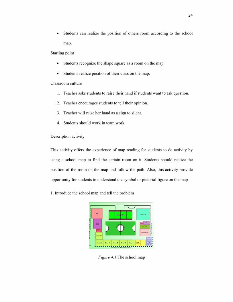


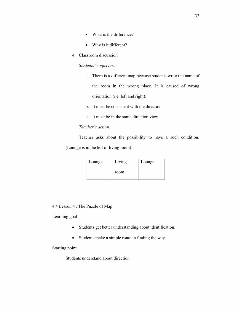


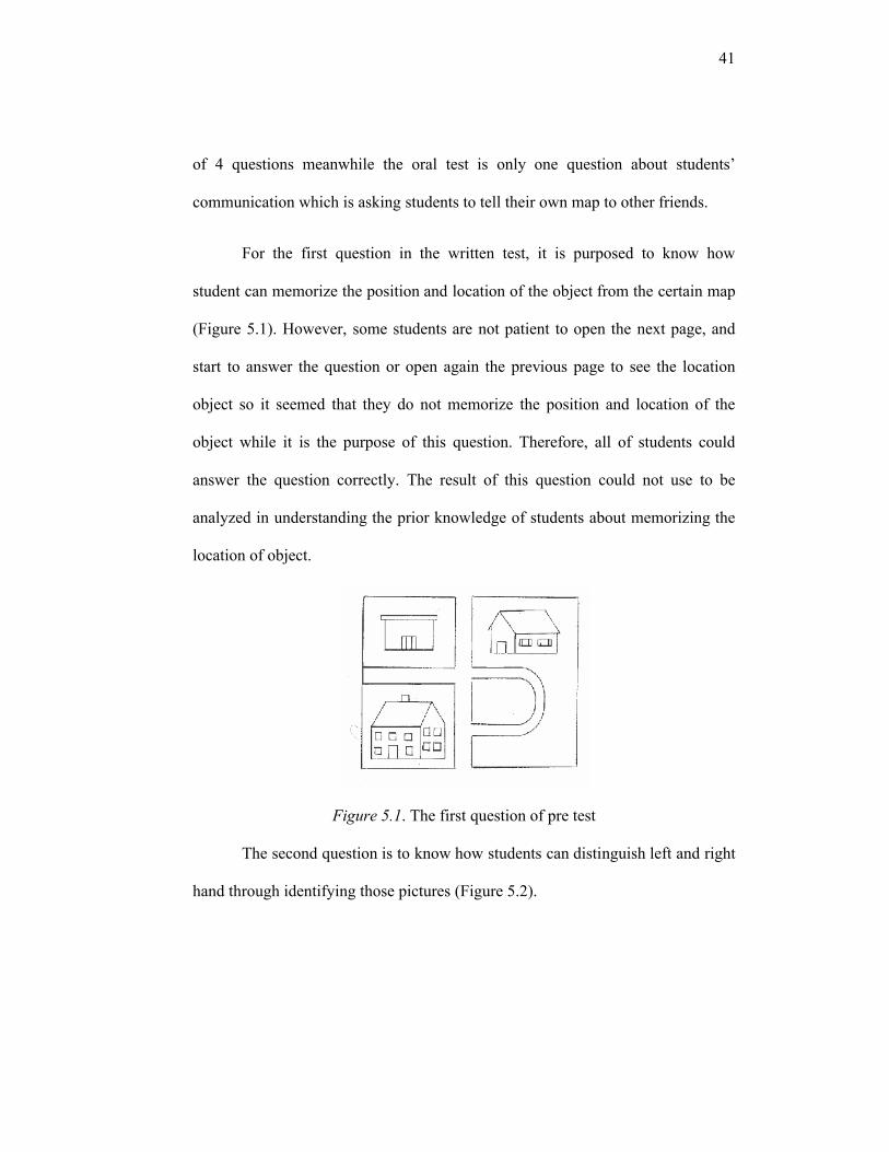


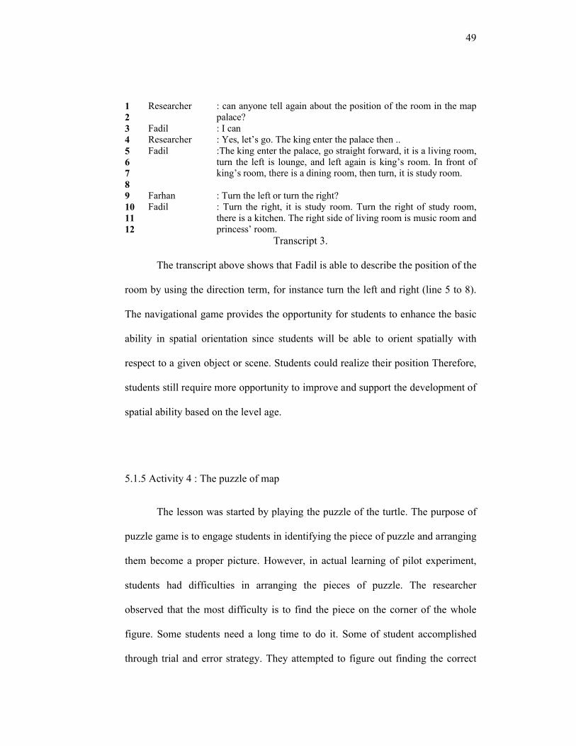


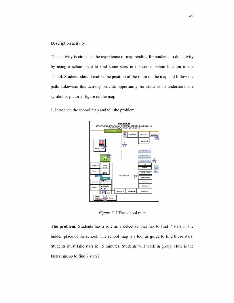


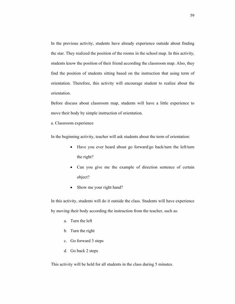


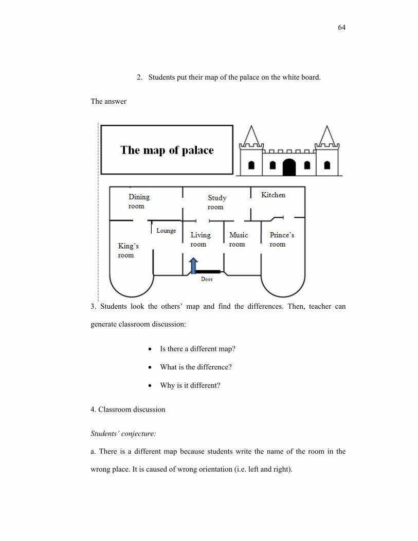


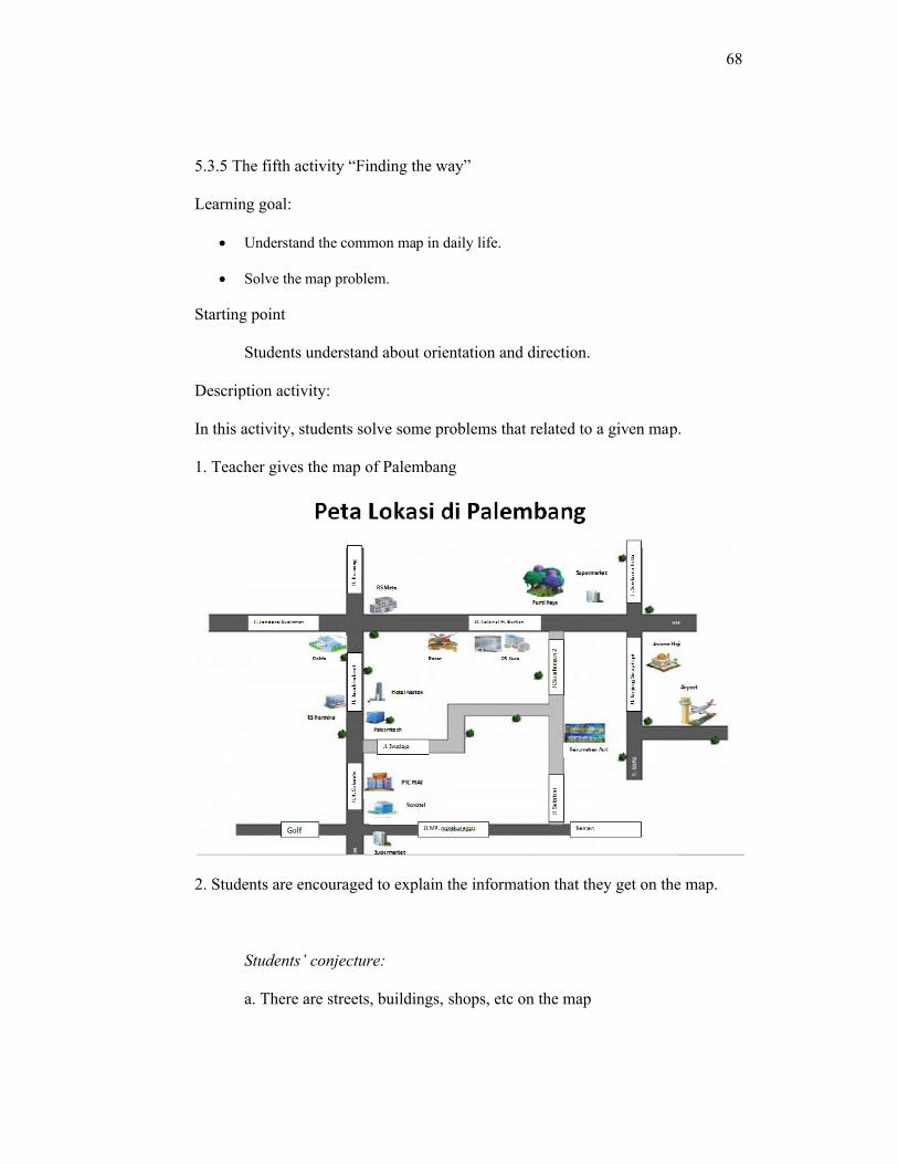


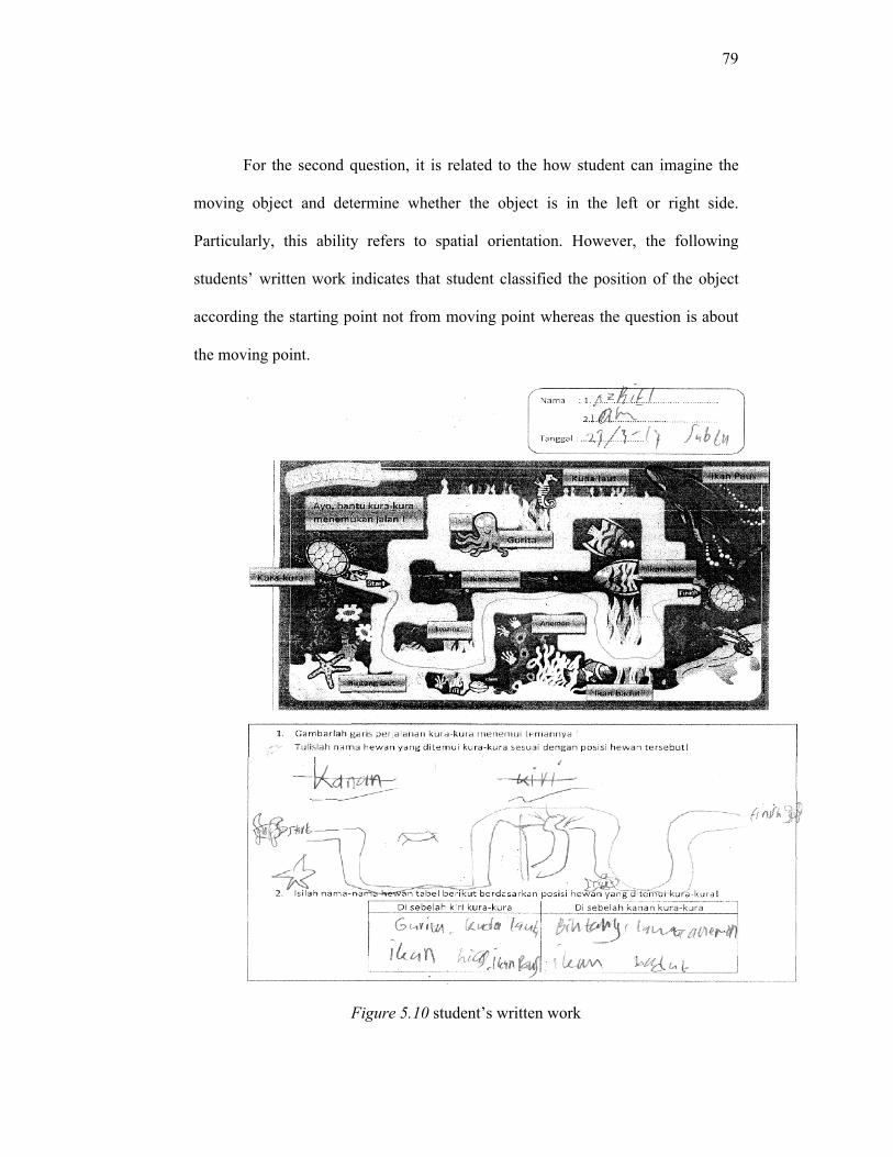


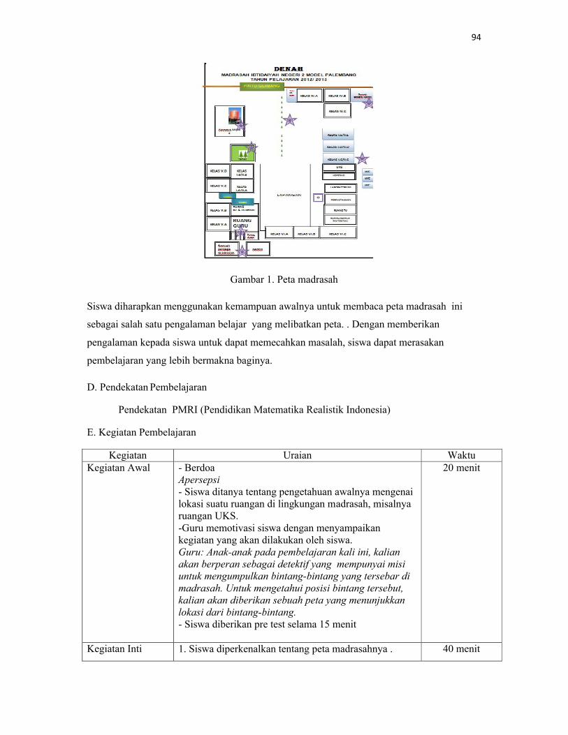

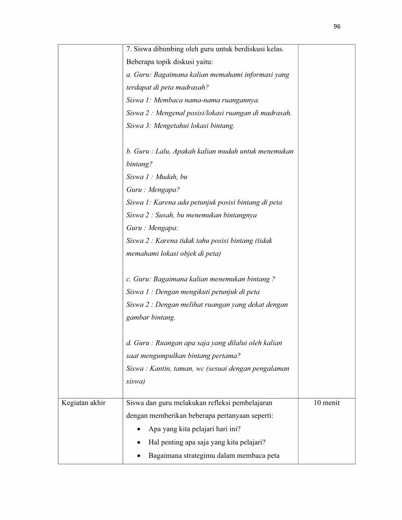


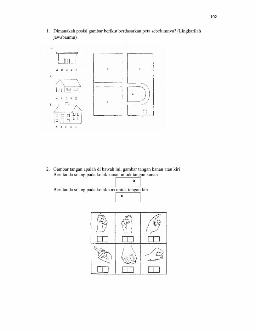


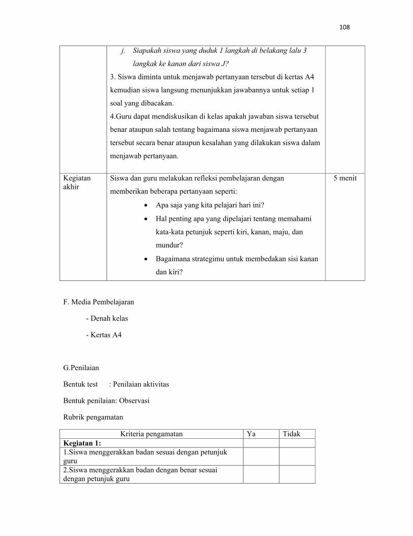


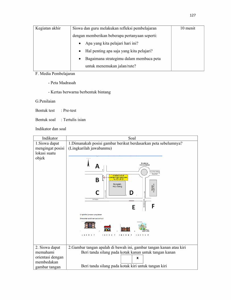

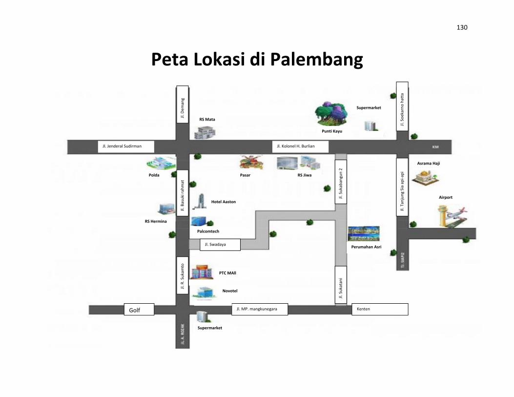
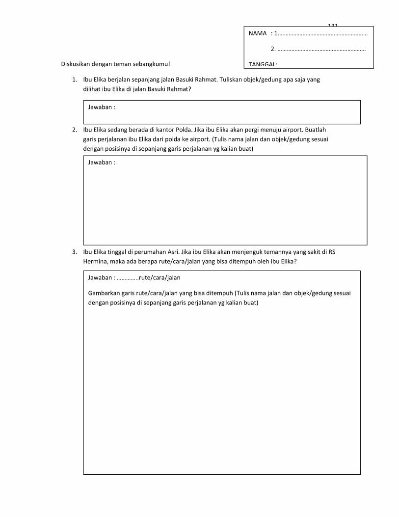


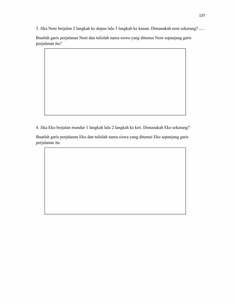

![UU PAPER-2 PCB Roll No. BA · 2-BA ] [ 3 ] [ P.T.O. UU UU UU UU UU UU UU UU UU UU UU UU UU 002. Two children Ramesh (on path ARB) and Sohan (on path ASB), travel down slides of identical](https://static.documents.pub/doc/80x56/5e1483c6a3dd674c594e381f/uu-paper-2-pcb-roll-no-ba-2-ba-3-pto-uu-uu-uu-uu-uu-uu-uu-uu-uu-uu-uu.jpg)


![372 - city.yokohama.lg.jp · wn u zuu vquuu vqzuu wquuu wqzuu xquuu xqzuu yquuu yqzuu ,v^ ,wv ,wx ,wz ,w\ ,w^ n o &)f a u wuu yuu [uu ]uu vquuu vqwuu vqyuu vq[uu vq]uu wquuu](https://static.documents.pub/doc/80x56/5b7990f07f8b9a332d8df337/372-city-wn-u-zuu-vquuu-vqzuu-wquuu-wqzuu-xquuu-xqzuu-yquuu-yqzuu-v-wv.jpg)

