Summer 2017 THE QUARTERLY OF THE TORONTO BRUCE TRAIL CLUB Vol. LIV No. 2 www.torontobrucetrailclub.org | 416-763-9061 | [email protected]A Trail for Sale – e Credit Valley Footpath In the spring of 1977, the Toronto Club received a letter about a trail for sale: At its May 1977 Board meeting the Club accepted the offer, and the Footpath became a Bruce Trail side trail. continued on page 4
Transcript
Summer 2017 THE QUARTERLY OF THE TORONTO BRUCE TRAIL CLUB Vol. LIV No. 2
ISSN 0380-9354 A member of the Bruce Trail Conservancy
Many thanks to all the volunteers who helped in the production of this issue.
Send address changes to:The Bruce Trail Conservancy
PO Box 857, Hamilton, ON L8N 3N9www.brucetrail.org 1-800-665-4453
For missing copies of Footnotes call 1-800-665-4453,
Monday to Friday 8:30 am - 4:30 pm
Opinions expressed in Footnotes are not necessarily the views of the TBTC unless
stated as such. Advertising does not imply endorsement by the TBTC.
Footnotes Resource Support
Footnotes Editor: Malcolm SandersonProofreaders: Marilyn MacKellar Kathryn EmirzianAdvertising & Mail Coordinator: Jude KeastActivities Editor: Victor RamautarWebmaster: Stephen Kamnitzere-Notes Editor: Brent MichalukArchivist: vacantInformation Line: Judy LeeneyCity of Toronto Liaison: vacantHalton Hills Chapter: Janet Le Lievre
Bus HikesHikers are discouraged from meeting bus hikes at the Trail in their own vehicles, unless the hike description includes this option. Meeting Places:• York Mills subway station: buses park on Old York Mills Road near the south exit of the station (not the exit for TTC buses)• Islington subway station: buses wait at the Beer Store on Bloor Street, two short blocks west of the subway station and opposite the TTC parking lot• Clarence Square: located south of King Street, north of Front Street, at 49 Spadina Avenue on the east side (south of the gas station). Buses wait at the west side of the Square.For maps, select the “Hiking Schedule” on the Club’s web site; click on the “Types of Hikes” tab, then click on “read more” at the bottom of the page.
Return:• usual return time is 6 pm; late returns are noted in the listingSeating:• based on a first-come, first-seated basis — guests are welcome but they must pre-register• check the listings for exceptions — leaders may give priority to defined groups• some outings involve extra costs; some require advance registration
Bus Fare (includes $1 donation to the Escarpment Legacy Fund):• $17 members, $23 non-members; $5 children under 12• Long distance fares (over 140 km one-way) $22 for members and $28 for non-members
Car Hikes• meet at the point stipulated in Footnotes and travel by car shuttle to the starting point; contact Hike Leader if you have questions
Car-Pool Hikes• meet at the point listed in Footnotes and ride or drive to the starting point as a group; save fuel and reduce pollution• passengers are expected to contribute to the driver’s costs (the suggested amount is $10, which should be offered — the driver should not have to request it)
Map References• the 28th edition of the Bruce Trail Reference is used
Things to RememberChanges are also posted in the Members section of the website (www.torontobrucetrailclub.org). Members log in using their BTC membership number and their own passwords. • all Club events are non-smoking• carry your BTC membership card at all times• bring a lunch, 2 litres of water, sunscreen and insect repellent• arrive at least 30 minutes before the departure time for any hike• dogs are not permitted on bus hikes with the exception of registered guide dogs. Dogs may only be taken on urban and car hikes if published in advance by hike leaders.
Pre-registration ( Online,
Email or Phone )You must pre-register even though the meeting time and place may be listed. Please register using the listed method(s). The registration opening and deadline dates are listed online under “pre-registration details” in the hike descriptions.
General InformationComfortable Hiking Holidays (416) 445-2628
www.letshike.com
MACHU PICCHU September 15 to 27, 2017
Explore the Sacred Valley of the Incas by hiking through the famed salt pans of Maras, the ancient ruins of Pisac,
and trekking high up into the Urubamba mountain range. Then that
all important day arrives when we hike into Machu Picchu –
rounding the corner of the Sun Gate and seeing Machu Picchu
with your own eyes will give you goose bumps!
(Note: This trip does not involve ANY camping – all accommodations are in
hotel & lodges.)
INTRODUCING THE C.H.H.
ADVENTURE COLLECTION
The perfect answer for those who love hiking holidays but wouldn’t mind a
few other activities as well. Our C.H.H. Adventure
Collection caters to your love of adventure and the outdoors, but we've expanded the focus to also
include other active pursuits. You will likely try an activity you’ve
never tried before!
NORTHERN LIGHTS NORWAY
Capture some of the most fascinating and fun adventures Norway is known
for like cross-country skiing, dog-sledding and snowmobiling plus
Mother Nature's lightshow - the Aurora Borealis (a.k.a. the Northern Lights). Home base is
Tromso - one of the best places in the world to see the Northern Lights.
Also visit the capital, Oslo, for a little cultural exploration.
Part of the Adventure Collection.
MARITIMES ROAD TRIP
Experience the world's highest tides at the Hopewell Rocks in NB; meet Anne of Green Gables and build sandcastles
in PEI; celebrate Canada Day in Halifax, NS. Plus lots more activities from cycling to hiking, and you could conceivably eat lobster every day of
this trip if you tried! Part of the Adventure Collection.
continued from page 1The Credit RiverFrom Wikipedia: “The Credit River is a river in southern Ontario which flows from headwaters above the Niagara Escarpment near Orangeville and Caledon East to empty into Lake Ontario at Port Credit, Mississauga. It drains an area of approximately 1,000 square kilometres (390 sq mi). The total length of the river and its tributary streams is over 1,500 kilometres (930 mi).The river became known as Missinnihe, or “trusting creek” to the Mississauga First Nation people who met annually with white traders there. To the first nations, the river was “held in reverential estimation as the favourite resort of their ancestors” and the band, which ranged from Long Point on Lake Erie, to the Rouge River on Lake Ontario, became known as the Credit River Indians. Their descendants are today the Mississaugas of the New Credit First Nation. The origins of the English name come from the time when French fur traders supplied goods to the native people in advance (on credit) against furs which would be provided the following spring. It was known as the Rivière au Crédit. The trading post was set up at the mouth of the river, in Port Credit, in the early 18th century.Despite urbanization and associated problems with water quality on the lower section of this river, it provides spawning areas for Chinook salmon and rainbow trout. There is a fish ladder on the river at Streetsville. Much of the river can still be travelled by canoe or kayak. The headwaters of the Credit River is home to a native self-sustaining brook trout population and an introduced brown trout population.”
Credit Valley ConservationCredit Valley Conservation was established in May 1954, eight years after the provincial Conservation Authorities Act was passed in 1946. Just five months later, on October 15, 1954, Hurricane Hazel dumped over eleven inches of rain over the GTA in 48 hours. The damage inflicted by Hurricane Hazel provided a major impetus to the work of the Conservation Authorities responsible for the watersheds and rivers in Southern Ontario.
CVC is a partner and a landowner of the Bruce Trail Conservancy. The Toronto Section of the Trail passes through the Terra Cotta, Limehouse and Silver Creek Conservation Areas.
The Credit Valley FootpathThe Footpath was originally developed in 1970 by the Credit Valley Footpath Club as part of a proposal to link the Bruce Trail to Lake Ontario through the valley of the Credit River. Despite many years of effort it proved impossible to complete because permission to cross a number of essential properties could not be obtained.
The trail follows the valley of the Credit River south from Terra Cotta to Georgetown through fields, forests, steep hillsides and the floodplain of the Credit River It passes the site of an old First Nation burial ground and the interesting village of Glen Williams, with its many craft and antique stores. The route leads past the ruins of an old paper mill and dam and an historic plaque which describes early industry along the river. Further south in the valley are the remains of the Barber Mill Dynamo, an old hydro generating station which once supplied power to the paper mill upstream.
Photo: Peter Leeney Oct. 26, 2004 Ruins of the Dynamo
The first map (next page) is from the Fourteenth Edition (1983) of the Bruce Trail Guidebook. It shows the footpath as it was inherited in 1977. Since then there have been some changes, as can be seen in the second map from 2009.
The first major change was the loss of the southern-most section, when Upper Canada College withdrew permission for the trail on its property. The southern terminus became km 12.0, where the railway tracks cross 10th Line. This road crossing is gated, and there is no pedestrian or vehicle crossing allowed (the fine for crossing the tracks is $125).
In 2009, the trail was temporarily closed (the ‘No Access’ mark be-tween km 6.3 and km 7.6 on the second map) due to a sub-division development. This part has since re-opened.
Map 2a, Bruce Trail Guidebook 1983
When Canadian National began work on a new railway bridge over the Credit River in 2009 to add a second track for GO train service, the trail under the bridge was closed. While work on the bridge has finished, CN, the Town and the BTC are still in discussions about re-opening the footpath.
CN Bridge over Credit River. Photo: Paul Vanhanen March 8th, 2009extract map showing trail closures at the CN tracks
Trail Captains (March 2017)Main Trail to 22nd SR (4.1 km) Rose Mary Mitter
22nd SR to 20th SR (2.2 km) Mahin & Christine Nadarajah
20th SR to Paper Mill Bridge, River Dr. (2.5 km) Laurent Thibault
Paper Mill Bridge, River Dr. to 10th Line (2.6 km) Dave Tyson
The FutureIn 2015, the Credit River Heritage Society kicked off an effort to create a heritage trail along the Credit River. A plenary meeting of interested parties, including the Toronto Club, was held February 5th 2015. The project received a $100,000 grant from Friends of the Greenbelt to develop a master plan. Public meetings to review the plan are expected in June 2017, and the plan should be completed by October. Twenty heritage sites have been identified as target destinations for hikers, canoeists and cyclists. For more information, or to volunteer, send an e-mail to Susan Robertson at [email protected]
The Toronto Bruce Trail Club hike leaders have arranged and organized a great variety of urban, bus and car hikes for your enjoyment this summer. You can explore parts of the Bruce Peninsula on car hikes, explore the Thames Valley Trail, stroll on Toronto Island, and visit the many favourite places along the Bruce Trail and the many other trails in Southern Ontario. Get out and take advantage of what the Club has on offer.
Remember that Footnotes provide only a partial list of what is available to you as leaders continue to add hikes to the schedule after the print deadline. Be sure to check the online calendar, http://torontobrucetrailclub.org/040~Lets_Hike/020~Hike_Calendar/, on a routine basis so you don’t miss anything that would interest you. If there is an unexpected development, a banner will be added to the calendar page to highlight the issue. I also encourage you to get a subscription to E-Notes as that will provide information on schedule changes and additions as needed, http://torontobrucetrailclub.org/100~Newsletter_Signup/. You will also find information on hikes through the TBTC Meetup page, Facebook and Instagram.
The Club continues to be interested in providing outreach to groups and communities that might unaware of the opportunities for recreation, fitness and conservation offered by the Bruce Trail, the TBTC and the BTC. If you are a member of a group or know of one that you think might enjoy a taste of the trail, please let us know and we will try to arrange an outing to introduce them to the hiking experience near Toronto.
If you are hiking on your own, don’t forget to check the website for trail changes, closures and re-routes before you head out on your trip. The Bruce Trail Conservancy regularly updates the information and you can find a description and map of any changes by visiting this page: http://brucetrail.org/trail_changes.
In some ways, summer hiking is as challenging as winter on the trails. Primarily, ensure that you remain hydrated. Hike leaders can only provide a limited emergency water supply and you the individual hiker have the primary responsibility to bring sufficient water for the day for yourself. Two to three litres of water is the minimum for the hot humid season and you won’t regret the extra weight. Hydration/electrolyte tablets or powders are recommended as part of your ‘kit’ for this time of year. Know your own limits. Not everyone can manage the heat and there is no shame in accepting that the conditions aren’t right for you. Just be sure to cancel any registration in a timely fashion. And don’t forget the sunscreen, head covering and bug spray that can make the day much more comfortable for you.
As always have an enjoyable and safe hiking season. I’ll see many of you on the trails this summer.Wayne Crockett, Hiking Director
2017 Hike Leader Training: Students and Instructors.
Thursday, June 1 -- Toronto, Toronto IslandsLevel I/II Urban walk Duration of Hike: 3.0 hrs, Pace: 3 km/hr,Terrain: Mostly flat. Dropout, Beginners, Families, No dogs.Depart 6 pm, At the Ferry Docks near the gate to Ward’s Island. From Union station take the LRT (Street Car) to the stop DOCKS. Walk up to Queens Quay street level and walk southbound to the ferry on the south side of Queens Quay at the foot of Bay street. Or, take bus number 6 along Bay Street southbound to the Ferry Docks and walk southbound to the Ferry.Miriam Stevens, (416) 443-6242 6-10 pm FOR MEMBERS ONLY with valid membership card. Rain or Shine, after a day’s work come and “cool off” on the Islands where there are no fumes. Enjoy the view of the city skyline. Bring dinner for a sit down picnic. Bring a warm jacket and a flashlight. You can not buy food on the islands. Ferry cost return $8 for adults, less for seniors. NO RESERVATION REQUIRED. Just show up on the day of the hike. This hike is repeated each THURSDAY in JUNE 2017
Saturday, June 3 -- Niagara, Queenston (Maps 1/2)
Level II Bus hike Length of Hike: 15 km, Pace: 3.5 km/hr,Terrain: Variable. Dropout at 8 km, End to End #5 of 5, Pub stop after, Pre-registration Online using Website.Depart 9 am, Islington.Wayne Crockett, [email protected] Poulouski, (905) 848-4307 or [email protected] Join Geri and I for the last leg of the Niagara end to end. We will walk from Taylor Rd to Queenston Heights km 15.2 to km 0. Some hills and rocks and a little bit of road, like all end to ends. We will do the presentation of end to end badges at the Queenston Cairn. Please let me know if you want to obtain a badge by the third hike in the set so I can order them.
Saturday, June 3 -- Blue Mountains, Devil’s Glen (Map 22)
Level II Bus hike Length of Hike: 16 km, Pace: 3 km/hr,Terrain: Hilly, Variable. Dropout, Hiking boots, Refreshments after, Pub stop after, Late return (after 6 pm), Long distance bus fare applies, Pre-registration Online using Website.Depart 8 am, York Mills.Alex Brown, (905) 764-0812 or [email protected]
Marilyn MacKellar, 416 653-4120 6-9 pm or [email protected] We will hike through the Devil’s Glen area encountering some challenging hills. After the hike we will go to Creemore for refreshments.
Saturday, June 3 -- Toronto Section, Limehouse, Loop Hike (Map 12)Level I/II Car hike Length of Hike: 10 km, Pace: 3.5 km/hr,Terrain: Rocky, Variable. No dropout, Beginners, Hiking boots.Depart 9 am, McDonald’s in Georgetown. On the northwest corner of Mountainview Rd and Guelph St (Hwy.7). Best route from the city is 401 to Winston Churchill Blvd. North to Norval then turn west on Guelph St into Georgetown. Vlado will then provide instructions to the start of the hike.Vladimir Bosnar, (905) 273-7569 7-9 pm There is lots to see on this hike, late spring flowers, old lime kilns, “Hole in the Wall”, ruins of lime works and radial train line. It is pleasant walk with varied terrain. Bring water and bug spray and dress for the weather. Call Vlado if questions, his cell available day of hike 416-518-5203.
Sunday, June 4 -- Toronto SectionLevel I/II Urban walk Length of Hike: 11 km, Pace: 3.5 km/hr,Terrain: Mostly flat, Variable. Dropout, Beginners, Families, Dogs welcome.Depart 9:30 am, in front of Loblaws, 396 St. Clair Ave. West (beside the St. Clair West subway station on north side of St. Clair).Danny Pivnick, (416) 484-6824 Come and join us for this pleasant walk through parts of central Toronto. We will head up the Cedarvale Ravine to join the Beltline Trail and then continue to Mt. Pleasant Cemetery. From there we will go through the lower part of the Beltline Trail and Rosedale Ravine ending at the Brick Works. Bring your lunch along or pick up something at the Brickworks Farmers Market.
Sunday, June 4 -- Seaton Hiking Trail, Pickering ON Level II Bus hike Length of Hike: 14 km, Pace: 3 km/hr,Terrain: Hilly, Challenging. Dropout, Hiking boots, Refreshments after, Pub stop after, No Dogs, Pre-registration Online using Website.Depart 9:30 am, York Mills. Old York Mills Rd subway exit, one block S of York Mills off Yonge St. adjacent to the gas station. On the east side of Yonge. Pay parking at the York Mills and Yonge NW corner, or South of the bus municipal parking lot adjacent to Miller tavern $9.Fred Berktin, 416 520 3797 or [email protected]
continued....
Summer 2017
Notice to ParticipantsAll Hike Leaders are volunteers. You are welcome to take part in their activities, but you do so at your own risk. Only written complaints against a Hike Leader or end person will be considered. Complaints (or commendations) may be addressed to the Hiking Director, Toronto Bruce Trail Club, P.O. Box 597, 2938 Dundas St. W., Toronto, ON M6P 4E7. The focus of the complaints policy is on improvement rather than discipline.
Please note that the maps and kilometre references in this listing are from the 28th Edition of the
Bruce Trail Reference.
The Toronto Hiking and Conservation Club
organizes Sunday hikes in the countryside surrounding Toronto
Hikes leave each Sunday at 10:00 a.m. (unless stated otherwise in the program) from the parking lot on the northwest corner of Yonge and York Mills, via car-pools. Hikes usually end around 3 p.m. and return to York Mills around 4 p.m. See our program at www.sproulephoto.ca/thcc or call 416-693-8639 for more information
Established in 1970, and brought back to life only a few years ago, it is a short drive from the City, in Pickering. Let me introduce you to this gem if you have not been on this hike with me before. It is the perfect time of the year to hike this well-maintained and blazed trail where I work as a trail maintenance volunteer. We will hike from south to north; although the trail’s tendency is uphill the challenging hills are in the beginning. I will slow down on the hills and allow fast hikers to pass and wait for the slower hikers at the top. The trail visits two spectacular lookout points on top of a glacial till, where you can see how the West Duffins Creek has carved the glacial till for over ten thousand years. The trail follows this creek which is in the Duffins and Caruthers Creek watershed and it is one of the most widely studied riparian habitat watersheds in Ontario, if not Canada. This is a Level II/III terrain but we will hike at a slower pace. Refreshments will be at an outdoor complex where there is a very hiker friendly British Sports Bar, Swiss Chalet and Tim Hortons.
Thursday, June 8 -- Toronto, Toronto IslandsLevel I/II Urban walk Duration of Hike: 3.0 hrs, Pace: 3 km/hr,Terrain: Mostly flat. Dropout, Beginners, Families, No dogs.Depart 6 pm, at the Ferry Docks near the gate to Ward’s Island. From Union station take the LRT (Street Car) to the stop DOCKS.Walk up to Queens Quay street level and walk southbound to the ferry on the south side of Queens Quay at the foot of Bay street. Or, take bus number 6 along Bay Street southbound to the Ferry Docks and walk southbound to the Ferry.Miriam Stevens, (416) 443-6242 6-10 pm FOR MEMBERS ONLY with valid membership card. Rain or Shine, after a day’s work come and “cool off” on the Islands where there are no fumes. Enjoy the view of the city skyline. Bring dinner for a sit down picnic. Bring a warm jacket and a flashlight. You can not buy food on the islands. Ferry cost return $8 for adults, less for Seniors. NO RESERVATION REQUIRED. Just show up on the day of the hike. This hike is repeated each THURSDAY in JUNE 2017.
Saturday, June 10 -- Toronto, Cedarvale RavineLevel I Urban walk Length of Hike: 3 km, Pace: 1 km/hr,Terrain: Mostly flat, One hill. Dropout, Beginners, Families, No dogs, Shoes with good treads.Depart 10 am, St. Clair West Station, Heath St. exit.Marilyn MacKellar, 416 653-4120 6-9 pmGlynn Richardson, (905) 426-5600 7-9 pm This hike will follow the Cedarvale Ravine north from St. Clair Ave. It will be very slow. It will focus on plants in the area, and there’s a surprising variety for a small ravine, plus a bit of history. We will stop-and-go for the length of the hike, so be prepared for a slow progress. The distance we travel will depend on what we see. Bring snacks and water. And a camera, perhaps.
Saturday, June 10 -- Toronto Section, Silver Creek (Map 13)
Level II Bus hike Length of Hike: 14 km, Pace: 3.5 km/hr,Terrain: Variable. Dropout at 7 km, Hiking boots, Refreshments after, Pre-registration Online using Website.Depart 9 am, Islington.Wayne Crockett, [email protected] Join me for a hike with a celtic flavour. We will do a 13-14 km walk through a combination of the main trail and the variety of side trails in the area of Scotsdale Farm and Silver Creek. Very scenic with a nice mixture of hills and somewhat flatter terrain. After the hike we
will drive down to Georgetown to take in the annual Georgetown Highland Games. A fun combination of music, food and athletic competitions.
Saturday, June 10 -- Peninsula, Tobermory, BTC 50th Anniversary Celebration
Lucy Leung, (647) 280-8868 or [email protected] Mockevicius, (416) 783-5282 Join us for the Bruce Trail Conservancy’s 50th Anniversary Celebration in Tobermory, commemorating fifty years since the official opening of the Bruce Trail. Take in a full day of program at this unique event including the formal ceremony at the Bruce Trail Northern Terminus Cairn; catered lunch at the Tobermory Community Centre; Bruce Trail historical displays; a silent auction; your choice of a short (1 hr, 2.5 km) or longer (2 hr, 7 km) hike to Little Dunks Bay and Burnt Point Loop respectively; as well as a ticket to enjoy a 90-minute boat cruise on Georgian Bay. Transportation to Tobermory will be by restroom-equipped motor coach. In order to experience the entire fun filled program, we depart bright and early at 6 am from York Mills and return to same location about 9 pm. Bus fare is $46 for members and $60 for non-members and covers the entire day’s program. Prepayment is required upon pre-registration and is non-refundable after May 20, 2017. Members must pre-register online and will receive instructions on where to send the bus fare cheque after pre-registration. For non-members, please contact Lucy Leung at [email protected] if you are interested to join us. Event details are available on BTC website http://brucetrail.org/events/135Please note: If you have signed up for this bus hike, please do NOT use the event registration again at brucetrail.org, as BTC registration is for those NOT on this bus hike.
Saturday, June 10 -- Dufferin Hi-Land, Boyne Valley, Primrose (Map 20)
Level II Bus hike Length of Hike: 15 km, Pace: 4 km/hr,Terrain: Hilly. Dropout at 6 km and 10 km, Hiking boots, Refreshments after, Pub stop after, Pre-registration Online using Website.Depart 8 am, York Mills.Larry Haigh, (416) 432-1239 before 8 pmor Ruth Dorey, [email protected] We are celebrating the 50th anniversary of BTC (the actual date of the anniversary is June 16th). Refreshments in Primrose. Back in Toronto by 6:00 pm.
Sunday, June 11 -- Toronto, West Highland Creek
Level I/II Urban walk Length of Hike: 14 km, Pace: 3.5 km/hr,Terrain: Mostly flat. Dropout, Beginners, Families, Pre-registration Online using Website.Depart 10 am, Scarborough Centre RT Station. Meet at Scarborough Centre RT Station bus platform by 9:40 am to take the #21 Bus southbound departing at 10:00 am.If driving, contact hike leader,Thomas Swales, (416) 912-2329 or [email protected] Join us to hike along this tributary of Highland Creek through one of Scarborough’s larger interconnected park systems. After our lunch stop in the charming and peaceful grounds of the Cedar Ridge Creative Arts Centre we descend into the main Highland Creek valley and hike north to Ellesmere, passing by the former Boy Scout “Camp Of The Crooked Creek”. Preregistration is optional but saves time during the sign-in process at the start.
Sunday, June 11 -- Caledon Hills, Hockley Valley (Map 18)Level II Car hike Length of Hike: 14 km, Pace: 4 km/hr,Terrain: Hilly. No dropout, Hiking boots, No dogs, Refreshments after, Cell number for day of hike is 647-918-4180.Depart 9 am, Hockley Road Parking Lot. Take Hwy 410 north, continue north on Hwy 10 north of Orangeville to County Rd 7. Hockley Rd veers off on the left. Continue on Hockley Rd to just east of 2nd Line EHS. The parking lot is on the north side of the road.Maureen McFarland, (416) 489-3703 not later than 9 pmor [email protected] Vanderlip, (416) 925-9134 7-10 pmor [email protected] Come out and enjoy an early summer hike in the Hockley Valley, where there is usually a breeze to blow the bugs away. We will hike a loop including the Tom East Side Trail, the Isabel East Side Trail and the Cam Snell Side Trail.
Thursday, June 15 -- Toronto, Toronto IslandsLevel I/II Urban walk Duration of Hike: 3.0 hrs, Pace: 3 km/hr,Terrain: Mostly flat. Dropout, Beginners, Families, No dogs.Depart 6 pm, At the Ferry Docks near the gate to Ward’s Island. From Union station take the LRT (Street Car) to the stop DOCKS.Walk up to Queens Quay street level and walk southbound to the ferry on the south side of Queens Quay at the foot of Bay street. Or, take bus number 6 along Bay Street southbound to the Ferry Docks and walk southbound to the Ferry.Miriam Stevens, (416) 443-6242 6-10 pm FOR MEMBERS ONLY with valid membership card. Rain or Shine, after a day’s work come and “cool off” on the Islands where there are no fumes. Enjoy the view of the city skyline. Bring dinner
for a sit down picnic. Bring a warm jacket and a flashlight. You can not buy food on the islands. Ferry cost return $8 for adults, less for Seniors. NO RESERVATION REQUIRED. Just show up on the day of the hike. This hike is repeated each THURSDAY in JUNE 2017
The Ongiara, the winter ferry of the Toronto Island Ferry Service.
Photo by Rev Edward Brain, D.D.
Friday, June 16 -- Toronto
Level II Urban walk Length of Hike: 10 km, Pace: 4 km/hr,Terrain: Variable. Dropout at Anywhere, Refreshments after, Pub stop after, Pre-registration Online using Website.Depart 9 am, Meet at Yonge & Lawrence, south-east corner at the library.Ruth Dorey, [email protected] Haigh, (416) 432-1239 before 8 pm Join us for a hike from Lawrence Park to Sunnybrook Park, ending at Olde Yorke for fish and chips. Lunch specials are available.
MAINLAND GREECE & ISLANDS TUSCANY - SOUTH & EAST SORRENTO & THE AMALFI COAST EASTERN SICILY PROVENCE & LANGUEDOC, FRANCE CAMINO DE SANTIAGO, SPAIN CUBA - HAVANA & WESTERN CUBA MADEIRA & THE AZORES
Saturday, June 17 -- Waterfront Trail, Mississauga
Level I Urban walk Length of Hike: 10 km, Pace: 3.5 km/hr,Terrain: Mostly flat. Dropout, Beginners, Families, Refreshments after, Pre-registration Online using Website.Depart 11 am, Kipling Subway Station, Bus Platform Level. Meet at Kipling Subway Station Bus Level west end (by the washrooms) by 10:40 am to take #123C at 11:00 am to start of hike.Thomas Swales, (416) 912-2329 or [email protected] We will hike the southern end of Etobicoke Creek and west along the Lake Ontario Waterfront Trail to picturesque Port Credit. Option to stay and enjoy the Mississauga Waterfront Festival in Port Credit. Return home by GO Train or Mississauga Miway Bus. Note that if staying for the evening entertainment, open beverage containers are not permitted, so for this hike only you may have to bring bottled water. Preregistration on website is optional.
Saturday, June 17 -- Toronto Section, Limehouse (Map 12)
Level I/II Bus hike Length of Hike: 12 km, Pace: 3 km/hr,Terrain: Variable. Dropout, Hiking boots, Refreshments after, Pub stop after, No Dogs, Pre-registration Online using Website.Depart 9 am, York Mills.Fred Berktin, 416 520 3797 or [email protected] Haigh We’ll start from St. Helena Road and hike north through the Pear Tree Park parking lot, through some farmers’ fields, around Black Creek, visit the Lime Kiln, Powder house, and Black Creek Rapids, hike through the Hole In The Wall and end up in the parking lot of the Limehouse Conservation Area. This is a favourite section of many BTC hikers. We’ll stop in the Hamlet of Glen Williams or in Georgetown for refreshments.
Saturday, June 17 -- Niagara, Ball’s Falls (Map 4)
Level I/II Bus hike Length of Hike: 10 km, Pace: 3.5 km/hr,Terrain: Rocky, Hilly, Stairs. Dropout at several locations, Hiking boots, Refreshments after, Pre-registration Online using Website.Depart 9 am, Islington.Barbara Euler, (416) 695-1838 before 10 pmor [email protected] A leisurely hike on the Main Trail, Jordan Side Trail and local trails with plenty of time to explore the historical village and the Upper and Lower Falls as well as Jordan Village. We may stop for strawberries (and pies) on the way home. Bring a little extra cash in case you want to buy something in Jordan Village or at the strawberry farm.
Saturday, June 17 -- Toronto Section, Scotsdale Farm (Map 13)Level I/II Car hike Length of Hike: 13 km, Pace: 3 km/hr,Terrain: Rocky, Variable. No dropout, Hiking boots, Refreshments after, Pub stop after.Depart 10 am, Scotsdale Farm parking lot. North from Hwy 401 on Trafalgar Rd to Georgetown. Continue past Georgetown to meet Hwy 7. North on 7 to Silver Creek (the highway takes a big left turn here). Right turn to get back onto Trafalgar. Go north about 1.5 km to the entrance to Scotsdale Farm on your right.Alex Brown, (905) 764-0812
We will complete a loop hike from the old homestead along the main and side trails. After the hike those who wish may go into Georgetown for refreshments.
Saturday, June 17 -- Thames Valley Trail (TVTA Map 3)Level II/III Car hike Length of Hike: 21 km, Pace: 4 km/hr,Terrain: Mostly flat, Some busy country roads. No dropout, End to End #3 of 6, Refreshments after. Depart: 9.00 am, from the parking area in Greenway Park in the City of London. The meeting point is on Greenside Ave to the north of Springbank Dr. This parking lot is slightly less than one kilometre west of Wharncliffe Rd. GPS 42.973796, -81.272559.Charles Whitlock, (519) 742-7435 or [email protected] Vanderlip, (416) 925-9134 7-10 pmor [email protected] This is the third of six hikes on the TVTA. Today’s hike will be through relatively flat parkland with some hilly terrain in Warbler Woods. Today we car shuttle back to the Oxford St W parking area at Komoka Provincial Park where we finished our hike on April 30th. Shared-parking cost of $15.00/vehicle. The hike will take us along busy country roads through beautiful Warbler Woods and then along lovely municipal trails alongside the Thames River, passing Storybook Gardens and the sight of the Victoria Boat Disaster. Charles’ mobile on day of hike 519-505-6298.
Sunday, June 18 -- NiagaraLevel II Car hike Duration of Hike: 4.0 hrs, Pace: 3 km/hr,Terrain: Hilly, Rocky. Dropout, Hiking boots, No dogs.Depart 10 am, Niagara Glen Nature Reserve, 3050 Niagara Parkway, Niagara on the Lake. The Niagara Glen Nature Reserve parking lot is located on the Niagara River side of the Niagara Parkway between the Golf Course and the Botanical Gardens. If you not familiar with the area leave extra time.Gregory & Jeanette Vincent, (519) 579-8210 Mon-Thurs 7-9 pmor [email protected] Talk about geology, history, trees, gigantic rocks! This hike has it all. The Niagara Glen is located in perhaps the best example of Carolinian Canada beside a raging river, amazing rock formations and a world famous whirlpool. Trekking poles and boots recommended. We descend into the Niagara Glen and the river and we must ascend back to the top. You will need a car to access this hike, there is no public transport. More information athikevincent.wordpress.com.
Sunday, June 18 -- Caledon Hills, Hockley Valley (Map 18)Level II Car hike Length of Hike: 15 km, Pace: 4 km/hr,Terrain: Hilly, Rocky. Dropout, Families, Hiking boots.Depart 9 am, We will meet at the parking lot just off Hockley Rd and past 3rd Line. Go north on Hwy 400, turn west (left) on Hwy 9, then north on Airport Rd, then west (left) on Hockley Rd. The parking lot is just past 3rd Line. We will depart promptly at 9:00 am and hike both blue trails and the main/white trail.Brandon Fahy, (416) 903-7572 before 9 pmLarry Haigh, (416) 432-1239 before 8 pm Come out for some fresh air and exercise and enjoy some time with friends and family.
Sunday, June 18 -- Thames Valley Trail (TVTA Maps 3,4)Level II/III Car hike Length of Hike: 19 km, Pace: 4 km/hr,Terrain: Mostly flat. No dropout, End to End #4 of 6, No dogs.Depart 9 am, Ted Early Sports Centre,1375 Clarke Rd, City of London. Depart: 9.00 am, from the Ted Early Sports Centre parking lot on Clarke Rd, 700 metres south of Kilally Rd and 250 metres south of the entrance to the Fanshawe Conservation Area in the City of London. GPS 43.018790, -81.183321.Charles Whitlock, (519) 742-7435 or [email protected] Vanderlip, (416) 925-9134 7-10 pmor [email protected] This is the fourth of six hikes on the TVTA. Today we car shuttle back to the Greenway Park parking lot where we finished the hike on the 17th of June. The hike today is relatively flat and will follow the Thames River across more of the City of London on municipal trails and streets to finish our 2017 hikes on the Thames Valley Trail at the entrance to the Fanshawe Conservation Area. And you guessed it! The Ted Early parking lot is not on the trail by 250 metres (What a bonus for the ardent hiker). Charles’ mobile on day of hike 519-505-6298.
Tuesday, June 20 -- TorontoLevel II Urban walk Length of Hike: 15 km, Pace: 4 km/hr,Terrain: Mostly flat. Dropout at Anywhere, Beginners, No dogs, Refreshments after, Walking Shoes.Depart 10 am, Lawrence Subway Station, street level.Taizo Shinkoda, (416) 423-4454 7-9 pmJohanna Lanfranco, (416) 961-4701 7-9 pm Join us for a hike from the Lawrence Subway Station through the Alex Muir Gardens, Sunnybrook Park, and the Lower Donlands Parklands to the Broadview Subway Station.
Thursday, June 22 -- Toronto, Toronto IslandsLevel I/II Urban walk Duration of Hike: 3.0 hrs, Pace: 3 km/hr,Terrain: Mostly flat. Dropout, Beginners, Families, No dogs.Depart 6 pm, At the Ferry Docks near the gate to Ward’s Island. From Union station take the LRT (Street Car) to the stop DOCKS.Walk up to Queens Quay street level and walk southbound to the ferry on the south side of Queens Quay at the foot of Bay street. Or, take bus number 6 along Bay Street southbound to the Ferry Docks and walk southbound to the Ferry.Miriam Stevens, (416) 443-6242 6-10 pm FOR MEMBERS ONLY with valid membership card. Rain or Shine, after a day’s work come and “cool off” on the Islands where there are no fumes. Enjoy the view of the city skyline. Bring dinner for a sit down picnic. Bring a warm jacket and a flashlight. You can not buy food on the islands. Ferry cost return $8 for adults, less for Seniors. NO RESERVATION REQUIRED. Just show up on the day of the hike. This hike is repeated each THURSDAY in JUNE 2017.
Saturday, June 24 -- Beaver Valley, Blue Mountain (Map 24)
Level I/II Bus hike Length of Hike: 13 km, Pace: 3 km/hr,Terrain: Variable. Dropout, Beginners, Hiking boots, Refreshments after, Pub stop after, Late return (after 6 pm), Long distance bus fare applies, Pre-registration Online using Website.Depart 7:30 am, York Mills.Alex Brown, (905) 764-0812 or [email protected] Brown, (416) 535-1059 or [email protected]
This is my annual berries and beach hike. We will hike the Beaver Valley section near Swiss Meadows. After the hike we will go to a local berry patch to purchase in season strawberries followed by a refreshment stop at Wasaga Beach (subject to weather).
Saturday, June 24 -- Peninsula, Lion’s Head (Map 39)Level III Car hike Length of Hike: 19 km, Pace: 4 km/hr,Terrain: Challenging. No dropout, Hiking boots, Possible refreshments after.Depart 9 am, Map 39 at km 104.6. From Ferndale head north on Hwy 6 to Lindsay Rd 5. Turn right. Pass Cherry Hill Rd to stop sign. Turn left on East St. Drive towards Cape Chin North Rd turning right to destination. Look for a bald headed hike leader!Charles Whitlock, (519) 742-7435 or [email protected] Do join me for two days of walking along Georgian Bay. Come and explore our vast and varied Peninsula section. We will have an opportunity to swim and relax on the shores of Georgian Bay. This is a rugged and remote trail with rough terrain. Sturdy walking footwear is required. Do bring lots of water and bug dope. Bring swimsuit (optional). Poison Ivy may be present. Car shuttle in effect to start of hike. We will start our walk from Richardson Side Rd (GPS 45.02046, -81.28379) and travel north. Bruce Trail Waiver Sheets will be used. We welcome all hike-leaders in training.
Local knowledge for yourhiking adventure in Algoma.
Saturday, June 24 -- Iroquoia, Dundas Valley, (Map 8)
Level I/II Bus hike Length of Hike: 13 km, Pace: 3.5 km/hr,Terrain: Hilly, Variable. Dropout, Families, Hiking boots, Refreshments after, Pre-registration Online using Website.Depart 8:30 am, York Mills.Victor Ramautar, 905-294-6718 before 9 pmor [email protected] Lee, (647) 770-9977 before 9 pm An early Summer favourite. The water flow must be at its maximum at Tiffany and Sherman Falls. Get your friends and adult family members to come out and enjoy a beautiful day hiking while making new friends. Dress for the weather and have with you water, a lunch and any other necessary items.
Saturday, June 24 -- Iroquoia, Waterdown (Map 9)
Level II/III Bus hike Length of Hike: 10 km, Pace: 5 km/hr,Terrain: Hilly. Dropout at 6 km, Hiking boots, Pub stop after, Pre-registration Online using Website.Depart 9:30 am, Islington.Camara Chambers, [email protected] Join us on this 10 km bus hike as we hike in the Waterdown area of the Bruce Trail ending at Shawn and Ed Brewing company, a craft brewery known for their adventurous beers. We’ll walk along creeks and through woodlands,and will finish with a well deserved pint of craft beer. This hike will be a brisk pace of 5 km/hour so is best for those who enjoy fast walking.
Saturday, June 24 -- Humber Valley Heritage TrailLevel I/II Car hike Length of Hike: 12 km, Pace: 3.5 km/hr,Terrain: Hilly, Variable. Dropout, Beginners, Hiking boots.Depart 9 am, Tim Hortons Bolton Hwy 50. Tim Hortons is just north of King St on Hwy 50 right in Bolton. Meet there and the hike leader will direct the group to start of hike and car shuffle procedure.Vladimir Bosnar, (905) 273-7569 7-9 pm This trail wanders off the Caledon Rail Trail at Duffy’s Lane, crosses the Albion Conservation Area then follows the Humber River down into Bolton. A good walk any season of the year. Be sure to have bug spray, lots of water and lunch. Vlado will be available the day of hike on cell 416-518-5203.
Saturday, June 25 Fort Erie, Lundy’s Lane Historical Walk
Level I/II Bus hike Length of Hike: 13 km, Pace: 3.5 km/hr,Terrain: Mostly flat. Dropout at 6 km, Beginners, Families, Refreshments after, Long distance bus fare applies, Pre-registration Online using Website.Depart 9:30 am, Islington.Wayne Crockett, [email protected] Join me for the annual walk and talk along the southern portion of the Niagara River. We will begin at Old Fort Erie where I will describe the siege and battle of 1814. We will then reboard the bus and drive to a point near the Battle of Chippawa Battlefield; from there we will walk on to Niagara Falls. Participants will have an opportunity to have refreshments and do photography while at the Falls. The final stop of the day will be at the Battle of Lundy’s Lane Memorial. An easy walk and painless history lesson.
Sunday, June 25 -- Peninsula, Dyer’s Bay (Map 39)Level III Car hike Length of Hike: 18 km, Pace: 4 km/hr,Terrain: Challenging. No dropout, Hiking boots.Depart 9 am, Map 39, km 104.6 Cape Chin North Rd. Directions: (Same as June 24, 2017) From Ferndale head north on Hwy 6 to Lindsay Rd 5. Turn right. Pass Cherry Hill Rd to stop sign. Turn left on East St. Drive towards Cape Chin North Rd turning right to destination. Look for a bald headed hike leader wearing sunglasses!Charles Whitlock, (519) 742-7435 or [email protected] This portion of Georgian Bay is one of my favourites. Why? I spend most of my summer time walking these trails that offer great vistas. Join me as we visit the tiny but popular hamlet of Dyer’s Bay, the Michiganders Arc, Cottrill Lake Side Trail, Lille Potholes and a swim at Devil’s Monument. This is a rugged and remote trail with rough terrain. Sturdy walking boots are required. Bring swimsuit (optional). Bring lots of water and bug dope. Poison Ivy will be present. Car shuttle in effect to start of hike to Lindsay Road 40 at GPS 45.19208, -81.34352 Bruce Trail Waiver Sheets will be used. We welcome all hike-leaders in training.
Thursday, June 29 -- Toronto, Toronto IslandsLevel I/II Urban walk Duration of Hike: 3.0 hrs, Pace: 3 km/hr,Terrain: Mostly flat. Dropout, Beginners, Families, No dogs.Depart 6 pm, At the Ferry Docks near the gate to Ward’s Island. From Union station take the LRT (Street Car) to the stop DOCKS.Walk up to Queens Quay street level and walk southbound to the ferry on the south side of Queens Quay at the foot of Bay street. Or, take bus number 6 along Bay Street southbound to the Ferry Docks and walk southbound to the Ferry.Miriam Stevens, (416) 443-6242 6-10 pm FOR MEMBERS ONLY with valid membership card. Rain or
Walking in BRITAIN Choose from 18 HF Holidays locations
Guided walking in Wales, Cotswolds, Scotland, Yorkshire, Cornwall, Dorset, Shropshire, Isle of Wight, Derbyshire, Lake District
Book HF Holidays with
TEACHERS’ TRAVEL 21 St Clair Ave E # 1003, Toronto, ON M4T 1L9
Shine, after a day’s work come and “cool off” on the Islands where there are no fumes. Enjoy the view of the city skyline. Bring dinner for a sit down picnic. Bring a warm jacket and a flashlight. You can not buy food on the islands. Ferry cost return $8 for adults, less for seniors. NO RESERVATION REQUIRED. Just show up on the day of the hike. This hike is repeated each THURSDAY in JUNE 2017.
Saturday, July 1 -- Toronto, Highland CreekLevel I/II Urban walk Duration of Hike: 5.0 hrs, Pace: 4 km/hr,Terrain: Mostly flat, remote areas having natural undisturbed environments. Dropout at any time, Bring a lunch, water, sunglasses, sunscreen.Depart 10 am, Guildwood GO station ticket collector. Guildwood GO station, 4105 Kingston Rd, is serviced by the TTC 86 Scarborough bus from Kennedy subway station as well as the Lakeshore East GO train. For GO train info: http://www.gotransit.com or call 1 888 GET ON GO.Ray Berzins, [email protected] Canada Day hike along Highland Creek from Guildwood GO station through Highland Creek Park, Morningside Park, Colonel Danforth Park and finally East Point Park on the shore of Lake Ontario. It is a loop hike, as we shall return to Guildwood GO station. Voluntary contributions to the Escarpment Legacy Fund will be greatly appreciated. No pre-registration required.
Saturday, July 1 -- Rouge Valley
Level I Bus hike Length of Hike: 12 km, Pace: 3 km/hr,Terrain: Mostly flat, Short steep sections. Dropout at 6, 8 km, Families, Hiking boots, Pub stop after, Pre-registration Online using Website.Depart 9 am, Islington.Barbara Euler, (416) 695-1838 before 10 pmor [email protected] Spend Canada’s birthday in our newest national park. Meet PARKA, Park Canada’s mascot, and join in the celebrations. Follow in the footsteps of centuries of aboriginal people on an important portage route. We’ll take time to look around at some of the natural features and will visit the grounds of the Italian-style villa, Valley Halla. Refreshment stop is one of hikers’ favourite pubs.
Saturday, July 1 -- Caledon Hills, Forks of the Credit (Maps 14/15)Level II Car hike Length of Hike: 16 km, Pace: 3 km/hr,Terrain: Hilly, Variable. No dropout, Hiking boots, Refreshments after, Pub stop after.Depart 10 am, Intersection of Forks of the Credit Rd and Dominion St. North on Hwy 10 to Forks of the Credit Rd. West 7 km to parking area on north side of roadway where the main trail intersects Forks of the Credit Road.Alex Brown, (905) 764-0812 We will complete a loop hike through the Forks of the Credit Provincial Park along the Main Trail and McLaren Road Side Trail.
Saturday, July 1 -- Peninsula, Smokey Head (Map 39)
Level II/III Car hike Length of Hike: 19 km, Pace: 4 km/hr,Terrain: Variable, Challenging. No dropout, Hiking boots, No dogs, Pre-registration by e-mail to Leader.
Depart 8:30 am, Map 39, km 86. From Hwy 6, turn right onto Caudle Sideroad and then right onto Forty Hills Road to the parking lot at Richardson Side Trail.Ron Granger, (519) 485-0879 7-10 pmor [email protected] Car shuttle to Km 104.6,Map 39. Hike back through Smokey Head - White Bluff Provincial Nature Reserve.
Sunday, July 2 -- Peninsula, Lion’s Head (Map 38)
Level II/III Car hike Length of Hike: 20 km, Pace: 4 km/hr,Terrain: Variable, Challenging. No dropout, Hiking boots, No dogs, Pre-registration by e-mail to Leader.Depart 8:30 am, Map 38, km 66.4. From Bruce Rd. 9, BTC Parking lot off Bruce Rd 9 in Barrow Bay just south of West Shore Rd.Ron Granger, (519) 485-0879 7-10 pmor [email protected] Car shuttle to km 86, Map 38. Hike back through Lion’s Head Provincial Nature Reserve.
Monday, July 3 -- Peninsula, Rush Cove and Barrow Bay (Maps 37/38)
Level II/III Car hike Length of Hike: 24 km, Pace: 4 km/hr,Terrain: Variable, Challenging. No dropout, Hiking boots, No dogs, Pre-registration by e-mail to Leader.Depart 8:30 am, Map 37, Km 42.6. From Bruce Rd 9, right on Beech Street, Hope Bay. Parking lot south of General Store.Ron Granger, (519) 485-0879 7-10 pmor [email protected] Car shuttle to Map 38, Km 66.4. Hike back through Rush Cove, Jackson’s Cove and Hope Bay Forest Provincial Nature Reserve.
Friday, July 7 -- Peninsula, Cape Chin (Map 39)Level II/III Car hike Length of Hike: 24 km, Pace: 4.5 km/hr,Terrain: Hilly. No dropout, Hiking boots, Bring two or more liters of water, Pre-registration by e-mail to Leader.Depart 9 am, Km 109.9. Borchardt Rd parking lot. Take Highway 6 from Wiarton; nine km north of Ferndale, turn right on Lindsay Rd 5; turn left (north) on East Rd. Turn right (east) on Cape Chin North Rd. 6 km to parking.Smadar Junkin, (905) 881-6080 or [email protected] This is the first hike of four hikes to get to Tobermory. We will shuttle to km 86.2. We will look back at Lion’s Head, walk on the beach and by Reed’s Dump.
Saturday, July 8 -- Iroquoia, Mount Nemo (Maps 9/10)
Level I/II Bus hike Length of Hike: 10 km, Pace: 3 km/hr,Terrain: Hilly, Rocky. Dropout at 3 and 6 kms, Beginners, Families, Refreshments after.Pre-registration Online using Website.Depart 10 am, York Mills.Miriam Stevens, (416) 443-6242 6-10 pmor [email protected] Swales, (416) 912-2329 or [email protected] Magnificent views along the Escarpment. A few short hills and one “mini canyon” accessible by wooden steps. Lots of water breaks along the look-out points. Refreshments at Tim Hortons and Long’s on Hwy 5. Please bring your valid BTC membership and your Halton Conservation membership.HIKING BOOTS REQUIRED.
Saturday, July 8 -- Norfolk Pathways to Port Dover
Level II Bus hike Duration of Hike: 5.0 hrs, Pace: 3.5 km/hr,Terrain: Mostly flat, Variable. Dropout at 8 km, Beginners, Hiking boots, Refreshments after, Late return (after 6 pm), Long distance bus fare applies, Pre-registration Online using Website.Depart 8 am, Islington.Wayne Crockett, [email protected] Join me for a scenic and easy paced walk along the trails running through Norfolk County ending at historic Port Dover. The route is primarily on rail trails so it will be ideal for those who don’t favour hills in the heat. After the walk you’ll have the opportunity to sample the local fish and chips that make the town famous.
Saturday, July 8 -- Caledon Hills, Forks of the Credit (Map 15)Level I/II Car hike Length of Hike: 12 km, Pace: 3.5 km/hr,Terrain: Hilly. No dropout, Beginners, Hiking boots.Depart 9 am, Tim Hortons south-west corner of Hwy 10 and Charleston Lake Side Rd ( Hwy 24). Travelling from the city, 401 to 410, then north and continue of Hwy 10 towards Orangeville. Turn left at the lights in Caledon, into Tim Hortons. Hike leader will have sign up sheet and direct the group to the start of the hike. Vlado available the day of hike Cell # 416-518-5203.Vladimir Bosnar, (905) 273-7569 7-9 pm We will park in the provincial park lot on McLaren Rd. Be sure to have money to pay for parking. The hike will go down through the fields past kettle lakes, old hydro electric dams and by the Credit River. Bug spray might be needed in parts of this area. Bring lots of water, lunch and dress for the weather. Lots of good photo opportunities along the trail.
Frederick Travel Waterloo Worldwide Central Trips 572 Weber Street North, Unit 1, Waterloo, On N2L 5C6 TICO: 50015067 (519) 745 1860 ext 303 (800) 578 8958 e-mail to: [email protected] Scott cell (519) 897 9673
Exceptional Experiences Abroad 2017Exceptional Experiences Abroad 2017Exceptional Experiences Abroad 2017 Malta and Gozo - Walking the Maltese Archipelago with Charles Whitlock: October 5 to 16, 2017—one of our most popular tours led by Charles Whitlock will again be offered in the fall of 2017. The Island of Malta, lying 95 kilometres south off Sicily is a true gem for walkers. The island offers some of the most breathtaking views anywhere in the Mediterranean. The 150 kilometres of coast-line includes spectacular cliffs overlooking the azure sea and sometimes broad coastal shelves with intensely farmed terraced land. The coast includes sandy beaches in places but also has surreal rock formations. Malta was a strategic centre in World War II and remnants of this period have marked the island. Despite being heavily populated the island has pastoral rural areas and quaint fishing villages. One departure only this fall—from / to Toronto at a rate of $3,325 CDN p.p. based on double. Space is very limited on this unique departure.
ROMANIA: We have four spots available on our Private Walkaway Treks walking tour of Romania due to last minute cancellations. Tour includes stops and visits to: Bucharest – Moroeni –Bucegi Mountains – Bran – Zarnesti gorges – Prejmer – Viscri – Sighisoara – Socevita – Moldovita – Brodina – Argel – Sucevita – Tarpesti – Lacu Rosu – Hasmasu Mare Peak – Balan – Brasov – Azuga – Bucharest. This tour is limited to 12 travelers—led by Charles Whitlock. September 4 to 17, 2017—p.p. twin cost from / to Toronto at CAD $3,995—Call or e-mail me for complete details.
Saturday, July 8 -- TorontoLevel II/III Urban walk Length of Hike: 11 km, Pace: 5 km/hr,Terrain: Variable, Challenging. Dropout, No dogs, Pub stop after.Depart 10 am, Coxwell Station. Inside Coxwell station at street level.Camara Chambers, [email protected] Let’s enjoy the warm weather (and a pint of beer) on this lovely summer’s 11 km walk, starting at Coxwell station and ending at Granite Brewery. We’ll be walking through Coxwell Ravine Park and Sunnybrook Park, before ending at Granite, a local brewery that has been open for 26 years, producing unique, quality English ales. They serve brunch too! We will be walking 11 km at 5 km per hour, which is faster than most Toronto Bruce Trail Club hikes. It will be a brisk pace and manageable by hikers who are used to an energetic walking speed. Bring water! No pre-registration required.
Saturday, July 8 -- Peninsula, Dyer’s Bay (Maps 40/41)
Level II/III Car hike Length of Hike: 26 km, Pace: 4.5 km/hr,Terrain: Hilly, Challenging. No dropout, Bring two or more liters of water, Pre-registration by e-mail to Leader.Depart 8 am, km 109.9. Borchardt Rd parking lot. Take Highway 6 from Wiarton; nine km north of Ferndale, turn right on Lindsay Rd 5; turn left (north) on East Rd. Turn right (east) on Cape Chin North Rd. 6 km to parking.Smadar Junkin, (905) 881-6080 or [email protected] Second day on the way to Tobermory. Great Peninsula hike. We will shuttle to km 126.6.
Sunday, July 9 -- Peninsula, Emmett Lake (Map 41)
Level II/III Car hike Length of Hike: 14 km, Pace: 4.5 km/hr,Terrain: Hilly, Rocky. No dropout, Hiking boots, Bring two or more liters of water., Pre-registration by e-mail to Leader.Depart 8 am, km 126.6. From Highway 6 take Emmett Lake Rd, continue on Halfway Dump Rd. Take the left side of the fork on the road. Park at the Half Way Dump Side Trail parking.Smadar Junkin, (905) 881-6080 or [email protected] Third day to Tobemory. We will shuttle to km 140.7. We will walk on the edge of the escarpment at High Dump.
Sunday, July 9 -- Niagara, St. Catharines, Welland Canal (Map 2)
Level I Bus hike Length of Hike: 12 km, Pace: 3 km/hr,Terrain: Mostly flat, Variable. Dropout at 6 km, Beginners, Families, Hiking boots, Refreshments after, Late return (after 6 pm), Long distance bus fare applies, Pre-registration Online using Website.Depart 9:30 am, York Mills.Mina Kazemnia, (905) 770-9954 or [email protected] Feran, (416) 736-6636 before 9 pmor [email protected] This is an annual cherry picking hike. After finishing the hike we will stop at a cherry farm to pick cherries. Bring extra money for cherries.
Monday, July 10 -- Peninsula, Tobermory (Maps 41/42)
Level II/III Car hike Length of Hike: 25 km, Pace: 4.5 km/hr,Terrain: Hilly, Rocky. No dropout, Hiking boots, Bring two or more liters of water., Pre-registration by e-mail to Leader.
Depart 8 am, Tobermory Community Center parking lot. From Wiarton take Hwy 6 to Tobermory. Park at the Community Center.Smadar Junkin, (905) 881-6080 or [email protected] We will meet at the Community Center parking lot. We will shuttle to km 140.7 and walk back through the Grotto and Cyprus Lake National Park. We will finish at the Northern Cairn.
Friday, July 14 -- Toronto, Walk to SunnybrookLevel I/II Urban walk Length of Hike: 10 km, Pace: 4 km/hr,Terrain: Variable. Dropout, Beginners, Families, Dogs welcome.Depart 10 am, Southeast corner of Yonge and Lawrence.Danny Pivnick, (416) 484-6824 or [email protected] Please join us for this pleasant weekday walk through the park system, beginning at Yonge and Lawrence and continuing towards the stables inside Sunnybrook Park. We will then return to the starting point. Bring along your lunch to have in the park.
Saturday, July 15 -- Oak Ridges Trail (ORTA Map #2)
Level II Bus hike Length of Hike: 16 km, Pace: 4 km/hr,Terrain: Variable. Dropout at 7 km, Hiking boots, Refreshments after, Pub stop after, Pre-registration Online using Website.Depart 8:30 am, York Mills.Larry Haigh, (416) 432-1239 before 8 pmor Ruth Dorey, [email protected] We’ll stop at Pine Farms Orchard for lunch and after the hike end in Schomberg on Main St. for refreshments at a local pub or for ice cream, etc. During the hike we will visit Eaton Hall and the Augustinian Monastery.
Saturday, July 15 -- Geology hike with Ed Freeman
Level II Bus hike Length of Hike: 14 km, Pace: 3.5 km/hr,Terrain: Variable. Dropout, Beginners, Families, Hiking boots, Refreshments after, Pre-registration Online using Website.Depart 9 am, Islington.Barbara Euler, (416) 695-1838 before 10 pm or [email protected] The Bruce Trail Conservancy was established to preserve the amazing geological feature - the Niagara Escarpment. Ed is a professional geologist and a Bruce Trail enthusiast. We will take you to some areas on the trail which have special significance. More details to follow.
Level I Urban walk Length of Hike: 12 km, Pace: 3.5 km/hr,Terrain: Mostly flat. Dropout, Beginners, Families, Pre-registration Online using Website.Depart 10 am, Kipling Subway Station Bus Platform. Meet Kipling Subway Station west end (by the washrooms) by 9:40 am to take #191 Highway #27 Rocket at 10:00 to Humber College.Thomas Swales, (416) 912-2329 or [email protected] Explore the trails of the Humber Aboretum, the West Humber Discovery Trail and the West Humber River Valley Trail. Preregistration is optional but saves time during the sign-in process at the start.
Saturday, July 22 -- Caledon Hills, Glen Haffy (Map 17)Level I/II Car hike Length of Hike: 11 km, Pace: 3 km/hr,Terrain: Hilly, Variable. No dropout, Hiking boots, No dogs.Depart 10 am, Map 17, km 33.8. Take Airport Rd to Finnerty Side Road (6 km north of Village of Caledon East). Then follow Finnerty Road east 1.4 km to roadside parking at Innis Lake Rd.Peter Leeney, (905) 822-1877 Mon-Thur before 10 pmor [email protected] This is hike #3 in the Caledon Hills Club series of five hikes to mark Canada’s 150th birthday.
Saturday, July 22 -- Blue Mountains, Pretty River (Maps 23/24)
Level II Bus hike Length of Hike: 13 km, Pace: 3 km/hr,Terrain: Hilly, Variable. Dropout at TBA, Hiking boots, Refreshments after, Pub stop after, Late return (after 6 pm), Long distance bus fare applies, Pre-registration Online using Website.Depart 8 am, York Mills.Alex Brown, (905) 764-0812 or [email protected] We will hike the upper part of the Blue Mountain section around the Pretty River. After the hike we will go to Collingwood to visit the Elvis Festival. Bring your sequined jump suits.
Saturday, July 22 -- Iroquoia, Waterdown (Map 9)
Level II Bus hike Length of Hike: 14 km, Pace: 3.5 km/hr,Terrain: Hilly, Variable. Dropout at 7 km, Hiking boots, Pub stop after, Pre-registration Online using Website.Depart 9 am, Islington.Wayne Crockett, [email protected] A shorter hike with a couple of good climbs but a reward in the views available. The last part of the hike climbs up Grindstone Creek to High Falls at Smoky Hollow. After the hike we’ll spend some time in Waterdown at a pub or sample the apple fritters across the street. A reward for your efforts.
Saturday, July 22 -- Toronto Section, Speyside (Map 12)Level I/II Car hike Length of Hike: 10 km, Pace: 3.5 km/hr,Terrain: Variable, wet in places. No dropout, Beginners, Hiking boots.Depart 9 am, Tim Hortons Hwy. 25 north of 401 at Milton. Travel west on 401 to Milton. Take the Hwy. 25 exit and go north past the Esso station to Tim Hortons. Hike leader will provide directions to the beginning of the hike. Vladimir Bosnar, (905) 273-7569 7-9 pm The hike will follow the Main Trail and the Canada Goose Side
Trail. This section can be boggy and wet, great home for bugs. Be sure to pack water, lunch and bug spray. Vlado’s available the morning of the hike cell # 416-518-5203.
Sunday, July 23 -- TorontoLevel I Urban walk Length of Hike: 7 km, Pace: 3.5 km/hr,Terrain: Mostly flat. Dropout, Beginners, Families, Dogs welcome.Depart 8:45 am, In front of the Loblaws on St. Clair (in between Bathurst and Spadina). Right beside the St. Clair West subway entrance.Danny Pivnick, (416) 484-6824 or [email protected] Join us for this summer morning walk along the beautiful Beltline Trail. We will end the walk at Yonge and St. Clair.
Sunday, July 23 -- Caledon Hills, Hockley Valley (Map 18)Level II Car hike Length of Hike: 15 km, Pace: 4 km/hr,Terrain: Rocky, Challenging. Dropout, Families, Hiking boots.Depart 9 am, We will meet at the parking lot just off Hockley Rd and past 3rd Line. Go north on Hwy 400, turn west (left) on Hwy 9, then north on Airport Rd, then west (left) on Hockley Rd. The parking lot is just past 3rd Line. We will depart promptly at 9:00 am and hike both blue trails and the main/white trail.Brandon Fahy, (416) 903-7572 before 9 pmLarry Haigh, (416) 432-1239 before 8 pm Come out for some fresh air and exercise and enjoy some time with friends and family.
Celebrate Canada’s 150th anniversary at Waterton Lakes National Park
Since 1933, Skyline Hikers of the Canadian Rockies has offered a unique way to experience Canada’s mountain parks. Come join us for great summer hiking memories and lifetime friendships.
For more information, visit www.skylinehikers.ca, email us at [email protected] or call 1-866-445-3774.
2017 Waterton Lakes Camp dates:Camp 1 July 16 to 22Camp 2 July 23 to 29Camp 3 July 30 to August 5Camp 4 August 6 to 12Camp 5 August 13 to 19
Thursday, July 27 -- Culham Trail - MississaugaLevel I Urban walk Length of Hike: 8 km, Pace: 3 km/hr,Terrain: Mostly flat, gravel path. No dropout, Beginners, Families, No dogs.Depart 11 am, Vic Johnston Community Centre - Church St, Streetsville - lower lot near ball diamond. From Hwy 401 go south on Mississauga Rd. Pass Argentia Rd and, at the next lights, turn left to stay on Mississauga Rd. Follow 3 km into Streetsville (where Mississauga Rd becomes Queen St) and turn left on Church St.; or, from QEW or Hwy 403 come north on Erin Mills Pkwy, then just south of Erin Mills Town Centre Mall turn right on Eglinton, then left at lights on to Mississauga Rd. Follow for 2 km to right turn at Church St.Tessa Shelvey, 416-320-8555 or [email protected] Nice easy walk along the Credit River. We will hike north for approximately 4 km and then return the same way.
Saturday, July 29 -- Mysterious
Level I/II Bus hike Length of Hike: 10 km, Pace: 3.5 km/hr,Terrain: Variable. Dropout, Hiking boots, Refreshments after, Pre-registration Online using Website.Depart 8:30 am, York Mills.Larry Haigh, (416) 432-1239 before 8 pmor Ruth Dorey, [email protected] This hike is for past and present caregivers of dementia patients. Others interested in hiking with us are welcome. (1) Hiking along the natural beauty of the Bruce Trail will recharge your spirit and energy. (2) Meet fellow hikers to share your caregiver experience. (3) Join us and develop the power of mutual support.
Saturday, August 5 -- Peninsula, Sydney Bay (Maps 36/37)
Level II/III Car hike Length of Hike: 20 km, Pace: 4 km/hr,Terrain: Variable, Challenging. No dropout, Hiking boots, No dogs, Pre-registration by e-mail to Leader.Depart 8:30 am, Map 37 km 42.6 From Bruce Rd 9, right on Beech St to Hope Bay to parking lot south of General Store.Ron Granger, (519) 485-0879 7-10 pmor [email protected] Car shuttle km 22, Map 36. Hike back through Jones Bluff and Sydney Bay Bluff.
Saturday, August 5 -- Iroquoia, Crawford Lake to Kelso (Map 11)
Level II Bus hike Length of Hike: 16 km, Pace: 3.5 km/hr,Terrain: Hilly, Variable. Dropout at 9 km, Hiking boots, Refresh-ments after, Pub stop after, Pre-registration Online using Website.Depart 9 am, Islington.Wayne Crockett, [email protected] Join me for a scenic hike from near Crawford Lake and through the Nassagaweya Canyon. We’ll continue on the main trail to the cliffs overlooking Kelso for outstanding views. To Milton afterwards for much deserved refreshments.
Saturday, August 5 -- Caledon Hills, Hockley Valley (Map 18)Level I/II Car hike Length of Hike: 12 km, Pace: 3.5 km/hr,Terrain: Hilly, Challenging. No dropout, Hiking boots, hiking poles helpful.Depart 9 am, Tim Hortons Airport Rd and Hwy. 9. From the city travel Hwy 401 and take Hwy 400 north; exit at Hwy 9 and travel west to the intersection of Hwy 9 and Airport Rd. This is east of Orangeville and north east of Brampton. Vladimir Bosnar, (905) 273-7569 7-9 pm This is a hilly part of the trail, great views along the way travelling through valleys and along the ridges. Be sure to pack lots of water and lunch, hiking poles, sunscreen and bug spray. Hike leader available by cell morning of the hike 416-518-5203.
Sunday, August 6 -- Oro-Medonte Rail TrailLevel II/III Bus hike Length of Hike: 14 km, Pace: 4 km/hr,Terrain: Mostly flat, rail trail. Dropout at 9 km, Beginners, Families, Hiking boots, Refreshments after, Pub stop after, Late return (after 6 pm), swim suit, towel, Pre-registration Online using Website.Depart 9:30 am, York Mills.Edmond Brown, (416) 535-1059 or [email protected] Szymanski-Kett, (416) 564-0506 We will walk around the City of Barrie lakefront out to Shanty Bay on the Oro-Medonte Rail Trail. We will have a swim at the end of the hike at Shanty Bay village . We will stop in Barrie at the annual Kampenfest event for refreshments. Bring swim suit.
Sunday, August 6 -- Peninsula, Colpoy’s Bay (Maps 35/36)
Level II/III Car hike Length of Hike: 22 km, Pace: 4 km/hr,Terrain: Variable, Challenging. No dropout, Hiking boots, No dogs, Pre-registration by e-mail to Leader.Depart 8:30 am, Map 35, km 0.0. Wiarton Bluewater Park, Parking area opposite the arena.Ron Granger, (519) 485-0879 7-10 pm or [email protected] Car shuttle to Map 36, km 22.0. Hike back Malcolm Bluff and Colpoy’s Bay.
Monday, August 7 -- Sydenham, Skinner’s Bluff (Maps 34/35)
Level II/III Car hike Length of Hike: 20 km, Pace: 4 km/hr,Terrain: Variable, Challenging. No dropout, Hiking boots, No dogs, Pre-registration by e-mail to Leader.Depart 8:30 am, Map 35, km 0.0. Wiarton, Bluewater Parking area opposite the arena.Ron Granger, (519) 485-0879 7-10 pmor [email protected] Car shuttle to km 148.2 Map 34. Hike Skinner’s Bluff Management Area.
Self Propelled Travel
Long Distance Walking carefully planned, self-guided
Let me share my knowledge with you. Suggested departures: Scotland in May,
Newfoundland in September, or whenever suits. For more information contact Frances Stober:
Saturday, August 12 -- Toronto Section, Hilton Falls, and Speyside (Maps 11/12)
Level II Bus hike Length of Hike: 16 km, Pace: 3.5 km/hr,Terrain: Rocky, Variable. Dropout at 9 km, Hiking boots, Refreshments after, Pub stop after, Pre-registration Online using Website.Depart 9 am, Islington.Wayne Crockett, [email protected] Join me for a not very hilly hike, rocky in sections, that will take you south through the Speyside Nature Reserve and along the edge of the Niagara Escarpment. We’ll do the southern half of the Hilton Falls Side Trail, spending a little while at the Falls. After the hike we’ll drive the short distance for well deserved refreshments in Milton.
Saturday, August 12 -- Caledon Hills, Hockley Valley (Map 18)
Level II Bus hike Length of Hike: 16 km, Pace: 4 km/hr,Terrain: Hilly, Challenging. Dropout, Families, Hiking boots, Pre-registration Online using Website.Depart 8 am, York Mills.Brandon Fahy, (416) 903-7572 before 9 pm or [email protected] Haigh, (416) 432-1239 before 8 pm Come out for some fresh air and exercise and enjoy some time with friends and family. No refreshments afterwards.
Friday, August 18 -- Toronto, Lake Front to CNE
Level II Urban walk Length of Hike: 6 km, Pace: 4 km/hr,Terrain: Mostly flat. Dropout at Anywhere, Pre-registration Online using Website.Depart 8:30 am, Meet at the ferry docks at the foot of Bay St.Ruth Dorey, [email protected] Haigh, (416) 432-1239 before 8 pm Hike with us along the lake front from the ferry docks to the Canadian National Exhibition and enjoy the CNE opening day (reduced price of admission) which includes free shows, farm exhibits, crafts, etc. We will arrive at the CNE around 10:00 am and split up at the gates so that everyone can enjoy what interests them. Food and water can be purchased at the CNE or you can bring your own.
Saturday, August 19 -- Rockwood Conservation Area.
Level I/II Bus hike Length of Hike: 10 km, Pace: 3.5 km/hr,Terrain: Mostly flat, Variable. Dropout, Beginners, Families, Hiking boots, Refreshments after, Pre-registration Online using Website.Depart 9:30 am, Islington.Barbara Euler, (416) 695-1838 before 10 pmor [email protected] Spend a relaxed day in this recreational area on the Eramosa River. We’ll explore the interesting geological features, including potholes and caves (challenging climb into North America’s second largest pot hole is optional), as well as some of the history of the area as evidenced by the ruins of the Harris Mill. We’ll be mostly on nature trails. Bring your bathing suit to make use of the beach after our hike or you can rent a canoe or paddleboat. On the way home, we’ll stop at Andrew’s Scenic Acres and Scotch Block Winery. We will be collecting the conservation area admission (amount not yet published) along with the bus fare.
Saturday, August 19 -- Dufferin Hi-Land, Boyne Valley (Map 20)Level I/II Car hike Length of Hike: 10 km, Pace: 3.5 km/hr,Terrain: Hilly, Rocky. No dropout, Beginners.Depart 9 am, Pete’s Donuts, Primrose. The donut shop is on the south east corner of Hwy 10 and Hwy 89. The hike leader will provide direction to the start of the hike and organize the car shuffle. Vladimir Bosnar, (905) 273-7569 7-9 pm The hike will follow the blue trail and white trail in this section. There is a 12,000 year old glacial deposit, Murphy’s Pinnacle. Lots of ups and downs in this valley region. Bring lots of water, hiking poles, bug spray, lunch, sunscreen, a hat and your smile. Hike leader available on cell morning of the hike # 416-518-5203.
Sunday, August 20 -- Trans Canada TrailLevel II/III Bus hike Length of Hike: 15 km, Pace: 4 km/hr,
Terrain: Variable. Dropout at 9 km, Beginners, Families, Hiking boots, Refreshments after, Pub stop after, Pre-registration Online using Website.Depart 9:30 am, York Mills.Edmond Brown, (416) 535-1059 or [email protected] We will hike a part of the Trans Canada trail. The exact part is a secret so this is a mystery hike . It seems appropriate on the 150th birthday of Canada to explore the Trans Canada Trail.
Thursday, August 24 -- Oak Ridges Trail, King City (ORTA Map 2)Level I Car hike Length of Hike: 10 km, Pace: 3 km/hr,Terrain: Variable. No dropout, Beginners, No dogs, Refreshments after.Depart 10 am, Roadside parking on Keele Street. Go north on Hwy 400; take King Rd east towards King City; turn north on Keele for 3 km. Park by the stile where the trail crosses the road.Tessa Shelvey, 416-320-8555 or [email protected] Nice loop hike, mostly in the forest. Pretty view of Mary Lake. Cell on day of hike 416-320-8555. After we’ll go to Toscana bakery off Bathurst.
Looking Ahead Saturday, September 2 -- Humber Valley Heritage Trail
Level II Bus hike Duration of Hike: 5.0 hrs, Pace: 3.5 km/hr,Terrain: Hilly, Variable. Dropout at 6 km, Hiking boots, Refreshments after, Pub stop after, Pre-registration Online using Website.Depart 9 am, Islington.Wayne Crockett, [email protected] Join me for a scenic walk on the long weekend. We’ll follow the Humber Heritage Trail south from near the source of the Humber River toward Bolton. A few hills, be prepared for bugs. Afterwards we’ll drive into Bolton for well deserved refreshments.
Sunday, September 3 -- Caledon Hills, Hockley Valley (Map 18)Level III Car hike Length of Hike: 15 km, Pace: 5 km/hr,Terrain: Hilly, Challenging. Dropout, Hiking boots.Depart 9 am, We will meet at the parking lot just off Hockley Rd and past 3rd Line. Go north on Hwy 400, turn west (left) on Hwy 9, then north on Airport Rd, then west (left) on Hockley Rd. The parking lot is just past 3rd Line. We will depart promptly at 9:00 am and hike both blue trails and the main/white trail.Remi and Brandon Fahy, 416 903-7572 before 9 pm or [email protected] Come out for some fresh air and exercise and enjoy some time with friends and family. Please note that this is a fast-paced hike.
Monday, September 18 -- TorontoLevel II Urban walk Length of Hike: 11 km, Pace: 4 km/hr,Terrain: Mostly flat. Dropout at Anywhere, Beginners, No dogs, Refreshments after, Walking Shoes.Depart 10 am, Victoria Park Subway Station by ticket booth.Taizo Shinkoda, (416) 423-4454 7-9 pmJohanna Lanfranco, (416) 961-4701 7-9 pm Join us for a hike from the Victoria Subway Station through Taylor Creek Park and the Lower Don Parklands to the Broadview Subway Station.
Independent outings:Independent outings are not sanctioned by the Toronto Bruce Trail Club (TBTC). The TBTC accepts no responsibility for how these events are run, nor is it involved in the collection of funds or administration of these events. The events listed here are not commercial operations but are offered by members of the TBTC on a cost shared basis.
Commercial Trips: FOOTNOTES has a number of advertisements from commercial hiking and outing organizations.
Independent Outing:
Friday, June 9 -- Peninsula, Tobermory Please join Jeanette and Greg as we explore the Tip o’ the Bruce in search of orchids and other flowers. Our search will extend to Flower Pot Island (cost approx. $50.00 for the glass bottom ferry and Parks Canada fee - waived with free Discovery Pass). The wildflowers in the Tobermory area at this time of year are wonderful and our slow-paced walks will focus on these flowers and the area’s great views. We stay and have our meals in a comfortable hotel overlooking Little Tub Harbour, the outing is restricted to those joining us at the hotel. You will need a car to access this outing. Leader: Greg Vincent (519) 579-8210 or [email protected] More information at hikevincent.wordpress.com
Bruce Trail Conservancy 2017 Annual General MeetingSave the Date!This year, the Toronto Club will have the honour of hosting the Bruce Trail Conservancy’s Annual General Meeting. The AGM will be held on Saturday, Sept. 23rd at the Teatro Conference Centre, 121 Chisholm Drive, Milton. A full weekend of fun events and stimulating hikes is being organized by our volunteer committee members.
This will be the last of the five AGMs organized to celebrate the 50th anniversary of the creation of the Bruce Trail Conservancy. It will be a memorable event . Plan to join us for the weekend: Friday, September 22 - Evening gathering Saturday, September 23 - Annual General Meeting, Hikes & Workshops Sunday, September 24 - Hikes
Agenda, Workshop details and Registration will be available in August on the BTC website at http://brucetrail.org
Help the Toronto Club ‘go green’
The Bruce Trail offers you the option to have Footnotes delivered electronically instead of ‘in the mail’. E-delivery has a number of benefits, for both you and the club:• less paper consumed, more trees preserved• less money spent on printing and postage, more on land securement• you get Footnotes earlier (when it goes to the printer)• it is in colour (printed version is black and white)
It’s a six-step process:1. go to the BTC web site: http://brucetrail.org/2. log in (click on ‘member login’ and enter username and password)3. click on “settings”4. click on “manage newsletter subscriptions” 5. make your selections - for e-delivery of Footnotes, tick the box “Newsletter & Hike Schedule from my
Club(s) by email”. 6. click “update”
Opting to receive the BTC e-news and Club email updates will keep you up-to-date between the quarterly magazine deliveries.
I have been the Mail and Advertising coordinator for the Toronto Bruce Trail Club since June of 2014. My unofficial title is the “badge guy”. In that capacity I have had the pleasure of ‘meeting’ hundreds of hikers of all ages and backgrounds and providing them with their hiking badges. In that time I have personally hiked – the Black Creek Side Trail. So I have a way to go to collect either my Toronto End to End or my Side Trail Challenge badge!
But I have walked the trail many times if only vicariously through the rambling of others. And it has been a wonderful experience. Most people who apply for their badges have a very utilitarian approach. I get names, dates, mileage and map references and the address of where to send the badge or badges. But many hikers give me much more than that.
So I know, for example, that on Friday, November 18th 2016 that the temperature in the morning was 11 C. rising to 17C. Perfect hiking weather. And that the two hikers walked 32,000 steps. Their description of the quarry bridge – “Fantastic”. I have met bears and deer in the shrubbery and snakes sunning themselves on the rocks. One couple told me how they had to return to their car for their water and another couple related going to a farmhouse because they had run out of same.
Many requests are accompanied with a big thank-you to the trail captains and maintenance crews who keep the trail in good condition. Others provide constructive criticism and commentary on the condition of the trail. This is very much appreciated because hikers provide that extra set of eyes that are so important to keeping our trail in world class condition.
To “Zoo Biscuits”, thanks for the DVD. And to John and Fred and OJ and Dan and many others, thanks for the photos. And to Stacie thanks for the Christmas card with your trail log attached. It all makes a routine job a pleasure to do. And motivates me to do more. And I promise that one day I too will meet the qualifications and issue the Toronto End to End and Side Trail Challenge badges to – myself.
When the Trail was officially opened in 1967, the Toronto Section was 25 miles long, from Kelso to Town Line (now Winston Churchill Blvd). The parking lot at the northern end of the Winston Churchill Side Trail is where boundary with Caledon Hills Club used to be. The annual end to end hike was a one-day affair, usually held in the spring. In 1977, 171 hikers started and 169 finished.
In September 1977, at the request of the Caledon Hills Club, the Toronto – Caledon Hills boundary was moved 4.7 miles north of Terra Cotta to Dark Corners, at the intersection of 34 Sideroad and 4th Line West (now Old Baseline Road and Mississauga Road).
Hiking Director Mike Webb, in his report to the Club’s Annual Meeting in April 1983, wrote “The highlight of this year’s programme has to be the First Annual Toronto Section ‘End-2-End’. Conceived and organized by Nina Carlisle, the event attracted 40 members who completed the entire 29 miles on two consecutive days in early May [1982]. Participants were rewarded with refreshments at regular intervals and on completion a new Toronto ‘End-2-End’ badge, designed by Nina, was presented. This event will be repeated each spring.”
In 1984, the Toronto – Caledon Hills boundary was once again moved, to the intersection of Creditview Road and Ballinafad Road, when a reroute moved the trail off Old Baseline Road. In 2009, the boundary was moved to its current position on Creditview Road, adjacent to the Cheltenham Badlands.
Today’s Toronto End-to-End Badges
The triangle on the left can be earned by completing all 49.5 km of the main trail in the Toronto section, and submitting a record of your hikes.. There is no time limit to do this, and you can hike as much or as little of the trail each day as you wish. You can do this on your own, or join up with other hikers on an organized TBTC hike. The rectangle on the right is given to those hikers who complete the end-to-end in the Club’s annual organized hike, in either the one-day challenge or the two-day weekend.
The ‘Side Trail Challenge’ badge, designed by Peter Leeney, is given to those who complete 50 of the approximately 69 km of Side Trails in the Toronto Section. There is no time limit, but a log of your hikes is required. This badge evolved out of the original ‘Side Trail Challenge’ events held annually for several years, ending in 2001. For one month each year, special signs were placed on side trails, and contestants had to find them all (like geocaching but without coordinates!). One winner was drawn from all the correct entries received.
When the Club decided it should have a Club Badge, it held an open competition. The winning design, by Al Darling, was announced at the 1977 Annual Meeting.
Unfortunately, this badge hasn’t been available for sale recently.
Excerpt from Map 14 of the 27th Edition of the Bruce Trail Reference, with arrows showing the changes in the boundary between the Toronto and Caledon Hills Clubs
The trail has changed routes several times over the years.
The 1977 boundary was at an intersection known as Dark Corners. The name was used for the small crossroads settlement in the 19th and early 20th century. It was so named because of the heavy growth of trees at the corner that gave the foreboding atmosphere to the place. It was never large enough to have its own post office.
Written by Malcolm Sanderson, with help from Jude Keast, Peter Leeney, and Barry Westhouse.
In October 2012, the Club’s archives were moved to the Trail Maintenance storage locker, a commercial facility that the Club rents in Georgetown. Wayne Crockett, the Club’s archivist since summer 2000, could no longer keep the archives in his apartment. The locker was to be a temporary home while the Club searched for a
permanent storage location. Over the next few months, Dave Tyson and Dave Paape, working at the locker, created an index into the contents of the 27 boxes of records.
In September 2013, John Drew took on the job of archivist, and quickly found that the locker was not a great place to work. He was, however, able to go through the boxes in detail and expand on the index.
The Georgetown locker, after the archives were removed from the top shelf.
When the Conservancy announced its new Head Office in Dundas, the Club arranged for space to be reserved for our archives. In January 2017, the shelving was installed. So on March 8th, John and I met in Georgetown and loaded the 27 boxes into my van. There were several other boxes of ‘new’ material that I had accumulated over the past few years, donations from other volunteers. We drove to Dundas, unloaded everything, and then stacked it all on the shelving
John Drew loading a ‘banker’s box’ of records into the van..
Sorting the boxes Shelving at BTC Head Office
The new location is not ideal - the space assigned is at the rear of a loading dock, with a large wall-height tracked door; the room will be subject to variations in humidity, temperature, and air quality - all enemies of archival document storage. However, it has a few positive aspects: the price is right (free); the BTC will not be moving again any time soon; and there is room in the office to spread out and work on the records.
Like most companies today, the Toronto Club has begun to digitize its records, both for preservation and for access. Footnotes have been stored in PDF format since 2011. Almost all E-Notes and all AGM and Board meeting materials since 2001 were created digitally and are now in PDF format. Scanning the minutes and reports from the earlier Annual Meetings is underway, and the Board minutes will be the next priority.
We are missing the earliest E-Notes - prior to March 2001. If you have preserved these ancient e-mails, please let me know - [email protected] Story and photos by Malcolm Sanderson.


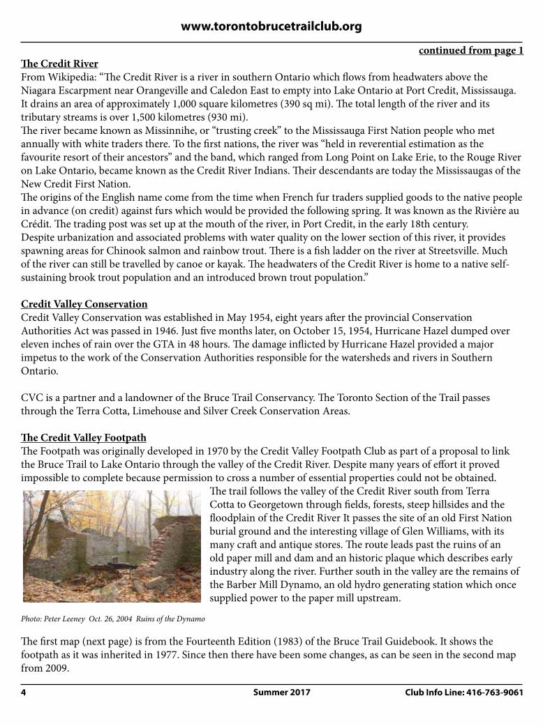


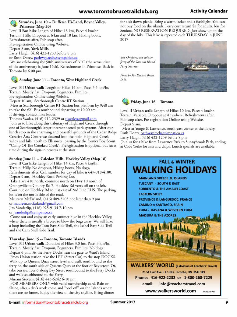


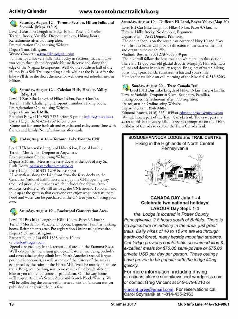

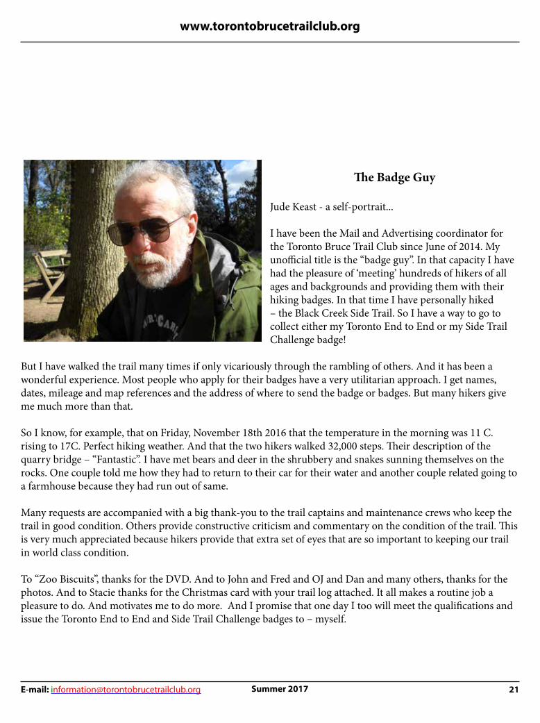


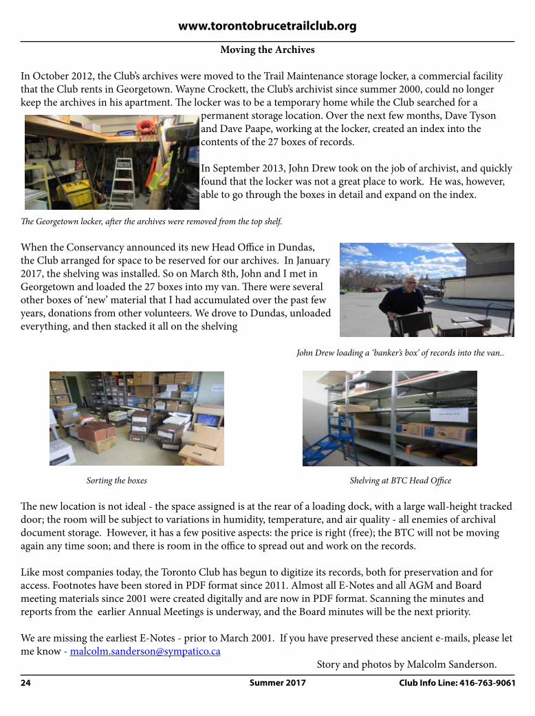


![Mathias Schardt, JOANNEUM Research, Co-ordinator EUFODOS ... · Mathias Schardt, JOANNEUM Research, Co-ordinator . EUFODOS: ... Project Co -ordinator ... Vertikale Struktur[cm] Profil](https://static.documents.pub/doc/80x56/5b5b9e887f8b9a905c8e6992/mathias-schardt-joanneum-research-co-ordinator-eufodos-mathias-schardt.jpg)