12
About ADAGUC Frans van der Wel Royal Netherlands Meteorological Institute 1st ADAGUC Workshop De Bilt, 3-4 October 2006
| Date post: | 21-Dec-2015 |
| Category: |
Documents |
| View: | 213 times |
| Download: | 0 times |

About ADAGUCAbout ADAGUC
Frans van der Wel Royal Netherlands Meteorological Institute
1st ADAGUC WorkshopDe Bilt, 3-4 October 2006
Frans van der Wel Royal Netherlands Meteorological Institute
1st ADAGUC WorkshopDe Bilt, 3-4 October 2006

ADAGUC is about …ADAGUC is about …
Bringing together
– People– Knowledge– Technology
Atmospheric Data Access for the Geospatial User Community
Bringing together
– People– Knowledge– Technology
Atmospheric Data Access for the Geospatial User Community

Atmospheric ScienceAtmospheric Science
GI ScienceGI Science

A golden team!A golden team!

• process driven• spatiotemporal• visualisation• continuous• time series
paradigm• dynamic• WMO as a reference• specialists only• dedicated
• process driven• spatiotemporal• visualisation• continuous• time series
paradigm• dynamic• WMO as a reference• specialists only• dedicated
• data driven• spatial• mapping• discrete/continuous• layer paradigm• static• ESRI as a reference• widely used• out-of-the-box
• data driven• spatial• mapping• discrete/continuous• layer paradigm• static• ESRI as a reference• widely used• out-of-the-box
GIS and AISGIS and AIS

• GIS can bridge the gap between science and end users
• GIS is supported by a rapidly evolving geo information science
• AIS can offer analyses, models and data sources not yet available in GIS
• AIS can enrich visualisation options
• GIS can bridge the gap between science and end users
• GIS is supported by a rapidly evolving geo information science
• AIS can offer analyses, models and data sources not yet available in GIS
• AIS can enrich visualisation options
Why GIS & AIS?Why GIS & AIS?
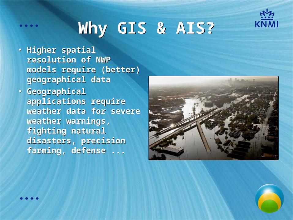
• Higher spatial resolution of NWP models require (better) geographical data
• Geographical applications require weather data for severe weather warnings, fighting natural disasters, precision farming, defense ...
• Higher spatial resolution of NWP models require (better) geographical data
• Geographical applications require weather data for severe weather warnings, fighting natural disasters, precision farming, defense ...
Why GIS & AIS?Why GIS & AIS?
A project is born …A project is born …
• Introducing GIS in Atmospheric Science is only feasible if we can easily exchange data
• THE MOMENT is now: NetCDF in ArcGIS 9.2, impact of Google Earth, web services, policies, social relevance …
• COST-719 Action just finished, valuable cooperation continues
• Look for a ‘case’ : SCIAMACHY
• Introducing GIS in Atmospheric Science is only feasible if we can easily exchange data
• THE MOMENT is now: NetCDF in ArcGIS 9.2, impact of Google Earth, web services, policies, social relevance …
• COST-719 Action just finished, valuable cooperation continues
• Look for a ‘case’ : SCIAMACHY

Scope of ADAGUCScope of ADAGUC
• Atmosperic data, not exclusively SCIAMACHY, but only limited time and resources
• Development of ‘generic’ tools and web services
• Listen, talk, look around!
• Atmosperic data, not exclusively SCIAMACHY, but only limited time and resources
• Development of ‘generic’ tools and web services
• Listen, talk, look around!

Learn from each other …Learn from each other …

“...the map projection that I choose is Mercator, just because it is the map projection that I am the most familiar with as a weather forecaster...”
“...the map projection that I choose is Mercator, just because it is the map projection that I am the most familiar with as a weather forecaster...”
… is never a bad idea!… is never a bad idea!


![WEL-COME [gfgc.kar.nic.in]](https://static.documents.pub/doc/80x56/61b087642e915f09992d751b/wel-come-gfgckarnicin.jpg)


