30
WebGL Virtual Globe and Map Engine AGIT 2017, Cesium Version 1.35 Emmanuel Belo [email protected] +41 21 619 10 25 @emmanuel_belo
| Date post: | 22-Jan-2018 |
| Category: |
Software |
| Upload: | camptocamp |
| View: | 236 times |
| Download: | 4 times |
WebGL Virtual Globe and Map Engine
AGIT 2017, Cesium Version 1.35
Emmanuel Belo [email protected] +41 21 619 10 25 @emmanuel_belo

www.camptocamp.com
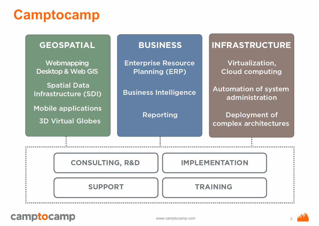
Camptocamp
2
www.camptocamp.com
Camptocamp
3

www.camptocamp.com
CesiumJS
● Javascript Software using WebGL○ 3D virtual globe○ 2D map○ 2.5D Oblique
● 3D Tiles● Different Terrain elevation profile sources● Time-dynamic Scene with CZML● Overlays:
○ Raster: WMS, TMS, OSM, Bing & Esri○ Vector: glTF, CZML, KML, Shapefiles
● Extensible with plugins
4

www.camptocamp.com
Web Graphics Library
● Javascript API for rendering interactive 2D/3D graphics within the web browser
● Hardware acceleration using the Graphics Processing Unit (GPU)WebGL Programs consist of :○ Control code written in Javascript (CPU) and ○ Shader code that is executed on a computer's GPU
● No Plugin ! Also in IE11 !!!● Mobile device compatible
○ iPhone/iPad○ Samsung Sx
5
www.camptocamp.com
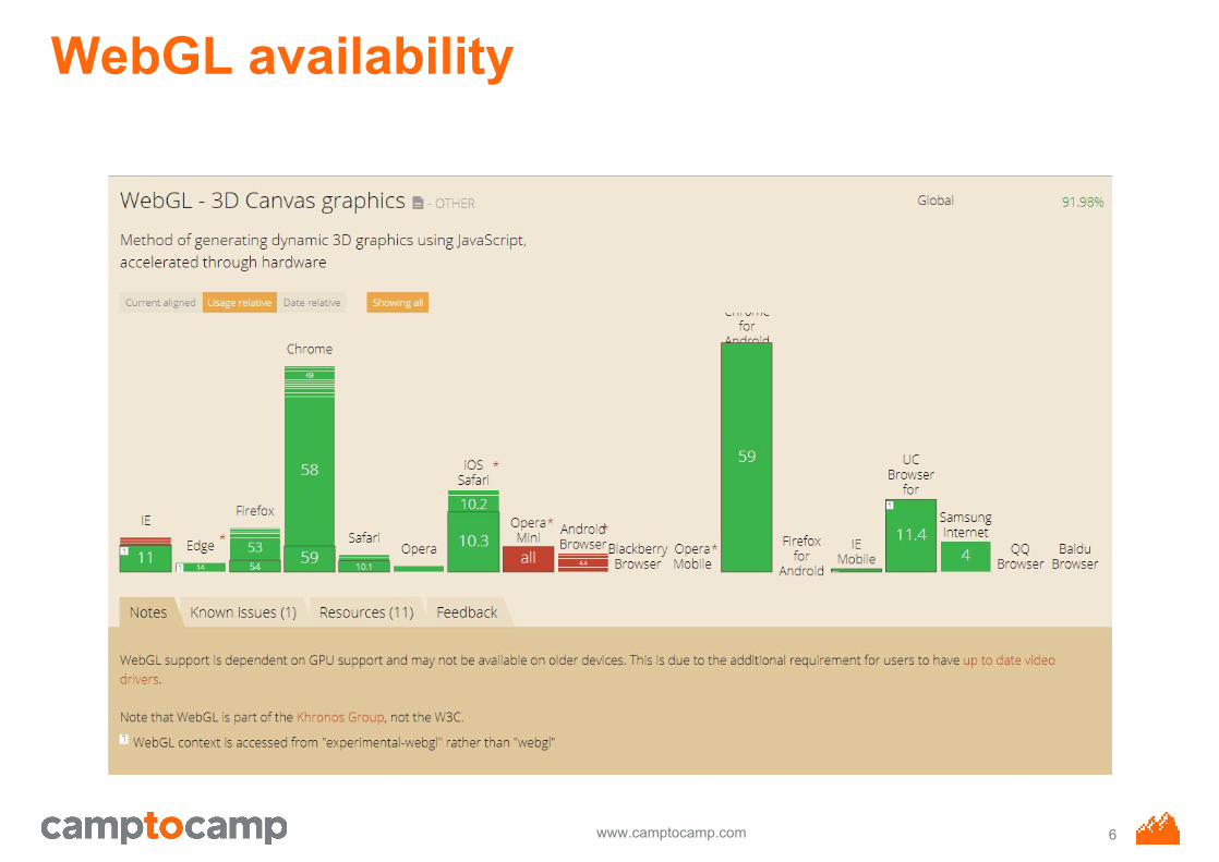
WebGL availability
6

www.camptocamp.com
Terrain Tiles
Stream high-resolution global terrain using the open quantized-mesh format or traditional height-maps, or plug in your own.
quantized mesh VS height-mapssrc: http://blog.mastermaps.com/2014/10/3d-terrains-with-cesium.html
7

www.camptocamp.com
Quantized Mesh
8

www.camptocamp.com
High precise DEM (quantized mesh)
9
www.camptocamp.com
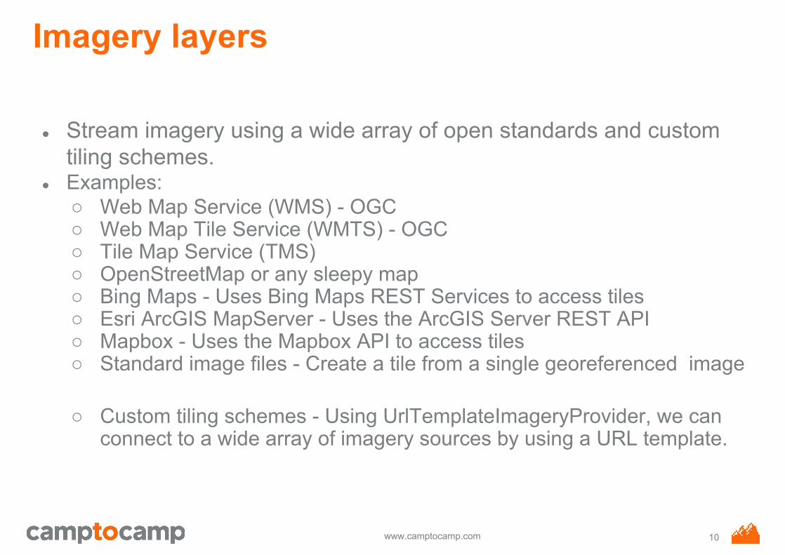
Imagery layers
● Stream imagery using a wide array of open standards and custom tiling schemes.
● Examples:○ Web Map Service (WMS) - OGC○ Web Map Tile Service (WMTS) - OGC○ Tile Map Service (TMS)○ OpenStreetMap or any sleepy map○ Bing Maps - Uses Bing Maps REST Services to access tiles○ Esri ArcGIS MapServer - Uses the ArcGIS Server REST API○ Mapbox - Uses the Mapbox API to access tiles○ Standard image files - Create a tile from a single georeferenced image
○ Custom tiling schemes - Using UrlTemplateImageryProvider, we can connect to a wide array of imagery sources by using a URL template.
10

www.camptocamp.com
WMTS dedicated background map
11

www.camptocamp.com
3D Models
Visualize 3D models using glTF, the runtime asset format for WebGL.
12
www.camptocamp.com
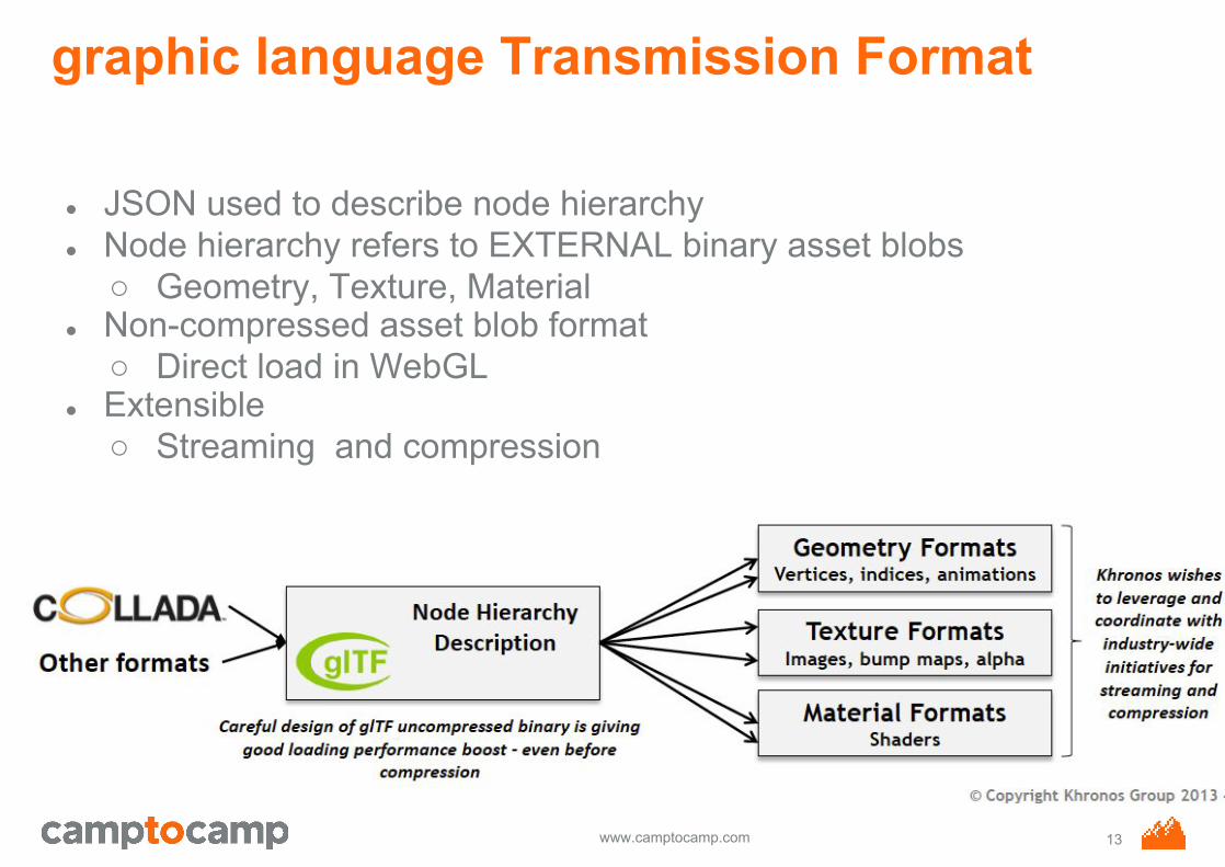
graphic language Transmission Format
● JSON used to describe node hierarchy● Node hierarchy refers to EXTERNAL binary asset blobs
○ Geometry, Texture, Material● Non-compressed asset blob format
○ Direct load in WebGL● Extensible
○ Streaming and compression
13

www.camptocamp.com
3D Tiles
Use 3D Tiles to stream, style, and interact with heterogeneous 3D data, including photogrammetry models, 3D buildings, CAD and BIM exterior and interiors, and point clouds.
14

www.camptocamp.com
Vectors and geometry
Load KML, GeoJSON, TopoJSON, and CZML. Use the Cesium API directly to draw a wide array of features and geometries.
15
www.camptocamp.com
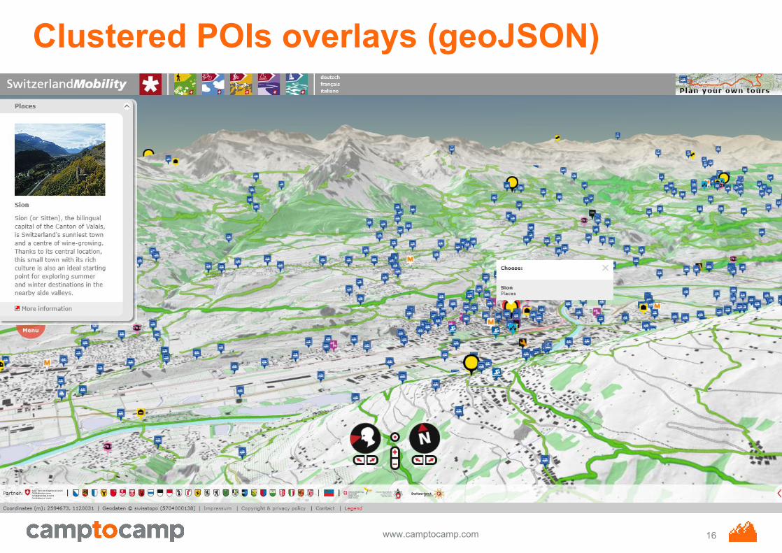
Clustered POIs overlays (geoJSON)
16

www.camptocamp.com
Time-dynamic visualization
See our first-class support for high-fidelity time-dynamic simulation, real-time telemetry streaming, and 4D visualization.
http://apps.agi.com/SatelliteViewer/?Status=Operational 17

www.camptocamp.com
Cesium Sandcastle
18

www.camptocamp.com
3D Web Expectation (2014)
● 3D Scenes○ Aerial imagery and terrain○ Buildings with textures○ Label and marker○ Rich interaction (Navigate, pick, popup, measure, usw.)○ Global perimeter, higher local resolution
● Technology○ Web (no plugin), Cross Platform and Cross Device○ Open Standards and Formats○ Open Source
● 2D-3D seamless transition
19

www.camptocamp.com
ol-cesium
● Write once, use in 2D and 3D● Receive and share with the community● Easiest way to add 3D to an OpenLayers 3 map● Start interacting in one world and continue in the other● It literally brings a new dimension to your maps
20
www.camptocamp.com
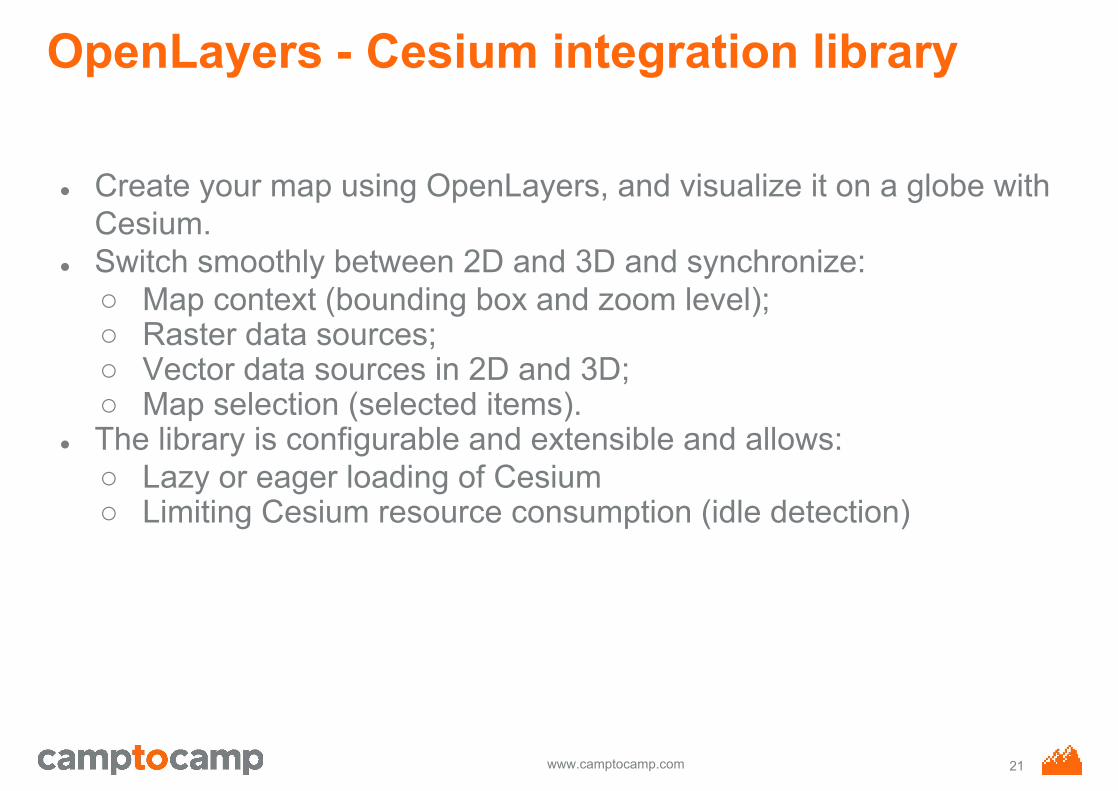
OpenLayers - Cesium integration library
● Create your map using OpenLayers, and visualize it on a globe with Cesium.
● Switch smoothly between 2D and 3D and synchronize:○ Map context (bounding box and zoom level);○ Raster data sources;○ Vector data sources in 2D and 3D;○ Map selection (selected items).
● The library is configurable and extensible and allows:○ Lazy or eager loading of Cesium○ Limiting Cesium resource consumption (idle detection)
21

www.camptocamp.com
Switzerlandmobility (2D)
22

www.camptocamp.com
Switzerlandmobility (3D)
23

www.camptocamp.com
ol-cesium
● Custom 3D terrain - different projections● Optimized for lots of users● CPU/GPU resource saving by stopping the render loop● Workaround for lines on terrain
24

www.camptocamp.com
ol-cesium
● Vector clustering: top quality, some geojsons instead ofmillions of raster tiles
● 3D vector clustering with 30'000 points● Fog: reduce details, improve performance
25

www.camptocamp.com
Topographical catchment areas of Swiss waterbodies
26
www.camptocamp.com
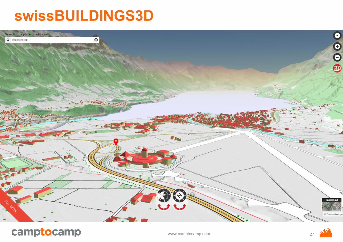
swissBUILDINGS3D
27

www.camptocamp.com
ol-cesium
● Lazy loading● 3D tiles: buildings, bridges● Own synchronizers (raster => vector, different projections)● Immersive views
28
www.camptocamp.com
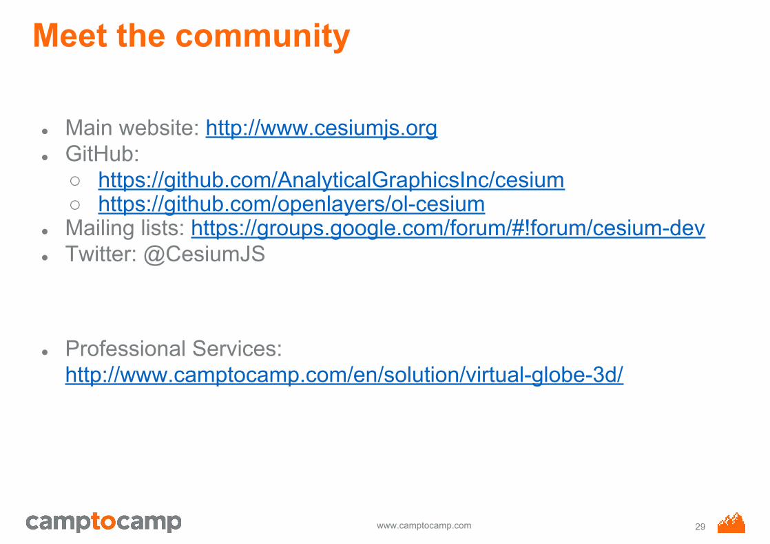
Meet the community
● Main website: http://www.cesiumjs.org● GitHub:
○ https://github.com/AnalyticalGraphicsInc/cesium○ https://github.com/openlayers/ol-cesium
● Mailing lists: https://groups.google.com/forum/#!forum/cesium-dev ● Twitter: @CesiumJS
● Professional Services: http://www.camptocamp.com/en/solution/virtual-globe-3d/
29


