18
AN END-TO-END SEVERE THUNDERSTORM FORECASTING SYSTEM IN AUSTRALIA: OVERVIEW AND TRAINING ISSUES. Tony Bannister and Roger Deslandes Bureau of Meteorology Melbourne, Australia
| Date post: | 19-Dec-2015 |
| Category: |
Documents |
| View: | 213 times |
| Download: | 0 times |

AN END-TO-END SEVERE THUNDERSTORM
FORECASTING SYSTEM IN AUSTRALIA: OVERVIEW AND
TRAINING ISSUES.
Tony Bannister and Roger Deslandes
Bureau of Meteorology
Melbourne, Australia

BackgroundSystem OverviewTraining issuesConclusion

Background

Background
Before this injection of resources, the Bureau of Meteorology Research Centre was developing a tool set that can be used end-to-end in the process of • diagnosing potential severe weather environments,• assessing storm severity on radar and• the issuing of warnings
The Australian Government funding provided resources and a focus to make the system operational

System Overview
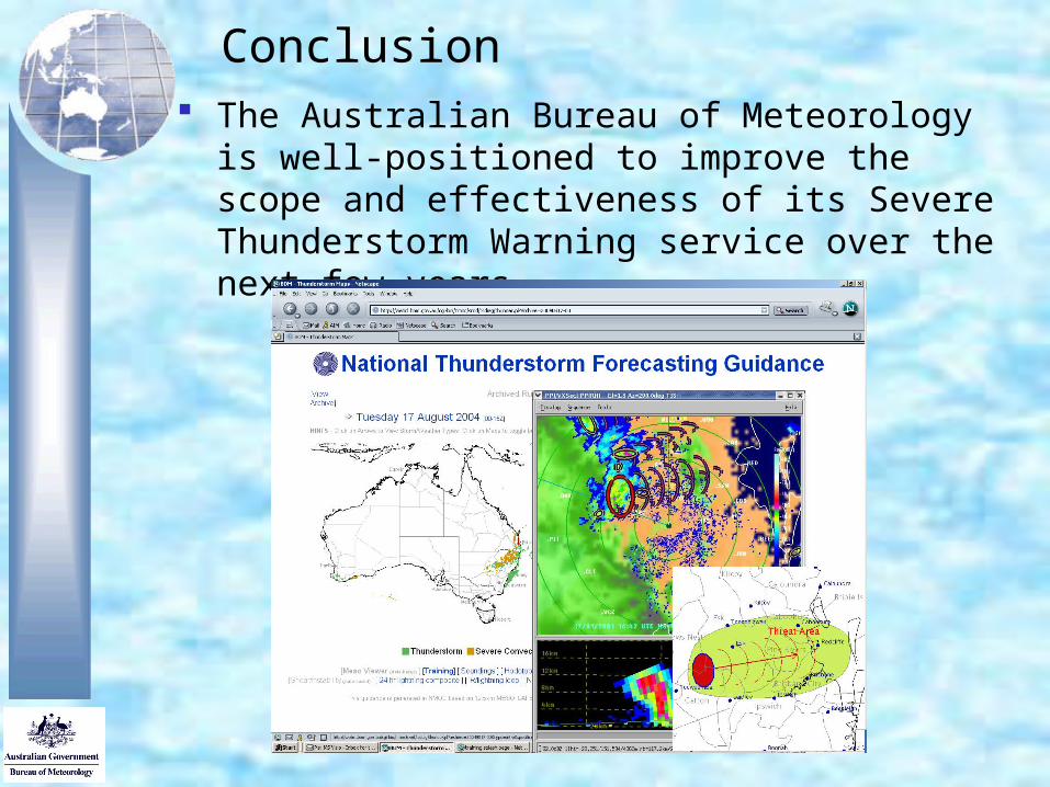
Outlook period to 48 hours • National Thunderstorm Forecast Guidance System
(NTFGS).
Nowcasting • Visualization - 3D-Rapic• radar-based algorithms TITAN and WDSS
Forecast Production• Thunderstorm Interactive Forecasting System (TIFS)

System Overview
Outlook period to 48 hours - National Thunderstorm Forecast Guidance System.
displays those output fields from the 0.125º Australian operational NWP model (Meso-LAPS) that are relevant in diagnosing (severe) thunderstorm potential.
Algorithms used to determine threat areas are ingredient based
Forecasters view the data in a way that reinforces the (severe) thunderstorm forecast process


Supercell (warm-season)
Conditions for surface-based convection met and:
Favourable: Lifted Index (500
hPa) -4.0 Deep Shear (surface
to 2.5-4km) 30 knots Very favourable: Lifted Index (500
hPa) -5.0 Deep Shear (surface
to 2.5-4km) 35 knots.


Nowcasting Visualization - 3D-Rapic

Nowcasting, radar-based algorithms
Thunderstorm Identification, Tracking Analysis and Nowcasting System - TITAN (from NCAR)• radar-based application that identifies and
tracks storm cells and provides short-term forecasts of their movement and size
Warning Decision Support System - WDSS (from NSSL)• radar-based severe weather detection and
prediction algorithms

TITAN WDSS

WDSS

Forecast Production - (TIFS)
Forecaster graphically selects and edits guidance to create a warning
TIFS then saves these forecast decisions and automatically generates a range of graphical and text warning products, guaranteeing consistency
Warning preparation time has been significantly reduced while the range of warning products has been increased.

Training issues
Based on severe thunderstorm and radar competencies.
Train-the-trainer model used. Regional trainers
• developed the training case studies
web-based delivery of the training material Case studies utilise the actual forecast
systems After the training forecasters are cross-
checked against core competencies to ensure that they are familiar with systems and procedures.
Conclusion The Australian Bureau of Meteorology is well-
positioned to improve the scope and effectiveness of its Severe Thunderstorm Warning service over the next few years.


