64
STRATA : DESERTS PAST, PRESENT AND FUTURE AN ENVIRONMENTAL ART PROJECT ABOUT A SIGNIFICANT CULTURAL PLACE Mandy Martin, Libby Robin and Mike Smith
| Date post: | 15-Jun-2018 |
| Category: |
Documents |
| Upload: | phungduong |
| View: | 213 times |
| Download: | 0 times |

S T R A T A : D E S E R T S P A S T , P R E S E N T A N D F U T U R E
AN ENV IRONMENTAL ART PROJECT ABOUT A S IGNIF ICANT CULTURAL PLACE
Mandy Martin, Libby Robin and Mike Smith

S T R A T A : D E S E R T S P A S T , P R E S E N T A N D F U T U R E
A N E N V I R O N M E N TA L A R T P R O J E C T A B O U T A S I G N I F I C A N T C U LT U R A L P L A C E
Mandy Martin, Libby Robin and Mike Smith

Strata: deserts past, present and future
© Mandy Martin, Libby Robin and Mike Smith 2005
ISBN 095 77481 4 0
This book is copyright. Apart from any fair dealing for the purposes of private study, research, criticism orreview, as permitted under the Copyright Act 1968, no part may be reproduced by any process withoutwritten permission. Enquiries should be made to the publisher: Mandy Martin, PO Box 35 Mandurama NSW2792. Copyright in individual essays and artworks remains with the authors and artists.
Cover photograph: M.A. Smith. Back cover photograph: Guy Fitzhardinge.
Frontispiece: Mandy Martin, Puritjarra 1 (see page 2) and Narputta Nangala Jugadai, My Father’s Country 2.Puritjarra is sacred country to the artist. In this work Narputta depicts the mountain ranges of her Father’sburial grounds of Puritjarra. Acrylic on canvas, 76 x 76 cm.
Photography: David Paterson; Trisha Dann, Wiko Djwan and Victoria Nelson, Ikuntji Arts Centre.Scanning of artwork: Rob Little Digital Images.
Design: Angel InkPrint: Goanna Print, Canberra
Publication supported by:
NORTHERN TERRITORY
SOUTH AUSTRALIA
WESTERN AUSTRALIA
Utopia
Cleland Hills
Alice Springs
Santa Teresa
Maryvale
Stuart Highway
Hermannsburg
Papunya
Yuendumu
Uluru Mutijulu
Kings Canyon
Lake Amadeus
Lake Neale
Docker River
Lake Mackay
Kintore Ikuntji Arts Centre
Tanami Highway

S T R A T A : D E S E R T S P A S T , P R E S E N T A N D F U T U R E
Visual artists Authors
Mandy Martin Libby Robin
Narputta Nangala Jugadai Mandy Martin
Daisy Napaltjarri Jugadai Mike Smith
Molly Napaltjarri Jugadai Guy Fitzhardinge
Anmanari Napanangka Nolan Jake Gillen
Eunice Napanangka Jack
Colleen Napanangka Kantawarra Editors
Alice Nampitjinpa Mandy Martin
Linda Ngitjanka Naparulla Libby Robin
Guy Fitzhardinge Mike Smith
Jake Gillen
Libby Robin
Mike Smith
iii

iv
Linda Ngitjanka NaparullaPuritjarraThis work depicts native bush raisins growing in the rich country of Puritjarra. Acrylic on canvas, 76 x 76 cm.

v
Daisy Napaltjarri JugadaiMuruntjiThis work depicts the artist’s home country around Muruntji. This is well known for its abundant bushtucker and wild flowers. Acrylic on canvas, 76 x 76 cm.
vi
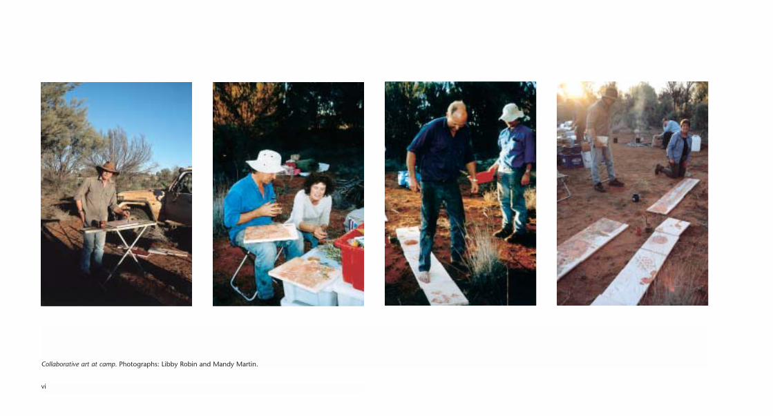
Collaborative art at camp. Photographs: Libby Robin and Mandy Martin.

C O N T E N T S
Introduction 1
Essays
West into the desert 5
Libby Robin with Mike Smith
Desert of the mind’s eye 15
Mandy Martin
Reading Puritjarra 19
Mike Smith
Archaeology, ecology and environmental history 25
Mike Smith and Libby Robin
A pastoralist’s eye in desert country 35
Guy Fitzhardinge
Desert plants and patterns 39
Jake Gillen
Leaving Puritjarra 44
Libby Robin
Contributors 48
Artwork 52

viii
Anmanari Napanangka NolanWaterhole at MuruntjiIn this work Anmanari shows the abundance of bush tucker growing in the region. The waterhole is freshand permanent with people, emus, kangaroos, camels and wallabies all relying on the water source.Acrylic on canvas, 76 x 76 cm.

IntroductionThis book is about diverse kinds of knowledge and ways of knowing place. Indigenous
knowledge depends on country — country is the context for knowledge and the place
where knowledge is significant. Western science, by contrast, typically differentiates
between the knowing and the place — in many cases, it seeks knowledge that is
independent of place, or universal. Other Western knowledge systems, such as aesthetics,
interpret place and locate art in space; such connections between place and knowledge are
different both from western science and from Indigenous knowing. In this interdisciplinary
project, we explore several knowledge systems, Indigenous, scientific and artistic — and
by locating them in a common place we seek co-understanding, for valuing the different
ways each of us sees a single place that is significant, but differently so, for each perspective.
The place is Puritjarra, a rock shelter in the Cleland Hills in western central Australia.
It is part of the country of the people of the Ikuntji/ Haasts Bluff community. It is also
the site of extremely significant archaeological finds in the 1980s. Generally speaking,
science builds its knowledge rather independently of place, but some sciences attend
closely to place, and archaeology is one of these. Archaeology is also a human science,
with a particular interest in people and how they live in place over time. Its focus on the
humans in the landscape creates a space where other knowledge systems can converse
with it.
When the archaeologist Mike Smith began his work in Central Australia in the 1980s, he
and his colleagues had evidence for people dwelling in the Central Australian deserts up
to 3000 years ago. Puritjarra radically changed this. The artefacts Smith dug from the site
showed dates of 35,000 years, that is, back into the Ice Age. This is a very long history of
dwelling in a place that is very dry and difficult for people to find water, food and shelter.
Although the climate has varied over these millennia, Smith and others have established
that this desert environment has been very dry for at least 100,000 years — and that most
of the past desert environments in this long period have been at least as dry as conditions
prevailing at present. The long sequence of occupation has opened up a raft of new
questions. Since his finds, Smith has developed conversations with history, with ecology
and with geomorphology. His work on this site has fostered some long and interesting
dialogues between different knowledge systems.
What Mike Smith had not done before Strata was to consider the contemporary aesthetic
dimensions of the site. He had conversed with the owners on numerous occasions, and
learned something of their traditional understandings of the Cleland Hills. He had studied
the rich rock art at the site, the cultural signatures of people who had sheltered at Puritjarra
in the past‚ over about 1000 years. In this project, Mike worked with contemporary artists:
Narputta Nangala Jugadai, Daisy Napaltjarri Jugadai, Molly Napaltjarri Jugadai, Eunice
Napanangka Jack, Colleen Napanangka Kantawarra, Alice Nampitjinpa, Linda Ngitjanka
Naparulla and Anmanari Napanangka Nolan, who painted the hills, the waterholes and
the food of Puritjarra country in vibrant colours. Here is traditional knowledge, interpreted
in acrylic on canvas, sharing understandings of the place that affirms who the artists are
and their ongoing relationship with country.
Mandy Martin, one of Australia’s pre-eminent environmental artists, joined the
archaeologist and the Indigenous owners, to offer another contemporary understanding
of Puritjarra. Martin is deeply concerned with Australian settler understandings of place,
and has long worked in Australia’s arid country. She aesthetically evaluates and engages
with the environment with her art, and demands new understandings from her viewers.
Her works physically incorporate the place through local pigments and soils. Through her
work she demands creative conversations across knowledge systems. In this project
Martin collaborated with four other people, each of whom brought different ideas to the
art project. Guy Fitzhardinge and Jake Gillen brought environmental and ecological
1

2
Mandy MartinPuritjarra 1
Found local and sourced pigment, sand, ochre and acrylic on canvas, 76 x 385 cm.

understandings to Puritjarra; Mike Smith, his long, archaeological perspective. Libby Robin,
whose formal training is in environmental and scientific history, worked with Martin to
find ways to represent changing ideas and environments in their collaborative work.
Libby Robin designed the interdisciplinary opportunity for collaboration between science
and art, and between western and traditional ways of knowing in a place. She conceived
the project to develop ways of understanding both knowledge and place, and also the ways
they interact and shape each other.
Environmental understandings must grapple with how people live in place over time.
Because Puritjarra is deep in a desert, water — the landscape’s most scarce and precious
resource — is a common element in many of our approaches. Food is also an important
interest, perhaps most noticeably in the works of Daisy Napaltjarri Jugadai, Molly Napaltjarri
Jugadai, Linda Ngitjanka Naparulla, Eunice Napanangka Jack and in the collaborative work
between Mandy Martin and Jake Gillen. The shelter of the hills and their sacred significance
is the theme of the works of Narputta Nangala Jugadai, a senior elder for the area. Mandy
Martin chose to work at a respectful distance from the waterhole itself because of its
sensitivities, and focused her works closely on the shelter. Water, food, shelter and spiritual
renewal are key elements of living in a beautiful but harsh landscape.
The landscape changes over time. Some of these changes are operating on very long
timescales (evolutionary and geological time). For example, various plant species, especially
grasses, emerged only in the past few thousand years, whilst others, like the distinctive
desert oaks have probably stood sentinel in the landscape for the whole 100,000 years
for which we have evidence. Some of our work has focused on very recent changes. The
introduced plants and animals that Mandy Martin and Guy Fitzhardinge explore in their
collaborative work emerge as dominant features within a single human lifetime. People
come and go over the 35,000 years at this site — and the changes in their populations
and different material artefacts, provide evidence of dwelling throughout a wide swathe
of country in every direction from the shelter. Knowledge is not just in place, it also has a
temporal context. What we know and what questions we ask depend very much on what
time-scales we are using. Knowledge is built through the mutual influence of contemporary
ideas. Strata captures some of the ideas at Puritjarra in 2004, and together these ideas tell
us more about both the place and environmental thinking than each knowledge system
could alone.
We wish to record our thanks to the people of Ikuntji/Haasts Bluff whose country is the
heart of this book, in particular to Douglas Multa who has supported this project from the
beginning. We are also honoured to have worked with the artists of the Ikuntji Arts Centre,
who so willingly shared their visual ideas about water, food and spiritual values in their
country at Puritjarra.
We are grateful for the financial support of the Australian Research Council (DP0208361)
and Land & Water Australia (ANU42, 2004–05 General Grant). The shared field trip in May
2004 was crucial to the co-understanding process and its success depended on logistical
support from Chris Delaney, Guy Fitzhardinge, Jake Gillen (participants), Alan Martyn
(Australian National University), Scott and Kath McConnell and Debbie Drewer (Haasts
Bluff Council) and Trisha Dann and Wiko Djwan (Ikuntji Arts Centre). Conversations with
Margaret Friedel, Ken Johnson, Dick Kimber, Bill Low, Kate Podger, Tim Rollason, Mark
Stafford Smith and Boyd Wright enriched the book.
An exhibition of the art works associated with Strata, curated by Tim Rollason, will appear
at the Araluen Arts Centre, Alice Springs in June–July 2005.
Mandy Martin, Libby Robin and Mike Smith
3

4
Mandy MartinPuritjarra 3
Found local and sourced pigment, sand, ochre and acrylic on canvas, 76 x 385 cm.

West into the desertL I B B Y R O B I N W I T H M I K E S M I T H
COMING IN FROM THE EAST
We are in sandplain country travelling west, deep in Pintupi-Luritja country, beyond Haasts
Bluff, some seven hours travelling west of Alice Springs. We are beyond where the
MacDonnells are a solid range — they are now just outliers on our right, an archipelago of
islands in a sea of desert. We are also beyond cattle, sheep, clay and reliable water. This
blue mallee, spinifex and desert oak country continues on westwards from here,
dominating sandplains all the way to the Pilbara in Western Australia.
We are privileged outsiders, guests of people at Ikuntji/Haasts Bluff, in a country with many
extraordinary stories. Mike Smith, an archaeologist who has worked in this country for
two decades, is driving and as we go along, he is telling us about the history of this country.
My other travelling companions are Mandy Martin, an environmental artist, Guy
Fitzhardinge, an environmental consultant and Jake Gillen, an arid zone ecologist. We all
see the country differently. Our aesthetics are informed by our training and our personal
histories. I am an historian of science with a personal curiosity about deserts. This trip is an
opportunity for me to interview Mike formally and informally about his understandings of
this desert country. These conversations in place have shaped much of the Strata project.
Our destination is due north of Uluru as the crow flies but we, like most European travellers
before us, have come to this sandplain country from the east, channelled along the sandy
east–west valleys between the rugged ranges. Ernest Giles and Peter E. Warburton came in
separate expeditions in 1872 and W.C. Gosse a year later. Giles came to the sandplain country
just east of the Cleland Hills via Tjungkupu in the Glen Edith hills, which he re-named the
Tarn of Auber.1 Tarn of Auber then became a destination for many following expeditions
including central Australia’s first and most famous scientific expedition, the Horn Expedition
of 1894. Explorers and adventurers most often came through Hermannsburg, the only
mission on the frontier until the 1940s. Others came from the south-east, setting out in a
northerly direction from the westernmost pastoral station Tempe Downs after it was
established in 1885. Once travellers crossed the Mereenie outliers at the western end of the
James Ranges, they generally followed our route along the valley between the ridges.
COMING IN FROM THE WEST
But these valleys channelled people in other ways too. The sandplain people, a western
diaspora, moved east out of the deserts in hard times, towards water sources in the ranges.
The Finke River at Glen Helen, some 100 kilometres east of the Haasts Bluff soak would be
the first reliable source of water encountered by these people. For Europeans it was the last
5
Phot
ogra
ph:
Man
dy M
artin
.

reliable place for pastoralism. Efforts to establish pastoral industries further west than Glen
Helen failed because there is too little water. The sandplain country absorbs water like a
sponge. Without a claypan base, even ephemeral waters are not retained, except in the
rocky ridges. Desperate times forced western desert peoples to leave their country, so their
movements are indicators of the ecological stress of long waterless periods, periods when
water and food were scarce.
The movements of people in country ebbed and flowed over thousands of years, east and
west past Puritjarra, a rock shelter in the Cleland Hills, which is our destination. Mike
Smith has worked beyond the normal bounds of archaeology, stretching time to encompass
the geological past and include the present. Puritjarra reveals much about past climates
with tough seasons, different ecological limits and ways of living in these deserts. But it is
a living country too, a frontier where easterly and westerly travellers cross paths. The
sandplain country overlooked by the Puritjarra rock shelter holds histories that must be
discovered in ways beyond traditional archaeology. The last 100 years appear in only the
top tiny slice of sediments, not enough to reveal much about recent histories.
The moving desert diaspora is a story of our own time. In the twentieth century, the 1920s,
the 1940s, the 1950s and the 1960s all contained long dry-spells tough enough to move
sandplain people. The time from 1924 to 1929 was a prolonged dry-spell that brought
many Pintupi peoples east out of the desert. There was another such time in the early
1940s. And some people didn’t make it.
AN EAST–WEST FRONTIER
The idea of a frontier in our own time, of people moving in and out of country, was
unavoidable in the 1980s. When Mike embarked on the task of reconstructing the
archaeology of central Australia, it was in the immediate aftermath of major population
movements. Commonwealth legislation for Aboriginal land rights had accelerated a
move westwards, with Aboriginal people moving back toward their country, establishing
outstations.2 One Pintupi man, Pinta Pinta, moved far, far west with his family to a small
outstation west of Kintore (NT) and Kiwirrkurra (WA), at Winparrku. Ecological and social
pressures, however, were forcing other people eastwards. Even further west in the Gibson
Desert in October 1984, Tjapaltjarri brought his family group, nine Pintupi people who
had always lived traditionally, to Winparrku, about 400 kilometres west of Puritjarra.3 Mike
told this story in his doctoral thesis:
In 1984 Tjapaltjarri walked out of the Gibson desert. With a small group of relatives
he had been marooned by the progressive depopulation of the area and isolated from
other people for more than twenty years — in fact for most of his life. His aunts sent
him south, with his brother, after they noticed a more consistent pattern in the smokes
in that direction, indicating the presence of other people. These fires were set by Pintupi
people moving out in 1984 to establish outstations west of the Kintore range,
reoccupying country they had left in the 1960s. As it turns out, the people Tjapaltjarri
met … were his relatives.
There must have been many such events. Tjapaltjarri’s story reflects some of the
processes that … shaped desert prehistory … The arid zone … register[s] substantial
changes in both population density and population distribution. … [A]lternating
periods of wetter and drier conditions operat[e] to enlarge and contract the available
living space for desert populations and affect … the quality of life within it. The process
of abandoning and subsequently re-colonising parts of the desert is likely to have
involved many small dramas such as that played out by Tjapaltjarri in 1984. Tentative
contact between long separated groups of people may often have begun in a similar
way. A family moves back into empty country and one night an unfamiliar voice just
beyond the firelight softly frames one crucial word ‘kapi’ — water.4
Tjapaltjarri’s story inspired and sustained a long research odyssey, which included a
number of family histories of other Aboriginal people who passed through the Puritjarra
shelter (and the desert country it supports) over a century and more.
6

7
From the 1870s onwards, the strobe light cast by the diaries of explorers, expeditioners
and adventurers provided discontinuous, but nonetheless snapshot historical records of
the country, and of their guides and the people that helped them negotiate it. Some of the
important records were scholarly and anthropological, compiled by N.B. Tindale at
Hermannsburg Mission (1929) and at Mt Liebig (1932). Some were practical. The ration lists
compiled by T.G.H. Strehlow at Haasts Bluff in 1941 provided useful information, especially
taken together with genealogies Strehlow developed over the following 20 years. Charge
sheets for prisoners received at Port Augusta Gaol record a steady stream of Aboriginal men
arrested for spearing cattle. A remarkable assortment of local histories and ephemera put
some western desert faces into east–west frontier stories.5
A PLACE IN THE DESERT
Puritjarra was seldom a long-term home for large numbers of people. Small groups —
maybe very small indeed in prehistoric times — sheltered there as they moved across a
wide swathe of their country. Some groups were as small as our own, and like us, stayed
only very briefly, before moving to the next place of water, food and shelter. Single family
groups of four and five people were probably the norm.
Mike had dug seven or eight other sites right across the southern flank of the central
Australian ranges when he came to this, his most westerly site. His job with the Northern
Territory Museum as government archaeologist gave him both the cachet and a salary to survey
record and excavate archaeological sites in the Northern Territory, and a base (The Residency) in
Alice Springs. By 1986, he had mapped human occupation over the past 3000 years in sites
spanning some 400 kilometres. With a search strategy radiating out onion like from Alice
Springs, he identified likely spots using aerial photographs cross-referenced with large-scale
topographical maps. He looked for dissected sandstone country where water could seep into
soft stone and etch out rock shelters. Such ridges also often held waterholes or ephemeral
rockholes that made them attractive to people, and the shelters formed artefact traps where
a sedimentary archive of a human history might accumulate. Although as government
archaeologist he had a standing permit to enter Aboriginal land in the course of his work,
he always sought formal permission from traditional elders and respected their concerns and wishes.
Archaeological reconnaissance necessarily takes in whatever elements of earlier cultural
landscapes that survive, but rock shelters promise the longest sedimentary records. Digging
in sandy and silty floors is technically difficult work, as is learning to read the sedimentary
and depositional histories of these sites, particularly if there is a need to read sediments for
environmental as well as cultural stories. A rock shelter provides the best possibility of
a place where meaningful sequences of sediments are not too disturbed (in a floor), or
deeply buried by recent wind-blown sand, or over-printed by geochemical processes.
Not all archaeology requires digging in the silty floors of rock shelters. One of Mike’s best
digs was in the drawers of his government office, where he found a cryptic note about an
enormous rock shelter near Mt Winter, at the southern end of the Cleland Hills. It had been
transcribed from an old Australian Institute of Aboriginal Studies site card, which itself
was an excerpt of a newspaper clipping about a 1969 expedition to the Cleland Hills by
Robert Edwards, curator of anthropology at the South Australian Museum.
Mike wrote to Edwards for more information and talked to local Aboriginal people, but the
Luritja name and location of this shelter eluded him. Eventually he found it on foot —
walking along the edge of the escarpment, checking likely looking shadows, looking at the ground
for stone artefacts and chippage, sniffing around like a dingo. Edwards had also found the place,
15 years earlier — on foot. The radiator had boiled on his Land Rover, in remote country
near the Cleland Hills. He was still some distance from his destination at Thomas Reservoir
(Alalya), where he was taking a party to photograph and document deep ancient deeply
weathered rock engravings. While waiting for the radiator to cool, Tjukadai, Edwards’ guide
from Haasts Bluff, took a walk towards Mt Winter. He returned with news of a rock shelter
with cave paintings:

8
Anmanari Napanangka NolanWaterhole near PuritjarraThis unusually representative work by Anmanari focuses on the richness of the Puritjarra region, west of Haasts Bluff and near the artist’s home country of Kungka Yunti. Acrylic on canvas, 76 x 76 cm.

We found it was huge — two hundred feet long and sixty feet high …
Numerous ochre paintings were around the wall in red, white, yellow and black. There
were simple hand stencils, hand prints, bird tracks, kangaroo tracks, circles and snake-
like designs. Then, delightedly, we came upon ancient engravings ... But more
precious, the floor of the main cave was covered with pieces of charcoal, and a small
test pit showed many feet of accumulated occupation deposit.6
Tantalised, but short of water and time, Edwards and his party had been forced to move
on to reach Murantji rock hole. Edwards never returned.
A good earth floor is a valuable document to a dirt archaeologist. To round out his survey of
central Australian sites, Mike sought an undisturbed sedimentary sequence that might
tell something about population and environmental changes before 3000 years ago.
He grabbed at a chance opportunity and a permit to travel to Thomas Reservoir in September
1986. On the ground, with aerial photographs in hand, he begged a few hours to scout
the Mt Winter area on foot. His mate, Alice Springs historian Dick Kimber, went south.
Mike walked north and within half an hour struck the Puritjarra rock shelter, one of the
biggest he had seen. It was a veritable gallery of rock art. And it had an undisturbed,
apparently deep, earth floor. Even better, the curved overhang created wind eddies that swept
the site clean of aeolian sand, preventing the promiscuous accumulation of sand that had made
other sites so difficult to work.
It was a race against time. Mike was nearing the end of his project and of his financial
support from the museum. He had to go to a conference in Southampton, England, at a
time when there was uncertainty because of the ongoing Irish situation and tension with
Libya.7 But he was sure that this shelter was important, that it was a key site that could rewrite
central Australian history. He wrote a sealed note for his university supervisor, telling him
how to find the shelter, in case he did not return from Europe, and boarded the plane with
his fingers crossed. By the time he returned, it was late October and the weather was getting
very hot. But a permit had come through and Mike headed west with just three colleagues
to help him with the dig, and a bare minimum of gear and supplies.
In eight days he and his team undertook the most westerly excavation of his project. From
26 October to 3 November 1986, Smith, Chris McColl, Michelle McGlasson and Ann Robb,
worked about 12 hours each day till they were knackered.8 They were on site by 7 am, and
surveyed, dug and sorted until nearly 7 pm. The weather harassed them — storms brought
rain on several nights — then later the same week water became scarce as the nearby
ephemeral rock holes dried up in the heat. It was a lean dig. Food supplies were low: Nearly
out of fresh food — crew a bit hungry. I made a pan-fried damper, which went down well at
lunchtime.9 Mike’s hope was that he could use the material from this excavation — garnered
carefully and systematically but working against the clock, growing hunger, the seasons
and the circumstances — to provide an extended chronicle of human settlement in the Centre.
By the end of the dig he was less hopeful. Although there were some differences in artefacts
and sediments — the deep red sediments simply screamed Pleistocene — the sequence seemed
to duplicate a pattern of changes familiar from his other excavations, changes that took
place only about 800 years ago. So much for a long sequence. His field notes ventured a
gloomy prediction: I anticipate a basal age for occupation at this site of 850 BP.10
But the radiocarbon dates came back very differently. When he least expected it, Mike had
uncovered material from the Ice Age. His new dates of 22,000 years BP (before present)
pushed evidence of central Australian occupation into the late Pleistocene, and opened
up a whole new suite of social, cultural and environmental questions.11 Almost before the
ink had dried on his letter to Nature reporting the finds, a new dating technique,
‘thermoluminescence’ (based on grains of sand not charcoal) took these dates even further
back.12 Puritjarra was one of the first three archaeological sites in Australia on which the
new technique was tested. Thermoluminescence dating, plus better constrained and more
9

refined 14C (‘carbon 14’ dating, based on the 14-isotope of carbon in organic remains)
pushed the dated human use of the site further back to 30–35,000 years ago. Mike returned
to Puritjarra for two longer seasons of field work and excavations (4–28 May 1988 and
14 April–3 May 1990), then at 7 pm on 29 April 1990, he filled in all the trenches for the
last time leaving the backfill well camouflaged and the site to settle back after the indignities I have
wrought on it.13
WHAT CAME YE OUT INTO THE DESERT TO SEE?14
Through Strata we are seeking to learn what one special place can teach us about the
cultural and natural histories of the Australian desert, about sandplain people dwelling in
deserts and the history of desert ecologies. It is a site where important scientific and cultural
ideas intersect. Puritjarra is a site of science, yet it also reveals much about environmental
history and the depth of antiquity of Aboriginal peoples in the land.
This lone site is an epicentre of ideas of enormous significance internationally as well as
for Australians. Some desert dwellers, such as the Atacama people in Chile or the Nama in
the Namib, live in drier deserts, but their oases, well-watered places surrounded by absolute
desert, are more reliable and predictable. As arid zone ecologists often say, the point about
desert organisms is that they don’t live in a desert. Australian desert people, by contrast, live
in their deserts, sustained by small wells and soakages, but relying on the desert hinterland
for food. Australians live in deserts that may appear less severe, but are climatically highly
variable. Where and when rain will fall is always uncertain. Australian desert peoples live
in a land where to be mobile is to survive, and a flexible, well-educated approach to
dwelling is essential to a future in the land. Each desert-dwelling group knows about a
range of possible better-watered places, and must know a large enough sweep of country
to find places even when times are tough and there has been no water for extended times.
Puritjarra offers desert stories, stories of multiple, stacked deserts. This place reveals deserts
in a distant past beyond people, deserts with people living under Ice Age conditions at the
height of a very tough glacial maximum, colonial deserts with people whose relations now
live at Haasts Bluff, whose children will inherit deserts future. The sedimentary stacking
separates the stories, but there is a leaching between the layers, as each desert informs
the stories of adjacent ones. For Strata, each of us chose a place, a vantage point, from
which to see Puritjarra, and the conversations in these places became part of the strata of
the project.
Mike’s place is of course the Puritjarra rock shelter itself, indeed perhaps in a two metre
hole there!15 His gaze is outward looking. He is reading the archaeological record for what
it can tell him about the series of landscapes beyond the shelter and how people lived
in them.
Jake Gillen chose a rocky knoll where he could look down on plants and changing
ecosystems in the sandstone plains below. He delighted in the central Australian ecology
all around him, desert plants and patterns that are familiar. If he looked to the west he
could see the whole Puritjarra shelter, and some of the plant systems of the Cleland Hills,
rather different from the sandplain patterns that surrounded him on the knoll. It was
such a good vantage point that Mandy chose the next dune east from which to depict
the shelter for her suite of paintings Puritjarra 2. For Jake, arid zone plant ecologist and
former central Australian resident, coming to Puritjarra was a chance to be, as he put it,
among friends. His eye roved affectionately toward the desert oaks Allocasuarina decaisneana
standing tall in the sandplains below — large and small, like parents and their children.
If Mike’s eye is trained to find William Blake’s world in a grain of sand, Jake sees heaven in a
wild flower.16
10

11
Alice NampitjinpaPuritjarra and GrevilleasIn this work Alice depicts the rich flora of the area known as Puritjarra or Mount Winter, west of Haasts Bluff. Grevilleas grow in profusion in this rich area of the desert. Acrylic on canvas, 76 x 76 cm.

Guy Fitzhardinge, an environmental consultant and beef producer, was also intrigued
by this country. In Australia’s arid and semi-arid lands, it is rare to see country that has not
been shaped and simplified by livestock production. Here in the Cleland Hills is a land
where, as Guy observes, the cost of the fence would be beyond the value of the cattle. The
uncertainty of water means that pastoral initiatives are not part of the vision or history of
the place. Yet the grass waves in the wind, taunting, while his own successful New South
Wales properties are suffering drought and he is feeding cattle by hand.17
Guy’s environmentally-sensitive eye roves the site: the introduced buffel grass Cenchrus
ciliaris is spreading, despite the ongoing efforts to conserve the hills. He is concerned too
about feral camels, whose fresh tracks are apparent in the sand. He is always looking for
ways to learn from a healthy landscape — for it is a healthy landscape that fosters healthy
communities. He works with the Australian Bush Heritage Fund in other desert country,
and with the Threatened Species Network, which has a major interest in desert ecologies.
He is also active in his own local community, and he prizes this opportunity to look
carefully at how the people at Ikuntji/Haasts Bluff work with their rich and interesting
country. He reflects on the responsibility for stewardship of landscape, how the modern
market system seems incapable of valuing things in ways that help a fragile environment,
especially things that might have to work out over 200–300 year cycles.
Mandy Martin wants to make aesthetic vision part of the conversation about deserts. She
believes that environmental appraisal is incomplete without an aesthetic perspective.
She celebrates light, scale, texture and colour. As she painted the place, she literally added
the place to her work through pigments and soils — stacking her deserts with visual
density. She chose a number of ways to see the Puritjarra rock shelter — from inside out,
and outside in, sometimes alone, sometimes through conversations and collaborations
with the rest of us. In seven major suites of art works, she offers a density of aesthetic
appraisals of the site, appraisals built through conversations with each of us, inveigling us
to share our ideas and aesthetics with her.
I was also interested in conversations about ideas. I ventured here to track ideas in place.
Puritjarra was for me a place where human and environmental history have been told well,
where new knowledge of deserts has been forged. Knowledge about this site tells much
about the country around — as far as the eye can see, perhaps much further. My place for
conversations was looking north across the sandplain to those blue island-mountain
outliers of the MacDonnells. At my feet in the foreground were paving stones patterned
by ancient beaches. As I looked at the distant geomorphological islands, I thought about
the cultural site below, a stepping-stone, one of very few straddling this desert. Just as
biodiversity is found concentrated in small patches in Australia’s desert landscapes, cultural
history also appears only in a few islands. Travellers in this land must travel light to survive.
The movements of wind, sand and floods make finding artefacts difficult in the open sea
between stepping-stones. Only at camp-sites, stopping places, will there be ‘things’ — stone
tools, charcoal from a fire. And only in rare places will these artefacts be buried safely, away
from erosive elemental forces. Puritjarra is a rare place.
For the Ikuntji artists, this is home, a landscape of rights and responsibilities, of tjukurrpa
and of family. Scattered through the hills, isolated graves memorialise their use of this
country, while the paintings they contribute to this project reflect its beauty, its waterholes
and bush foods.
All travellers have their own reasons for a journey. Each of us brought different
expectations, based on our knowledge and interests, and these gave us different vantage
points. We saw different dimensions, layers and textures in this desert. Our hosts at Ikuntji/
Haasts Bluff have their own eyes for this country, which they care for so deeply. Each
of us newcomers wants to respect and understand this view, this aesthetic, this logic of
country, for we are self-confessedly outsiders who feel privileged to be here.
12

ENDNOTES1 Mike Smith, ‘Peopling’ the Cleland Hills: Aboriginal history in western central Australia, 1850–1980.
Aboriginal History Monograph, 2005.2 Aboriginal Land Rights (Northern Territory) Act No. 191/1976 (Commonwealth).3 The twentieth anniversary of this event was recently celebrated by Paul Toohey, ‘What happened
to the Pintupi nine’, Bulletin, 4 May 2004: 28–35.4 M.A. Smith, ‘The Pattern and Timing of Prehistoric Settlement in Central Australia’. PhD Thesis,
Department of Archaeology and Palaeoanthropology, Armidale, University of New England,1988.5 See Mike Smith, ‘Peopling’ the Cleland Hills.6 Robert Edwards, Curator of Anthropology, South Australian Museum, in Hemisphere, 1971.7 The Orange Day marches in Northern Ireland in July 1986 were some of the worst on record. The
bombing on TWA Flight 840 from Rome to Athens was also earlier the same year (2 April 1986),making aeroplane travel seem particularly risky.
8 Mike Smith Field journals 1986–90 (digitised and lightly edited Canberra 27 December 2000). 9 Field notes, 31 October 1986.10 Field notes, 1 November 1986.11 M.A. Smith, ‘Pleistocene occupation in arid Central Australia’. Nature, 328, 1987: 710–11. 12 M.A. Smith, ‘The case for a resident human population in the Central Australian Ranges during
full glacial aridity’ Archaeology in Oceania, 24, 1989: 93–105. Smith was also involved in thermo-luminescence dating at Malakunanja II in the Alligator Rivers region. This was a tropical not desertoccupation record, but it documented use 50,000 years ago. See R.G. Roberts, Rhys Jones and M.A. Smith, ‘Thermoluminescence dating of a 50,000 year-old human occupation site in northernAustralia’ Nature, 345, 1990: 153–56.
13 Field notes, 29 April 1990. For the 1988 trip, Mike was accompanied by Doreen Bowdery, RowlandReeve, Giles Hamm, and, from 18 May, Ann Robb; and in 1990 by Barry Cundy, Andrée Rosenfeld,Amanda Brown, Ben Smith (Mike’s son, aged 10) and locals Dick Kimber and son Stevie.
14 Luke 7: 24. This was the question Jesus asked the crowd who had gathered in curiosity about Johnthe Baptist. The fascination with deserts — places ‘deserted’ of people and civilisation, which arealso seen to be places of spiritual renewal, is strong in the Christian tradition, and in Islam andJudaism, other religious traditions which originate in the desertified lands of the Middle East.
15 Mike’s 1986 field notes are preceded by the note: Puritjarra (Mt Winter) Puri (shade) tjarra (place,belonging).
16 From the first two lines of the Auguries of Innocence, penned by William Blake in 1794.17 Guy Fitzhardinge, ‘In the bush the word drought is back’, The Australian Financial Review, 25 May
2004: 71.
13

14
Mandy MartinPuritjarra 2
Found local and sourced pigment, sand, ochre and acrylic on canvas, 76 x 385 cm.

Desert of the mind’s eyeM A N D Y M A R T I N
In 1991 I painted with the women at Ipolera, an outstation of Hermannsburg, a few hours
away from the Cleland Hills. What has remained with me powerfully is that despite the
obvious poor health and minimal vision of these older women, their representations of
the landscape in front of them as we sat on sandhills or looked out from a cave towards
Mt Hermannsburg, were vivid and immediate. What I was hoping to find in the desert was
a clue to how one conjures up this incredible skill and how that acts as testimony to the
place and its resources.
I knew the paintings of Haasts Bluff artists Mitjili Napurrula, Narputta Nangala and Long
Tom Tjapanangka. They are hung prominently in the Art Gallery of New South Wales, the
Art Gallery of Western Australia and in many other collections. We were travelling into
their country and the hard working artists who are the core of the Ikuntji Art Centre were
planning to work with us. But not at the site, which was another four hours drive
westwards. It was already too cold for people not in good health to camp out. They would
work projecting an inner landscape, taking from the outer landscape and transforming it
into paintings that become the place. We passed Brown’s Bore, the Kungkayunti outstation,
now unpopulated, just a windmill, some rough stockyards and a much graffitied tank
marking the spot, but strikingly, it was the exact place depicted in Long Tom’s paintings.
Further west again, we approached the conical humps of the Cleland Hills, already familiar
to me from repetitive patterning in Long Tom and Narputta’s work. All the bush tucker of
Daisy Jugadai and Anmanari Napanangka’s paintings appeared as if by magic, right there,
just as they paint them.
It is like the sort of shock one has looking at a Piero de la Francesca painting then driving
through the mountains in Umbria and seeing the eroded, stark desert hills he used for the
backgrounds to his religious allegories.
Puritjarra is a place held in the mind’s eye of the artists who know it. Those allowed to paint
its stories do so in a way that falls between mimetic and symbolic painting. Literally so, for
some of the artists who are virtually blind now or too sick to visit such far away, inaccessible
country, even though it is theirs. They create paintings that, as Nicolas Rothwell writes
(of another place), ‘for all the depiction of tree and earth, are not so much landscapes
as memory-scapes-memorials to empty country.’1 Daisy captures in a stylised but dazzling
personal language all the bush tucker of the place. Narputta does the same, but peoples the
empty place with repeated brown figures standing naked amongst the abundant flowering
plants and trees. It is some time since they have physically visited the place.
15
Phot
ogra
ph:
Guy
Fitz
hard
inge
.

The challenge for me as an artist visiting Puritjarra for the first time was the immensity
of the task and the huge responsibility of representing it. We all first sought permission
from the Ikuntji Council to visit there with Mike Smith, already well known through his
archaeological work on Ikuntji country over two decades. We also specifically sought
permission to paint out there. It was Mike Smith who introduced us all to the site. I was
concerned to know where I would be allowed to work and which places were no go. We
entered Murantji rockhole in the hushed silence appropriate to any cathedral, and, after a
respectful time, drank a little of the crystal clear water. In Mike’s passionate return to this
loved country, he walked us for hours, until well after sunset, over the waves of sandhill
plains, along the base of the Cleland Hills escarpment to the rockshelter, the site of his
archaeological dig, a most significant site in central Australia.
I wanted to paint the layers of resource: the plants, animals, the historical significance of
the water in the Cleland Hills, the environmental threats, the strata of stacked histories
and the multiple stacked deserts themselves, as Mike Smith calls them. I decided to
collaborate on multi-panelled paper canvases with each of the team members. We carried
our gear in to set up a base camp near the rock shelter each day. First we drove slowly along
a seismic line to within a respectful distance, then filed in together, assortedly burdened
with crates of canvases, supplies of water and painting gear, including an esky of pigments
and brushes and my working table, a light and portable ironing board. Our overnight
camp was well away from the hills. The ecological restoration of the Cleland Hills is a
major project underway, a project that is designed to help reconnect young people
with their country.2 We outsiders did not want to introduce new problems for them to
deal with.
Jake Gillen indicated that he wanted me to paint a panorama of the approach to the rock
shelter and escarpment to capture the rich and diverse beauty of desert flora. He illustrated
each of the plants in Daisy’s bush tucker paintings, using European plant illustration
conventions and describing some of their uses in traditional culture.
Mike Smith wanted to capture the deserts past, multiple stacked deserts, each projecting into
the fabric of the present. Recycled, Reinterpreted and Appropriated. Using the visual language of
post-modernism we dropped his archaeological diagrams and illustrations into textural
representations of the cave floor and walls. He wanted the memory of other hands 3 so
we literally used the pigment and material of the shelter. He ground up sandstones, ochres,
charcoal and sand to paint his fragmented, panoramic palimpsest. He evoked Thomas
Carlyle’s idea of a life as a little gleam of Time between two Eternities.4 The wet pigment that
flowed from our brushes paid homage to our privileged inclusion in that space.
Libby Robin chose to look out on the land subtended by the rock shelter, thinking about
the histories in it that were revealed by the clues left behind. I painted the panorama from
above, balancing canvases on flat slabs of raised ancient sea bed and looking towards the
archipelago of islands, Mike’s phrase for the geomorphological outcrops of the western
MacDonnells.5 Equally the islands could be seen to be cultural — the Puritjarra rock shelter
is one of the very few documents that extend into the deep past in a desert land that allows
its treasures to slip away in shifting sand. Libby made drawings of the pieces of charcoal
collected from the rock shelter then used them to write 14C and draw ancient sea waves
on the slabs of sea-bed I had painted in the foreground: vestiges of human stories over the
geomorphological littoral.6 This was to emphasise the human and deep-history layers,
overlaid in the landscape. She found and drew in bleached land snail shells suggesting
the sea. This deliberate confusion between land and sea was a reminder that some of the
ancient deserts of this place were sea-beds. My wave crashing on the desert floor, picking
up colour from the sea-green foliage of many of the desert plants of the sand plain, reminds
us that with climate change, deserts future may not be as they are today.
Guy Fitzhardinge turned his keen stockman’s eye to good country and potential threats and
problems. As a passionate environmentalist, he is always on the look out for incursions into
the natural world. He chose a view above the ground looking down for his canvases. He saw
the effects that drilling for water, windmills and bores have had because of introducing stock
16

17
Molly Napaltjarri JugadaiPuli at PuritjarraMolly’s work focuses on the massive mountains at Puritjarra and the native foods that grow in the region.Acrylic on canvas, 76 x 76 cm.

into country too fragile for grazing. He sees hot fires that have burnt destructively in the
past, as regular cool fire burning practices stopped happening. In the sand he sees car tracks,
starting erosion patterns, bringing destructive weeds like Mossman River burr (Cenchrus
echinatus) and spreading buffel grass (C. ciliaris), even in this country remote from cattle and
sheep. There are also camel tracks, too many, warning of imminent population explosion.
There are dingo tracks: fresh ones appeared over the human tracks we left on our first day.
Fox and cat tracks and feral bees’ nests suggest other invaders. Then there is detritus along
the roadsides, some very much of the place: old grindstones and stone flakings; other objects
less romantic, from elsewhere: bully beef cans, a 1960s orange Holden, other ‘stacked’ cars,
plastic drink bottles, even a disposable nappy and a toy car.
My paintings Puritjarra 1, 2 and 3, using the artist’s eye alone, are painted with found and
natural pigments, sand, ochres, many from the Cleland Hills. I use the European pictorial
convention so appropriate to these vast horizons and massive skies, the panorama. The same
convention is used by Imax cinemas to capture the vast and sublime, but digital and
photographic images miss the certain quality of colour because of the mechanical dyes,
digital colours and flat illusory surface. I use the material of the place, the physicality of
surface, texture to capture the quality everything in this landscape has, that is, of holding
light, giving it a luminous opacity, a contradiction in terms. The colours I use are natural.
Many of them are high key because all surfaces in this place are bathed in ambient and
reflected light. Not only that but every colour occurs in every other colour it seems, there
is as much red in the greens as vice versa, so there is an infinite array of chromatic greys to
be painted. These paintings become an aesthetic evaluation of all the non-tangible qualities
that contribute to the spirituality of this place. After all a painting is only a codified
collection of abstract marks, marks which have imprinted themselves on the traditional
Aboriginal owners of this place, and which they take with them as memory-scapes. So just
as I hear the sound of waves crashing on the desert I also have subliminal imprints of the
many other emotional, non-tangible values that are key resources at this site.
The women back at the Ikuntji Arts Centre were pleased to know there was plenty of bush tucker
out there at the moment, the water was beautiful and that everything looked very good. The country
and its resources are intact; always important for people who come and go as circumstances allow.
Their paintings maintain that country well; their job is fulfilled.
ENDNOTES1 Nicolas Rothwell, ‘Artist paints desert of the mind’, The Australian, November 2003.2 Scott McConnell, Clerk of the Haasts Bluff Council, told us about this project on 9 May 2004,
before we went in, and recommended where we could leave vehicles so as not to damage the workin progress.
3 Kim Mahood, Craft for a dry lake, Sydney: Random House, 2000: 61.4 From lecture V ‘The Hero as a Man of Letters’ (delivered 19 May 1840) in Thomas Carlyle, On
Heroes, Hero-Worship and the Heroic in History, London: Chapman & Hall, 1901: 176.5 This phrase appears in Mike Smith ‘Peopling’ the Cleland Hills: Aboriginal History in western central
Australia, 1850–1980, Canberra: Aboriginal History Monographs 2005 and in ‘Reading Puritjarra’,this collection.
6 These words written by Libby at the site are included in the work.
18
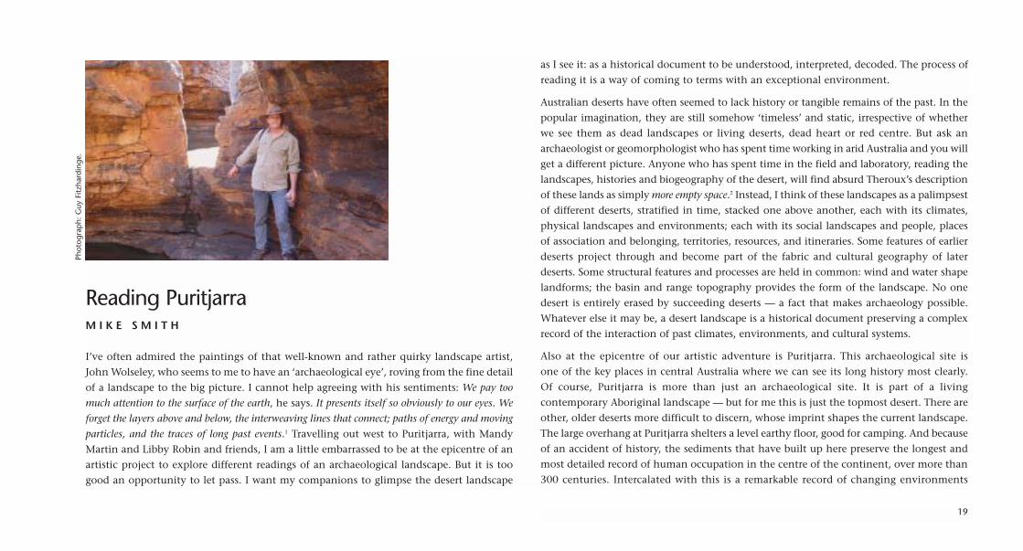
Reading PuritjarraM I K E S M I T H
I’ve often admired the paintings of that well-known and rather quirky landscape artist,
John Wolseley, who seems to me to have an ‘archaeological eye’, roving from the fine detail
of a landscape to the big picture. I cannot help agreeing with his sentiments: We pay too
much attention to the surface of the earth, he says. It presents itself so obviously to our eyes. We
forget the layers above and below, the interweaving lines that connect; paths of energy and moving
particles, and the traces of long past events.1 Travelling out west to Puritjarra, with Mandy
Martin and Libby Robin and friends, I am a little embarrassed to be at the epicentre of an
artistic project to explore different readings of an archaeological landscape. But it is too
good an opportunity to let pass. I want my companions to glimpse the desert landscape
as I see it: as a historical document to be understood, interpreted, decoded. The process of
reading it is a way of coming to terms with an exceptional environment.
Australian deserts have often seemed to lack history or tangible remains of the past. In the
popular imagination, they are still somehow ‘timeless’ and static, irrespective of whether
we see them as dead landscapes or living deserts, dead heart or red centre. But ask an
archaeologist or geomorphologist who has spent time working in arid Australia and you will
get a different picture. Anyone who has spent time in the field and laboratory, reading the
landscapes, histories and biogeography of the desert, will find absurd Theroux’s description
of these lands as simply more empty space.2 Instead, I think of these landscapes as a palimpsest
of different deserts, stratified in time, stacked one above another, each with its climates,
physical landscapes and environments; each with its social landscapes and people, places
of association and belonging, territories, resources, and itineraries. Some features of earlier
deserts project through and become part of the fabric and cultural geography of later
deserts. Some structural features and processes are held in common: wind and water shape
landforms; the basin and range topography provides the form of the landscape. No one
desert is entirely erased by succeeding deserts — a fact that makes archaeology possible.
Whatever else it may be, a desert landscape is a historical document preserving a complex
record of the interaction of past climates, environments, and cultural systems.
Also at the epicentre of our artistic adventure is Puritjarra. This archaeological site is
one of the key places in central Australia where we can see its long history most clearly.
Of course, Puritjarra is more than just an archaeological site. It is part of a living
contemporary Aboriginal landscape — but for me this is just the topmost desert. There are
other, older deserts more difficult to discern, whose imprint shapes the current landscape.
The large overhang at Puritjarra shelters a level earthy floor, good for camping. And because
of an accident of history, the sediments that have built up here preserve the longest and
most detailed record of human occupation in the centre of the continent, over more than
300 centuries. Intercalated with this is a remarkable record of changing environments
19
Phot
ogra
ph:
Guy
Fitz
hard
inge
.

extending back to the last interglacial 120,000 years ago. There may be many such sites in
central Australia, but at present, Puritjarra is the only one that archaeologists have taken
pains to read in any detail.
Imagine finding a place like Puritjarra. How does one approach such a fragile archive of desert
history? Unlike historians, archaeologists only get one chance to read their documents:
excavation destroys the evidence in the process of reading the record. For me, an
archaeological excavation is like surgery. It involves careful, meticulous dissection of hidden
structure. But unlike surgery, an archaeological dig is almost always exploratory: prior to
excavation the basic anatomy of a site is unknown. Each site is different. An archaeologist
approaches each dig with trepidation and just a little excitement.
But if excavation is surgery, modern excavation is ‘keyhole surgery’ designed to minimise
disturbance to the sediments. We often imagine an archaeological excavation as stripping
back a site, layer by layer, to uncover traces of long past events. In practice the process is
more a series of small controlled cuts probing different parts of a site to build up
progressively a picture of its overall structure. An archaeological project then becomes a
highly iterative exercise. Each dig allows you to see a little more of the site, each allows
you to test your interpretation of the site. Each season feels like a gentle flirtation with the
site: what will it allow me to see this time? What challenges will it throw at me?
Each season of digging has surprises. This is because sites are often complex documents. Few
sites are simple layer cake accumulations of sediments. The surest key to the history of a site
is its stratigraphy.3 And even in a small rock shelter, the warp and weft of stratigraphy can
be as complex as a Persian carpet. In an archaeological deposit, debris from human activities
interdigitates with a sedimentary sequence that may itself have a complex history. The
history of a particular deposit may be punctuated by periods when sediment builds up very
rapidly, or slows to a standstill, with long breaks in sedimentation. There may be as much
gap as sequence in a stratigraphic sequence.4 One layer may rest unconformably on another:
a boundary or interface between two layers may represent a period of unrecorded time as
much as a change in the sediments themselves. Periods of erosion may lead to the selective
removal of fine sediments from the site or perhaps the wholesale removal of parts of the
deposit. All of this has to be unpicked by an archaeologist: decoding the sedimentary history
of a site is our version of what a historian does when critically analysing sources.
Nor is the stratigraphy of a site stable. Like a bleached photograph, the fine detail literally
fades with time. Burrowing insects and animals mix sediments across layer and feature
boundaries. Earlier deposits may be disturbed by people tramping or scuffing the surface,
or by digging pits for fireplaces, ovens or sleeping hollows. With sufficient time, natural
soil-forming processes will reorganise the constituents of a deposit — leaching the clay,
silt, finely-pulverised charcoal and soluble carbonates down the profile — eventually
forming soil horizons that have little to do with the original structure of the deposit. Over
time, all these factors tend to obscure, blur or simply overprint the fine cultural details
embedded in a sedimentary sequence. At Puritjarra, it was impossible to know how much
detail had survived before I began to dig.
In fact, Puritjarra very narrowly escaped one of the most destructive burrowing animals.
Rabbits reached the Puritjarra area in about 1903 and at one or two spots in the rock shelter
you can still see their droppings today.5 They were the leading edge of an invasion but
apparently did not establish a breeding population north of Lake Amadeus. Today there
are no signs of burrows in the rock shelter or of any old warren systems in the Cleland
Hills. However, the reprieve may only be temporary as rabbits are well-established just
150 kilometres to the south. The next archaeologist to work at Puritjarra may not have the
same opportunity to work with a relatively undisturbed earth floor.
So how much detail was there at Puritjarra? More than enough to keep this archaeologist
interested and enthralled for a couple of decades. Between 1986 and 1990, I carried out
three seasons of digging at the rock shelter, and have spent the better part of a decade since
20

21
Rock art at Puritjarra. Photographs: M.A. Smith.
then analysing and publishing the results. The archaeological picture that emerged from
the excavations at Puritjarra in the 1980s and 1990s was one of a series of developments
in Australian archaeology that opened the way conceptually for a richer history of
Australian deserts.6
Archaeologists can learn much from artists like John Wolseley. We should not feel guilty if
we allow ourselves to wallow in the minutiae of the archaeological record, but, like John,
we need to marry this with an eye for the big picture. A site like Puritjarra is not just
sequence and chronology, but also a dynamic part of landscape — a place on someone’s
itinerary as they moved across western central Australia, stepping out across the desert.
Novelist Rodney Hall also got the feeling right when he wrote:
Can you imagine how caring the forger must be, how exact with his craft how much
in love with what he does? First he must grasp what he is to achieve and then keep
this general understanding in mind while he goes over the parts in finest detail. He
must look into each detail to see details within a detail. He has to love the whole piece
in the act of loving these details within details, otherwise he will never make a forger.7
I’m not advocating forgery — but Hall’s description will resonate with anyone immersed
in detailed scientific research, who is trying not to lose sight of broader objectives, or
anyone creating a striking work of art.
So what of those stacked deserts? Let’s choose one stratum and move out from the rock
shelter into the wider landscape — a landscape that we can see from the top of the
escarpment, reaching out to distant hills, that archipelago of islands in the distance.
The archaeology shows that people began using the overhang as an itinerant campsite
35,000 years ago, about the same time as modern humans were moving into Western
Europe, at the other end of the known world.8 Initially, this involved repeated short visits
by small (presumably) family groups, using the Puritjarra–Muruntji area as part of a wider
territory lying west of the MacDonnell Ranges. These people used red ochre from the
Karrku mine, 125 kilometres north-west of Puritjarra,9 white chalcedony from the Puli
Tjulkurr quarry near Putarti,10 and brought in flakes of fine-grained silcrete, probably from
the western end of the main range system. They moved across a desert landscape where
the cooler climate favoured more shrubs and trees than today, one that may have more
closely resembled the shrublands of the Great Victoria Desert to the south, than the
spinifex grasslands in the area today.11
The ephemeral traces of their camps 35,000 years ago (32,000 radiocarbon years BP) are
significant because they reflect the initial ‘rolling out’ of a social landscape in this region.
Over the following millennia, the archaeological record registers a series of changes in this
landscape. The archaeological evidence is imperfect, but provides a record of a society with
deep roots, interacting with a series of changes in population, technology and landscape,
and an overall trend over 300 centuries towards increasingly consolidated use of the
Cleland Hills.
The first people to visit Puritjarra would have found a huge domed rock shelter very like
the one we see today. Structurally, it is a mature rock shelter. There is little evidence of
any significant rock fall during the formation of the archaeological deposits, apart from
some shedding of large boulders along bedding planes and slip faces in the centre of the
overhang. The shelter owes its domed shape to slip faces inherited from an ancient
Devonian dune, which now forms the sandstone roof of the shelter. This gives a sense of
a desert within a desert. Standing in the deepest part of my excavations, I would be shoulder
deep in a Quaternary desert, the walls of my trench spanning 100,000 years of desert
history. But, looking up, I would see the hollowed out form of an ancient dune, literally
the underside of an ancient coastal desert, about 360 million years older.
22

23
Mandy Martin and Mike SmithPalimpsestFound local and sourced pigment, sand, rock shelter floor matter, ochres and acrylic on Arches paper, 30 x 200 cm.

I am reminded of Charles Laseron’s words: Something of the old always remains to be built
into the new. The shape of a hill, the contour of a waterfall … the alluvium of a plain are all links
with the past, and within them lies the story of what has gone before.12 What will my travelling
companions make of all this, I wonder? Perhaps like others, they will be blinded by the
beauty of red sand and spinifex, desert oak and flawless blue skies — and the false sense
of timelessness. Fred Williams, another landscape artist, said famously that To see the desert
is like peeling the skin off a landscape.13 Will Mandy Martin see it this way — with her well-
honed aesthetic and strong intellectual desire to understand and see a landscape? Can a
recidivist archaeologist learn to see the central Australian landscape through an artist’s eye
— seeing the play of light and shadow, breathtaking blues, crimson, carmine, red ochre
and olive? And what of the Ikuntji artists whose striking paintings emphasis connection
to land and the richness of the sandplain at the foot of escarpment?
Looking back now, I am surprised to find my own children grown, and that I have worked
with three generations of the Multa and Tjukadai families responsible for the Cleland Hills.
Such long involvement is a reminder that archaeological projects themselves become part
of regional history, and that the interactions between researchers and local communities
become a factor in the lives of both parties. I feel privileged to have had the opportunity
to read Puritjarra. It is not a bad way to have spent a quarter of a century.
ENDNOTES1 John Wolseley, 1990. Diary entry quoted in J. Hawley Encounters with Australian Artists, St Lucia:
University of Queensland Press, 1993: 146.2 Paul Theroux, cited in R.G. Kimber, ‘Australian Rangelands in Contemporary Literature’, The
Rangelands Journal, 16(2), 1994: 311–20, quote p. 318.3 In an archaeological context, the term stratigraphy refers to the arrangement and sequence of layers
at a site, their physical extent and character, and correlation across a site.
4 Comment by S. Gale, p. 168 in I. Davidson, S.A. Sutton, and S.J. Gale, ‘The Human Occupationof Cuckadoo 1 Rockshelter, northwest central Queensland’, in M.A. Smith, M. Spriggs and B. Fankhauser (eds), Sahul in Review: Pleistocene archaeology in Australia, New Guinea and IslandMelanesia, Canberra, Department of Prehistory, Research School of Pacific Studies, ANU. OccasionalPapers in Prehistory No. 24, 1993: 164–72.
5 E. Stodart and I. Parer, Colonisation of Australia by the Rabbit ORYCTOLAGUS CUNICULUS (L.),CSIRO Division of Wildlife and Ecology, Report No. 6, Canberra, 1998: 11–12. Burrowing nativeanimals such as the Burrowing Bettong (Bettongia lesueur) do not appear to have been active at Puritjarra though they have severely compromised other central Australian sites such asIntirtekwerle (James Range East rockshelter).
6 For an early assessment, see Rhys Jones, ‘Pleistocene life in the dead heart of Australia’, Nature,328, 1987: 666.
7 Rodney Hall, in The Second Bridegroom, 1991.8 M.A. Smith, J.R. Prescott and M.J. Head, ‘Comparison of 14C and luminescence chronologies
at Puritjarra rock shelter, Central Australia’, Quaternary Science Reviews (Quaternary Geochronology),16, 1997: 299–320.
9 M.A. Smith, B. Fankhauser and M. Jercher, ‘The changing provenance of red ochre at Puritjarrarock shelter, central Australia: Late Pleistocene to present’, Proceedings of the Prehistoric Society, 64, 1998: 275–92.
10 W.B. Law, ‘Chipping away in the past: Stone artefact reduction and Holocene systems of land usein arid Central Australia’, unpublished M. Phil. thesis, ANU, 2003.
11 Using data from Puritjarra, Doreen Bowdery carried out a pioneering study of the grass sequence,and of the relative contribution of shrubs and grasses to the central Australian flora over the last50,000 years. See D.E. Bowdery, Phytolith analysis applied to Pleistocene-Holocene archaeological sitesin the Australian arid zone. Oxford: British Archaeological Reports Series 695, 1998. In acomplementary study, data on tree and shrub cover is provided in M.A. Smith, L. Vellen and J. Pask, ‘Vegetation history from archaeological charcoals in central Australia: The late Quaternaryrecord from Puritjarra rock shelter’, Vegetation History & Archaeobotany, 4: 171–77, 1995.
12 Charles Laseron, The Face of Australia, 1953, reproduced in A.H. Chisholm, Land of Wonder: TheBest Australian Nature Writing, Sydney: Angus & Robertson, 1964: 31.
13 Fred Williams, landscape artist, quoted in S. McGrath and J. Olsen, The artist and the desert, Sydney:Bay Books, 1981: 110.
24
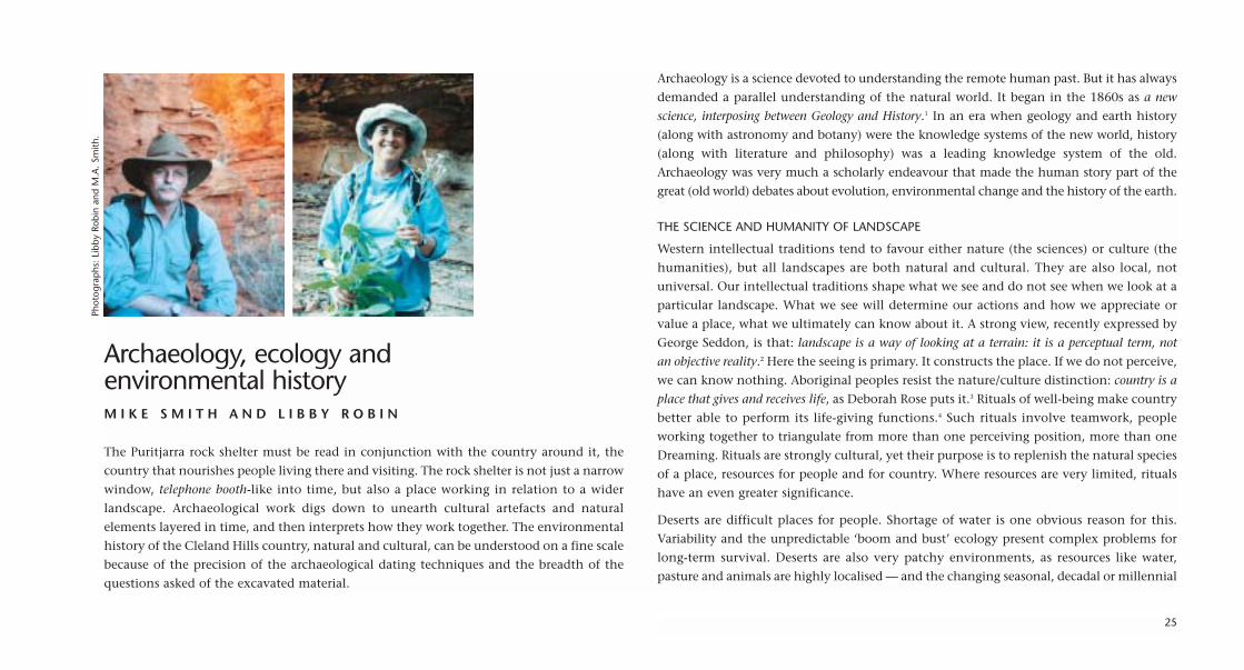
Archaeology, ecology and environmental historyM I K E S M I T H A N D L I B B Y R O B I N
The Puritjarra rock shelter must be read in conjunction with the country around it, the
country that nourishes people living there and visiting. The rock shelter is not just a narrow
window, telephone booth-like into time, but also a place working in relation to a wider
landscape. Archaeological work digs down to unearth cultural artefacts and natural
elements layered in time, and then interprets how they work together. The environmental
history of the Cleland Hills country, natural and cultural, can be understood on a fine scale
because of the precision of the archaeological dating techniques and the breadth of the
questions asked of the excavated material.
Archaeology is a science devoted to understanding the remote human past. But it has always
demanded a parallel understanding of the natural world. It began in the 1860s as a new
science, interposing between Geology and History.1 In an era when geology and earth history
(along with astronomy and botany) were the knowledge systems of the new world, history
(along with literature and philosophy) was a leading knowledge system of the old.
Archaeology was very much a scholarly endeavour that made the human story part of the
great (old world) debates about evolution, environmental change and the history of the earth.
THE SCIENCE AND HUMANITY OF LANDSCAPE
Western intellectual traditions tend to favour either nature (the sciences) or culture (the
humanities), but all landscapes are both natural and cultural. They are also local, not
universal. Our intellectual traditions shape what we see and do not see when we look at a
particular landscape. What we see will determine our actions and how we appreciate or
value a place, what we ultimately can know about it. A strong view, recently expressed by
George Seddon, is that: landscape is a way of looking at a terrain: it is a perceptual term, not
an objective reality.2 Here the seeing is primary. It constructs the place. If we do not perceive,
we can know nothing. Aboriginal peoples resist the nature/culture distinction: country is a
place that gives and receives life, as Deborah Rose puts it.3 Rituals of well-being make country
better able to perform its life-giving functions.4 Such rituals involve teamwork, people
working together to triangulate from more than one perceiving position, more than one
Dreaming. Rituals are strongly cultural, yet their purpose is to replenish the natural species
of a place, resources for people and for country. Where resources are very limited, rituals
have an even greater significance.
Deserts are difficult places for people. Shortage of water is one obvious reason for this.
Variability and the unpredictable ‘boom and bust’ ecology present complex problems for
long-term survival. Deserts are also very patchy environments, as resources like water,
pasture and animals are highly localised — and the changing seasonal, decadal or millennial
25
Phot
ogra
phs
: Li
bby
Robi
n an
d M
.A.
Smith
.

26
Archaeological excavations at Puritjarra. Photographs: M.A. Smith.

distribution of watering points (the islands in a desert sea) determines access to the sparse
resources of the surrounding desert. The next century will accentuate these challenges:
the Australian desert will see greater climatic extremes — hotter and colder weather and also
more droughts and floods.5
SCALES OF DESERT UNDERSTANDING
Ecological science has historically tended to work on very broad scales in Australian desert
country. Ecologists use the terms ‘arid zone’ or ‘drylands’ in preference to ‘desert’. A ‘desert’
seems too loosely defined for their purposes. As biologist Dom Serventy put it in 1971:
A desert occurs wherever it is said to occur. A definition by acclamation!6 But ‘desert’ does capture
the human dimensions and ambiguities of these lands. A desert is a place where Western
peoples cannot do ‘normal’ (temperate) things, a place where dryness and heat are so
excessive that normal agriculture is impossible in average years.7 The ‘arid zone’, by contrast, is
a bland label that gathers together some 70 per cent of the Australian continent. Baldwin
Spencer, first professor of biology at the University of Melbourne, began this pattern of
seeing deserts ‘in bulk’. The 1894 Horn Expedition took him from the temperate south,
north and west, out into Arrernte country in central Australia. His biogeographical map
of the continent defined three biologically distinct regions: the temperate (Bassian), the
tropical (Torresian) and the largest of all, the massive desert heart: the ‘Eyrean Region’.8
The exact edges of the desert zone have shifted. In the early 20th century, when there were
many efforts to encourage pastoralism for the ‘outside country’, maps tended to minimise
the zone designated desert. From the 1940s to the 1980s the area designated as ‘arid’ in
Australia increased steadily, as Australians became more aware of their desert heartland and
started to value it in different ways.9 The newfound vastness of deserts made them a
national priority. An ever-expanding sense of arid country drove a propensity to embrace,
settle and account for as much as possible of it. A fear of emptiness — and perhaps a lack
of Western understanding of deserts — saw a new upsurge of science and survey in the
insecure postwar years of the 1940s and 1950s. The CSIRO’s Land Research and Regional
Survey Section (later Land Survey Division) chose efficient, broad scales to explore and map
vegetation and potential mineral resources. The large single ‘glances’ of their team surveys
by land and air aimed for patterns and forms on a gross scale. But by the 1990s new
questions and new styles of science were emerging.
Arid zone ecologists Steve Morton and Mark Stafford Smith led the new scientific enterprise
that increasingly focuses on the patchiness of desert life, the mosaic of biodiverse pockets
separated widely and unpredictably in space.10 Detail is the new big picture, and the focus
must be on these spatially unpredictable pockets, with variable microclimates, whose very
biodiversity is dynamic. There are two reasons for the emergence of biodiverse, rich pockets
— water and fire. These are both spatially and temporally unpredictable.
Small, rich pockets may be spread over large areas. Boyd Wright, the fire ecologist working
in the Cleland Hills area, is presently mapping and experimenting with fire regimes over
a range that extends from Haasts Bluff to 50 kilometres further west than the Cleland Hills,
and as far north as Newhaven station and south to the Mereenie Gasfields, in order to
evaluate the effects of the severe fire events caused by lightning in 2000–02. In parts of
this area, fires burned unabated for two years. Wright needs a study area the size of a
European nation to look at burning on this scale. He also needs the spatial and temporal
perspectives offered by historical aerial photographs dating back to 1979. These provide a
good idea of the fire history of recent decades, and help him to make sense of the
vegetation patterns now.11 So the large scale and the detail come together in understanding
the ways fire works in the landscape.
Central Australian rainfall, like fire, falls in unpredictable places. It may be summer rain
(driven by monsoons from the tropical north) or winter rain (outliers of temperate storms
in the south). No rain at all is the most common. The idea of ‘average rainfall’ is very
misleading. Most years have less than average rainfall, with just a few years of very high
27

rainfall skewing that average. Small isolated rainfall events may not much stimulate plant
growth, while big rains can have major and widespread effects on the biota because water
can flow long distances across the prevailing flatness of inland Australia. All the dormant
annual plants that cannot survive long dry periods emerge with rain or ephemeral waters
— growing, flowering and setting seed quickly, before the water disappears again. Water
does not just bring moisture. It also captures nutrients, and — given the right soil
conditions (especially a clay layer that retains moisture rather than sands that allow water
to slip away) — water works to shift and concentrate nutrients in places of last moisture
before the return of the dry.
Lightning strikes can cause major very hot and extensive fires spreading quickly in tinder-
dry hummock grasslands (Triodia spp.), and building heat with the fuel of mulga (Acacia
aneura), a tree tolerant of many of the varieties of soils in inland Australia. Mulga, the
classic arid zone wattle, covers about 20 per cent of the Australian landmass, and is one
of the nation’s most widespread acacias, but it is damaged severely by hot fires. People also
use fire traditionally, to flush game and keep country ‘clean’ (open for walking and
hunting), but these fires are different; they are generally small, contained, cooler burns.
Hot fires kill not just vegetation but also the organisms that build the soil. Cooler fires start
the regenerative cycle for many plants by cracking open seed pods, and if the soil is not
damaged, green shoots start appearing almost as soon as the fire has passed. Such ‘green
pick’ attracts animals. Desert biodiversity is seldom very widespread, but rather is found
in pockets that have received good rain and/or have a means to hold water after rain.
Mosaic burning patterns also create refugia, places of preference for animals (vertebrate
and invertebrate), where the limited resources of a harsh environment are concentrated.
Mobility means survival, as few of these refugia are permanent oases.
Arid zone zoologist Stephen Morton has noted with alarm the many mammal extinctions
that have occurred in inland Australia since European settlement. The rate of mammal
extinctions in the Australian rangelands is the highest in the world. He has described the
losses as catastrophic and his role as a CSIRO ecologist working in Australia as akin to that
of an ambulance driver arriving at the scene of a bad accident.12 In a conceptual paper, he
sought to understand the patterns underpinning these losses. His first question was: Why
were they so bad for mammals, especially medium-sized, herbivorous and omnivorous
ones? Why, when there was minimal effect on birds and reptiles in the same desert country,
were so many of the desert’s original terrestrial mammals (72 known species) either extinct
(11), or greatly reduced in range? Many only survive on offshore islands (5) or on the semi-
arid fringes (15).13 Morton also asked the mirror-question: Why are the arid zone terrestrial
mammals over-represented on lists of endangered or extinct Australian animals? More than
60% of the listed endangered animals (23 of 38) originally occurred in the arid zone, but
only 13% of the animals originated in temperate areas, despite the fact that there were
far more temperate species (62%) than desert species (38%) in Australia’s total list of
terrestrial mammals.
Because the deserts were such demanding places for animals depending on plants for food
to live, Morton argued, they had evolved specialist strategies. Poor soils and unpredictable
rainfall limited productivity, but desert animals had survived by finding scattered pockets
of favourable habitat until the next rain or fire brought a flush of growth in plants. These
were not necessarily in the same places for each drought/flush cycle, but the varying
locations functioned like moving oases, responding to variable local conditions. While
Aboriginal burning contributed to maintaining a desirable patchiness in the landscape for
the animals, European pastoral practices, including unintended ones such as invasions of
feral animals, upset the balance, and made it significantly more difficult for the indigenous
mammals to return after drought. Desert conditions made it hard to repopulate after
drought anyway, but cattle and sheep also fatally altered the vegetation in the survival
niches. Through their preferential grazing patterns, crucial plant species that desert animals
needed for habitat in times of stress were no longer available. The desert animal
populations moved (offshore, or to less extreme country) or they became extinct.
28
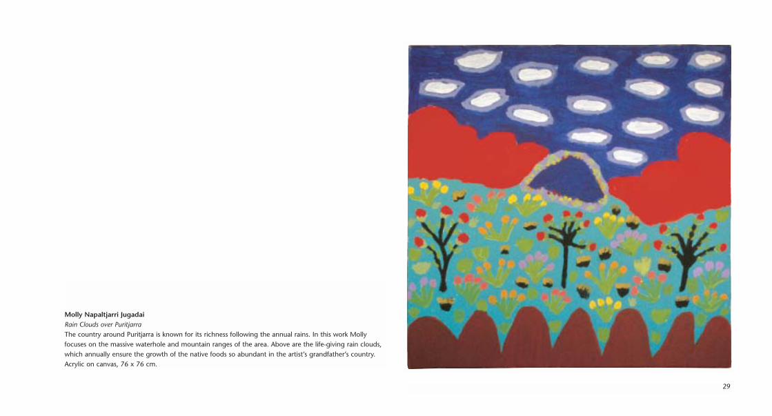
29
Molly Napaltjarri JugadaiRain Clouds over PuritjarraThe country around Puritjarra is known for its richness following the annual rains. In this work Mollyfocuses on the massive waterhole and mountain ranges of the area. Above are the life-giving rain clouds,which annually ensure the growth of the native foods so abundant in the artist’s grandfather’s country.Acrylic on canvas, 76 x 76 cm.

Archaeology and historical ecology work closely together in Australia, more so than in
many other parts of the world. Archaeological finds have a strongly ecological context, and
throw up ecological questions as well as ideas about desert cultures. It is not just the cutting
or grinding tools that archaeologists consider. They also ask: Why these tools and not
others? What sorts of plants were people using for food and fuel? How long had they been
available to people? How far did they have to carry the tools? The environmental and
cultural questions are interrelated, and inseparable.
ENVIRONMENTAL STORIES IN THE LAYERS
Archaeologists sought not just cultural artefacts, but also other sorts of evidence to assist
in understanding their finds. Phytoliths (plant opal silica bodies) provide a detailed record
of vegetation and vegetation changes. The presence of phytoliths and also abundant
fragments of wood charcoal in well-dated stratified archaeological deposits at Puritjarra
rock shelter was crucial to obtaining fundamental information about the late Quaternary
vegetation history of the region. It provided the first long palaeobotanical record in
central Australia, with direct information on the nature of vegetation during the last
glacial maximum in the heart of the continent, as well as data on pre-glacial and last
interglacial environments. The phytolith analysis at Puritjarra was also important because
it provided independent corroboration of the archaeological sequence developed from
the cultural artefacts. It revealed much about the historical landscape where the people
dwelt, and about the palaeo-landscape, before there was evidence for the presence of
people.14
Although the rock shelter today features communities of mulga (Acacia aneura) to the north
and south and just a few kilometres to the east, the phytoliths show that 20,000 years
ago there was no mulga in the region. Mulga now provides a very important and distinctive
shelter habitat and its presence is important to both people and animals today, though
trees (such as desert oak, Allocasuarina decaisneana) were present, through this time.
Some time after the earliest evidence of people, the climate became very much more extreme
than it was 100,000 years ago or is today. People, however, coped with both extreme aridity
and continental extreme temperatures. They lived out in this country, and left their artefacts
in well-dated layers. The ochres and cherts found in the layer that represented some of the
most extremely arid climatic conditions in the past hundred millennia (the period from
13,000 to 32,000 years ago) revealed that people had travelled widely to Puritjarra.15 Indeed,
the range of these people was larger than some small European nation-states.
At the height of the glacial maximum, about 20,000 years ago, the phytoliths and charcoal
show that there was little grass cover in the area of the rock shelter. The hummock grasslands
so distinctive in the area today, and the many other grasses, did not flourish until later,
perhaps 13,000 years ago, perhaps not until 7500 years ago. By 3000 years ago, there was
another significant change in tools, with many more grass and seed-grinding tools evident.16
Not only were grasses present, they were gaining in importance as staple foods for the people
living in and around Puritjarra. Archaeologists interpret the presence of large heavy grinding
stones as suggesting that people were staying in place (such stones are heavy to carry around).
The stones also suggest that people were putting their effort into developing secondary
sources of food from seed, rather than just roaming widely, hunting animals and foraging
for plants. There are two, possibly interrelated, reasons for such a change in strategy:
significantly more grasses, and more people living together putting pressure on resources.
People needed to cover a great deal of ground to make a living from the desert, and they
probably had to do this at speed, as water sources were spaced widely in the landscape,
especially in the arid period of the last glacial maximum. Quick, effective travelling over
long distances has been corroborated for the recent past as well. Local historian Dick
Kimber has estimated from explorers’ accounts of parallel travels that some people, given
extreme conditions, could cover up to 80 kilometres per day, by marching all day and well
into the night. Other accounts show that groups including women and children were able
to keep up with camel-supported European parties travelling 40–50 kilometres in a day.
30

Some of the ways people have responded in the past continue to help them. Some
responses by people are behavioural: flexibility, resilience, mobility and opportunism are
virtues in desert environments for people, just as they are for animals. Other responses,
evident in deserts elsewhere in the world, are technological: the technology and
infrastructure to harvest and move water continue to be important for sedentary
communities. Along with this is the need for facilities to store water, grain or fodder, to
buffer the frequent and unpredictable hard times.
Not all the challenges faced by desert communities are environmental. Their futures are also
shaped by dealings with the outside world. Small desert communities want to keep what
is important to them, but also to accommodate or exploit new opportunities emerging from
the outside world. In other world deserts, some groups have been working between deserts
and outside worlds for a thousand years or more.17 The romance of the desert and the ease
of travel increasingly open deserts to travellers, adventurers, and even extreme sports. But
then desert people have always been good at relationships: reciprocity, trade and exchange
have helped to offset or evade the hardest times over the thousands of years people have
been living in Australian deserts. Newcomers need to learn these skills too.
POSTSCRIPT: FIRE, WATER AND HISTORICAL PARABLES
In 1872, Ernest Giles and his party spent the first half of October traversing the country
east of the Cleland Hills. Although it rained a good deal, water was short. I do not believe a
week ever passes without a shower of rain, but none falls to do any good in the way of leaving
water behind, he wrote.18
In Giles’ original historical account, his survival depended on finding water, and he
was constantly on the lookout for clues about where water might be found. He had
two strategies: the first was to look for geomorphological features — rocky surfaces — that
might hold water, rather than allowing it to slip away in the sand. His other strategy was
to look for smoke. Where there are people in numbers, they will need water, he reasoned,
so dense fires are likely to lead to water. An abundance of native fires was a sure sign ‘that
there should be some water in the neighbourhood’.19 Perhaps the juxtaposition of the
classical elements of fire and water was too much for the writer of the romantic later version
of Giles’ diary, Mrs Cashel Hoey, who was working in comfortable circumstances and not
the least anxious about her personal survival. Keen to build narrative tension for her heroic
explorer, she created a version of Giles’ account where the burning itself takes on myth-
making status:
[T]he natives were about, burning, burning, ever burning: one would think they were
the fabled salamander race and lived on fire instead of water.20
Once Giles was no longer worried about survival, he (with the help of his shadow author)
set about claiming a classical legacy for the people and country. The inhospitable desert
became a challenge for heroes, and its peoples a newfound fabled race. It was hardly an
understanding that enabled equality of exchange, but it did at least acknowledge that
passing travellers might learn from desert dwellers, and that living in a desert required some
specialist strategies. In particular, fire is crucial to this country, not just for biodiversity and
ecological regeneration, but also for people. Fire provided Giles with landscape way markers,
smoke signals to water in a land bereft of features familiar to a European eye.
Water continues to be a common need for people in deserts, whether they are passing
through or living there permanently. Understanding water — where it is, how to locate it,
how to conserve it — is fundamental to dwelling in central Australian deserts. Fire
continues to be central to people and to the cultural and natural resources of country.
Although these are general principles applicable across the wide span of desert country,
crucial knowledge is always precise and local; it demands a specialist eye for the country,
for individual rock formations and habitats, located in specific places. Giles acknowledged
this. His survival depended on his ability to interpret the smoke signals, the evidence of
people in the country, keeping country and caring for it.
31

ENDNOTES1 The author of this remark, Langham Dale, was Superintendent-General of Education in the Cape
Colony. He was an enthusiastic collector of stone tools. See Saul Dubow, ‘Earth history, naturalhistory and prehistory at the Cape, 1860–1875’, Comparative Studies in Society and History, 46(1)2004: 107–33. The quote is p. 123.
2 George Seddon, ‘Fugue for six voices’ in Landprints: Reflections on Place and Landscape, Cambridge:Cambridge University Press, 1997: 1.
3 Deborah Bird Rose, Nourishing Terrains: Australian Aboriginal Views of Landscape and Wilderness,Canberra: Australian Heritage Commission, 1996: 7.
4 Ibid: 53–57.5 K. Hennessy, C. Page, K. McInnes, B. Pittock, J. Bathols and R. Suppiah, Climate Change in the Northern
Territory, Canberra: CSIRO March 2004: 31–35. The graph on page 31 shows particularly severeaverage temperature change (relative to 1990) for the wet season (November–April) for the areaaround Puritjarra, for 2030 and 2070. This Consultancy Report (prepared for the Northern TerritoryDepartment of Infrastructure, Planning and Environment) was kindly provided by R. Suppiah.
6 D.L. Serventy, ‘Biology of Desert Birds’, in Donald S. Farner and James R. King (eds) Avian Biology,New York: Academic Press, 1971: 287–339.
7 Ibid: 292.8 Spencer’s map was published in 1896, as part of the report on the Horn Expedition. The Bassian
region comprised Tasmania plus the mainland east coast up to the Clarence River, and theTorresian went from the Clarence River along the coast north to New Guinea and the Malayanarchipelago as far as Lombok, then south across northern Australia, but Eyrean (the rest ofAustralia) was by far the biggest. Spencer’s map did not recognise the temperate south-west. It wasjust Eyrean with the rest. (He had not been to Western Australia.) See also D.J. Mulvaney and J.H.Calaby, So much that is new, Carlton: Melbourne University Press, 1985: 147.
9 See Libby Robin (forthcoming), ‘Ecology and Identity’ in David Callahan (ed.) Australia: Who Cares?Perth: API network. On increasing percentages of ‘arid lands’ see R.L. Heathcote, ‘Images of a desert?Perceptions of Arid Australia’, Australian Geographical Studies, 25, 1987: 3–25, especially Table II: 11.
10 S.R. Morton ‘Land of Uncertainty: The Australian Arid Zone’, in Harry F. Recher, Daniel Lunneyand Irina Dunn (eds) A natural legacy: Ecology in Australia (2nd edition), Sydney, Pergamon Press,1986: 122–44; D.M. Stafford Smith and S.R. Morton, ‘A framework for the ecology of aridAustralia’, Journal of Arid Environments, 18, 1990: 255–78, especially p. 257.
11 Boyd Wright, work in progress, 2004 (under the supervision of Peter Clarke University of NewEngland), pers. comm. 27 May 2004. (Telephone conversation with LR.)
12 Stephen Morton, ‘European Settlement and the Mammals of Arid Australia’, in Stephen Dovers(ed.) Australian Environmental History: Essays and Cases, Melbourne: Oxford University Press, 1994:141–66. The accident reference was made in his address to a workshop on ‘Environmental Historyin the National Museum of Australia’, jointly sponsored by the Museum and the History Program,Research School of Social Sciences, ANU, 14 April 1999.
13 S.R. Morton ‘The impact of European settlement on the vertebrate animals of arid Australia: aconceptual model’, Proceedings of the Ecological Society of Australia, 16, 1990: 201–13. Extinction datap. 202.
14 Later the archaeological work of Peter Thorley in the Palmer River area and Sue O’Connor andPeter Veth in the Western Desert, Western Australia, provided ‘deep time’ dates for humanhabitation to the east and west of Puritjarra. For phytolith and charcoal analysis see M.A. Smith,L. Vellen and J. Pask, ‘Vegetation history from archaeological charcoals in central Australia: Thelate Quaternary record from Puritjarra rock shelter,’ Vegetation History & Archaeobotany, 1995, 4:171–77; D.E. Bowdery, Phytolith analysis applied to Pleistocene–Holocene archaeological sites in theAustralian arid zone, Oxford: British Archaeological Reports Series 695, 1998.
15 M.A. Smith, B. Fankhauser and M. Jercher, ‘The changing provenance of red ochre at Puritjarrarock shelter, central Australia: Late Pleistocene to present’, Proceedings of the Prehistoric Society, 64,1998: 275–92.
16 M.A. Smith ‘The antiquity of seedgrinding in arid Australia’, Archaeology in Oceania, 21, 1986: 29–39.17 This is true of desert communities in, for example, Chile (Atacama) and Namibia. See M.A. Smith
and P. Hesse (eds), 23ºS: Archaeology and environmental history of the Southern Deserts, Canberra:National Museum of Australia, 2005.
18 Entry for 5 October 1872, Mr Ernest Giles’ explorations 1872, South Australian ParliamentaryPaper No. 21, 1875, republished Adelaide: Friends of the State Library of South Australia, 2000(hereafter Giles, field diary): 52.
19 Giles, field diary: 54.20 Ernest Giles (‘enhanced by Mrs Cashel Hoey’) Victoria Park WA: Hesperian Press 1995 (original
version 1889): 42.
32

33
Daisy Napaltjarri JugadaiMy CountryThe Puritjarra region is the home country of the artist and is a frequent reference in her works. This work has Minkelba flowers growing along the mountain ridges and an Ininti tree with its red seeds.Acrylic on canvas, 76 x 76 cm.

34
Mandy Martin and Guy FitzhardingeGround Plane
Found local and sourced pigment, smoke, singeing, sand, ochre, rusty tin and acrylic on Arches paper, 30 x 200 cm.

A pastoralist’s eye in desert countryG U Y F I T Z H A R D I N G E
An hour or so west of Haasts Bluff, the road forks at the windmill, with one fork going to
the left of the mill and the other around the tank to the right. The fan spins aimlessly in
the breeze, its shadow creating a flickering pattern in the sand below. The track to the right
is the track you take to get to the Cleland Hills, still a couple of hours drive away. It’s a
good point also to start thinking about people and landscape, with the fork to the left
leading to the outstation at Kunkayunti (Brown’s Bore), built in 1973. The track to the right
leads to Puritjarra in the Cleland Hills, a site of habitation for thousands of years, though
no longer used in this way now. The mill and the tank are reminders of an Aboriginal cattle
enterprise though the occupation by cattle was only brief and in the very recent past. Brief
is a relative word, as in the semi-arid and arid rangelands of Australia ‘change’ is often
beguilingly slow; tempting in its illusion of permanency for one or two generations, but
frighteningly realistic retrospectively. At least that’s my impression.
I’ve been asked to join the team as I spent almost 20 years running a sheep and cattle
station west of Bourke in NSW. There are some similarities in the country, though there
are some important differences as well. The rainfall was about the same, though with a
slightly different distribution. The station at Bourke had a large area that was liable to
flooding out of the Warrego River, a feature not present in this landscape. Probably the
most significant difference was the fact that the Bourke region has been occupied by
Europeans and their livestock for almost 150 years, and in that time there has been an
accelerated and significant change. The Warrego River flows into the Darling River, and in
the early days this was a major transport artery south and east. Central Australia had no
such artery, and the movement of livestock and goods was an expensive and perilous
process where long distances of waterless country had to be crossed, or in exceptional
circumstances where flooding rains made passage impossible. In a land full of dingoes and
miles from markets sheep would be difficult to make money out of, and thankfully for the
soils there were never many sheep in the Territory. Likewise rabbits found the going tough,
and whereas they were a major problem in the Western division of NSW, their effect was
mainly felt south of Alice Springs and not as far west as this area.
Being so far away from the major population centres, central Australian pastoral
developments were late. Although cattle were brought to the Centre in 1872, and the
first stations established before 1880, there was little advocacy of closer settlement
developments like in New South Wales, and so pastoralists did not suffer the same
legislative nightmare, with uncertainty about extent and duration of tenure. The pressure
for closer settlement and associated ‘development schemes’ never came this far west.
35
Phot
ogra
ph:
Lib
by R
obin
.

So, what does one see with a ‘pastoralist’s eye’? The reality is probably not much difference
to anyone else, except that maybe we place what we see in a different context. Pastoralists
are not environmental rapers and pillagers covering the landscape with ever-increasing
numbers of livestock, but economic rationalists responding to market signals. To date,
landscape potential and industry profitability have determined the extent of stocking, and
a quick appraisal of this landscape would indicate that it was extremely marginal. A highly
variable climate and the distances involved would have meant that it was an opportunistic
grazing environment at best. There had been cattle here, as the windmill and troughs
testified, but one suspects that the operation could have only been marginal at best, in an
economic sense.
The lack of grazing pressure from both domestic and feral animals is obvious. The good
rain before we arrived ensured that many of the ephemerals were now up and growing,
and it was clear that this rainfall had created similar results to a flood from the Warrego
River on my New South Wales property. Looking at the biota one suspects that this is
probably as good as it gets, and the luxuriant growth stands in stark contrast to the
more normal state of affairs, that of blowing sand and the fight for survival through
searing heat.
We European Australians know a lot more about the arid and uncertain climate of Australia
than when our forebears first arrived here. Without this knowledge would we have seen
this landscape as a normal state of affairs? Some people made their fortune from 20 good
years, others lost it in three bad years — we’re all gamblers, but if there is a miscalculation
it is not just the pastoralists who lose, it is the environment as well. As they say, the
difference between a ‘good’ manager and a ‘bad’ manager is sometimes just a fall of rain.
Few pastoralists would look upon this particular landscape with covetous eyes. Most would
appreciate it for what it is. The fact that rabbits never seriously threatened it is a huge
bonus. Total grazing pressure is what is of concern, and not just domestic livestock. The
pressure from feral animals (goats, camels, donkeys and rabbits) can sometimes more than
double the intensity of grazing. With rabbits came foxes and cats in large numbers and so
not only was flora at risk, but also fauna.
All is not Arcadian bliss, however. It is worrying that a few visitors to the site have had a
significant impact. Tracks have been re-routed as the old ones have eroded by local and
visitor traffic leaving them impassable, and gullies have appeared where there were none
before. Mossman River Grass, an exotic weed, has been introduced by accident by outsiders,
and now has a substantial hold in some areas. Visitors spread the tenacious seeds ever
further afield, making it harder and harder to control. Buffel grass, introduced by
governments earlier this century for erosion control and as a pasture grass, now appears
throughout the landscape, even in the Cleland Hills. While this weed is considered a good
pasture grass, like most introduced species the qualities that are appealing for a grazing
environment often become real threats to native vegetation.
There is a lot to learn by looking at tracks, and by this method it is easy to detect animals
that one may not see physically. The presence of native animals, insects and reptiles is
obvious, and so is the presence of intruders. Tracks of camels, foxes and cats are
everywhere. Camels are a real worry as their numbers are expanding exponentially and it
is hard to see who has direct responsibility for their control. The camels in the Cleland
Hills today could be in Queensland or Western Australia in a few months time. A pastoralist
has a vested interest in controlling noxious weeds and animals, but where does the vested
interest lie in this case?
It is clear that while pastoralists create footprints in the landscape, they are not the only
ones who imprint it. Just the presence of people can have impacts that may be far reaching,
even though the traces may initially appear small. For example, once established, weeds
are expensive to control (control rather than eradication often being the appropriate word),
and may out-compete native species for scarce resources.
36
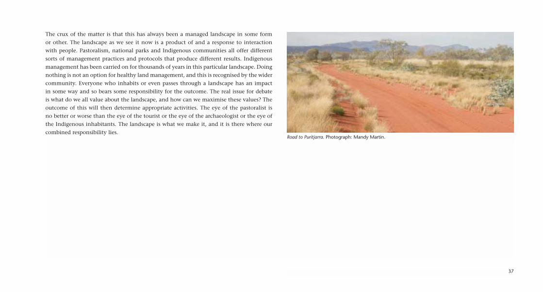
37
The crux of the matter is that this has always been a managed landscape in some form
or other. The landscape as we see it now is a product of and a response to interaction
with people. Pastoralism, national parks and Indigenous communities all offer different
sorts of management practices and protocols that produce different results. Indigenous
management has been carried on for thousands of years in this particular landscape. Doing
nothing is not an option for healthy land management, and this is recognised by the wider
community. Everyone who inhabits or even passes through a landscape has an impact
in some way and so bears some responsibility for the outcome. The real issue for debate
is what do we all value about the landscape, and how can we maximise these values? The
outcome of this will then determine appropriate activities. The eye of the pastoralist is
no better or worse than the eye of the tourist or the eye of the archaeologist or the eye of
the Indigenous inhabitants. The landscape is what we make it, and it is there where our
combined responsibility lies. Road to Puritjarra. Photograph: Mandy Martin.

38
Eunice Napanangka JackBush Tucker at PuritjarraA visitor to the area, Eunice Napanangka Jack highlights the waterhole and mungada or bush tuckerfound at Puritjarra. Desert oaks are found in profusion at Puritjarra. Acrylic on canvas, 76 x 76 cm.
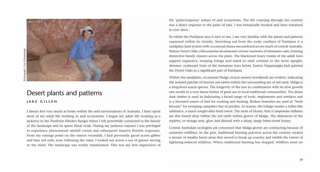
Desert plants and patternsJ A K E G I L L E N
I always feel very much at home within the arid environments of Australia. I have spent
most of my adult life working in arid ecosystems. I began my adult life working as a
jackeroo in the Northern Flinders Ranges where I felt powerfully connected to the beauty
of the landscape and its sparse floral cloak. During my jackeroo sojourn I was privileged
to experience phenomenal rainfall events and subsequent massive floristic responses.
From my vantage point on the station verandah, I had previously gazed across gibber
and bare red soils; now, following the rains, I looked out across a sea of grasses waving
in the wind. The landscape was totally transformed. This was my first impression of
the ‘pulse/response’ nature of arid ecosystems. The life coursing through the country
was a direct response to the pulse of rain. I was botanically hooked and have remained
so ever since.
So whilst the Puritjarra area is new to me, I am very familiar with the plants and patterns
expressed within its vicinity. Stretching out from the rocky confines of Puritjarra is a
sandplain land system with occasional dunes encountered across much of central Australia.
Mature Desert Oaks (Allocasuarina decaisneana) oversee nurseries of immature oaks, forming
distinctive family clusters across the plain. The blackened hoary trunks of the adult trees
support expansive, weeping foliage and stand in stark contrast to the more upright,
slimmer, exuberant form of the immature trees below. Eunice Napanangka Jack painted
the Desert Oaks as a significant part of Puritjarra.
Within the sandplain, occasional Mulga (Acacia aneura) woodlands are evident, indicating
the isolated patches of heavier red earths within the surrounding sea of red sand. Mulga is
a long-lived acacia species. The longevity of the tree in combination with its slow growth
rate results in a very dense timber of great use to local traditional communities. The dense
dark timber is used in fashioning a broad range of tools, implements and artefacts and
is a favoured source of fuel for cooking and heating. Broken branches are used as “bush
brooms” for sweeping campsites free of prickles. In season, the foliage exudes a toffee-like
substance, a much sought-after bush sweet. The nests of Honey Ants (Camponotus inflatus)
are also found deep within the red earth within groves of Mulga. The abdomens of the
repletes, or storage ants, glow and distend with a sharp, tangy bitter-sweet honey.
Central Australian ecologists are concerned that Mulga groves are contracting because of
extensive wildfires. In the past, traditional burning practices across the country created
a mosaic of smaller burnt areas that served to break up country and inhibit the extent of
lightning-induced wildfires. Where traditional burning has stopped, wildfires meet no
39
Phot
ogra
ph:
Guy
Fitz
hard
inge
.

40
The lithe, silken limbs of Ghost Gums dance seductively against a rocky backdrop. Photographs: Jake Gillen.

41
Central Australian flora (left to right): Honey Grevillea Grevillea eriostachya, Parrot Pea Crotalariacunninghamii, Holly Grevillea G. wickhamii, Blue Pincushion Brunonia australis. Photographs: Jake Gillen.

firebreaks and range freely across extensive areas. It takes about 6–8 years for Mulga to
mature and set seed, so if a second wild fire comes through before the young trees mature,
Mulga can easily become locally extinct. It is now uncommon to encounter ‘old growth’
stands of Mulga. Appropriate fire management regimes incorporating traditional practices
are now being investigated and implemented across the Centre.
The patterns of vegetation are heavily influenced by the patterns of moisture and soil across
the landscape. Here, at Puritjarra in 2004, grassland species on the sandplain are looking
particularly spectacular. Recent fires have refreshed them, and they are lush and young,
growing strongly. Traditional patch burning of these hummock grasslands encouraged a
range of bush tucker plants, as Daisy Napaltjarri Jugadai and her sister Molly both show
in their paintings of Puritjarra. One of these in evidence is the Honey Grevillea (Grevillea
eriostachya), painted by Alice Nampitjanpa. The pendulous golden flowers drip with a
highly-regarded nectar in good seasons. As we approach the Cleland Hills small shrubs
of Holly Grevillea (Grevillea wickhamii) appear, their flowers glowing like red embers.
Drainage lines emanating from the range and running onto the sandplain are softened
by billowing, swirling swards of Kangaroo Grass (Themeda triandra), overshadowed
occasionally by the strange, haunting, Batswing Coral Tree (Erythrina vespertilio). The leaf
of the tree imitates the outstretched wings of a bat in flight. Its coral-red, lustrous seeds
are popular in desert jewellry.
Moving from the plain onto the fractured, fissured flanks of the Cleland Hills or what
Molly Napaltjarri Jugadai calls the Puli around Puritjarra, we encounter a sharp botanical
transition. Here the roots of Native figs, like vegetative fingers, search for purchase,
stretching, grasping across lichen-encrusted surfaces. Fig (Ficus platypoda) and Fern
(Cheilanthes sieberi) flourish within the depths of dark, moist cracks and crannies. Chasms
of shadow provide cool damp floristic refugia. From the shadows the sensuous, twining
tendrils of Spearvine (Pandorea doratoxylon) twist and embrace towards the light. Amongst
the rocks, stand solitary sentinels of White Cypress Pine Callitris glaucophylla, with grey-
green foliage upon silver-grey trunks. The lithe, silken limbs of Ghost Gums (Corymbia
aparrerinja) dance seductively against a rocky backdrop of dull red.
42

43
Mandy Martin and Jake GillenPuritjarra FloraFound local and sourced pigment, ochre and acrylic on Arches paper, 40 x 150 cm.

Leaving PuritjarraL I B B Y R O B I N
In my field notebook on 11 May 2004, I wrote:
I am sitting in the Puritjarra rock shelter, a stone’s throw from the place where Mike
dug two metres down and found 35,000 years. To my untrained eye there is no trace
of this incursion. The floor of the shelter is sandy, a deep red colour with charcoal
fragments scattered about, not the critical ones that revealed deep time and
environmental change, but the same black substance, evidence of fires past, maybe
stuff for archaeologists in future millennia.
The cave floor is divided into a northern and a southern precinct, the former being
more undisturbed and valuable to Mike’s work. Between them is a pile of large boulders
that have fallen from the cliff above. The crazy paving facade of the dissected
sandstone layers overhead drops off regularly — the one just near Mike’s excavation
fell between 6000 and 13,000 years ago — which helped him date some of the rock
art on the fallen stone.
Looking up to where they fell from, I see above me a huge golden amphitheatre ceiling
basking in reflected light. I am sitting inside a dune, a relic of a geomorphological
littoral long, long before human time.
Between the floor and the ceiling, the walls are a riot of colour, ochres from white and
yellow to dark orange depicting hands past, and the painted tracks of tucker and
significant animals. Emu tracks are particularly prominent near where I sit. Snake trails
suggest water, but they are small. Every last flat surface seems to have a cultural
signature, or many, one above the other, overlaid as layers of times past, further past
and in the deep past. None of them is from a time as deep as the floor reveals (as Mike’s
work has shown) but they offer a very visible sense of people coming and going,
visiting as we have done, and leaving.
The floor is the deep time scale (20 or 30, and perhaps up to 100 millennia in a two metre
hole), the stories of the ceiling are measured on a geological time scale and the walls, the
most riotous and clearly human historical time — perhaps just one millennium. The strata
of Puritjarra demand a constant ability to shift time zones, like a sci-fi traveller, yet they
are all together in one precious place. In May 2004, there were a few desiccated desert
lantern plants (Abutilon otocarpum or tatji-tatji) dotted around the sandy floor, perhaps
circumstantial evidence of disturbance, according to Peter Latz’s description of them,
but no trace of the momentous intellectual events that had occurred here in the past
two decades.
44
Phot
ogra
ph:
Guy
Fitz
hard
inge
.

45
Mandy Martin and Libby RobinDesert Stepping StonesFound local and sourced pigment, charcoal from rock shelter and acrylic on Arches paper, 30 x 200 cm.

The lack of evidence of disturbance is a point of pride for Mike. His own field notes when
he returned for his third major excavation on 16 April 1990 are similar to my own, even
though he is looking for different things, and knows so much more:
The rockshelter is intact — no sign of any recent rockfall. The floor has a dense, tall
growth of Abutilon, with scattered Nicotiana, almost identical to that in August 1986.
The position of the N5/N6 trench is only detectable by the slightly different colour of
the sand. There is no sign of Pit N18 — completely invisible.
Mike knows where his excavations were in 1986, 1988 and 1990. He has mapped every last
centimetre of this floor, and with his help, I can just detect a slight difference in the colour
of the sand; the backfill is just one shade lighter than the surrounding dark red. The several
visits he has paid since 1990 have been all about paying respect to the site and checking
that traces of excavations are not emerging. The risk is that backfill subsides, revealing the
sharp lines of trenches. These sharp wall-lines, once two metres deep and shored up with
timber, ensured the cleanest possible view of the layers beneath. Now they are lost entirely
beneath layers of overlay. As the ideas have found their way into Nature (and other
prestigious journals), the place has returned to another nature — the sediments are back
in situ, with the latest stratum being the overlay following the dig. Mike likes the analogy
of the archaeologist as surgeon: clean cuts and precision work are needed to get the
exceptional dates and insights he has achieved.
We now walk out into the desert landscape beyond, home for people for 35,000 years and
more. Strata is about layers of deserts, layers of ideas and the past in the present and future.
We know from Mike Smith’s archaeology of this one stepping-stone place, so much about
the deserts past, and how people have lived in them. The present desert climate is like
100,000 years ago, the last interglacial maximum. The last Ice Age was tough for people
climatically; and 18,000 years ago there were no grasses — and therefore no animals
dependent only on grass. Now we see kangaroo grass, spinifex, porcupine grass everywhere
— but we also know from both people and landscape that they are plentiful and fresh
because of very recent and dramatic fire history. Archaeology gives us ways to see through
the present, to find a scale for understanding the tracings of past deserts, and to think anew
about deserts future. The artists’ works make us use our eyes differently. Each is a careful
observer and tells the place in different ways. In a singular place we bring together
traditional, scientific and aesthetic views of the long cultural and environmental history
of people in deserts.
46
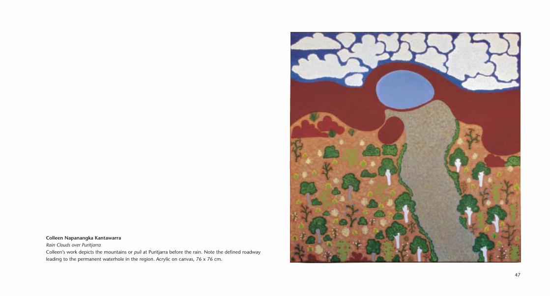
47
Colleen Napanangka KantawarraRain Clouds over PuritjarraColleen’s work depicts the mountains or puli at Puritjarra before the rain. Note the defined roadwayleading to the permanent waterhole in the region. Acrylic on canvas, 76 x 76 cm.

Contributors
Mandy Martin is a practising artist who has held more than 100 solo
exhibitions in Australia, the USA and Mexico since 1976. Her works are in many public and
private collections including the National Gallery of Australia and the Araluen Art Centre,
Alice Springs. Between 1978 and 2003 she was a lecturer at the National Institute of the Arts,
School of Art, Australian National University, and she is currently a Fellow of the Arts ANU.
She lives and works near Cowra, New South Wales.
Her work has always been concerned with the environment and our relationship to the
landscape. Between 1995 and 2001, she completed a trilogy of projects collaborating with
environmental writers — Tracts: Back O’ Bourke, Watersheds: the Paroo to the Warrego and
Inflows: the Channel Country.
Since 2001, she has undertaken a number of collaborative projects on mining and water
issues in landscapes, including Auriferous: The Gold Project (with Wiradjuri artist Alana
Harris and other artists from Bathurst and Sydney), and Alchemy, the Cadia Gold Mine project
(with artists from Orange). In 2002–03 she worked with Wiradjuri mentors and other
collaborators from ANU, CSIRO and local communities on environmental projects titled
Land$cape: Gold & Water and Lachlan: Blue–Gold.
Libby Robin is an environmental historian at the Centre for Resource
and Environmental Studies at the Australian National University. Her work focuses on the
history of science and ideas about the environment. Her previous workplaces include
universities in London and Melbourne, and the National Museum of Australia where she
worked as a curator.
Her books include The Flight of the Emu: One Hundred Years of Australian Ornithology
(Melbourne University Press), which in 2003 won the inaugural Victorian Premier’s Literary
Award for Science Writing. She is also author of Defending the Little Desert: the Rise of
Ecological Consciousness in Australia (MUP: 1998) and co-editor (with Tim Sherratt and Tom
Griffiths) of A Change in the Weather: Climate and Culture in Australia (NMA: 2005) and
(with R. Quentin Grafton and R.J. Wasson) of Understanding the Environment: Bridging the
Disciplinary Divides (UNSW Press: 2005).
Mike Smith is an archaeologist, environmental historian and Director,
Research and Development, at the National Museum of Australia, Canberra. His previous
appointments include the post of field archaeologist with the Northern Territory Museum
in Darwin and Alice Springs, Research Fellow in the Research School of Pacific and Asian
Studies at the Australian National University, and Lecturer in Archaeology in the
Department of Archaeology and Anthropology, ANU.
48

Mike pioneered research into late Pleistocene (ice age) settlement in the Australian desert
and is well published in leading international journals such as Nature, Science, Proceedings
of the Prehistoric Society, Antiquity, Archaeology in Oceania and Quaternary Science Reviews.
He led the team that in 2001 created Tangled Destinies, the permanent exhibition on
Australian environmental history at the National Museum of Australia. He has a major
international collaborative project 23°South, comparing the archaeology and environ-
mental history of Southern Hemisphere deserts and the prehistory of global colonisation,
and based on this work, a major special exhibition Extremes, at the National Museum of
Australia in 2005.
Guy Fitzhardinge holds a degree in Agricultural Economics from the
University of New England and manages a series of cattle properties in central New South
Wales. He is also working towards a PhD at the University of Western Sydney. He has
travelled widely throughout Australia and overseas, and worked as an environmental
consultant for a range of groups including the New South Wales Biodiversity Advisory
Council, the CSIRO Textile Clothing and Footwear Sector Advisory Committee and the
National Assessment Panel for the Threatened Species Program. He is a Director of the
Australian Bush Heritage Trust and a former Director of Meat and Livestock Australia.
Jake Gillen holds an Agricultural Science degree from Adelaide
University and is currently studying for a PhD in the Centre for Resource and Environ-
mental Studies at the Australian National University. His love affair with the arid zone
began with his work as a jackeroo in the Northern Flinders Ranges in the 1970s.
Jake is an experienced arid zone plant ecologist who has conducted floristic surveys in the
Murray Mallee and in the Kanowana and Coongie Wetlands of South Australia, as well as
biological surveys in the Anangu Pitjantjarra lands, the western Simpson Desert and
elsewhere.
He was the Co-ordinating Ecologist at Uluru Kata Tjuta National Park for six years, during
which time he established a seed bank of indigenous plants within the park, and developed
plant propagation for land management purposes.
49
Looking out at Puritjarra.Photograph: Guy Fitzhardinge.

Narputta Nangala Jugadai is a senior artist from the Cleland Hills.
Narputta’s father’s country is Puritjarra and she has deep connections with the lands around
Puritjarra. She is one of the senior artists in the Ikuntji Arts Centre. Her works were part
of the exhibition Ikuntji — Stories from the Red Lands, which travelled to London (Rebecca
Hossack Gallery, Fitzrovia) in May–June 2004. Her work is in many major collections in
Australia and overseas, including the National Gallery of Australia, the Groninger Museum
in the Netherlands and the Baillieu Myer Collection of the de Young Museum, San Francisco.
Daisy Napaltjarri Jugadai comes from the Puritjarra region and her
home country is a frequent reference in her works. Her paintings reflect her interest in
bush tucker and wildflowers. She is a well-known contemporary artist, and her work is
in many major galleries. It was featured in the opening exhibition of the newly renovated
and expanded Araluen Galleries in Alice Springs in 2001. Daisy Napaltjarri Jugadai is the
daughter of Narputta Nangala Jugadai and the younger sister of Molly Napaltjarri Jugadai.
Molly Napaltjarri Jugadai paints her home country around Puritjarra. This
is her grandfather’s country. Her work celebrates the seasons, especially the clouds that signal
the coming of rain, and the native foods that grow in the Cleland Hills. Her work was part
of the exhibition What Color Is Your Heart? held at the Fire-Works Gallery in Newstead,
Queensland in February–March 2004, and she had a solo exhibition My Grandmother’s
Napaltjarri Dreamings at the Hogarth Gallery, Paddington, Sydney in August–September 2004.
Alice Nampitjinpa is a senior artist in the team at the Ikuntji Arts Centre.
She had a solo exhibition of her work Through Alice’s eyes at the Onshore Gallery Geelong,
Victoria in October–November 2004, and her works were featured in the Divas of the Desert
exhibition at Gallery Gondwana, Alice Springs in March–April 2004. Her work is
represented in many major collections including the National Gallery of Victoria and the
Araluen Art Centre.
50

Linda Ngitjanka Naparulla was born north-west of Papunya and is one
of the recognised Ikuntji artists. Her works were included in the exhibition Ikuntji — Stories
from the Red Lands, which travelled to London (Rebecca Hossack Gallery, Fitzrovia) in
May–June 2004. She also exhibited at the Indigenart Gallery, Paddington, Sydney in May
2002.
Anmanari Napanangka Nolan was born near Haasts Bluff. Anmanari’s
work represents Ikuntji artists in several overseas collections including the Baillieu Myer
Collection of the de Young Museum, San Francisco and the Active Group Japan Collection.
Her work was also included in the exhibition Ikuntji — Stories from the Red Lands, which
travelled to London (Rebecca Hossack Gallery, Fitzrovia) in May–June 2004.
Eunice Napanangka Jack was born at Tjukurrla, Docker River, and is a
senior member of the Ikuntji Arts Centre. She had a solo exhibition in May 2004, Desert
Secrets of Eunice Napanangka, at the Gallery Gabrielle Pizzi, Melbourne. Her works are in
many major galleries, including the National Gallery of Victoria and the Flinders University
and University of Tasmania collections.
Colleen Napanangka Kantawarra is an emerging artist with the Ikuntji
Art Centre. Her work was part of the exhibition What Color Is Your Heart? held at the Fire-
Works Gallery in Newstead, Queensland in February–March 2004. Her work was recently
chosen to feature on the cover of the Northern Territory Indigenous Arts Strategy.
51

ArtworksMandy MartinPuritjarra 1Found local and sourced pigment, sand, ochre and acrylic on canvas, 76 x 385 cm.
Puritjarra 2Found local and sourced pigment, sand, ochre and acrylic on canvas, 76 x 385 cm.
Puritjarra 3Found local and sourced pigment, sand, ochre and acrylic on canvas, 76 x 385 cm.
Narputta Nangala JugadaiMy Father’s Country 1Acrylic on canvas, 76 x 76 cm.
My Father’s Country 2Acrylic on canvas, 76 x 76 cm.
Linda Ngitjanka NaparullaPuritjarraAcrylic on canvas, 76 x 76 cm.
Daisy Napaltjarri JugadaiMy CountryAcrylic on canvas, 76 x 76 cm.
MuruntjiAcrylic on canvas, 76 x 76 cm.
Anmanari Napanangka NolanWaterhole near PuritjarraAcrylic on canvas, 76 x 76 cm.
Waterhole at MuruntjiAcrylic on canvas, 76 x 76 cm.
Alice NampitjinpaPuritjarra and GrevilleasAcrylic on canvas, 76 x 76 cm.
Molly Napaltjarri JugadaiRain Clouds over PuritjarraAcrylic on canvas, 76 x 76 cm.
Puli at PuritjarraAcrylic on canvas, 76 x 76 cm.
Eunice Napanangka JackBush Tucker at PuritjarraAcrylic on canvas, 76 x 76 cm.
Colleen Napanangka KantawarraRain Clouds over PuritjarraAcrylic on canvas, 76 x 76 cm.
Mandy Martin and Mike SmithPalimpsestFound local and sourced pigment, sand, rock shelter floor matter, ochres and acrylic on Arches paper, 30 x 200 cm.
Mandy Martin and Guy FitzhardingeGround PlaneFound local and sourced pigment, smoke, singeing, sand, ochre, rusty tin and acrylic on Arches paper, 30 x 200 cm.
Mandy Martin and Jake GillenPuritjarra FloraFound local and sourced pigment, ochre and acrylic on Arches paper, 40 x 150 cm.
Mandy Martin and Libby RobinDesert Stepping StonesFound local and sourced pigment, charcoal from rock shelter and acrylic on Arches paper, 30 x 200 cm.
52

53
Narputta Nangala JugadaiMy Father’s Country 1Narputta’s father’s country is Puritjarra. He is buried in that area. The artist has deep connections with thelands around Puritjarra. Acrylic on canvas, 76 x 76 cm.

54
Collaborative art at evening campPhotographs (left to right): Mandy Martin, Chris Delaney, Libby Robin, Chris Delaney.


