28
An Introduction to Oil Sands Pit Lakes March, 2021

An Introduction to Oil Sands Pit Lakes
March, 2021

AN INTRODUCTION TO OIL SANDS PIT LAKES 2
Overview
Surface mining activities result in large pits that must be reclaimed. Some mine pits are filled with mine materials such as overburden or tailings to form a solid surface, which is then reclaimed. However, at many mines, insufficient material is available to fill one or more of the mine pits because some of the material that was mined may have been processed for sale, deposited in tailings areas, or used for reclamation or reclaimed elsewhere on the mine site. These pits may be partially or fully filled with water (mine and/or fresh water) and reclaimed as a lake (pit lake). Pit lakes are often formed in the final mine pit as materials from this pit would have been used to infill previous mine pits.
A successful pit lake is one that is a self-sustaining part of the reclaimed landscape and meets the intended end land use outcomes (planned land features and uses after mining). Outcomes for end land use are developed by the mine operators as part of mine planning and take into consideration a number of factors including regulatory frameworks, inputs from local stakeholders and Indigenous communities, and the surrounding environment. There are many examples of pit lakes as a key component to successful mine reclamation worldwide, including in Canada and in Alberta. Coal and hard-rock mines have developed successful pit lakes in their closure (reclaimed) landscapes.
Like surface mines worldwide, oil sands mine reclamation plans include pit lakes. Oil sands pit lakes may contain a variety of materials ranging from:
• Only fresh water,• A mixture of fresh and mine water,• Tailings and/or other mine materials covered with fresh and/or mine water.
Pit lakes are included in mine plans submitted to government regulators as part of the application for operation and reclamation of an oil sands mine. Over time, mine and reclamation plans are modified to better suit mining conditions and adapt to technological advances. As well, pit lake research and monitoring is undertaken to inform pit lake design, operation, adaptive management, and the path toward meeting closure outcomes.
This document has been prepared to provide a plain-language overview of oil sands pit lakes and their role in oil sands mine reclamation and closure. Numerous technical documents are available to supplement this information should the reader want more details by visiting: www.cosia.ca and the document Pit Lakes: A Surface Mining Perspective.

AN INTRODUCTION TO OIL SANDS PIT LAKES 3
Table of ContentsOverview
List of FiguresFigure 1 Active tailings Areas and Pit LakesFigure 2 Mine Pit Progression and Mine Material ManagementFigure 3 Littoral and Riparian ZonesFigure 4 Adaptive Management Cycle (after Jones, 2005)
1 Background
2 Defining a Pit Lake 2.1 What is a pit lake? 2.2 What is a successful pit lake? 2.3 What are tailings ponds? 2.4 Are pit lakes tailings ponds?
3 Pit Lake Development 3.1 Pit lake planning 3.2 Advantages of pit lakes 3.3 Pit lake mechanics 3.4 Alternatives to pit lakes
4 Pit Lake Examples 4.1 Use of pit lakes around the world 4.2 Lessons learned from pit lakes around the world 4.3 Pit lakes in Alberta Sphinx Lake Quarry Lake
5 Oil Sands Pit Lakes 5.1 History of oil sands pit lakes 5.2 How are oil sands pit lakes designed? 5.3 Engagement
6 Adaptive Management
7 Monitoring
8 Pit Lake Research 8.1 COSIA Demonstration Pit Lake (DPL) mesocosm study 8.2 Syncrude Test Ponds 8.3 Suncor Lake Miwasin 8.4 Syncrude Base Mine Lake
9 Frameworks, Guidance and Plans for Pit Lakes 9.1 Legislative and policy frameworks 9.2 Regulatory and other guidance 9.3 Pit lake plans and approvals
10 Summary
11 Definitions
12 References

AN INTRODUCTION TO OIL SANDS PIT LAKES 4
1 BackgroundPit lakes are used at many mine sites around the world, and are a mining industry best practice worldwide for reclamation and closure (completed reclamation). Pit lakes support a variety of locally common terrestrial and aquatic species and are integrated into the reclaimed landscape.
Developing a successful pit lake requires a great deal of planning and incorporation of research results. Pit lakes have been part of oil sands mine closure plans since the first mine was opened in 1967, and are the most researched component of closure plans for oil sands mines. Pit lake designs have changed over time to reflect the state of knowledge of oil sands mine waters and tailings, technology advances, changing regulations and inputs from local stakeholders and Indigenous communities.
Research to date has informed current pit lake designs and plans. Ongoing research and monitoring will further enhance pit lake designs and plans in the years to come. Ultimately, the intent is to develop pit lakes that meet environmental and end land use objectives and form an accepted part of the reclamation and closure landscape for local stakeholders and Indigenous communities.
Pit lake in Alberta. Photo credit: Jerry Vandenberg

AN INTRODUCTION TO OIL SANDS PIT LAKES 5
2 Defining a Pit Lake
2.1 What is a pit lake?
The Cumulative Environmental Management Association (CEMA) developed the following definition for an oil sands pit lake, formerly called end pit lakes or EPLs (CEMA, 2012):
“an engineered water body, located below grade in oil sands post-mining pits. It may contain oil sands by-product material and will receive surface and groundwater from surrounding reclaimed and undisturbed landscapes. EPLs will be permanent features in the final reclaimed landscape, discharging water to the downstream environment. (Westcott and Watson, 2007)”
The oil sands by-product material referenced in the CEMA definition includes mine waters (also known as oil sands process-affected water or OSPW), which are waters that have come into contact with oil sands during the mining or extraction processes, tailings (both treated and untreated), and/or mine materials (mostly overburden).
In simple terms, a pit lake is any lake formed within the boundaries of a former mine pit. Often, pit lakes are created in the final mine pit but they may also be incorporated earlier to align with mining and tailings activities and objectives. After it has been created and the necessary time has passed to allow stabilization, a pit lake will generally look and behave like a natural lake. Pit lake water quality will improve over time and will, at closure, meet regulatory criteria and support the end land use objectives for the lake. A pit lake will generally provide habitats for locally common aquatic and terrestrial species and may also serve as a hydrologic buffer for water flowing from the reclaimed mine landscape back to the environment.

AN INTRODUCTION TO OIL SANDS PIT LAKES 6
2.2 What is a successful pit lake?
A successful pit lake is one that:• Meets closure objectives,• Can be certified by regulators and returned to the province.
In general, meeting closure objectives, including reaching scientific and monitoring benchmarks and achieving the intended end land use, provides a platform for reclamation certification (and ultimate return to the Crown). Objectives for pit lake closure, and end land uses, are developed as part of the mine planning process and then evolve over time to reflect mine pit development, research inputs and monitoring results.
In general, the overarching objective for pit lakes is to be fully integrated into the oil sands mine reclamation landscape. To reach that objective, a successful pit lake normally achieves many milestones along the way. As pit lakes will eventually be part of the closure landscape, incorporation of local stakeholder and Indigenous community inputs is also a factor in determining the success of a pit lake.
2.3 What are tailings ponds?
Oil sands tailings are a waste product resulting from the process of separating the bitumen from the oil sands. Tailings are a mixture of sand, water, clay and small amounts of bitumen.
Once the bitumen is extracted, tailings may undergo further treatment or may be deposited directly into active tailings areas, commonly referred to as tailings ponds. In the tailings area the heavier materials in the tailings, like sand, quickly settle to the bottom. Some of the very small (finer) materials, like clays, remain suspended in the fluid and settle over time; these tailings are known as fluid tailings. Once the tailings area is no longer needed for active tailings operations, it then moves into the next phases of reclamation and closure.
2.4 Are pit lakes tailings ponds?
Although some pit lakes may contain tailings, they are not considered active tailings areas (or tailings ponds). Figure 1 outlines some of the key differences between active tailings areas and pit lakes.

AN INTRODUCTION TO OIL SANDS PIT LAKES 7
Figure 1: Active Tailings Areas and Pit Lakes
Once tailings areas are no longer required for active operations they are reclaimed. Reclaimed tailings areas may also include smaller water bodies or wetlands as part of the reclamation and surface drainage design but generally these will be much smaller and shallower than a pit lake.
Active Tailings Areas
• Are not directly connected to the surrounding environment.• Are an integrated part of the active operations tailings management system.• Receive regular inputs of tailings from the extraction process.
Pit Lakes
• Are connected to the environment once it is safe to do so.• Are not a part of active mine operations as they have moved into the reclamation and closure phases.• Do not receive regular inputs of solid tailings from the extraction process once established.
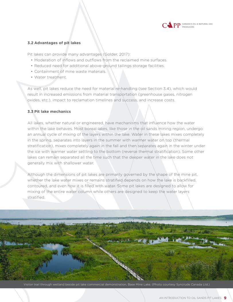
Wetland located beside pit lake commercial demonstration, Base Mine Lake. (Photo courtesy Syncrude Canada Ltd.)
AN INTRODUCTION TO OIL SANDS PIT LAKES 8
3 Pit Lake Development
3.1 Pit lake planning
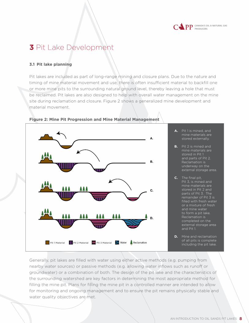
Pit lakes are included as part of long-range mining and closure plans. Due to the nature and timing of mine material movement and use, there is often insufficient material to backfill one or more mine pits to the surrounding natural ground level, thereby leaving a hole that must be reclaimed. Pit lakes are also designed to help with overall water management on the mine site during reclamation and closure. Figure 2 shows a generalized mine development and material movement.
Figure 2: Mine Pit Progression and Mine Material Management
Generally, pit lakes are filled with water using either active methods (e.g. pumping from nearby water sources) or passive methods (e.g. allowing water inflows such as runoff or groundwater) or a combination of both. The design of the pit lake and the characteristics of the surrounding watershed are key factors in determining the most appropriate method for filling the mine pit. Plans for filling the mine pit in a controlled manner are intended to allow for monitoring and ongoing management and to ensure the pit remains physically stable and water quality objectives are met.
A. Pit 1 is mined, and mine materials are stored externally.
B. Pit 2 is mined and mine materials are stored in Pit 1 and parts of Pit 2. Reclamation is underway on the external storage area.
C. The final pit, Pit 3, is mined and mine materials are stored in Pit 2 and parts of Pit 3. The remainder of Pit 3 is filled with fresh water or a mixture of fresh and mine water to form a pit lake. Reclamation is completed on the external storage area and Pit 1.
D. Mine and reclamation of all pits is complete including the pit lake.Pit 1 Material Pit 2 Material Pit 3 Material
AN INTRODUCTION TO OIL SANDS PIT LAKES 9
3.2 Advantages of pit lakes
Pit lakes can provide many advantages (Golder, 2017):• Moderation of inflows and outflows from the reclaimed mine surfaces.• Reduced need for additional above-ground tailings storage facilities.• Containment of mine waste materials.• Water treatment.
As well, pit lakes reduce the need for material re-handling (see Section 3.4), which would result in increased emissions from material transportation (greenhouse gases, nitrogen oxides, etc.), impact to reclamation timelines and success, and increase costs.
3.3 Pit lake mechanics
All lakes, whether natural or engineered, have mechanisms that influence how the water within the lake behaves. Most boreal lakes, like those in the oil sands mining region, undergo an annual cycle of mixing of the layers within the lake. Water in these lakes mixes completely in the spring, separates into layers in the summer with warmer water on top (thermal stratification), mixes completely again in the fall and then separates again in the winter under the ice with warmer water settling to the bottom (reverse thermal stratification). Some other lakes can remain separated all the time such that the deeper water in the lake does not generally mix with shallower water.
Although the dimensions of pit lakes are primarily governed by the shape of the mine pit, whether the lake water mixes or remains stratified depends on how the lake is backfilled, contoured, and even how it is filled with water. Some pit lakes are designed to allow for mixing of the entire water column while others are designed to keep the water layers stratified.
Visitor trail through wetland beside pit lake commercial demonstration, Base Mine Lake. (Photo courtesy Syncrude Canada Ltd.)
AN INTRODUCTION TO OIL SANDS PIT LAKES 10
3.4 Alternatives to pit lakes
CEMA (2012) suggested options for infilling mine pits rather than reclaiming as pit lakes. The CEMA options pose a number of complexities and are not aligned with intended operating and closure outcomes. The approaches proposed by CEMA were:
• Re-handle waste materials (overburden, tailings, etc.) and move them to infill the final mine pit.
» Operators would note that re-handling materials, particularly those that may have already been stored and reclaimed, creates additional disturbance, increases emissions associated with transportation, and may impact reclamation timing. In addition, increased costs associated with material re-handling can potentially impact competitiveness of the operating company and of the oil sands sector.
• Work with other mine operators to stage development such that waste materials from an active mining area at one site can be used to infill an inactive area at another mine to reduce the number of total pit lakes required.
» From the operator perspective, this approach has very similar considerations to those noted above for use of stored materials. In addition, this approach introduces additional, significant concerns related to responsibility for long-term liability of the transferred material, costs and logistics of moving material potentially tens to hundreds of kilometers, and regulatory approvals, which would currently impede this type of material transfer.
• Create a pit lake and if it does not meet its intended outcomes, use either of the options above to infill the lake.
» For operators, the originally proposed CEMA approach would involve the added complexity of having to treat and release the water from the former pit lake in addition to considerations related to materials handling, water release, and the expenses and concerns associated with infilling as identified above in addition to a high probability of a lack of available infill material. » Evolution of oil sands mining regulations and requirements since 2012 has enabled
operators to propose revised outcomes for a pit lake if there is a barrier to achieving the original intended outcomes. The revised outcomes may, or may not, include infilling of the lake.
Given the success of pit lakes at most mine sites around the world (see Section 4), and the multiple decades of oil sands pit lake research (see Section 8), pit lakes are seen as a best practice for surface mining and a preferred option for reclaiming oil sands mine pits.

AN INTRODUCTION TO OIL SANDS PIT LAKES 11
4 Pit Lake Examples
4.1 Use of pit lakes around the world
There are thousands of examples of pit lakes around the world, including a significant number in Canada (Golder, 2017). Many have achieved the objectives of a successful pit lake and are integrated into the reclaimed landscape. Pit lakes have been used most extensively by coal and hard-rock mining operations. Each pit lake design is intended to address the specific conditions within the pit that holds the lake. In general, this involves management of water quality considerations associated with the type of material that was mined from, or placed into, the pit. The design of each pit lake provides an opportunity for learning so that future pit lakes have a greater chance of success.
4.2 Lessons learned from pit lakes around the world
By reviewing the experiences of previous pit lakes, oil sands pit lakes can be designed and managed to take advantage of learnings by other operators. Experiences from other operators that have been incorporated into oil sands pit lake designs include:
• Gathering input from local stakeholders and Indigenous communities to understand expectations.• Applying an adaptive management approach that assesses potential problems in advance and proposes potential solutions (see Section 6).• Conducting research programs on multiple scales. In the oil sands this includes research in laboratories as well as on pit lake mesocosms, demonstration pit lakes and commercial- scale pit lakes (see Section 8).• Planning, design, construction, operation and monitoring to ensure that the final pit lake meets planned reclamation outcomes, can be connected to the natural environment, and provides value for local communities.• Encouraging development and implementation of regulatory frameworks that recognize closure as a necessary part of mine planning. • Starting closure planning before mine construction begins and ensuring plans are continually updated as mine plans change and new information emerges.

AN INTRODUCTION TO OIL SANDS PIT LAKES 12
4.3 Pit lakes in Alberta
The mining industry in Alberta, particularly the coal mining industry, has successfully reclaimed and certified thousands of hectares of previously disturbed lands, including several pit lakes. TransAlta’s East Pit Lake and Coal Valley Resources Inc.’s Silkstone Lake, for example, have received reclamation certificates from the Government of Alberta.
The following sections offer a more detailed look at two examples of pit lakes developed in Alberta. These, and other, pit lakes provide an opportunity to gain insight into approaches to mine design, planning, operation and closure to enable successful development of pit lakes.
Sphinx Lake
Sphinx Lake was developed by Teck coal mining operations near Hinton, Alberta. The mine was operated between 1992 and 1998 and Sphinx Creek was diverted around the mine footprint prior to mining. Pit 51-C6, which ultimately became Sphinx Lake, was the last of a series of mine pits and, as identified in the mine plan, there was insufficient overburden material to fully infill the excavation.
Reclamation work began in 2005 and consisted of the following steps (Brinker et al, 2011):• Surface and groundwater that entered into the pit following mining was drained.• The slopes surrounding the pit were contoured and a littoral zone up to three metres deep was created. The littoral zone comprised about 25 per cent of the surface area of the lake and included aquatic habitat such as rock piles and islands.• Inlet and outlet channels were designed so that Sphinx Creek could be re-routed through the lake.• Reclamation and revegetation of the uplands surrounding the lake was completed.
Monitoring of Sphinx Lake began upon completion of the reclamation activities. Monitoring parameters were based on recommendations from a multi-stakeholder group initiated by Alberta Environment to provide guidance on the design. By 2016, the lake had met all of the criteria of an ecologically healthy lake. The Sphinx Creek watershed, into which the lake is integrated, provides healthy habitat for substantial populations of both resident and migratory native rainbow trout, as well as bull trout (Teck, 2016).

AN INTRODUCTION TO OIL SANDS PIT LAKES 13
Quarry Lake
Quarry Lake near Canmore, Alberta is a former coal mine pit that was mined in the early 1970s. Several previous pits, adjacent to Canmore Creek, had been mined with no attempt at remediation following mining. In the early 1970s, there were minimal regulatory requirements for reclamation and as the town was heavily dependent on coal mining, there was little public pressure to reclaim the mine sites. However, the mining company decided to attempt reclamation of some of the older pits based on experiences with reclamation of coal mine pits in England.
In 1972, a new coal pit, Canmore Creek Mine Number 3, was opened. This pit was designed with the knowledge that had been gained through reclamation of the older mine sites in the Canmore area. By designing the mine to be ready for reclamation and having a plan for what the reclaimed mine site would look like, the mine planners effectively created one of the first mine closure plans in Alberta. The mine plan included:
• Excavation of the soil, gravel and rock separately.• Placement of these materials in locations convenient for use in reclamation.• Incorporation of spring-fed streams into the finished landscape.• Creation of a lake.
Eventually, the entire mined area near Canmore was taken over by the Government of Alberta to ensure it was reclaimed to a state that would enhance recreational opportunities and provide wildlife habitat. The reclamation of Canmore Creek Mine Number 3 was completed based on the original closure plan. Today, the lake is known as Quarry Lake and is a popular recreation area for residents and visitors to the Canmore area.
Pit lake in Alberta. Photo credit: Jerry Vandenberg

AN INTRODUCTION TO OIL SANDS PIT LAKES 14
5 Oil Sands Pit Lakes5.1 History of oil sands pit lakes
Pit lakes have been a part of the oil sands mine plans since the first mine was opened. The nature and design of those lakes has changed over time and the number and location of pit lakes identified in closure plans has also changed as oil sands mining has expanded, new mining and tailings treatment technologies have been developed, and regulatory requirements have changed.
The first pit lake designs were generally a mined-out pit filled with water; some also included placement of fluid tailings in-pit prior to filling with water. Fifty years ago, there was little understanding of how these oil sands pit lakes would differ from pit lakes found in other mining regions around the world; however, ongoing research and monitoring was started early on to ensure the pit lakes would become self-sustaining parts of the closure landscape.
Regulatory, public, and corporate expectations for pit lakes have continued to change and are key to leading operators to research, design and construct successful pit lakes in the oil sands. Pit lakes will become part of the landscape and be a link between the reclaimed mine site and the natural environment. Extensive research programs (see Section 7) have allowed mine operators to be confident that pit lakes will meet these expectations.
5.2 How are oil sands pit lakes designed?
Oil sands pit lakes are carefully planned and designed with the end land use and overall site closure goals in mind. As much as possible, a pit that will be reclaimed to a lake is planned and mined in a manner that recognizes the conceptual design of the pit lake and incorporates the necessary features to enable the pit lake to be part of the closure landscape.
Pit lakes planned in the oil sands region can generally be divided into three broad categories:• Pits filled with only fresh water.• Pits filled with a mixture of fresh and mine waters.• Pits partially filled with tailings and/or other mine materials and covered with fresh and/or mine waters.
Infilling with mine material or tailings is done, whenever possible, in a manner that will allow natural lake processes to develop. In particular, development of littoral zones, or shallower areas around the perimeter of the lake, are planned and constructed to provide habitat for aquatic and near-shore plants and animals. Riparian areas are also expected to develop in the transitional area between the water’s edge and the reclaimed slopes surrounding the lake (Figure 3).

AN INTRODUCTION TO OIL SANDS PIT LAKES 15
Figure 3: Littoral and Riparian Zones
Pit lake plans are developed to ensure all the necessary pit lake design elements are considered, including inflows and outflows, and to enable incorporation of the pit lake into the overall mine closure plan. The goal for every oil sands pit lake is that it becomes a self-sustaining part of the final closure landscape. Specific end land uses for the oil sands mine pit lakes will vary depending on a number of factors, such as the location, pit lake design, local stakeholder and Indigenous community considerations, closure goals and objectives.
5.3 Engagement
Oil sands mine operators participate in regular engagement with local stakeholders and Indigenous communities on all aspects of their operations. The various aspects of water use and mine reclamation for oil sands mines, including pit lakes, have been a topic of discussion for decades. Indigenous and local communities are keenly interested in how reclamation outcomes, including those related to pit lakes, will be achieved. Engagement with local Indigenous communities and stakeholders will continue to be an important component of oil sands mine pit operations, and inputs from these groups and individuals will be considered in development of end land use objectives to inform reclamation and pit lake planning.
Littoral Zone Riparian Zone Upland/Surrounding Land

AN INTRODUCTION TO OIL SANDS PIT LAKES 16
6 Adaptive ManagementAdaptive management is a decision-making process for natural resource management that emphasizes learning through management and allows for adjustments as outcomes from actions and events are better understood. This approach builds on learning from experience, and modifying actions based on that experience.
By applying adaptive management to pit lake planning, operators seek to: • Understand the intended objectives.• Plan and execute activities to achieve the objectives.• Measure results to see what is, and is not, working.• Apply information learned to make decisions about any additional actions needed to achieve the outcomes.
The iterative adaptive management process is cyclical and is a “learn by doing” approach, not a “trial and error” approach. The adaptive management cycle is commonly viewed as having four components as illustrated in Figure 4.
Figure 4: Adaptive Management Cycle (after Jones, 2005)
For oil sands pit lakes, adaptive management has been actively applied for many years. Adaptive management is, and will continue to be, applied at a range of scales including regional, site specific, pit level, pilot and lab bench, to enable effective and methodical evolution of pit lake design.
AN INTRODUCTION TO OIL SANDS PIT LAKES 17
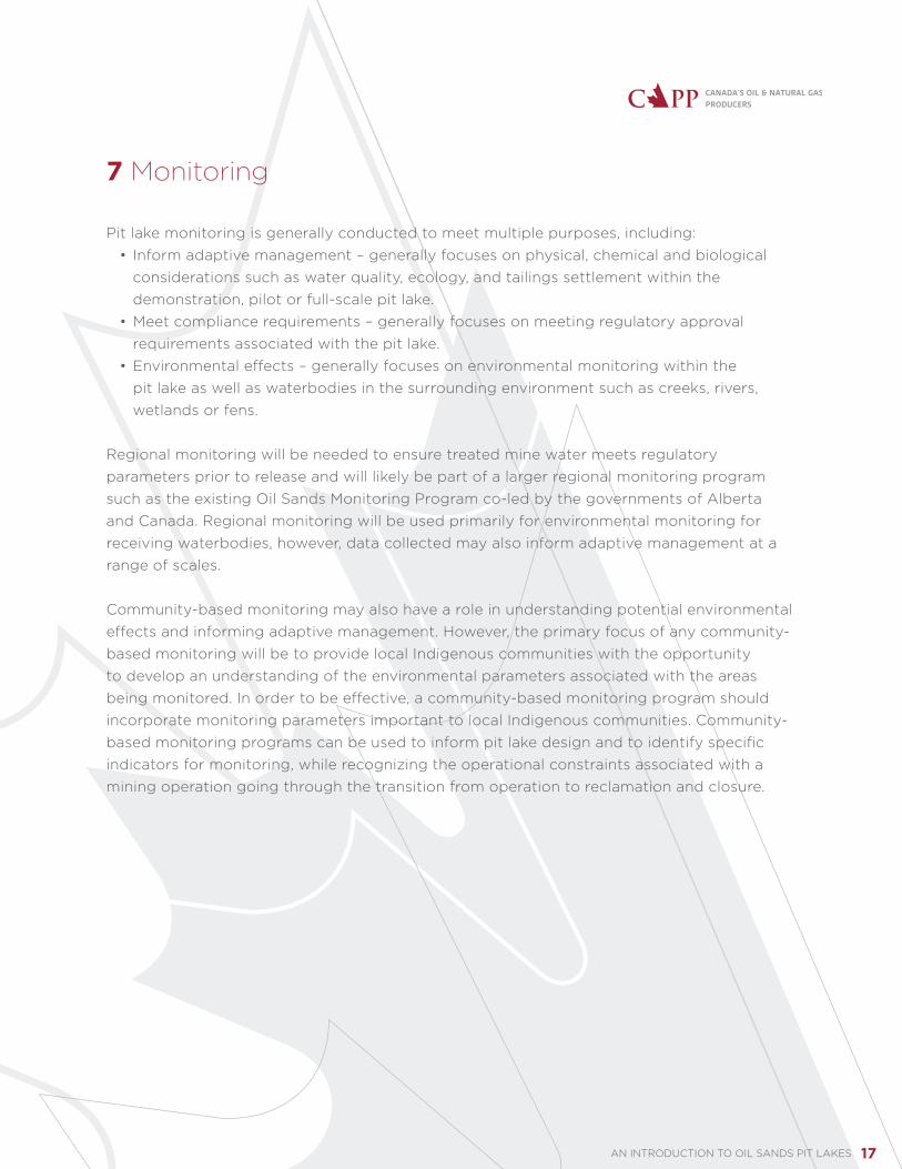
7 Monitoring
Pit lake monitoring is generally conducted to meet multiple purposes, including:• Inform adaptive management – generally focuses on physical, chemical and biological considerations such as water quality, ecology, and tailings settlement within the demonstration, pilot or full-scale pit lake.• Meet compliance requirements – generally focuses on meeting regulatory approval requirements associated with the pit lake.• Environmental effects – generally focuses on environmental monitoring within the pit lake as well as waterbodies in the surrounding environment such as creeks, rivers, wetlands or fens.
Regional monitoring will be needed to ensure treated mine water meets regulatory parameters prior to release and will likely be part of a larger regional monitoring program such as the existing Oil Sands Monitoring Program co-led by the governments of Alberta and Canada. Regional monitoring will be used primarily for environmental monitoring for receiving waterbodies, however, data collected may also inform adaptive management at a range of scales.
Community-based monitoring may also have a role in understanding potential environmental effects and informing adaptive management. However, the primary focus of any community-based monitoring will be to provide local Indigenous communities with the opportunity to develop an understanding of the environmental parameters associated with the areas being monitored. In order to be effective, a community-based monitoring program should incorporate monitoring parameters important to local Indigenous communities. Community-based monitoring programs can be used to inform pit lake design and to identify specific indicators for monitoring, while recognizing the operational constraints associated with a mining operation going through the transition from operation to reclamation and closure.
AN INTRODUCTION TO OIL SANDS PIT LAKES 18
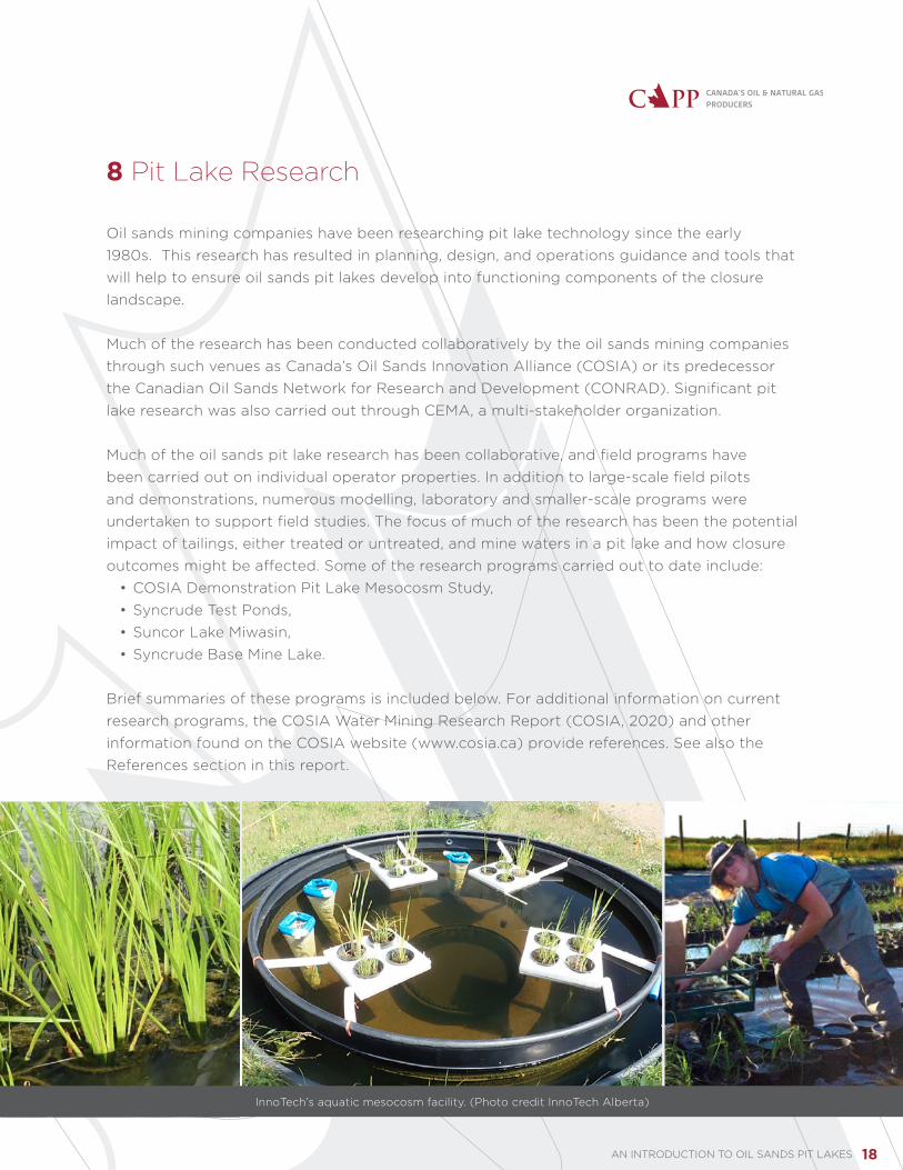
8 Pit Lake Research
Oil sands mining companies have been researching pit lake technology since the early 1980s. This research has resulted in planning, design, and operations guidance and tools that will help to ensure oil sands pit lakes develop into functioning components of the closure landscape.
Much of the research has been conducted collaboratively by the oil sands mining companies through such venues as Canada’s Oil Sands Innovation Alliance (COSIA) or its predecessor the Canadian Oil Sands Network for Research and Development (CONRAD). Significant pit lake research was also carried out through CEMA, a multi-stakeholder organization.
Much of the oil sands pit lake research has been collaborative, and field programs have been carried out on individual operator properties. In addition to large-scale field pilots and demonstrations, numerous modelling, laboratory and smaller-scale programs were undertaken to support field studies. The focus of much of the research has been the potential impact of tailings, either treated or untreated, and mine waters in a pit lake and how closure outcomes might be affected. Some of the research programs carried out to date include:
• COSIA Demonstration Pit Lake Mesocosm Study, • Syncrude Test Ponds,• Suncor Lake Miwasin,• Syncrude Base Mine Lake.
Brief summaries of these programs is included below. For additional information on current research programs, the COSIA Water Mining Research Report (COSIA, 2020) and other information found on the COSIA website (www.cosia.ca) provide references. See also the References section in this report.
InnoTech’s aquatic mesocosm facility. (Photo credit InnoTech Alberta)

AN INTRODUCTION TO OIL SANDS PIT LAKES 19
8.1 COSIA Demonstration Pit Lake (DPL) mesocosm study
The COSIA DPL mesocosm study is located at the InnoTech facility in Vegreville, Alberta. The study includes 30 mesocosms, each 3.6 metres in diameter by 1.5 metres deep. The research is designed to understand the response of aquatic ecosystems to various oil sands materials including mine waters and different tailings streams. Monitoring parameters include:
• Water toxicity,• Water chemistry,• Zooplankton diversity,• Benthic invertebrates,• Aquatic plant health and growth rates.
To date, the work has demonstrated that after several weeks the turbidity, dissolved oxygen and temperature at depth demonstrate no difference between the mesocosms containing mine waters and the controls. In addition, after several weeks, acute toxicity for rainbow trout declined to non-detectable levels in the mesocosms containing mine waters. This work demonstrates beyond the laboratory scale what ecological effects could be expected to occur in a short period of time and which may be more long-term in nature.
InnoTech’s aquatic mesocosm facility. (Photo credit InnoTech Alberta)

AN INTRODUCTION TO OIL SANDS PIT LAKES 20
8.2 Syncrude Test Ponds
Syncrude has included water-capped fluid tailings in pit lakes since its earliest closure plan designs. The company initiated research in 1982 to understand the effects on water quality from placing fluid tailings in the bottom of a mined-out pit and capping the tailings with either fresh or mine water. The work was initiated in the laboratory, then expanded to field pilots known as the Syncrude Test Ponds in 1989. The test facility consists of 11 ponds ranging in size from 0.5 to four hectares. The ponds were filled with about three metres of fluid tailings and capped with water from a range of sources. Monitoring continued until 2012. This research provided the basis for advancing the use of water-capped tailings and led to the development of the full-scale demonstration of water-capped fluid tailings known as Base Mine Lake.
Some key findings from the Syncrude Test Ponds and modelling activities include:• Naturally occurring bacteria were able to break down many compounds, such as ammonia, sulfate and dissolved organics.• The relatively small-scale test ponds (up to four hectares in size) demonstrated acute water toxicity dissipated quickly and chronic toxicity declined over time. These small ponds did not reflect normal boreal lake mixing dynamics that are important drivers of lake performance at full scale.• For the Base Mine Lake configuration, including the lake size and orientation, the water cap must be at least five metres deep to prevent fines from the lake bottom from being resuspended by wind-generated waves. (Lawrence, 1991)
Results from this work laid the foundation for a range of ongoing pit lake and mine water quality research programs and have also informed pit lake planning. The full-scale Base Mine Lake demonstration (see Section 8.4) builds upon the knowledge gained from Syncrude’s Test Ponds.
Pit lake (water-capped tailings technology) test ponds. (Photo credit Syncrude Canada Ltd.)

AN INTRODUCTION TO OIL SANDS PIT LAKES 21
8.3 Suncor Lake Miwasin
Suncor’s Lake Miwasin is designed to store treated fluid tailings beneath a water cap. Lake Miwasin is a demonstration pit lake that uses Suncor’s PASS (Permanent Aquatic Storage Structure) process to treat fluid tailings. PASS is a tailings treatment process that dewaters fluid tailings and improves the quality of release water. The pit lake is part of an 18-hectare demonstration area, which includes the watershed that supports the lake and the downstream treatment wetlands. Lake Miwasin itself is 10 metres deep, including five metres of water cover. Fifteen per cent of the lake area is littoral. Various littoral and riparian slopes have been revegetated using guidance from local community members and CEMA recommendations.
An extensive research and monitoring program has been designed for Lake Miwasin. The 15-year program will test the design assumptions for the lake and will include programs to monitor:
• Pore water quality,• Treated fluid tailings settlement rates,• Lake water interactions with groundwater,• Ecological development.
Lake Miwasin also includes treatment wetlands that will be used to further treat water leaving the lake; this water will not be released to the environment but the design concept of a pit lake with treatment wetlands is being considered as part of the final closure landscape. Preliminary monitoring data shows the treated fine tailings and release water quality are performing as expected. In addition, vegetation has been established within Lake Miwasin as planned.
8.4 Syncrude Base Mine Lake
Syncrude’s full-scale demonstration, Base Mine Lake, is one of the original mine pits at the company’s Mildred Lake site. Once mining was completed, Syncrude transferred in fluid tailings from tailings storage facilities and used the pond as part of its recycle water system. In 2012, tailings infilling was completed and the pond became Base Mine Lake, with 800 hectares of surface area and containing approximately 45 metres of fluid tailings capped with roughly five metres of mine and fresh waters. Natural consolidation processes are occurring within the fluid tailings, which will ultimately reduce the volume of fluid tailings in the lake as well as release pore waters from the tailings. Additional fresh water and mine waters have been added above the fluid tailings so the lake is at the depth designed to prevent resuspension of fine materials.
Base Mine Lake operates as a flow-through system with fresh water imported from the Beaver Creek Reservoir to the south and outflow water returned to the water recycle system

AN INTRODUCTION TO OIL SANDS PIT LAKES 22
for the mining operations – no water is currently being released to the environment from Base Mine Lake although, ultimately, discharge of lake water to the Athabasca River is intended.
An extensive monitoring and research program has been ongoing at Base Mine Lake since it was commissioned. The program is designed to support adaptive management for Base Mine Lake and to enable stewardship to closure outcomes.
Results from the research and monitoring program indicate that the fines are physically isolated beneath the water cap and the fluid tailings are settling as predicted through modelling. As of 2019, the fluid tailings have settled an average of five metres and the water cap has increased in depth proportionately. The research and monitoring program has also demonstrated that surface water quality is improving as expected: the lake water is not acutely toxic and chronic toxicity is declining over time. All water quality parameters measured, with the exception of F2 hydrocarbons, are below Alberta Surface Water Quality short-term guidelines for the protection of aquatic life. (GoA, 2018).
As discussed in Section 6, adaptive management plays an important role in ensuring the overall success of Base Mine Lake. It is through this process that parameters not meeting expectations are identified, assessed, and plans put in place to remediate unfavorable outcomes. For example, residual bitumen has been observed as mats on the tailings surface at locations where the tailings were poured into the pit; these bitumen mats are being removed from the tailings surface and it is expected that the F2 hydrocarbon concentrations will decline as a result.
Base Mine Lake is Syncrude’s full-scale pit lake demonstration project. (Photo courtesy Syncrude Canada.)

AN INTRODUCTION TO OIL SANDS PIT LAKES 23
9 Frameworks, Guidance and Plans for Pit Lakes
9.1 Legislative and policy frameworks
There is no legislation specific to pit lakes either federally or provincially. Rather, pit lakes are currently governed under various environmental laws relevant to specific aspects of the lake such as water quality and reclamation criteria.
While the majority of the requirements to enable government oversight of pit lakes are in place, it should be noted that in order to enable pit lakes to be an integrated part of the closure landscape, requirements related to release of treated mine water are required. Governments at the federal and provincial level are currently working on developing the requirements for release of treated mine waters and, once complete, these requirements will become part of the suite of laws and other requirements that govern regulation of pit lakes.
Existing legislation that may apply to oil sands pit lakes, depending on the pit lake and the end land use outcomes planned, includes:
• The federal Fisheries Act (2019), • The Environmental Protection and Enhancement Act (2020),• The Oil Sands Conservation Act (2020),• The Water Act (2017),• The Public Lands Act (2020).
Employees collect samples at the company’s test ponds for pit lake technology. (Photo courtesy Syncrude Canada Ltd.)

AN INTRODUCTION TO OIL SANDS PIT LAKES 24
9.2 Regulatory and other guidance
In addition to the legislation above, Alberta has developed policy and regulatory frameworks and requirements relevant to oil sands tailings and pit lakes. The Tailings Management Framework (Government of Alberta, 2015) and the Alberta Energy Regulator’s (AER) Directive 085 (AER, 2017) were developed to set requirements for managing oil sands mine tailings. Both are aimed at reducing the volume of stored fluid tailings during and after mine operation in order to manage and decrease liability and environmental risk resulting from the accumulation of fluid tailings on the landscape while also enabling reclamation and options for land use, including potential use of pit lakes.
From a closure perspective, the information requirements for the design and performance of pit lakes in the closure plan can be found in the AER’s Specified Enactment Directive 003 (AER 2018).
The Government of Alberta also worked with CEMA to develop Oil Sands End Pit Lakes: A Review to 2007 (2007) and the End Pit Lakes Technical Guidance Document (2012). The development of these documents was overseen by a multi-stakeholder group that included representation from local communities, government, environmental groups and industry, and the documents were prepared by engineers and scientists with appropriate expertise.
9.3 Pit lake plans and approvals
Designs for pit lakes, including intended objectives, are part of closure plans included in project applications for approval under Alberta’s Environmental Protection and Enhancement Act (Government of Alberta, 2018). It is recognized that closure plans start as conceptual and become more detailed over time as mine plans are updated and new research data becomes available.
Closure plans, including details on pit lake design, are required to be updated every 10 years and may be revised more frequently based on regulatory approval requirements and/or in alignment with knowledge achieved through adaptive management. For pit lakes, the updates allow incorporation of any changes to the pit lake design resulting from changes to mine plans, technological advances, and monitoring and research findings.
Oil sands pit lakes are approved conceptually as part of the mine approvals for all currently approved oil sands mines. Operating approvals require ongoing research into tailings treatment options, pit lake design and other reclamation requirements. These conditions will help to ensure that once constructed, pit lakes will function as designed.
AN INTRODUCTION TO OIL SANDS PIT LAKES 25
10 Summary
Pit lakes are any lake formed within the boundaries of a mined-out pit and are essential to the eventual closure of surface mining operations. Pit lakes are common elements of surface mining operations and closure plans across Alberta and around the globe, and have been used extensively in hard-rock and coal mines throughout the world.
Oil sands pit lakes are carefully planned, designed, and managed with the end land use and overall site closure goals in mind. As much as possible, a pit that will be reclaimed as a lake is planned and mined in a manner that recognizes the conceptual design of the pit lake and incorporates the necessary features to enable the pit lake to become a viable, self-sustaining component of the reclaimed mine site.
Oil sands mining companies have applied, and will continue to apply, an adaptive management approach to pit lake design, mine pit construction, and pit lake development to ensure that oil sands pit lakes form an integrated part of the closure landscape in the region. Oil sands mining companies have years of extensive research to inform pit lake design. Ongoing laboratory work, pilots, demonstrations and full scale developments have provided substantial opportunities for gathering monitoring and research data to enable understanding of all aspects of pit lakes.
Pit lakes, through adaptive management, will form an integrated and successful part of the oil sands mine closure landscape.
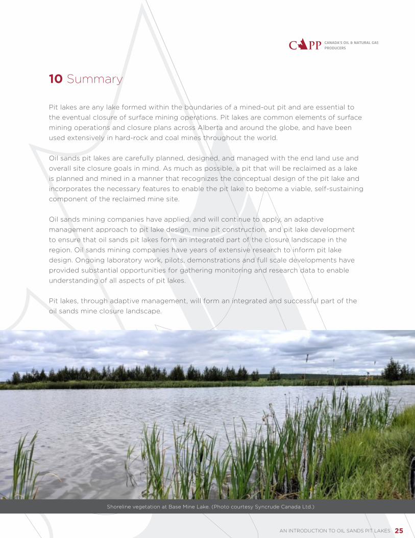
Shoreline vegetation at Base Mine Lake. (Photo courtesy Syncrude Canada Ltd.)

AN INTRODUCTION TO OIL SANDS PIT LAKES 26
11 Definitions
Acute toxicity A toxic effect (severe biological harm or death) produced in an organism by a substance or mixture of substances within a short exposure period (usually 96 hours or less).
Chronic toxicity A toxic effect (severe biological harm or death) produced in an organism by a substance or mixture of substances over a long exposure period.
Closure The mine lifecycle stage following active operations. Includes suspension, abandonment, remediation and reclamation activities undertaken with the goal of meeting the end land use objectives identified in the mine closure plans.
End land use The end land use is the desired land use or uses to be established as part of the reclamation process. Land uses in the oil sands may include forestry, recreation, traditional land uses, industrial activity, etc.
F2 hydrocarbons
Hydrocarbons are categorized based on carbon chain length. Shorter chain length hydrocarbons are lighter and more volatile and longer chain length hydrocarbons are heavier. F2 hydrocarbons are light, extractable petroleum hydrocarbons ranging from C10-C16 in carbon chain length.
Fresh water Naturally occurring water found in the environment. Does not include mine waters or saline water. Generally recognized as water having less than 4000 mg/L of total dissolved solids.
Fluid tailings Any fluid discard from bitumen extraction facilities meeting specific parameters related to amount of solid and shear strength (i.e., more than 5 mass per cent suspended solids and having an undrained shear strength of less than 5 kPa). Also previously referred to as ‘fluid fine tailings’ or FFT.
Hydrologic Buffer
A waterbody or other landscape feature that diverts surface runoff water to subsurface pathways and/or dissipates the energy/flow of surface runoff. This can provide key landscape processes such as reducing sediment loads, providing flood protection, and moderating water flows. (Source: Herron and Wilson 2001).
Littoral Area within a body of water that is close to the shore or land and where light reaches the sediment surface permitting the growth of attached autotrophs (partially to fully submerged aquatic plants and algae attached to the plants). For pit lake planning purposes, the littoral zone is usually defined by a specific depth. (Source: Lewis 2009.)

AN INTRODUCTION TO OIL SANDS PIT LAKES 27
Mesocosms Simplified, outdoor, experimental set ups that allow for examination of natural environments under controlled conditions. Used to bridge the gap between laboratory microcosms and large, complex, full-scale macrocosms. (Source: Odum 1984.)
Mine materials Components associated with the mining process including overburden, waste rock, tailings, target material (bitumen), granular materials and reclamation materials such as peat, subsoil and topsoil.
Mine overburden
The natural geological material located above and around the material to be mined (i.e., oil sands ore in the case of oil sands mining).
Mine plans Mines are required to prepare a suite of plans and reports to manage activities and for submission to the government. These activities include: mining operations, tailings management and reclamation and closure.
Mine waters Any waters that result from an industry process or mine pit dewatering carried out at an oil sands mine lease, which are not already approved for release to the environment.
Pore Water Water that is found in the open areas (voids) in the surrounding material. In oil sands tailings, it is the water contained within the open areas between the solid particles in the tailings mixture.
Riparian Land along the edges of water bodies where the vegetation and soils are under the influence of both terrestrial and aquatic processes and considered a transition from aquatic to terrestrial areas (Source: Clare and Sass 2012.)
Surface mining A method of extracting materials located near the surface of the earth. Common types of surface mining are open-pit mining, strip mining, mountaintop removal mining and quarrying. Oil sands mining operations are generally open-pit where materials are removed from an open pit in the ground.
Tailings A mixture of sand, clay, water, silts, residual bitumen and other hydrocarbons, salts and trace metals produced as a byproduct of the extraction process.
Treated tailings Tailings materials that have been processed through one or more treatment technologies or processes with the objective of supporting reclamation.

AN INTRODUCTION TO OIL SANDS PIT LAKES 28
12 References
[AER] Alberta Energy Regulator. 2017. Directive 085: Fluid Tailings Management for OIl Sands Mining Projects. Calgary: Alberta Energy Regulator. www.aer.ca/documents/directives/Directive085.pdf.
[AER] Alberta Energy Regulator. 2018. Specified Enactment Direction 003: Direction for Conservation and Reclamation Submissions under an Environmental Protection and Enhancement Act Approval for Mineable Oil Sands Sites. Calgary, AB: Alberta Energy Regulator. www.aer.ca/documents/manuals/Direction_003.pdf.
Brinker CJ, Symbaluk MD, Boorman JG., 2011. Constructing habitat for a sustainable native fisheries in the Sphinx Lake end pit lake system. Mine Closure 2011. September 18-21, 2011. Lake Louise, Canada.
Canada’s Oil Sands Innovation Alliance (COSIA). 2020. 2019 Water Mining Research Report. COSIA. Calgary, Alberta. https://cosia.ca/sites/default/files/attachments/COSIA_2019_Mining%20Research%20Summary%20Report_Final.pdf
Clare, S. and G. Sass. 2012. Riparian Lands in Alberta: Current state, conservation tools, and management approaches. Report prepared for Riparian Land Conservation and Management Team, Alberta Water Council, Edmonton. Fiera Biological Consulting Ltd. Report #1163. https://www.awchome.ca/uploads/source/Publications/Project_Team_Reports/1163_AWC_Riparian_Lands_FINAL-compressed.pdf
Cumulative Environmental Management Association (CEMA). 2007. Oil Sands End Pit Lakes: A Review to 2007. Prepared by F. Wescott, Clearwater Environmental Consultants. Fort McMurray, AB: Cumulative Environmental Management Association, 42 pp.
Cumulative Environmental Management Association (CEMA). 2012. End Pit Lakes Guidance Document 2012. Edited by Hrynyshyn J and Wylynko D. Fort McMurray, AB: Cumulative Environmental Management Association, 436 pp.
Government of Alberta. 2020. Environmental Protection and Enhancement Act: Conservation and Reclamation Regulation. Edmonton, AB: Alberta Queen’s Printer. http://www.qp.alberta.ca/documents/Acts/E12.pdf.
Government of Alberta. 2018. Environmental Quality Guidelines for Alberta Surface Waters. Water Policy Branch, Alberta Environment and Parks. Edmonton, Alberta
Government of Alberta. 2015. Lower Athabsasca Region:Tailings Management Framework for Mineable Athabasca Oil Sands. Edmonton, AB: Alberta Queen’s Printer. https://open.alberta.ca/dataset/962bc8f4-3924-46ce-baf8-d6b7a26467ae/resource/7c49eb63-751b-49fd-b746-87d5edee3131/download/2015-larp-tailingsmgtathabascaoilsands.pdf.
Golder Associates. 2017. Pit Lake - Case Studies. Calgary, AB: Report prepared for Suncor Energy Inc., 31 pp.
Herron, N. and C. Wilson. 2001. A water balance approach to assessing the hydrologic buffering potential of an alluvial fan. Water Resources Research 37(2):341-351.https://agupubs.onlinelibrary.wiley.com/doi/pdfdirect/10.1029/2000WR900253#:~:text=A%20geomorphic%20feature%20that%20diverts,it%20reduces%20the%20hydrologic%20connectivity
Jones, G. 2005. Is the management plan achieving its objectives? Case study 21.1. In: Worboys, G., De Lacy, T. and Lockwood, M., eds. Protected Area Management. Principles and Practices. 2nd Ed. Oxford: Oxford University Press. pp. 555–557.
Lawrence, GA., Ward, PRB, and MacKinnon MD. 1991. Wind-wave induced suspension of mine tailings in disposal ponds-a case study. Can. J. Civ. Eng. 18: 1047-1053https://cdnsciencepub.com/doi/pdf/10.1139/l91-127
Odum, E.P. 1984. The Mesocosm. BioScience 34(9) 558-562. https://doi.org/10.2307/1309598
Teck Resources Limited. 2016. Reclamation Example: Making a Mine Pit into an Aquatic Habitat. https://www.teck.com/news/stories/2016/reclamation-example--making-a-mine-pit-into-an-aquatic-habitat. Accessed November, 2020.
2021-0013


