24
Meteorologisk institutt met.no Apache tips & tricks Using Apache to work around Mapserver limitations

Meteorologisk institutt met.no
Apache tips & tricks
Using Apache to work around Mapserver limitations

Meteorologisk institutt met.no
Background
Mapserver
DIANA
• We use in-house software DIANA as WMS-server for weather maps
• Mapserver is mostly used for background maps
• We wanted it to be possible to fetch a single image with background and weather data
• Configured Mapserver to function as a Cascading WMS. All requests to DIANA-WMS goes through Mapserver

Meteorologisk institutt met.no
Shorter URLs
• Standard mapserver URL needs full path to location of the mapfile as a parameter
http:// wms.met.no/cgi-bin/mapserver?map=/var/www/weather/mapfiles/atmosphere.map& ...
• Long and impractical
• Would prefer something shorter, like this:
http:// wms.met.no/weather/atmosphere.map? ...

Meteorologisk institutt met.no
Apache request cycle

Meteorologisk institutt met.no
mod_rewrite
RewriteRule
/([^/]*)/(.*\.map$)
/cgi-bin/mapserv?map=/var/www/$1/mapfiles/$2
[PT,QSA]

Meteorologisk institutt met.no
mod_rewrite
RewriteRule
/([^/]*)/(.*\.map$)
/cgi-bin/mapserv?map=/var/www/$1/mapfiles/$2
[PT,QSA]
Incoming URL:
http:// wms.met.no/weather/atmosphere.map? ...

Meteorologisk institutt met.no
mod_rewrite
RewriteRule
/([^/]*)/(.*\.map$)
/cgi-bin/mapserv?map=/var/www/$1/mapfiles/$2
[PT,QSA]
Incoming URL:
http:// wms.met.no/weather/atmosphere.map? ...

Meteorologisk institutt met.no
mod_rewrite
RewriteRule
/([^/]*)/(.*\.map$)
/cgi-bin/mapserv?map=/var/www/$1/mapfiles/$2
[PT,QSA]
Incoming URL:
http:// wms.met.no/weather/atmosphere.map? ...
Translated URL:
http:// wms.met.no/cgi-bin/mapserv?map=/var/www/weather/mapfiles/atmosphere.map& ...

Meteorologisk institutt met.no
• We have nearly 50 years of climate grid files
• 5 datasets with 1-day resolution
• About 100,000 files
File organisation:
.../climate/<parameter>/<year>/<month>/<day>.png
• Mapserver does variable substitution in the mapfile
• %VARNAME% is substituted with the value of cookie or CGI-parameter with the name VARNAME
Meteorologisk institutt met.no
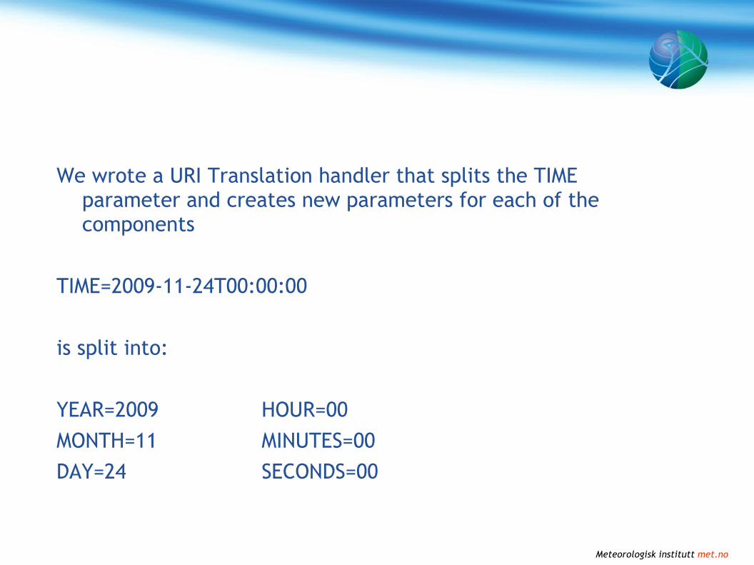
We wrote a URI Translation handler that splits the TIME parameter and creates new parameters for each of the components
TIME=2009-11-24T00:00:00
is split into:
YEAR=2009 HOUR=00
MONTH=11 MINUTES=00
DAY=24 SECONDS=00

Meteorologisk institutt met.no
Mapserver configuration
LAYER
NAME tam
DATA .../climate/tam/%YEAR%/%MONTH%/%DAY%.png
...
END
LAYER
NAME rr
DATA .../climate/rr/%YEAR%/%MONTH%/%DAY%.png
...
END

Meteorologisk institutt met.no
Mapserver configuration
With TIME=2009-11-24T00:00:00
LAYER
NAME tam
DATA .../climate/tam/2009/11/24.png
...
END
LAYER
NAME rr
DATA .../climate/rr/2009/11/24.png
...
END

Meteorologisk institutt met.no
Passthrough of Dimensions
• Mapserver does not pass through TIME, ELEVATION or any other dimensional parameters to remote WMS servers when acting as a cascading server
• It's possible to add TIME=%TIME%&ELEVATION=%ELEVATION% to connection string, to work around this
• %VARNAME% is case sensitive, WMS-parameter names are not

Meteorologisk institutt met.no
Passthrough of Dimensions
Solution:
• Wrote a URI Translation handler that packs all dimension parameters (TIME, ELEVATION, DIM_*) into a string
• Adds parameter PASSTHROUGH=<dimension string> to the query string
Mapserver config:
CONNECTION http:// localhost/diana?%PASSTHROUGH%& ...

Meteorologisk institutt met.no
Using Named Styles with mapserver
LAYER=sea.temp
STYLE=256colour
LAYER=sea.temp
STYLE=default

Meteorologisk institutt met.no
First attempt
LAYER=sea.temp_STYLE_256colour
STYLE=default
LAYER=sea.temp
STYLE=default

Meteorologisk institutt met.no
Using Named Styles with mapserver
• Works
• Requires special handling by client, or the styles will appear as two layers
• Poor support for named styles in clients, so we'd have to modify the client anyway
• Non-standard solution means we can't commit solution back to community
• Better to fix it server-side, so the client will think it's proper named styles

Meteorologisk institutt met.no
Using Named Styles with mapserver
Solution:
• Keep separate layers and naming convention in Mapserver
• Rewrite input from clients
• Filter GetCapabilities output from Mapserver

Meteorologisk institutt met.no
GetMap request translation
From client:• LAYERS=background,sea.temp,coastlines
• STYLES=default,256colours,default
Translated:• LAYERS=background,sea.temp_STYLE_256colours,coastlines
• STYLES=default,default,default
Mapserver will only see the translated LAYERS and STYLES parameters, and does not know what the client actually requested.

Meteorologisk institutt met.no
GetCapabilities filtering
• Mapserver's GetCapabilities response will treat each style as a separate layer
• Need to filter output from mapserver– Apache 1.3: RewriteRule + cgi-script– Apache 2.0: OutputFilter
• Locate all <Layer>-nodes where name contains _ STYLE _– Delete the <Layer> node– Add <STYLE>-node to the real layer

Meteorologisk institutt met.no
GetCapabilities filtering
<Layer>
<Name>sea.temp</Name>
<Title>Temperature</Title>
</Layer>
<Layer>
<Name>sea.temp_STYLE_256colours</Name>
<Title>Temperature (256colours)</Title>
</Layer>
Mapserver returns the two styles as two different layers

Meteorologisk institutt met.no
GetCapabilities filtering
<Layer>
<Name>sea.temp</Name>
<Title>Temperature</Title>
<Style>
<Name>default</Name>
<Title>default</Title>
</Style>
<Style>
<Name>256colours</Name>
<Title>256colours</Title>
</Style>
</Layer>
But the client will see it as one layer with two named styles

Meteorologisk institutt met.no
Thank You!


