2
ACT Planning & Land Authority Page 151 of 152 MacroPlan Australia Setting New Standards Appendix 10: Potential Planning Precincts

ACT Planning & Land Authority Page 151 of 152
MacroPlan Australia Setting New Standards
Appendix 10: Potential Planning Precincts
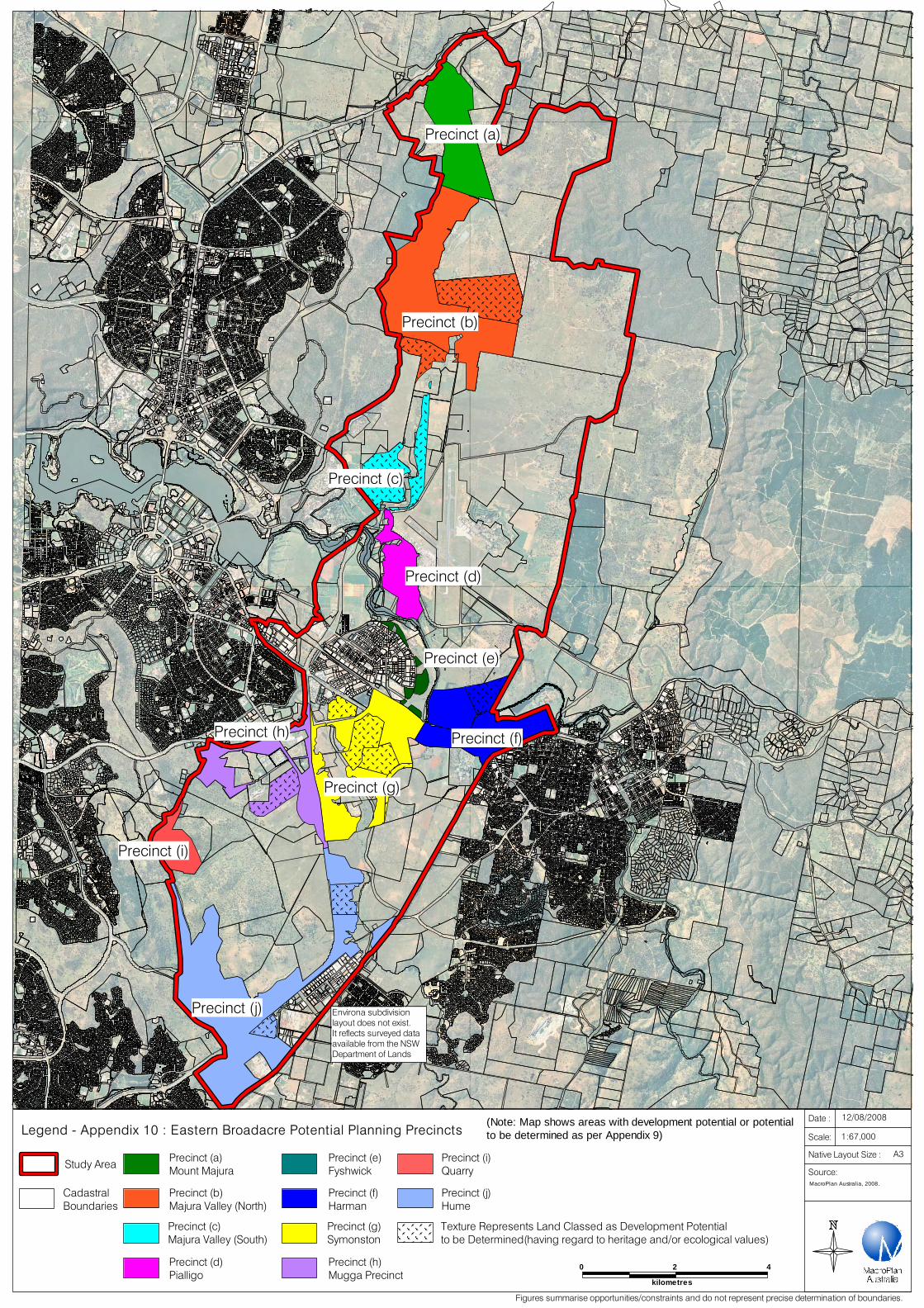
Legend - Appendix 10 : Eastern Broadacre Potential Planning Precincts
Study Area
Cadastral Boundaries
MacroPlan Australia, 2008.
Date :
Scale:
Native Layout Size :
12/08/2008
1:67,000
A3
Source:
Precinct (a)Mount Majura
Precinct (b)Majura Valley (North)
Precinct (c)Majura Valley (South)
Precinct (d)Pialligo
Environa subdivisionlayout does not exist.It reflects surveyed data available from the NSW Department of Lands
Figures summarise opportunities/constraints and do not represent precise determination of boundaries.
0 2 4
kilometres
Precinct (e)Fyshwick
Precinct (f)Harman
Precinct (g)Symonston
Precinct (h)Mugga Precinct
Precinct (i)Quarry
Precinct (j)Hume
Texture Represents Land Classed as Development Potentialto be Determined(having regard to heritage and/or ecological values)
Precinct (a)
Precinct (b)
Precinct (c)
Precinct (d)
Precinct (e)
Precinct (f)
Precinct (g)
Precinct (h)
Precinct (i)
Precinct (j)
(Note: Map shows areas with development potential or potential to be determined as per Appendix 9)


