10
The City of Winnipeg Appendices RFP No. 142-2012 Template Version: SrC120110218- C RFP APPENDIX C – AECOM’S LAND DRAINAGE PROPOSAL
| Date post: | 28-Jul-2018 |
| Category: |
Documents |
| Upload: | trinhkhuong |
| View: | 222 times |
| Download: | 2 times |

The City of Winnipeg Appendices RFP No. 142-2012 Template Version: SrC120110218- C RFP
APPENDIX C – AECOM’S LAND DRAINAGE PROPOSAL

AECOM 99 Commerce Drive 204 477 5381 tel Winnipeg, MB, Canada R3P 0Y7 204 284 2040 fax www.aecom.com
L-BNerinick-COW-2012-02-10-Plessis Underpass Land Drainage Study-60162461.docx
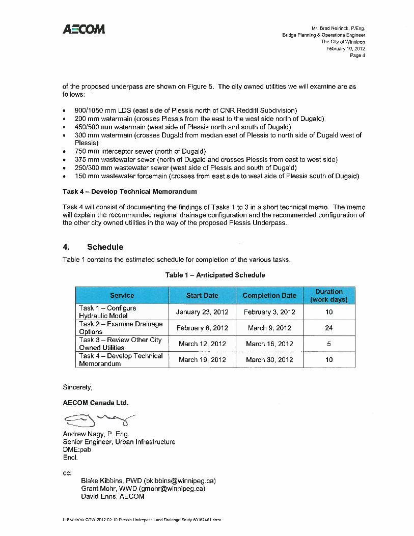
February 10, 2012 60162461 (600) VIA E-MAIL ([email protected]) Mr. Brad Neirinck, P.Eng. Bridge Planning & Operations Engineer The City of Winnipeg Public Works Department 106-1155 Pacific Avenue Winnipeg, MB R3E 3P1 Dear Mr. Neirinck: RE: Plessis Underpass RFP Write-up for Land Drainage Study As requested, below is the possible write-up that could be included in the upcoming RFP for the proposed underpass project. 1. Introduction The Plessis Underpass Land Drainage Study will examine at a conceptual level the regional land drainage system, the underpass drainage servicing configuration, and other city utilities that will be impacted by the construction of the Plessis Underpass. The study will largely focus on the regional land drainage system configuration since the area is currently serviced with a rural land drainage system that provides a very low level of service relative to the value of the surrounding development. The findings of the study will be summarized in a technical memorandum. 2. Background The proposed Plessis Underpass shown on Figure 1 will provide grade separation between vehicular traffic on Plessis Road and rail traffic on the C.N.R. Redditt Subdivision (Main Line). Land drainage servicing will be provided via a lift station and temporary storage. The temporary storage, which may be in the form of surface storage as well as oversized piping will eventually discharge back into the Dugald Drain which is the primary outlet for the South Transcona Drainage District and St. Boniface Industrials Lands. This is the drainage area located south of the C.N.R. Reddit Subdivision. The Dugald Drain, which is the ditch located on the south side of Dugald Road, is located approximately 200 m south of the current at-grade crossing between the C.N.R. Redditt Subdivision and Plessis Road. The preliminary design of the underpass indicates that part of Dugald Road and the intersection at Plessis Road will need to be lowered by up to 3 to 4 m because of its close proximity to the future underpass. Any significant lowering of Dugald Road will likely require the diversion of the Dugald Drain in one form or another. The Dugald Drain is the main drainage element that services the 1185 Ha South Transcona and St. Boniface Industrial Land Drainage Area shown on Figure 1. At Plessis Road, the Dugald Drain provides servicing for approximately 330 Ha (approximately 1.3 square miles) of mostly large lot residential development. This development is located between Plessis Road to the west, Murdock Road to the east, the C.N.R. Redditt Subdivision to the north and Esselmont Avenue to the south. The area has a long history of overland flooding problems arising from large rainstorm events with the worst flooding occurring in the summer of 1993. There were some major drainage upgrades implemented in the area following the 1993 events, however, the area is still, susceptible to major
Mr. Brad Neirinck, P.Eng. Bridge Planning & Operations Engineer
The City of Winnipeg February 10, 2012
Page 2
L-BNerinick-COW-2012-02-10-Plessis Underpass Land Drainage Study-60162461.docx
flooding events since the upgrades were intended as an interim solution and not a final drainage solution for the area. West of Plessis Road, stormwater retention basins (SRB’s) in the St. Boniface Industrial Park discharge to the Dugald Drain by way of a small lift station that is activated only after levels in the Dugald Drain subside. The Dugald Drain passes through the Mission Combined Sewer District (Mission CSD) and discharges to the Seine River just south of the Marion Street Bridge in Happyland Park. Because of the low level of service provided by the Dugald Drain, the long term plan is to diminish the importance of the drain as a regional drainage course and replace it with a new underground land drainage sewer (LDS) discharging to the Seine River. A portion of the future LDS Trunk is shown snaking through the Mission CSD on Figure 1. The existing SRB’s in the district will connect to the future LDS Trunk using the abandoned 1350/1200 mm Dugald Interceptor between Mazenod Road and Lagimodiere Boulevard. The currently undeveloped parts of the South Transcona and St Boniface Industrial Land Drainage Area will eventually be serviced with new SRB’s that will discharge to the future LDS Trunk and the St. Boniface Industrial Park SRB system. The future LDS Trunk will also serve to relieve a large part of the Mission CSD (by sewer separation) in addition to servicing the South Transcona and St Boniface Industrial Land Drainage Area. AECOM is currently working on the Mission CSD Basement Flooding Relief program for the City of Winnipeg Water and Waste Department which includes examining the outlet requirements for the South Transcona and St. Boniface Industrial Land Drainage Area. The Mission CSD is immediately west of the South Transcona and St. Boniface Industrial Land Drainage Area as shown on Figure 1. As a part of the Mission CSD Study, an InfoWorks CS model of the future South Transcona, St. Boniface Industrial and Mission land drainage systems has been developed. It will be modified and used for the Plessis Underpass Land Drainage Study. 3. Study Tasks Plessis Underpass Land Drainage Study will have four main components as follows. Task 1 – Configure Hydraulic Model Task 1, Will modify the InfoWorks CS model of the South Transcona and St. Boniface Industrial Land Drainage Areas created for the Mission CSD Study to reflect the existing or interim conditions in the district. The South Transcona model created for the Mission CSD Study already includes many existing drainage features however they require some refinement to ensure existing conditions are properly represented in the model. This includes configuring the future urban land drainage catchments already in the model to exhibit a rural runoff pattern and replicating the proper rise and fall of the SRB’s in the St. Boniface Industrial Park under existing conditions in the InfoWorks model. Task 1 will also include additional updates to the InfoWorks CS model containing the proposed land drainage system in South Transcona that was not included in the original InfoWorks CS model. These are required in order to determine the ultimate configuration of the underpass land drainage system.

Mr. Brad Neirinck, P.Eng. Bridge Planning & Operations Engineer
The City of Winnipeg February 10, 2012
Page 3
L-BNerinick-COW-2012-02-10-Plessis Underpass Land Drainage Study-60162461.docx
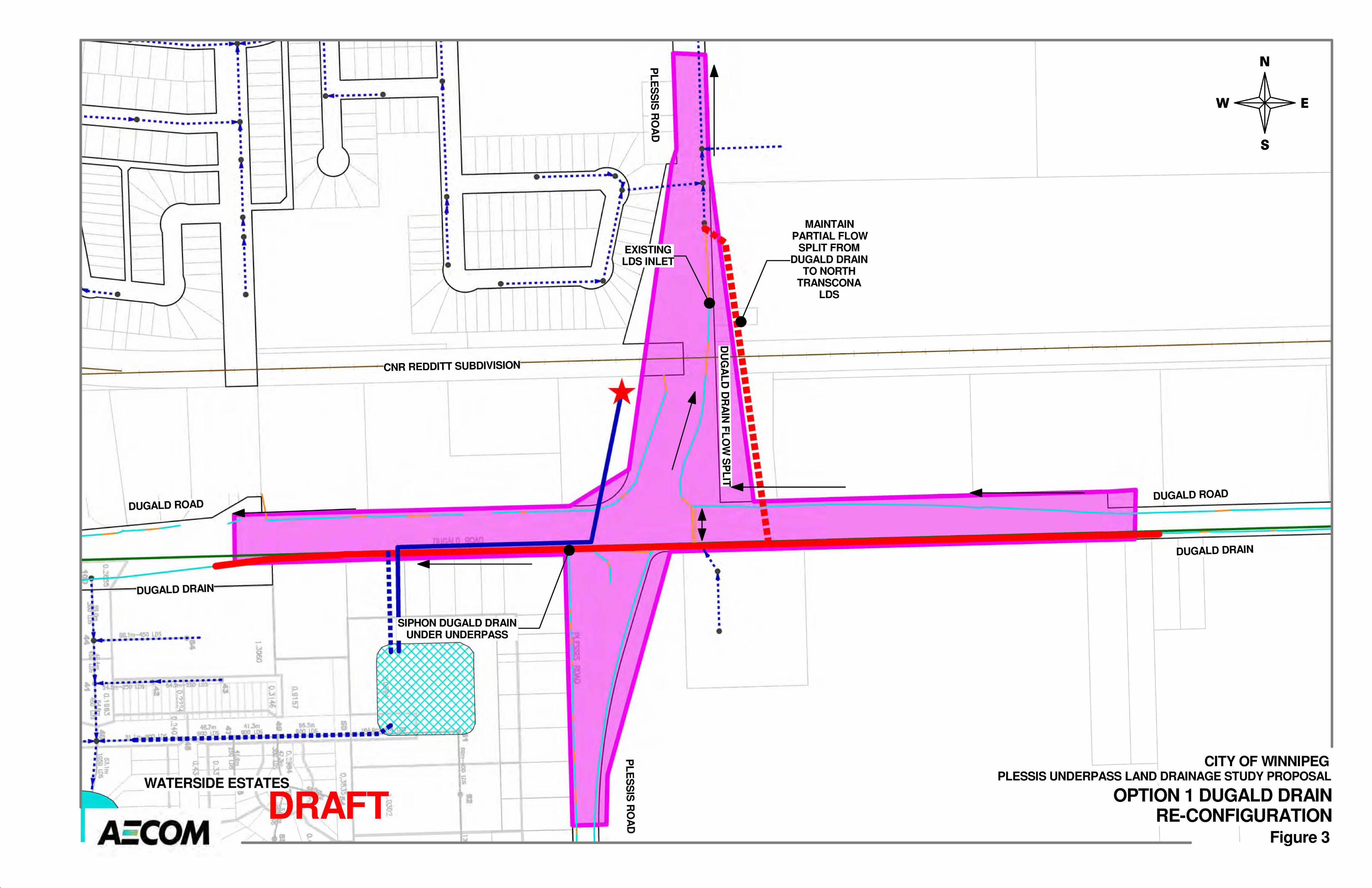
Task 2 – Examine Drainage Options Task 2 will focus on evaluating two main drainage options for the proposed Plessis Underpass regional drainage configuration. It will also examine multiple sub-options relative to these two main options with the InfoWorks CS model. Both options will assume that the Plessis Underpass will be serviced with a high capacity lift station, roughly sized based on the preliminary depressed area of approximately 8 Ha to 12 Ha and a 25 year design storm as per City of Winnipeg Drainage Safety Guidelines. The lift station will discharge to a smaller SRB or other storage element located on undeveloped land to the southwest of the Plessis Road and Dugald Road intersection or to an SRB located within the Transcona Golf Course lands. The final location will depend on which location is more feasible based on these investigations. The underpass drainage configuration in the area of the intersection is shown on Figure 2 using the SRB option located on the undeveloped lands to the southwest of the intersection. Option 1, which is shown in more detail on Figure 3, will focus on allowing the Dugald Drain to continue to operate as is, on an interim basis, until the underground regional LDS system in South Transcona and Mission Districts are fully constructed. Currently most of the runoff in the Dugald Drain continues westward along the Dugald Drain toward Lagimodiere Boulevard and the Seine River. However, about 25% of runoff that is generated east of Plessis Road heads north along the east side of Plessis Road to the underground LDS system located north of the C.N.R. Redditt Subdivision in North Transcona. Option 1 will also examine the best way to provide an outlet for the proposed underpass, both on an interim as well as a long term basis. One option that will be examined is the use of the abandoned interceptor sewer located within the Dugald Road right-of-way between Plessis Road and Mazenod Road. The abandoned Dugald Interceptor was replaced with a new parallel Dugald Interceptor beginning in 2006 from McFadden Street to Lagimodiere Boulevard. The 1350/1200 mm abandoned interceptor between Mazenod Road and Lagimodiere Boulevard is already envisioned to be a part of the regional land drainage system. The video inspections have determined that it is suitable for rehabilitation using a CIPP liner and/or small external point repairs. We will examine the abandoned 1050 mm interceptor from Plessis Road to Mazenod Road as the ultimate long term outlet for the Dugald Drain and the underpass SRB. Option 2, shown on Figure 4, will focus on diverting the Dugald Drain east of Plessis Road to the SRB’s in St. Boniface Industrial Park as an alternative to siphoning the drain under the underpass. Option 2 will assume the diversion uses the combination of a new open channel drain, possibly a new SRB and an underground LDS leading to the St. Boniface Industrial Park drainage system. Option 2 will examine both the interim condition (i.e. with the SRB’s in the St. Boniface Industrial Park being pumped to the Dugald Drain after the levels in the drain have subsided) and the ultimate long-term condition (i.e. with the new underground regional LDS trunk discharging to the Seine River). Option 2 will assume the same underpass drainage configurations as Option 1 with a high capacity lift station discharging to a small SRB or storage element near the Plessis Road and Dugald Road intersection. It should be noted that Option 2 will not likely be feasible under the current pumped outlet configuration (i.e. interim condition) but will likely require the permanent gravity outfall offered by the future LDS trunk to the Seine River as noted on Figure 1. Task 3 – Review Other City Owned Utilities Task 3 will focus on reviewing potential conflicts with the existing city owned utilities in the vicinity of the proposed Plessis Underpass and providing relocation options. The city owned utilities in the area