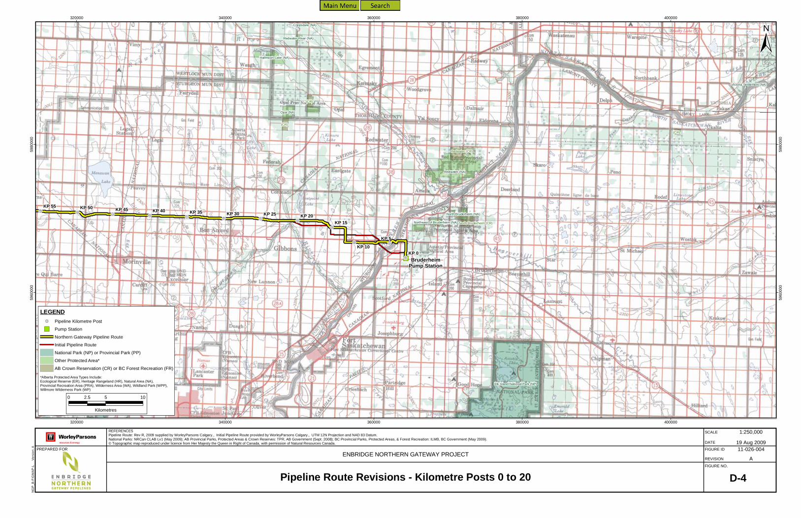
Sec. 52 Application Volume 3: Engineering, Construction and Operations Appendix D: Pipeline Route Alternatives May 2010 Page D-1 Appendix D Pipeline Route Alternatives List of Maps Map No. Description D-1 Alternative Sites for Initiating Pump Station D-2 Alternative Sites for Kitimat Terminal D-3 Initial Pipeline Route Alternatives D-4 Pipeline Route Revisions – Kilometre Posts 0 to 20 D-5 Pipeline Route Revisions – Kilometre Posts 186 to 260 D-6 Pipeline Route Revisions – Kilometre Posts 310 to 415 D-7 Pipeline Route Revisions – Kilometre Posts 415 to 475 D-8 Pipeline Route Revisions – Kilometre Posts 475 to 535 D-9 Pipeline Route Revisions – Kilometre Posts 634 to 681 D-10 Pipeline Route Revisions – Kilometre Posts 810 to 833 D-11 Pipeline Route Revisions – Kilometre Posts 915 to 927 D-12 Pipeline Route Revisions – Kilometre Posts 955 to 1042 D-13 Pipeline Route Revisions – Kilometre Posts 1067 to 1161
Transcript
Sec. 52 Application Volume 3: Engineering, Construction and Operations Appendix D: Pipeline Route Alternatives
May 2010 Page D-1
Appendix D Pipeline Route Alternatives List of Maps
Map No. Description D-1 Alternative Sites for Initiating Pump Station D-2 Alternative Sites for Kitimat Terminal D-3 Initial Pipeline Route Alternatives D-4 Pipeline Route Revisions – Kilometre Posts 0 to 20 D-5 Pipeline Route Revisions – Kilometre Posts 186 to 260 D-6 Pipeline Route Revisions – Kilometre Posts 310 to 415 D-7 Pipeline Route Revisions – Kilometre Posts 415 to 475 D-8 Pipeline Route Revisions – Kilometre Posts 475 to 535 D-9 Pipeline Route Revisions – Kilometre Posts 634 to 681 D-10 Pipeline Route Revisions – Kilometre Posts 810 to 833 D-11 Pipeline Route Revisions – Kilometre Posts 915 to 927 D-12 Pipeline Route Revisions – Kilometre Posts 955 to 1042 D-13 Pipeline Route Revisions – Kilometre Posts 1067 to 1161
Edmonton
BruderheimStation Site
Edmonton Initiating PumpStation Alternative Site
North Saskatchewan River
Paddle R
iver
Pembina River
Sturge
on Rive
r Beaverhill Creek
Vermilion River
Bruderheim
Pembina River Moon Lake (NA)
Elk Island National Park (NP)
Miquelon Lake (PP)
Lois Hole Centennial (PP)
Thunder Lake (PP)
Wabamun Lake (PP)
Strathcona Science (PP)
KP 0KP 75KP 50
KP 25
KP 125KP 100
Cooking Lake-Blackfoot (PRA)
Beaverhill Lake Heritage Rangeland (NA)
Redwater (NA)
Opal (NA)
Parkland (NA)
Roselea (NA)
Wagner (NA)
Halfmoon Lake (NA)
Matthews Crossing (NA)
Lily Lake (NA)Bilby (NA)
Beaverhill (NA)
Isle Lake (NA)
Sundance (NA)
Park Court (NA)
Riverlot 56 (NA)
North Cooking Lake (NA)
Thorsby (NA)
Edgar T. Jones (NA)
Crippsdale (NA)
Kakina Lake (NA)
Majeau Lake (NA)George Lake (NA)
Halfway Lake (NA)
Prefontaine Brock Lakes (NA)
Sherwood Park (NA)
Pembina River (NA)
Redwater River (NA)
Dussault Lake (NA)
Lac La Nonne (NA)
Newton Lake (NA)
Clifford E. Lee (NA)
Victoria Settlement (NA)
Bear Lake (NA)
Gunn (PRA)
Antler Lake Island (NA)
Hastings Lake Islands (NA)WABAMUN 133A
ALEXIS 133
ALEXANDER 134
STONY PLAIN 135
WABAMUN 133B
STONY PLAIN 135A
Leduc
St. Albert
Fort Saskatchewan
Spruce Grove
Beaverhill LakeWabamun Lake
Big Lake
Legal
Devon
Calmar
Mundare
Gibbons
Tofield
Beaumont
Redwater
Westlock
Barrhead
Vegreville
Bon Accord
Morinville
Stony Plain
33
2
15
16
18
45
14
28
43
39
651
60
37
21
19
63
2A
14X100
33
18
2
2
2
28
43
112°0'0"W
112°40'0"W
112°40'0"W
113°20'0"W
113°20'0"W
114°0'0"W
114°0'0"W
114°40'0"W
114°40'0"W
54°0'
0"N
54°0'
0"N
53°40
'0"N
53°40
'0"N
53°20
'0"N
53°20
'0"N
PREPARED FOR
D-1Alternative Sites for the Initiating Pump StationENBRIDGE NORTHERN GATEWAY PROJECT
LEGENDPipeline Kilometre PostPump StationTownNorthern Gateway Pipeline RouteMajor Road
Major RailwayCityIndian ReserveNational Park (NP) or Provincial Park (PP)Other Protected Area*
11-026-001
FIGURE NO.
SCALE
REVISION
DATEFIGURE ID
NGP_
B-FIG
MAP-
L V
ersion
: A
*Alberta Protected Area Types Include:Ecological Reserve (ER), Heritage Rangeland (HR), Natural Area (NA), Provincial Recreation Area (PRA),Wilderness Area (WA), Wildland Park (WPP), Willmore Wilderness Park (WP)
Eagle Bay Park (PP)
Kitimat Terminal Site
Alternate Site 1
Alternate Site 2Alternate Site 3
Kitimat River
Kitimat
Kitamaat Village
KP 1150KP 1170
KP 1165 KP 1160
KP 1155KP 1172.19
Eagle Bay Park (PP)
Kitimat River Park (PP)
Coste Rocks Park (PP)
Jesse Falls Protected Area (PA)
(FR)
(FR)
KITAMAAT 2
KITAMAAT 1
BEES 6
JUGWEES 5
WALTH 3HENDERSON'S RANCH 11
KITASA 7
KUASTE 8
5100
00
5100
00
5200
00
5200
00
530000
5300
00
5960000
5960000
5970000
5970000
5980000
5980000
5990000
PREPARED FOR
D-2Alternative Sites for the Kitimat TerminalENBRIDGE NORTHERN GATEWAY PROJECT
LEGENDPipeline Kilometre PostNorthern Gateway Pipeline RouteKitimat Terminal DrawingKitimat Terminal Facility BoundaryAlternate SiteInstitutionalExisting and Proposed ResidentialExisting and Proposed RecreationalExisting and Proposed IndustrialExisting and Proposed CommercialIndian ReserveNational Park (NP) or Provincial Park (PP)Other Protected Area*BC Forest Recreation (FR)
11-026-002
FIGURE NO.
SCALE
REVISION
DATEFIGURE ID
5990000
NGP_
B-FIG
MAP-
L V
ersion
: A
*British Columbia Protected Area Types Include:Conservancy (CV), Ecological Reserve (ER),Protected Area (PA), Recreation Area (RA),Wildlife Management Area (WMA)
LEGENDPipeline Kilometre PostPump StationNorthern Gateway Pipeline RouteInitial Pipeline RouteNational Park (NP) or Provincial Park (PP)Other Protected Area*AB Crown Reservation (CR) or BC Forest Recreation (FR)
11-026-004
FIGURE NO.
SCALE
REVISION
DATEFIGURE ID
NGP_
B-FIG
MAP-
L V
ersion
: A
*Alberta Protected Area Types Include:Ecological Reserve (ER), Heritage Rangeland (HR), Natural Area (NA),Provincial Recreation Area (PRA), Wilderness Area (WA), Wildland Park (WPP),Willmore Wilderness Park (WP)
Carson-Pegasus (PP)
KP 275KP 270
KP 265
KP 245
KP 240
KP 235KP 230 KP 225 KP 220
KP 260
KP 255KP 250
KP 205KP 200
KP 195
KP 190
KP 185KP 180
KP 215
KP 210
KP 175
Whitecourt Mountain (NA)
Groat Creek (PRA)
(CR)(CR)
WhitecourtPump Station
5200
00
520000
540000
540000
560000
560000
580000
580000
600000
6000
00
5980000
5980
000
6000000
6000
000
6020000
6020
000
6040000
6040
000
PREPARED FOR
D-5Pipeline Route Revisions - Kilometre Posts 186 to 260ENBRIDGE NORTHERN GATEWAY PROJECT
LEGENDPipeline Kilometre PostPump StationNorthern Gateway Pipeline RouteInitial Pipeline RouteNational Park (NP) or Provincial Park (PP)Other Protected Area*AB Crown Reservation (CR) or BC Forest Recreation (FR)
11-026-005
FIGURE NO.
SCALE
REVISION
DATEFIGURE ID
NGP_
B-FIG
MAP-
L V
ersion
: A
*Alberta Protected Area Types Include:Ecological Reserve (ER), Heritage Rangeland (HR), Natural Area (NA),Provincial Recreation Area (PRA), Wilderness Area (WA), Wildland Park (WPP),Willmore Wilderness Park (WP)
KP 410KP 405
KP 400
KP 395
KP 390
KP 385
KP 415
KP 380
KP 375
KP 355
KP 350
KP 345
KP 340 KP 335KP 330
KP 370
KP 365 KP 360
KP 325
KP 320
KP 315
KP 310
KP 305
Smoky RiverPump Station
4000
00
400000
420000
420000
440000
440000
460000
460000
480000
4800
00
6020000
6020
000
6040000
6040
000
6060000
6060
000
6080000
6080
000
PREPARED FOR
D-6Pipeline Route Revisions - Kilometre Posts 310 to 415ENBRIDGE NORTHERN GATEWAY PROJECT
LEGENDPipeline Kilometre PostPump StationNorthern Gateway Pipeline RouteInitial Pipeline RouteTransCanada Alberta System Pipeline Route AlternativeNational Park (NP) or Provincial Park (PP)Other Protected Area*AB Crown Reservation (CR) or BC Forest Recreation (FR)
11-026-006
FIGURE NO.
SCALE
REVISION
DATEFIGURE ID
NGP_
B-FIG
MAP-
L V
ersion
: A
*Alberta Protected Area Types Include:Ecological Reserve (ER), Heritage Rangeland (HR), Natural Area (NA),Provincial Recreation Area (PRA), Wilderness Area (WA), Wildland Park (WPP),Willmore Wilderness Park (WP)
Alberta
British Columbia
KP 505
KP 500
KP 495 KP 490
KP 485KP 480 KP 475
KP 470
KP 450 KP 445KP 440
KP 435 KP 430
KP 425
KP 465
KP 460
KP 455KP 410
KP 405
KP 400
KP 395
KP 420
KP 415
Musreau Lake (PRA)
Shuttler Flats (PRA)
Big Mountain Creek (PRA)
Smoky RiverPump Station
3200
00
320000
340000
340000
360000
360000
380000
380000
400000
400000
420000
4200
00
6060000
6060
000
6080
000
6080
000
6100000
6100
000
PREPARED FOR
D-7Pipeline Route Revisions - Kilometre Posts 415 to 475ENBRIDGE NORTHERN GATEWAY PROJECT
LEGENDPipeline Kilometre PostPump StationNorthern Gateway Pipeline RouteInitial Pipeline RouteTransCanada Alberta System Pipeline Route AlternativeNational Park (NP) or Provincial Park (PP)Other Protected Area*AB Crown Reservation (CR) or BC Forest Recreation (FR)
11-026-007
FIGURE NO.
SCALE
REVISION
DATEFIGURE ID
NGP_
B-FIG
MAP-
L V
ersion
: A
*Alberta Protected Area Types Include:Ecological Reserve (ER), Heritage Rangeland (HR), Natural Area (NA),Provincial Recreation Area (PRA), Wilderness Area (WA), Wildland Park (WPP),Willmore Wilderness Park (WP)
Albert
aBr
itish C
olumb
ia
Bearhole Lake Park (PP)
KP 550 KP 545 KP 540 KP 535 KP 530 KP 525
KP 505KP 500
KP 495KP 490
KP 485
KP 480
KP 520KP 515
KP 510
KP 475KP 470
KP 450KP 465
KP 460KP 455
Shuttler Flats (PRA)
Bearhole Lake Protected Area (PA)
(FR)
(FR)
280000
280000
300000
300000
320000
320000
340000
340000
360000
360000
6060
000
6060
000
6080
000
6080
000
6100
000
6100
000
PREPARED FOR
D-8Pipeline Route Revisions - Kilometre Posts 475 to 535ENBRIDGE NORTHERN GATEWAY PROJECT
LEGENDPipeline Kilometre PostPump StationNorthern Gateway Pipeline RouteInitial Pipeline RouteNational Park (NP) or Provincial Park (PP)Other Protected Area*AB Crown Reservation (CR) or BC Forest Recreation (FR)
11-026-008
FIGURE NO.
SCALE
REVISION
DATEFIGURE ID
NGP_
B-FIG
MAP-
L V
ersion
: A
*Alberta Protected Area Types Include:Ecological Reserve (ER), Heritage Rangeland (HR), Natural Area (NA),Provincial Recreation Area (PRA), Wilderness Area (WA), Wildland Park (WPP),Willmore Wilderness Park (WP)*British Columbia Protected Area Types Include:Conservancy (CV), Ecological Reserve (ER), Protected Area (PA),Recreation Area (RA), Wildlife Management Area (WMA)
Monkman Park (PP)
Arctic Pacific Lakes Park (PP)
KP 705 KP 700 KP 695 KP 690KP 685
KP 680
KP 675KP 655
KP 650KP 645
KP 640
KP 635
KP 670KP 665 KP 660
KP 615
KP 610 KP 605
KP 600 KP 595
KP 630
KP 625KP 620
Tacheeda Lakes Ecological Reserve (ER)
Greg Duke Memorial Rec (FR)
Wicheeda Lake (FR)
(FR)
(FR)
(FR)
(FR)
(FR)
(FR)
(FR)
(FR)
Tumbler RidgePump Station
540000
540000
560000
560000
580000
580000
600000
600000 620000
6200
00
6020
000
6020000
6040
000
6040
000
6060
000
6060
000
6080000
6080
000
PREPARED FOR
D-9Pipeline Route Revisions - Kilometre Posts 634 to 681ENBRIDGE NORTHERN GATEWAY PROJECT
LEGENDPipeline Kilometre PostPump StationNorthern Gateway Pipeline RouteInitial Pipeline RouteNational Park (NP) or Provincial Park (PP)Other Protected Area*AB Crown Reservation (CR) or BC Forest Recreation (FR)
11-026-009
FIGURE NO.
SCALE
REVISION
DATEFIGURE ID
NGP_
B-FIG
MAP-
L V
ersion
: A
*British Columbia Protected Area Types Include:Conservancy (CV), Ecological Reserve (ER), Protected Area (PA),Recreation Area (RA), Wildlife Management Area (WMA)
Sutherland River Park (PP)
Stuart River Park (PP)
Mount Pope Park (PP)
Paarens Beach Park (PP)
Babine Lake Marine Park (PP)
Rubyrock Lake Park (PP)
Sowchea Bay Park (PP)
Stuart Lake Marine Park (PP)
KP 860 KP 855 KP 850 KP 845KP 840
KP 835
KP 830
KP 825KP 820
KP 815
KP 810 KP 805 KP 800
KP 900 KP 895
KP 890 KP 885 KP 880 KP 875 KP 870KP 865
Sutherland River Protected Area (PA)
(FR)
(FR)
(FR)
(FR)
(FR)
(FR)
(FR)
(FR)
(FR)
(FR)
(FR)
(FR)
(FR)
(FR)
(FR)
(FR)
(FR)
(FR)
(FR)
(FR)
(FR) (FR)
(FR)
(FR)
(FR)
(FR)
(FR)
(FR)
Fort St. JamesPump Station
360000
360000
380000
380000
400000
400000
420000
420000
440000
440000
6000
000
6000
000
6020
000
6020
000
6040
000
6040
000
PREPARED FOR
D-10Pipeline Route Revisions - Kilometre Posts 810 to 833ENBRIDGE NORTHERN GATEWAY PROJECT
LEGENDPipeline Kilometre PostPump StationNorthern Gateway Pipeline RouteInitial Pipeline RouteNational Park (NP) or Provincial Park (PP)Other Protected Area*AB Crown Reservation (CR) or BC Forest Recreation (FR)
11-026-010
FIGURE NO.
SCALE
REVISION
DATEFIGURE ID
NGP_
B-FIG
MAP-
L V
ersion
: A
*British Columbia Protected Area Types Include:Conservancy (CV), Ecological Reserve (ER), Protected Area (PA),Recreation Area (RA), Wildlife Management Area (WMA)
LEGENDPipeline Kilometre PostPump StationNorthern Gateway Pipeline RouteInitial Pipeline RouteNational Park (NP) or Provincial Park (PP)Other Protected Area*AB Crown Reservation (CR) or BC Forest Recreation (FR)
11-026-011
FIGURE NO.
SCALE
REVISION
DATEFIGURE ID
NGP_
B-FIG
MAP-
L V
ersion
: A
*British Columbia Protected Area Types Include:Conservancy (CV), Ecological Reserve (ER), Protected Area (PA),Recreation Area (RA), Wildlife Management Area (WMA)
HoustonPump Station
KP 1000
Tazdli Wyiez Bin/Burnie-Shea Park (PP)
Nanika-Kidprice Park (PP)
Nadina Mountian Park (PP)Morice Lake Park (PP)
Old Man Lake Park (PP)
KP 995
KP 990KP 985
KP 980 KP 975
KP 970 KP 965 KP 960
KP 955 KP 950
KP 1055
KP 1050 KP 1045KP 1040
KP 1035
KP 1030 KP 1025 KP 1020KP 1015 KP 1010
KP 1005
Morice River Ecological Reserve (ER)
Morice Mtn Ski Trail / Silverthorne Lake Rec. Site (FR)
Owen Hill (FR)
Thautil-burnie Lakes Trail (FR)
Lamprey Tableland Trail (FR)
Mt. Harry Davis (FR)
Owen Flats "A" & "B" (FR)
(FR)
(FR)
(FR)
(FR)
(FR)
(FR)
(FR)
(FR)
(FR)
(FR)
(FR)
(FR)
(FR)
(FR)
(FR)
(FR)
(FR)
(FR)
(FR)(FR)
(FR)
(FR)
600000
600000
620000
620000
640000
640000
660000
660000
680000
680000
6000
000
6000
000
6020
000
6020
000
PREPARED FOR
D-12Pipeline Route Revisions - Kilometre Posts 955 to 1042ENBRIDGE NORTHERN GATEWAY PROJECT
LEGENDPipeline Kilometre PostPump StationNorthern Gateway Pipeline RouteInitial Pipeline RouteNational Park (NP) or Provincial Park (PP)Other Protected Area*AB Crown Reservation (CR) or BC Forest Recreation (FR)
11-026-012
FIGURE NO.
SCALE
REVISION
DATEFIGURE ID
NGP_
B-FIG
MAP-
L V
ersion
: A
*British Columbia Protected Area Types Include:Conservancy (CV), Ecological Reserve (ER), Protected Area (PA),Recreation Area (RA), Wildlife Management Area (WMA)
A
B
C
TunnelTunnel
TunnelTunnel
Kitimat Terminal
Lakelse Lake Park (PP)
4.3 km
3.3 km8.8 km
8.9 km
D
ClearwaterPump Station
6.5 km
6.6 km KP 1080
Clore Tunnel
Hoult Tunnel
Morice Lake Park (PP)
Gitnadoiks River Park (PP)
Atna River Park (PP)
Tazdli Wyiez Bin/Burnie-Shea Park (PP)
Foch-Gilttoyees Park (PP)
Nanika-Kidprice Park (PP)
Lakelse Lake Wetlands Park (PP)
Hai Lake - Mount Herman Park (PP)
Lakelse Lake Park (PP)
Lower Skeena River Park (PP)
Nalbeelah Creek Wetlands Park (PP)
Kitimat River Park (PP)
KP 1070
KP 1065
KP 1150
KP 1145
KP 1140
KP 1060KP 1055
KP 1050 KP 1045 KP 1040
KP 1135
KP 1130KP 1125
KP 1120 KP 1115KP 1110
KP 1105
KP 1100
KP 1095KP 1090
KP 1170
KP 1165
KP 1085
KP 1075
KP 1160
KP 1155
KP 1172.19
Williams Creek Ecological Reserve (ER)
Burnie River Protected Area (PA)
Swan Creek Protected Area (PA)
Thautil-burnie Lakes Trail (FR)
Lamprey Tableland Trail (FR)
Tableland-kidprice Trail (FR)
Clearwater Lakes Tr. (FR)
Nanika Lake Trail (FR)
(FR)
(FR)
(FR)
(FR)(FR)
(FR)(FR)
(FR)
(FR)
(FR)
(FR)
(FR)
(FR)
(FR)
(FR)
(FR)(FR)500000
500000
520000
520000
540000
540000
560000
560000
580000
580000
600000
600000
5980
000
5980
000
6000
000
6000
000
6020
000
6020
000
PREPARED FOR
D-13Pipeline Route Revisions - Kilometre Posts 1067 to 1161ENBRIDGE NORTHERN GATEWAY PROJECT
LEGENDPipeline Kilometre PostPump StationNorthern Gateway Pipeline RouteInitial Pipeline RouteKitimat River via Davies Creek (Alternative A)Hirsch Creek South (Alternative B)Hirsch Creek North (Alternative C)Williams Creek (Alternative D)National Park (NP) or Provincial Park (PP)Other Protected Area*AB Crown Reservation (CR) or BC Forest Recreation (FR)
11-026-013
FIGURE NO.
SCALE
REVISION
DATEFIGURE ID
NGP_
B-FIG
MAP-
L V
ersion
: A
*British Columbia Protected Area Types Include:Conservancy (CV), Ecological Reserve (ER), Protected Area (PA),Recreation Area (RA), Wildlife Management Area (WMA)