30
January 2016 Appendix F – Underwater Archaeological Assessment Report • ADCO – Underwater Archaeological Assessment Report (October 2008)

January 2016
Appendix F – Underwater Archaeological Assessment Report
• ADCO – Underwater Archaeological Assessment Report
(October 2008)
Underwater Archaeological Assessment
Beach Re-nourishment Area South Bay, Rosslare
Co. Wexford
08D064, 08R197
THE ARCHAEOLOGICAL DIVING COMPANY LTD.

Underwater Archaeological Assessment Beach Re-nourishment Area
South Bay, Rosslare Co. Wexford
08D064, 08R197
3rd October 2008 Project Director Dr. Niall Brady Project Archaeologist Rex Bangerter MA Brehon House, Kilkenny Road, Castlecomer, Co. Kilkenny [email protected] THE ARCHAEOLOGICAL DIVING COMPANY LTD.

CONTENTS
SUMMARY 1
LIST OF FIGURES 2
LIST OF PLATES 2
1.0 INTRODUCTION 3
2.0 PROPOSED DEVELOPMENT 4
3.0 THE RECEIVING ENVIRONMENT 4
4.0 SURVEY METHODOLOGY 8
5.0 ARCHAEOLOGICAL ASSESSMENT 9
6.0 PROPOSED IMPACTS 10
7.0 RECOMMENDATIONS 11
8.0 ACKNOWLEDGEMENTS 11
Appendix 1: Shipwrecks Listed in the Shipwreck Inventory for the South Coast of Co. Wexford.
12
FIGURES AND PLATES

08D064, 08R197 South Bay, Rosslare Underwater Archaeological Assessment Co. Wexford
A D C O 1
SUMMARY
The Archaeological Diving Company Ltd. was appointed by RPS Group,
consulting engineers on behalf of Wexford County Council, to undertake
an underwater archaeological assessment of a 550m x 380m area of
seabed, prior to a proposed beach re-nourishment programme within
South Bay, Rosslare, Co. Wexford. The re-nourishment material will be
dredged from a large sandbar located outside the breakwater at Rosslare
Europort. This material will be spread across a designated, near-shore,
dump zone within South Bay, located between National Grid Reference
numbers: 311181.2370E/ 113420.0219N - 311589.3054E/ 113768.7028N,
and 311828.3556E/ 113465.7805N - 311414.6653E/ 113123.6322N. The
material will provide beach re-nourishment sediment for Rosslare Strand
and help to mitigate against the impact Rosslare Euorport has had on
the sediment transport regime in the area.
Systematic visual inspection of the designated dump zone area was
undertaken. In addition, a metal-detection survey was undertaken
across a 400m x 40m seabed area to provide a sample of the frequency
of hits to be expected from this arte of seabed; due to the size of the
survey area it was not possible to undertake a metal-detection survey of
the area in its entirety. No archaeologically significant material,
deposits, or structures were revealed within the survey area. The work
was carried out under licence from the Department of the Environment,
Heritage, and Local Government (DoEHLG), on the 25th and 26th August
2008; licence numbers: 08D064, 08R197.
This report recommends that further archaeological assessment in
advance of construction works is not required. In addition, as seabed
impacts are restricted to the placement of dredged material and no
sediment removal will take place within the survey area, no
archaeological mitigation measures are required for the operational
phase of the proposed development.

08D064, 08R197 South Bay, Rosslare Underwater Archaeological Assessment Co. Wexford
A D C O 2
LIST OF FIGURES
Figure 1: Discovery Series 1:50,000 map showing approximate location of ADCO seabed survey area.
Figure 2: Extract of Project Drawing showing location and extent of proposed re-deposition area associated with the beach re-nourishment programme.
Figure 3: Extract from RMP 6” OS mapping (Wexford Sheet: 48) showing location of ADCO Survey Area, Rosslare Harbour, and the South Bay Area
Figure 4: Extract of Project Drawing showing plate locations and extent ADCO visual survey and metal-detection survey areas.
LIST OF PLATES
Plate 1: West-facing view of the strand from north-west corner of the Survey Area (NW corner buoyed).
Plate 2: South-southeast view of survey area from northwest corner of the designated re-deposition zone.
Plate 3: Working shot of diver establishing coordinates for the dropping of surface marker buoys at the four corners of the survey area.
Plate 4: Shot of sandy seabed at NGR: 311294E, 113464N.
Plate 5: Shot of sandy seabed at NGR: 311419E, 113392N.
Plate 6: Shot of sandy seabed at NGR: 311530E, 113286N.
Plate 7: Shot of part of seabed mound at NGR: 311405E, 113560N.
Plate 8: Shot of part of seabed mound at NGR: 311577E, 113517N.
Plate 9: Shot of part of seabed mound at NGR: 311704E, 113474N.

08D064, 08R197 South Bay, Rosslare Underwater Archaeological Assessment Co. Wexford
A D C O 3
1.0 INTRODUCTION The Archaeological Diving Company Ltd (ADCO) was appointed by RPS Group,
consulting engineers on behalf of Wexford County Council, to undertake a non-
disturbance archaeological assessment of a 550m x 380m section of seabed located
within South Bay, Rosslare, Co. Wexford (Figure 1, Plates 1-2). The assessment was
undertaken prior the proposed dumping of dredged seabed-material within the
designated survey area; this material being used to re-nourish Rosslare Strand and
help mitigate against the impact Rosslare Europort has had on the sediment transport
regime in the area.
A seabed dredging programme will be undertaken along a large sandbar that has
built up against the main breakwater at the Rosslare Europort Terminal. The sand bar
will not be dredged to beneath its original, pre-formation, beach-level. No
archaeological assessment of the dredge site was required by the Department of the
Environment, Heritage, and Local Government (DoEHLG).1
The archaeological assessment was focused on the immediate impact area and
sought to identify and record the location, nature and dimensions of any
archaeological features, fabric or artefacts that may be impacted by the proposed
development. In addition, a buffer-zone was incorporated into the archaeological
survey, extending the survey by 20m+ around the seabed dump zone.
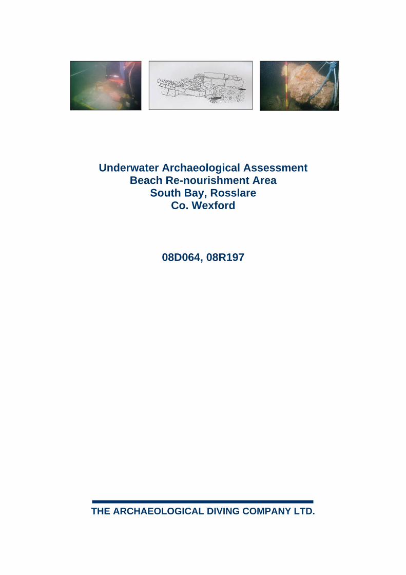
The underwater assessment was carried out on 25th-26th August 2008 by a team of
three maritime archaeologists and a certified dive supervisor.
The following report addresses the known and potential archaeological environment;
assesses the actual and proposed impacts on that environment from the works
programme; and makes recommendations to resolve any further archaeological
requirements during/ following the works programme.
1 Communication from DoEHLG to RPS.

08D064, 08R197 South Bay, Rosslare Underwater Archaeological Assessment Co. Wexford
A D C O 4
2.0 PROPOSED DEVELOPMENT2
It is proposed to remove the seabed deposits that have built-up against the main
breakwater at Rosslare Europort. This material will be removed by suction dredger,
down to original beach level, and be re-deposited within a designated seabed area
within South Bay (Figure 2). The designated seabed dump zone is located 300m east
of the High Water Mark, within the near-shore zone. It will be located between the
following National Grid coordinates: a). 311181.2370E/ 113420.0219N, b).
311589.3054E/ 113768.7028N, c). 311828.3556E/ 113465.7805N, d).
311414.6653E/ 113123.6322N.
3.0 THE RECEIVING ENVIRONMENT
The earliest exploitation of the Wexford coastline is likely to date to the Mesolithic
Period (c.5000BC -3000BC) and is confirmed by the recovery of flint tools of ‘Larnian
type’ from the east and south east coast. Further prehistoric activity is evidenced with
the presence of coastal midden sites, of possible Neolithic date, at Clare Island and
the River Slaney Estuary. It is likely that any prehistoric settlement within Co. Wexford
was focused around the River Slaney Estuary; a valuable landscape resource
providing transport links, coastal exploitation, and fertile floodplains for the earliest
settlers. This resource was further developed within the Bronze Age which saw the
Wexford coast act as an arrival-point for influences, artefacts, and individuals from
Britain and the Continent.
The arrival of Celtic speaking peoples from the continent (C.500BC) saw increased
coastal exploitation, the beginning of maritime trade, and construction of
sophisticated seagoing vessels. This maritime culture was additionally developed by
the introduction of Scandinavian seafaring peoples in the tenth-century, establishing
complex commercial operations based around the exploitation of Ireland’s east coast,
most notably in Wexford, Waterford, and Dublin.
This maritime economy was accelerated with the Anglo-Norman incursion into
Ireland, 1169-70, and the subsequent settlement of Wexford Town. The medieval
period saw a blossoming of maritime activity, both in shipbuilding, mercantile
seafaring, and fishing within the estuarine settlements at Waterford, New Ross, and
Wexford town.
2 This is an overview of the available information, forwarded by RPS Group and does not relate to specific engineering details.
08D064, 08R197 South Bay, Rosslare Underwater Archaeological Assessment Co. Wexford
A D C O 5
By the sixteenth-century a vibrant trade had been created in which large quantities of
coal being imported from Wales and fish, hides, timber, and raw produce being
exported from Wexford and New Ross. In addition, the fishing industry was of great
importance to local communities and by the seventeenth-century fish became the
areas major export commodity.
Rosslare Harbour was developed in the mid-nineteenth century to provide safe
anchorage on the south easternmost tip of the Wexford coastline, c. 15km from
Wexford town. The port developed due to its geographic location (c.50m miles from
the Welsh coast) as a port for cross channel shipping. By 1906 the Fishguard to
Rosslare Harbour Ferry Service was established and today the harbour functions
largely as a ferry port and roll-on roll-off terminal.
Record of Monuments and Places3
The Record of Monuments & Places (RMP) is a list of archaeological sites known to
the National Monuments Service with accompanying RMP Maps, based on OS 6”
Sheets, which indicate the location of each recorded site. The RMP list is based on
The Sites and Monuments Record files housed in the National Monuments Services
offices. The Sites and Monuments Records (SMR) are lists with accompanying maps
and files of all known or possible archaeological sites and monuments, predominately
pre-1700AD in date, for all counties.
There are no sites listed in the RMP for the stretch of coastline adjacent to the
proposed re-deposition area. Only three sites are listed for the wider area and are
included below in Table 1 (Figure 3):
SMR number:
Townland: NGR: Site type/Description: Distance from Survey Area:
WX48-06 Churchtown 31006E, 11281N
Church/Graveyard: situated in an area of flat rolling countryside – large extended fields to the south, east, and north of church enclosure. Site consists of an irregular straight-sided enclosure with entrance arch feature. Interior features include a church in ruins and large assortment of 18th-20th century grave markers. The enclosure is a 5-sided construction (46mE-W and 39.5mN-S) of earthen bank field with stone walling in parts probably post-medieval in date. The surviving church remains consist of a
c.5km
3 The RMP is maintained by the National Monument Section, Department of Environment, Heritage and Local Government.

08D064, 08R197 South Bay, Rosslare Underwater Archaeological Assessment Co. Wexford
A D C O 6
rectangular choir with the western nave wall – the nave side walls are entirely gone to foundation level, truncating this parish church. There are several box tombs in the nave area – one burial around 1811 indicates a late date for destruction of nave walls.
WX48-17 Ballygeary 31252E, 11193N
Castle (site of): the site is occupied by a derelict farmhouse. A few low wall features are located in the middle of dense thicket of briars to east of cottage. Immediately west of castle site is a white plastered two storey mud house with decaying thatch roof. Informant spoke of at least four more mud houses located to south of this extant example but they had been cleared for land reclamation.
c.6.1km
WX48-18 Ballygeary 31278E, 11223N
Windmill: site marked on 1840 OS mapping, located within a rectangular field. No surface evidence apart from eastern field boundary having double banking though which a leat feature may have run. Dunes located to the north, beyond the railway line.
c.7.5km
Table 1: RMP Sites listed for the townlands surrounding the South Bay area.
Shipwreck Inventory
Given Wexford’s long history of maritime activity it is of no surprise that the
foundering of vessels has been a constant feature along this stretch of coastline.
Indeed, efforts to increase maritime safety within this are were initiate 1811 by the
Ballast Board with the proposals for the construction a Light House at Tusker Rock; a
dangerous, low-lying, rock located six nautical miles of Carnsore Point.
The Shipwreck Inventory in the DoEHLG archive attests to the large number of
shipwrecks located along the Wexford Coast. This archive comprises is a list of
recorded instances of wrecking since 1750. The details provided in the inventory
include: the type of vessel, the journey it foundered on, and information on the
ultimate plight of the vessel and its crew, where possible. In describing the wrecking
event, the records will locate the incident in relation to the nearest headland or other
topographic marker where known. This is not however a record of where the
wreckage lies, since the historic records generally only deal with the vessel before it
sunk. Such finer details emerge from other sources, such as fishermen’s’ records of
snag points and diver records of sites located underwater. These are included in the
Inventory wherever possible but it is true to say that most entries lack this final level
of data. Finally, it should be pointed out that while the Inventory provides a record of
wrecking incidents since 1750, it does not claim to be a comprehensive record for

08D064, 08R197 South Bay, Rosslare Underwater Archaeological Assessment Co. Wexford
A D C O 7
earlier events, and therefore the medieval and prehistoric periods are not represented
in this archive.
A total of 103 shipwrecks are listed are listed in the inventory for the south Wexford
Coast, dating from the 1840s to the 1920s. A total of 28 entries are listed for ‘South
Bay’ and are highlighted within the Appendix 1. Other Topographic references from
the list include: Rosslare, Rosslare Point, Rosslare Harbour, Ballgeary Point, South
Wexford Coast, and off Wexford Coast. Shipwrecks listed for these areas are also
included in the appendix.
National Museum Topographic files
The National Museum of Ireland Topographical Files is the national archive of all
known antiquities recorded by the National Museum. These files relate primarily to
artefacts but also include references to monuments and also contain a unique archive
of records of previous archaeological excavations. The Museum's files present an
accurate catalogue of objects reported to that institution from 1928. There is a
computerised database of finds from the 1980s onwards. The find-spots of artefacts
can also be an important indication of the archaeological potential of the related or
surrounding area.
No finds are listed for the National Museum’ s topographic files, for the area under
survey, however, the potential for sub-surface and in-water archaeological material
remains.
Excavations Bulletin
The excavations bulletin provides a published (yearly) summary of accounts of
archaeological excavations undertaken throughout Ireland.4 Summaries are also
submitted for inter-tidal survey, underwater assessments, and the archaeological
monitoring of marine dredging works. The majority of the entries relate to
development-led archaeological work. There are no entries relating to the
development area and only one entry for the wider area:5
Bulletin Entry:
Licence Number:
Site type/Description: Distance from Survey Area:
1999:887 99E0429 Assessment took place along the proposed route of the upgraded sewer network. A total of 61 trial-pits, 30 slit-trenches and 10 boreholes were dug by the contracting geotechnical engineers at
11km
4 Isabel Bennett (ed.) Excavations Bulletin: summary Accounts of archaeological excavations in Ireland, Wordwell Ltd. 5 Stuart Elder, 99E0429, Rosslare Harbour Interim Drainage Scheme, Archaeological Monitoring and Testing, Excavations Bulletin Entry: 1999:887.

08D064, 08R197 South Bay, Rosslare Underwater Archaeological Assessment Co. Wexford
A D C O 8
various points along the proposed route. Nothing of archaeological significance was found in any of these areas, and subsequent archaeological test-trenching was undertaken, both at the site of the proposed treatment works and at a low mound in the same field that had already produced waste flint/chert in the initial walk-over assessment. Four test-trenches were opened in all, with one at the treatment works site producing a single struck flint flake, and the one on the mound producing a single sherd of medieval green-glazed pottery. During reinstatement a damaged stone axe was recovered from the topsoil adjacent to the trench on the mound. Further investigation and/or excavation was therefore recommended
Conclusion
There are no known coastal archaeological sites located adjacent to the seabed
survey area and no finds listed in the National Museum Topographic Files. In
addition, there are no entries in the excavations bulletin relating to the previous
archaeological work within South Bay. In contrast, there a large number of
shipwrecks lilted in the Shipwreck Inventory for the waters surrounding the proposed
re-deposition area and on that basis a high archaeological potential should be
ascribed to he seabed within South Bay.
4.0 SURVEY METHODOLOGY
Visual inspection was employed to assess the archaeological potential of the seabed
within the designated re-deposition area. The survey was undertaken in a systematic
fashion, the archaeological diver being towed N-S within a series of c.20m wide
search corridors. Surface marker buoys were used to mark the four corners of the
survey area. In addition, a 400m base line was lain NNW to SSE east across the
survey area to provide a reference point for the diver. This baseline was laid across
the survey area at 40m intervals. A differential GPS receiver was used to position-fix
any dive observations and insure accurate poisoning of the surface marker buoys
(Plate 3). A buffer zone was incorporated into the survey, extending the survey 20m
to the north, east, south and west of the re-deposition area (Figure 4).
A detailed description of the seabed topography and bottom composition was made.
Magnetometer survey by hand-held metal-detector (Fisher Aquanaut 1280X) was
employed across a 400m x 40m section of the survey area to provide a sample
record of metal detection hits encountered; due to the size of the survey area it was
not possible to undertake a metal-detection survey of the area in its entirety (Figure

08D064, 08R197 South Bay, Rosslare Underwater Archaeological Assessment Co. Wexford
A D C O 9
4). In addition, an area of inter-tidal foreshore located adjacent to the proposed re-
deposition zone was field-walked by three archaeologists at Low Water. A finds
retrieval strategy dealing with conservation issues, cataloguing, and locational
recording was in place to deal with any artefacts recovered during the survey.
A water depth of approximately 6m (maximum) was noted for the eastern limit of the
survey area. Visibility was very good and ranged between 6m-10m. A strong south-
westerly wind was present on both survey days. Diving operations were carried out to
HSA/HSE standard using surface supplied equipment, supported with suitable boat
cover and VHF communications to the relevant authorities.
5.0 ARCHAEOLOGICAL ASSESSMENT
Seabed Topography
The western half of the survey area is composed of fine sand with a light dusting of
overlying silt. The seabed is gently rippled, the ripples running in a in a north-
northeast to south-southeast direction (Plates 4-6). Occasional small stones and shell
inclusions were encountered across this section of seabed. A series of low-lying
seabed mounds, upstanding c.0.20m-0.30m from the seabed, were encountered
approximately 100m east of the survey start point. These mounds are irregular in
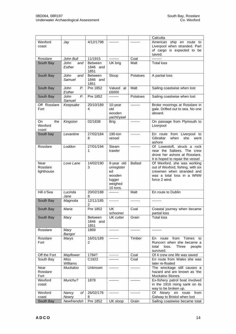
shape and measure 3m-5m in width and up 30m in length. They are composed of a
deposit of sub-angular stones (average size: 0.05m x 0.10m) and are covered by a
fine, close-growing, seaweed (Plates 7-9). These stony deposits are located between
50m-100m apart; although in several places they form an almost continuous, low-
level, stony outcrop. Several areas comprising of large rocks and boulders (<0.1m x
0.15m in size) were encountered across the eastern limit of the survey area. Some of
these larger rocks were covered in dead man’s fingers. Noted marine-life included:
edible crap, velvet crab, hermit crabs, sea snails, razor shellfish, clams, and small
flat-fish, including dab and place.
Visual Survey and Assessment
A systematic visual survey of the seabed was conducted across the re-deposition
area (Figure 4). The Seabed was largely sterile of any man-made material and no
archaeological material/ deposits or structures were encountered as part of the
survey. In addition, the seabed was largely free from marine vegetation.
A survey of the adjacent foreshore was also undertaken to visually assess the
archaeological potential of the inter-tidal zone along South Bay. A 200m (north-south)

08D064, 08R197 South Bay, Rosslare Underwater Archaeological Assessment Co. Wexford
A D C O 10
x 30m (east-west) area of foreshore was inspected at Low Water (Figure 4). No
archaeological material, deposits, or structures were encountered as part of the
inspection.
Magnetometer Survey
A metal-detection survey was undertaken across a 400m x 40m area of seabed
(Figure 4). This was conducted to provide a sample record of the number of hits that
could be expected across the survey area as a whole. Relatively few metal-detection
hits were encountered and no surface targets were visible when compared to areas
of seabed located closer to a port or harbour area. A total of twenty-five targets were
logged within the metal-detection survey area. It is likely that these hits represent
modern jetsam from local fishing vessels that have bedded into the sandy seabed.
Conclusion
The assessment was comprehensive and extended beyond the site boundaries as
indicated. No archaeologically significant materials, deposits, or structures were
observed during the assessment. The seabed is remarkably clean, being free from
any of visible surface modern debris. In addition, the metal-detection survey revealed
a relatively small amount of targets; adding weight to the relative sterility of the
seabed from modern metallic debris.
The mound material and boulders encountered as part of the survey are not believed
to be part of the natural composition of the seabed within South Bay. It is most likely
that these deposits represent the re-deposition of material from previous dredging
activities within the area; wave-action having removed the finer sediments to leave
the larger non-mobile stone and rock deposits.
A relatively good archaeological holding content is present within the survey area and
the possibility of buried, in-situ, archaeological material still remains. However, no
impact to any potential archaeological material is likely to take place with the
deposition of the dredged sediment across the survey area.
6.0 PROPOSED IMPACTS
No impact to any archaeological materials, deposits, or structures will arise from the
proposed re-deposition of seabed material. Likewise no impact to archaeological
materials, deposits, or structures is anticipated during the associated dredging works;

08D064, 08R197 South Bay, Rosslare Underwater Archaeological Assessment Co. Wexford
A D C O 11
seabed dredging will not pass beneath the original beach level and the dredge
material will all come from a recently deposited sandbar.
7.0 RECOMMENDATIONS
Pre-deposition Phase Measures
No further ameliorative measures are recommended in advance of the beach re-
nourishment programme commencing.
Deposition Phase Measures
Seabed impacts are restricted to the placement of dredged material and no sediment
removal will take place within the survey area, and no archaeological measures are
recommended during the re-deposition phase.
PLEASE NOTE: All of the above recommendations are based on the information supplied for the South Bay Beach Re-nourishment Project, Rosslare, Co. Wexford. Should any alteration occur, further assessment maybe required.
PLEASE NOTE: The above recommendations are subject to the approval of the Department of the Environment, Heritage, and Local Government.
8.0 AKNOWLEDGEMENTS
Thanks are extended to, Sophie Gilloway, Senior Environmental Scientist, RPS
Group. The survey team included Rex Bangerter (Project/Maritime Archaeologist), Dr.
Jimmy Lenehan (Maritime Archaeologist), Dr. Edwad Pollard (Maritime Archaeologist)
and Brian MacAllister (Dive supervisor). The report was written by Rex Bangerter and
edited by Dr. Niall Brady (Project Manager).

08D064, 08R197 South Bay, Rosslare Underwater Archaeological Assessment Co. Wexford
A D C O 12
Appendix 1: Shipwrecks listed in the Shipwreck Inventory for the South Coast of County
Wexford.
Location Name Date Ship Type Cargo Information Off the east coast of Wexford
Active 01/1922 -------- Wheat En route from Liverpool to Wexford. All on board survived.
Off Wexford Adventure 12/11/1812
-------- -------- En route from Limerick to Liverpool. Captured and sunk by French schooner Brestois a privateer
Off Rosslare Fort
Angharad 1891 Schooner -------- Wexford vessel became a total wreck
Rosse lake (perhaps Rosslare)
Ann 26/11/1820
-------- -------- En route from Liverpool to Cork
Rosse Lake, near Wexford
Ann 26/11/1820
-------- -------- En route from Liverpool to Cork when she went ashore. The cargo was expected to be saved.
Ballygeary L’Aventeen Pre 1852 -------- General cargo
--------
Off wexford coast
Ayrshire Lass
9/05/1867 -------- -------- Four people survived
Wexford coast
Betsey/Betsy
24/09-10/1805
Sloop Ballast Sloop of Dartmouth
South Bay Betsey and Mary Ann/Betsey & Mary
1/01/1822 -------- -------- En route from Cork to Glasgow driven ashore in a heavy gale
South Bay Blue Bone Unknown -------- -------- This may still be a hazard to fishing
Off Rosslare Bonefide 08?/1905 -------- Copper En route from Fiji to Liverpool. All aboard survived.
Rosslare Bonita 6/8/1900 11 year old Yawl (yacht)
Ballast Weighed 12 tons, of Cork en route from Kingstown to Cork stranded in NNW force 8 wind. She was a total loss.
Ballygeary Boston packet
14/11/1880
53-ton 38-year old Wexford schooner
Coal En route from Cardiff to Ballygeary became stranded in a NNE force 9 gale and was totally wrecked.
South bay Brittania Pre 1852 UK schooner
Coal Sailing coastwise when became lost
Off the Wexford coast
Britton Haliburton
09/1839 -------- -------- Valued at £4500.00
South Bay Brothers Pre 1852 UK sloop Grain Coastal journey when she became a partial loss.
South Bay Brothers Between 1846 and 1851
-------- -------- --------
Off Rosslare Civil Servant
03/1868 UK brig Coal 14 people survived
South of Rosslare, around 3 miles north of Rosslare coastguard station
Clara and Jessie
10/12/1890
46 year old wooden schooner weighing 67 tons
-------- All those on board survived. She sailed from Wexford bound for Milford when she was wrecked.
South bay Clonmel Pre 1852 UK General Sailing coastwise when ran

08D064, 08R197 South Bay, Rosslare Underwater Archaeological Assessment Co. Wexford
A D C O 13
steamer cargo aground but got off later. South Bay Commerce 26/01/184
3 Schooner Lost two cables while lying at
anchor Coast of Wexford
Coquette 15-16/12/1820
-------- -------- The ship was en route from Liverpool to Africa. She was totally wrecked and only two of the crew were saved.
Beach at Rosslare Harbour
Crest 9/3/1936 Three masted auxillary schooner
Salt Formerly called the Vigilant en route from Wexford to Dublin. The crew survived and at low tide the wreck was accessible.
Rosslare Cymric 01/1924 -------- Bricks -------- Ballygeary Denbighshir
e Lass 6/3/1908 -------- -------- --------
Off the Wexford coast
Demara 1816 -------- -------- --------
Near Rosslare 52 14 21N 006 17 42W Wreck no 010400606
Earl 1930 -------- -------- 35m depth of water
Rosslare harbour
Edward 11/1915 -------- Oats --------
Near Rosslare
Eiderslic/Elerslie
1859 -------- -------- --------
Hill of Sea Elerslie 21/01/1858
Emigrants -------- En route from Liverpool to Barbados
Coast of Wexford
Elizabeth 23/12/1816
-------- -------- Dartmouth based ship en route from London to Cork when driven ashore and feared lost
Rosslare Ellen Kerr 1/9/1883 -------- -------- From Wexford. All on board survived.
Wexford coast?
Fairie After 11/12/1883
48-year old schooner
Beans From Whitehaven weighed 59 tons. En route from Wexford to Glasgow when went missing with all four aboard in gale.
Off the Wexford coast
Felix Pensamiento
09/1839 Brig -------- On passage from St. Ubes to Sligo
South bay Frenchman Early 1900s
-------- -------- This vessel is still a hazard to fishing.
Rosslare Harbour
Friendship 11/1915 -------- -------- This vessel was refloated later
Near Rosslare
Gannet 23/1/1906 -------- -------- Four people survived
Near Rosslare
Goelta 1/12/1929 2473-ton vessel
-------- From Swansea, caught in fog and ran ashore. Was refloated and brought to Dublin for repairs.
Hill O’Sea Harvest Home
4/10/1909 -------- -------- The vessel was later refloated
South Bay Harvest Home
C1922 -------- -------- The vessel was later refloated
Rosslare Harbour
Harvest King
11/1915 -------- -------- This vessel was later refloated
Near Rosslare
Helen 01/1879 -------- -------- En route from Liverpool. 13 people survived.
Rosslare Isabella Davidson
19/01/1861
-------- Ballast Inverness based ship en route from Falmouth to Troon when driven ashore.
Off Wexford coast
Jager 01/1845 -------- -------- Valued at £30000 was en passage from Liverpool to
08D064, 08R197 South Bay, Rosslare Underwater Archaeological Assessment Co. Wexford
A D C O 14
Calcutta Wexford coast
Jay 4/12/1798 -------- -------- American ship en route to Liverpool when stranded. Part of cargo is expected to be saved.
Rosslare John Bull 11/1915 -------- Coal -------- South Bay John and
Esther Between 1846 and 1851
UK brig Malt Total loss
South Bay John and Samuel
Between 1846 and 1851
Sloop Potatoes A partial loss
South Bay John P. Esther
Pre 1852 Valued at £6000
Malt Sailing coastwise when lost
South Bay John P. Samuel
Pre 1852 -------- Potatoes Sailing coastwise when lost
Off Rosslare Fort
Keepsake 20/10/1894
10-year old wooden yacht/yawl
-------- Broke moorings at Rosslare in gale. Drifted out to sea. No one aboard.
On the Wexford coast
Kingston 02/1838 Brig -------- On passage from Plymouth to Liverpool
South bay Levantine 27/02/1848
190-ton vessel
-------- En route from Liverpool to Gibraltar when she went ashore
Rosslare Loddon 27/01/1941
Steam trawler
-------- Of Lowestoft, struck a rock near the Saltees. The crew drove her ashore at Rosslare. It is hoped to repair the vessel
Near Rosslare lighthouse
Love Lane 14/02/1903
9-year old unregistered wooden lugger weighed 10 tons.
Ballast Of Wexford, she was working out of Wexford, fishing, with six crewmen when stranded and was a total loss in a WNW force 2 wind.
Hill o’Sea Lucinda Jane
20/02/1888
-------- Malt En route to Dublin
South Bay Magnolia 12/11/1852
-------- -------- --------
South Bay Maria Pre 1852 UK schooner
Coal Coastal journey when became partial loss
South Bay Mary Between 1846 and 1851
UK cutter Grain Total loss
Rosslare Mary Bangor
1869 -------- -------- --------
Rosslare Fort
Marys 16/01/1892
-------- Timber En route from Totnes to Runcorn when she became a total loss. Three people survived.
Off the Fort Mayflower 1784? -------- Coal Of 4 crew one life was saved South Bay Miss
Williams C1922 -------- Coal En route from Wales she was
later re-floated Near Rosslare Fort
Muckaloo Unknown -------- -------- The wreckage still causes a hazard and are known as ‘the Muckaloo Stones.
Wexford coast
Murichu? 1878 -------- -------- Ex-fishery patrol boat involved in the 1916 rising sank on its way to be broken up.
Wexford coast
Nancy of Newry
26/02/1768
-------- -------- Of Newry en route from Galway to Bristol when lost
South Bay Newfriendsh Pre 1852 UK sloop Grain Sailing coastwise became total

08D064, 08R197 South Bay, Rosslare Underwater Archaeological Assessment Co. Wexford
A D C O 15
ip/ New friendship
loss
South Bay, Rosslare
Orinoco 11-12/11/1876
-------- -------- En route from St John’s Brunswick to Liverpool with a cargo of timber. 34 people survived but three were lost.
South Bay Orangeman Early 1900’s
-------- -------- Became a total wreck and remains a hazard to fishing
Wexfod coast
Orissa 2/1838 Schooner -------- On passage from Glasgow to Bristol
Near Rosslare Point
Pilot 31/01/1888
67-ton wooden schooner
Coal 53 years old, of Wexford, en route from porthcawl to wexford. Totally wrecked in a NW force 6 gale. No loss of life.
South Bay Ponsonby Pre 1852 UK Schooner
Cattle Partial loss
Near Rosslare
Puffin 8/3/1906 -------- -------- 6 people survived. Edward Wickham, cox of the Rosslare lifeboat was awarded a silver medal.
Kilrane/South Bay
Seaview 1/11/1915 86-ton schooner
Oats Built in 1861
South Bay Shubenacaddie/Subernacadie
25/11/1835
UK brig Timber En route from Canada. The crew survived.
South Bay Star Pre 1852 UK schooner
Coal Sailing coastwise when became a partial loss.
Near Rosslare
Stella 7/1/1859 -------- Marble En route from Leghorn to Dublin when lost
Rosslare Statendrick 02/1884 -------- Coal, iron Enroute from Liverpool to Rio Grande. All on board survived
South Bay Swallow Pre 1852 UK sloop Grain On coastal journey when became a partial loss.
Rosslare Tempest 7/12/1908 Unregistered fishing ketch
ballast Of Wexford, built of wood, 41 years old and 6 tons. Fishing out of Wexford with 2 crew she became stranded and was a total loss.
--------- Theodore 15/7/1875 208-ton wooden brig
Timber 33 years old stranded in ENE force 10 gale becoming a total loss.
Off the Wexford coast
Theseus 10/1840 -------- -------- Valued at £8000 en passage from St John’s to the Clyde when lost
South Bay Thistle 31/1/1839 British schooner
Ballast Total loss
Near Rosslare
Thomas Farrel
1829 199-ton vessel
-------- Of Wexford
South Bay Thomas Farrel/Thomas Farell
Pre 1852 -------- Timber Partial loss
Fort of Rosslare
Torrance 1/2/1855 -------- Coal Sheltered in bay but anchor cables broke. She went ashore and was wrecked.
Rosslare/South Bay, under Hill of Sea, Ballygeary
Versailles 18-19/01/1861
620-ton vessel
General cargo
en route from Liverpol to Shanghai, driven ashore. She was towed off and cargo unloaded. The tug Erin placed a valuable steam pump belonging to the Liverpool towing company but it was lost.
Ballygeary Pier
Victoria 11/02/1906
-------- -------- This vessel was at anchor when she hit the pillars of a

08D064, 08R197 South Bay, Rosslare Underwater Archaeological Assessment Co. Wexford
A D C O 16
viaduct and sank. South Bay Wave 8/11/1906 -------- -------- The vessel was later salvaged. Rosslare William and
Mary 18/01/1803
Smack Slates En route from Port Gain when wrecked
Off Wexford Coast
William of Weymouth
1818 -------- -------- Some of the bodies are buried at St. Vogue’s graveyard, Carne
Rosslare Yarra Yarra 7/03/1904 -------- Coal En route from Newport to Wexford. Five people survived and the vessel was later saved.
South Bay Young Hudson
8/11/1906 -------- -------- Lost
Hill O’Sea Zion Hill 4/10/1909 -------- -------- -------- Off S Wexford coast
Unknown 10/01/1549
-------- Wine On passage from Spain to Limerick. The ship was plundered by the inhabitants.
Off east coast
unknown 19?/11/1807
Two transport ships
-------- Lost in severe blizzards
South Bay unknown Between 1846 and 1851
Portuguese brig
In ballast Became a total loss
Rosslare unknown 18/12/1855
Ship -------- Came ashore near pilot station
Rosslare unknown 18/12/1855
Ship -------- Came ashore near pilot station
Near Rosslare
unknown 27/01/1906
Ketch -------- --------
Near Rosslare
unknown 27/01/1906
Ketch -------- --------
Near Rosslare
unknown 27/01/1906
Schooner -------- --------
South Bay, Rosslare
26/07/1906
1-ton 6-year old unregistered wooden fishing lugger
In ballast En route from Ballygeary to Rosslare capsized in a SSE wind but was recovered later.


08D064, 08R197 South Bay, Rosslare Underwater Archaeological Assessment Co. Wexford
A D C O Figures and Plates
Plate 1: West-facing view of the strand from north-west corner of the Survey Area (NW corner buoyed).
Plate 2: South-southeast view of survey area from northwest corner of the designated re-deposition zone.

08D064, 08R197 South Bay, Rosslare Underwater Archaeological Assessment Co. Wexford
A D C O Figures and Plates
Plate 3: Working shot of diver establishing coordinates for the dropping of surface marker buoys at the four corners of the survey area.
Plate 4: Shot of sandy seabed at NGR: 311294E, 113464N.

08D064, 08R197 South Bay, Rosslare Underwater Archaeological Assessment Co. Wexford
A D C O Figures and Plates
Plate 5: Shot of sandy seabed at NGR: 311419E, 113392N.
Plate 6: Shot of sandy seabed at NGR: 311530E, 113286N.

08D064, 08R197 South Bay, Rosslare Underwater Archaeological Assessment Co. Wexford
A D C O Figures and Plates
Plate 7: Shot of part of seabed mound at NGR: 311405E, 113560N.
Plate 8: Shot of part of seabed mound at NGR: 311577E, 113517N.

08D064, 08R197 South Bay, Rosslare Underwater Archaeological Assessment Co. Wexford
A D C O Figures and Plates
Plate 9: Shot of part of seabed mound at NGR: 311704E, 113474N.

Recording prehistoric logboat at Gormanston, Co. Meath GAS 2025 Irish Sea Interconnector
Underwater elevation of bridge pier collapsed in 1763. River Nore Flood Alleviation Scheme
Iron cannon on site of 17th-century timber wreck discovered during
dredging programme, Waterford Harbour


