Page 1
114
APPLICATION OF SWAN MODEL FOR HINDCASTING WAVE
HEIGHT IN JEPARA COASTAL WATERS, NORTH JAVA,
INDONESIA
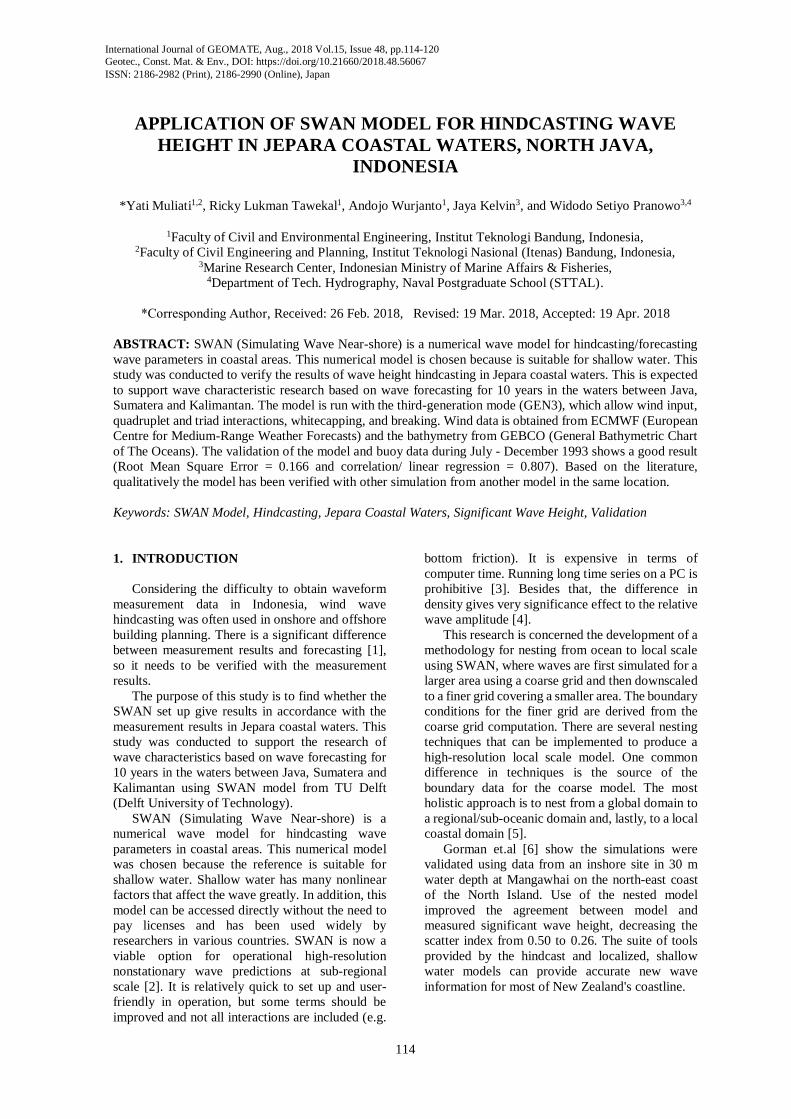
*Yati Muliati1,2, Ricky Lukman Tawekal1, Andojo Wurjanto1, Jaya Kelvin3, and Widodo Setiyo Pranowo3,4
1Faculty of Civil and Environmental Engineering, Institut Teknologi Bandung, Indonesia, 2Faculty of Civil Engineering and Planning, Institut Teknologi Nasional (Itenas) Bandung, Indonesia,
3Marine Research Center, Indonesian Ministry of Marine Affairs & Fisheries, 4Department of Tech. Hydrography, Naval Postgraduate School (STTAL).
*Corresponding Author, Received: 26 Feb. 2018, Revised: 19 Mar. 2018, Accepted: 19 Apr. 2018
ABSTRACT: SWAN (Simulating Wave Near-shore) is a numerical wave model for hindcasting/forecasting
wave parameters in coastal areas. This numerical model is chosen because is suitable for shallow water. This
study was conducted to verify the results of wave height hindcasting in Jepara coastal waters. This is expected
to support wave characteristic research based on wave forecasting for 10 years in the waters between Java,
Sumatera and Kalimantan. The model is run with the third-generation mode (GEN3), which allow wind input,
quadruplet and triad interactions, whitecapping, and breaking. Wind data is obtained from ECMWF (European
Centre for Medium-Range Weather Forecasts) and the bathymetry from GEBCO (General Bathymetric Chart
of The Oceans). The validation of the model and buoy data during July - December 1993 shows a good result
(Root Mean Square Error = 0.166 and correlation/ linear regression = 0.807). Based on the literature,
qualitatively the model has been verified with other simulation from another model in the same location.
Keywords: SWAN Model, Hindcasting, Jepara Coastal Waters, Significant Wave Height, Validation
1. INTRODUCTION
Considering the difficulty to obtain waveform
measurement data in Indonesia, wind wave
hindcasting was often used in onshore and offshore
building planning. There is a significant difference
between measurement results and forecasting [1],
so it needs to be verified with the measurement
results.
The purpose of this study is to find whether the
SWAN set up give results in accordance with the
measurement results in Jepara coastal waters. This
study was conducted to support the research of
wave characteristics based on wave forecasting for
10 years in the waters between Java, Sumatera and
Kalimantan using SWAN model from TU Delft
(Delft University of Technology).
SWAN (Simulating Wave Near-shore) is a
numerical wave model for hindcasting wave
parameters in coastal areas. This numerical model
was chosen because the reference is suitable for
shallow water. Shallow water has many nonlinear
factors that affect the wave greatly. In addition, this
model can be accessed directly without the need to
pay licenses and has been used widely by
researchers in various countries. SWAN is now a
viable option for operational high-resolution
nonstationary wave predictions at sub-regional
scale [2]. It is relatively quick to set up and user-
friendly in operation, but some terms should be
improved and not all interactions are included (e.g.
bottom friction). It is expensive in terms of
computer time. Running long time series on a PC is
prohibitive [3]. Besides that, the difference in
density gives very significance effect to the relative
wave amplitude [4].
This research is concerned the development of a
methodology for nesting from ocean to local scale
using SWAN, where waves are first simulated for a
larger area using a coarse grid and then downscaled
to a finer grid covering a smaller area. The boundary
conditions for the finer grid are derived from the
coarse grid computation. There are several nesting
techniques that can be implemented to produce a
high-resolution local scale model. One common
difference in techniques is the source of the
boundary data for the coarse model. The most
holistic approach is to nest from a global domain to
a regional/sub-oceanic domain and, lastly, to a local
coastal domain [5].
Gorman et.al [6] show the simulations were
validated using data from an inshore site in 30 m
water depth at Mangawhai on the north-east coast
of the North Island. Use of the nested model
improved the agreement between model and
measured significant wave height, decreasing the
scatter index from 0.50 to 0.26. The suite of tools
provided by the hindcast and localized, shallow
water models can provide accurate new wave
information for most of New Zealand's coastline.
International Journal of GEOMATE, Aug., 2018 Vol.15, Issue 48, pp.114-120
Geotec., Const. Mat. & Env., DOI: https://doi.org/10.21660/2018.48.56067
ISSN: 2186-2982 (Print), 2186-2990 (Online), Japan
Page 2
International Journal of GEOMATE, Aug., 2018 Vol.15, Issue 48, pp.114-120
115
2. PHYSICAL PROCESSES
All information about the sea surface is
contained in the wave variance spectrum or energy
density E(), distributing wave energy over
(radian) frequencies (as observed in a frame of
reference moving with current velocity) and
propagation directions (the direction normal to
the wave crest of each spectral component). Usually,
wave models determine the evolution of the action
density N (x,t;) in space x and time t. The action
density is defined as N=E/and is conserved
during propagation in the presence of ambient
current, whereas energy density E is not. It is
assumed that the ambient current is uniform with
respect to the vertical co-ordinate and is denoted as
U [7].
The evolution of the action density N is
governed by the action balance equation, which
reads [8]:
𝜕N
𝜕t+ ∇𝑥[(𝑐𝑔 + U)N] +
𝜕𝑐𝜎N
𝜕𝜎+
𝜕𝑐𝜃
𝜕𝜃=
Stot
σ (1)
The left-hand side is the kinematic part of this
equation. The second term denotes the propagation
of wave energy in two-dimensional geographical x-
space, with the group velocity cg = ∂σ/∂k following
from the dispersion relation σ2 = g|k| tanh(|k|d)
where k is the wave number vector and d the water
depth. The third term represents the effect of
shifting of the radian frequency due to variations in
depth and mean currents. The fourth term represents
depth-induced and current-induced refraction. The
quantities cσ and cθ are the propagation velocities in
spectral space (σ,θ). The right-hand side contains
Stot, which is the source/sink term that represents all
physical processes which generate, dissipate, or
redistribute wave energy. They are defined for
energy density E(σ, θ). The second term in Eq. (1)
can be recast in Cartesian, spherical or curvilinear
co-ordinates. For small-scale applications, the
spectral action balance equation may be expressed
in Cartesian co-ordinates as given by [7]
𝜕N
𝜕𝑡+
𝜕𝑐𝑥N
𝜕𝑥+
𝜕𝑐𝑦N
𝜕𝑦+
𝜕𝑐𝜎N
𝜕𝜎+
𝜕𝑐𝜃N
𝜕𝜃=
Stot
𝜎 (2)
with
c𝑥 = 𝑐𝑔,𝑥 + U𝑥 , 𝑐c𝑦 = c𝑔,𝑦 + U𝑦 (3)
With respect to applications at shelf sea or
oceanic scales the action balance equation may be
recast in spherical co-ordinates as follows [7]:
𝜕𝑁
𝜕𝑡+
𝜕𝑐𝑥𝑁
𝜕𝑥+
𝜕𝑐𝑦𝑁
𝜕𝑦+
𝜕𝑐𝜎𝑁
𝜕𝜎+
𝜕𝑐𝜃𝑁
𝜕𝜃=
Stot
σ (4)
with longitude and latitude
In shallow water, six processes contribute to
Stot:
Stot = Sin + Snl3 + Snl4 + Sds,w + Sds,b + Sds,br (5)
These terms denote, respectively, wave growth by
the wind, nonlinear transfer of wave energy through
three-wave and four-wave interactions and wave
decay due to whitecapping, bottom friction and
depth-induced wave breaking [7].
There are some options in SWAN regarding the
model set-up which pertains to the type and/or
parameterization of the formulations used for the
source terms in Eq.(5). The user can choose
between three different formulations for Sin, which
accounts for the linear and exponential growth of
waves due to wind [5].
Wind energy to waves is commonly described
as the sum of linear and exponential growth. There
are two wind growth models in SWAN that are
available for us. Both expressions of wind growth
model of them share the following form (Eq.(6))
and the same linear growth (Eq.(7)), while the
exponential growth term is different.
Sin (σ,θ) = A + BxE(σ,θ) (6)
In which A describes linear growth and BxE
exponential growth [9].
Linear growth by wind:
A =𝛼
𝑔22𝜋[U∗ max(0, cos(𝜃 − 𝜃𝑤))]4H (7)
with
H = exp (−(σ/σPM* )-4) and σPM
* =0.13𝑔
28𝑈∗2𝜋 (8)
Exponential growth:
a. Expression from [10]:
𝐵 = max [0,0.25𝜌𝑎
𝜌𝑤(28
𝑈∗
𝐶𝑝ℎcos(𝜃 − 𝜃𝑤) − 1)]𝜎 (9)
in which U* is friction velocity, wis wind direction,
Cph is the phase speed and aand ware the density
of air and water, respectively.
b. Expression from [11]:
𝐵 = 𝛽𝜌𝑎
𝜌𝑤(
𝑈∗
𝐶𝑝ℎ)2(max(0, cos(𝜃 − 𝜃𝑤)))2𝜎 (10)
where is the Miles“constant”.
The dissipation term of wave energy is
represented by the summation of three different
contributions: white-capping Sds,w, bottom friction
Sds,b and depth-induced breaking Sds,br [7].
Page 3
International Journal of GEOMATE, Aug., 2018 Vol.15, Issue 48, pp.114-120
116
3. MATERIALS AND METHODS
3.1 Available Data
The scarcity of time series oceanographic
datasets, especially the observational wave data, is
one of the challenges to develop the ocean model in
Indonesia. However, data is obtained from long-
term wave observation located in Jepara, Central
Java (110.7722oE, 6.3983oS), which has granted the
access from PT. Geomarindex. The data is from
July to December 1993 with three-hour temporal
resolution. The available parameter is only the wave
height values.
The bathymetry data is obtained from General
Bathymetric Chart of the Oceans (GEBCO) with a
spatial resolution of 30 arc-sec (~1 km). There is no
available local bathymetry dataset to cover the
coastal waters. Therefore, it is applied to all model
domains. The only forcing included in this wave
model is from the wind. It is obtained from the
European Centre for Medium-Range Weather
Forecasts (ECMWF) with a spatial resolution of
0.125 degrees (~13.75 km) and 6-hour temporal
resolution. The FNMOC global WW3 model is
vastly used for open boundary condition of wave
forcing in several studies, e.g. [5], however, wave
data in 1993 is unavailable.
The significant wave height output from the
ECMWF reanalysis (ERA)-Interim reanalysis is
used as a comparison to our model. The nearest
point to the buoy station is located at 110.75oE and
6.375oS. The distance between these two points is
4.16 km or 4 grid cells in the smallest domain.
3.2 Model Domain
The SWAN model provides nesting application
to the parent grid. Hence, there is two model
domains, the Java Sea (JS) domain as the parent grid
and Jepara Coastal Waters (JCW) domain as the
child/nested grid (Fig. 1). The JS domain extends
from Aceh to Bali that includes two marginal seas,
i.e. the South China Sea and the Java Sea, while the
JCW domain covers the Jepara coastal waters
(110.450oE -110.918oE and 5.996oS - 6.450oS). The
JS and JCW domains have 1/8 degree and 1/96 grid
resolutions with the total of 176x120 and 44x48
grid-cells, respectively.
The bathymetry in this region is relatively
shallow (<100 m), with the presence of narrow
straits (e.g. Malacca Strait) and small islands that
add the complexity of the model domain (Fig. 1).
The deep waters are concentrated in the edge of
model domain, i.e. North of Sumatera (top-left),
North of Kalimantan (top-right), and North of Bali
(bottom-right). The depth range is 500-3300 m.
3.3 Model Setup
The non-stationary 2D wave model within
SWAN is simulated with 1-hour interval from July
to December 1993. The frequency range is set at
0.3-1.1 Hz and divided linearly into 38 frequencies.
The number of directional bins is set for 72 due to
the physical characteristics of the study areas, such
as the geographical conditions, bathymetry
gradients, and global and local wind effects [12]. In
addition, the first order, backward space, backward
time (BSBT) numerical scheme are employed for
both model domains with three maximum number
of iterations and 98% percentage of accuracy for the
wet/dry condition.
The same physics setup is applied to both
domains. GEN3 wave model with Komen linear
growth formulation and the white capping default
configurations were used [10]. Further, the triad and
quad wave-wave interaction, as well as breaking
and diffraction processes are activated by using the
default configurations [7]. For bed friction, the
dissipation coefficients (Cb) was 0.019 as suggested
for the region with smooth sediment characteristic,
while the default value was 0.038 [7]. The
vegetation, turbulence, and fluid mud are omitted in
the physical processes due to the absence of
datasets. Finally, the model is simulated in parallel
computing with OpenMP (Open Multi-Processing)
to reduce computation times.
Fig.1 Grid-view of wave model domains; (left) JS domain with isobath at 50 m and (right) JCW domain with
10 m of isobath interval. Red point denotes a buoy location.
Page 4
International Journal of GEOMATE, Aug., 2018 Vol.15, Issue 48, pp.114-120
117
4. RESULTS AND DISCUSSION
4.1 Model Validation
Wave statistics for the buoy sites were
computed from the hindcast. Occurrence statistics
for significant wave height Hs, mean direction Qmem,
and second moment mean period Tm2 were
computed. Significant wave height results were
compared with data over the relevant deployment
periods.
Significant wave height at a wave buoy site as
simulated by the wave model and as measured by
the buoy, shown as time series in Fig.2a and
regression in Fig.2c, with the line of best fit and
equivalence lines shown by dashed and solid lines
respectively.
In December 1993, there appeared to be extreme
wave height (see Fig.2b) and after further study of
the cause, this was due to Manny typhoon where
propagation of waves from the center of the cyclone
Manny to Jepara occurred over 10 days (see Fig.2d).
The result of forecasting with SWAN shows a
wave distribution pattern corresponding to the buoy
data, except for the duration of Oct-Nov 1993 for
which the wave height of the measurement needs to
be reconfirmed.
Factors that may affect the inaccuracy of the
model:
1. Coarse resolution of bathymetry dataset used
in this model
2. Global wind data are usually unable to achieve
the magnitude of extreme events
3. The absence of wave-current interaction in the
model and static water level (zero value)
4. The grid on the model is also still rough and in
rectangular form
5. The accuracy of the buoy data for validation
also needs to be confirmed again, especially
the Oct-Nov 1993 timeframe, because the
wave height was only about 10-15 cm.
Fig.2 (a) and (b) are showing time-series of significant wave height from SWAN model (blue line), ECMWF
model (red line) and buoy observation (black dots) for whole observation period and during Typhoon
Manny, respectively. (c) Hs density plot of SWAN & Jepara Buoy, and (d) Typhoon Manny propagation
track that obtained from Joint Typhoon Warning Center (JTWC) and plotted in Google Earth.
Page 5
International Journal of GEOMATE, Aug., 2018 Vol.15, Issue 48, pp.114-120
118
Table 1. Significant wave height (Hs) statistic in the Jepara Buoy station and the model accuracy. R is
correlation coefficient and SI is scattered index.
Data Basic Stats Model Accuracy
Min Max Mean Std RMSE R Bias SI
Jepara Buoy 0.017 1.878 0.230 0.202 x x x x
SWAN 0.041 1.406 0.339 0.203 0.166 0.807 -0.109 0.720
ECMWF* 0.071 1.955 0.535 0.288 0.354 0.778 -0.304 1.535
* Significant wave height output from the ECMWF (European Centre for Medium-Range Weather Forecasts)
reanalysis (ERA)-Interim reanalysis
4.2 Comparison with Existing Models
The European Centre for Medium-Range
Weather Forecasts (ECMWF) is an independent
intergovernmental organization supported by 34
states. ECMWF is both a research institute and a
24/7 operational service, producing and
disseminating numerical weather predictions to its
Member States. This data is fully available to the
national meteorological services in the Member
States [13].
The result of SWAN modeling is compared with
the wave forecasting result from ECMWF as shown
in Fig 2a and 2b. Both models exhibit similar wave
distribution patterns, although Hs ECMWF model
results tend to be always larger than the Hs model
of SWAN.
Statistical analysis for Hs model and Hs buoy
included minimum, maximum, mean, standard
deviation and model accuracy values against the
measurement results are presented in Table 1 where
the Hs model SWAN (0.807) showed a better
correlation value than Hs ECMWF (0.778). Root
Mean Square Error (RMSE) for Hs SWAN is
smaller than Hs ECMWF. This shows the SWAN
modeling more closely to the measurement results,
in other words, the SWAN model setting is good.
4.3 Monsoonal Significant Wave Characteristics
Examples of the significant wave (Hs) and wind
pattern models in east monsoon and west monsoon
are presented in Fig.3, both also show normal
conditions and extreme wave (typhoon) condition.
Wind patterns during east and west monsoon are
distinctly recognized based on its direction. The
east monsoon winds travel from southeast to
northwest, while the west monsoon winds are the
opposites. The east monsoon wind or Australian
monsoon wind blows from Australia to the equator
and is known as the dry season that peaks in June-
July-August. The west monsoon wind or Asian
monsoon wind blows from the Asian continent with
water vapors that cause rain, so it is called the rainy
season and reaches its peak in December-January-
February. Wind data treated in accordance with
both monsoon wind patterns and can be seen in Fig.
3a and 3b (right).
In normal condition as depicted in Fig. 3a and
3b, Hs is strongly associated with the wind pattern.
Although, occasionally there are cyclones coming
from Indian Ocean (south of Java) or typhoon in the
South China Sea region and causing a disturbance
within model domains for up to 15 days. One of the
examples is the Typhoon Manny, which was
originated in the Western Pacific. Fig. 3c shows the
generation of typhoon within model domains and it
has significantly amplified the wave height.
In normal conditions, the wind speed 5-7 m/s
produces Hs 0.5-1.2 meter (Fig, 3a and 3b), while
at maximum Hs condition between July-December
1993, wind speed 8-15 m/s yield Hs 1-3 meters
(Fig.3d).The relative maximum Hs in the model
domain reaches 3.16 m. It is located in the south of
Kalimantan (see Fig. 3d). Meanwhile, in Jepara
coastal waters, the increasing maximum Hs is up to
1.41 m.
The results of statistical calculations for the four
areas in the study area obtained the Hs min-max and
average Hs (meter) in the east monsoon conditions
for the Java Sea 0.43-0.99 (average 0.64) Karimata
Strait 0.18- 0.98 (0.51), Malacca Strait 0.02-0.58
(0.24), South China Sea 0.09-1.21 (0.47) and for the
west monsoon; Java Sea 0.08-2.44 (average 0,57)
Karimata Strait 0.09-2.09 (0,56), Malacca Strait
0.07-0.77 (0.28), South China Sea 0,21-2.93 (0.97).
This results are suitable when compared to Hs
for 9 years forecasting by Wicaksana et.al (2015)
[14] where at the west monsoon in Karimata Strait
of Hs 1.5-3 m (Hs SWAN 2.09 m) and Java Sea 0.5-
2.5 m (Hs SWAN 2.44 m), while at the east
monsoon in Karimata Strait Hs 1,5-2,5 m (Hs
SWAN 0,98 m) and Java Sea 1-2 m (Hs SWAN
0,99 m). Suitable in question is data analysis results
for 6 months entered in the range of 9-year
forecasting results.
4.4 Future Works Application
This study is expected to support wave
characteristic research based on wave forecasting
for 10 years in the waters between Java, Sumatera
and Kalimantan. The wave forecasting research
needed 10-year wind data (2007 - 2016) from
Page 6
International Journal of GEOMATE, Aug., 2018 Vol.15, Issue 48, pp.114-120
119
Fig. 3 Significant wave height with directional spreading (left) and wind speed (right) within the large model
domain in different conditions: (a) east monsoon, (b) west monsoon, (c) typhoon Manny generation, and
(d) relative maximum Hs for the period of July to December 1993.
ECMWF and bathymetry data from GEBCO where
both data use the same resolution used in this study.
The results of the research are expected to help
practitioners to plan the structure of the beach
building, coastal protection, the structure of the
building at sea, or marine structures. For example,
as mentioned by Rathod et.al [15]; Piles used in
marine structures are subjected to lateral loads from
the impact of berthing ships and from waves. Piles
used to support retaining walls, bridge piers and
abutments, and machinery foundations carry
combinations of vertical and horizontal loads.
The 10-year wave data can be used as a basis to
determine the probability of 25, 50, or even 100
years in the future. The use of significant wave
heights with specific return periods is associated
with the risk of planned building structures. The
higher the risk value the longer return period is
chosen.
Page 7
International Journal of GEOMATE, Aug., 2018 Vol.15, Issue 48, pp.114-120
120
Significant wave forecasting is also required for
shipping safety. Until now the Karimata Strait
(between south Sumatera and Kalimantan Island) is
still a trading channel and the Java Sea becomes one
of the important national service channels,
especially in the present role in the Indonesian toll
lane [14].
5. CONCLUSION
The result of forecasting with SWAN shows a
wave distribution pattern corresponding to the buoy
data, except for the duration of Oct-Nov 1993 for
which the wave height of the measurement needs to
be reconfirmed.
Refers to the Root Mean Square Error (RMSE)
value (0,166) and correlation/ linear regression
value (0,807), and the waveform pattern
corresponding to the monsoon pattern, it can be
stated that this SWAN model is valid.
The setting up of wave hindcast for Jepara
waters will be helpful for improving the level of
shallow sea wave hindcast in the waters between
Java, Sumatera, and Kalimantan.
6. ACKNOWLEDGEMENTS
The authors would like to thank PT.
Geomarindex/PT. Wiratman & Associates for
providing observation wave data and also thank the
ECMWF and GEBCO for providing access to wind
and bathymetry data.
Sincere gratitude to scientists at Delft University
of Technology (TU Delft) who developed the
SWAN model and special thanks to the Marine and
Coastal Data Laboratory, Indonesian Ministry of
Marine Affairs & Fisheries for providing places of
simulations.
7. REFERENCES
[1] Muliati Y., Wurjanto A., and Pranowo W.S.,
Validation of Altimeter Significant Wave
Height Using Wave Gauge Measurement in
Pacitan Coastal Waters, East Java, Indonesia,
International Journal of Advances in
Engineering Research, Vol. 2, Issue No. IV,
2016, pp. 25-33.
[2] Rogers W., Kaihatu J.M., Hsu L., Jensen R.E.,
Dykes J.D., and Holland K.T., Forecasting and
Hindcasting Waves with the SWAN Model in
the Southern California Bight, Coastal
Engineering, Vol, 54, Issue 1, 2007, pp. 1-15
[3] Wolf J., Hargreaves J.C., Flather R.A.,
Application of The SWAN Shallow Water
Wave Model to Some U.K. Coastal Sites.
Proudman Oceanographic Laboratory Report,
NO 57, 51PP, 2000, pp.ii-48.
[4] Harun F.N. and Khairuddin M.A.A., Analytical
Solution For a Long Waves Propagation in
Two-Layer Fluid Over a Submerged Hump,
International Journal of GEOMATE, Vol. 12,
Issue 33, 2017, pp. 30-37.
[5] Atan R., Nash S., and Goggins J., Development
of a Nested Local Scale Wave Model for a 1/4
Scale Wave Energy Test Site Using SWAN,
Journal of Operational Oceanography, 2017,
pp.1-20.
[6] Gorman R.M., Bryan K.R., and Laing A.K.,
Wave hindcast for the New Zealand region:
Nearshore validation and coastal wave climate,
New Zealand Journal of Marine and Freshwater
Research, Vol.37, Issue 3, 2003, pp. 567-588.
[7] The SWAN team, SWAN Technical
Documentation, Delft University of
Technology, 2006, pp. 11–27.
[8] Komen G.J., Cavaleri L., Donelan M.,
Hasselmann K., Hasselmann S. and P.A.E.M.
Janssen, Dynamics and Modelling of Ocean
Waves, Cambridge Univ. Press, 1994, pp. 532.
[9] Baoshu Y., Dezhou Y., Application Study of
Shallow Water Wave Model (SWAN) in Bohai
Sea, Proceedings of The Twelfth OMISAR
Workshop on Ocean Models, 2004, pp. 3-1-3-8.
[10] Komen G.J., Hasselmann S., and Hasselmann
K, On the Existence of a Fully Developed
Windsea Spectrum, Journal of Physical
Oceanography, 14, 1984, pp.1271-1285.
[11] Janssen P.A.E.M., Quasi-linear Theory of
Wind-wave generation applied to Wave
Forecasting, Journal of Physical Oceanography,
21, 1991, pp.1631-1641. [12] WMO, Guide to wave analysis and forecasting,
Second ed, Geneva, Switzerland: Secretariat of
the World Meteorological Organization
(WMO), 1998.
[13] ECMWF, Who We Are, www.ecmwf.int/en/
about, 2018.
[14] Wicaksana S., Sofian I., Pranowo W.S.,
Kuswardani A.R.T.D., Saroso, Sukoco, N.B.,
Karakteristik Gelombang Signifikan di Selat
Karimata dan Laut Jawa Berdasarkan Rerata
Angin 9 Tahunan (2005-2013), Omni Akuatika,
Vol.11, Issue 2, 2015, pp.33-40.
[15] Rathod D., Muthukkumaran K., Sitharam T.G.,
Dynamic Response of Single Pile Located In
Soft Clay Underlay by Sand, International
Journal of GEOMATE, Vol. 11, Issue 26, 2016,
pp. 2563-2567.
Copyright © Int. J. of GEOMATE. All rights reserved,
including the making of copies unless permission is
obtained from the copyright proprietors.