Application of SWAT to assess the Application of SWAT to assess the Illinois Conservation Reserve Illinois Conservation Reserve Enhancement Program in the Enhancement Program in the La Moine River Basin La Moine River Basin T. Kevin O’Donnell 1 , Claire Baffaut 2 , David L. Galat 3 1 School of Natural Resources 2 Food and Agricultural Policy Research Institute 3 U.S. Geological Survey, Fish and Wildlife Research Unit University of Missouri-Columbia
Transcript
Application of SWAT to assess the Application of SWAT to assess the Illinois Conservation Reserve Illinois Conservation Reserve Enhancement Program in the Enhancement Program in the
La Moine River BasinLa Moine River Basin
T. Kevin O’Donnell1, Claire Baffaut2, David L. Galat3
1School of Natural Resources2 Food and Agricultural Policy Research Institute
3U.S. Geological Survey, Fish and Wildlife Research Unit
University of Missouri-Columbia
Talk OutlineTalk Outline
Illinois Conservation Reserve Illinois Conservation Reserve Enhancement Program (CREP)Enhancement Program (CREP)
BackgroundBackgroundImplementationImplementationGoals and objectivesGoals and objectives
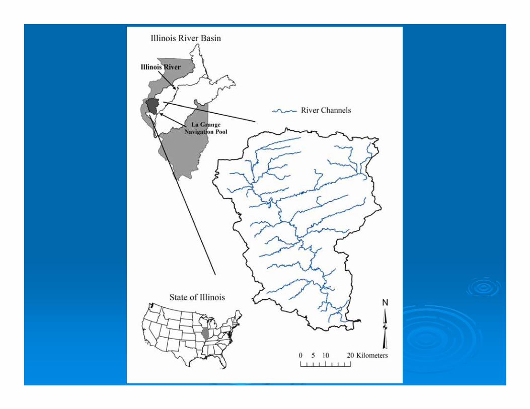
Illinois CREP effects in the La Moine River Illinois CREP effects in the La Moine River BasinBasin
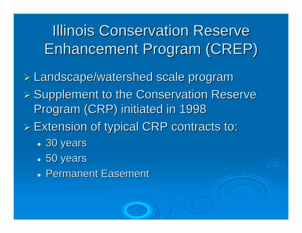
Illinois Conservation Reserve Illinois Conservation Reserve Enhancement Program (CREP)Enhancement Program (CREP)
Landscape/watershed scale programLandscape/watershed scale programSupplement to the Conservation Reserve Supplement to the Conservation Reserve Program (CRP) initiated in 1998Program (CRP) initiated in 1998Extension of typical CRP contracts to:Extension of typical CRP contracts to:
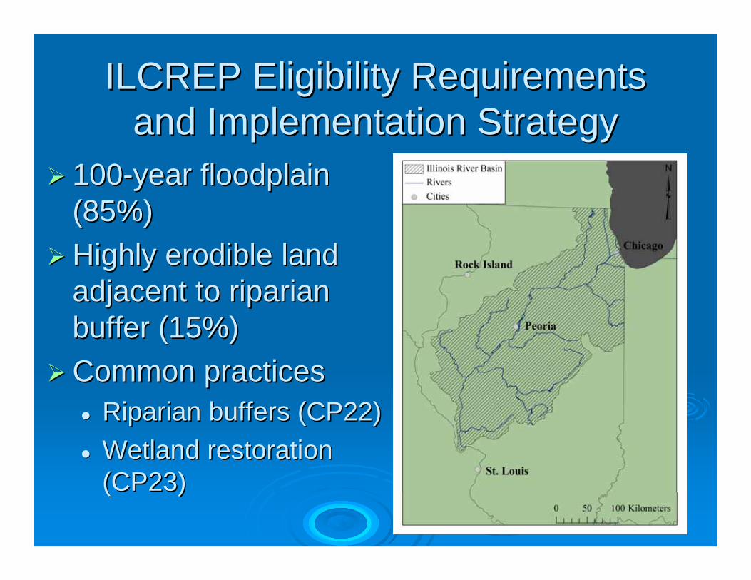
100100--year floodplain year floodplain (85%)(85%)Highly Highly erodibleerodible land land adjacent to riparian adjacent to riparian buffer (15%)buffer (15%)Common practicesCommon practices
Illinois Conservation Reserve Illinois Conservation Reserve Enhancement Program (CREP)Enhancement Program (CREP)
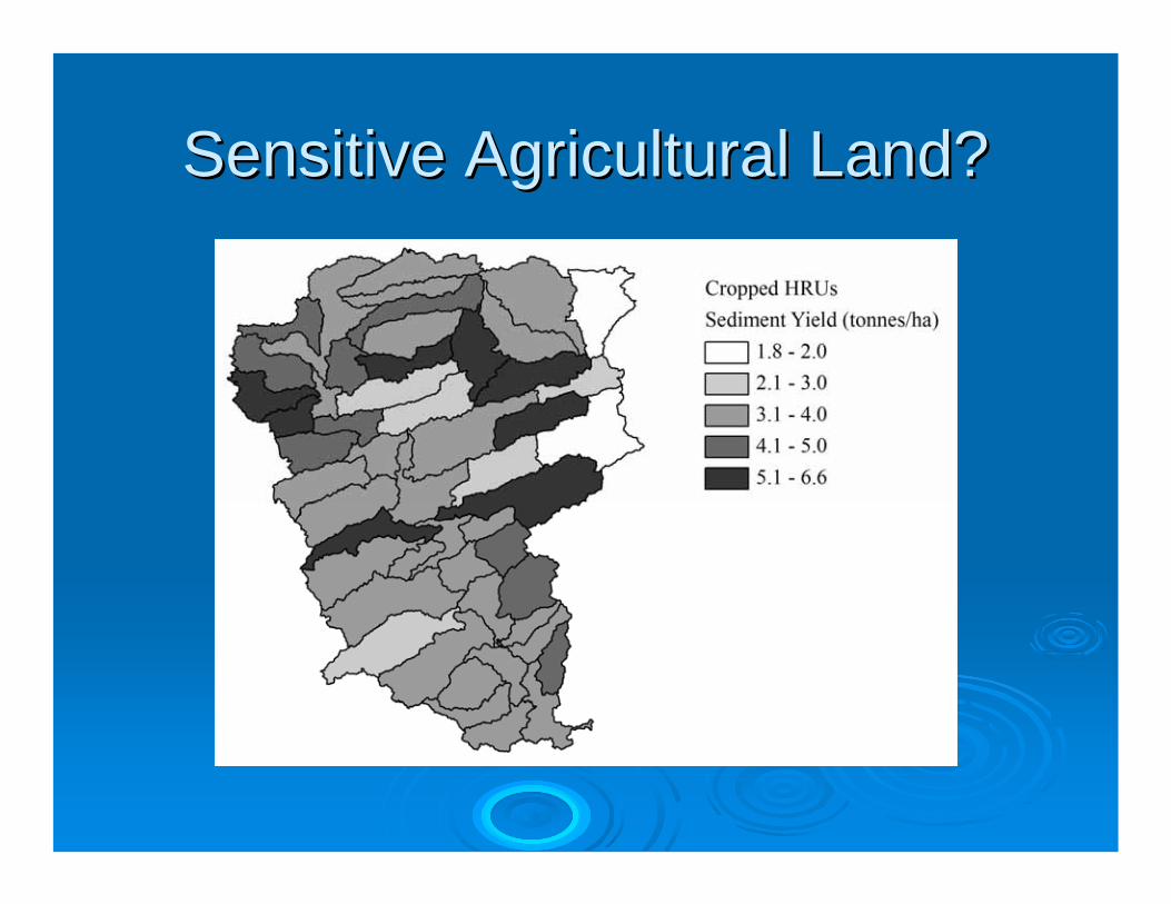
Goal: Goal: ““Reduce the contribution of Reduce the contribution of sensitive sensitive agricultural landagricultural land to sedimentation to sedimentation occurring in the Illinois Riveroccurring in the Illinois River””ObjectivesObjectives
““ReduceReduce……silt and sediment entering the silt and sediment entering the Illinois River by 20 percentIllinois River by 20 percent””Additional goals for nutrient reduction and Additional goals for nutrient reduction and increases in fish, waterfowl, and mussel increases in fish, waterfowl, and mussel populations populations
Farm Service Agency. 2004. Illinois CREP Programmatic Environmental Assessment. U.S. Department of Agriculture, Washington, D.C.
ObjectivesObjectives
Evaluate the success of the Illinois CREP Evaluate the success of the Illinois CREP in the La Moine River Basin based on:in the La Moine River Basin based on:
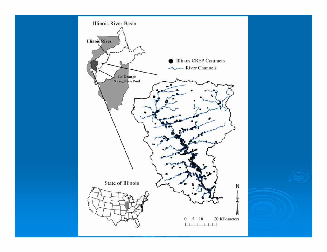
Current location of Current location of BMPsBMPs
Sediment reductionSediment reduction
MethodsMethodsPredict hydrologic and physical processes Predict hydrologic and physical processes at the watershedat the watershed--scalescaleSoil and Water Assessment Tool (SWAT) Soil and Water Assessment Tool (SWAT) version 2000version 2000
(Benson 2004)
Collect data important to model inputsCollect data important to model inputsSoils (NRCSSoils (NRCS--StatsgoStatsgo))Land use (Illinois Dept. of Agriculture)Land use (Illinois Dept. of Agriculture)Climate (NOAA)Climate (NOAA)Topography (USGS)Topography (USGS)Land management (NRCS)Land management (NRCS)
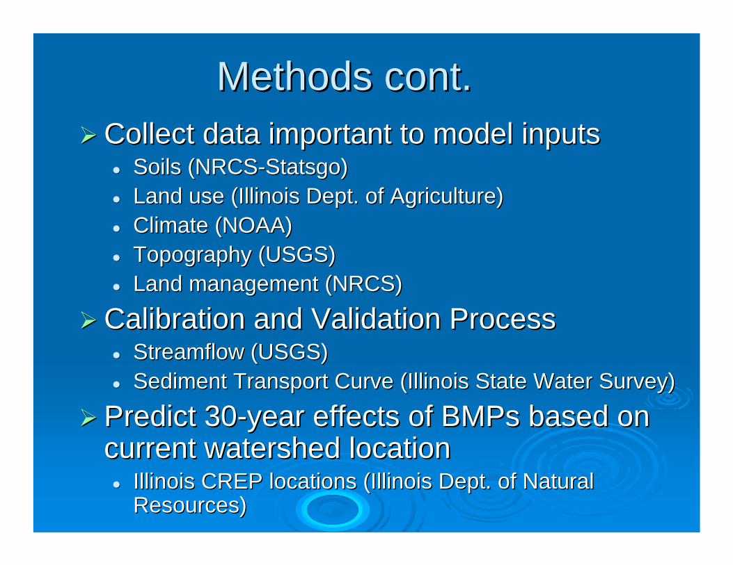
Methods cont.Methods cont.
Collect data important to model inputsCollect data important to model inputsSoils (NRCSSoils (NRCS--StatsgoStatsgo))Land use (Illinois Dept. of Agriculture)Land use (Illinois Dept. of Agriculture)Climate (NOAA)Climate (NOAA)Topography (USGS)Topography (USGS)Land management (NRCS)Land management (NRCS)
Calibration and Validation ProcessCalibration and Validation ProcessStreamflowStreamflow (USGS)(USGS)Sediment Transport Curve (Illinois State Water Survey)Sediment Transport Curve (Illinois State Water Survey)
Predict 30Predict 30--year effects of year effects of BMPsBMPs based on based on current watershed locationcurrent watershed location
Illinois CREP locations (Illinois Dept. of Natural Illinois CREP locations (Illinois Dept. of Natural Resources)Resources)
Methods cont.Methods cont.
Sediment Transport CurveSediment Transport Curve
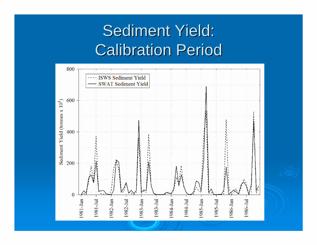
Sediment Yield:Sediment Yield:Calibration PeriodCalibration Period
Sediment Yield Statistics:Sediment Yield Statistics:Pearson (RPearson (R22) and Nash) and Nash--Sutcliffe (RSutcliffe (RNSNS))
RR22 = 0.60 = 0.60 RRNSNS = 0.59 = 0.59
RR22= 0.74 = 0.74 RRNSNS= 0.74 = 0.74
DailyDaily
RR2 2 = 0.70 = 0.70 RRNSNS = 0.76 = 0.76
RR22 = 0.79 = 0.79 RRNSNS= 0.79 = 0.79
MonthlyMonthly
RR22 = 0.79= 0.79RRNSNS = 0.72 = 0.72
RR2 2 = 0.81= 0.81RRNSNS = 0.81 = 0.81
AnnualAnnual
Validation Period Validation Period (1991(1991--1998)1998)
Calibration Period Calibration Period (1981(1981--1986)1986)
Time ScaleTime Scale
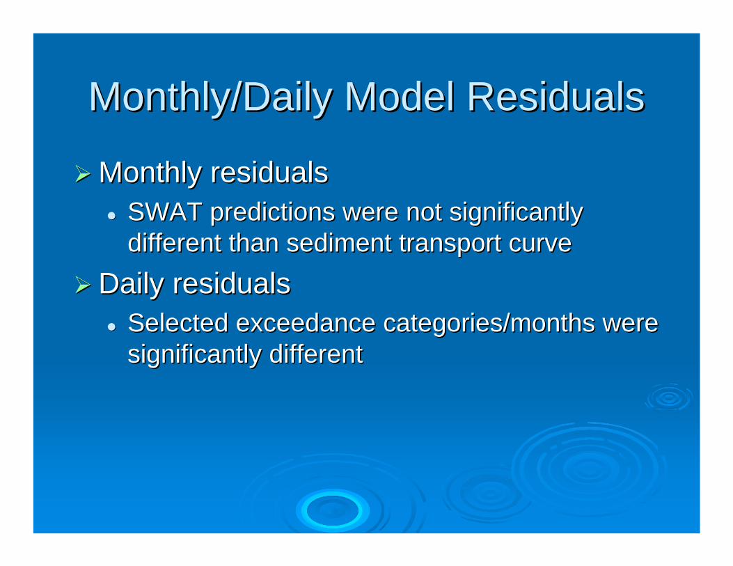
Monthly/Daily Model ResidualsMonthly/Daily Model Residuals
Monthly residualsMonthly residualsSWAT predictions were not significantly SWAT predictions were not significantly different than sediment transport curvedifferent than sediment transport curve
Daily residualsDaily residualsSelected Selected exceedanceexceedance categories/months were categories/months were significantly differentsignificantly different
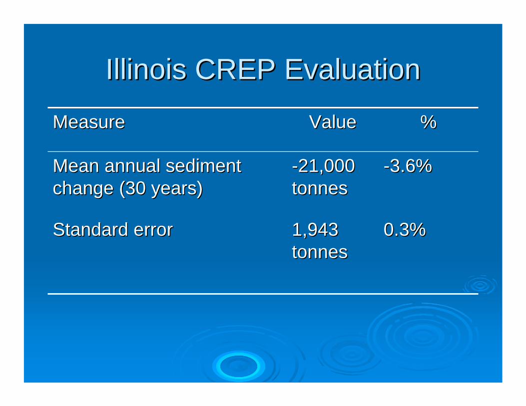
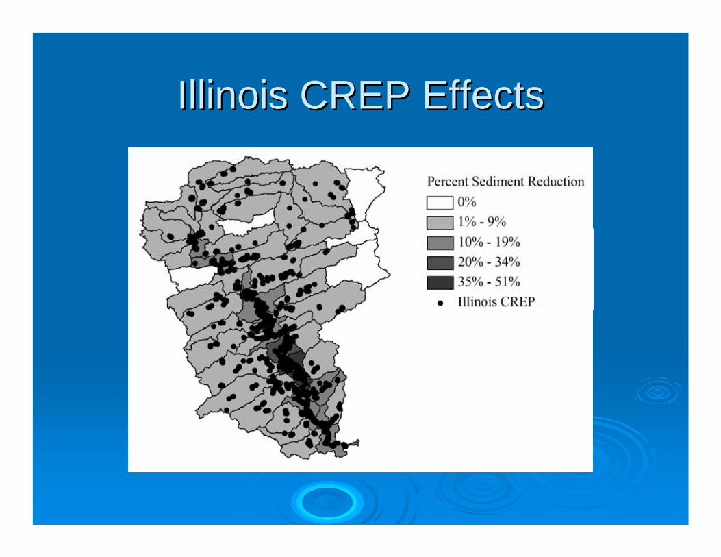
Illinois CREP EvaluationIllinois CREP Evaluation
0.3%0.3%1,943 1,943 tonnestonnes
Standard errorStandard error
--3.6%3.6%--21,000 21,000 tonnestonnes
Mean annual sediment Mean annual sediment change (30 years)change (30 years)
BroadBroad--scale, general objectives may not scale, general objectives may not costcost--effectively guide the Illinois CREPeffectively guide the Illinois CREP
Models can help refine implementation Models can help refine implementation plans at the initial stages of programsplans at the initial stages of programs
Develop targeted objectives for Illinois Develop targeted objectives for Illinois River subRiver sub--watershedswatersheds