27
APPLIED GEOPHYSICS AN INTRODUCTION FRED BEEKMAN JEANNOT TRAMPERT
| Date post: | 18-Dec-2015 |
| Category: |
Documents |
| Upload: | olivia-gallagher |
| View: | 220 times |
| Download: | 2 times |
APPLIED GEOPHYSICS AN INTRODUCTION
FRED BEEKMAN
JEANNOT TRAMPERT
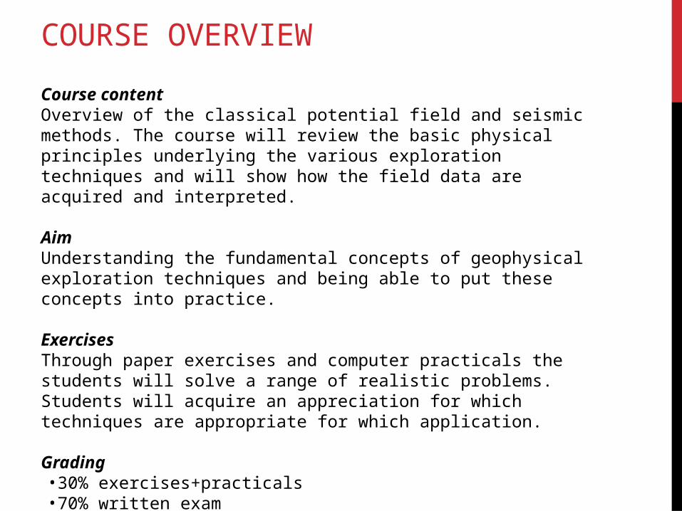
COURSE OVERVIEW
Course contentOverview of the classical potential field and seismic methods. The course will review the basic physical principles underlying the various exploration techniques and will show how the field data are acquired and interpreted.
AimUnderstanding the fundamental concepts of geophysical exploration techniques and being able to put these concepts into practice.
Exercises Through paper exercises and computer practicals the students will solve a range of realistic problems. Students will acquire an appreciation for which techniques are appropriate for which application.
Grading•30% exercises+practicals•70% written exam
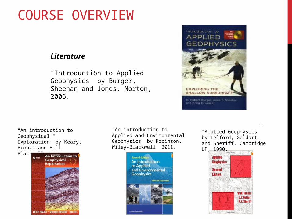
COURSE OVERVIEW
Literature
“Introduction to Applied Geophysics” by Burger, Sheehan and Jones. Norton, 2006.
“An introduction to Geophysical Exploration” by Keary, Brooks and Hill. Blackwell, 2002.
“An introduction to Applied and Environmental Geophysics” by Robinson. Wiley-Blackwell, 2011.
“Applied Geophysics” by Telford, Geldart and Sheriff. Cambridge UP, 1990.
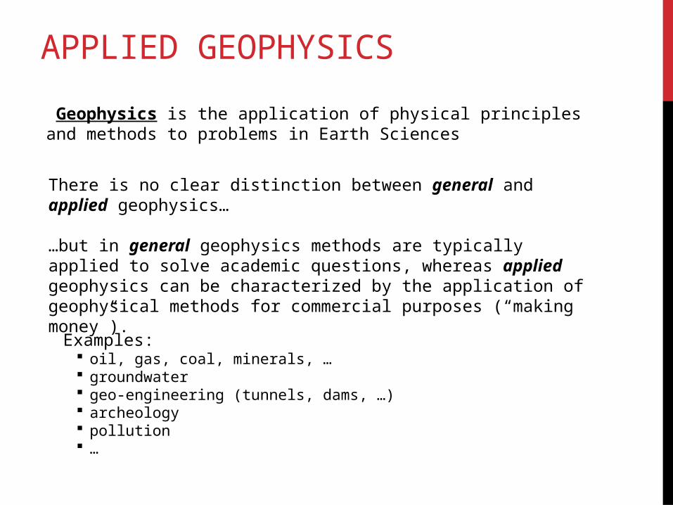
APPLIED GEOPHYSICS
Geophysics is the application of physical principles and methods to problems in Earth Sciences
There is no clear distinction between general and applied geophysics…
…but in general geophysics methods are typically applied to solve academic questions, whereas applied geophysics can be characterized by the application of geophysical methods for commercial purposes (“making money”).
Examples: oil, gas, coal, minerals, … groundwater geo-engineering (tunnels, dams, …) archeology pollution …
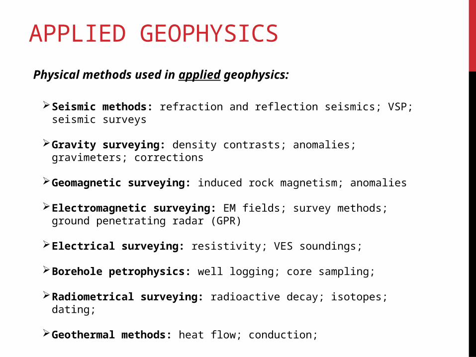
APPLIED GEOPHYSICS
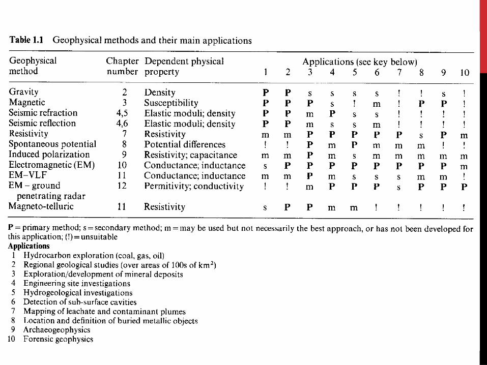
Physical methods used in applied geophysics:
Seismic methods: refraction and reflection seismics; VSP; seismic surveys
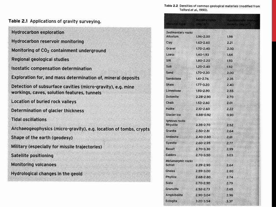
Gravity surveying: density contrasts; anomalies; gravimeters; corrections
Geomagnetic surveying: induced rock magnetism; anomalies
Electromagnetic surveying: EM fields; survey methods; ground penetrating radar (GPR)
Electrical surveying: resistivity; VES soundings;
Borehole petrophysics: well logging; core sampling;
Radiometrical surveying: radioactive decay; isotopes; dating;
Geothermal methods: heat flow; conduction;
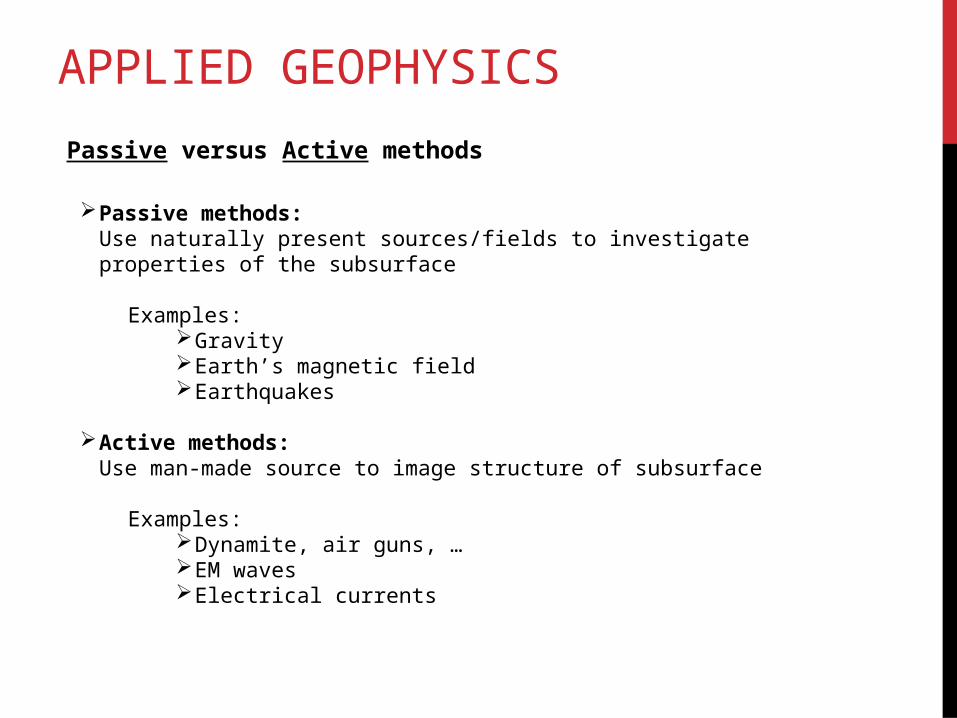
APPLIED GEOPHYSICS
Passive versus Active methods
Passive methods:Use naturally present sources/fields to investigate properties of the subsurface
Examples:GravityEarth’s magnetic fieldEarthquakes
Active methods: Use man-made source to image structure of subsurface
Examples:Dynamite, air guns, …EM wavesElectrical currents
APPLIED GEOPHYSICS
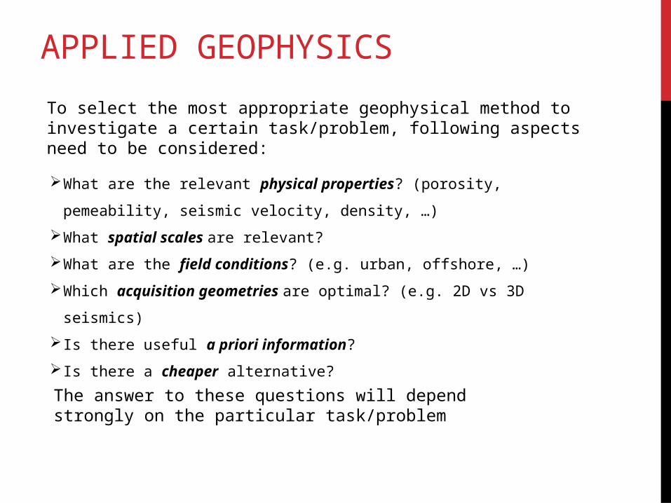
To select the most appropriate geophysical method to investigate a certain task/problem, following aspects need to be considered:
What are the relevant physical properties? (porosity, pemeability, seismic
velocity, density, …)
What spatial scales are relevant?
What are the field conditions? (e.g. urban, offshore, …)
Which acquisition geometries are optimal? (e.g. 2D vs 3D seismics)
Is there useful a priori information?
Is there a cheaper alternative?
The answer to these questions will depend strongly on the particular task/problem
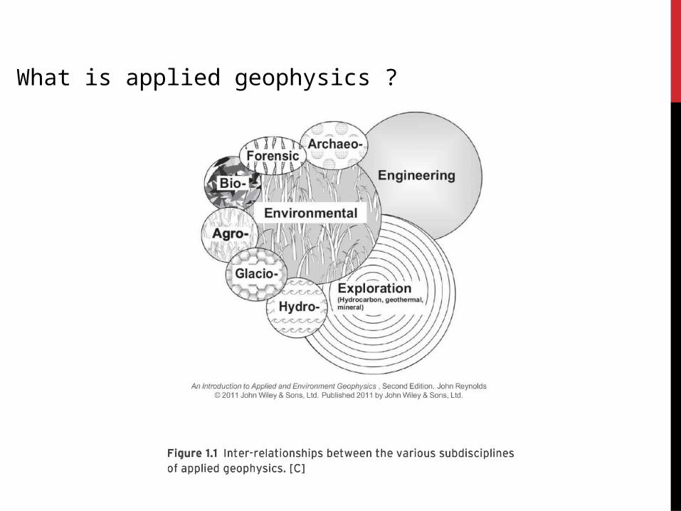
What is applied geophysics ?
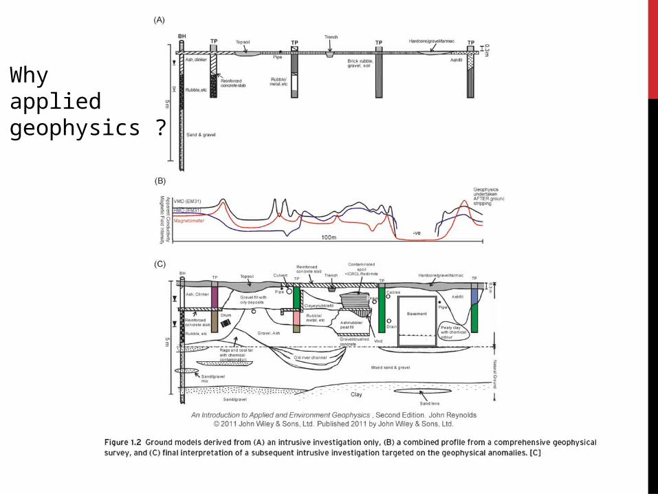
Why applied geophysics ?
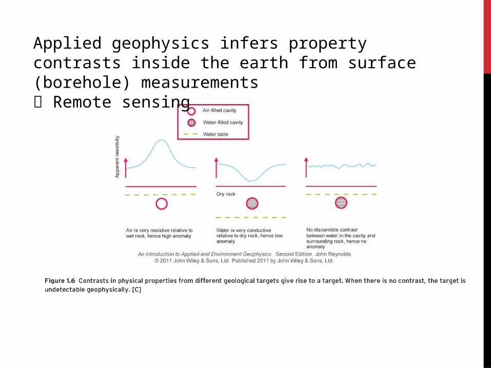
Applied geophysics infers property contrasts inside the earth from surface (borehole) measurements Remote sensing
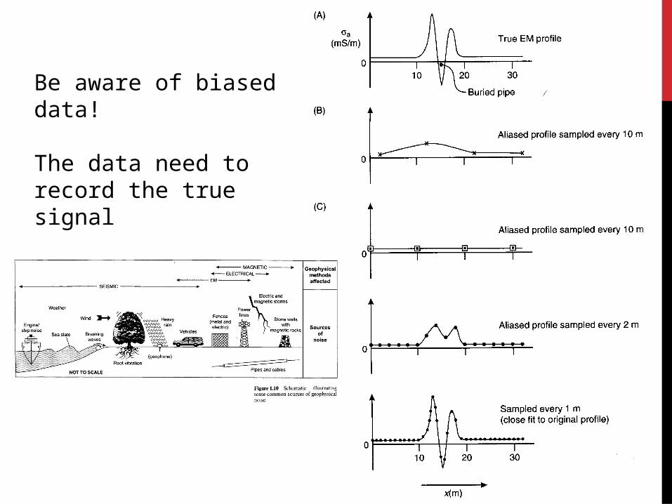
Be aware of biased data!
The data need to record the true signal
Noise is also an issue
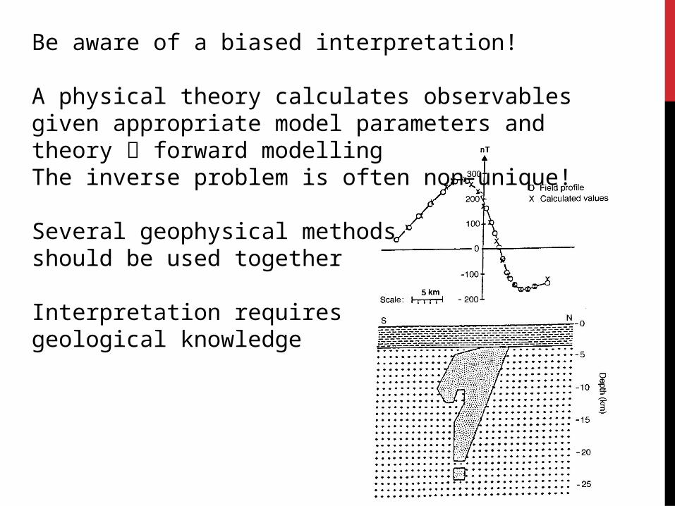
Be aware of a biased interpretation!
A physical theory calculates observables given appropriate model parameters and theory forward modellingThe inverse problem is often non-unique!
Several geophysical methods should be used together
Interpretation requires geological knowledge
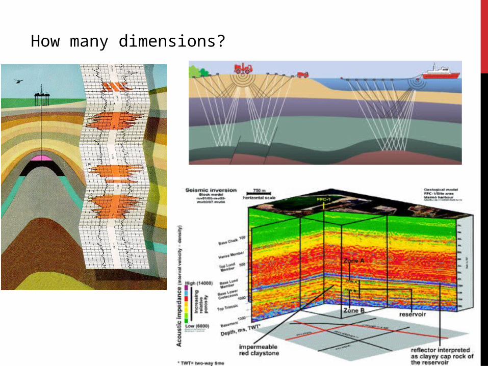
How many dimensions?
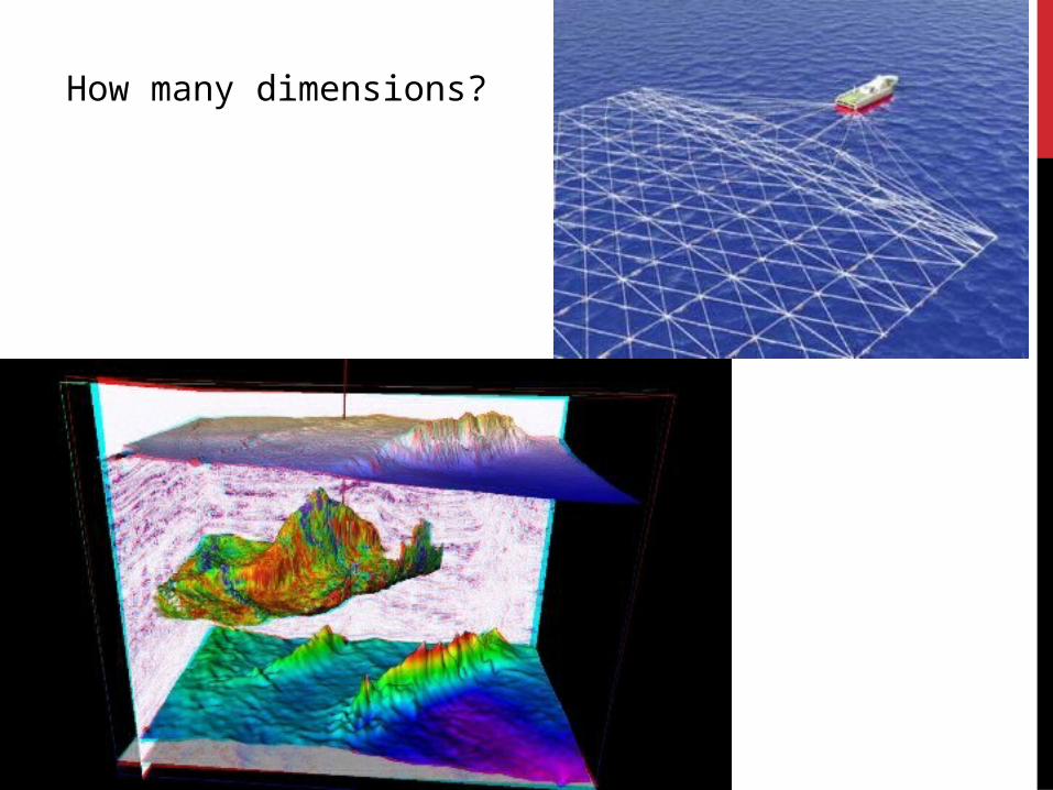
How many dimensions?
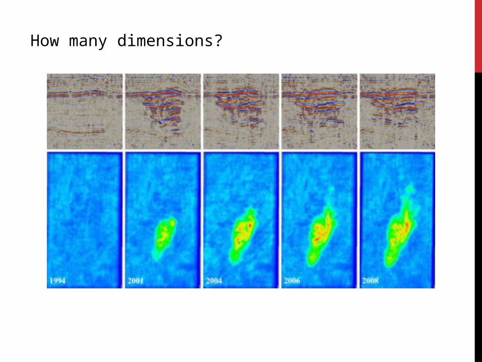
How many dimensions?
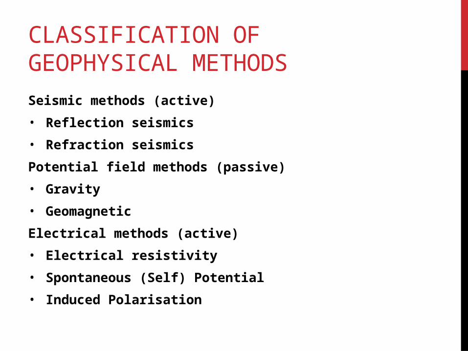
CLASSIFICATION OF GEOPHYSICAL METHODS
Seismic methods (active)
• Reflection seismics
• Refraction seismics
Potential field methods (passive)
• Gravity
• Geomagnetic
Electrical methods (active)
• Electrical resistivity
• Spontaneous (Self) Potential
• Induced Polarisation
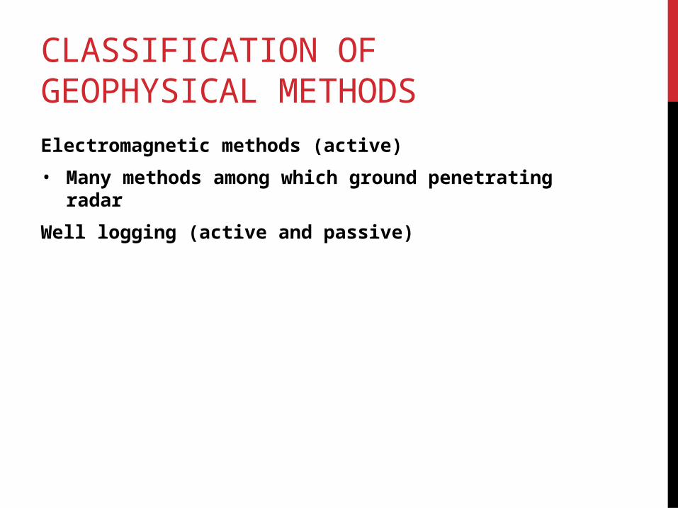
CLASSIFICATION OF GEOPHYSICAL METHODS
Electromagnetic methods (active)
• Many methods among which ground penetrating radar
Well logging (active and passive)
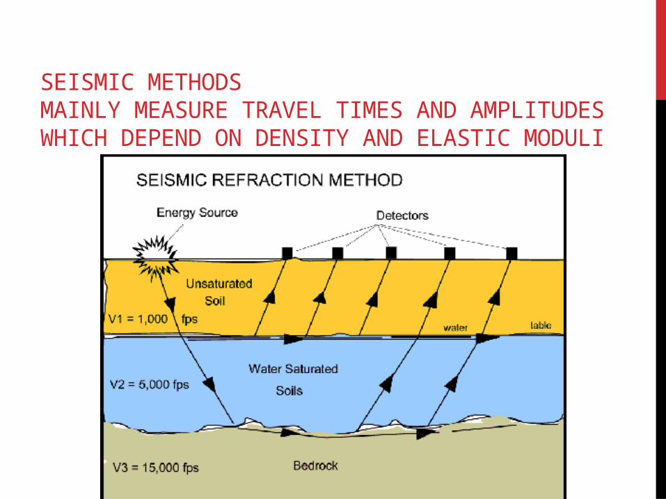
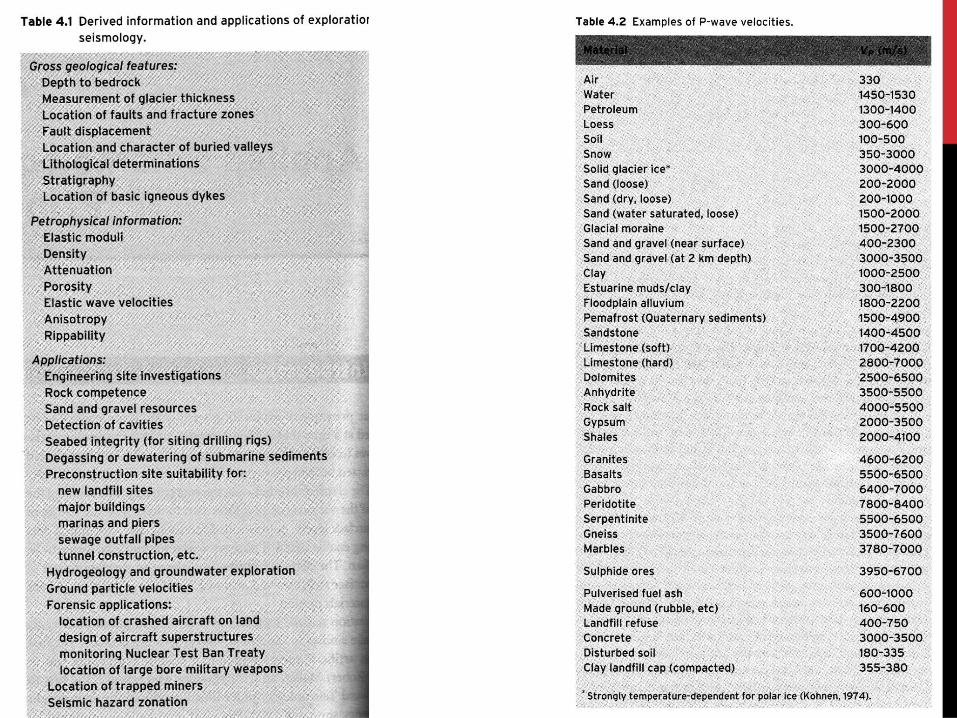
SEISMIC METHODSMAINLY MEASURE TRAVEL TIMES AND AMPLITUDES WHICH DEPEND ON DENSITY AND ELASTIC MODULI
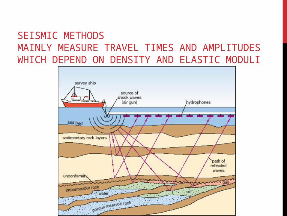
SEISMIC METHODSMAINLY MEASURE TRAVEL TIMES AND AMPLITUDES WHICH DEPEND ON DENSITY AND ELASTIC MODULI
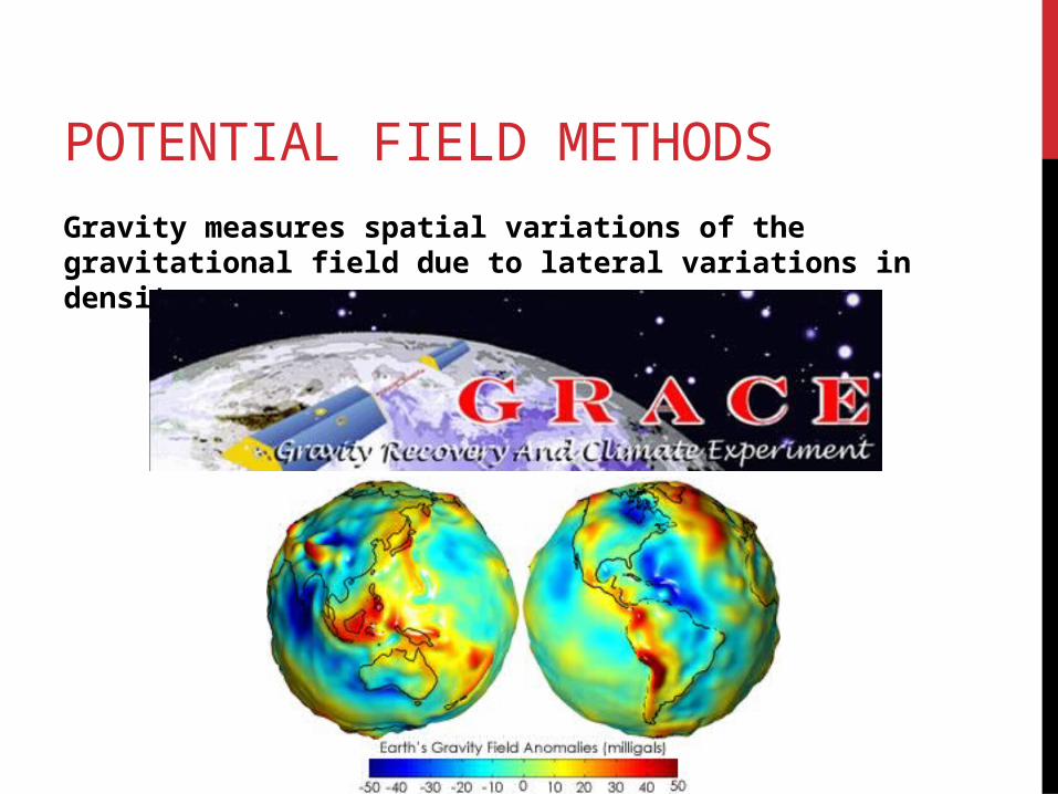
POTENTIAL FIELD METHODS
Gravity measures spatial variations of the gravitational field due to lateral variations in density.
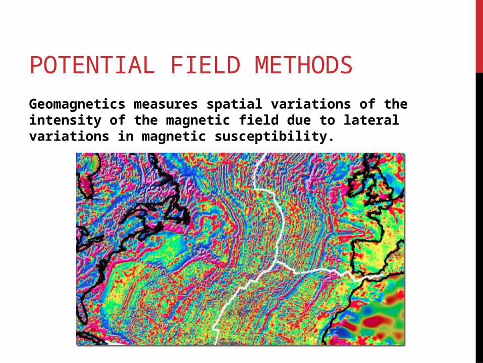
POTENTIAL FIELD METHODS
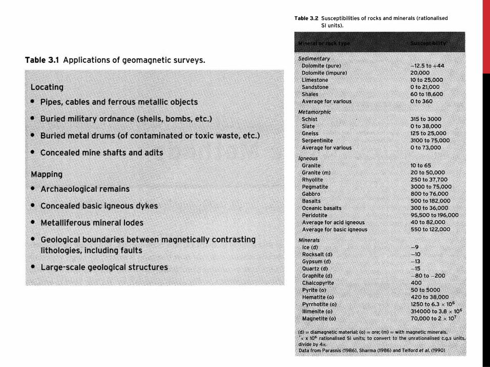
Geomagnetics measures spatial variations of the intensity of the magnetic field due to lateral variations in magnetic susceptibility.
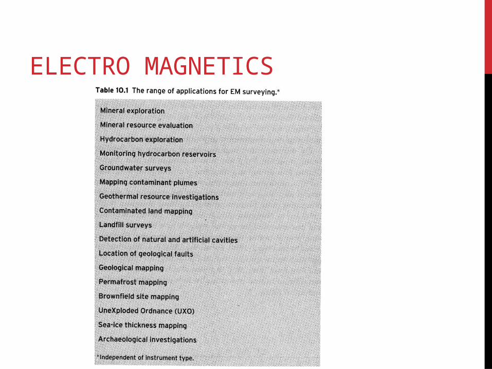
ELECTRO MAGNETICS
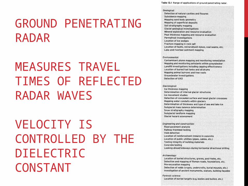
GROUND PENETRATING RADAR
MEASURES TRAVEL TIMES OF REFLECTED RADAR WAVES
VELOCITY IS CONTROLLED BY THE DIELECTRIC CONSTANT


