23
April 2010 Oracle Spatial User Conference

April 2010
Oracle Spatial User Conference

Oracle Spatial
User Conference
April 29, 2010
Hyatt Regency Phoenix
Phoenix, Arizona USA
April 2010
Oracle Spatial
User Conference

Jayant SharmaTechnical Director, Spatial
Mike SiciliaVP Development, Oracle Primavera
April 2010
Oracle Spatial
User Conference
Integrating MapViewer with Primavera Project Management and Business Intelligence Applications
April 2010
Oracle Spatial
User Conference

April 2010
Oracle Spatial
User Conference
April 2010
Oracle Spatial
User Conference
The following is intended to outline our general product direction. It is intended for information purposes only, and may not be incorporated into any contract. It is not a commitment to deliver any material, code, or functionality, and should not be relied upon in making purchasing decisions.The development, release, and timing of any features or functionality described for Oracle’s products remains at the sole discretion of Oracle.
April 2010
Oracle Spatial
User Conference
April 2010
Oracle Spatial
User Conference
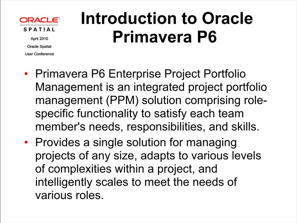
• Primavera P6 Enterprise Project Portfolio Management is an integrated project portfolio management (PPM) solution comprising role-specific functionality to satisfy each team member's needs, responsibilities, and skills.
• Provides a single solution for managing projects of any size, adapts to various levels of complexities within a project, and intelligently scales to meet the needs of various roles.
Introduction to Oracle Primavera P6

April 2010
Oracle Spatial
User Conference
April 2010
Oracle Spatial
User Conference
• Plan, schedule, and control large-scale programs and individual projects
• Select the right strategic mix of projects• Balance resource capacity• Allocate best resources and track progress• Monitor and visualize project performance
versus plan• Foster team collaboration• Integrate with financial management and
human capital management systems
Oracle Primavera P6 Benefits
April 2010
Oracle Spatial
User Conference
April 2010
Oracle Spatial
User Conference
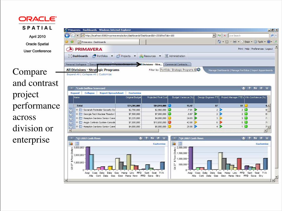
Compare and contrast project performance across division or enterprise
April 2010
Oracle Spatial
User Conference
April 2010
Oracle Spatial
User Conference
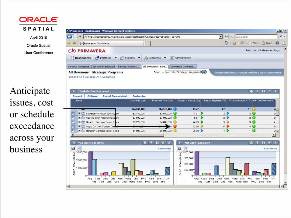
Anticipate issues, cost or schedule exceedance across your business
April 2010
Oracle Spatial
User Conference
April 2010
Oracle Spatial
User Conference
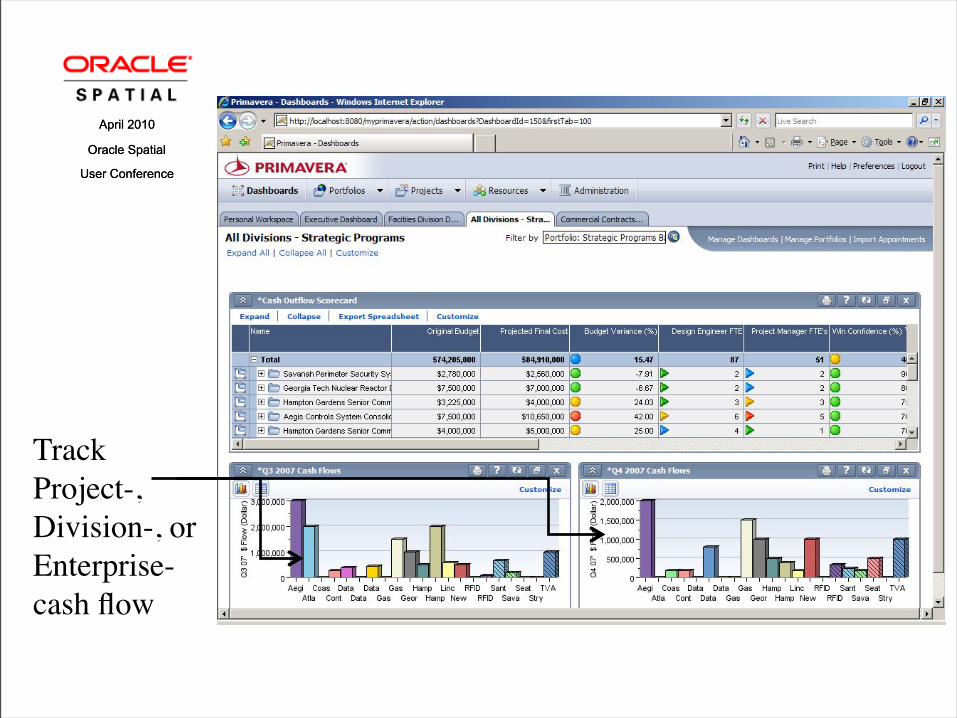
Track Project-, Division-, or Enterprise- cash flow
April 2010
Oracle Spatial
User Conference
April 2010
Oracle Spatial
User Conference
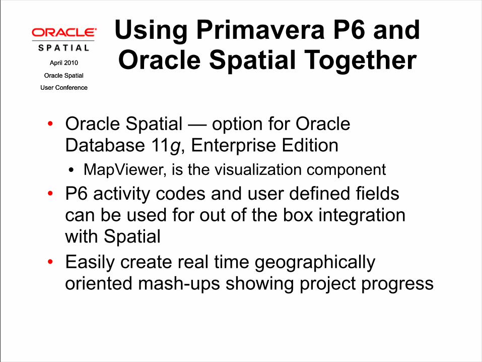
Using Primavera P6 and Oracle Spatial Together
• Oracle Spatial — option for Oracle Database 11g, Enterprise Edition• MapViewer, is the visualization component
• P6 activity codes and user defined fields can be used for out of the box integration with Spatial
• Easily create real time geographically oriented mash-ups showing project progress

April 2010
Oracle Spatial
User Conference
April 2010
Oracle Spatial
User Conference
Using Primavera P6 and Oracle Spatial Together
• Out of the box prototype linking of P6 activity codes and geographic indicators via Web Services APIs• City, State• Latitude/Longitude• Mile markers
• Built using custom portlets feature in P6 and Oracle Locator pack for Oracle database

D E M O N S T R A T I O N
MapViewer and P6 Integrated
April 2010
Oracle Spatial
User Conference

April 2010
Oracle Spatial
User Conference
April 2010
Oracle Spatial
User Conference
Implementing P6-Spatial Integration
• Key components:• Oracle Spatial• MapViewer and MapBuilder• P6 version 7.0 or greater EPPM• P6 Web Services

April 2010
Oracle Spatial
User Conference
April 2010
Oracle Spatial
User Conference
Implementing P6-Spatial Integration
• Key assumptions:• P6 project has been tagged with project and or
activity codes• Codes are a method by which projects or activities
within projects can tagged with a certain attribute. • In this case we are tagging projects or activities with
a geospatial attribute.• Codes in P6 are associated with some geospatial
datatype (city/state, latitude/longitude, etc.)

April 2010
Oracle Spatial
User Conference
April 2010
Oracle Spatial
User Conference
Implementing P6-Spatial Integration
• Step 1: Create a Base Map
• mapView.display();

April 2010
Oracle Spatial
User Conference
April 2010
Oracle Spatial
User Conference
Implementing P6-Spatial Integration
• Step 2: Define Dynamic Styling• Create 2 markers, a green highway marker and a
red highway marker.
• Create a numeric range bucket series, values below .5 will be rendered using the red marker, otherwise use the green marker.

April 2010
Oracle Spatial
User Conference
April 2010
Oracle Spatial
User Conference
Implementing P6-Spatial Integration
• Step 3: Create a Theme Based Feature of Interest• Create theme based on a query that loads
geometries and mile points from a table called route_mile_markers
• Add the styles created to this theme (highway markers and buckets)

April 2010
Oracle Spatial
User Conference
April 2010
Oracle Spatial
User Conference
Implementing P6-Spatial Integration
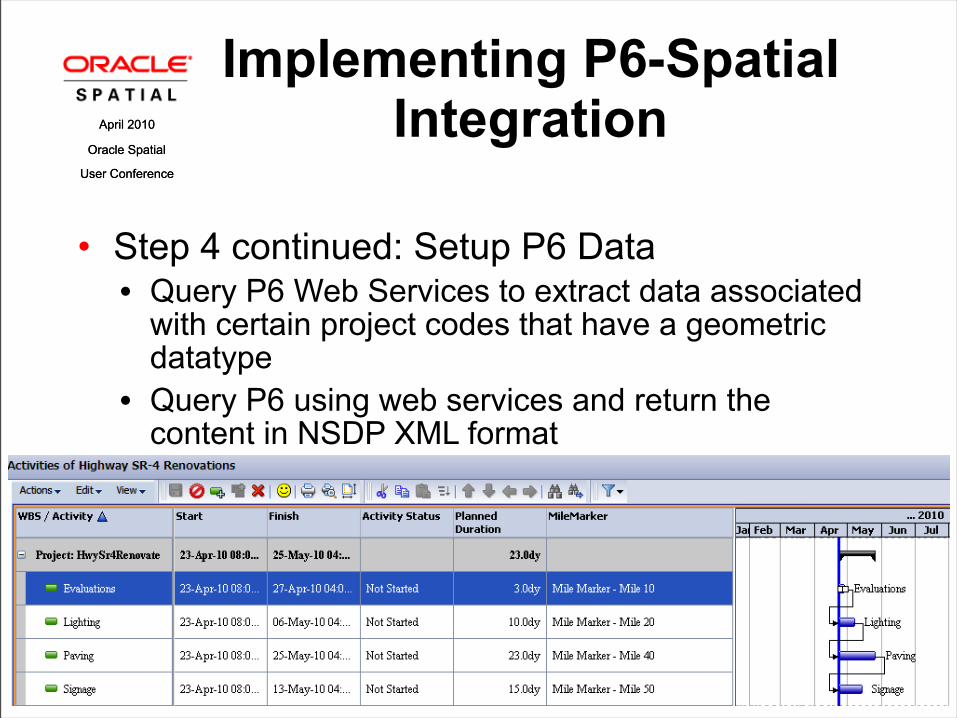
• Step 4: Setup P6 Data• Query P6 Web Services to extract data associated
with certain project codes that have a geometric datatype
April 2010
Oracle Spatial
User Conference
April 2010
Oracle Spatial
User Conference
Implementing P6-Spatial Integration
• Step 4 continued: Setup P6 Data• Query P6 Web Services to extract data associated
with certain project codes that have a geometric datatype
• Query P6 using web services and return the content in NSDP XML format

April 2010
Oracle Spatial
User Conference
April 2010
Oracle Spatial
User Conference
Implementing P6-Spatial Integration
• Step 5: Add NSDP Join to P6 Data for Thematic Mapping• // map the P6 data to points or buckets on the
MapViewer component
P6 activities mapped to mile markers
P6 activities mapped to buckets

April 2010
Oracle Spatial
User Conference
April 2010
Oracle Spatial
User Conference
The preceding is intended to outline our general product direction. It is intended for information purposes only, and may not be incorporated into any contract. It is not a commitment to deliver any material, code, or functionality, and should not be relied upon in making purchasing decisions.The development, release, and timing of any features or functionality described for Oracle’s products remains at the sole discretion of Oracle.

AQ&April 2010
Oracle Spatial
User Conference


