.. F 914 .AS 584 1980 Archaeological Survey and Cultural itesources Overview Fort Richardson, Alaska United States Army Corps of Engineers U! ... Serving the Army ... Serving the Nation tsks District e1980
Transcript
..
F914.AS5841980
Archaeological Surveyand
Cultural itesources OverviewFort Richardson, Alaska
Cabin #1: Site ANC-263 37Cabin #2: Site ANC-264•.•••.•••••..•-.~ 38Structure #3: Site ANC-265 .•••.•••.••.••.•.••.••••.••.•.•.••••.•41Eagle River Railroad Bridge: Site ANC-266 ••.••••.••••••••••••.•. 43Other Structures and Features ••••.••..••..•.••.••.••••••.••.•••.•44
ARCHAEOLOGICAL RESULTS AND EVALUATION •.••.••••••••••.•••••.•••..••••• 45RECOMMENDATIONS ~ •••••••••••••••••••••••••••••••••••••••• ••49
1 Previously Known Sites in Study Area2 Future Development Survey
i
TABLE OF CONTENTS (cont)
LIST OF FIGURES
Number Title
1 Vegetation of the Study Area•••....•••.••••••.••••••••••••.•• 22 Wildlife Species of Fort Richardson ••.••••••••••••••.••••••5-63 Physiography of the Study Area•.••••••••••••.••••••.•••.••••• 94 Local Sequence for Upper Cook Inlet Illustrating
Cultural Affiliations 135 Local Tanaina Place Names .•..•.......•...•.....•••.•....••.. 156 BLM Cadastral Survey Maps •.•••••••.•••••••••••••••.•••••• 21-237 Homestead Map of Fort Richardson Area 1942.••••..•••.•••.•••248 Historic Structures Near Eagle River Railroad Bridge•.••.••. 269 Schematic Drawing of Sampling Scheme ..•.•.•••••.•••.••.••.••30
10 Fort Richardson, Alaska: Surveyed Areas .•.••••.••.••••••.••3211 Military Activity Areas •••.•...••••••.•.•.••..•..•.•..••••.•3612 Cabin 1: Site ANC-263 ...•.•................•..•............ 3913 Cabin 1: Site ANC-263•.•..................... e .•••••••••••••4014 Structure 3: Site ANC-265 ..••••.•.•.•••••••••.•••.•••..•..• 4215 Ship Creek Valley .....•....•...•..............•.........•.•...5016 Chugach Foothills Looking West to Eagle River Flats •.••..••• 5117 Grassy Area Near Knik Arm Bluffs ••••••..••••.••••.....•••••.5218 Tundra Bog Area •• . ',_ ... .•••••••••.••••.•••••••••.••.•.••••••• 5319 Alder Thicket in Disturbed Area•••••••..•..•.•••••••..••••.•54
i i
ABSTRACT
A reconnaissance level survey, including some minor subsurface testing, was conducted on Fort Richardson, Alaska in summer 1979 in order toassist the Army in complying with Federal laws applying to culturalresources. A three part sampl ing strategy was devi sed in order to provide reliable information for future planning purposes and to locatesites for an inventory of cultural resources. Part I consisted of asystematic interval sample with random starts for each set of transects.Part II consisted of intensive survey of areas deemed to have high potential for the recovery of cultural remains on the basis of backgroundresearch into aboriginal settlement patterns. Part III involved intensive survey in areas known to have been used historically by EuropeanAmericans. Four (4) sites probably related to European American activities in the past 80 years were located. No archeological sites werediscovered.
iii
)
)
ACKNOWLEDGMENTS
The help given by many people in making this project a success isgratefully appreciated. Lizette Boyer, Christopher Brown, and BarbaraThurston provided able assistance as crew during the field portion of thesurvey. Many others helped in the field work and report writing phasesincluding l20th Aviation Company, Fort Richardson, Alaska (ArcticKnights); Fort Richardson Range Control; Facility Engineer SupportSection, Alaska District, Corps of Engineers; and Douglas R. Reger,Alaska State Office of History and Archaeology, Alaska Division of Parks.
iv
)
INTRODUCTION
This study was implemented to enable the Army to partially fulfill itsobligations under AR 200-1, Chapter 8, in compliance with Executive Order11593, the National Historic Preservation Act of 1966, the NationalEnvironmental Policy Act of 1969, and the Archaeological and HistoricalPreservation Act of 1974.
This report provides a partial inventory of cultural resources on theFort Richardson installation. It also presents the results of aprobabilistic survey that provides data suitable for predicting the likelihood of finding cultural resources in various sectors of the post.Although this sort of determination can help the Army in managing itslands and provide guidance for future cultural resources surveys, apart ia1 survey does not fu1fi 11 the Army I s responsibil ities ~to completelyinventory all sites on Army land. Complete compliance can only be theresult of an ongoing plan to identify all properties on Fort Richardsonthat are eligible for the National Register of Historic Places.
The report is divided into three ~ections: Background Research,Research Design and Implementation, and Results and Recommendations.
v
PART I: BACKGROUND RESEARCH
ENVIRONMENT
Ascertaining the environmental associations at archaeological sites isone of the goals of modern archaeology. Only by discovering the place ofhuman populations within the ecosystems in which they exist can we understand past human cultural processes and how they facilitate adaptation tothe environment. Furthermore, once certain types of sites have beenfound to be associated with particular environmental feature we have avaluable tool for predicting site distributions across the landscape.
Fort Richardson, stretching as it does from the Chugach Mountains toKnik Arm, encompasses several different environmental zones. On thelarge scale these zones are directly related to elevation, i.e., tundraecosystems at high altitudes and forest systems at lower altitudes.Other factors such as slope, orientation, relief, and availability ofmoisture and light cause variation on a smaller scale.
Another variable is the fact that the environment has not necessarilyremained the same during the period of human occupancy of the UpperInlet. Unfortunately, the climatological and environmental sequence forthe region is not well known, so it is necessary to use present dayenvironmental data to model past human resource exploitation.
The following descriptions of present day ecosystems and physiographyare summarized from the working Draft Environmental Impact Statement forInstallation Utilization at Fort Richardson, Alaska (Metrek Corporation,1978).
Terrestrial Ecosystems of Fort Richardson
Barren Ecosystems
These areas consist of unvegetated landscapes such as mountains,glaciers, and river terraces. Viereck (1967) describes mountain zonationmoving from the low spruce forests upward. Above the spruce is a zone oflow, matted alpine vegetation which becomes more sparse until there ismerely bare rock, and above that perpetual snow. This pattern can beseen in the mountainous areas of Fort Richardson. Many of these trulybarren areas are so steep, inaccessible, and support so little animal orvegetable life that it is unlikely they were exploited by humans.
Tundra
The moist type of tundra occurs in the eastern mountainous area ofFort Richardson above treeline at about 3,500 to 4,000 feet (see Figure1). Alpine tundra is found at higher elevations and on better drained
slopes. It varies from dwarf shrubs~ thick moss and grass, to a fewlichens. Lower protected valleys and wetter depressions in the rocksupport low shrubs, berry plants~ grasses, sedges~ and a spongy mosslayer. Exposed ridges are usually only covered with lichens.
Dall sheep live in alpine tundra zones, and can be found within thefort boundaries and in the adjacent areas of Chugach State Park; sheepwere a relatively important game animal for Tanaina populations in theUpper Inlet. Ground squirrels are found in the subalpine zones. Thesesmall animals were eaten by aboriginal peoples although they were notusually a major resource. During the summer months moose were sighted inthe protected shrubby valleys above treeline although such areas are notconstdered their "typica1 U habitat.
High Brush Ecosystems
These are usually narrow zones of transition between forests andbarren areas or betweenforests~ lakes~ and streams. On Fort Richardsonbrushy vegetation occurs between timberline and the moist tundra on thewest face of the mountains Qn fairly steep slopes. It also follows wetvalleys and south facing slopes at higher elevations. As noted~ moosebrowse up into this zone during summer months. Ptarmigan are also foundhere. These birch/a 1der/wi 11 ow thickets can be extremely dense andvirtually impenetrable to people. Devils Club is found under the brushin particularly moist areas which makes travel through the area even lesspleasant. Many areas disturbed by human activity in the past havereturned to this dense vegetattonal stage. Old roads and once clearedareas on post have generally regrown into thick alder patches.
Forest
Most of Fort Richardson is forested with the white and black sprucetypical of Alaska's "taiga." This is wooded vegetation typical of theboreal subarctic latitudes and subalpine elevations adjacent to treelesstundra zones (Le Roi 1967). Species diversity is low (only about four orfive species) with a more diverse herb and shrub strata below. Whitespruce predominates on well drained sites with black spruce typical ofcoo1er~ poorly drained sites. In general~ the forested areas of the postare easily traversed on foot because the trees are not particularly denseand the undergrowth is low.
Spruce Bog
Bogs are common in the low~ flat sections of the post and in thenorthwestern area especially. The cold, waterlogged soils often supportstands of small black spruce. Spruce bogs are usually underlain by athi~k mat of sphagnum, sedges, grasses~ and heath shrubs. They arecharacterized by several kinds of edible berries~ including cranberry,1ingonberry~ and blueberry, as well as paper birch, willows~ and labradortea.
Spruce hen were noted in these areas.
3
Although these are moist places at some times of year, it was usuallyno problem to walk through a spruce bog in midsummer. Many spruce bogsseem to be located in dried up beds of old 1akes', ponds, and, streams.Frequently old shorelines could be observed ringing the bogs.
Marsh
Both freshwater and saltwater marshes occur on post.
Salt marshes occur in small patches along Knik Arm and in the tidalreach of Eagle River. These marshes are characterized by salt tolerantvegetation.
Freshwater marshes are found along Eagle River and in bogs, ponds, andlakes. Associated vegetation includes sedges, rushes, and grasses aswell as floating and submerged plant species.
Marshes are important bird habitat and freshwater marshes are primemoose habitat.
Wildlife
At present Fort Richardson is noted for high moose and sheep populations. Caribou were found in the area at one time and were hunted by theTanaina, but they are presently extinct in the Anchorage area.
Both black and brown bears and wolves are found in the area.
See Figure 2 for a list of other animals found in the area.
Aquatic Ecosystems
Marine Ecosystems
Knik Arm of Cook Inlet forms the western boundary of Fort Richardson.Steep bluffs make access to the Arm difficult in many places except whereerosion or streams have cut through the bluff. Extensive tidal marshesand mudflats are found along Knik Arm. Beluga whales and harbor seal dotravel up the Arm but they are mainly found along the western shore.These animals are more abundant in lower Cook Inlet.
Waterfowl are found in great numbers on Eagle River flats, especiallyduring the spring and fall migrations, and there is a resident summerduck population.
Salmon migrate through the Arm to reach their spawning streams. Thesefish were extremely important to aboriginal populations.
FIGURE 2 ContinuedWildlife, Ranges, Concentrations, of Study Area.
SOURCE: ALASKA DEPARTMENT OF FISH AND GAME. 1973.
1\\11 HARBOR SEAL I:ZZ1 DALL SHEEP
IlZ!i!llI GRIZZLY BEAR, SUSPECTEDEiZISl:I DENNING AREA RANGES FOR MOOSE, BLACK BEAR, GRIZZLY
BEAR, WOLF AND WOLVERINE COVER ENTIRESTUDY AREA.BELUGA WHALES ARE PRESENT IN KNIK ARMAND TURNAGAIN ARM.
o..~ WATERFOWL AND SEA BIRD~ NESTING OR MOLTING AREA ~:.: +
MILES NR2W, T14N-RANGE AND TOWNSHIP I
WILDLIFE RANGES AND CONCENTRATIONS OF STUDY AREA
Freshwater Ecosystems
Fishing, especially for salmon, was a major subsistence activity ofthe Tanaina, so the margins of lakes and streams were particularlyimportant to this study.
Ship Creek had substantial runs of salmon in the past (D. Reger,personal communication). People from Eklutna would travel to its mouthwhere there was a fishing camp as well as to the mouth of Eagle River.Campbell Creek and Chester Creek could have provided trout and grayling.
The Tanaina place names listed in the prehistory section below attestto fishing camps along Knik Arm and to the further importance of ShipCreek for its run of sticklebacks.
Geology
Physical Characteristics
Most of Fort Richardson is located within the Cook Inlet-Susitnalowland section of the coastal trough physiographic province. Jhis_Ls__~ _
- -----g-la-ci-ate-d-nrwl ana contaYn-fng--area-s-oTg-rouna-riiorai ne -a-rids tagnant icetopography, drumlin fields, eskers, and outwash plains. Most of the areais below 500 feet in elevation with local relief of 50-250 feet(Wahrhaftig 1965).
The fort borders Knik Arm, which is a branch of Cook Inlet, one ofthe deepest indentations in the west coast of North America. The banksof the Inlet are constantly eroding or being sloughed off by earthquakesand forming steep cliffs which range in height from 30 to 100 feet alongKnik Arm. As the banks are eaten back the Inlet is becoming broader andshallower. These cliffs or bluffs bounding the Inlet are a very distinctive feature and in some places make access to the plateau difficult.
The other province in the study area is the Kenfti-Chugach Mountains.The area was heavily glaciated during the Pleistocene and the resultanttopography exhibits typical glacial gemorphology i.e., U-shaped valleys,cirques, etc.
Glacial History
Archaeologists are interested in the record of glaciation in the hopeof determining the times in the past when the environment would have beensuitable for human colonization of Alaska and the New World, and in orderto distinguish areas where signs of early human occupation could beuncovered. The study area would not be a prime zone for remains of earlypeoples due to heavy glaciation until Holocene times (Karlstrom 1960).The later glacial history of the specific study area has not beenresolved, but it seems clear that the Anchorage area was basically freeof ice by about 10,000 years ago, although for most of the Pleistocenesouthcentral Alaska was a heavily glaciated zone.
7
,;
Soils
The main soil categories basically correspond with the physiographicdivisions outlined above.
a. Rocky soils are found in the steep, unvegetated, mountainousareas.
b. Upland mineral soils are composed primarily of silt, loam~ andpeat. Above 60 percent of these are shallow silt loam over gravelly loamor sandy loam on moraine hills. Twenty-five percent are fibrous peat.Fifteen percent are silty soils associated with depressions. These typesare the typical soils of the lower areas of the fort.
8
)
"\)
FIGURE 3
SOURCE: WAHRHAFTIG.1965.
ELEVATIONS IN FEET
MILES
R2W. T14N-RANGE AND TOWNSHIP
..o.. 2 345- tNi
PHYSIOGRAPHY OF STUDY AREA
PREHISTORY
This section will attempt to outline previous archaeological work inthe Upper Inlet area with the purpose of developing an hypothetical'chronological and cultural framework for human occupation in the area.The prehistory of the Upper In let is not well defined as yet, a situationthat is not surprising given the gaps in the archaeological record.Therefore, any discussion of the cultural sequence is, of necessity,tentative, and will draw heavily on broad regional level analyses.Temporal and cultural constructs are necessary models through whicharchaeologists evaluate new data; these constructs may then be reviewedand refined on the basis of new information.
Review of previous research in the area is important for otherreasons besides establishing or synthesizing cultural sequences. Previous studies serve as guides in formulating research questions and problems for the area, and in devising the research design and samplingstrategy. The available archaeological documentation, in conjunctionwith pertinent environmental, historical, and ethnographic data, aides inthe derivation of initial predictions about the kinds and distribution ofarchaeological sites that might be expected in the area.
The broad spectrum of past human behavior in the Upper Inlet has notbeen well studied as yet for at least several reasons: 1) research hasbeen concentrated along the shores of Knik Arm and along road and powercorridors, so the complete settlement-subsistence system has not necessarily been recovered from the archaeological record; 2) few stratifiedsites are known from the area, which makes it difficult to clarifyquestions of chronology and culture change, and; 3) researchers havefocussed on questions of coast-interior migrations and interactions, anddating, to the exclusion of other problems of potential interest toarchaeology. These comments are not meant to be critical, but rather to~oint out that there is still a good deal to be learned about the prehistoric cultures of the Upper Inlet.
The first systematic program of survey and excavation carried out inthe study area was that conducted by Frederica de Laguna (1975) in theearly 1930s. De Laguna was interested in Cook Inlet because data indicated that the Tanaina Indians had only recently moved into the areawhich had previously been Eskimo territory. She wanted to examine thisshift in ethnic groups and place it in a temporal framework. Althoughshe concentrated her efforts on the Lower Inlet and Kachemak Bay, part ofher time was spent in exploring Knik Arm and in gathering much ethnographic and ethnohistoric data. De Laguna excavated at the Fish Creeksite near the town of Knik, where recovery of a stone 1amp similar tothose found near Kachemak Bay indicated an Eskimo occupation at approximately 1000 A.D.
In 1966 excavations were resumed at the Fish Creek site under thedirection of A. C. Spaulding of the University of Oregon. The purpose ofhis research was to attempt to fix the time of the earliest arrival of
10
the Tanaina in the area (Dumond and Mace 1968:3). As later reported byDumond and Mace (1968), the house they excavated was found to be aTanaina summer house placed on top of an earlier Eskimo site.
The University of Oregon excavated three other sites on Knik Arm thatproved to be Tanaina. On the basis of this evidence, Dumond and Maceconclude that the "vicinity of Knik Arm, and probably all of Cook Inlet,was at least seasonally occupied by Facific Eskimo, or their directancestors, beginning some time before A.D. 1000 and lasting perhaps aslate as 1700 A. D." (p. 19).
The site that provides us with the most information about the earlyprehistory of the area is the Beluga Point Site on the north shore ofTurnagain Arm (Reger 1976, 1978). This site provides clear-cut stratigraphic evidence of the time depth of human occupation in the Upper Inletand can be dated on the basis of radiocarbon assays and by correlationwith dated sites from other areas. Davis (1979) provides an excellentdiscussion of some of the other regional sequences correlated with theBeluga Point sequence. The site is worth discussing in some detail dueto the period of time it spans and the cultural affiliations it documents.
Two areas of Beluga Point, which were separated by. a bull dozer cut,were excavated. The stratigraphic connections between the areas are notalways clear, possibly as a result of different geomorphologicalprocesses affecting the two portions of the site. Reger has called thetwo components Beluga Point North (B.P.N.) and Beluga Point South(B.P.S.). A brief summary of his findings at the various levels of eachcomponent follows:
a. B.P.N. I can be compared with the Denali complex, a core andblade industry first recovered from interior Alaska, which suggests adate ca. 6,500-9,000 years ago. Other similar finds have been madefairly near the project area so it might be possible that they occur onFort Richardson. These other finds include Denali related assemblages atLong Lake (West 1975, fig 1) and the Matanuska Canyon (Bacon 1975:1).
b. B.P.N. II correlates with the Takli Birch and possibly BrooksRiver gravel phases of the Alaska Peninsula, which are generally characterized as illustrating adaptation to fishing and sea mammal hunting andare thought to be associated with ground slate using people of the"Eskaleut Pacific Zone" (Dumond 1977:60). Reger sees similaritiesbetween the stemmed and tapering base points of Beluga Point N. II andthe above phases. This similarity suggests a date of 3,000-4,000 B.P.
c. B.P.N. III-a has been carbon dated to 790:120 years ago. Thiscomponent is comparable to B.P.N. III-b but seems to postdate itstratigraphically. Reger (p. 9) feels that the B.P.N. III-b component isseveral centuries older than III-a, or ca. 1000B.P.; both assemblagesinclude ground slate and chipped slate. These may be related to theKachmak III materials of Kodiak and the Lower Inlet.
d. Beluga Point South I (B.P.S. I) consists of 1 undiagnostic scraperand has been dated at 4,155:160 B.P.; it cannot be correlated withother sites at present.
11
e. B.P.S. II is compared with Norton material from the Iyatayetsite, placing it roughly in a 2,200-2,500 B.P. age bracket based onBristol Bay dates.
f. B.P.S. III and IV are difficult to correlate with other collections and cannot be dated as of now. They are more recent than B.P.S. IIand therefore, are less than 2,000 years old.
The general picture presented at Beluga Point indicates that at anearly date, perhaps as early as 9,000 B.P., people whose technology wasassociated with the Denali Complex were camped on the shores of UpperCook Inlet. All indications are that this complex developed at an earlydate in the Alaskan and Canadian interior and that aspects of it arestill evident at a later date in the interior (ca. 2,500 B.C. toA.D.1000) (Dumond 1976: 51, 52-54). It is unlikely that these earlypeople are ancestral to the marine resource oriented Eskimo people represented in the later components of the site and elsewhere in the Inlet ata later date (see Figure 4).
Population replacement in the area is an interesting problem whichneeds to be resolved by future research. It may be related to climacticchange and associated vegetation changes to which Denali hunters were notadapted (see Bacon 1977). It is interesting to note that the resourcesof the Beluga Point area were of interest to people of two differentcultural traditions.
The data garnered from the sites discussed above are useful in constructing a rough chronology of Upper Inlet prehistory but are not particularly adequate for assessing such aspects of prehistoric life assettlement and subsistence patterns. Not much information is availablefor making predictions on site locations for the earliest occupations.We do know that Eskimo and earlier sites are found near Knik Arm,Turnagain Arm, and freshwater sources, but we don1t really know that theyaren1t found elsewhere.
For the later Tanaina period there is a good deal more evidenceavailable from both archaeology and ethnography that is useful in makingpredictions about the nature and location of sites. There is also moreavailable information on the full scope of Tanaina technology andmaterial culture to assist the researcher in reconstructing the lifestyles of these people. Several locations of past Tanaina activity andsettlement are known from the Upper Inlet area and from the immediatevicinity of Fort Richardson. Information is derived from both the archaeological record and documentary sources, and will be discussed below.
De Laguna (1975), Dumond and Mace (1968), and Reger (1975) all reporton artifacts and structures found in excavation of Tanaina sites in theUpper Inlet area. In general, these sites do not yield vast quantitiesof material goods, but do provide information that clarifies buildingmethods (see Discussion of Structures in the Ethnography section).
To the south of Fort Richardson there may have been as many as sixpit houses along the bluff at Point Woronzoff facing Fire Island. Aquarter mile to the northeast is a graveyard where, until recently, the
12
FIGURE 4
LOCAL SEQUENCE FOR UPPER COOK INLETILLUSTRATING CULTURAL AFFILIATIONS
DATE1 INTERIOR PACIFIC COAST (ESKIMO/ALEUT)
2000Tanaina
(Athapaskan)AD,lOOO Fish Creek Site
Beluga E:-o.in:t North lIla and IUb(correlated with Kachemak III of
0 Kodiak and Alaska Penninsu1a)
BC 1000
2000Beluga Point South II(correlated with Norton materials from
NW Alaska)3000
Beluga Point North II4000 (correlated with TakliBirch and Brooks
River Gravels of Alaska Penninsu1a)Beluga Point South I
5000
6000Long Lake Site
7000Beluga Point North I
8000(both sites related toDenali complex ofinterior Alaska)
9000
1See body of report for specific dates and citations.
roof portion of a spirit and the remains of a fairly recent, ca. 1900,sweat house could be seen (Reger n.d.).
One of the pit houses was excavated in 1967 by Alaska MethodistUniversity. It yielded one dog skull, some fire cracked rocks, and somewooden structural members.
To the north of the post is the village of Eklutna, presently theonly native village in the area. This village has been in existence as awinter settlement at least since the 19th century. In the summer monthsthe villagers would disperse to various fishing camps at Fire Island,Ship Creek, and the mouth of Eagle River (Chandonnet, 1979; Daniel Alex,personal communication).
In the 1880 census several other Tanaina villages were noted alongKnik Arm (see map; Petroff 1884). Some of these villages may have beenmisplaced on the map and/or misidentified, but it is clear there was morethan one settlement in the area. For example, what Petroff labelledZdluiat was probably Eklutna, there may have been a village at Anchorage,and house pits and fortifications were seen on the north bank of ShipCreek. To the north of Fort Richardson, besides Eklutna, there is evidence of a village on the north bank of Moonshine Creek (De Laguna1975:140.)
Near the mouth of the Knik and Matanuska Rivers there was a villagethat De Laguna thinks was the Kinik of Petroff's map. Another villagecalled Niteh was located on the Matanuska River and was not abandoneduntil the 1930's (J. Kari cited in Carberry 1979:141).
Other villages and fishing camp sites are known from the western sideof Knik Arm. Undoubtably, the local Tanaina did not see the Arm as aboundary to movement and a group may have utilized the resources of bothsides.
Another line of evidence for Tanaina use of the project area isprovided by linguistics. Or. James Kari of the University of Alaska,Alaska Native Language Center, has compiled a comprehensive list ofTanaina place names for the Eklutna area (as reprinted in Carberry 1979:144-145). Those names related to Fort Richardson are listed in Figure5. The names indicate the importance of fishing in local subsistencepatterns in that many indicate the location of specific fishingactivities.
Several small scale surveys have been done on, or near, the fort. In1978, rights-of-way for the Chugach Electric Association from the University substation to the east terminal in Knik Arm were surveyed for cultural resources.
A large section of this right of way (between the Glenn Highway andKnik Arm) passed through Fort Richardson. The only cultural remainsfound were related to recent military activities (Veltre, 1978; KarenWorkman, 1978).
In a reconnaissance of ~ Fort Richardson land withdrawal area locatedin the Chugach Mountains no cultural resources were found (Holmes 1978),nor were any found in a survey of the Malemute Air Assault Strip (Bacon1974).
14
FIGURE 5
LOCAL TANAINA PLACE NAMES
Benka (Big Lake) - Lake Clunie
K'qiydulghakt (where they put up fish)-point north of Eagle Bay,"Whitney. II
This name refers to a fishing location at this unnamed point.Kaydulrak is the anglicized version.
K'eltaydeght (high place)-bluff and point two miles north of Eagle Rivermouth.
Kethtaydat is the anglicized version.
Tsaltl'uu-gully half mile north of Eagle River mouth.Chathlu is the anglicized name.
Nuk'elehitnu (spawn again creek)-Eagle River.Luther Kelly used the term IIYukla-hitna ll in describing this river in1898. Kelly's commander. Captain LF. Glenn, abbreviated the nameto Yukla Creek.
K'ults'ey (wind against it)-Mt. Magnificent.
K'ults'eytnu (wind against it creek)-Meadow Creek
Liq'ata Bugh (fish soup shore)-creek from Mt. Yukla 18 miles up EagleRiver
Likatabo is the anglicized version.Nantutsaghala (?-pack)-mountain at head of Eagle River on south side.
Nantucharala is the anglicized version.
Ts'ak'dinlen'at (where it flows out)-small creek from Green Lake.This was important fishing site on Knik Arm. The Alex family fishedhere annually until 1918.
Dgheyaytnu (neddlefish creek)-Ship Creek.The creek was named by the Tanaina for its run of needlefish (or
sticklebacks).This was an important fish site for Knik people well into this
century.
Tak'at (dipnet platform)-bank on beach at Ocean Dock.It is said a pole fish fence was built here and a fisherman wouldstand out on it and dip net salmon.Tak'at Qenuts'en (dipnet dock across from)-one-fourth mile from dock
toward Anchorage.
Tsanstnu (grass creek)-Chester Creek.
15
TANAINA: ETHNOGRAPHIC BACKGROUND
Ethnographic data provides the basis for predicting and understandingmany of the manifestations of past human behavior that are preserved asarchaeological evidence. Ethnographic studies furnish the IIground workon which archaeological interpretations can be built, both in regard tothe behavioral components of past technologies and in regard to the widerrealm of ecological relationships between prehistoric societies and theirenvironments" (Nelson 1974:64). Through the means of ethnographicanalogy it is frequently possible to suggest viable hypotheses about pasthuman behavior that enable us to piece together the evidence gatheredfrom the archaeological record in terms of behaviorally meaningfulpatterns.
In this case, there is a direct correspondence between theethnographically known group and a portion of the archaeological record.Clearly, knowledge of the ethnographic data is vital if we are to be ableto predict and interpret Tanaina site distributions.
The Tanaina Indians, who were the inhabitants of the Cook InletSusitna Valley region at the time of white contact in the late 18thcentury, are a subgroup of the most widely spread Indian group of NorthAmerica, the northern Athapaskans. The Athapaskans, who are related bylanguage, occupy a vast stretch of the northern coniferous forest wherethey have adapted to a relatively inhospitable environment through theuse of a diversified subsistence strategy. In some areas of northernAthapaskan habitation inland fish resources are extremely important; inother places hunting of various game animals is the main subsistencebase. The Tanaina are unique among northern Athapaskans in that the seacoast is included in their territory and marine resources were locallyvery important.
Much of Tanaina material culture and many extractive teChniques wereprobably borrowed from the Eskimo who neighbored the Tanaina to the eastin Prince William Sound, to the west on the Alaska Peninsula, and to thesouth on Kodiak Island. In fact, most evidence points to an Eskimooccupation of the Cook Inlet region before the Tanaina moved into thearea sometime after 1650 A.D. (See Archaeological Background Section,above). The Tanaina probably moved to the coast from the neighboringinterior where they had ties with the Ahtna of the Copper River drainageduring late prehistoric times (Reger, n.d.:16-l7; Davis 1979:59-60).
Tanaina adaptability did not stop with borrowing from the Eskimo.Archaeological and ethnographic evidence points to the fact that afterwhite contact the Tanaina, like many Athapaskan groups, quickly adoptedmany European customs and goods (Nelson 1975:284-290). The Tanaina inparticular were much more receptive to European material goods than weretheir more conservative Eskimo neighbors (Van Stone and Townsend 1970).
The most complete ethnographic account we have of the Tanaina is thatof Osgood (1937). Obviously his work was done years after many of the
16
aboriginal 1ifeways had been altered by contact with both Russian andAmerican cultures. Nonetheless, it is still extremely useful to reviewthe subsistence data reported in Osgood1s study for the insight it mayprovide on aspects of resource exploitation and settlement that may bepreserved in the archaeological record.
According to Osgood, the following marine species were exploited inthe Upper Cook Inlet: humpback salmon, dog salmon, silver salmon, redsalmon, king salmon, herring, cand1efish, tomcod, hair seal, and beluga.
For the Tanaina in general, fish was the most important article ofdiet but in the Upper Inlet (centered on Knik Arm) caribou was equally,if not more, important. The Eskimo kayak was adopted in the lower Inletwhere sea products were particularly important while in the Upper Inletthe birch bark canoe remained in general .use.
Other land mammals, besides caribou, contributing to the diet in theUpper Inlet area were beaver, moose, bear, porcupine, rabbit, muskrat,and squirrel; birds were also quite important. Van Stone (1975:30)states that moose are more abundant in the Tanaina area than in mostnorthern Athapaskan territories and that black bear are particularlyimportant to the Tanaina. Sheep and goat were also hunted quite intensively here and contribute a good deal to the food supply. Also, VanStone and Townsend (1970:157) mention that caribou were captured incarefully constructed surrounds; details of construction are not given.
Vegetable resources did not playa large role here, nor do theyanywhere in the north. Berries were important in July and August.Particularly important in the Upper Inlet, was a parsnip like root(Hedysarum borealis) that was dug in the mudflats along the shore of theInlet. This root was abundant enough and desired enough elsewhere thatit became an important trade item.
The Tanaina constructed several different sorts of structures. Themost permanent was the winter house or "barabara" (from the Russianterm). According to Osgood (p. 55) the dimensions of the largest ofthese rectangular structures were 20 X 40 feet, but most were muchsmaller. Barabaras were semisubterannean with gabled roofs covered withthatch or birch bark. Inside were a fireplace, sleeping platform, andseveral small sleeping compartments. Additional rooms might be added tothe main part of the house for use as sweat house, menstrual lodge or asextra sleeping rooms if needed.
Summer houses were similar but more simple than winter houses.Sometimes the people would live in the smokehouses with their catchduring the warmer months.
This description is of a general Tanaina pattern but Osgood providesan even more specific description of Upper Inlet winter houses. Thesewere excavated to a depth of 5 feet below the surface and had ridgepolesthat might be 12 feet above the floor. More than one nuclear familyusually lived in a house and four or five houses in one place constituteda large viiiage.
17
)
)
)
)
Although such structures would eventually fall apart and the woodmight rot there is still a good possibility that some features would bepreserved in the archaeological record. The remains of these semisubterranean houses are usually discovered by recognizing depressions in theground •.
Other structures associated with Tanaina villages include caches,which are elevated, miniature, cabin-like structures, and drying racks.for meat and fish.
The Tanaina also used less permanent structures when traveling orhunting away from the village. The lean-to was probably used the mostbut there is some evidence of the teepee in the Upper Inlet (Osgood1937:65). Van Stone and Townsend (1970:159) concluded, on the basis oftheir excavations at the Old Kijik Fish Camp Site, a Tanaina ruin, thatthere were few if any cabins at this site. They suggest that the peoplemust have lived in tents while pursuing fishing activities during thewarmer months.
In terms of adaptation the Tanaina probably deviated somewhat fromthe general Athapaskan pattern described by Van Stone: "Wherever they1ive, Athapaskans have exploited their total environment" (1974: 121), and"there are very few subsistence methods not shared by all Athapaskans"(1974:122). This difference was due to the relative abundance of foodresources available in the Cook Inlet region, particularly salmon and seamammals, which allowed a greater degree of sedentism than was possiblefor inland hunters.
This emphasis on coastal and riverine resources as well as on theresources of large inland lakes (i.e., Lakes Iliamna and Clark) does notmean the Tanaina disdained other resources; to the contrary, the information presented above shows that a wide range of species wereexploited. It is likely that the Tanaina were capable of the more traditional, inland pattern of exploitation if forced into it by circumstances. Davis (1979:57) suggests that lIincreasingly smaller and moremobile groups might be expected to exist further (inland) as fish resources, (particularly salmon) decreased and large game hunting became theprimary means of subsistence.
On this basis it is possible to predict that larger Tanaina settlements would be located near water bodies in order to exploit marine andriverine resources. Smaller camps and hunting stations would be locatedfurther inland in order to exploit other, less concentrated, resources.Such sites are probably less visible in the archaeological record sincethey are records of brief encampments.
18
HISTORY
The history of Fort Richardson is obviously closely associated withthe history and growth of Anchorage. This chapter will discuss somehistorical episodes that may have left a visible record on FortRichardson lands both before and after they were withdrawn for militarypurposes.
Russian Influence
Russian fur traders exploited Alaska from the late 1700's until theterritory was sold to the United States in 1867. ~lthough the Russiansdid not establish any permanent settlements on the eastern shore of KnikArm, they did pass through the area while travelling and to trade withnatives. The Russians also sent missionaries and most of the Tanainaadopted some of the beliefs of the Russian Orthodox Church, at leastofficially. The Orthodox Church at Eklutna may have been built at leastas early as 1870 (see Chandonnet 1979), and the influence of the missionaries in the area must have predated church construction.
As a result of this contact, the potential exists for findingarticles of Russian manufacture on Fort Richardson. Other Tanainavillages beside Eklutna were extant during the Russian and early Americanperiod and the native population was greater than it has been in the 20thCentury. These villages are discussed in the section on prehistory.
Trail s
Perhaps the earliest Americans to arrive in the Anchorage area wereminers who began exploring the local creeks and valleys by the 1890's.Soon a network of trails developed tying the Anchorage area to variousother settlements and mining districts. The most important settlement inthe area before the birth of Anchorage was Knik which had become a commercial center supplying the interior as well as the Upper Inlet area(Carberry 1979:106).
The Iditarod trail, which ran from Seward to the Iditarod miningdistrict near Nome, ran up the north side of Turnagain Arm then branchedout to cross the mountains through Crow Creek Pass or Indian Creek Pass.This trail has been designated a National Historic Trail by the Secretaryof the Interior. Once through the mountains the trail skirted Knik Armto Eklutna and then turned west toward Knik. There were several roadhouses along this stretch (Carberry 1979:107). After Ship Creek (laterto be called Anchorage) was settled, the trail ran from the Indian CreekPass to the headwaters of Ship Creek and down the length of the creek toKnik Arm. By 1916, after railroad construction had begun, the AlaskaEngineering CommissiDn ran a telegraph line over this route.
Later, after Anchorage had become established, another branch of theIditarod detoured to the town. It ran along Knik Arm and turned eastnear Otter Lake in order to swing around the Eagle River Flats.
19
When work began on the Alaska Railroad in 1915 there were only twohomesteaders in the Anchorage Bowl area. One was at the mouth of ShipCreek and the other was J.P. Whitney whose place was further up the creekon present day Fort Richardson land. Whitney Road was named afterWhitney, who supplied meat and produce to the growing town.
The history of the Anchorage area is closely tied to the constructionand operation of the Alaska Railroad, the only federally constructed andoperated railroad in the country. The railroad runs through FortRichardson, so it is necessary to take its history into account.
Construction was begun in 1915 by the Alaska Engineering Commission.A large tent city erupted at the mouth of Ship Creek when those lookingfor work flocked to the area. The stretch of rail between Ship Creek andthe Matanuska coal fields had top priority and the rails were laid as faras Eagle River by fall 1915. It took another year until the trestlebridge over Eagle River was completed. During this time constructionworkers appear to have camped on the river bank near the bridge; tentsand cabins can be seen there in pictures taken by the Alaska EngineeringCommission (Figure 8).
Later a section house was built near the bridge to house those responsible for the section of track running from just north of the terminalyards in Anchorage to Eagle River. During World War I Army guards werealso stationed here to protect the bridge.
After the war the Eagle River section was closed down and the Whitneysection lengthened. The Whitney section house stood on what is nowElmendorf AFB: about amile closer to town than the Whitney homestead; asign presently marks its location (Carberry 1979:82) ..
20
____-'-('_.-_(\715 '!)
J'OlI'l1.<;!lip .N? 14- North HangeN? :J Ue.<;b of'the Sewa:rrl .Meridian. Alaska.r F E d n R
In 1939 there was only one active military post in Alaska, theChilkoot Barracks near Haines. As the world situation got worse, construction was begun on Elmendorf Field in May 1940. Fort Richardson wasbegun a month later. The cantonment area of the fort was where ElmendorfAFB stands now. By 1942 Fort Richardson was home to roughly 16,000 men,many of whom lived in temporary shelters, including dugouts (U.S. Army inAlaska, Pamphlet 1972).
The present Fort Richardson was established in 1950 on the easternportion of the military reserve after the Air Force became a separatebranch of the military in 1947. It encompasses 71,372 acres of land andis important as the headquarters of l72d Infantry Brigade.
25
)
FIGURE 8Eagle River Railroad Bridge
These photographs were taken by the Alaska Engineering Commission in1916 and 1922 during the early years of the Alaska Railroad. Remains of someof the structures seen here can still be found although the vegetation has regrown.
Courtesy of the Anchorage Historical and Fine Arts Museum, AlaskaRailroad Collection.
;
PART II: RESEARCH DESIGN AND IMPLEMENTATION
RESEARCH DESIGN
It has long been recognized that the form and location of humansettlement bears a definite relationship to the strategies used by humangroups to exploit the natural environment in order to provide subsistence. This relationship is the case in the present as well as in thepast, but it is more difficult to understand the past where the data baseis limited to the archaeological record and environmental reconstructions. The goal of archaeology is not just to locate sites but to understand them within the context of the environment in which they existedand in terms of the human behavior that formed them. Sites occur acrossthe landscape in meaningful patterns and with definite associations tovarious landforms, natural features, and resources; however, interpretingthese patterns and associations is not always easy with our presentknowledge and data base. Archeologists work under the assumption that ifthe biophysical environment is structured then there will be structure tohuman utilization and exploitation of the environment and that thosestructures can be defined and analyzed; different sorts of sites will befound in different environmental zones.
King, Hickman, and Berg (1977:147) caution us to remember that notall sites are settlements in the sense of long term, relatively permanent, groups of shelters. Sites can also be the material remains ofhunting lookouts or blinds, butchering locales, caribou fences, fishwiers, quarries, or any other event that leaves its mark in the archaeological record. We need to understand and interpret all these sitetypes if we wish to obtain an accurate picture of the past, not just interms of technology, but also in terms of less tangible social and cultural processes.
The study of the distribution of human groups relative to materialresources and the resultant social and cultural patterning is oftentermed II cu ltural ecology," and will be the framework of this survey.
Research Problems
The data resulting from the survey will be used to address severalarchaeological problems as well as to' help fulfill the Army's obligationto inventory sites on Fort Richardson. The data from regional surveyssuch as this can be used to,infer demographic patterns and to help understand the reasons behind specific settlement systems. The data can giveus a representative picture of types of archaeological and historic sitesand thus shed light on the range of variability of sites within theregion. If a statistically valid sampling strategy is implemented it ispossible to infer the total population of sites in the study area.
Broad based area studies are particularly necessary in the Upper CookInlet region where there is little data available on areas distant from
27
)
\,-'
the Inlet or far from roads. Ethnographic sources indicate a variety ofsubsistence and procurement activities that are presently undocumented inthe local archaeological record; for instance, sheep and caribou hunting. It may be that such activities do not leave many material remainsor it may be that archaeologists have not looked in the appropriateplaces.
More specifically, as discussed in the archaeological backgroundsection above, in this particular area there are many problems in theinterpretation of the archaeological record and many questions of chronology and cultural change that still need to be answered. These include:
What was the nature of the first human colonization of the area afterthe glaciers retreated? More information is necessary to supplement datafrom early levels at the Beluga Point Site.
De Laguna (1975) and Dumond and Mace (1968) have documented Eskimooccupation in the Upper Inlet dating to at" least 1000 A.D. By the evidence of a stone lamp this occupation can be related to the Kachemak IIIculture of the Lower Inlet and Kodiak Island. The late stages, extent,and nature of the Eskimo occupation needs to be further understood. Wasuse of the Upper Inlet merely seasonal or sporadic? If so, what aspectof the subsistence system is exhibited in the Upper Inlet?
The Tanaina appear to be fairly recent immigrants to the Upper Inlet. Reger (n.d. 1978) suggests they may be related to the Ahtna of theCopper River drainage. More evidence is needed to clarify this association and to explain Tanaina movement into the area.
There is .fairly good documentary evidence for early Russian andAmerican activities in the Upper Inlet - but the location and identification of historic sites and other features can help answer questionsabout the actual daily existence and activities of early settlers and ontheir degree of contact with aboriginal populations.
Other standard archaeological/anthropological questions could well beaddressed for both Tanaina and Eskimo occupations of the area. Forinstance, the nature of inland/coast interactions and relationships,subsistence and settlement patterns, resource scheduling, trade relationships, social organization, demographic patterns, technologi~al adaptation, intrasite spatial analyses. This list is not exhaustive but merelyattempts to outline some research questions that could be pursued on aregional or site by site basis in the Upper Inlet.
Clearly, there is room for much future work before we truly begin tounderstand the prehistory of the study areas.
Predictions and Sampling Strategy
On the basis of the background information outlined above, it waspossible to make some initial predictions about prehistoric and historicland use on Fort Richardson. These predictions were tested through fieldwork and have been further refined in order to aid future researchers.The predictions were the basis of stratification in the sampling designand are discussed below.
28
If the study area to be considered were an undifferentiated plain,the most efficient and informative means of sampling for archaeologicalsites would be a form of random sample wherein each sampling unit has anequal probability of being selected. One reason this form of sampling isso simple as to detract from its utility and usefulness is that itrequires few assumptions about the nature of the area or material understudy; it does not take into account any theoretical or empirical knowledge, such as environmental data or cultural ecology, that may be available to differentiate the universe under study.
A second practical, but not theoretical, disadvantage to simplerandom sampling that occurs when the universe is a spatial unit is thepossibility of uneven coverage of the area; by chance all the selectedsampling units may be clustered in one area. If inferences are to bemade about patterning across the landscape this can be a real shortcoming.
With these considerations in mind, it was decided to sample FortRichardson in a manner that would insure even coverage, take into accounta prior knowledge of the environment, yet still maintain an element ofrandomness. It is seldom the case that any area (universe) can be considered as an undifferentiated plain and the area of Fort Richardsoncertainly does not meet this criteria in that it encompasses severaldifferent environmental and physiographic zones or strata. These weredealt with as follows:
1. The first phase of the sampling strategy was a systematic interval sample built on transects 100 meters wide.
Systematic interval sampling is an accepted technique for providing astatistically valid regional sample for purposes of predictive modelingof site type and locations. Ebert, Judge, and Hitchcock (1975) recommendinterval or evenly spaced transects oriented counter to the grain of theecological strata as the first stage in a regional design, especiallywhere not much is known about prehistoric settlement patterns. Systematic interval samples have the advantage of providing more even arealcoverage and a better basis for spatial analysis than do random samples.Redman (1974:13) also finds that a II systematic sample is not only easierto carry out, but often yields a more accurate estimate of the values ofa totalpopulation ll than does a random sample where fairly large areasmay be excluded from the sample (i.e. the sample proportion is relativelylow). Furthermore, it is possible to make systematic interval samplesmore reliable by drawing what is essentially a different random start foreach set of transects.
The Fort Richardson area was stratified into the two basic physiographic zones (see Figure 3), mountain and lowland, for the -purposes ofthis sample. These physiographic divisions correlate well with vegetation and faunal distributions (see Environmental Section). The lowlandsector was judged to be a more likely area for human activity and cultural remains on the basis of ethnohistoric data, and thus was sampledmore intensively. Data indicates fish and marine resources to be moreimportant to the Tanaina than upland resources such as caribou.
29
FIGURE 9
Multiple systematic transect sample, random start for each set of transects:
set 1set 2
»> .. >, 't' b > >
------ -;.
~--I
\.
~
~
(,I
~,,
I~ ,
1/ ~:;.
. ~ I
- ~........,,,,-~
-~
ndom start from position 1-10,~~
1,< ra
arbitrary interval between transects
SCHEMATIC DIAGRAM OF SAMPLING STRATEG Y
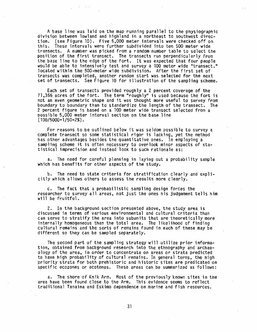
A base line was laid on the map running parallel to the physiographicdivision between lowland and highland in a northeast to southwest direction. (see Figure 10). Five 5,000 meter intervals were checked off onthis. These intervals were further subdivided into ten 500 meter widetransects. A number was picked from a ramdom number table to select theposition of the first transect. The transects run perpendicularly fromthe base line to the edge of the fort. It was expected that four peoplewould be able to intensively test and survey a 100 meter wide "transect."located within the 500-meter wide subdivision. After the first set oftransects was completed, another random start was selected for the nextset of transects. See Figure 10 for illustration of the sampling scheme.
Each set of transects provided roughly a 2 percent coverage of the71,356 acres of the'fort. The term "roughly" is used because the fort isnot an even geometric shape and it was thought more useful to survey fromboundary to boundary than to standardize the length of the transect. The2 percent figure is based on a 100 meter wide transect selected from apossible 5,000 meter interval section on the base line(100/5000=1/50=2%).
For reasons to be outlined below it was seldom possible to survey acomplete transect so some statistical rigor is lacking, yet the methodhas other advantages besides the quantitative ones. In employing asampling scheme it is often necessary to overlook minor aspects of statistical imprecision and instead look tcr such rationale as:
a. The need for careful planning in laying out a probability samplewhich has benefits for other aspects of the study.
b. The need to state criteria for stratification clearly and explicitly which allows others to assess the results more clearly.
c. The fact that a probabilistic sampling design forces theresearcher to survey all areas, not just the ones his judgement tells himwill be fruitful.
2. In the background section presented above, the study area isdiscussed in terms of various environmental and cultural criteria thancan serve to stratify the area into subunits that are theoretically moreinternally homogeneous than the total area. The likelihood of findingcultural remains and the sorts of remains found in each of these may bedifferent so they can be sampled separately.
The second part of the sampling strategy will utilize prior information, obtained from background research into the ethnography and archaeology of the area, in order to concentrate on areas or strata predictedto have high probability of cultural remains. In general terms, the highpriority strata for both prehistoric and historic sites are predicated onspecific ecozones or ecotones. These areas can be summarized as follows:
a. The shore of Knik Arm. Most of the previously known sites in thearea have been found close to the Arm. This evidence seems to reflecttraditional Tanaina and Eskimo dependence on marine and fish resources.
31
I
.....:..--~,:;"r--
! ,'&-'"84
i i
I I~ . .iT~"kl:. I
--I Ii!11 I Iij15 1I i
i~ IJ~ ,357 40"00.358 , '80I ;~
12
-I i ~"i .'641 , I .I II I11
!-1
!.v !
---_..
r-i I Ii i II
09-
·i·I
I'I
t'", '~~I~I1t' .-.·-.,1;-.~-.2-~:i'~'~~__ or.
.'----~__!~-~~--~-±--tl ....-c-
SCALE: 1: 50,000-
2r-+it-I_---+1_-'__--+1_K_+I_K_-!A_R_M_+-_+-_+_~F -ilr-..,.------=~o.c-~. '-'--+-~~~---'e--;L---?;L--+-'::'=-'I-+---,d"--tLt-----;f.+----'---:ri--'-t-:----''I I I'
i l-? ""lIIH',.....---...;...----,----'---rc=r.::=f
J-I
~~'99 1 ,I
i I
Furthermore, as a consequence of the steep bluffs that bound Cook Inletand Knik Arm, De Laguna suggests "only at the mouths of streams is itpossible, in most places to come up on the plateau, and it is only hereof course, that we should expect to find village sites" (1975:12).
b. Along river and stream margins. These are good areas forexploiting fish, small mammals, and birds, and are also water sources.
c. Around lake and pond margins. The reasons are similar to thoseoutlined above.
d. Elevated areas within the inland forest, high brush, and transitional areas. These high areas provide vantage points for sighting game.
e. Raw Material Quarries.
The areas outlined above concentrate primarily on the water-landecotone. It was hoped to intensively survey all river, stream, and lakemargins on the fort, but this was not possible in the time periodallowed. Most of the bluff along Knik Arm, as well as Ship Creek, OtterLake, Lake Clunie, and parts of Eagle River and Fossil Creek were intensively surveyed. Other smaller streams and ponds were encountered anddealt with in the course of surveying transects.
Similarly, elevated hills and knolls were given particular attentionwhen transects intersected them. No outcrops of slate or knapable rockswere known previously or discovered.
3. A third aspect of the research strategy involved intensive surveyin some areas known, on the basis of background research, to have alikelihood of historic American remains. Crews surveyed adjacent to therailroad right-of-way because maps and other evidence indicated therailroad followed earlier trails. It was possible to find indications ofold wagon roads, railroad construction camps, and homesteads near theright-of-way.
These three strategies combined, i.e., systematic interval sampling,intensive survey of specific zones stratified on archaeological andethnographic evidence, and survey along an historic right-of-way providedthe means of identifying sites and making probabilistic statements aboutpast human utilization of various area of the fort. Furthermore, thiscoverage provides a basis for further stratification and survey in thefuture.
Unfortunately, the Eagle River Flats, an area known to have been usedhistorically by both the Tanaina and Americans, was off limits for thesurvey because it is a military impact zone. This area was judged to bea high probability zone for both archaeological and historic remains.
Implementation and Data Recovery
The field crew consisted of four people divided into two, two personteams for the purpose of note taking. Each crew was headed by a person
..., i \r,nH)v(\t~"",~~.,- ~-_i.i.'\".\
A.L H~K'h pr'\!tWJ,~:", ~.r.'I\.,'-\", n q. r"l 11~. ,:>-,..,..) - _ ••. ,..."",' of the intcnor
33 u.s. Departmcnt
with an M.A. in anthropology and extensive field experience. The othertwo crew members had B.A.ls in anthropology and also had field experience.
For the probabilistic portion of the survey, crew personnel generallydrove to a spot where a road crossed the transect line. In mountainousareas and in the remote NW corner of the post the crew was transported tothe beginning of the transect by helicopter. Orientation was achievedusing compasses, maps, and landmarks. Much of the time in wooded areascompasses were the only means of staying on the transect. (See map foractual transects.) We found it was actually quite easy to stay oncourse, contrary to the experience of some other researchers. Luckilyfor us there were enough 1andmarks in the form of road crossings, rai 1road crossings, buildings, and topographic features to check our positionfrequently.
Crew members were spaced 20 meters apart and attempted to cover anarea of 10 meters on each side. Special attention was given to highspots, transitional zones, and natural or manmade disturbances thatprovided a view of the subsurface. Foxholes were particularly useful forviewing soil strata. .
The crew chiefs were responsible for deciding when and where testswould be excavated. In general, the criteria for digging pits were thatthe location be either well-drained and elevated or well-drained, leveland suitable for lookouts or camps. Subsurface testing was not systematic but was based on jUdgement.
A log was kept of all test pits excavated, including information ontheir location, size, depth, soil strata, and cultural remains.
In wooded areas of the post it was generally only possible to coverthe 100 meter wide transect. Above treeline we were able to reconnoitera broader area due to a clear field of vision. The extra area should notbe taken into account in a statistical evaluation. After bushwackingthrough trees and brush to follow the transect it was usual to return tothe vehicle by walking on roads. The roadsides were surveyed at thispoint as crews walked along. Once again, this aspect of the reconnaissance was not part of the probabilistic sample.
One environmental zone that, in the end, received very little attention in terms of on ground reconnaissance was the lower slopes of themountains in the transitional zone between interior forest and treeline.These areas consisted of extremely dense alder thickets, frequently withequally dense brush and devils club underneath. Walking and pathfindingwas so difficult and time-consuming that it was decided to delete thosesections of the transects that occurred in brush. This zone will have tobe further evaluated at some point, but at the present it seems to be inlittle danger since few army activities are carried out on the lowerslopes of the Chugach.
Another means of locating sites was from aerial reconnaissance.Although flight plans were never systematized, whenever a helicopter was
34
used to take crews out to the field the opportunity was used to look forstructures, pit houses, etc. Several cabins were located in dense vegetation in this way.
Some transects ran through military impact zones that were off limitsto us due to the possibility of encountering li"ve ammunition. Theseportions of the transects were dropped from the sample. See Figure 11for locations of impact zones.
FIRING RANGES:A. MCLAUGHLINB. 40-90C. GREZELKAD. OATE5-MCGEEE. STATLER·NEWTONF. FIELD FIREG. ZEROH. RECORDI. HAND GRENADEJ. BIATHLON
~ ~ +MILES ~
A2W, T14N-RANGE AND TOWNSHIP t
MILITARY ACTIVITY AREAS
PART III RESULTS AND RECOMMENDATIONS
RESULTS
Cabin #1: Site ANC-263
This deteriorating cabin was located by helicopter in a small manmadeclearing about 100 meters east of Tok1e Creek on the hillside above ShipCreek. The clearing is about 50 meters in diameter and is surrounded bya dense white spruce and aspen forest. Willows and grasses are growingluxuriously in the clearing.
The cabin was built of horizontally placed round logs with the barkapparently left on (although most has rotted by now). The joints weresquare notched and a saw was used. The cabin floor has been leveled~ butnot excavated to any depth~ and dirt is piled up around the outside.Moss and wooden slats nailed between the logs were used to chink thecabin. The roof has fallen in but consists of corrugated tin over wood~
canvas and tar paper.
Many modern looking nails were used in construction along with asteel door latch. The door~ door frame~ and window frames are constructed from what seems to be machine sawn lumber.
The doorway of the cabin is oriented almost directly west towardsTok1e Creek. There is a window in the east wall. The north side of thecabin has almost totally fallen in.
The cabin may have been partially burned since some of the logs areblackened. There are some 5-foot high spruce trees growing inside so ithas been ruined for some time.
The dimensions of the structure are: 4.5 meter north and southwa11s~ 3.8 meter east and west walls. The height of the extant walls was.92 meters at the NW corner.
Near the cabin are at least three rectangular pits (see map)~ twofilled with trash and one empty. Surrounding the cabin and for severalmeters downslope large quantities of flattened and rusted tin cans couldbe crunched underfoot. These were already overgrown with vegetation.The number of cans seems to indicate fairly intensive use of the cabin.
An olive oil can labeled "San Antonio~" a variety of prepop-top beercans~ a rusted oil drum~ and the frying pan section of a mess kit stamped"1943US" and a fo1gers coffee can with a 1946 date were noted. Anotherfind was a scrap of newspaper which ment ioned the movie "The Informer"which won an academy award in 1935.
37
About 30 meters north of the cabin was a distinct trail eXhibitingtwo tracks for vehicles. This trail died out about 1/4 mile to theeast. To the west it crosses Tokle Creek then turns north and intersectssome ski trails (see Figure 12).
Significance
On the basis of the recent age of this cabin as evidenced by thenature of the construction material and the date of the trash found thereit would seem that this building is not eligible for inclusion in theNational Register of Historic Places. It is possible that the cabin isolder than the 1930's or 40's and may perhaps be associated with theIditarod Trail but this is difficult to prove in the absence of historical records (no claims were filed for this land).
Furthermore, this cabin does not seem likely to qualify for the .National Register on the basis of its structural qualities or its likelihood of adding to our knowledge of twentieth century European Americans.
Cabi n #2 Site: ANC-264
This cabin was also first located from the air. It is located justto the east of a faint trail in a cleared area where some of the stumpsare old enough to have thick moss growing over them. The surroundingvegetation is typical of inland forest, with grass, dogwood and alderregrowing in the cleared areas. The terrain slopes toward the EagleRiver Flats to the NW.
This cabin is small and the floor is subterranean. Dirt is heapedaround the outer walls toa height of .5 meters. The gabled roof wasconstructed of log's split in half, plywood, and tin sheeting coveredwith sod; it is now collapsed.
The walls were constructed of unpeeled logs. The corners are notchedboth in the square and saddled faShion.
The floor of the cabin is dirt. Inside were a metal bunkbed, awooden folding chair, a table constructed from wooded planks, some sheetmetal including a stove pipe protector and some new looking pepsi cans.Just outside the door was a strip of wood with a row of coat hangers onit painted institutional green.
The door and windows were on the south wall of the cabin.
The cabin was small and roughly square. Its dimensions were: westwall, 3.53 meters; south wall, 3.85 meters.
The cabin is slumping to the SE but is still intact.
In the area around the cabin a mossed over stack of 2 X 6 boards,some sheet metal, part of a militry mess kit, plywood boards, and somefaint rectangular pits were noted.
38
Pit 1
o
CABIN 1: SITE ANC-263
T To Old Trail
\,
oTrash Pile
+--- To Tok1e Creek
5m.
Pit 2
3.8m.
Pit 3
n
N
FIGURE 12
)
)
)
FIGURE 13
Site ANC- 263: The ruins of a small cabin.
Unfortunately as a result of torrential rain we were unable to takesatisfactory photographs of this cabin or draw an adequate map. To theNE was a raised soil rectangle about 3 feet square with a wooden foundation. This is filled with a dark organic looking soil and may havebeen the base of an outhouse.
About 15 meters to the west of the cabin was a pile of coal coveredwith deteriorating canvas and some aviation fuel cans.
Two faint trails lead from the cabin to the south but die out afterabout 200 meters.
!Significance
The quantity of military equipment near this cabin gives the impression that it was used by the military at one point. The cabin itself
'could predate military usage but it is difficult to judge this withoutbetter records. A map of the area in the early 1940's indicates thatseveral homesteads existed south of the Eagle River Flats and records atthe Bureau of Land Management indicate the land in this section wasclaimed by a succession of individuals from the early 1920's on. Thiscabin may have been associated with a homestead although it seems a bitsmall and crude for this purpose. In light of its apparent recent ageand condition it would not appear to be eligible for the NationalRegister of historical Places.
Structure 3: Site ANC-265
This is the remains of a tent platform or some other sort ofstructure. It consists of a rectangle of plywood, 3.7 meters by 4.5meters, which have rotted away to reveal a pit or cellar underneath,about 1 meter deep. The perimeter is bordered by square, rough hewn logsand rotted canvas is scattered around the area.
At the north end of the rectangle is a pile of wood that may havebeen part of the superstructure. A rotted door and window frame lie onthe ground to the south. A pile of illegible, rusted cans is nearby.
The cabin is next to a fairly definite road or trail. Severalhundred meters north on the road was a pile of objects including a zincwashtub, large square tin cans, aluminum pot, wood and an old HillisBrothers coffee can.
Near this pile is some tar paper, a long (ca. 10 feet) wooden planktable, aluminum tea kettle, and stovepipe.
On the east side of the trail across from the structure is a largeshaft dug into the gravel. This reaches a depth of about 2 meters and isan inverted cone in shape. Some wooden timbers stock out on the bottom.Next to this pit is a large trash dump. In it was a 1936 patent Hill'sBrothers coffee can.
41
STRUCTURE 3: SITE ANC-265
... 1/," "Pit
...
~ Kitchen goodsa~ Plank
Schematic Sketchof Tent Platform
Location
table
TrashHeap
Excavated Cellar
Tent Platform
N
5 m.
Fi'1w!aoYFrame
Planks andBirch Poles
\\\\\\ Door
illill
Tar Paperand
Canvas
TENT. PLATfORMFIGURE 14
"
)
'.)
\?
Significance
This structure may have been a homestead or squatter's "cabin." Thenumber of household goods around the site~ the quantity and variety oftin cans and the nonmilitary nature of the goods argue for one of theabove interpretations. Records at the Bureau of Land Management showthat Thaddeus McGrath filed for a homestead in this section in 1934 thenrelinquished his claims in 1939. Then William Chambers claimed the landand held it until it became a military withdrawal in 1942. The words"Hot Springs" were appended to both claims. We didn't notice anysprings, nor are any noted on the maps. This site does not seem to meetNational Register criteria due to its recent age and deteriorated condition.
Eagle River Railroad Bridge: Site ANC-266
Several structures are standing on the banks of Eagle River near therailroad bridge.
#1
On the southeast side of the bridge there is a small cabin likestructure, 3 meters by 1.5 meters, constructed from small sapling sizebirch and alder logs. The structure is not chinked at all, although thecorners are saddled notched very nicely.
Based on the condition of the wood the cabin does not seem very old.It may have been a temporary shelter used during military maneuvers.
#2
On the NW side of the bridge are the remains of a large~ well constructed cabin. The dimensions are 6.3 meters by 5.2 meters. Soil isbanked around the outside of the walls which has preserved the lower twoto three log courses. The upper portions of the cabin and the roof havefallen in so it is difficult to know the manner of construction. Thecabin is chinked with both moss and lathing. Many nails were used inconstruction.
Surrounding the cabin was a good deal of junk and trash includingrusted cans, glass, tin sheets, and many indeterminate, rusted metalpieces.
About 25 meters to the south is a squarish pit and some fallen boardsthat seems to be a latrine.
To the southeast is what appears as a raised rectangle in the soil.This is a log foundation with no element of the superstructure remaining.
The entire river terrace surrounding the bridge shows a good deal ofevidence of past human activity. Trees, stumps, cleared areas, andtrails indicate vegetation disturbances that have not totally regrown.Old telephone'poles lie on the ground near the new telephone poles.
43
j
)
The area around the Eagle River Railroad bridge is particularlyinteresting because there are some historical records illustrating pastusage (see Part I).
It is known that at various times in the past 80 years a roadhouse,workers camp, and railroad section house were located near the bridge.Old photographs from the early days of the railroad show a number ofstructures near the bridge. It is possible that remnants of these couldbe located by a more thorough scrutiny of the area but they are no longerstanding and obviously were not built on very substantial foundations.The land surrounding the bridge was filed as a headquarters site in 1920but was never patented. There are no further entries for the specificarea on file at the Bureau of Land Management until the military withdrewthe land in the 1940's.
Significance
The construction of the Alaska Railroad can be included in lIeventsthat have made a significant contribution to the broad patterns of ourhistoryll (CFR 800.10 National Register Criteria), yet these particularremains no longer possess lIintegrity of location, design, setting,materials, workmanship, feeling and association ll in that they are in verypoor condition. Therefore, they do not appear to be eligible for inclusion to the National Register of Historic Places.
Other Structures and Features
Several other structures were found during the course-of the surveybut it was possible to associate these with recent activities, i.e., girlscout and boy scout camps, an abandoned warmup shack for a ski lift, andbuildings used by the Army.
Glimpses were caught of two other structures that may be of moreinterest. One was a dilapidated log frame located near cabin #1 in asmall clearing on the hillside above Ship Creek. We sighted this ruinfrom the air but were never able to relocate it. The other structure wasa building that was noticed in the woods to the south of the railroadtrack at mile 124 of the railroad. This was sighted at the end of a longhard day at the end of the field season; it was never investigatedfurther, but should be in the future.
In many places on the installation there were clearings as a resultof cutting down trees, but no sign as to why the trees were cut. TheOtter Lake and Knik Arm bluff areas in particular showed signs of cutting. Whether this is related to native activities, homesteading, firewood procurement, or military maneuvers is difficult to say.
Similarly, in the lowland areas of the base many faint, overgrowntrails and roads can be found. Some of these might date to the earlypart of the century but it is difficult to ascertain their age in theabsence of artifacts. An effort was made to locate the trails indicatedon the BLM cadastral survey maps from the early part of the century but
44
we were not able to i dent ify them in the maze of trail s found on thepost. It is also very probable that old trails would be overgrown afteryears of disuse and virtually impossible to relocate.
Military
As mentioned previously, military activities have greatly impactedmany areas of the post. Certain areas are contaminated firing ranges andwere totally closed to archaeological survey (see Figure 11). This wasparticularly unfortunate in terms of the Eagle River Flats where background research has indicated the likelihood of finding sites. From thebluffs on the north side of the Eagle River Flats three old wooden platforms could be seen standing in the marsh. Several constructions recognizable as "duck blinds" could be seen in the flats as well. These couldbe related to historic Tanaina use of the area, but this could not beestablished without going into the impact area.
The greatest impact, however, is probably in the cantonment areawhere a good deal of the land has been graded, filled, topsoiled, pavedor built upon. Test pits were excavated here to confirm the impressionsof the surface reconnaissance and indicated that a great deal of landdisturbance had indeed occurred (see Appendix 2).
The third sort of impact is that related to Army training activitiesand can be found in all areas of the post. Hundreds of foxholes, leantosand other temporary structures have been constructed since the beginningof military activities in the Fort Richardson area. As might be expectedthese shelters are generally found on raised, well drained vantagepoints; exactly the same sort of places where it has been argued thatsites would be located. In one sense the placement of foxholes couldpotentially disturb archaeological or historical remains, yet in anothersense the foxholes and other associated ground disturbances provide alarge "window" on the subsurface. In this survey the walls of foxholesand other pits were scrutinized for indications of artifacts and othercultural indications such as charcoal. Frequently the walls of suchholes were scraped by trowel to get a clearer look at the soil.
Military hardware was also found scattered throughout the postincluding the remains of a radioplane, several vehicle parts, targets,oil barrels, tires, etc.
Archaeological Results and Evaluation
No archaeological remains were located as a result of this survey ineither the systematic interval sample or in the predicted high probability strata.
In all, over 200 shovel test pits were sunk, all in the lowlandprovince of the fort, and all sterile. Detailed notes were kept on theseincluding exact location, but since nothing was found these will not bediscussed further here.
45
\j
The dearth of finds suggests a low probability of recovering archaeological remains in the area of Fort Richardson we were allowed tosample. Extrapolating from the sample, a grand total of zero sites ispredicted for the fort. It is necessary to warn that due to the lowsampling fraction in the probabilistic portion of the survey (less than 4percent surface coverage) the precision of our estimates about the totalpopulation of sites on Fort Richardson is not great, yet the confidencelevel would be even broader if the sample had been selected in a biasedmanner. HOwever, the lack of finds in the predicted high probabilitystrata substantiates this extrapolation. A further caution is that sitesmay be located beyond our testing abilities, i.e., they are too deeplyburied, located under present buildings or roads, or under water. If thisis so they will not be sUbjected to further adverse impact in most cases.
It is not adequate to merely state that no sites were located by thissurvey; if the goal is understanding prehistoric settlement and subsistence patterns within an environmental framework it is necessary toattempt to explain negative as well as positive evidence. The first setof explanations for the lack of cultural remains in the study areaaddresses natural and cultural processes that might obliterate evidenceof past human activity.
1. The mouth of Eagle River is possibly the most likely area on theinstallation in terms of finding cultural resources; however, this areahas already been impacted by military activities and is off limits tofurther investigation.
2. Vegetation is quite dense in the areas below tree line and makesit difficult to discern such features as housepits or hearths, much lessrecover artifacts. It may be necessary to implement a much more intensive program of subsurface testing to locate cultural remains in thisarea. Furthermore, this study did not rely greatly on geological data.A greater emphasis on understanding the geological history of the areamight help in defining areas with high potential of site recovery.
3. The shoreline of Knik Arm was predicted to be a high probabilityarea on the basis of background research. Unfortunately for the archaeologist, the bluff area is highly unstable geologically and is involvedin a constant erosion process wherein sites may be sloughed off down thecliff. It is difficult to know the rate of backcutting under normalcircumstances but it is likely that large sections of cliff falloffduring earthquakes. Clearly, cultural remains near the bluff edge haveprobab ly been destroyed.
4. Evidence from other Tanaina and Eskimo areas seems to indicatemost major settlements are located near large water bodies or near themouths of rivers and streams. Resources located further inland areutilized, but such activities do not result in anything more thantemporary encampments of small groups or even single individuals. Manysorts of activities do not leave many, or any, indications in thearchaeological record. However. as we continue to refine our predictionsabout past resource utilization abetter understanding of the entiresettlement system can be obtained.
46
Despite the fact that the factors outlined above may be operating atFort Richardson and hindering the recovery of cultural remains, it isstill fair to say that the area does not seem particularly rich in cultural resources.
We know from ethnohistoric accounts that the area was exploited, butit appears human occupation was never especially dense along this particular section of Knik Arm. Presently the western side of Knik Arm is amore favorable habitat for seal and beluga (Metrek 1978:2-48) suggestingit may have been a more favorable locale for humans in the past if conditions were similar.
Travel and access may have been particularly difficult in thisdensely wooded area before trails and roads were cut, making it unattractive for human utilization.
Furthermore, much recent research indicates that Athapaskan settlements were located in places which provided access to a wide variety ofresources at all seasons of the year (Van Stone 1974; Nelson 1973). Itis difficult to assess the scale at which such factors become important,but most of the lowland area of Fort Richardson consists of relativelyundifferentiated stretches of interior forest which may not have providedthe range of hunting opportunities that other areas could provide.
Still, the Fort Richardson area was probably used sporadically bysmall mobile parties of hunters who would leave little indication oftheir passage. Relatively permanent settlements were undoubtably locatedin places where marine and riverine resources were more abundant yet alsoprovided other resources to fall back upon during lean years or seasons.
Only portions of the Eagle River Valley were surveyed (see Figure10). Once again, vegetation and steep banks impeded this investigation,but survey should be further pursued in this valley before any negativeconclusions can be,legitimately reached.
Ship Creek was surveyed quite intensively with negative results.Especially in the lowland area near the cantonment there is a good dealof evidence of land leveling near the creek and even rechannelization;therefore, the potential for site recovery has been adversely affected.Upstream, in the mountainous area of the post, there is still the potential for finding indications of trail cutting or materials associatedwith the Indian-Ship Creek Trail.
The Fossil Creek drainage was crossed several times in the course ofthe survey but should be investigated further. Drainage is minimal atpresent, but the banks and terraces associated with this feature indicateit was once a much larger stream, possibly a channel of Eagle River, andmight be a likely place for recovering evidence of past human activity.
Elmendorf Moraine should also be surveyed further in the future.High ground like this has a good potential for finding signs of humanutilization.
47
The above areas seem particularly sensitive and may yet yield cultural resources, while other areas removed from these features have alower potential in terms of past use; however, this comment should not beconstrued as a clearance of the rest of the installation. Thesecommentsare meant as guidance for planning purposes. Even though some areas arejudged as having low probability in terms of cultural resources theystill need to be cleared in advance of ground disturbing activities.
48
RECOMMENDATIONS
1. An ongoing plan of survey should be developed for Fort Richardsonso the Army can comply with Executive Order 11593 and inventory allproperties potentially eligible for the National Register under itsjurisdiction. The surveys should be done within the framework of aproblem oriented research design in order to further regional archaeological studies and provide guidance for future decision making aboutland use. The work should be conducted in a manner which will allowcontinual refinement and utilization of data collected during all phasesof the effort, thus, assuring judicious use of resources.
2. In advance of any potential land disturbing activities aprofessional archaeologist should test the area for cultural remains.The previous section provides evaluation of areas of the fort in terms ofthe likelihood of finding cultural remains. These evaluations should beuseful in planning future development in that high probability areas canbe avoided if possible. However, this report should not be construed asa clearance of any areas not directly surveyed.
3. Helicopter reconnaissance was found to be very useful andexpedient in locating historic remains. A systematic aerial survey ofthe installation for the purpose of finding such remains should beimplemented. I would recommend that such a survey be conducted in springor fall when the foliage does not offer quite the impediment to sight asit does in the summer. This sort of reconnaissance does not replace theneed for on-ground coverage of an area, but supplements it in anexpedient fashion.
4. At this time no further study is recommended for the four sitesdiscussed above except that determinations of eligibility should besought from the Secretary of Interior as out.lined in 36CFR63. Thisprocess will require coordination with the State Historic PreservationOffice.
5. Further study of the portions of the Iditarod Trail that crossFort Richardson is recommended in order to preserve any remnants of thisNational Historic Trail that may still exist. If the trail could belocated and posted with interpretive signs it could prove to be ofinterest to Army personnel and the general public.
49
)
)
FIGURE 15
Ship Creek valley looking east. A branch of the Iditarod trail ran alongthe creek from Knik Arm to Indian in the early part of the century.
)
)
)
Figure 16
This photograph spans most of the physiographic and vegetational divisionsof Fort Richardson. In the foreground is the alpine tundra of the Chugachfoothills, surrounding the Gle nn Highway in the middle dLstance is interiorforest, and in the distance is the marsh which delineates the mouth ofEagle River.
Tundra bog area typical of the northwestern section of Fort .Richardson. Photograph also illustrates crew spacing on transect survey.
)
)
FIGURE IS)
Dense growths of alders are found in many areas of the fort, particularlyin disturbed areas and in the transition zone between forest and tundra.
BIBLIOGRAPHY
Bacon, Glen1974 Malemute Drop Zone: Preliminary Archaeological Survey Report.
Alaska Department of Natural Resources, Division of Parks, Anchorage.
Carberry, Michael E.1979 Patterns of the Past - An Inventory of Anchorage's Heritage
Resources. The Municipality of Anchorage.
Chandonnet, Ann1979 The once and Future Village of Ikluat/Eklutna. Adams Press,
Chicago.
Cook Inlet Historic Sites Project (CIHSP)1975 Cook Inlet Inventory of Historic Sites and Cemeteries.
Cook Inlet Region, Incl, Anchorage.
Davis, Craig W.1979 The Toksoitna Development Area, Denali State Park, Alaska:
Cultural Resources Overview. Manuscript on file with the NationalPark Service~ Alaska Area Office, Anchorage, Alaska.
DeLaguna, Frederica1975 The Archaeology of Cook Inlet Alaska. The A1Hska Historical
Society, Anchorage, Alaska.
Dumond, D.E. and Robert L. Mace1968 An Archaeological Survey along Knik arm. Anthropological Papers
of The University of Alaska 14 (1).
Dumond, Don E1977 The Eskimos and Aleuts. Thames and Hudson, London.
Holmes, Charles E.1979 Report of Archeological Reconnaissance: Fort Richardson
Withdrawal Area, Fort Richardson, Alaska. Alaska District U.S.Army Corps of Engineers.
Judge, W. James, James I Ebert and Robert K. Hitchcock1975 Sampling in regional archaeological survey. In James W.,Mueller ed. Sampling in archaeology. University of Arizona Press:Tuscan, Arizona.
Kari, James1979 Tanaina Place Names as published in Michael E. Carberry.
Patterns of the Past. Municipality of Anchorage.
55
Karlstrom, Thor V.1960 The Cook Inlet, Alaska, Glacial Record and Quaternary
Classification, in Short Papers in the Geological Sciences 1960.U.S.G.S., Professional Paper 400-B pp. 8330-B332.Washington: Government Printing Office.
Kent, Frederick J., John V. Matthews and Frederick Hadleigh - West1964 An Archaeological Survey of portions of the Northwestern K~nai
Peninsula. In Anthropological Papers of the University of Alaska12(2): 101-134.
King, Thomas F., Patricia Parker Hickman and Gary Berg1977 Anthropology in Historic Preservation. Academic Press,
New York.
King, T.F.1978 The Archeological Survey; Methods and Uses. Heritage
Conservation and Recreation Service. U.S. Department of theInterior, Washington, D.C.
La Roi, G.H.1967 Ecological Studies in the Boreal Spruce-Fir Forests of the
North American (Taiga). Ecological Monographs 37:299-353.
Mueller, James W., ed.1975 Sampling in Archaeology. University of Arizona Press: Tucson,
Arizona.
Metrek Corporationn.d. Draft Environmental Impact Statement for Installation Util
ization at Fort Richardson.
Nelson, Richard K.1973 Hunters of the Northern Forest. University of Chicago Press,
Chicago.
Osgood, Cornelius1976 The Ethnography of the Tanaina. Yale University Publications
in Anthropology, Number 16.
Prince, Bernadine Le May1964 The Alaska Railroad in Pictures 1914-1964. Ken Wray's Print.
Shop, Anchorage, Alaska. V. 1 and 2.
Rabich, J.C.n.d •• The Archaeological Significance of Point Woronzoff 1976. Cook
Inlet Region Inc: Anchorage.
Redman, Charles L.1974 Archeological Sampling Strategies. An Addison-Wesley Module in
Anthropology, No. 55.
56
Reger, Douglas R.1977 Prehistory in the Upper Cook Inlet, Alaska. In J.W. Helmer,
S. Van Dyke and F.J. Keats, eds. Problems in the prehistory of theNorth American SUbarctic; the Athapaskan problem. ArchaeologicalAssociation, Department of Archaeology, University of Calgary.
Reger, Douglas R.n.d. 1977 Excavations on the Beluga Point Site. Paper presented at
the 5th Annual meeting of the Alaska Anthropological Association.
Reger, Douglas R.n.d. Report of Archaeology Field Survey in the Willow-Wasilla Area,
1978. Manuscript on file at the AlaskaState Historic PreservationOffice.
Reger, Douglas R.n.d. Archeological Survey Along Proposed Tesoro Gas Pipeline
Route, Point Campbell to the Tesoro Terminal Portion. Manuscript on file at Alaska State Historic Preserv~tion Office.
Selkregg, Lidia l.1972 Environmental Atlas of the Greater Anchorage Area Borough,
Alaska. Arctic Environmental Information and Data Center,University of Alaska, Anchorage.
United States Army, Alaska1972 The U.S. Army, in Alaska. Pamphlet 360-5.
Van Stone, James W.1974 Athapaskan Adaptations. AHM Publishing Corporation, Arlington
Heights, Illinois.
Van Stone, James W. and Joan B. Townsend1970 Kijik: An Historic Tanaina Indian Settlement. Field Museum
of Natural History: Chicago.
Veltre, Douglas W.1978 Report to the Chugach Electric Association: Archaeological
Survey of Right of Way from University Substation to Knik Arm(East Terminal).
Viereck, leslie,1967 Plants above 3,140 meters (7,000 feet) in the Alaska Range.
The Bryologist 70 (3):345-346.
Viereck, l. and E.l. little Jr.1972 Alaska Trees and Shrubs U.S. Forest Service (USDA), Handbook
410.
Wahrhaftig, C.1965 Physiographic Divisions of Alaska Professional Paper 482
U.S. Department of the Interior, Geological Survey, Washington
Workman, K.W.1978 Survey Report: East Terminal Site on Elmendorf AFB. Report to
Chugach Electric Association.57
o
I
\
APPENDIX ONE: PREVIOUSLY KNOWN SITES IN STUDY AREA
SOURCE: ALASKA DEPARTMENT OF NATtiRAL RESOURCES, DIVISION OFPARKS, OFFICE OF HISTORY AND ARCHAEOLOGY. 1976. 1977;McWILLIAMS. 1977.
• ARCHAEOLOGICAL SITE
• HISTORICAL SITE
r"\ AREA OF SEVERAL HISTORICAl SITESlJ NUMBERS REFER TO LISTINGS IN APPENDIX H.
~~ +MILES ~
R2W, T14N-RANGE AND TOWNSHIP i
ARCHAEOLOGICAL AND HISTORICAL SITES OF STUDY AREA
CATEGORY CODE FOR ARCHAEOLOGICALAND HISTORICAL SITES
General Resource Nature
Code
H
Q
T
P
'\ FF
I
Historic
Protohistoric (Accounts of missionaries, traders)
Protohistoric (Evidence of European trade goods)
Prehistoric (Dated or undated archaeologicalsites lacking evidence of European influence)
Paleontological
Specific Resource Nature
District - a geographically definable area, urbanor rural, possessing a significant concentration,linkage or continuity of sites, buildings, structures, or objects unified by past events ora~sthetically by plan or physical development
2 Site - the locus of an event, building, structureor object
3 Building a structure created to shelter any formof human activity
4 Structure - a work constructed by man (bridge canallocks, etc.)
5 Object - a material thing of functional, aesthetic,cultural, historical, or scientific value that isusually, by nature or design, movable (ship, locomotive)
Source: Alaska Department of Natural Resources, Division ofParks, 1973. Alaska's Heritage Resources 1973-1983.Office of History and Archaeology, Anchorage.
, ../
~~1~1~,'~~.,' :1
ARCHAEOLOGICAL AND HISTORICAL SITESFORT RICHARDSON STUDY AREA
A. ARCHAEOLOGICAL SITES ( ... ) *
NO. SITE NAME SIT~ LD. ** CATEGORY*** . COMMENT
1 Fish Creek ANC052 P-2
2 Knik Lake Local ANC036 P-2
3 Fisher-Hong ANC038 P-2
4 Fish Creek Location ANC037 P-2
B. HISTORICAl, SITES C. )*
1 Knit<. Russian Church ANC022 H-2
2 Knik Township ANC003 H-2 1902 Town Site
3 Fish Creek Rock ANC002 11-5 Rock Carved With Date by 19thCentury Russian Traders
4 Old St. Nicholas ANCOO4 H-3 1870's Russian Orthodox ChurchChurch (On National Register' of
Historic Places)
5 Eklutna Village ANCOOS H-2 1800's Village Site
6 Eklutna Station ANC09l 11-2 1917 Station on the Alaska .Railroad
\.... / vfjr,.
r.~t\~,~I~.
!
I\I!rii
.!
i
, \.1IIii
B. HISTORICAL SITES (. )*(Continued)
NO. SITE NAME SITE LD. ~~* CATEGORY*** COMMENT
7 Ek1utna River Bridge /l.NC080 H-4 1927 Bridge
8 Peters Creek Bridge ANC079 11-4 1927 Bridge
9 Birchwood ANCOl7 11-2 Early Alaska Railroad Depot,Mile 136.3
'10 Eagle River ANC076 11-2 Alaska Railroad·Mi1e 126.6,1917 Station
.',-, 11 Eagle River Bridge ANC099 11 1924 Bridge~.\
12 Ft. Richardson ANC013 11-2 1941 CemeteryCemetery
14 lfuitney Station ANC044 B-3 1917 Section Bouse On AlaskaRailroad
15 Alaskan Chateau ANC042 H-3 Frame Building Used as QuartersFor Visiting Dignitaries
16 CINC Quarters ANC043 B-3 Quarters Of Commander-In-Chief,
-.Alaska; Used In 1971 For Meetingof President Nixon and EmperorBirohito
17 AFC Cottage ANC045 B-3 1915 Structure
~.t.ry
~.. Y'.'.'.~.l..~.:,..k~,,,
B. HISTORICAL SITES CO}*(Continued)
NO. SITE NAME SITE LD.** CATEGORY COMMENT
18 AFC Cottage ANC046 H,..3 1915 Structure
19 Quonset Huts ANC047 H-3 1940 Military Buildi~gs
20 Federal Houses ANC049 R-3 1945 Military Housing
21 U.S. Army Engineer's ANC048 U,-3 1941 Military HouseHouse
22 Anchorage Historic ANC08l H-l 70-Block Area Of Anchorage'sDistrict Original Residential & Business
District
23 Oscar Anderson House ANC098 II 1915 Bungalow; One Of First Per-manent Residences In Anchorage
2/, St. Innocent Church ANC02l H-·3
25 Earthquake Park ANCOOI H-2 Park Showing Effects Of 1964 GoodFriday Earthquake
26 Douglas DC-3(N-99) ANC12l U,-5 1945 Aircraft Used By FAA AndPredecessor Agencies
27 Campbell Station ANCo.l1 H,...) 1917 Station On Alaskan. Railroad..
* Symbol in parentheses and map number are coding system used to identify sites on Figure 2-16.** Site I.D. from Alaska Archaeological/Historical Survey' Record Cards; three letters identify
U.S.G.S. 1:250,OOO-scale quadrangle (ANC-Anchorage quad). Numbers are sequentially assignedas sites are reported.
*** Category Code - See Table H-2
SOURCE: Alaska Department of Natural Resources, Division of Parks, Office of History and Archaeology, 1976, 1977. Manuscript Record Cards and Map File. Anchorage •
FUTURE DEVELOPMENT PLAN - CANTONMENT AREA, FORT RICHARDSON
On July 12, 1979 a crew of four archeologists, including projectsupervisor, Julia L. Steele~ travelled to areas indicated as being sitesof future development in the cantonment area of Fort Richardson. Theselocations were obtained from a map entitled Fort Richardson, Anchorage,Alaska, Master Plan, Basic Information Maps, Building Area Plan preparedfor the Alaska District, U.S. Army Corps of Engineers.
The following proposed building sites were evaluated for culturalresource potential: I
1. Pest Control and Herbicide Building.
This area is totally impacted at present and was impossible to test.It is presently covered with a level, built-up gravel pad.
2. Airfield Fire and Rescue.
This proposed building will be located near the edge of Bryant Airfield. The area is graded, disturbed, and covered with scatteredgravel. No testing was done due to lack of soil cover. Cultural remainsare deemed very unlikely.
3. Child Care Center Addition.
This area is now a playground located behind the present Child CareCenter. It is graded and sod-covered now - a situation in which weusually found imported organic soil. We were unable to test because thearea had a locked fence around it.
4. AVNArmaments Shop.
This was on a disturbed area near Bryant Airfield. Two test pitswere excavated but results were negative.
5. Youth Center.
This building is to be placed in a cleared area in the middle of manyother buildings. The area has been graded flat so no tests were done.
6. Sentry Dog Kennels.
This area is probably disturbed but we tested with negative results.
7. NCO Academy.
We excavated two test pits here but found no cultural remains.
59
8. Religious and Army Education Center.
No test pits were placed here because this is in a low lying brushyarea at the base of a hill. Site potential was deemed low.
9. Training Audiovisual Center.
This is to be placed on a graveled parking lot; site potential isconsidered low.
10. Main Post Library.
This is to be situated in a cleared grassy area. We dug a test pitand found introduced topsoil on top of gravel.
11. Bowling Center.
Two test pits were excavated but nothing was found.
12. Air Flying Club Hangar.
On gravel near Bryant Airstrip. The soil has either been stripped orgravel placed down. No cultural remains were noted but no pits were dug.
13. BE C-E Equipment Storage.
This area is under a built-up gravel pad. No test pits wereexcavated.
14. NBC School.
This area is also under a gravel pad. No pit dug.
15. Medical Logistics Building.
One pit excavated but nothing was found. Unlikely area.
16. Field Print/Publication Center
In the midst of many buildings. The area was obviously graded andotherwise impacted so no pits were dug.
17. Vehicle Wash Shed.
Area covered by a thick gravel pad. Testing not feasible.
18. Sand and Equipment Storage Building.
The area is totally graded. In fact, a grader was working on itwhile we were there. Low probability of cultural remains.
60
CONCLUSIONS.
The likelihood of uncovering cultural remains in the locations discussed above seems low. All areas that were not already impacted bygrading, filling, or recent structures were tested and the results werenegative.
In general, the cantonment area of Fort Richardson has been soimpacted by roads, buildings, and other activities that any culturalremains that may have been there are probably destroyed or obscured. Iwould recommend that these areas be cleared for the specified futureconstruction activities. Should any cultural remains be found in thefuture the appropriate office should be consulted.