Welcome! Investigation of Basement Flooding and Stormwater Runoff Quality Control Study Area 38 Master Plan Class EA Public Information Centre #1 View displays and discuss the study with project staff Feel free to ask questions and fill out a comment sheet 1
Transcript
Welcome!
Investigation of Basement Flooding and Stormwater
Runoff Quality Control Study Area 38
Master Plan Class EA
Public Information Centre #1
View displays and discuss the study with project staff
Feel free to ask questions and fill out a comment sheet
1
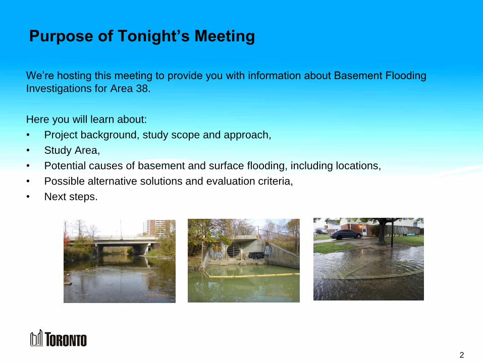
Purpose of Tonight’s Meeting
We’re hosting this meeting to provide you with information about Basement Flooding
Investigations for Area 38.
Here you will learn about:
• Project background, study scope and approach,
• Study Area,
• Potential causes of basement and surface flooding, including locations,
• Possible alternative solutions and evaluation criteria,
• Next steps.
2
Background
• Large storm events in 2000, 2002,
2005 and 2006 caused basement
and surface flooding across the
City.
• Through the Basement Flooding
Protection Program, the City is
developing plans to reduce flooding
risk in certain areas.
Maintenance hole lid damage from Black Creek flooding Example of flooded basement
Example of ponding
Example of storm sewer surcharging
3
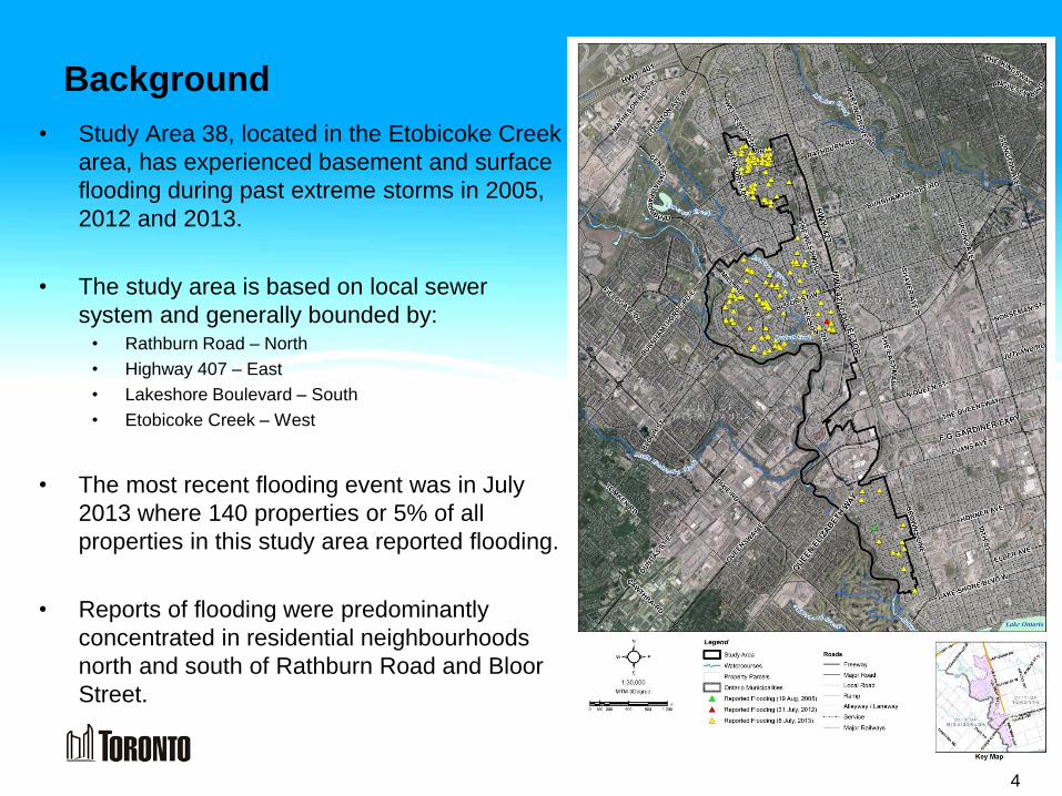
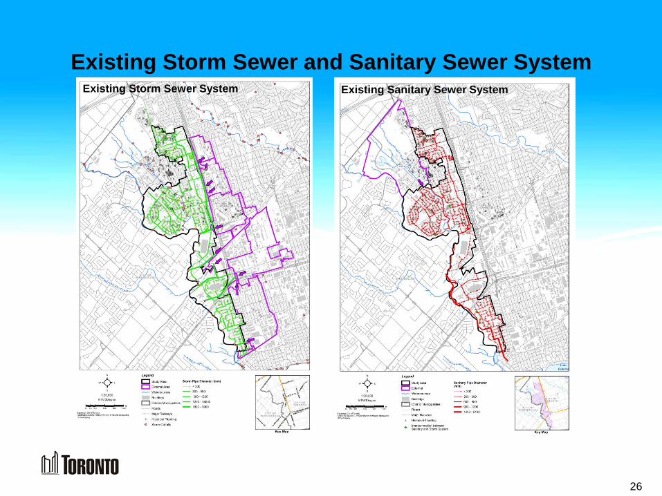
Background
• Study Area 38, located in the Etobicoke Creek
area, has experienced basement and surface
flooding during past extreme storms in 2005,
2012 and 2013.
• The study area is based on local sewer
system and generally bounded by: • Rathburn Road – North
• Highway 407 – East
• Lakeshore Boulevard – South
• Etobicoke Creek – West
• The most recent flooding event was in July
2013 where 140 properties or 5% of all
properties in this study area reported flooding.
• Reports of flooding were predominantly
concentrated in residential neighbourhoods
north and south of Rathburn Road and Bloor
Street.
4
Purpose of Study
• Determine the contributing factors for surface and basement flooding in Area 38.
• Address flooding by improving infrastructure and where feasible, improve the
quality of stormwater runoff before it goes to Etobicoke Creek and Renforth
Creek.
• Recommend solutions to improve the City’s storm and sanitary sewer systems
including overland drainage routes.
5
What This Study Will and Will Not Cover
Will Cover: Public Lands - Any improvements to the sewer and drainage system to be
made within the City’s property such as parks, roads and sewer infrastructure.
Will Not Cover: Private Property Improvements - Each homeowner is responsible for
the operation and maintenance of drainage systems on private property which
includes:
• Lot grading
• Front and rear-yard or driveway
drainage catchbasins
• Foundation drains
• Sump pumps and backwater valves
• Private tree roots and what you put
down the drains (fats, oils, grease, etc)
• Disconnecting downspouts
6
• Storm sewers (minor system) convey up to 1 in 2 year storms.
• Streets (major system) convey major storms that exceed the storm sewer capacity.
• Temporary ponding on streets is expected during major rain storms.
Design Standards:
• Water level in the storm & sanitary sewer is below basement elevation.
• Street flow depth should not exceed the street right-of-way limits.
Storm System Drainage
7
Investigating Basement Flooding: Steps Involved
8
Data Collection and Inventory of Existing Conditions
Preliminary Assessment Report
Identify Causes of Flooding and Potential Solutions
Identify & Recommended Solutions/Overall Strategy
Develop Conceptual Design for Preferred Solutions
Prepare & File EA Report
WE ARE HERE
PIC #2
PIC #1
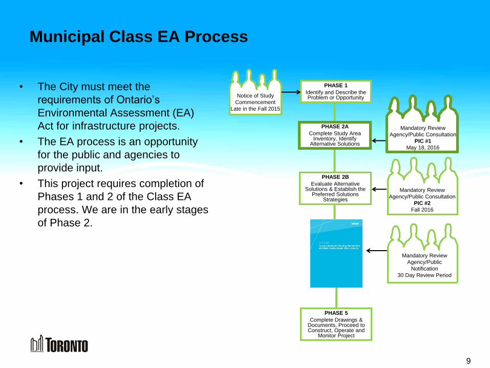
Municipal Class EA Process
• The City must meet the
requirements of Ontario’s
Environmental Assessment (EA)
Act for infrastructure projects.
• The EA process is an opportunity
for the public and agencies to
provide input.
• This project requires completion of
Phases 1 and 2 of the Class EA
process. We are in the early stages
of Phase 2.
9
PHASE 1
Identify and Describe the Problem or Opportunity
PHASE 2A
Complete Study Area Inventory, Identify
Alternative Solutions
Mandatory Review
Agency/Public
Notification
30 Day Review Period
Notice of Study
Commencement
Late in the Fall 2015
PHASE 5
Complete Drawings & Documents, Proceed to Construct, Operate and
Monitor Project
PHASE 2B
Evaluate Alternative Solutions & Establish the
Preferred Solutions Strategies
Mandatory Review
Agency/Public Consultation
PIC #2
Fall 2016
Mandatory Review
Agency/Public Consultation
PIC #1
May 18, 2016
Existing & Future Land Use / Natural Environment
10
“The study area is
highly urbanized
with vegetation
communities
clustered around
Etobicoke Creek.”
Existing Land Use Future Land Use Natural Environment
Natural environment
features include Etobicoke
Creek, Renforth Creek and
vegetation communities
clustered around these
water courses. Natural
environment features
including species at risk
will be further defined
based on desk top and
field investigations
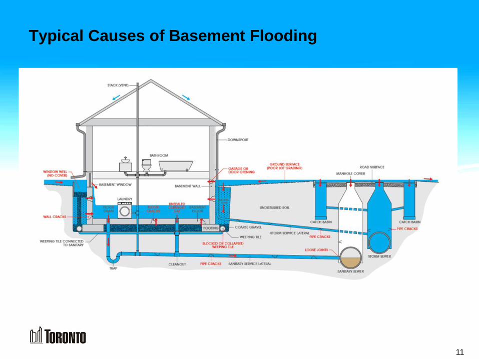
Typical Causes of Basement Flooding
11
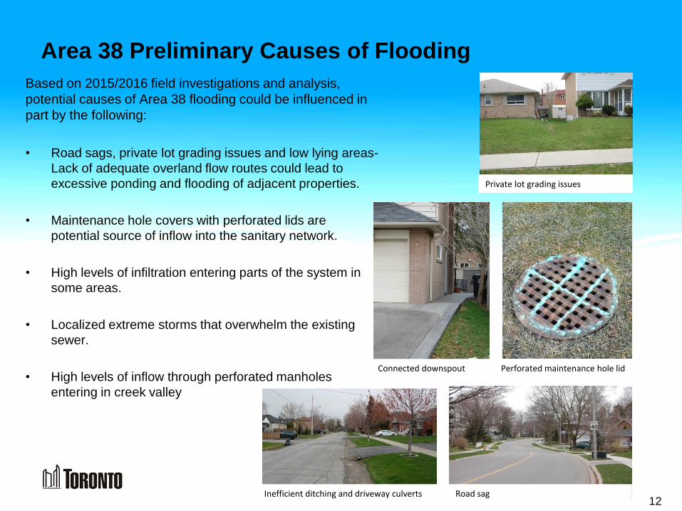
Area 38 Preliminary Causes of Flooding
Based on 2015/2016 field investigations and analysis,
potential causes of Area 38 flooding could be influenced in
part by the following:
• Road sags, private lot grading issues and low lying areas-
Lack of adequate overland flow routes could lead to
excessive ponding and flooding of adjacent properties.
• Maintenance hole covers with perforated lids are
potential source of inflow into the sanitary network.
• High levels of infiltration entering parts of the system in
some areas.
• Localized extreme storms that overwhelm the existing
sewer.
• High levels of inflow through perforated manholes
entering in creek valley
12
Perforated maintenance hole lid
Road sag
Connected downspout
Inefficient ditching and driveway culverts
Private lot grading issues
Basement Flooding
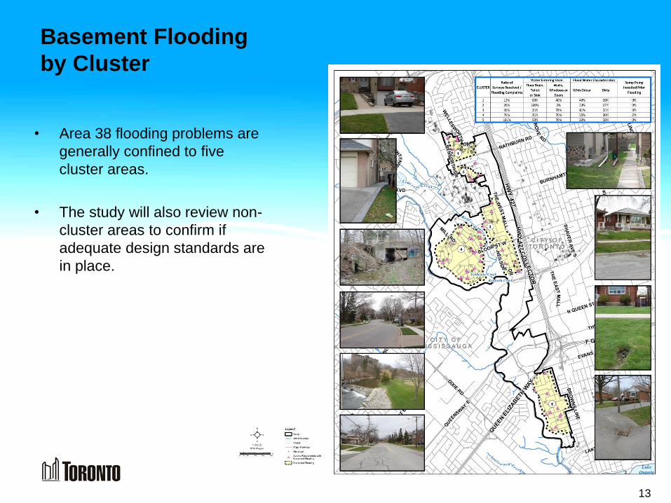
by Cluster
13
• Area 38 flooding problems are
generally confined to five
cluster areas.
• The study will also review non-
cluster areas to confirm if
adequate design standards are
in place.
Summary of Survey Results to date
14
Majority of
homeowners who
responded live in
detached homes
with basements
Found areas of
flooding not
previously
identified
About 30% of
respondents
indicated sewage
like odour with
past flooding
About 60% of
respondents do
not have back-
water valves
Significant
percentage of
downspouts have
been disconnected
from the sewer
Public Feedback
What we heard from
you…….
About 50% of the
respondents have
experienced
basement flooding
• Of approximately 4400 properties, over 180 survey forms were received from home owners.
• This information was used to update flooding data bases and validate flooding areas – clusters.
15
Homeowner Measures to Control Flooding - Isolating your
home’s plumbing from the City’s sewer systems
16
Methods for Reducing Basement Flooding & Improving
Stormwater Runoff Quality
Source Controls:
• Source control measures involve managing stormwater
where it originates (roofs, roads, driveways), before it
enters the City’s sewer pipes.
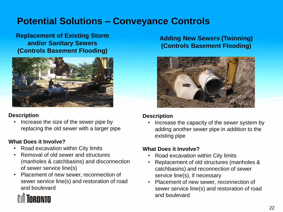
Conveyance Controls:
• Conveyance control measures help to control stormwater
as it travels along the drainage system (in pipes or along
the road).
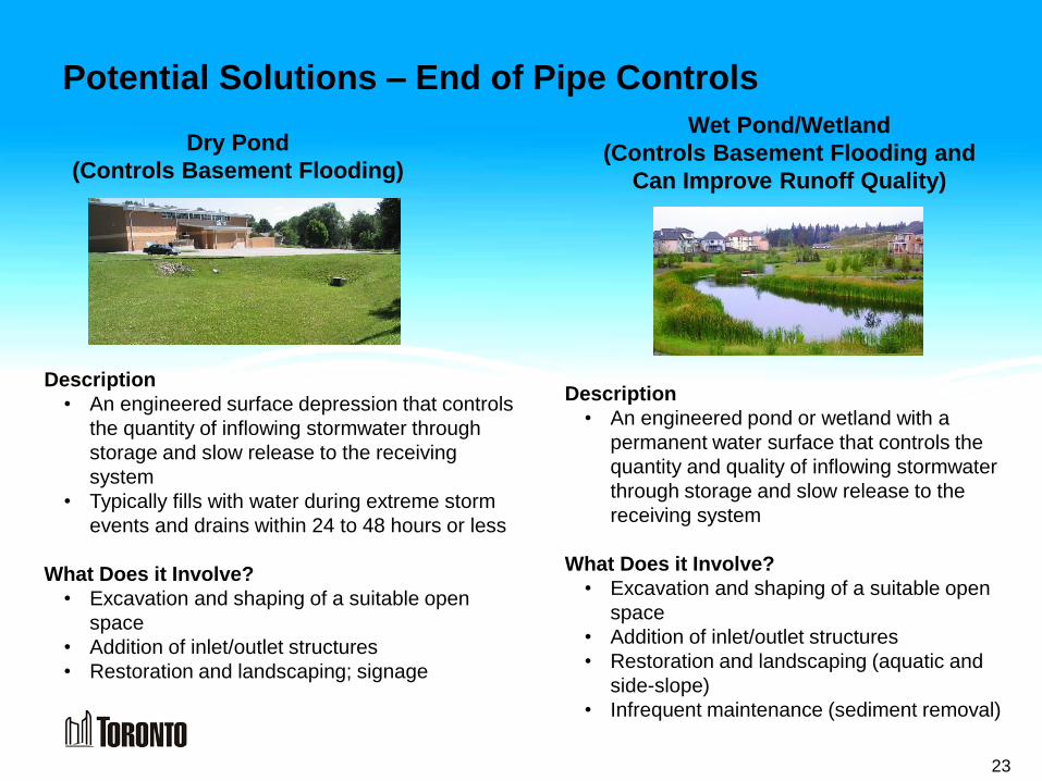
End of Pipe Controls:
• End-of-pipe control measures control stormwater just
before it is discharged to a watercourse (stream, river, or
lake).
17
Potential Solutions – Source Controls
Residents can help reduce runoff – the water that flows from hard surfaces into the sewer system. Naturalizing
your property lowers the risk of basement flooding and contributes to improving stormwater runoff quality.