19
Arne Schilling University of Bonn, Germany OGC TC Meeting 09/30/2009 Darmstadt
Arne SchillingUniversity of Bonn, Germany
OGC TC Meeting 09/30/2009 Darmstadt
2 TC Darmstadt– W3DS - Arne Schilling
W3DS StatusStatus: internal OGC Discussion Paper (OGC 09-104)
Released: July 2009Version: 0.4.0
Editor: Arne Schilling
Download: http://portal.opengeospatial.org/files/?artifact_id=35283&version=1http://portal.opengeospatial.org/files/?artifact_id=35706 (doc)
Package contains also XSD schemas
Presentations at TC Meetings:January, 18th 2005, OGC TC Meeting, New York City November 7th 2005 OGC TC Meeting, BonnDecember 3rd 2008 OGC TC Meeting, Valencia
3 TC Darmstadt– W3DS - Arne Schilling
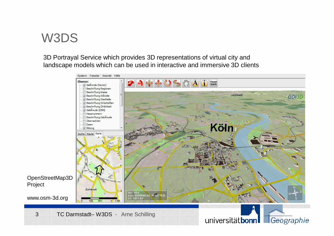
W3DS3D Portrayal Service which provides 3D representations of virtual city and landscape models which can be used in interactive and immersive 3D clients
OpenStreetMap3D Project
www.osm-3d.org
4 TC Darmstadt– W3DS - Arne Schilling
W3DS StatusDownload: http://portal.opengeospatial.org/files/?artifact_id=35283&version=1
Document is almost complete:• Based on the current OGC template• Contains all content and chapters required for an OGC specification (except the test suite)• Package contains also all XSD schemas providing the technical details of the service interface
5 TC Darmstadt– W3DS - Arne Schilling
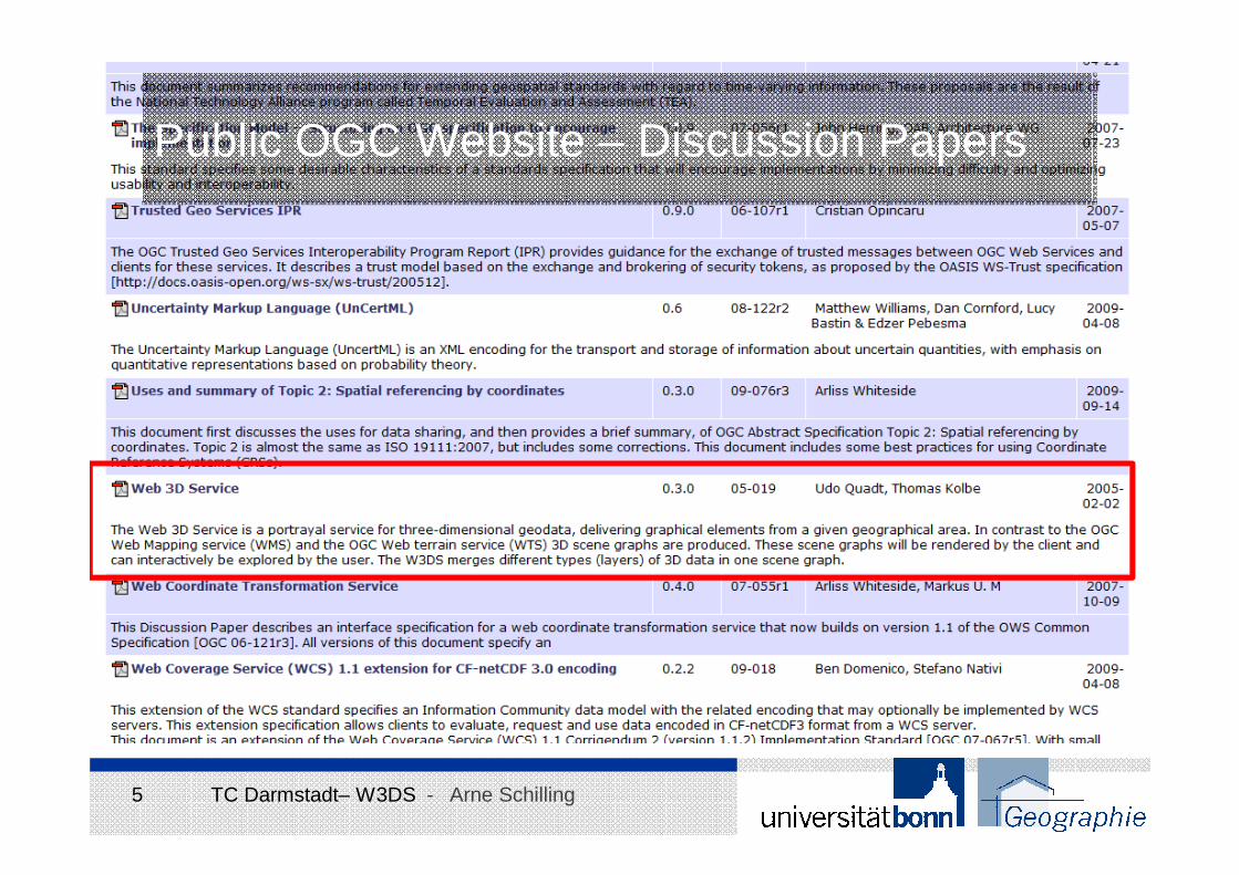
Public OGC Website – Discussion Papers
6 TC Darmstadt– W3DS - Arne Schilling
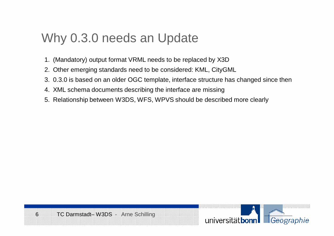
Why 0.3.0 needs an Update
1. (Mandatory) output format VRML needs to be replaced by X3D
2. Other emerging standards need to be considered: KML, CityGML
3. 0.3.0 is based on an older OGC template, interface structure has changed since then
4. XML schema documents describing the interface are missing
5. Relationship between W3DS, WFS, WPVS should be described more clearly
7 TC Darmstadt– W3DS - Arne Schilling
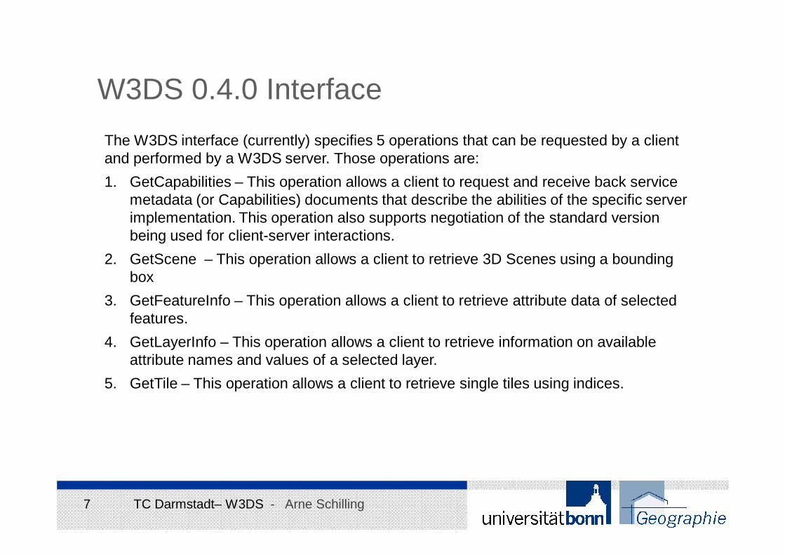
W3DS 0.4.0 Interface
The W3DS interface (currently) specifies 5 operations that can be requested by a client and performed by a W3DS server. Those operations are:
1. GetCapabilities – This operation allows a client to request and receive back service metadata (or Capabilities) documents that describe the abilities of the specific server implementation. This operation also supports negotiation of the standard version being used for client-server interactions.
2. GetScene – This operation allows a client to retrieve 3D Scenes using a bounding box
3. GetFeatureInfo – This operation allows a client to retrieve attribute data of selected features.
4. GetLayerInfo – This operation allows a client to retrieve information on available attribute names and values of a selected layer.
5. GetTile – This operation allows a client to retrieve single tiles using indices.
8 TC Darmstadt– W3DS - Arne Schilling
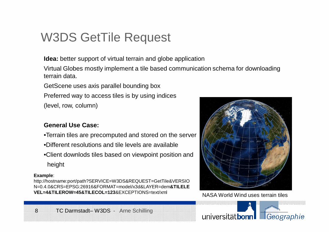
W3DS GetTile Request
Idea: better support of virtual terrain and globe application
Virtual Globes mostly implement a tile based communication schema for downloadingterrain data.
GetScene uses axis parallel bounding box
Preferred way to access tiles is by using indices
(level, row, column)
General Use Case:
•Terrain tiles are precomputed and stored on the server
•Different resolutions and tile levels are available
•Client downlods tiles based on viewpoint position and
height
NASA World Wind uses terrain tiles
Example:http://hostname:port/path?SERVICE=W3DS&REQUEST=GetTile&VERSION=0.4.0&CRS=EPSG:26916&FORMAT=model/x3d&LAYER=dem&TILELEVEL=4&TILEROW=45&TILECOL=123&EXCEPTIONS=text/xml
9 TC Darmstadt– W3DS - Arne Schilling
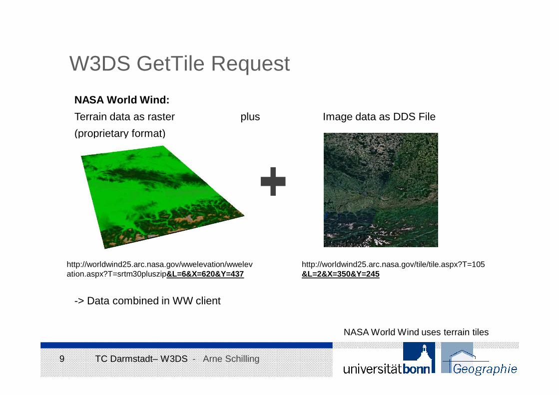
W3DS GetTile Request
NASA World Wind:
Terrain data as raster plus Image data as DDS File
(proprietary format)
-> Data combined in WW client
NASA World Wind uses terrain tiles
http://worldwind25.arc.nasa.gov/wwelevation/wwelevation.aspx?T=srtm30pluszip&L=6&X=620&Y=437
http://worldwind25.arc.nasa.gov/tile/tile.aspx?T=105&L=2&X=350&Y=245
10 TC Darmstadt– W3DS - Arne Schilling
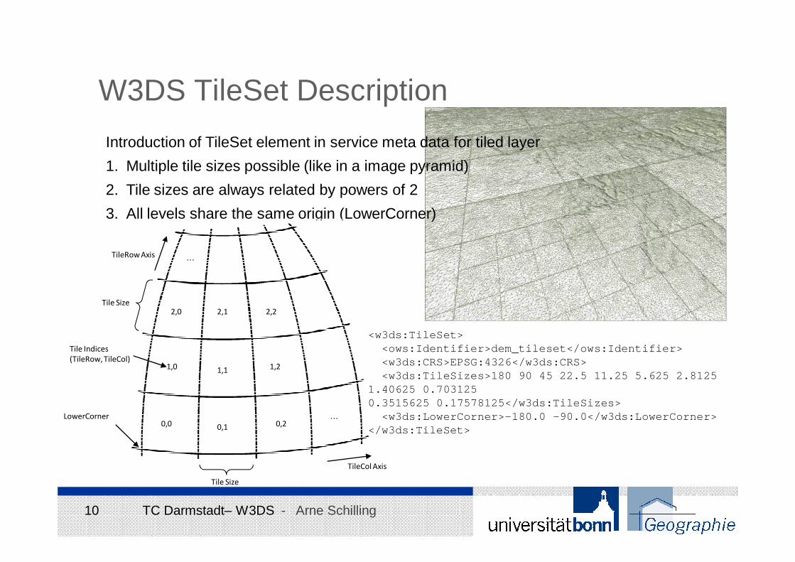
W3DS TileSet Description
Introduction of TileSet element in service meta data for tiled layer
1. Multiple tile sizes possible (like in a image pyramid)
2. Tile sizes are always related by powers of 2
3. All levels share the same origin (LowerCorner)
LowerCorner0,0
1,21,1
0,1 0,2
1,0
Tile Indices
(TileRow, TileCol)
Tile Size
Tile Size
TileCol Axis
TileRow Axis
2,0 2,1 2,2
…
…
<w3ds:TileSet><ows:Identifier>dem_tileset</ows:Identifier><w3ds:CRS>EPSG:4326</w3ds:CRS><w3ds:TileSizes>180 90 45 22.5 11.25 5.625 2.8125
1.40625 0.7031250.3515625 0.17578125</w3ds:TileSizes>
<w3ds:LowerCorner>-180.0 -90.0</w3ds:LowerCorner></w3ds:TileSet>
11 TC Darmstadt– W3DS - Arne Schilling
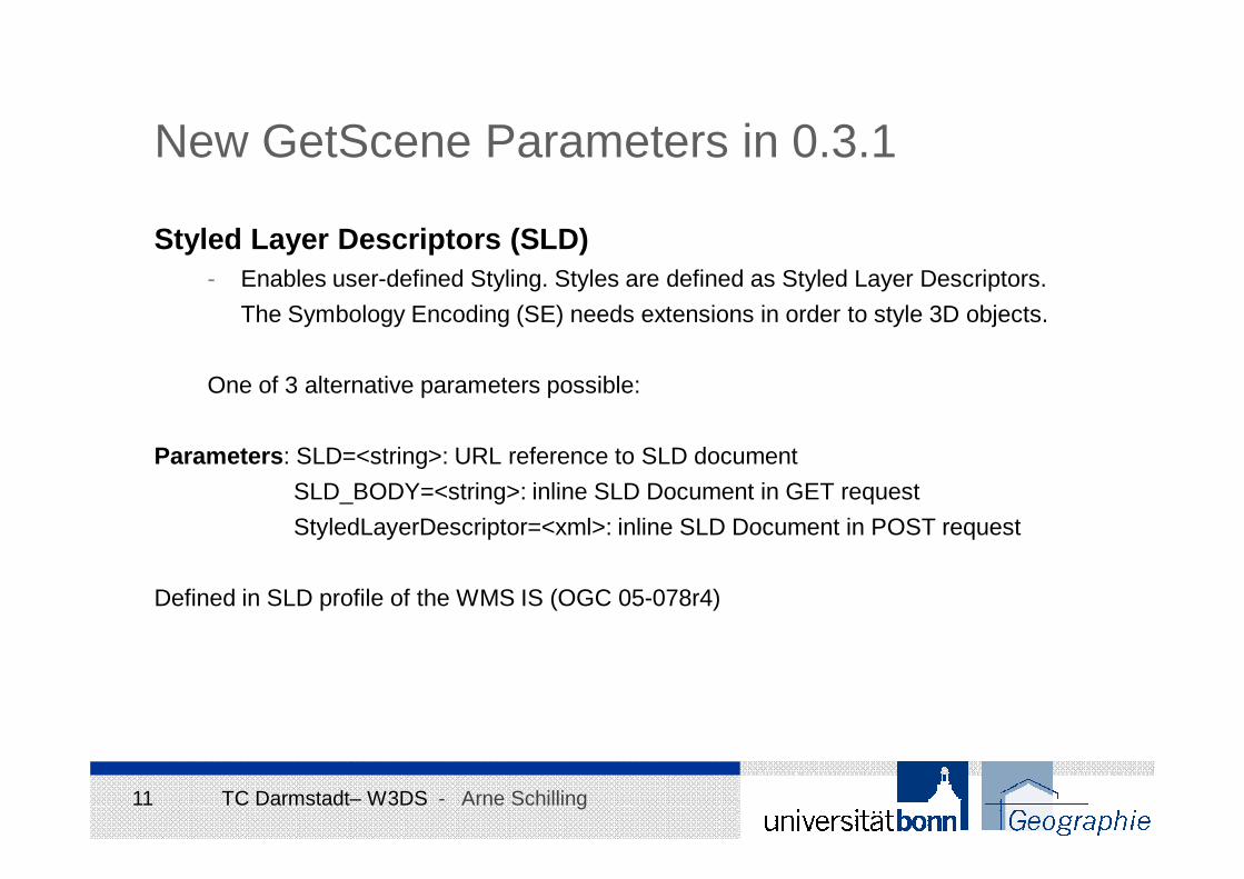
New GetScene Parameters in 0.3.1
Styled Layer Descriptors (SLD)- Enables user-defined Styling. Styles are defined as Styled Layer Descriptors.
The Symbology Encoding (SE) needs extensions in order to style 3D objects.
One of 3 alternative parameters possible:
Parameters: SLD=<string>: URL reference to SLD document
SLD_BODY=<string>: inline SLD Document in GET request
StyledLayerDescriptor=<xml>: inline SLD Document in POST request
Defined in SLD profile of the WMS IS (OGC 05-078r4)
12 TC Darmstadt– W3DS - Arne Schilling
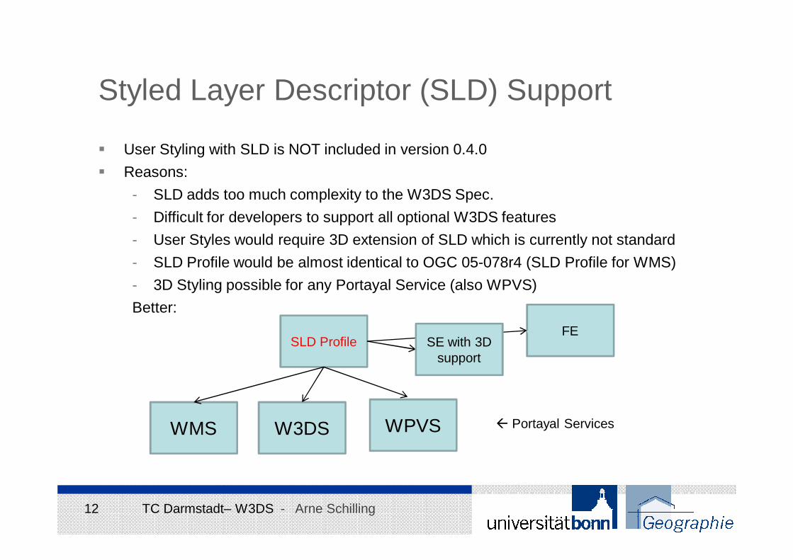
Styled Layer Descriptor (SLD) Support
� User Styling with SLD is NOT included in version 0.4.0
� Reasons:
- SLD adds too much complexity to the W3DS Spec.
- Difficult for developers to support all optional W3DS features
- User Styles would require 3D extension of SLD which is currently not standard
- SLD Profile would be almost identical to OGC 05-078r4 (SLD Profile for WMS)
- 3D Styling possible for any Portayal Service (also WPVS)
Better:
WMS W3DS WPVS
SLD ProfileFE
SE with 3D support
� Portayal Services
13 TC Darmstadt– W3DS - Arne Schilling
X3D Geospatial Component
Benefits:
Geospatial accuracy (WGS84, UTM, etc.)True mapping of 3D Geospatial coordinates to X3D’s Cartesian X, Y, Z coordinates
X3D Earth Working Group at Web3D Consortium
http://www.web3d.org/x3d-earth/
Presentations at Technical Workshop in 2007:
• OGC CityGML and W3DS - Thomas Kolbe• OGC 3DIM activities, goals, and collaboration points with Web3D - Tim Case
14 TC Darmstadt– W3DS - Arne Schilling
6.2.1 Anchor6.2.2 Appearance6.2.3 Arc2D6.2.4 ArcClose2D6.2.5 AudioClip6.2.6 Background6.2.7 BallJoint6.2.8 Billboard6.2.9 BooleanFilter6.2.10 BooleanSequencer6.2.11 BooleanToggle6.2.12 BooleanTrigger6.2.13 BoundedPhysicsModel
6.2.14 Box6.2.15 CADAssembly6.2.16 CADFace6.2.17 CADLayer6.2.18 CADPart6.2.19 Circle2D6.2.20 ClipPlane6.2.21 CollidableOffset6.2.22 CollidableShape6.2.23 Collision6.2.24 CollisionCollection6.2.25 CollisionSensor6.2.26 CollisionSpace6.2.27 Color6.2.28 ColorDamper6.2.29 ColorInterpolator6.2.30 ColorRGBA6.2.31 ComposedCubeMapT
exture6.2.32 ComposedShader6.2.33 ComposedTexture3D6.2.34 Cone6.2.35 ConeEmitter6.2.36 Contact6.2.37 Contour2D6.2.38 ContourPolyline2D6.2.39 Coordinate6.2.40 CoordinateDamper6.2.41 CoordinateDouble6.2.42 CoordinateInterpolator6.2.43 CoordinateInterpolator
2D
6.2.44 Cylinder6.2.45 CylinderSensor6.2.46 DirectionalLight6.2.47 DISEntityManager6.2.48 DISEntityTypeMapping
6.2.49 Disk2D6.2.50 DoubleAxisHingeJoint6.2.51 EaseInEaseOut6.2.52 ElevationGrid6.2.53 EspduTransform6.2.54 ExplosionEmitter6.2.55 Extrusion6.2.56 field6.2.57 fieldValue6.2.58 FillProperties6.2.59 FloatVertexAttribute6.2.60 Fog6.2.61 FogCoordinate6.2.62 FontStyle6.2.63 ForcePhysicsModel6.2.64 GeneratedCubeMapTexture
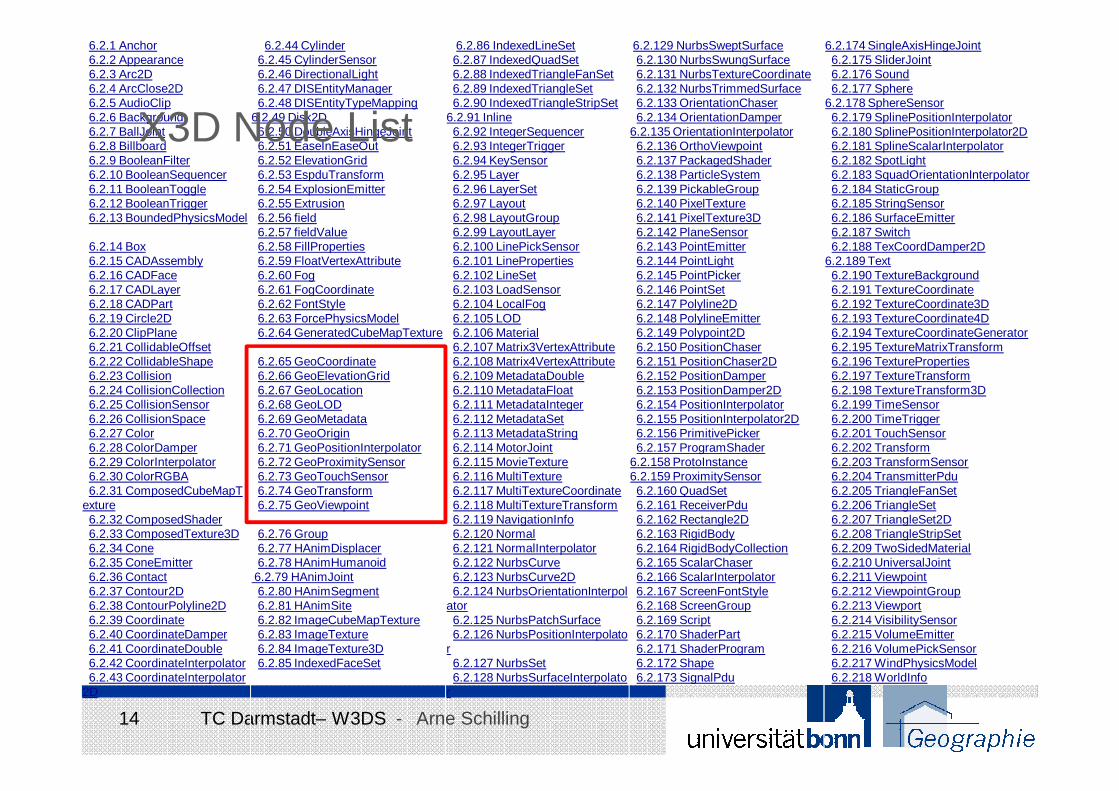
6.2.65 GeoCoordinate6.2.66 GeoElevationGrid6.2.67 GeoLocation6.2.68 GeoLOD6.2.69 GeoMetadata6.2.70 GeoOrigin6.2.71 GeoPositionInterpolator6.2.72 GeoProximitySensor6.2.73 GeoTouchSensor6.2.74 GeoTransform6.2.75 GeoViewpoint
6.2.76 Group6.2.77 HAnimDisplacer6.2.78 HAnimHumanoid
6.2.79 HAnimJoint6.2.80 HAnimSegment6.2.81 HAnimSite6.2.82 ImageCubeMapTexture6.2.83 ImageTexture6.2.84 ImageTexture3D6.2.85 IndexedFaceSet
6.2.86 IndexedLineSet6.2.87 IndexedQuadSet6.2.88 IndexedTriangleFanSet6.2.89 IndexedTriangleSet6.2.90 IndexedTriangleStripSet
6.2.91 Inline6.2.92 IntegerSequencer6.2.93 IntegerTrigger6.2.94 KeySensor6.2.95 Layer6.2.96 LayerSet6.2.97 Layout6.2.98 LayoutGroup6.2.99 LayoutLayer6.2.100 LinePickSensor6.2.101 LineProperties6.2.102 LineSet6.2.103 LoadSensor6.2.104 LocalFog6.2.105 LOD6.2.106 Material6.2.107 Matrix3VertexAttribute6.2.108 Matrix4VertexAttribute6.2.109 MetadataDouble6.2.110 MetadataFloat6.2.111 MetadataInteger6.2.112 MetadataSet6.2.113 MetadataString6.2.114 MotorJoint6.2.115 MovieTexture6.2.116 MultiTexture6.2.117 MultiTextureCoordinate6.2.118 MultiTextureTransform6.2.119 NavigationInfo6.2.120 Normal6.2.121 NormalInterpolator6.2.122 NurbsCurve6.2.123 NurbsCurve2D6.2.124 NurbsOrientationInterpol
ator6.2.125 NurbsPatchSurface6.2.126 NurbsPositionInterpolato
r6.2.127 NurbsSet6.2.128 NurbsSurfaceInterpolato
r
6.2.129 NurbsSweptSurface6.2.130 NurbsSwungSurface6.2.131 NurbsTextureCoordinate6.2.132 NurbsTrimmedSurface6.2.133 OrientationChaser6.2.134 OrientationDamper
6.2.135 OrientationInterpolator6.2.136 OrthoViewpoint6.2.137 PackagedShader6.2.138 ParticleSystem6.2.139 PickableGroup6.2.140 PixelTexture6.2.141 PixelTexture3D6.2.142 PlaneSensor6.2.143 PointEmitter6.2.144 PointLight6.2.145 PointPicker6.2.146 PointSet6.2.147 Polyline2D6.2.148 PolylineEmitter6.2.149 Polypoint2D6.2.150 PositionChaser6.2.151 PositionChaser2D6.2.152 PositionDamper6.2.153 PositionDamper2D6.2.154 PositionInterpolator6.2.155 PositionInterpolator2D6.2.156 PrimitivePicker6.2.157 ProgramShader
6.2.158 ProtoInstance6.2.159 ProximitySensor6.2.160 QuadSet6.2.161 ReceiverPdu6.2.162 Rectangle2D6.2.163 RigidBody6.2.164 RigidBodyCollection6.2.165 ScalarChaser6.2.166 ScalarInterpolator6.2.167 ScreenFontStyle6.2.168 ScreenGroup6.2.169 Script6.2.170 ShaderPart6.2.171 ShaderProgram6.2.172 Shape6.2.173 SignalPdu
6.2.174 SingleAxisHingeJoint6.2.175 SliderJoint6.2.176 Sound6.2.177 Sphere
6.2.178 SphereSensor6.2.179 SplinePositionInterpolator6.2.180 SplinePositionInterpolator2D6.2.181 SplineScalarInterpolator6.2.182 SpotLight6.2.183 SquadOrientationInterpolator6.2.184 StaticGroup6.2.185 StringSensor6.2.186 SurfaceEmitter6.2.187 Switch6.2.188 TexCoordDamper2D
6.2.189 Text6.2.190 TextureBackground6.2.191 TextureCoordinate6.2.192 TextureCoordinate3D6.2.193 TextureCoordinate4D6.2.194 TextureCoordinateGenerator6.2.195 TextureMatrixTransform6.2.196 TextureProperties6.2.197 TextureTransform6.2.198 TextureTransform3D6.2.199 TimeSensor6.2.200 TimeTrigger6.2.201 TouchSensor6.2.202 Transform6.2.203 TransformSensor6.2.204 TransmitterPdu6.2.205 TriangleFanSet6.2.206 TriangleSet6.2.207 TriangleSet2D6.2.208 TriangleStripSet6.2.209 TwoSidedMaterial6.2.210 UniversalJoint6.2.211 Viewpoint6.2.212 ViewpointGroup6.2.213 Viewport6.2.214 VisibilitySensor6.2.215 VolumeEmitter6.2.216 VolumePickSensor6.2.217 WindPhysicsModel6.2.218 WorldInfo
X3D Node List
15 TC Darmstadt– W3DS - Arne Schilling
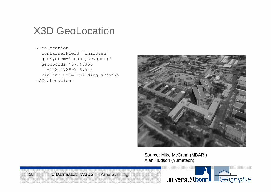
X3D GeoLocation<GeoLocation
containerField="children”geoSystem=""GD"" geoCoords=”37.45855
-122.172997 6.5”><inline url=“building.x3dv”/>
</GeoLocation>
Source: Mike McCann (MBARI)Alan Hudson (Yumetech)
16 TC Darmstadt– W3DS - Arne Schilling
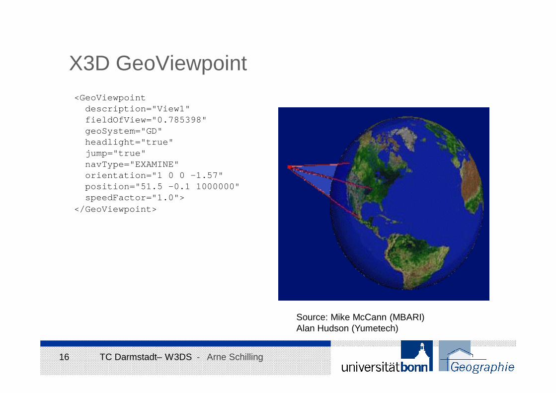
X3D GeoViewpoint<GeoViewpoint
description="View1"fieldOfView="0.785398"geoSystem="GD"headlight="true"jump="true"navType="EXAMINE"orientation="1 0 0 -1.57"position="51.5 -0.1 1000000"speedFactor="1.0">
</GeoViewpoint>
Source: Mike McCann (MBARI)Alan Hudson (Yumetech)
17 TC Darmstadt– W3DS - Arne Schilling
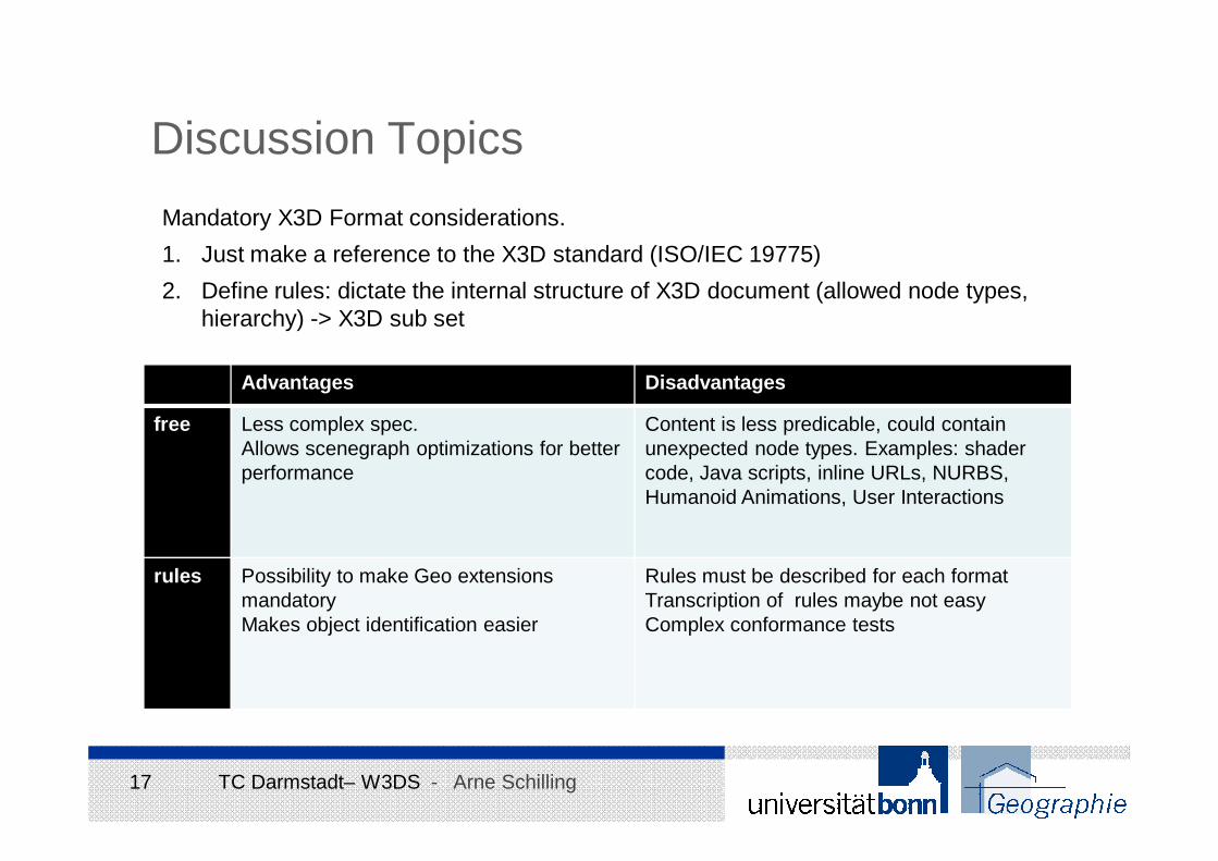
Discussion Topics
Mandatory X3D Format considerations.
1. Just make a reference to the X3D standard (ISO/IEC 19775)
2. Define rules: dictate the internal structure of X3D document (allowed node types, hierarchy) -> X3D sub set
Advantages Disadvantages
free Less complex spec.Allows scenegraph optimizations for betterperformance
Content is less predicable, could containunexpected node types. Examples: shadercode, Java scripts, inline URLs, NURBS, Humanoid Animations, User Interactions
rules Possibility to make Geo extensionsmandatoryMakes object identification easier
Rules must be described for each formatTranscription of rules maybe not easyComplex conformance tests
18 TC Darmstadt– W3DS - Arne Schilling
Next Steps
� ?
� Fix errors, receive Change Requests from 3Dim group
� Make it a public Discussion Paper
� Carsten suggested to publish a white paper on the OGC Network Website
(http://www.ogcnetwork.net/), content?
19 TC Darmstadt– W3DS - Arne Schilling
The End


