50
Assessing Slope Instabilities Victoria Leffel & Joey Franzino

Assessing Slope InstabilitiesVictoria Leffel & Joey Franzino

• Today’s Presentation: Slope instability and landslide terms will be used interchangeably
• Landslide: downward and outward movement of slope-forming materials composed of natural rocks, soils, or combination of these materials
• Landslides can be further classified by types of movement
• Landslides are under the influence of geologic, topographic, or climatic factors
Slope Stability and Landslides
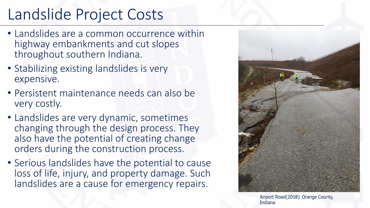
• Landslides are a common occurrence within highway embankments and cut slopes throughout southern Indiana.
• Stabilizing existing landslides is very expensive.
• Persistent maintenance needs can also be very costly.
• Landslides are very dynamic, sometimes changing through the design process. They also have the potential of creating change orders during the construction process.
• Serious landslides have the potential to cause loss of life, injury, and property damage. Such landslides are a cause for emergency repairs.
Landslide Project Costs

Indiana’s Topography
Gray (2000)
• Topography: Shape and features of land surfaces• Physiographic regions: Areas of similar geologic structure and
geomorphic history. Contain similar landforms.

Overview of Indiana Geology• Glacial advances dissect the northern and
southern half of Indiana
• Glacial till deposits can be hundreds of feet thick in the northern half of the state
• Residual soil is the dominant unconsolidated deposit beyond the glacial advance, this is limited to the southern half of Indiana
• Depth to bedrock is shallower in the southern half of Indiana, typically less than 50 feet
• Map: Solid gray line is the Wisconsin Glacial Limits(50,000 years ago) and dotted line is Illinoian Glacial Limits(300,000 to 140,000 years ago)
Indiana Map (2019)
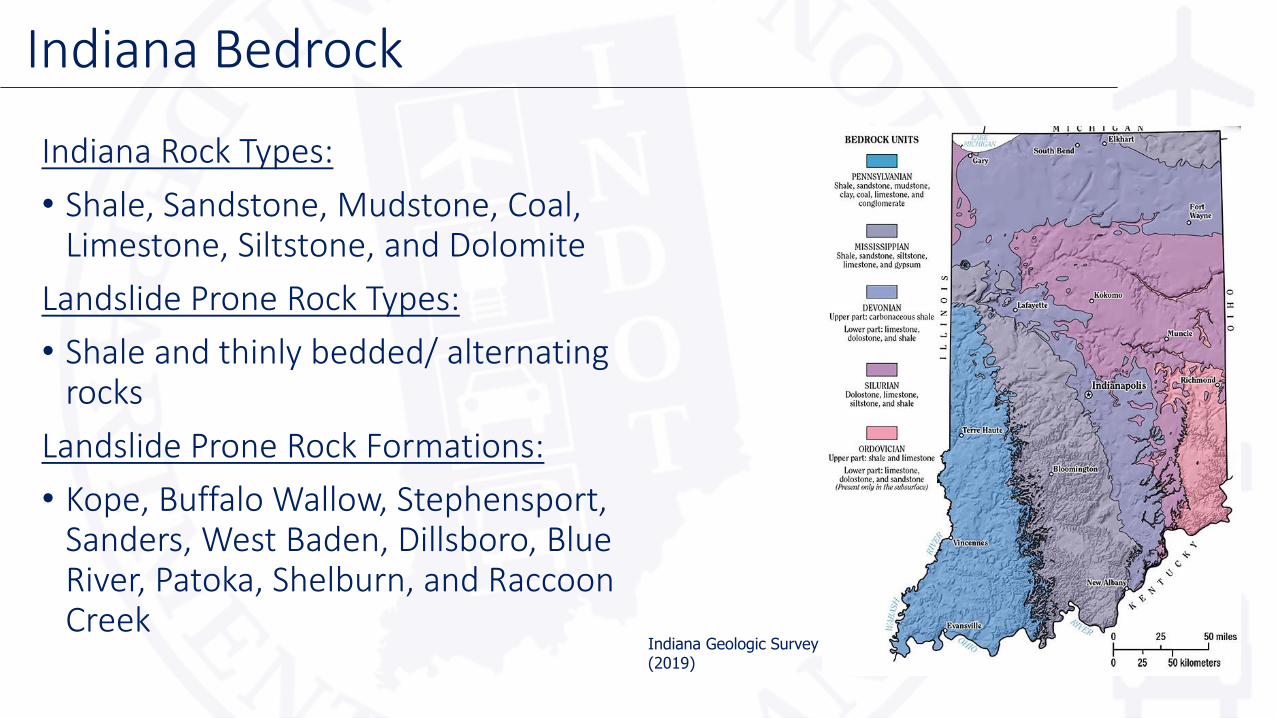
Indiana Rock Types:
• Shale, Sandstone, Mudstone, Coal, Limestone, Siltstone, and Dolomite
Landslide Prone Rock Types:
• Shale and thinly bedded/ alternating rocks
Landslide Prone Rock Formations:
• Kope, Buffalo Wallow, Stephensport, Sanders, West Baden, Dillsboro, Blue River, Patoka, Shelburn, and Raccoon Creek
Indiana Bedrock
Indiana Geologic Survey (2019)

• Mapped landslides are relative to Indiana’s highway network
• Landslides occur in two primary clusters-South Central and Southeastern
• Limited number in Southwest due to cut slope failures
• Landslides in Indiana are a function of both topography and bedrock geology
• The data mapped is a collection of Seymour & Vincennes GIS data, 1999 JTRP report, and Geotechnical Services data
• Map- Black dots represent historical data and red dots are 2018 active slides
Indiana Bedrock Geology & Landslides
Dots- INDOT GIS data (2018). Bedrock information- Indiana Map(2018)

• Water or poor drainage
• Slope is too steep (for height)
• Creek at the toe of the slope
• Groundwater at soil-rock interface
• Sloping Bedrock
• Engineering of Fill
• Failed internal/adjacent drainage structures
• Poor soils in natural ground
• Loading from traffic or slopes above the road
• Earthquake or other natural disaster
Common Causes of Landslides
US 52. Franklin County, Indiana

In relation to highway construction:
• Constructed highway embankments
• Cut slopes
• Unvegetated slopes
• Slopes 2:1 or steeper
• Stream banks
Potentially Hazardous Slopes
SR 445. Greene County, Indiana

Embankments:
• Poor compaction
• Embankment material containing large fragments of broken up shale material• Shale can degrade from a hard mass to a
fine-grained mass of soil causing settlement in embankments
Cut Slopes:
• Thinly layered bedrock(alternating between shale and limestone)
• Sometimes slopes are designed/constructed too steep for soil type – Right of Way/Environmental Constraints
Engineered Slopes
I-69. Monroe County, Indiana(2019)
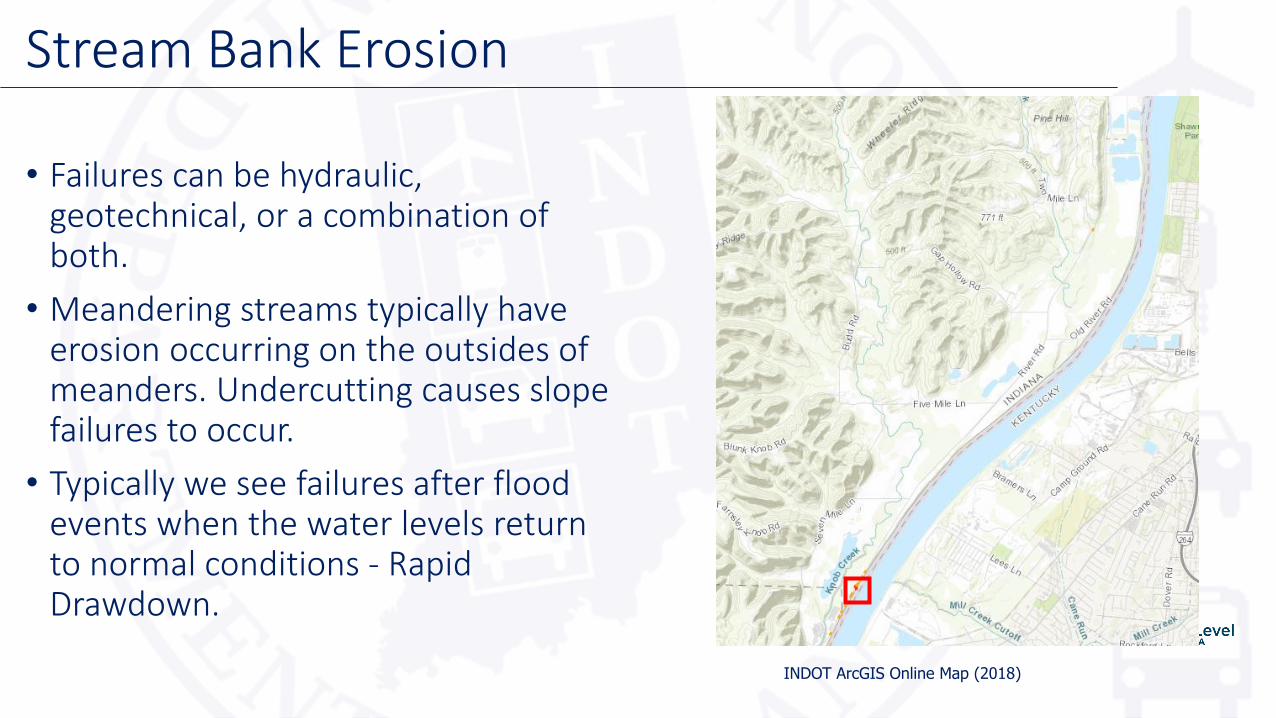
• Failures can be hydraulic, geotechnical, or a combination of both.
• Meandering streams typically have erosion occurring on the outsides of meanders. Undercutting causes slope failures to occur.
• Typically we see failures after flood events when the water levels return to normal conditions - Rapid Drawdown.
Stream Bank Erosion
INDOT ArcGIS Online Map (2018)

Stream Bank Failure - SR 111 Floyd County
March 28, 2018 May 15, 2018

Not limited to, but can include:
• Headscarps
• Toe bulges
• Tension cracks in pavement or slope
• Hummocky appearance of the slope surface
• Misalignment of the guardrail
• Tilting trees, J-shaped trees
• Patching of the roadway surface
• Water seepage on the slope
• Debris blockage or poorly flowing ditches along the toe of the slope
• Some of these conditions can be noted, but will not represent slope instability. Typically, when slope instability is occurring multiple characteristics are present.
Common Evidence of Ground Movement
US 52. Franklin County, Indiana.

• The intent of the collector app:• Help identify potential hazardous slopes• Assess relative risk• Determine a degree of monitoring required• Allow for action to be taken to minimize the
risk to the public’s safety and protect the highway system
• Provides a standardized way to collect data.
• Users can be INDOT district personnel, geotechnical services personnel, and approved geotechnical consultants.
• Map - Red lines are slides mapped by Geotechnical Consultants(2018) and Orange lines are legacy slides mapped by Seymour District
Slide Collector App
INDOT Collector App Map (2018)

Slide Collector App-SR 1
SR 1. Dearborn County, Indiana(2018). Earth Exploration.
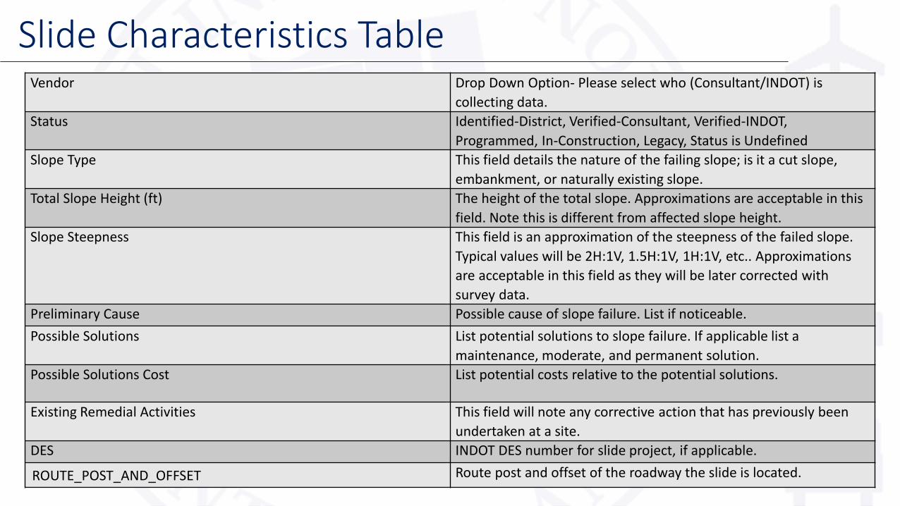
Vendor Drop Down Option- Please select who (Consultant/INDOT) is
collecting data.
Status Identified-District, Verified-Consultant, Verified-INDOT,
Programmed, In-Construction, Legacy, Status is Undefined
Slope Type This field details the nature of the failing slope; is it a cut slope,
embankment, or naturally existing slope.
Total Slope Height (ft) The height of the total slope. Approximations are acceptable in this
field. Note this is different from affected slope height.
Slope Steepness This field is an approximation of the steepness of the failed slope.
Typical values will be 2H:1V, 1.5H:1V, 1H:1V, etc.. Approximations
are acceptable in this field as they will be later corrected with
survey data.
Preliminary Cause Possible cause of slope failure. List if noticeable.
Possible Solutions List potential solutions to slope failure. If applicable list a
maintenance, moderate, and permanent solution.
Possible Solutions Cost List potential costs relative to the potential solutions.
Existing Remedial Activities This field will note any corrective action that has previously been
undertaken at a site.
DES INDOT DES number for slide project, if applicable.
ROUTE_POST_AND_OFFSET Route post and offset of the roadway the slide is located.
Slide Characteristics Table

Slide Collector App
SR 1. Dearborn County, Indiana(2018). Earth Exploration.
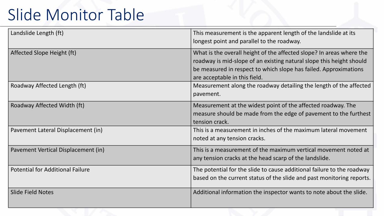
Landslide Length (ft) This measurement is the apparent length of the landslide at its
longest point and parallel to the roadway.
Affected Slope Height (ft) What is the overall height of the affected slope? In areas where the
roadway is mid-slope of an existing natural slope this height should
be measured in respect to which slope has failed. Approximations
are acceptable in this field.
Roadway Affected Length (ft) Measurement along the roadway detailing the length of the affected
pavement.
Roadway Affected Width (ft) Measurement at the widest point of the affected roadway. The
measure should be made from the edge of pavement to the furthest
tension crack.
Pavement Lateral Displacement (in) This is a measurement in inches of the maximum lateral movement
noted at any tension cracks.
Pavement Vertical Displacement (in) This is a measurement of the maximum vertical movement noted at
any tension cracks at the head scarp of the landslide.
Potential for Additional Failure The potential for the slide to cause additional failure to the roadway
based on the current status of the slide and past monitoring reports.
Slide Field Notes Additional information the inspector wants to note about the slide.
Slide Monitor Table

• Landslides are often very dynamic
• The slide monitor table is separate from the slide details to capture landslide changes in relation to pavement distress
• Multiple slide monitor tables can be added
• Multiple tables allow us to track pavement distress over time
• A hazard rating can be assigned to prioritize landslides based on slide monitor tables
Slide Monitor Table

• The optimum time for field work for identifying slides is October through April, however, snow may also limit field activities in December through February.
• The more precise the data the better.
• Series of small instabilities closely associated with each other should be combined, however, slope instabilities on opposite sides of the road should be mapped separately.
Inventory Tips
US 35. Howard County, Indiana
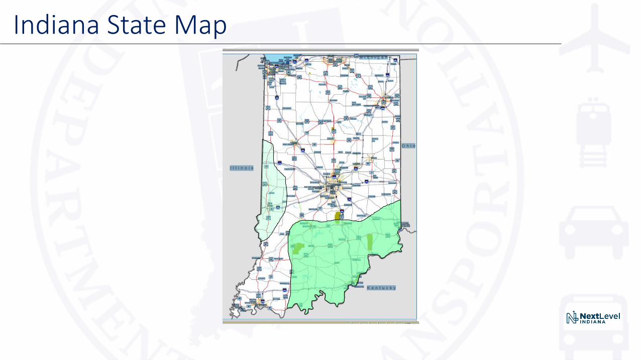
Indiana State Map
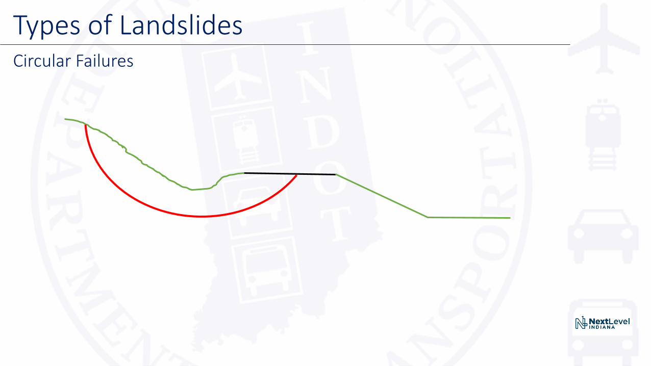
Types of LandslidesCircular Failures
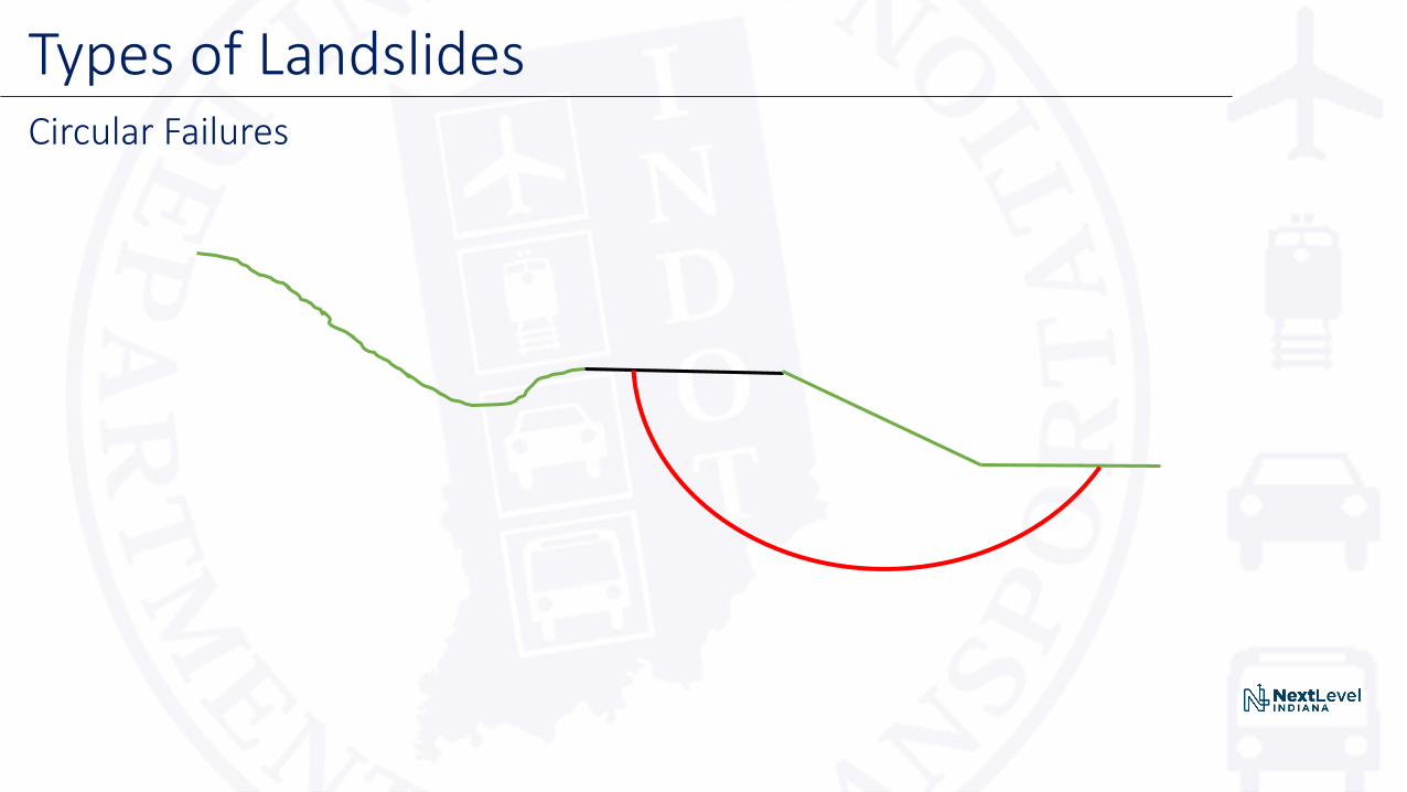
Types of LandslidesCircular Failures
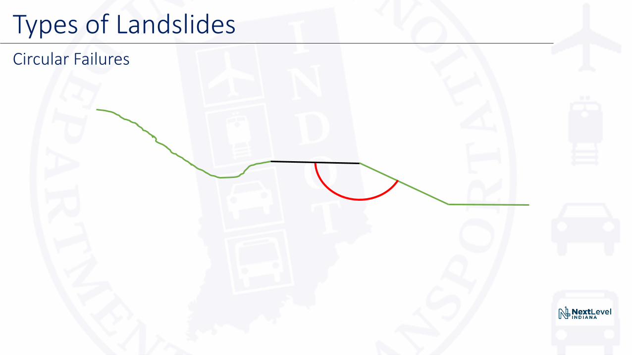
Types of LandslidesCircular Failures
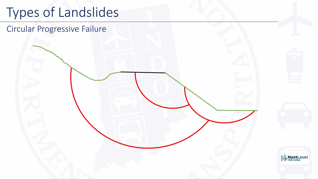
Types of LandslidesCircular Progressive Failure
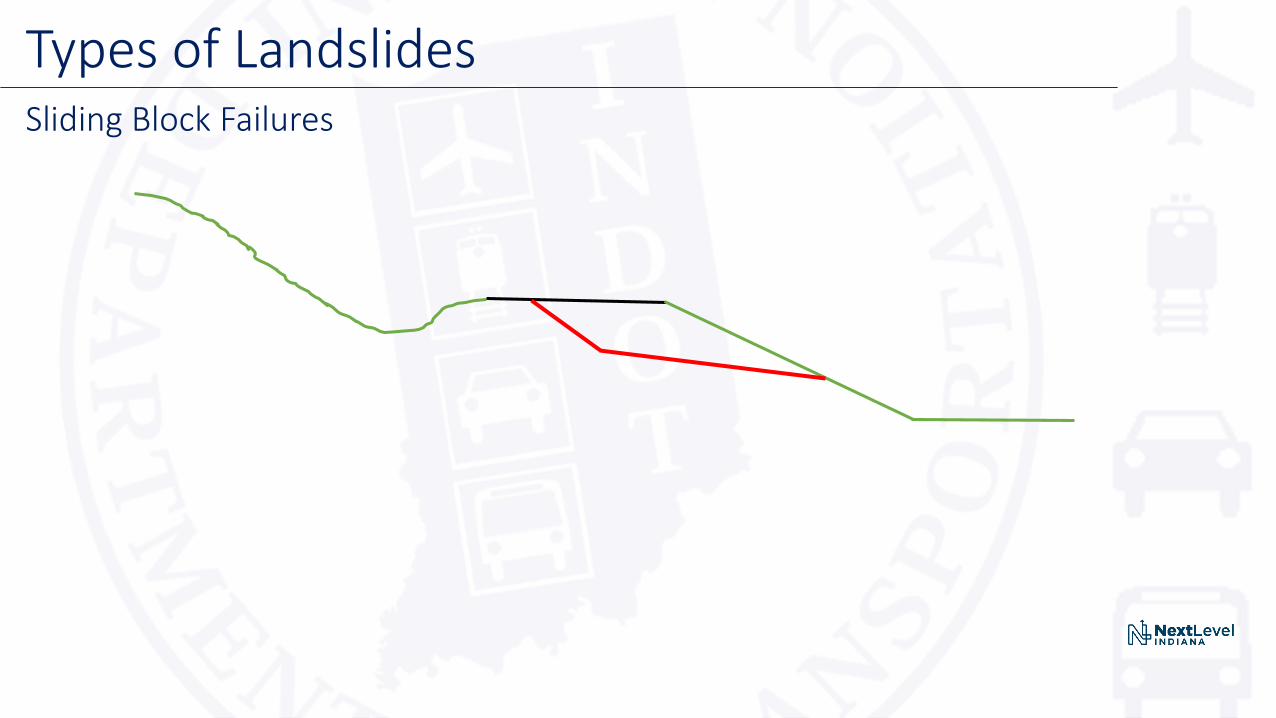
Types of LandslidesSliding Block Failures

Types of LandslidesErosion Failures
Could Lead to Larger Problems

Landslide EffectsCracks in Pavement

Landslide EffectsCracks in Pavement
US 52. Franklin County, Indiana
Most Popular Landslide Corrections
1. Flatten the Slope
2. Rock Backfill Correction
3. Drilled Piers with Tiebacks
4. Soldier Pile Wall with Tiebacks
5. Reinforced Slope
6. Soil Nail Wall
7. Gabion Wall

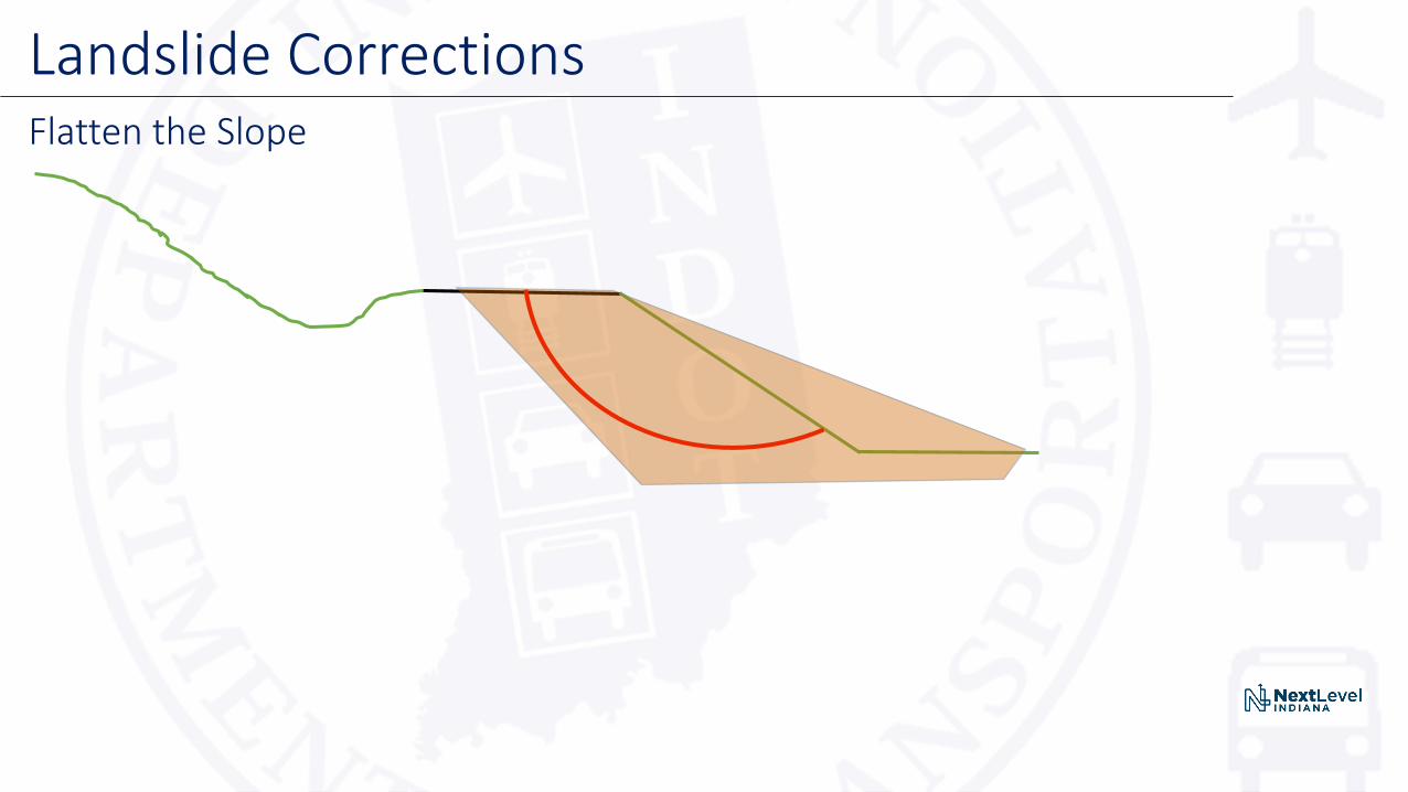
Landslide CorrectionsFlatten the Slope
Advantages:
1. Cost effective
2. Failed material can often be reused for fill
Disadvantages:
1. New slope has larger footprint (may require right of way)
2. Road closed or partially closed for construction
3. Depending on height, temporary excavation can be risky
Landslide CorrectionsFlatten the Slope

Landslide CorrectionsRock Backfill
Advantages:1. Cost effective
2. Depending on analysis, existing slope steepness can generally be maintained
3. Rock backfill keys into bedrock very well
Disadvantages:
1. Requires hauling in rock backfill and hauling away most failed material
2. Road closed or partially closed for construction
3. Depending on height, temporary excavation can be risky
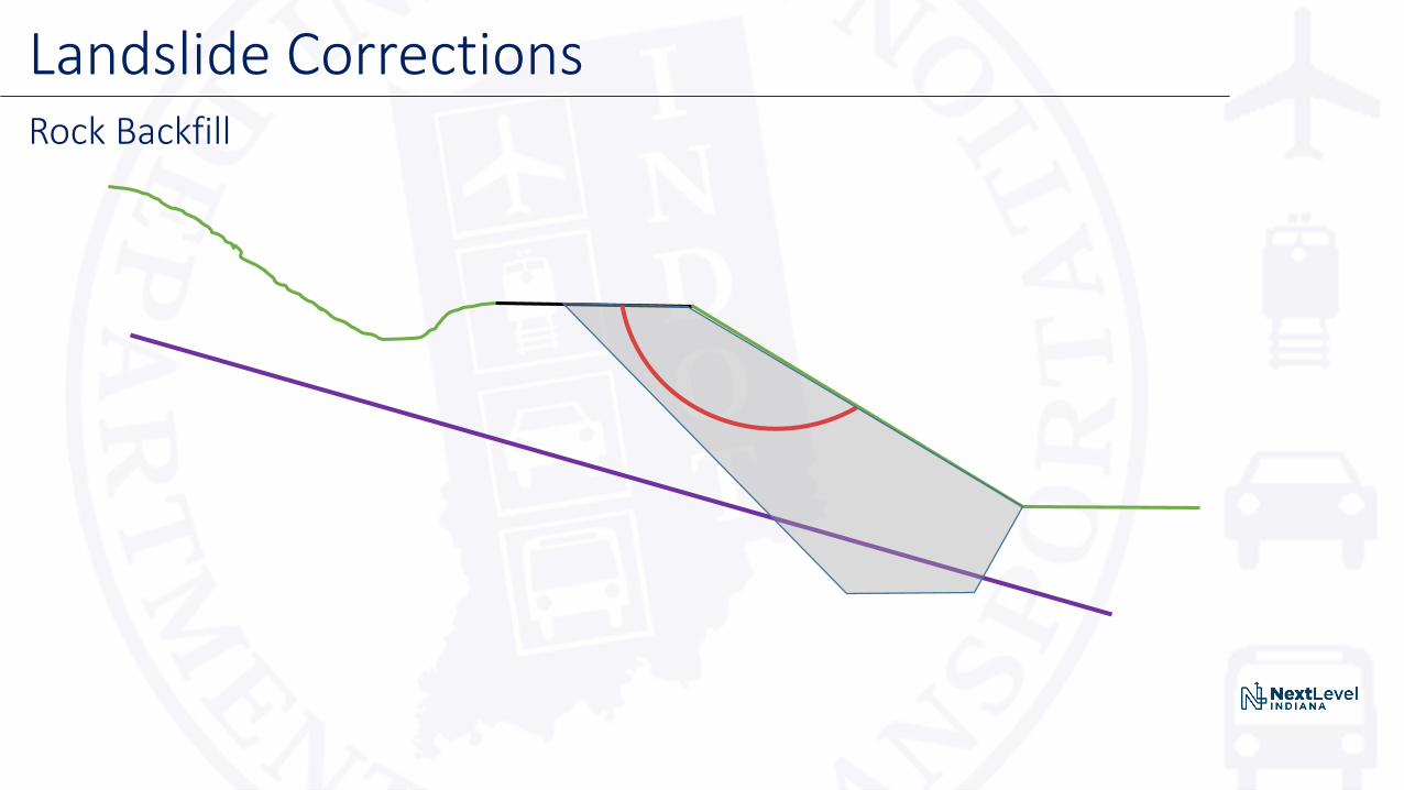
Landslide CorrectionsRock Backfill
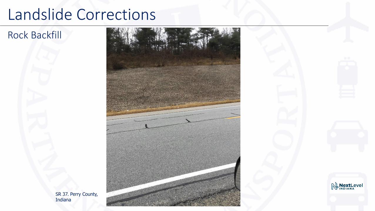
Landslide CorrectionsRock Backfill
SR 37. Perry County, Indiana
Landslide CorrectionsDrilled Piers or Soldier Piles (usually with Tiebacks)
Advantages:
1. Gold standard of landslide repairs
2. Extremely robust system, there has never been a failure of this correction in Indiana
3. Construction time is relatively quick
Disadvantages:
1. Most costly correction in our arsenal, we use it as a last resort when nothing else is feasible
2. Not a redundant system
3. May require monitoring during construction and post construction

Landslide CorrectionsDrilled Piers or Soldier Piles (Usually with Tiebacks)
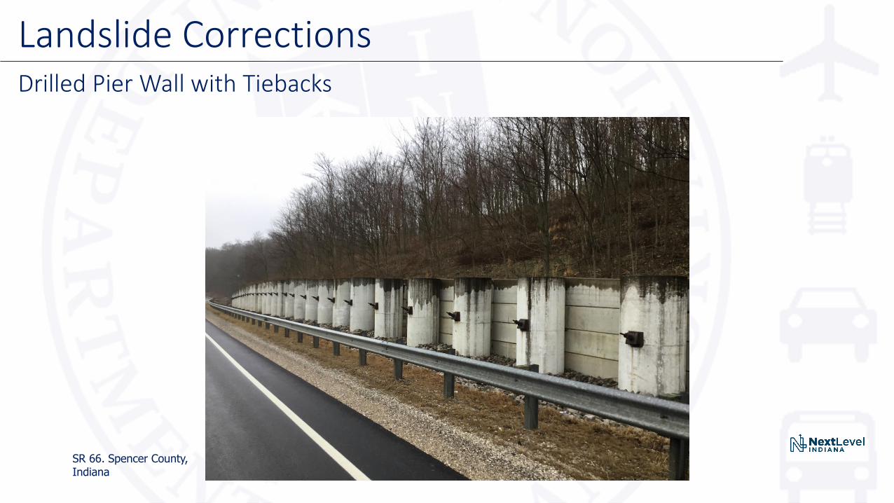
Landslide CorrectionsDrilled Pier Wall with Tiebacks
SR 66. Spencer County, Indiana

Landslide CorrectionsSoldier Pile Wall without Tiebacks
SR 66. Spencer County, Indiana

Landslide CorrectionsReinforced Slopes
Advantages:1. Cost effective
2. Robust system with plenty of redundancy
3. Works very well when slide is on a gently sloping bedrock surface
Disadvantages:
1. Very labor intensive
2. Almost always requires closing the road
3. Road closure time often excessive and multiplies with height of reinforcement zone

Landslide CorrectionsReinforced Slopes (Geogrids or Geotextiles or both)

Landslide CorrectionsReinforced Slope
Source: retainingsolutions.com.au
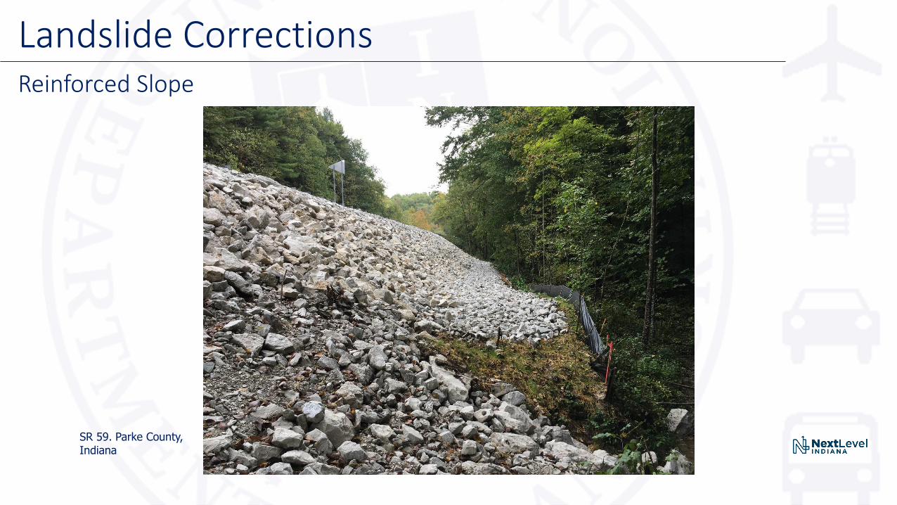
Landslide CorrectionsReinforced Slope
SR 59. Parke County, Indiana
Landslide CorrectionsSoil Nail Walls
Advantages:
1. Cost effective2. Plenty of redundancy3. Works very well when slide is on a steeply sloping bedrock surface4. Traffic can often be maintained on a limited basis during work, and can be
maintained completely during non-working hours
Disadvantages:
1. Require extra work to stabilize below the toe when rivers, creeks, or other issues can cause erosion
2. The elements which provide redundancy can also create nuisance maintenance

Landslide CorrectionsSoil Nail Wall
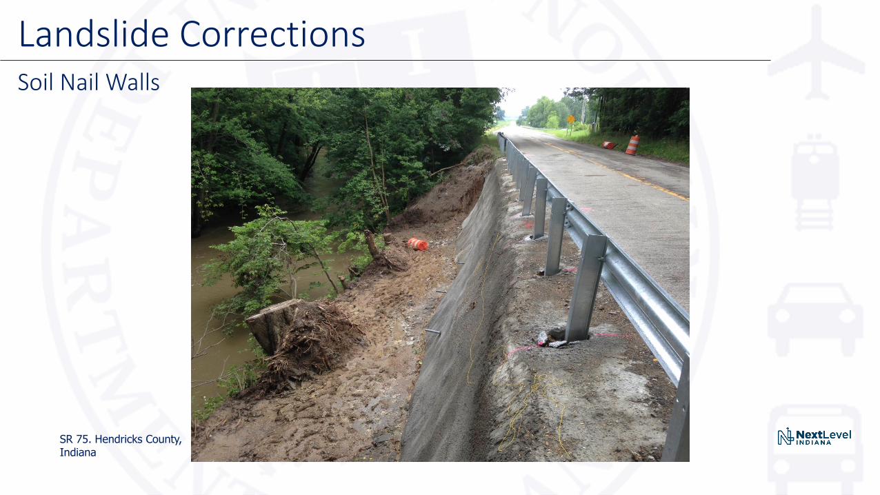
Landslide CorrectionsSoil Nail Walls
SR 75. Hendricks County, Indiana
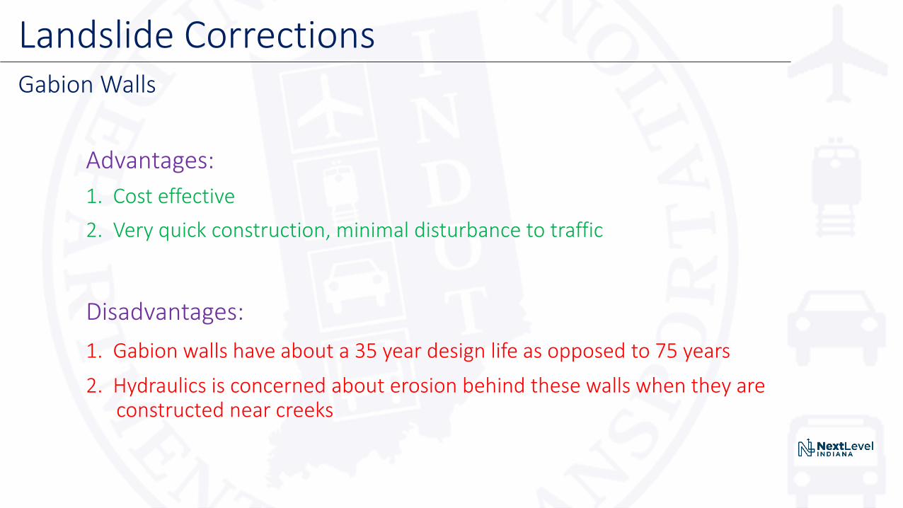
Landslide CorrectionsGabion Walls
Advantages:
1. Cost effective
2. Very quick construction, minimal disturbance to traffic
Disadvantages:
1. Gabion walls have about a 35 year design life as opposed to 75 years
2. Hydraulics is concerned about erosion behind these walls when they are constructed near creeks
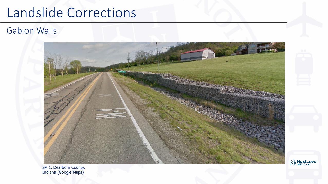
Landslide CorrectionsGabion Walls
SR 1. Dearborn County, Indiana (Google Maps)
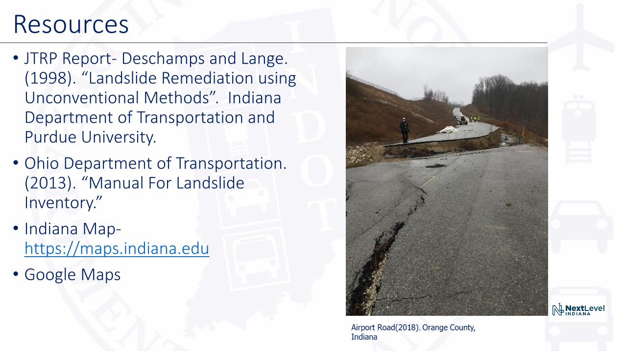
• JTRP Report- Deschamps and Lange. (1998). “Landslide Remediation using Unconventional Methods”. Indiana Department of Transportation and Purdue University.
• Ohio Department of Transportation. (2013). “Manual For Landslide Inventory.”
• Indiana Map-https://maps.indiana.edu
• Google Maps
Resources

Questions?Contact information:
• Joey Franzino, INDOT Geotechnical Engineer
Email: [email protected]
• Victoria Leffel, INDOT Engineering Geologist
Email: [email protected]


