45
Photo 9 – Hazard area 109 Photo 10 – Hazard area 110 ATTACHMENT 4 TO CLAUSE 2 EARTHQUAKE RECOVERY COMMITTEE OF THE WHOLE 1. 5. 2014 246

Photo 9 – Hazard area 109
Photo 10 – Hazard area 110
ATTACHMENT 4 TO CLAUSE 2 EARTHQUAKE RECOVERY COMMITTEE OF THE WHOLE 1. 5. 2014
246

Photo 11 – Hazard area 111
Photo 12 – Hazard area 112
ATTACHMENT 4 TO CLAUSE 2 EARTHQUAKE RECOVERY COMMITTEE OF THE WHOLE 1. 5. 2014
247

Photo 13 – Hazard area 113
Photo 14 – Hazard area 114
ATTACHMENT 4 TO CLAUSE 2 EARTHQUAKE RECOVERY COMMITTEE OF THE WHOLE 1. 5. 2014
248

Photo 15 – Hazard area 115
Photo 16 – Hazard area 116
ATTACHMENT 4 TO CLAUSE 2 EARTHQUAKE RECOVERY COMMITTEE OF THE WHOLE 1. 5. 2014
249

Photo 17 – Hazard area 117
Photo 18 – Hazard area 118
ATTACHMENT 4 TO CLAUSE 2 EARTHQUAKE RECOVERY COMMITTEE OF THE WHOLE 1. 5. 2014
250

Photo 19 – Hazard area 119
Photo 20 – Hazard area 120
ATTACHMENT 4 TO CLAUSE 2 EARTHQUAKE RECOVERY COMMITTEE OF THE WHOLE 1. 5. 2014
251

Photo 21 – Hazard area 121
Photo 22 – Hazard area 122
ATTACHMENT 4 TO CLAUSE 2 EARTHQUAKE RECOVERY COMMITTEE OF THE WHOLE 1. 5. 2014
252

Photo 23 – Hazard area 123
Photo 24 – Hazard area 124
ATTACHMENT 4 TO CLAUSE 2 EARTHQUAKE RECOVERY COMMITTEE OF THE WHOLE 1. 5. 2014
253

Photo 25 – Hazard area 200
Photo 26 – Hazard area 200
ATTACHMENT 4 TO CLAUSE 2 EARTHQUAKE RECOVERY COMMITTEE OF THE WHOLE 1. 5. 2014
254

Photo 27 – Hazard area 200
ATTACHMENT 4 TO CLAUSE 2 EARTHQUAKE RECOVERY COMMITTEE OF THE WHOLE 1. 5. 2014
255

Photo 28 – Hazard area 201
Photo 29 – Hazard area 202
ATTACHMENT 4 TO CLAUSE 2 EARTHQUAKE RECOVERY COMMITTEE OF THE WHOLE 1. 5. 2014
256

Photo 30 – Hazard area 203/204
Photo 31 – Hazard area 203/204
ATTACHMENT 4 TO CLAUSE 2 EARTHQUAKE RECOVERY COMMITTEE OF THE WHOLE 1. 5. 2014
257

Photo 32 – Hazard area 205/206
Photo 33 – Hazard area 207/208
ATTACHMENT 4 TO CLAUSE 2 EARTHQUAKE RECOVERY COMMITTEE OF THE WHOLE 1. 5. 2014
258

Photo 34 – Hazard area 209/210
Photo 35 – Hazard area 211
ATTACHMENT 4 TO CLAUSE 2 EARTHQUAKE RECOVERY COMMITTEE OF THE WHOLE 1. 5. 2014
259
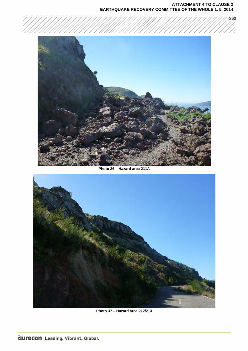
Photo 36 – Hazard area 211A
Photo 37 – Hazard area 212/213
ATTACHMENT 4 TO CLAUSE 2 EARTHQUAKE RECOVERY COMMITTEE OF THE WHOLE 1. 5. 2014
260

Photo 38 – Hazard area 214
Photo 39 – Hazard area 215
ATTACHMENT 4 TO CLAUSE 2 EARTHQUAKE RECOVERY COMMITTEE OF THE WHOLE 1. 5. 2014
261

Photo 40 – Hazard area 216
Photo 41 – Hazard area 217
ATTACHMENT 4 TO CLAUSE 2 EARTHQUAKE RECOVERY COMMITTEE OF THE WHOLE 1. 5. 2014
262

Photo 42 – Hazard area 218/219
Photo 43 – Hazard area 220
ATTACHMENT 4 TO CLAUSE 2 EARTHQUAKE RECOVERY COMMITTEE OF THE WHOLE 1. 5. 2014
263

Photo 44 – Hazard area 221
Photo 45 – Hazard area 222
ATTACHMENT 4 TO CLAUSE 2 EARTHQUAKE RECOVERY COMMITTEE OF THE WHOLE 1. 5. 2014
264

Photo 46 – Hazard area 223
Photo 47 – Hazard area 224
ATTACHMENT 4 TO CLAUSE 2 EARTHQUAKE RECOVERY COMMITTEE OF THE WHOLE 1. 5. 2014
265

Photo 48 – Hazard area 225
Photo 49 – Hazard area 226
ATTACHMENT 4 TO CLAUSE 2 EARTHQUAKE RECOVERY COMMITTEE OF THE WHOLE 1. 5. 2014
266

Photo 50 – Hazard area 227
Photo 51 – Hazard area 228
ATTACHMENT 4 TO CLAUSE 2 EARTHQUAKE RECOVERY COMMITTEE OF THE WHOLE 1. 5. 2014
267

Appendix DRocFall Modelling Data
ATTACHMENT 4 TO CLAUSE 2 EARTHQUAKE RECOVERY COMMITTEE OF THE WHOLE 1. 5. 2014
268

Section 1 – Sumner Road RocFall Modeling
ATTACHMENT 4 TO CLAUSE 2 EARTHQUAKE RECOVERY COMMITTEE OF THE WHOLE 1. 5. 2014
269

Section 2 - Sumner Road RocFall Modeling
ATTACHMENT 4 TO CLAUSE 2 EARTHQUAKE RECOVERY COMMITTEE OF THE WHOLE 1. 5. 2014
270

Section 3 – Sumner Road RocFall Modeling
ATTACHMENT 4 TO CLAUSE 2 EARTHQUAKE RECOVERY COMMITTEE OF THE WHOLE 1. 5. 2014
271

Section 4 – Sumner Road RocFall Modeling
ATTACHMENT 4 TO CLAUSE 2 EARTHQUAKE RECOVERY COMMITTEE OF THE WHOLE 1. 5. 2014
272

Section 5 – Sumner Road RocFall Modeling
ATTACHMENT 4 TO CLAUSE 2 EARTHQUAKE RECOVERY COMMITTEE OF THE WHOLE 1. 5. 2014
273

Section 6 – Sumner Road RocFall Modeling
ATTACHMENT 4 TO CLAUSE 2 EARTHQUAKE RECOVERY COMMITTEE OF THE WHOLE 1. 5. 2014
274

Section 7 – Sumner Road RocFall Modeling
ATTACHMENT 4 TO CLAUSE 2 EARTHQUAKE RECOVERY COMMITTEE OF THE WHOLE 1. 5. 2014
275

Section 8 – Sumner Road RocFall Modeling
ATTACHMENT 4 TO CLAUSE 2 EARTHQUAKE RECOVERY COMMITTEE OF THE WHOLE 1. 5. 2014
276

Section 9 – Sumner Road RocFall Modelling
ATTACHMENT 4 TO CLAUSE 2 EARTHQUAKE RECOVERY COMMITTEE OF THE WHOLE 1. 5. 2014
277

Section 10 – Sumner Road RocFall Modeling
ATTACHMENT 4 TO CLAUSE 2 EARTHQUAKE RECOVERY COMMITTEE OF THE WHOLE 1. 5. 2014
278

Aurecon New Zealand Limited
Unit 1, 150 Cavendish Road Casebrook Christchurch 8051
PO Box 1061 Christchurch 8140 New Zealand
T +64 3 366 0821 F +64 3 379 6955 E [email protected] W aurecongroup.com
Aurecon offices are located in: Angola, Australia, Botswana, China, Ethiopia, Hong Kong, Indonesia, Lesotho, Libya, Malawi, Mozambique, Namibia, New Zealand, Nigeria, Philippines, Singapore, South Africa, Swaziland, Tanzania, Thailand, Uganda, United Arab Emirates, Vietnam.
ATTACHMENT 4 TO CLAUSE 2 EARTHQUAKE RECOVERY COMMITTEE OF THE WHOLE 1. 5. 2014
279

Appendix HStage 2, Variation 2 Letter
ATTACHMENT 4 TO CLAUSE 2 EARTHQUAKE RECOVERY COMMITTEE OF THE WHOLE 1. 5. 2014
280

31 October 2013 Lynne Armitage Project Manager Christchurch City Council 36 Lichfield Street Christchurch 8011 Dear Lynne Sumner Road Stage 2 Review of DDSRA Assessment for Public Access
1 Introduction
As instructed by Christchurch City Council on 22nd October 2013 Aurecon undertook a review of the Stage 2 Detailed Phase Designation and Detailed Slope Risk Assessment (DDSRA) along Sumner Road. This review was used to gain an understanding of what impact opening the road for public use would have on the risk level previously calculated for corridor access only, and how this would affect the level of remediation work which would need to be undertaken on the bluffs above Sumner Road.
2 Review for public use
Following the field mapping exercise and the roped access inspection, the Detailed Phase assessment was completed in accordance with the DDSRA Procedure (Aurecon, 2013) during Stage 2. The procedure utilises a comprehensive visual inspection and a series of assessment tables and risk registers which review likelihood of the event, consequence to asset and consequence to life/injury (temporal probability and vulnerability) parameters to determine the risk level and risk category of an individual hazard.
The system allows for the recording of key details, sketches and any additional information which can be used at a later stage. The DDSRA system has been developed recently and trialled on several sites proving a suitable method for qualitative slope risk assessment for the site.
When originally assessed during Stage 2 the road was not intended to be used by the public or normal traffic usage and was planned for corridor access only. Hence the temporal probability in the DDSRA was based on limited use. We estimated that the traffic volumes would be no more than 30 people/vehicles on the road per day which gives a T1 (the lowest temporal probability). The vulnerability was also adjusted to people working in open spaces with specific health and safety plans in place rather than travelling in vehicles.
We have now undertaken a review of the DDSRA results from the Stage 2 assessment as instructed by Christchurch City Council (CCC) to consider the change in risk category on each of the hazard zones if the road was to be opened to the public with higher traffic volumes.
When undertaking the DDSRA assessment review to consider the road being open for public use we used pre-earthquake traffic flows provided by CCC of 1253 vehicles per day. This gives a temporal probability of a T3 which covers from 270 to 2600 vehicles per day. The vulnerability has also been adjusted to people driving in vehicles at the road speed limit which is 70 km/ph; with block sizes over
ATTACHMENT 4 TO CLAUSE 2 EARTHQUAKE RECOVERY COMMITTEE OF THE WHOLE 1. 5. 2014
281

1m dimension giving a Vulnerability of V4 instead of people working in open spaces. A T3 and V4 rating gives a consequence for life/injury of C4 when they are combined.
A summary of the identified hazards, risk levels and risk categories derived from the original DDSRA assessment and the revised DDSRA assessment are shown in Table 1 below and on Drawing GEO 03 A and GEO 04 A attached.
Table 1 - Summary of the Detailed DDSRA results
Hazard Zone
Hazard Number
Hazard Type/Feature
Risk Value (corridor
access only)
Risk Category (corridor
access only
Risk Value (public access)
Risk Category (public access)
1
101 Bluff failure 6 RC2 12 RC3
102 Boulder roll 2 RC2 8 RC3
103 Bluff failure 15 RC4 20 RC5
106 Boulder roll 12 RC3 16 RC4
2
109 Boulder roll 4 RC2 8 RC3
110 Bluff failure 20 RC5 20 RC5
200 Bluff failure 20 RC5 20 RC5
201 Boulder roll 6 RC2 8 RC3
3 202 Boulder roll (talus slope)
16 RC4 16 RC4
4 211 Bluff failure 25 RC5 25 RC5
5
107 Bluff failure 3 RC1 4 RC2
115 Bluff failure 16 RC4 16 RC4
116 Bluff failure 16 RC4 16 RC4
117 Bluff failure 16 RC4 16 RC4
203 Bluff failure 20 RC5 20 RC5
204 Boulder roll 12 RC3 16 RC4
205 Bluff failure 16 RC4 16 RC4
206 Boulder roll 9 RC3 12 RC3
207 Bluff failure 16 RC4 16 RC4
208 Boulder roll 12 RC3 16 RC4
209 Bluff failure 12 RC3 12 RC3
210 Boulder roll 9 RC3 8 RC3
212 Bluff failure 12 RC3 12 RC3
213 Boulder roll 9 RC3 12 RC3
216 Gully release 16 RC4 16 RC4
218 Bluff failure 12 RC3 12 RC3
219 Boulder roll 9 RC3 12 RC3
221 Gully release 16 RC4 16 RC4
6 118 Bluff failure 12 RC3 16 RC4
124 Boulder roll (talus slope)
9 RC3 12 RC3
7 112 Boulder roll 20 RC5 20 RC5
ATTACHMENT 4 TO CLAUSE 2 EARTHQUAKE RECOVERY COMMITTEE OF THE WHOLE 1. 5. 2014
282

Hazard Zone
Hazard Number
Hazard Type/Feature
Risk Value (corridor
access only)
Risk Category (corridor
access only
Risk Value (public access)
Risk Category (public access)
(behind tree)
113 Boulder roll (talus slope)
15 RC4 20 RC5
114 Bluff failure 15 RC4 20 RC5
119 Bluff failure 20 RC5 20 RC5
120 Bluff failure 16 RC4 16 RC4
121 Bluff failure 20 RC5 20 RC5
122 Bluff failure 4 RC2 8 RC3
123 Boulder roll (talus slope)
2 RC1 4 RC2
228 Bluff failure 9 RC3 12 RC3
8A
105 Road cutting
failure 16 RC4 16 RC4
108 Road cutting
failure 15 RC4 20 RC5
211A Road cutting
failure 20 RC5 20 RC5
215 Road cutting
failure 8 RC3 16 RC4
220 Road cutting
failure 8 RC3 16 RC4
223 Soil road
cutting failure 10 RC3 10 RC3
224 Rock road
cutting failure 8 RC3 16 RC4
227 Rock road
cutting failure 8 RC3 16 RC4
8B
104 Embankment
failure 15 RC4 15 RC4
111 Embankment
failure 15 RC4 15 RC4
214 Embankment
failure 16 RC4 16 RC4
217 Embankment
failure 25 RC5 25 RC5
222 Embankment
failure 25 RC5 25 RC5
226 Embankment
failure 25 RC5 25 RC5
9 225 Major road
cutting failure 20 RC5 20 RC5
ATTACHMENT 4 TO CLAUSE 2 EARTHQUAKE RECOVERY COMMITTEE OF THE WHOLE 1. 5. 2014
283

ATTACHMENT 4 TO CLAUSE 2 EARTHQUAKE RECOVERY COMMITTEE OF THE WHOLE 1. 5. 2014
284

200
202
110
109
108
201
111104
106
105
103102
101
211A211212/213
203/204
216
214215217220
218/219
107
209/210115
116
117
221
222
124
223
123
113
114119112122
120
225
224
226227
228121
205/206
207/208
HIGHEST RC VALUE ALONG ROAD LEVEL RC3RC4RC5RC5RC5RC4RC5RC4RC5RC4RC5RC4RC3RC5
Recreation Reserve
Lyttelton PortCompany Limited
Lyttelton PortCompany Limited
Lyttelton PortCompany Limited
CCC Waste WaterTreatment PlantCrown Land
727-
3331
m
445-
727m
WindyPoint
BatteryPoint
Lyttelton PortCompany Limited
Lyttelton PortCompany Limited
118Crown Land
Scenic Reserve
RC5
LEGENDRISK CATEGORIES
RC1
RC2
RC3
RC4
RC5
BASED ON DDSRA (AURECON 2013)TABLE 12
CLIENT
DATE TITLE
REVISION DETAILSDATEREV APPROVED
CHECKED
APPROVED
PROJECT
DRAWN
DESIGNED
PROJECT No. TYPE REVWBS DISC NUMBER DRAWING No.
SCALE SIZEA1
.
DDSRA SUMNER ROAD
RISK HAZARD AREASREVIEW FOR PUBLIC ACCESS
236152 0000 DRG GEO 03 B
NTSISSUE
INFORMATION
R DAWSON
L SWATTON
I McPHERSON I McPHERSON
A 23.10.13 ISSUE I McPHERSONB 30.10.13 HAZARD AREA 223 & RELATED ROAD AMENDED I McPHERSON
Filen
ame:
Plot
Date:
Offic
e:P:
\2361
52\C
ADD\
DWGS
\GEO
TECH
\2361
52-G
EO-0
3 AND
04.D
WG
30/10
/2013
2:20
:36 p.
m.NZ
CHC
AREAS SHOWN ARE BASED ON FIELDWORK UNDERTAKEN13 SEPTEMBER 2013 TO 19 SEPTEMBER 2013
ATTACHMENT 4 TO CLAUSE 2 EARTHQUAKE RECOVERY COMMITTEE OF THE WHOLE 1. 5. 2014
285

SUMNER
ROAD
LYTTELTON
OLD
SUMNER
ROAD
ASSESSMENT AREA
Lyttelton Port
Company Limited
Lyttelton Port
Company Limited
Lyttelton Port
Company Limited
Lyttelton Port
Company Limited
Scenic Reserve
Crown Land
Recreation Reserve
00m
100m
200m
300m
400m
500m
600m
700m
800m
900m
1000m
1100m
1200
m
1300m
1400m
1500m
1600m
1700m
1800m
1900m
2000m
2100m
2200m
2300m
2400
m
2500m445-727m
321-445m
187-321m
727-3331m
Windy
Point
Battery
Point
CLIENT
DATE TITLE
REVISION DETAILSDATEREV APPROVED
CHECKED
APPROVED
PROJECT
DRAWN
DESIGNED
PROJECT No. TYPE REVWBS DISC NUMBER DRAWING No.
SCALE SIZEA1
.
DETAILED DDSRA SUMNER ROAD
ROAD RISK CATEGORIESREVIEW FOR PUBLIC ACCESS
236152 0000 DRG GEO 04 B
1:3000ISSUE
INFORMATION
R DAWSON
L SWATTON
I McPHERSON I McPHERSON
A 25.10.13 ISSUE I McPHERSONB 30.10.13 ROAD ADEAS AMENDED WRT HAZARD AREA 223 I McPHERSON
Filen
ame:
Plot
Date:
Offic
e:P:
\2361
52\C
ADD\
DWGS
\GEO
TECH
\2361
52-G
EO-0
3 AND
04.D
WG
30/10
/2013
2:17
:34 p.
m.NZ
CHC
LEGENDRISK CATEGORIES
RC1
RC2
RC3
RC4
RC5
AREAS SHOWN ARE BASED ON FIELDWORK UNDERTAKEN13 SEPTEMBER 2013 TO 19 SEPTEMBER 2013
030 60 120m
SCALE 1:3000
ATTACHMENT 4 TO CLAUSE 2 EARTHQUAKE RECOVERY COMMITTEE OF THE WHOLE 1. 5. 2014
286

Aurecon New Zealand Limited
Unit 1, 150 Cavendish Road Casebrook Christchurch 8051
PO Box 1061 Christchurch 8140 New Zealand
T +64 3 366 0821 F +64 3 379 6955 E [email protected] W aurecongroup.com
Aurecon offices are located in: Angola, Australia, Botswana, China, Ethiopia, Hong Kong, Indonesia, Lesotho, Libya, Malawi, Mozambique, Namibia, New Zealand, Nigeria, Philippines, Singapore, South Africa, Swaziland, Tanzania, Thailand, Uganda, United Arab Emirates, Vietnam.
ATTACHMENT 4 TO CLAUSE 2 EARTHQUAKE RECOVERY COMMITTEE OF THE WHOLE 1. 5. 2014
287

Project 236152 File Sumner Road Stage 3A&B Concept Design report 13 December 2013 Revision 0 Page 8
Figure 1 – Areas of work for Stage 3A and 3B locations along Sumner Road and Key Feature.
Figure 2 – All 49 hazard zones along Sumner Road
Stage 3B Area
Stage 3A Area
Stage 3A Area
Note The hazard zone numbers were assigned in the field and have no particular significance other than as a unique identifier.
Lyttelton
LPC
Evans Pass Road
Old Lyttelton Sumner Road
Sumner Road
Coal Handling Terminal
Note Based on oblique aerial photograph. Not to scale, photo taken 14/08/13
ATTACHMENT 5 TO CLAUSE 2 EARTHQUAKE RECOVERY COMMITTEE OF THE WHOLE 1. 5. 2014
288

Key Information
Sumner Road Re-opening Project
Information Leaflet April 2014
The Christchurch City Council proposes to undertake works to reduce the risk from geotechnical hazards to road users, and to repair the road and retaining walls to enable the reopening of the earthquake damaged Sumner Road to the public, from Reserve Terrace to the Summit Road.
BackgroundSumner Road provides an important link from Christchurch/Sumner to Lyttelton for both the general public and for the Port of Lyttelton. Prior to the Canterbury earthquakes, the road served as an alternative route for port vehicles that were unable to use the Lyttelton Road Tunnel. Users included over-sized vehicles, and those carrying specified hazardous substances. Since the closure of the road due to risk of rockfall and significant damage to the road surface, those vehicles have accessed the port via Dyers Pass or Gebbies Pass. These are longer routes, with the Dyers Pass route also passing through residential areas. The road was also a popular link for cyclists and serves as alternative route to the port should an emergency (including a natural disaster) close other roads.
This leaflet aims to provide nearby residents and other stakeholders with information about the project. The Christchurch City Council’s public consultation generally invites the community to give feedback about elements that can add value to a project. Because the main elements of this project are driven by the technical design and health & safety requirements relating to the location and layout, we are not seeking any further feedback on the benching and other repair work.
If you require further information about the project please contact Christine Toner (details on the back of this leaflet) or view the Project Infromation Number 4663 and www.ccc.govt.nz/porthillsgeotech
This is an ‘Earthquake Recovery Project’. The works are required for the purpose of reopening the earthquake damaged Sumner Road. Christchurch City Council undertakes to inform Lyttelton, Sumner and Redcliffs communities and other stakeholders. Key stakeholders including Department of Conservation, Lyttelton Port Company, Ngai Tahu, Summit Road Protection Authority and Ngati Wheke Runanga have been consulted and involved in decision making on this project to date.
ELEC
08/4
598
For further information please contact:
Christine TonerConsultation LeaderChristchurch City CouncilPO Box 73011Christchurch Mail Centre Christchurch 8154Phone (03) 941 8355Email [email protected]
or view Project Information and Frequently Asked Questions (FAQs) at www.ccc.govt.nz/sumnerroadreopening and www.ccc.govt.nz/porthillsgeotech
Anticipated effects:
The proposed project methodology has been subject to rigorous professional and technical investigation and peer review by a multi-disciplinary team including planners, engineers, geologists, landscape architects, construction and operations consultants, and ecologists.The team has investigated many potential effects during construction and in the long term. These include threats to plant and wildlife; erosion; stormwater runoff; nuisance, noise and dust effects; landscape impacts; impacts on walkers and mountain bikers using the Crater Rim paths and many more. They are developing strategies for avoiding, remedying and mitigating these effects, which may include native restoration planting and gecko translocation.
Project TimelineIt is expected that the proposed work will start mid 2014 and the road potentially open at the end of 2016.
ATTACHMENT 6 TO CLAUSE 2 EARTHQUAKE RECOVERY COMMITTEE OF THE WHOLE 1. 5. 2014
289

The proposed works :The area for the proposed work extends from the small upper bluffs approximately 100m from the Evans Pass layby down to Reserve Terrace. It includes the Crater Rim Bluffs and the slopes below these, the Battery Point Bluffs, the road cuttings, the forested areas and Double Gully. After this work is completed the embankments and retaining walls below the road under the Crater Rim Bluffs will require repairs.
The proposed work varies depending on the specific area of the site, and includes scaling to remove loose surface materials; blasting to remove boulders and outcrops; and earthworks including engineered removal of soil and rock to reshape the land. Bunds will also be required to contain any future rock fall. The earthworks will include the construction of terraces.There is also a proposal for the Council to undertake native restoration planting in the area adjacent to Buckleys Bay Scenic
Reserve (see locality diagram) which would contribute towards environmental mitigation for the project.Minimal disturbance and disruption to the residents of Lyttelton Harbour and Sumner/Redcliffs areas is a priority.The overall project will be undertaken in two phases as follows:
• Works above Sumner Road to reduce risks to road users.
• Road works by contractors to repair the road, including retaining walls and any necessary drainage.
The works will generally move from the higher parts of the site down toward the road and from west and eastern sides of the project site toward the centre. It is possible that some stages may occur simultaneously.
Existing View
Artists Impression Post Construction
ATTACHMENT 6 TO CLAUSE 2 EARTHQUAKE RECOVERY COMMITTEE OF THE WHOLE 1. 5. 2014
290


