STATE ENVIRONMENTAL POLICY ACT (SEPA) DETERMINATION OF NON-SIGNIFICANCE For more information about this project visit www.redmond.gov/landuseapps PROJECT INFORMATION IMPORTANT DATES PROJECT NAME: Penny Lane II COMMENT PERIOD Depending upon the proposal, a comment period may not be required. An “X” is placed next to the applicable comment period provision. There is no comment period for this DNS. Please see below for appeal provisions. 'X' This DNS is issued under WAC 197-11-340(2), and the lead agency will not make a decision on this proposal for 14 days from the date below. Comments can be submitted to the Project Planner, via phone, fax (425)556-2400, ema or in person at the Development Services Center located a 15670 NE 85th Street, Redmond, WA 98052. Comments must be submitted by 03/13/2020. APPEAL PERIOD You may appeal this determination to the City of Redmond Office of the City Clerk, Redmond City Hall, 15670 NE 85th Street, P.O. Box 97010, Redmond, WA 98073-9710, no later than 5:00 p.m. on 03/27/2020, by submitting a completed City of Redmond Appeal Application Form available on the City’s website at www.redmond.gov or at City Hall. You should be prepared to make specific factual objections. DATE OF DNS ISSUANCE: For more information about the project or SEPA procedures, please contact the project planner. SEPA FILE NUMBER: SEPA-2020-00206 PROJECT DESCRIPTION: The project consists of 14 townhouse units within a single building (LAND-2019-00399 & 00400). The project is with a seismic hazard and CARA 1, both considered critical areas per the RZC. Per RZC 21.70.090.B exemptions within WAC 197-11-800(1) do not apply. PROJECT LOCATION: 7960; 7970 and 7980 170th Ave NE SITE ADDRESS: 7960 170TH AVE NE REDMOND, WA 98052 APPLICANT: Randy Barnett LEAD AGENCY: City of Redmond The lead agency for this proposal has determined that the requirements of environmental analysis, protection, and mitigation measures have been adequately addressed through the City’s regulations and Comprehensive Plan together with applicable State and Federal laws. Additionally, the lead agency has determined that the proposal does not have a probable significant adverse impact on the environment as described under SEPA. An Environmental Impact Statement (EIS) is not required under RCW 43.21C.030(2)(c). This decision was made after review of a completed environmental checklist and other information on file with the lead agency. This information is available to the public on request. SIGNATURE: Interim Planning Director RESPONSIBLE OFFICIAL: Caro; V. Helland CITY CONTACT INFORMATION PROJECT PLANNER NAME: PHONE NUMBER: EMAIL: Elise Keim RESPONSIBLE OFFICIAL: SIGNATURE: 425-556-2480 [email protected]15670 NE 85th Street Redmond, WA 98052 Address: Dave Juarez Public Works Director ATTACHMENT I
Transcript
STATE ENVIRONMENTAL POLICY ACT (SEPA)DETERMINATION OF NON-SIGNIFICANCE
For more information about this project visit www.redmond.gov/landuseapps
PROJECT INFORMATION IMPORTANT DATES
PROJECT NAME: Penny Lane II COMMENT PERIOD
Depending upon the proposal, a comment period may not be required. An “X” is placed next to the applicable comment period provision.
There is no comment period for this DNS. Please see below for appeal provisions.
'X' This DNS is issued under WAC 197-11-340(2), and the lead agency will not make a decision on this proposal for 14 days from the date below. Comments can be submitted to the Project Planner, via phone, fax (425)556-2400, email or in person at the Development Services Center located at 15670 NE 85th Street, Redmond, WA 98052. Comments must be submitted by 03/13/2020.
APPEAL PERIOD
You may appeal this determination to the City of Redmond Office of the City Clerk, Redmond City Hall, 15670 NE 85th Street, P.O. Box 97010, Redmond, WA 98073-9710, no later than 5:00 p.m. on 03/27/2020, by submitting a completed City of Redmond Appeal Application Form available on the City’s website at www.redmond.gov or at City Hall. You should be prepared to make specific factual objections.
DATE OF DNS ISSUANCE:
For more information about the project or SEPA procedures, please contact the project planner.
SEPA FILE NUMBER: SEPA-2020-00206
PROJECT DESCRIPTION:The project consists of 14 townhouse units within a single building (LAND-2019-00399 & 00400). The project is within a seismic hazard and CARA 1, both considered critical areas per the RZC. Per RZC 21.70.090.B exemptions within WAC 197-11-800(1) do not apply.
PROJECT LOCATION: 7960; 7970 and 7980 170th Ave NE
SITE ADDRESS: 7960 170TH AVE NE REDMOND, WA 98052
APPLICANT: Randy Barnett
LEAD AGENCY:City of Redmond
The lead agency for this proposal has determined that the requirements of environmental analysis, protection, and mitigation measures have been adequately addressed through the City’s regulations and Comprehensive Plan together with applicable State and Federal laws.
Additionally, the lead agency has determined that the proposal does not have a probable significant adverse impact on the environment as described under SEPA.
An Environmental Impact Statement (EIS) is not required under RCW 43.21C.030(2)(c). This decision was made after review of a completed environmental checklist and other information on file with the lead agency. This information is available to the public on request.
SIGNATURE:
Interim Planning DirectorRESPONSIBLE OFFICIAL: Caro; V. Helland
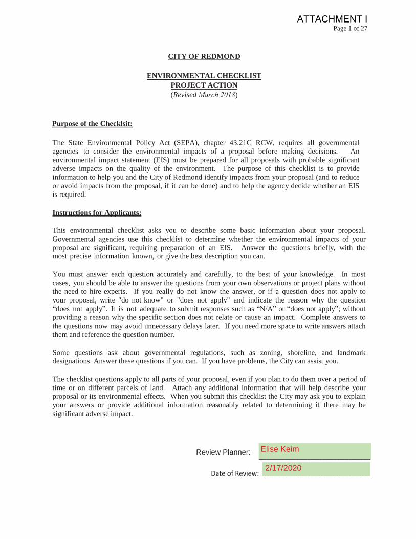
The State Environmental Policy Act (SEPA), chapter 43.21C RCW, requires all governmental agencies to consider the environmental impacts of a proposal before making decisions. Anenvironmental impact statement (EIS) must be prepared for all proposals with probable significantadverse impacts on the quality of the environment. The purpose of this checklist is to provide information to help you and the City of Redmond identify impacts from your proposal (and to reduce or avoid impacts from the proposal, if it can be done) and to help the agency decide whether an EIS is required.
Instructions for Applicants:
This environmental checklist asks you to describe some basic information about your proposal. Governmental agencies use this checklist to determine whether the environmental impacts of yourproposal are significant, requiring preparation of an EIS. Answer the questions briefly, with the most precise information known, or give the best description you can.
You must answer each question accurately and carefully, to the best of your knowledge. In mostcases, you should be able to answer the questions from your own observations or project plans without the need to hire experts. If you really do not know the answer, or if a question does not apply toyour proposal, write "do not know" or "does not apply" and indicate the reason why the question “does not apply”. It is not adequate to submit responses such as “N/A” or “does not apply”; without providing a reason why the specific section does not relate or cause an impact. Complete answers tothe questions now may avoid unnecessary delays later. If you need more space to write answers attachthem and reference the question number.
Some questions ask about governmental regulations, such as zoning, shoreline, and landmark designations. Answer these questions if you can. If you have problems, the City can assist you.
The checklist questions apply to all parts of your proposal, even if you plan to do them over a period oftime or on different parcels of land. Attach any additional information that will help describe your proposal or its environmental effects. When you submit this checklist the City may ask you to explainyour answers or provide additional information reasonably related to determining if there may be significant adverse impact.
Planner Name: ______________________________
Date of Review: _____________________________
Review Planner: Elise Keim
2/17/2020
ATTACHMENT I
Page 2 of 27
To Be Completed By ApplicantEvaluation for
Agency Use Only
A. BACKGROUND
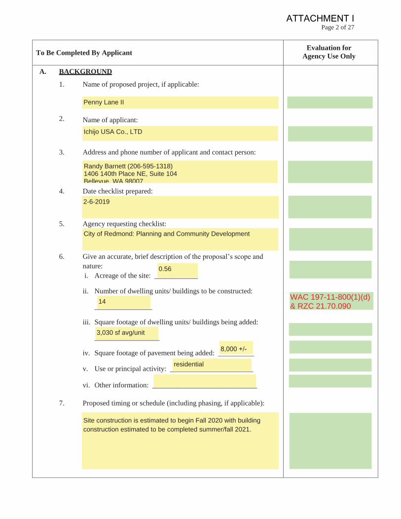
1. Name of proposed project, if applicable:
2. Name of applicant:
3. Address and phone number of applicant and contact person:
4. Date checklist prepared:
5. Agency requesting checklist:
6. Give an accurate, brief description of the proposal’s scope andnature:i. Acreage of the site: ____________
ii. Number of dwelling units/ buildings to be constructed:
________________
iii. Square footage of dwelling units/ buildings being added:
__________________
iv. Square footage of pavement being added: __________
v. Use or principal activity: _______________________
vi. Other information: _____________________________
7. Proposed timing or schedule (including phasing, if applicable):
Site construction is estimated to begin Fall 2020 with buildingconstruction estimated to be completed summer/fall 2021.
residential
8,000 +/-
3,030 sf avg/unit
14
0.56
City of Redmond: Planning and Community Development
2-6-2019
Randy Barnett (206-595-1318)1406 140th Place NE, Suite 104Bellevue, WA 98007
Ichijo USA Co., LTD
Penny Lane II
WAC 197-11-800(1)(d)& RZC 21.70.090
ATTACHMENT I
Page 3 of 27
To Be Completed By ApplicantEvaluation for
Agency Use Only
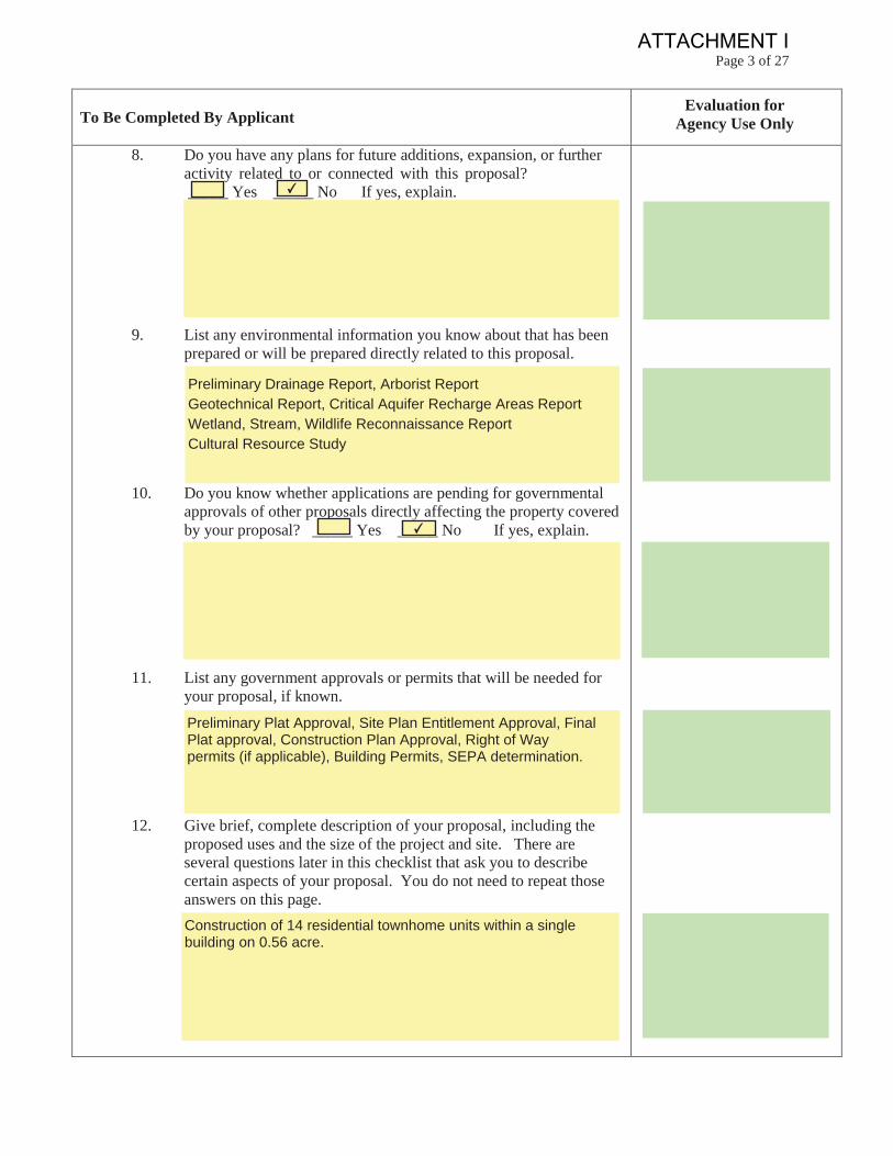
8. Do you have any plans for future additions, expansion, or furtheractivity related to or connected with this proposal?_____ Yes _____ No If yes, explain.
9. List any environmental information you know about that has beenprepared or will be prepared directly related to this proposal.
10. Do you know whether applications are pending for governmentalapprovals of other proposals directly affecting the property coveredby your proposal? _____ Yes _____ No If yes, explain.
11. List any government approvals or permits that will be needed foryour proposal, if known.
12. Give brief, complete description of your proposal, including theproposed uses and the size of the project and site. There areseveral questions later in this checklist that ask you to describecertain aspects of your proposal. You do not need to repeat thoseanswers on this page.Construction of 14 residential townhome units within a singlebuilding on 0.56 acre.
Preliminary Plat Approval, Site Plan Entitlement Approval, FinalPlat approval, Construction Plan Approval, Right of Waypermits (if applicable), Building Permits, SEPA determination.
✔
Preliminary Drainage Report, Arborist ReportGeotechnical Report, Critical Aquifer Recharge Areas ReportWetland, Stream, Wildlife Reconnaissance ReportCultural Resource Study
✔
ATTACHMENT I
Page 4 of 27
To Be Completed By ApplicantEvaluation for
Agency Use Only
13. Location of the proposal. Give sufficient information for a personto understand the precise location of your proposed project,including a street address, if any, and section, township, and range,if known. If a proposal would occur over a range of area, providethe range or boundaries of the site(s). Provide a legal description,site plan, vicinity map, and topographic map, if reasonablyavailable. While you should submit any plans required by theagency, you are not required to duplicate maps or detailed planssubmitted with any permit applications related to this checklist.
B. ENVIRONMENTAL ELEMENTS
1. Eartha. General description of the site
_____ Flat
_____ Rolling
_____ Hilly
_____ Steep slopes
_____ Mountainous
_____ Other
b. What is the steepest slope on the site (approximate percent slope)?Describe location and areas of different topography.
The steepest slope on site is approximately 3%.Overall the site has an elevation change of approximately 2 feet.Topography is sloped towards the two roads located on the eastand west sides of the site.
✔
The site is located at 7960, 7970, and 7980 170th Ave NE.TPN's 7792900125; 7792900130; 7792900140
Please see plans submitted as part of this application for a vicinitymap, legal description, and topographic map.
ATTACHMENT I
Page 5 of 27
To Be Completed By ApplicantEvaluation for
Agency Use Only
c. What general types of soils are found on the site (for example,clay, sand, gravel, peat, mulch)? If you know the classification ofagricultural soils, specify them and note any agricultural land oflong-term commercial significance and whether the proposalresults in removing any of these soils.
d. Are there surface indications or history of unstable soils inthe immediate vicinity? _____ Yes _____ No If yes, describe.
e. Describe the purpose, type, total area, location and approximatequantities and total affected area of any filling, excavation, andgrading proposed. Indicate source of fill.
f. Could erosion occur as a result of clearing, construction, or use?If so, generally describe.
g. About what percentage of the site will be covered withimpervious surfaces after project construction (for example, asphaltor buildings)?
The project currently proposes 83% +/- impervious surfaces. Thezoning code has no limitation on impervious coverage for thesubject development.
Erosion could occur as a result of denuded soil during andimmediately following storm events during the constructioncycle of the plat.
The purpose of grading will be to create level building pads, road,and ensure proper site drainage. Cut will be 400 CY +/- and fillwill be 1,050 CY +/-. Location of source fill has not been chosenbut will be from approved location.
✔
According to the USDA Websoil Survey the site is generallyEverett very gravelly sandy loam, 0 to 8 percent slopes.
WAC197-11-800(1)(b)(v)
RZC 21.10.130
ATTACHMENT I
Page 6 of 27
To Be Completed By Applicant Evaluation for Agency Use Only
h. Proposed measures to reduce or control erosion, or other impactsto the earth, if any.
i. Does the landfill or excavation involve over 100 cubic yardsthroughout the lifetime of the project?
2. Air
a. What types of emissions to the air (i .e . dust , automobile ,odors , industrial wood smoke, and greenhouse gases)would result from the proposal during construction, operation, andmaintenance when the project is completed? If any, generallydescribe and give approximate quantities if known.
b. Are there any off-site sources of emissions or odor that mayaffect your proposal? _____ Yes _____ No If yes, generallydescribe.
c. Proposed measures to reduce or control emissions or otherimpacts to air, if any.
Construction impacts will not be significant and can be controlledby several methods: watering or using dust suppressants onareas of exposed soils, washing truck wheels before leaving thesite, and maintaining gravel construction entrances.
Off-site sources of emissions are those typical of the residentialneighborhoods that surround this site, such as automobileemissions from traffic on adjacent roadways and fireplaceemissions from nearby homes.
✔
During construction there will be increased exhaust and dustparticle emissions. After construction, the principle source ofemissions will be from automobile traffic.
Yes.
A TESC plan will be prepared and implemented prior to commencement of construction activities.
WAC197-11-800(1)(b)(v)& RZC 21.70.090
ATTACHMENT I
Page 7 of 27
To Be Completed By ApplicantEvaluation for
Agency Use Only
3. Water
a. Surface
1. Is there any surface water body on or in the immediatevicinity of the site (including year-round and seasonalstreams, lakes, ponds, wetlands)? _____ Yes _____ NoIf yes, describe type, location and provide names. Ifappropriate, state what stream or river it flows into.Provide a sketch if not shown on site plans.
2. Will the project require any work over, in, or adjacent to(within 200 feet) the described waters?_____ Yes _____ No If yes, please describe and attachavailable plans. Note approximate distance betweensurface waters and any construction, fill, etc.
3. Estimate the amount of fill and dredge material thatwould be placed in or removed from surface water orwetlands and indicate the area of the site that would beaffected. Indicate the source of fill material.
4. Will the proposal require surface water withdrawals ordiversions? _____ Yes _____ No
If yes, give general description,purpose, and approximate quantities if known.
Dewatering may be required for deep utility installation. The amount, if any, cannot be determined at this time.
✔
✔
Not applicable. There are no surface waters or wetlands withinthe vicinity of the project.
✔
✔
ATTACHMENT I
Page 8 of 27
To Be Completed By ApplicantEvaluation for
Agency Use Only
5. Does the proposal lie within a 100-year floodplain?_____ Yes _____ No If yes, note location on the site plan.
6. Does the proposal involve any discharge of wastematerials to surface waters? _____ Yes _____ NoIf yes, describe the type of waste and anticipated volumeof discharge.
7. Is your property located within the Bear/Evans CreekWatershed (see attached map)? _____ Yes _____ NoIf yes, answer questions 8 & 9. If no, go to the nextsection.
8. Provide details on how you propose to maximizeinfiltration of runoff to recharge associated stream duringthe summer months.
9. Does your project propose an increase in fecal coliformlevels in the surface water? If so, describe impacts.
No.
Clean roof drainage will be fully infiltrated.
✔
✔
✔
ATTACHMENT I
Page 9 of 27
To Be Completed By Applicant Evaluation for Agency Use Only
b. Ground
1. Will groundwater be withdrawn from a well for drinkingwater or other purpose? If so, give a general description ofthe well, proposed uses and approximate quantitieswithdrawn from the well. Will water be discharged togroundwater? _____ Yes _____ No Give generaldescription, purpose, and approximate quantities if known.
2. Describe waste material that will be discharged into theground from septic tanks or other sources, if any (forexample: domestic sewage; industrial, containing thefollowing chemicals, agricultural; etc.) Describe thegeneral size of the system, the number of such systems, thenumber of houses to be served (if applicable), or thenumber of animals or humans the system(s) are expected toserve.
c. Water Runoff (including storm water):
1. Describe the source(s) of runoff (including stormwater) and method of collection, transport/conveyance,and disposal, if any (include quantities, if known).Where will this water flow? Will this water flow intoother waters? If so, describe.
Runoff will be generated from road frontage improvements,driveways, and roof. Drainage generated from the roof will beinfiltrated. All other drainage will be routed to the adjacenttight-lined conveyance system which is tributary to the City'sregional stormwater facility.
Not applicable. The site will be served by sanitary sewers.
✔
ATTACHMENT I
Page 10 of 27
To Be Completed By ApplicantEvaluation for
Agency Use Only
2. Could waste materials enter ground or surface waters?If so, generally describe.
3. Does the proposal alter or otherwise affect drainagepatterns in the vicinity of the site? If so, describe.
d. Proposed measures to reduce or control surface, ground, andrunoff water, and drainage pattern impacts, if any.
4. Plants
a. Select types of vegetation found on the site:
Deciduous Tree: Alder ___ Maple ___ Aspen ___ Other ___
Evergreen Tree: Cedar ___ Fir ___ Pine ___ Other ___
_____ Shrubs
_____ Grass
_____ Pasture
_____ Crop or Grain
_____ Orchards, Vineyards, or Other Permanent Crops
A City approved storm drainage system will be designed andimplemented to mitigate any adverse impacts from thedevelopment. Temporary erosion control measures will includesilt fence and mulching, plastic covering, temporary/permanentseeding, and dust control as needed.
The proposal will not alter drainage patterns in the vicinity of thesite.
This would be very unlikely. The only materials that couldenter ground or surface waters would be those associated withautomobile discharges and yard/garden preparations.Pollutants generated during construction include suspendedsolids and trace petroleum hydrocarbons.
ATTACHMENT I
Page 11 of 27
To Be Completed By Applicant Evaluation for Agency Use Only
Other types of vegetation (please list)
b. What kind and amount of vegetation will be removed or altered?
c. Provide the number of significant and landmark trees located onthe site and estimate the number proposed to be removed and savedin the table below.
Note: Since a SEPA Determination is issued early on in theproject’s review process; the information above is a preliminaryestimate only and could change during the development review process.
* DBH – Diameter at breast height
d. List threatened or endangered species known to be on or nearthe site.
Tree Type Total(#)
Removed(#)
Saved (#) Percentage saved (%)
Landmark (>30” dbh*)
Significant (6” – 30” dbh*)
Percentage(%)
There are no known threatened or endangered species knownto be on or near the site.
00100%100%
0022
0011
Trees, ornamental shrubs, and mowed lawn will be removed.
Replacement perRZC 21.72.080required
ATTACHMENT I
Page 12 of 27
To Be Completed By Applicant Evaluation for Agency Use Only
e. Proposed landscaping, use of native plants, or other measures topreserve or enhance vegetation on the site, if any:
f. List all noxious weeds and invasive species known to be on or nearthe site.
5. Animals
a. List any birds and o t h e r animals which have been observed onor near the site or are known to be on or near the site.
Birds: Hawk ___ Heron ___ Eagle ___ Songbirds ___
Other ___
Mammals: Deer ___ Bear ___ Elk ___ Beaver ___
Fish: Bass ___ Salmon ___ Trout ___ Herring ___
Shellfish ___ Other ___
b. List any threatened or endangered species known to be on ornear the site.
c. Is the site part of a migration route? ___ Yes ___ No If yes,explain.
✔
No threatened or endangered species are known to be onor near the site.
✔
There are no known noxious or invasive species known to beon or near the site.
Proposed landscaping may include the use of native or droughtresistant plans. Due to the proposed development whichmaximizes development within the allowed building footprint,existing vegetation will be removed. Please reference theLandscape Plans submitted with this proposal.
Ecological scoreachieved RZC21.32.060
ATTACHMENT I
Page 13 of 27
To Be Completed By ApplicantEvaluation for
Agency Use Only
d. Proposed measures to preserve or enhance wildlife, if any:
e. List any invasive animal species known to be on or near the site.
6. Energy and Natural Resources
a. What kinds of energy (electric, natural gas, oil, wood stove,solar) will be used to meet the completed project's energy needs?Describe whether it will be used for heating, manufacturing, etc.
b. Would your project affect the potential use of solar energy byadjacent properties? ____ Yes ____ No If yes, generallydescribe.
c. What kinds of energy conservation features are included in theplans of this proposal? List other proposed measures to reduce orcontrol energy impacts, if any.
The requirements of the Uniform Building Code and the StateEnergy Code will be incorporated into the construction of thebuildings. Energy conserving materials and fixtures will beevaluated for the suitability in all new construction.
✔
Electricity or Gas will be the primary source of energy used toprovide heating and cooling to each home. This form of energyis immediately available to the site.
There are no known invasive animal species known to beon or near the site.
Per Redmond Zoning Code, the site will provide landscaping.Non-invasive vegetation and a mix of native plants will be addedto the site. A landscape plan has been completed and submittedas part of this package.
ATTACHMENT I
Page 14 of 27
To Be Completed By ApplicantEvaluation for
Agency Use Only
7. Environmental Health
a. Are there any environmental health hazards, including exposure totoxic chemicals, risk or fire and explosion, spill, or hazardous wastethat could occur as a result of this proposal? ____ Yes ____ NoIf yes, describe.
1. Describe any known or possible contamination at the sitefrom present or past practices.
2. Describe existing hazardous chemicals/conditions thatmight affect project development and design. This includesunderground hazardous liquid and gas transmissionpipelines located within the project area and in the vicinity.
3. Describe any toxic or hazardous chemicals that might bestored, used, or produced during the project’s developmentor construction, or at any time during the operating life ofthe project. (for example: flammable liquids, combustibleliquids, flammable gases, combustible or flammable fibers,flammable solids, unstable materials, corrosives, oxidizingmaterials, organic peroxides, nitromethane, ammoniumnitrate, highly toxic material, poisonous gas, smokelesspowder, black sporting powder, ammunition, explosives,cryogenics, medical gas, radioactive material, biologicalmaterial or high piled storage (over 12’in most cases).
The storage of toxic or hazardous chemicals stored on site isvery unlikely. If any were to be, it would be typical of standardresidential construction.
There are no known hazardous chemical/conditions whichmay affect the proposal of this design.
There are no on-site environmental health hazards known toexist today, nor are there any that will be generated as a directresult of this project.
✔
ATTACHMENT I
Page 15 of 27
To Be Completed By Applicant Evaluation for Agency Use Only
4. Describe special emergency services that might be required.
5. Proposed measures to reduce or control environmentalhealth hazards, if any.
b. Noise
1. What types of noise exist in the area which may affect yourproject (for example: traffic equipment, operation, other)?
2. What types and levels of noise would be created by orassociated with the project on a short-term or a long-termbasis (for example: traffic, construction, operation, other)?Indicate what hours noise would come from the site.
Short-term noise impacts will result from the use ofconstruction and building equipment during site developmentand construction. These temporary activities will belimited to legal working hours as prescribed by City Code.Long-term impacts will be those associated with the increaseof human population, additional traffic and noise associatedwith residential buildings.
No negative affect is anticipated from off-site noises. The main source of off-site noise in the area originates from the vehicular traffic present on NE 80th St, 170th Ave NE, and 170th Ct NE.
There are no proposed measures because there or no knownor expected environmental health hazards.
None to our knowledge.
RMC 6.36
ATTACHMENT I
Page 16 of 27
To Be Completed By Applicant Evaluation for Agency Use Only
3. Proposed measures to reduce or control noise impacts, ifany.
8. Land and Shoreline Use
a. What is the current use of the site and adjacent properties? Will theproposal affect current land uses on nearby or adjacent properties?If so, describe.
b. Has the site been used as working farmlands or working forestlands? Is so, describe. How much agricultural or forest land oflong term commercial significance will be converted to other usesas a result of the proposal, if any? If resource lands have not beendesignated, how many acres in farmland or forest land tax statuswill be converted to non-farm or non-forest use?
1). Will the proposal affect or be affected by surrounding working farm or forest land normal business operations, such as oversize equipment access, the application of pesticides, tilling, and harvesting? If so, how?
No. There are none of these lands in the surrounding area.
To our knowledge the site has not been used as workingfarmlands or working forest lands.
Site: Single Family North: Single Family East: Multifamily South: Single Family West: Multifamily The proposal is not expected to impact nearby uses.
Building construction will be done during the hours prescribedby the City of Redmond.
RMC 6.36
Site is currentlyvacant
ATTACHMENT I
Page 17 of 27
To Be Completed By Applicant Evaluation for Agency Use Only
c. Describe any structures on site.
d. Will any structures be demolished? ____ Yes ____ No If yes,what?
e. What is the current zoning classification of the site?
f. What is the current comprehensive plan designation of the site?
g. If applicable, what is the current shoreline master programdesignation of the site?
h. Has any part of the site been classified as a critical area by the cityor county? ____ Yes ____ No If yes, specify. (If unsure, checkwith City)
Site is partially located within a seismic hazard area. Site islocated within Wellhead Protection Zone 1.
✔
Not applicable. There is no current shoreline master programdesignation for the subject project.
Downtown Mixed Use.
EH.
All structures will be demolished.
✔
Each underlying parcel has one single family home on it. Homesrange in size from 818 sf to 2,650 sf.
All structures havebeen demolished
East Hill RZC21.10.100
Now called criticalaquifer recharge area
ATTACHMENT I
Page 18 of 27
To Be Completed By Applicant Evaluation for Agency Use Only
i. Approximately how many people would reside or work in the completed project?
j. Approximately how many people would the completed project displace?
k. Proposed measures to avoid or reduce displacement impacts, ifany:
l. Proposed measures to ensure the proposal is compatible with existing and projected land uses and plans, if any:
m. Proposed measures to ensure the proposal is compatible withnearby agricultural and forest lands of long-term commercialsignificance, if any:
n. What percentage of the building will be used for:
Warehousing ________
Manufacturing ________
Office ________
Retail ________0
0
0
0
None. There are no nearby agricultural or forest lands of longterm commercial significance.
The proposal will follow the Redmond Zoning Code whichhas been designed to ensure comparability with adjacent landuses.
None. There are no displacement impacts.
None. The original residents are proponents of the project.
35 people would reside at the completed project.(2.5 persons per dwelling unit X 14 dwelling units = 35)
3 units demolished
compliant with RZC21.10 for downtowndevelopments
ATTACHMENT I
Page 19 of 27
To Be Completed By ApplicantEvaluation for
Agency Use Only
Service (specify) ____________
Other (specify) ____________
Residential ________
0. What is the proposed I.B.C. construction type?
p. How many square feet are proposed (gross square footageincluding all floors, mezzanines, etc.)?
q. How many square feet are available for future expansion (grosssquare footage including floors, mezzanines and additions)?
9. Housing
a. Approximately how many units would be provided, if any?Indicate whether high, middle, or low-income housing.
Fouteen units will be provided. They will be in the middle-highincome range.
None.
The proposed building includes a total of approximately 42,500square feet of livable space and garages.
Construction type will be what is required at time ofvesting.
100
0
0
ATTACHMENT I
Page 20 of 27
To Be Completed By ApplicantEvaluation for
Agency Use Only
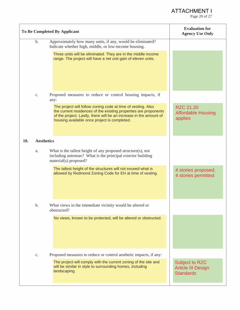
b. Approximately how many units, if any, would be eliminated?Indicate whether high, middle, or low-income housing.
c. Proposed measures to reduce or control housing impacts, ifany:
10. Aesthetics
a. What is the tallest height of any proposed structure(s), notincluding antennas? What is the principal exterior buildingmaterial(s) proposed?
b. What views in the immediate vicinity would be altered orobstructed?
c. Proposed measures to reduce or control aesthetic impacts, if any:
The project will comply with the current zoning of the site andwill be similar in style to surrounding homes, includinglandscaping.
No views, known to be protected, will be altered or obstructed.
The tallest height of the structures will not exceed what isallowed by Redmond Zoning Code for EH at time of vesting.
The project will follow zoning code at time of vesting. Alsothe current residences of the existing properties are proponentsof the project. Lastly, there will be an increase in the amount ofhousing available once project is completed.
Three units will be eliminated. They are in the middle incomerange. The project will have a net unit gain of eleven units.
RZC 21.20Affordable Housingapplies
4 stories proposed,4 stories permitted
Subject to RZCArticle III DesignStandards
ATTACHMENT I
Page 21 of 27
To Be Completed By ApplicantEvaluation for
Agency Use Only
11. Light and Glare
a. What type of light or glare will the proposal produce? What timeof day or night would it mainly occur?
b. Could light or glare from the finished project be a safety hazard orinterfere with views?
c. What existing off-site sources of light or glare may affect yourproposal?
d. Proposed measures to reduce or control light and glare impacts, ifany:
12. Recreation
a. What designated and informal recreational opportunities are in theimmediate vicinity?
Anderson Park is approximately 0.2 miles to the southwest
Street lighting, when deemed necessary, will be installed in amanner that directs the lighting downward.
Sources from vehicles and street lighting from the adjacentstreets and neighborhoods.
Not to our knowledge.
Building lighting and exterior lighting and vehicles using thesite. Before dawn and evenings.
ATTACHMENT I
Page 22 of 27
To Be Completed By ApplicantEvaluation for
Agency Use Only
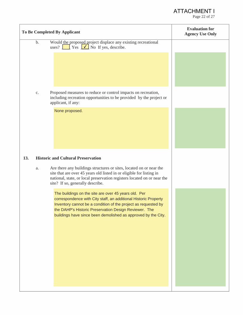
b. Would the proposed project displace any existing recreationaluses? ____ Yes ____ No If yes, describe.
c. Proposed measures to reduce or control impacts on recreation,including recreation opportunities to be provided by the project orapplicant, if any:
13. Historic and Cultural Preservation
a. Are there any buildings structures or sites, located on or near thesite that are over 45 years old listed in or eligible for listing innational, state, or local preservation registers located on or near thesite? If so, generally describe.
The buildings on the site are over 45 years old. Per correspondence with City staff, an additional Historic Property Inventory cannot be a condition of the project as requested by the DAHP's Historic Preservation Design Reviewer. The buildings have since been demolished as approved by the City.
None proposed.
✔
ATTACHMENT I
Page 23 of 27
To Be Completed By ApplicantEvaluation for
Agency Use Only
b. Are there any landmarks, features, or other evidence of Indian orhistoric use or occupation? This may include human burials or oldcemeteries. Are there any material evidence, artifacts, or areas ofcultural importance on or near the site? Please list any professionalstudies conducted at the site to identify such resources.
c. Describe the methods used to assess the potential impacts tocultural and historic resources on or near the project site.Examples include consultation with tribes and the Department ofArchaeological and Historic Preservation, archaeological surveys,historic maps, GIS data, etc.
d. Proposed measures to avoid, minimize, or compensate for loss,changes to, and disturbance to resources. Please include plans forthe above and any permits that may be required.
None, there are no known impacts. If archaeological resourcesor human remains are discovered during the course ofconstruction, the discovery shall be protected/work suspectedwithin the area of discovery and the proper individuals contactedas detailed in the cultural resources study.
A cultural resource study was completed. Please review thereport for its exact research methodology.
The cultural resource study found no evidence of Indian use of the site or immediate area. Please reference the cultural resource study submitted as part of this application for detailed information regarding the surrounding area and its history.
ATTACHMENT I
Page 24 of 27
To Be Completed By ApplicantEvaluation for
Agency Use Only
14. Transportation
a. Identify public streets and highways serving the site, or affectedgeographic area, and describe proposed access to the existing streetsystem. Show on site plans, if any.
b. Is the site currently or affected geographic area currently served bypublic transit? ____ Yes ____ No If yes, generally describe. Ifnot, what is the approximate distance to the nearest transit stop?
c. How many additional parking spaces would the completed projecthave? How many would the project eliminate?
d. Will the proposal require any new or improvements to existingroads, streets, pedestrian, bicycle, or transportation facilities notincluding driveways? If so, generally describe (indicate whetherpublic or private).
Yes, there will be new public frontage improvementsconstructed as part of the project.
No additional public parking spaces have been added or eliminated. Twenty eight private parking spaces have been added.
The nearest stop is 0.2 miles to the south and located at 17090Avondale Way.
✔
North: NE 80th StSouth: Penny LaneWest: 170th Ave NEEast: 170th Ct NEVehicular access will be via 170th Ct NE. Pedestrian accesswill be via 170th Ave NE and 170th Ct NE.
Frontageimprovements doinclude constructionof public streetparking
ATTACHMENT I
Page 25 of 27
To Be Completed By ApplicantEvaluation for
Agency Use Only
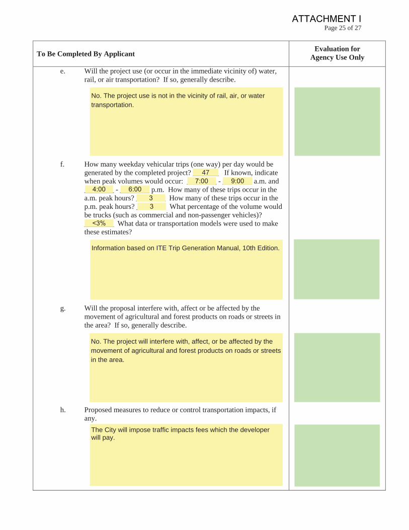
e. Will the project use (or occur in the immediate vicinity of) water,rail, or air transportation? If so, generally describe.
f. How many weekday vehicular trips (one way) per day would begenerated by the completed project? _______ If known, indicatewhen peak volumes would occur: ________ - ________ a.m. and________ - ________ p.m. How many of these trips occur in thea.m. peak hours? ________ How many of these trips occur in thep.m. peak hours? ________ What percentage of the volume wouldbe trucks (such as commercial and non-passenger vehicles)?________ What data or transportation models were used to makethese estimates?
g. Will the proposal interfere with, affect or be affected by themovement of agricultural and forest products on roads or streets inthe area? If so, generally describe.
h. Proposed measures to reduce or control transportation impacts, ifany.
The City will impose traffic impacts fees which the developerwill pay.
No. The project will interfere with, affect, or be affected by the movement of agricultural and forest products on roads or streets in the area.
Information based on ITE Trip Generation Manual, 10th Edition.
<3%
33
6:004:009:007:00
47
No. The project use is not in the vicinity of rail, air, or water transportation.
ATTACHMENT I
Page 26 of 27
To Be Completed By ApplicantEvaluation for
Agency Use Only
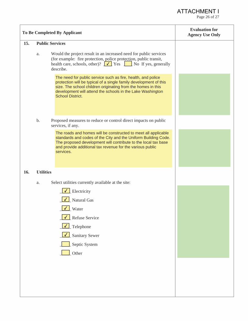
15. Public Services
a. Would the project result in an increased need for public services(for example: fire protection, police protection, public transit,health care, schools, other)? ____ Yes ____ No If yes, generallydescribe.
b. Proposed measures to reduce or control direct impacts on publicservices, if any.
16.
a. Select utilities currently available at the site:
_____ Electricity
_____ Natural Gas
_____ Water
_____ Refuse Service
_____ Telephone
_____ Sanitary Sewer
_____ Septic System
_____ Other
✔
✔
✔
✔
✔
✔
The roads and homes will be constructed to meet all applicablestandards and codes of the City and the Uniform Building Code.The proposed development will contribute to the local tax baseand provide additional tax revenue for the various publicservices.
The need for public service such as fire, health, and policeprotection will be typical of a single family development of thissize. The school children originating from the homes in thisdevelopment will attend the schools in the Lake WashingtonSchool District.
✔
ATTACHMENT I
Page 27 of 27
To Be Completed By ApplicantEvaluation for
Agency Use Only
b. Describe the utilities that are proposed for the project, the utilityproviding the service, and the general construction activities on thesite or in the immediate vicinity which might be needed.
C. SIGNATURE The above answers are true and complete to the best of my knowledge. I understand that the lead agency is relying on them to make its decision.
Signature:
Name of Signee:
Position and Agency/Organization:
Relationship of Signer to Project: ________________________
Date Submitted: _______________________________________
Applicant Signature:
4/8/19
Project Lead
Senior Operations Manager
Randy Barnett
Digitally signed by Randy Barnett Date: 2019.04.08 14:38:40 -07'00'
Water: City of Redmond Sewer: City of Redmond Power and Gas: Puget Sound Energy Telephone: Verizon