10
Devonian structure-production and Avalon porosity study area 25S to 26S + 32E to 34E
| Date post: | 14-Apr-2017 |
| Category: |
Documents |
| Upload: | jerry-beets |
| View: | 219 times |
| Download: | 1 times |

Devonian structure-production and Avalon porosity study area 25S to 26S + 32E to 34E

producing zones 25S to 26S + 32E to 34ELea County, New MexicoAvalon production light green

Structure Avalon Lt GrnLea County, New MexicoLocation of SW-NE 5 well structure cross section

SW-NE 5 well structure cross sectionLea County, New Mexico
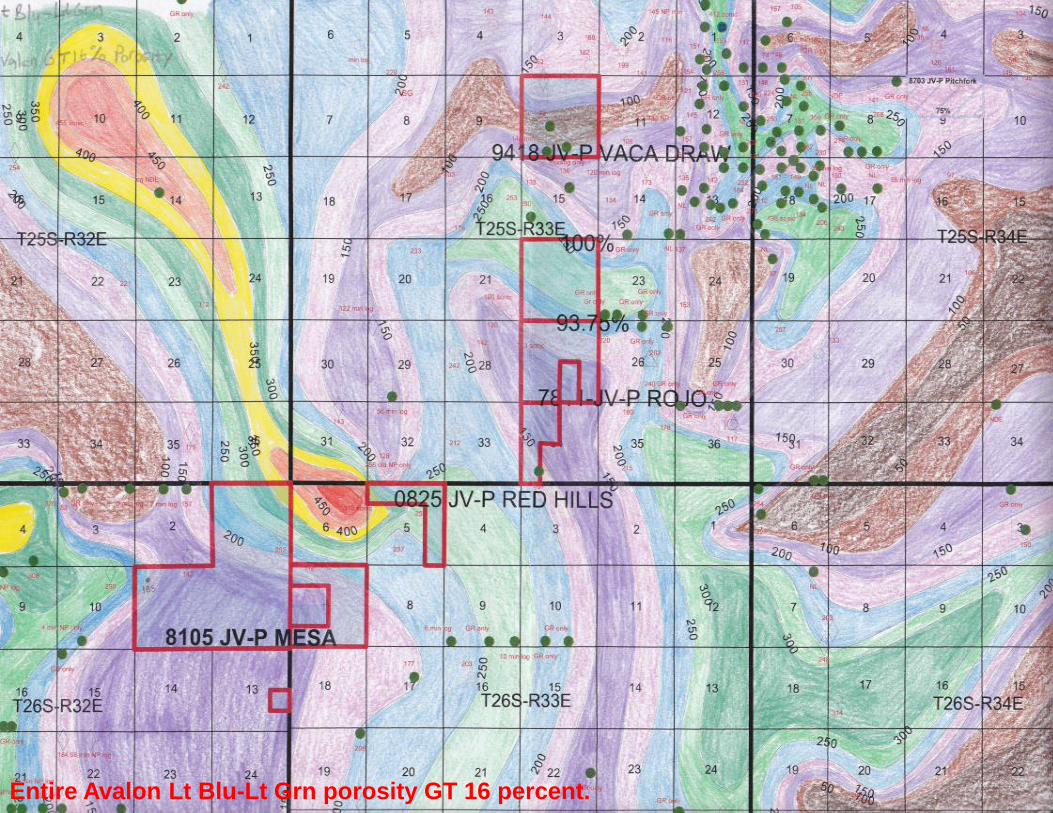
Entire Avalon Lt Blu-Lt Grn porosity GT 16 percent.

Avalon Lt Blu-Dk Blu porosity GT 16 percent

Avalon Dk Blu-Dk Grn porosity GT 16 percent
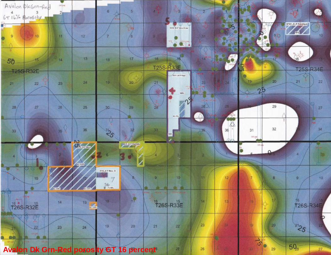
Avalon Dk Grn-Red porosity GT 16 percent

Avalon Red-Lt Grn porosity GT 16 percent

Conclusions
• Production data supports higher Avalon initial rates and higher estimated ultimate recoveries in specific Avalon zones with thicker log porosity above 16 percent and covering larger map areas.
• Detailed correlation and mapping of Avalon porosity distribution defines the production sweet spots for offset infill drilling and explains poor recovery from wells in thin porosity areas or small porosity pods that drain smaller map areas.
• A gross interval series of Avalon porosity thick trends oriented from NW-SE indicate deposition sourced from structural highlands to the NW.
• Porosity logs in pilot holes prior to horizontal wells or older wells that tested deeper structures are crucial for mapping the complex porosity thick trends within the Avalon and maximizing the Avalon play economics.


