26
BACCHUS MARSH URBAN GROWTH FRAMEWORK OCTOBER 2017 DRAFT 26/10/2017

BACCHUS MARSHURBAN GROWTH FRAMEWORK
OCTOBER 2017
DRAFT 26/10/2017

PRODUCED BY
WITH
OCTOBER 2017
CONTENTS
EXECUTIVE SUMMARY 6
1 INTRODUCTION 11Why a UGF for Bacchus Marsh? 11What is the project? 14Planning context 16Growth context 18Consultation 20Structure of the UGF 21
2 VISION & PRINCIPLES 23Vision 23Principles 24
3 UGF ELEMENTS 27
4 ELEMENT 1: ENVIRONMENT 28Key issues 29Environment objectives 33Environment strategies 34
5 ELEMENT 2: EMPLOYMENT 36Key issues 37Employment objectives 42Employment strategies 43
6 ELEMENT 3: HOUSING & COMMMUNITY INFRASTRUCTURE 46Key issues 47Community facilities and education 53Housing and community objectives 55Housing and community strategies 55
7 ELEMENT 4: TRANSPORT 56Key issues 57Transport objectives 61Transport strategies 61
8 GROWTH AREAS 64Defining and allocating strategic growth areas 64Component 1: District boundary 64Component 2: Constraints 65Component 3: Principles for the allocation of growth areas 66Component 4: Potential residential or employment growth areas 67

9 STRATEGIC OUTCOME AREAS 69Merrimu residential growth precinct 71Parwan employment growth precinct 75Parwan Station residential & commercial growth precinct 79Hopetoun Park North residential growth precinct 81Investigation and transition areas 82Supporting projects 83
10 IMPLEMENTATION 86UGF actions 86
Sequencing the growth 89
APPENDICES 92Appendix 1 Background studies 93
Appendix 2 Consultation process 94
Appendix 3 Agency consultation 97
Appendix 4 Assessment of land constraints, Bacchus Marsh growth areas 100
PLANSPlan 1 Urban Growth Framework 10
Plan 2A Regional Context 12
Plan 2B Local Context 13
Plan 3 Natural Features & Open Space 30
Plan 4 Physical Constraints 32
Plan 5 Employment 40
Plan 6 Housing & Community 52
Plan 7 Transport & Movement 58
Plan 8 Key Actions 88
ACRONYMS
AEO Airport Environs OverlayBMID Bacchus Marsh Irrigation DistrictCHRGP Central Highlands Regional Growth PlanCouncil Moorabool Shire CouncilCZ Commercial ZoneDDO Design and Development OverlayDEDJTR Department of Economic Development, Jobs, Transport and ResourcesDELWP Department of Environment, Land, Water and PlanningESO Environmental Significance OverlayFO Flood OverlayICPO Infrastructure Contribution Planning OverlayINZ Industrial ZoneIWM Integrated Water ManagementLPPF Local Planning Policy FrameworkPEP Parwan Employment PrecinctPSP Precinct Structure PlanSLO Significant Landscape OverlaySPPF State Planning Policy FrameworkSRW Southern Rural WaterUDF Urban Design FrameworkUGF Urban Growth FrameworkUGZ Urban Growth ZoneVPA Victorian Planning Authority

E X E C U T I V E S U M M A R Y
| BACCHUS MARSH URBAN GROWTH FRAMEWORK6 DRAFT 26/10/2017
EXECUTIVE SUMMARYBacchus Marsh is growing rapidly due to its proximity to Melbourne and the jobs and opportunities this brings. Lifestyle and amenity are key growth drivers, along with affordable land and housing, and quality regional health and education facilities. High-quality surrounding rural landscapes and open space enhance liveability. Agriculture, natural resources (sand and coal) as well as local industry provide employment opportunities.
Bacchus Marsh is the second largest settlement in the Central Highlands region (behind Ballarat) and the closest to Melbourne. Growth in Bacchus Marsh has well exceeded the rates of Ballarat or Melbourne for many years, and the existing planning framework needs to be revised. Train station usage has grown significantly, and local road congestion has increased. Retail, industry, education and health services need to respond to the increasing demand. Open space planning and provision of community services are needed to support the town’s growth.
State planning policy identifies that Bacchus Marsh can and should grow due to its locational advantages. An Urban Growth Framework (UGF) provides a long-term land use vision of how growth can be planned for, matched with coordinated infrastructure delivery by agencies and other stakeholders. The vision of the UGF is:
Bacchus Marsh will be an emerging regional growth centre, providing metropolitan-edge convenience, set within a distinctive agricultural valley framed by steep escarpments and significant waterways. Bacchus Marsh will be planned as a rural city in a farming district, and as the gateway to Victoria’s Central Highlands region.
Bacchus Marsh will draw new residents, investors and tourists due to its liveability, comparatively affordable land, diversity of residential lot sizes, access to services and attractive landscapes. The Bacchus Marsh Irrigation District is a food bowl for Victoria, and a range of other state-significant natural resources present opportunities for economic growth.
As a rural city, Bacchus Marsh’s service role and investment in education, health, retail and local industry will be strengthened. The combination of landscape, natural resources and liveability are unique to Bacchus Marsh and will be central to managing future growth.
A coordinated UGF, which includes a strategy for implementation, will ensure that housing, employment, road networks, rail corridors, local services, open space and other opportunities are provided for residents and visitors to enjoy. A comprehensive growth plan will ensure Bacchus Marsh remains a regional settlement with its own unique identity and not a physical extension of Melbourne’s rapid growth. Importantly the UGF aims to create a unified Bacchus Marsh where all neighbourhoods, from Parwan to Darley, are connected and integrated.

ES
BACCHUS MARSH URBAN GROWTH FRAMEWORK | 7DRAFT 26/10/2017
The vision set out in the UGF is to be achieved by:
• identifying four strategic outcome areas for 2041 and beyond so as to guide areas for development clear of constraints
• planning for new residential areas with capacity for a range of housing needs, supported by local services and schools
• planning for new employment areas to grow the local economy
• identifying high-level infrastructure needs to support growth, from roads to train stations to new schools and parks
• protecting high-value agricultural land, such as the Bacchus Marsh Irrigation District
• protecting natural and built environmental values.
The UGF is a long-term vision, which makes precise growth projections difficult. Sequencing of new growth fronts should be continuously reviewed based equally on supply and demand analysis and on the ability to deliver needed infrastructure, particularly the Eastern Link Road.
The UGF is a broad high-level document. It makes recommendations on identified opportunities for urban growth as well as new employment precincts (amongst other initiatives). These are conditional on relevant Council resolutions, Planning Minister support (where amendments occur) and a range of further assessments that will occur at the appropriate time.
The key actions of the UGF can be divided into two categories: state/regional and local. State/regional projects will support future growth in accordance with Plan Melbourne and the Central Highlands Regional Growth Plan.
A list of priority state/regional projects that support the implementation of the UGF are provided in Table 1 Key growth actions – state/regional.

E X E C U T I V E S U M M A R Y
| BACCHUS MARSH URBAN GROWTH FRAMEWORK8 DRAFT 26/10/2017
Table 1 Key growth actions – state/regional
REF # PROJECT TIMING1 RESPONSIBILITY
1 Eastern Link Road Planning Study Immediate VicRoads
2 Water and gas supply for the Parwan Employment Precinct
Short term RDV
3 Parwan Employment Precinct growth framework and infrastructure contribution plan
Short term VPA
4 District Open Space Framework to inform future growth planning
Short term Council/VPA
5 Bacchus Marsh Irrigation District Facilitation. Review zones, overlays, policy statements and buffers to protect and facilitate investment in agricultural sector. Address opportunities to facilitate value-adding enterprises
Short to medium term
Council/ Southern Rural Water
6 Maddingley integrated college precinct – planning/access study for Bacchus Marsh Grammar and Bacchus Marsh College
Short to medium term
Council/ Department of Education & Training/Independent Education Sector
7 Merrimu Residential Growth Precinct Medium term2 Proponent
8 Parwan Station Residential/Commercial Growth Precinct (including future railway station)
Medium term2 Proponent
9 Health services precinct in Bacchus Marsh. Plan and advocate for precinct that responds to the community needs of a rural city
Medium term Council/ Department of Health and Human Services
10 Hopetoun Park North Residential Growth Precinct
Medium term VPA/Council
Notes:
1 Immediate/ongoing: next 12 months Short term: 1–5 years Medium term: 5–10 years Long-term: 10+ years.
2 Timing can be brought forward, e.g. if there are significant contributions to Eastern Link Road construction funding.
3 Refer to Plan 1 Urban Growth Framework.

ES
BACCHUS MARSH URBAN GROWTH FRAMEWORK | 9DRAFT 26/10/2017
THIS PAGE IS INTENTIONALLY BLANK

I N T R O D U C T I O N
PARWAN[POTENTIAL]
MERRIMURESERVOIR
LONG FORESTNATURE
CONSERVATIONRESERVE
PARWANWASTEWATERTREATMENT
PLANT
LERDERDERGSTATE FOREST
WERRIBEEGORGESTATEPARK
BACCHUSMARSH
RECREATIONRESERVE
MELTONRESERVOIR
BALLARAT–MELBOURNE
B A C C H U SM A R S H
L O N GF O R E S T
H O P E T O U NP A R K
M A D D I N G L E Y
D A R L E Y
C O I M A D A I
BACCHUSMARSH[EXISTING]
W
ERRIBEE RIVER
LERDERDERG RIVE
R
PY
RIT
ES
CREE
K
EASTERN LINK ROADPLANNING STUDY
M E R R I M U
P A R W A NS T A T I O N
P A R W A N
MADDINGLEYEMPLOYMENT
INVESTIGATIONAREA
DARLEYSAND QUARRY
INVESTIGATIONAREA
H O P E T O U NP A R K N O R T H
WESTERN FREEWAY
BACCHUS MARSH ROAD
HALL
ETTS
WAY
GREY STREET
GIS
BOR
NE R
OAD
WO
OLP
ACK
RO
AD
GEE
LON
G–B
ACC
HU
S M
ARSH
RO
AD
BAC
CH
US
MAR
SH–B
ALLI
ANG
RO
AD
Bacchus Marsh district boundarymunicipal boundaryexisting urban areaexisting rural residentialexisting greenfield residential developmentfarmingBacchus Marsh Irrigation Districtpublic park public usesextractive industry
industrial useswatercoursesexisting activity centre & retailpotential activity centre & retailpotential health & communitypotential educationfuture residential growth precinct*future investigation area*future employment growth precinct*future residential/commercial growth precinct*
buffer interface required for sensitive uses (subject to further investigation)railway lines/stations (existing or future potential)freewayarterial roadBacchus Marsh Aerodrome
NOTES:* boundary alignment subject to confirmation
Eastern Link Road planning study to be undertaken by VicRoads; location and alignment subject to confirmation
© Victorian Planning Authority, 2017. The State of Victoria does not warrant the accuracy or completeness of information in this publication and any person using or relying upon such information does so on the basis that the State of Victoria shall bear no responsibility or liability whatsoever for any errors, faults, defects or omission in the information.
Bacchus Marsh District Urban Growth Framework 0.60 1.2 2.41.8 3km
1:75,000 @ A4Plan 1 — Urban Growth Framework
| BACCHUS MARSH URBAN GROWTH FRAMEWORK10 DRAFT 26/10/2017
01
PARWAN[POTENTIAL]
MERRIMURESERVOIR
LONG FORESTNATURE
CONSERVATIONRESERVE
PARWANWASTEWATERTREATMENT
PLANT
LERDERDERGSTATE FOREST
WERRIBEEGORGESTATEPARK
BACCHUSMARSH
RECREATIONRESERVE
MELTONRESERVOIR
BALLARAT–MELBOURNE
B A C C H U SM A R S H
L O N GF O R E S T
H O P E T O U NP A R K
M A D D I N G L E Y
D A R L E Y
C O I M A D A I
BACCHUSMARSH[EXISTING]
W
ERRIBEE RIVER
LERDERDERG RIVE
R
PY
RIT
ES
CREE
K
EASTERN LINK ROADPLANNING STUDY
M E R R I M U
P A R W A NS T A T I O N
P A R W A N
MADDINGLEYEMPLOYMENT
INVESTIGATIONAREA
DARLEYSAND QUARRY
INVESTIGATIONAREA
H O P E T O U NP A R K N O R T H
WESTERN FREEWAY
BACCHUS MARSH ROAD
HALL
ETTS
WAY
GREY STREET
GIS
BOR
NE R
OAD
WO
OLP
ACK
RO
AD
GEE
LON
G–B
ACC
HU
S M
ARSH
RO
AD
BAC
CH
US
MAR
SH–B
ALLI
ANG
RO
AD
Bacchus Marsh district boundarymunicipal boundaryexisting urban areaexisting rural residentialexisting greenfield residential developmentfarmingBacchus Marsh Irrigation Districtpublic park public usesextractive industry
industrial useswatercoursesexisting activity centre & retailpotential activity centre & retailpotential health & communitypotential educationfuture residential growth precinct*future investigation area*future employment growth precinct*future residential/commercial growth precinct*
buffer interface required for sensitive uses (subject to further investigation)railway lines/stations (existing or future potential)freewayarterial roadBacchus Marsh Aerodrome
NOTES:* boundary alignment subject to confirmation
Eastern Link Road planning study to be undertaken by VicRoads; location and alignment subject to confirmation
© Victorian Planning Authority, 2017. The State of Victoria does not warrant the accuracy or completeness of information in this publication and any person using or relying upon such information does so on the basis that the State of Victoria shall bear no responsibility or liability whatsoever for any errors, faults, defects or omission in the information.
Bacchus Marsh District Urban Growth Framework 0.60 1.2 2.41.8 3km
1:75,000 @ A4Plan 1 — Urban Growth Framework
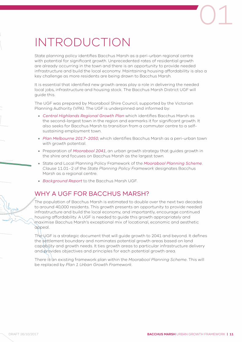
INTRODUCTIONState planning policy identifies Bacchus Marsh as a peri-urban regional centre with potential for significant growth. Unprecedented rates of residential growth are already occurring in the town and there is an opportunity to provide needed infrastructure and build the local economy. Maintaining housing affordability is also a key challenge as more residents are being drawn to Bacchus Marsh.
It is essential that identified new growth areas play a role in delivering the needed local jobs, infrastructure and housing stock. The Bacchus Marsh District UGF will guide this.
The UGF was prepared by Moorabool Shire Council, supported by the Victorian Planning Authority (VPA). The UGF is underpinned and informed by:
• Central Highlands Regional Growth Plan which identifies Bacchus Marsh as the second-largest town in the region and earmarks it for significant growth. It also seeks for Bacchus Marsh to transition from a commuter centre to a self-sustaining employment town.
• Plan Melbourne 2017–2050, which identifies Bacchus Marsh as a peri-urban town with growth potential.
• Preparation of Moorabool 2041, an urban growth strategy that guides growth in the shire and focuses on Bacchus Marsh as the largest town.
• State and Local Planning Policy Framework of the Moorabool Planning Scheme. Clause 11.01–2 of the State Planning Policy Framework designates Bacchus Marsh as a regional centre.
• Background Report to the Bacchus Marsh UGF.
WHY A UGF FOR BACCHUS MARSH?The population of Bacchus Marsh is estimated to double over the next two decades to around 40,000 residents. This growth presents an opportunity to provide needed infrastructure and build the local economy, and importantly, encourage continued housing affordability. A UGF is needed to guide this growth appropriately and maximise Bacchus Marsh’s exceptional mix of locational, economic and aesthetic appeal.
The UGF is a strategic document that will guide growth to 2041 and beyond. It defines the settlement boundary and nominates potential growth areas based on land capability and growth needs. It ties growth areas to particular infrastructure delivery and provides objectives and principles for each potential growth area.
There is an existing framework plan within the Moorabool Planning Scheme. This will be replaced by Plan 1 Urban Growth Framework.
BACCHUS MARSH URBAN GROWTH FRAMEWORK | 11DRAFT 26/10/2017
I N T R O D U C T I O N
50km
100km
BENDIGO
CASTLEMAINE
CRESWICK
BALLARAT
BALLANBUNGAREE
WALLACE
DUNNSTOWN
LARA
AVALON
MELBOURNEINTERNATIONAL
PAKENHAM
GEELONG
MELBOURNECBD
PORT PHILLIP BAY
BACCHUSMARSH
DAYLESFORD
KYNETON
KILMORE
BROADFORD
SEYMOUR
GISBORNE
MOORABOOL
Bacchus Marsh district boundary municipal boundaryurban growth boundarybuilt up arearegional city regional town
watercoursepark & reserveCentral Highlands regionrailway lines/stationsairportport
© Victorian Planning Authority, 2017. The state of Victoria does not warrant the accuracy or completeness of information in this publication and any person using or relying upon such information does so on the basis that the State of Victoria shall bear no responsibility or liability whatsoever for any errors, faults, defects or omission in the information.
Bacchus Marsh District Urban Growth Framework 60 12 2418 30km
1:750,000 @ A4Plan 2A — Regional Context
| BACCHUS MARSH URBAN GROWTH FRAMEWORK12 DRAFT 26/10/2017

01
50km
100km
BENDIGO
CASTLEMAINE
CRESWICK
BALLARAT
BALLANBUNGAREE
WALLACE
DUNNSTOWN
LARA
AVALON
MELBOURNEINTERNATIONAL
PAKENHAM
GEELONG
MELBOURNECBD
PORT PHILLIP BAY
BACCHUSMARSH
DAYLESFORD
KYNETON
KILMORE
BROADFORD
SEYMOUR
GISBORNE
MOORABOOL
Bacchus Marsh district boundary municipal boundaryurban growth boundarybuilt up arearegional city regional town
watercoursepark & reserveCentral Highlands regionrailway lines/stationsairportport
© Victorian Planning Authority, 2017. The state of Victoria does not warrant the accuracy or completeness of information in this publication and any person using or relying upon such information does so on the basis that the State of Victoria shall bear no responsibility or liability whatsoever for any errors, faults, defects or omission in the information.
Bacchus Marsh District Urban Growth Framework 60 12 2418 30km
1:750,000 @ A4Plan 2A — Regional Context
M A C E D O N R A N G E SS H I R E
M E LT O N C I T Y
W Y N D H A M C I T Y
M O O R A B O O L S H I R E
G R E A T E R G E E L O N G
MERRIMURESERVOIR
LONG FORESTNATURE
CONSERVATIONRESERVE
LERDERDERGSTATE FOREST
WERRIBEE GORGESTATE PARK
MELTONRESERVOIR
BALLARAT–MELBOURNE
WESTERN FREEWAY
W E R R I BEE R I V E R
LE
RD
ER
DE
RG
RIV
ER
PY
RIT
ES
CR
EE
K
PA R W A N CRE E K
KORKUPERR
IMU
L C
RE
EK
GISB
OR
NE
RO
AD
HA
LL
ET
TS
WAY
M E R R I M U
B A C C H U SM A R S H
L O N GF O R E S T
H O P E T O U NPA R K
ME LTON
PA R W A N
M A D D I N G L E Y
D A R L E Y
C O I M A D A I
© Victorian Planning Authority, 2017. The state of Victoria does not warrant the accuracy or completeness of information in this publication and any person using or relying upon such information does so on the basis that the State of Victoria shall bear no responsibility or liability whatsoever for any errors, faults, defects or omission in the information.
Bacchus Marsh District Urban Growth Framework1:125,000 @ A4
1km0 2km 4km3km 5km
Plan 2B — Local Context
BACCHUS MARSH URBAN GROWTH FRAMEWORK | 13DRAFT 26/10/2017

Figure 1 The UGF delivery
I N T R O D U C T I O N
WHAT IS THE PROJECT?The project’s aim is to deliver a strategic document that will guide population, infrastructure and economic growth within Bacchus Marsh to 2041 and beyond.
Work commenced on the Bacchus Marsh UGF in late 2014. A request was made to the Minister for Planning in 2015 to prepare an amendment to the planning scheme. Subsequently a project brief was developed between the parties and a scope of works was signed off by the Minister for Planning.
Growth Area Framework Plans Requirements are set out in Clause 11.02-2 of the State Planning Policy Framework.
The Bacchus Marsh UGF is based on long-term projections that are and will continue to be influenced by a range of factors beyond Council’s control. For this reason, the UGF does not prescribe growth areas of specific size for development at set times – these steps will be applicable to later, more detailed planning stages. Rather, the UGF identifies areas that are capable of accommodating growth more broadly, lists the infrastructure that potential growth areas need to deliver, and sequences growth according to investment needs.
The UGF sets out a strategic vision for Bacchus Marsh. It identifies the settlement boundary, where future potential growth can occur, key priority projects for Council to undertake and relevant partnerships with other government bodies.
The ultimate goal of the UGF is to articulate a comprehensive work plan for guiding future growth and development, and to ensure alignment and common purpose between state, regional and local planning decisions (see Figure 1 The UGF delivery).
CENTRAL HIGHLANDSREGIONAL GROWTH PLAN
& STATE PLANNINGPOLICY FRAMEWORK
URBAN GROWTH FRAMEWORK& LOCAL PLANNING POLICY
FRAMEWORK CHANGES
PRECINCT PLANNING& REZONING
PLANNING PERMITS
DEVELOPMENT INFRASTRUCTURE
| BACCHUS MARSH URBAN GROWTH FRAMEWORK14 DRAFT 26/10/2017
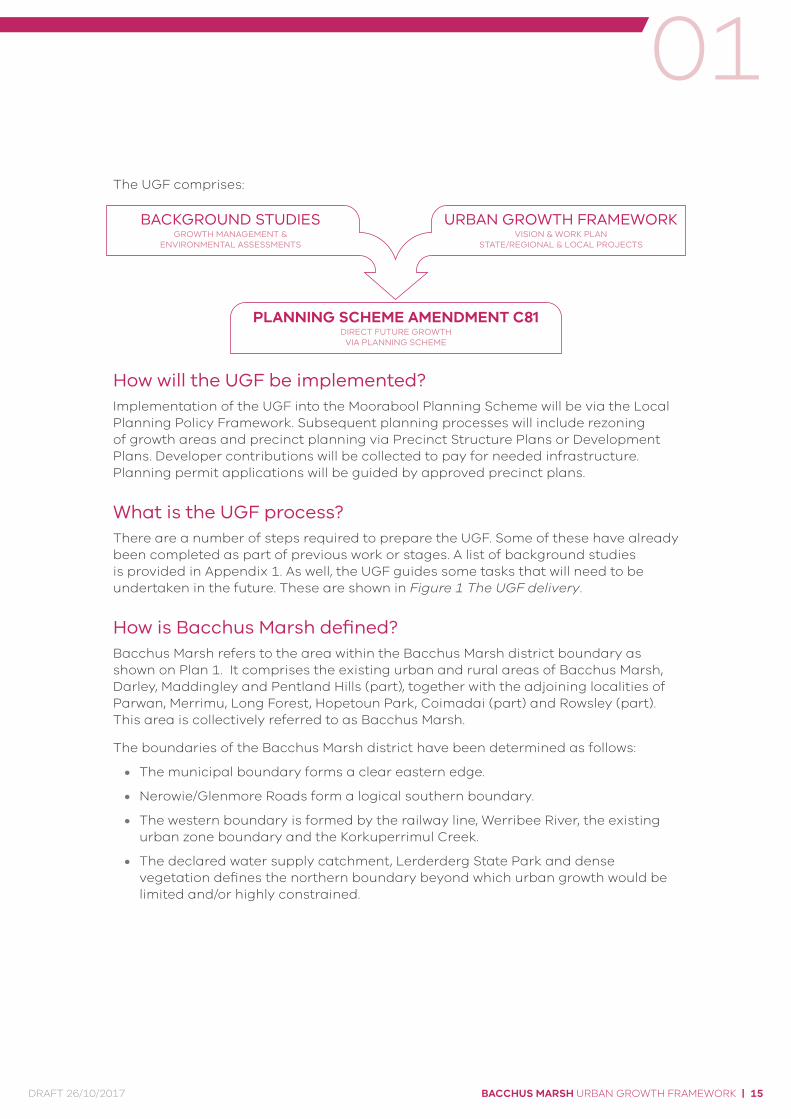
01The UGF comprises:
How will the UGF be implemented?Implementation of the UGF into the Moorabool Planning Scheme will be via the Local Planning Policy Framework. Subsequent planning processes will include rezoning of growth areas and precinct planning via Precinct Structure Plans or Development Plans. Developer contributions will be collected to pay for needed infrastructure. Planning permit applications will be guided by approved precinct plans.
What is the UGF process?There are a number of steps required to prepare the UGF. Some of these have already been completed as part of previous work or stages. A list of background studies is provided in Appendix 1. As well, the UGF guides some tasks that will need to be undertaken in the future. These are shown in Figure 1 The UGF delivery.
How is Bacchus Marsh defined?Bacchus Marsh refers to the area within the Bacchus Marsh district boundary as shown on Plan 1. It comprises the existing urban and rural areas of Bacchus Marsh, Darley, Maddingley and Pentland Hills (part), together with the adjoining localities of Parwan, Merrimu, Long Forest, Hopetoun Park, Coimadai (part) and Rowsley (part). This area is collectively referred to as Bacchus Marsh.
The boundaries of the Bacchus Marsh district have been determined as follows:
• The municipal boundary forms a clear eastern edge.
• Nerowie/Glenmore Roads form a logical southern boundary.
• The western boundary is formed by the railway line, Werribee River, the existing urban zone boundary and the Korkuperrimul Creek.
• The declared water supply catchment, Lerderderg State Park and dense vegetation defines the northern boundary beyond which urban growth would be limited and/or highly constrained.
BACKGROUND STUDIESGROWTH MANAGEMENT &
ENVIRONMENTAL ASSESSMENTS
URBAN GROWTH FRAMEWORKVISION & WORK PLAN
STATE/REGIONAL & LOCAL PROJECTS
PLANNING SCHEME AMENDMENT C81DIRECT FUTURE GROWTH
VIA PLANNING SCHEME
BACCHUS MARSH URBAN GROWTH FRAMEWORK | 15DRAFT 26/10/2017

I N T R O D U C T I O N
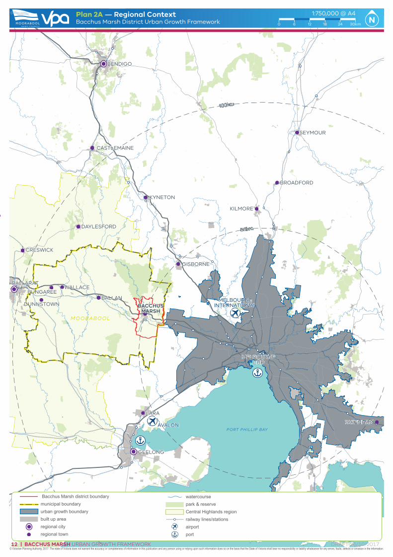
PLANNING CONTEXTState planning policy seeks to direct a greater share of growth to regional Victoria. Plan Melbourne 2017–2050 specifically identifies Bacchus Marsh as a peri-urban town with growth potential. Bacchus Marsh is located in the Central Highlands region. The Central Highlands Regional Growth Plan identifies Bacchus Marsh as a regional centre, second in size to the Ballarat regional city. These two settlements are projected to accommodate a majority of the region’s growth over the next 30 years. Bacchus Marsh has strong links to Melbourne and can attract residential and employment growth from the metropolitan region.
The Central Highlands Regional Growth Plan sets the following directions for growth in Bacchus Marsh:
• Support Bacchus Marsh as a regional centre and key growth location.
• Support the development of new north–south transport links.
• Growth should be supported in locations that will accommodate the largest increases in population.
• Provide a balanced approach to growth by promoting a range of local employment opportunities as an alternative to Bacchus Marsh’s role as a commuter centre.
• Undertake investigations for employment and agribusiness opportunities at the Bacchus Marsh Aerodrome and in Parwan.
• Identify the need for and encourage the provision of social, service and transport infrastructure to support significant growth and investigate implementation opportunities including development contribution plans.
• Encourage the development of Bacchus Marsh to protect surrounding regional environmental, heritage, landscape, resource and agricultural assets and consider natural hazards.
• Maintain the character and form of a distinct regional settlement, separated from Melbourne’s western growth corridor.
| BACCHUS MARSH URBAN GROWTH FRAMEWORK16 DRAFT 26/10/2017

01Moorabool 2041 and local policyAt the local level, Bacchus Marsh is the municipality’s main centre for retail, services and employment, and anticipated for the most growth. It is intended to be the focus area for activity and high-order community facilities, including libraries, performing arts and leisure centres.
Council’s strategic planning strategy, Moorabool 2041, seeks to manage growth in Bacchus Marsh in a manner that responds to existing context and character. Key components of this work include community engagement and visioning, as detailed in Section 2 Vision & Principles.
Background strategic work includes: Bacchus Marsh Housing Strategy (Mesh, 2016), Moorabool Shire Retail Strategy (Macroplan, 2015), and the Bacchus Marsh Integrated Transport Strategy (Moorabool Shire, 2015). These studies are discussed in detail in Report 2 – Technical Findings.
BACCHUS MARSH URBAN GROWTH FRAMEWORK | 17DRAFT 26/10/2017
I N T R O D U C T I O N
GROWTH CONTEXTThere is strong demand for new housing in Bacchus Marsh which is driving population growth. Council’s Bacchus Marsh Housing Strategy notes that Bacchus Marsh is an integrated component of the wider metropolitan housing market and is therefore competing for growth with Melton and Wyndham. Plan Melbourne 2017–2050 foreshadows that peri-urban regional centres can and should provide viable alternative housing choices for new residents settling in Victoria.
In part, the attraction is the affordability of land and quality of landscape and amenity in the district. Other key drivers include access to quality education (four primary schools, two colleges), a regional hospital, a main street retail precinct, historic buildings and landscapes (including the Avenue of Honour) and high-quality rail and road linkages with Melbourne, Ballarat and Geelong. The Bacchus Marsh Housing Strategy confirms that many of these growth drivers are beyond Council control or influence:
• Total housing demand will largely be influenced by macro level and regional population growth. This includes an ageing population, the increase in migration and increases in fertility (more babies being born).
• Within adjoining growth areas, the ongoing capacities and pricing of broadhectare lots released within the growth areas of Melton and Wyndham will continue to cater for large-scale demand, although any shortage of land supply may increase demand in Bacchus Marsh.
• National, state and local government land use policies affecting Melbourne’s Growth Areas will significantly impact the future of Bacchus Marsh, for example changes to Melbourne’s Urban Growth Boundary or policy direction to increase housing densities.
• Dwelling demand will not solely be generated by additional household growth; there will also be household lifecycle changes, preferences and needs. Dwelling demand may increase through down/upsizing and changing tenure (i.e. renter to purchaser). Other drivers of household types include economic pressures (such as the increasing costs of housing and children living at home for longer) and social trends (higher rates of divorce and single parents).
| BACCHUS MARSH URBAN GROWTH FRAMEWORK18 DRAFT 26/10/2017
01How does the UGF seeks to manage growth?The UGF:
» Sets the vision for Bacchus Marsh.
» Defines the settlement boundary and identifies where future potential growth can occur within it.
» Identifies key priority projects to manage growth and connect the neighbourhoods of Bacchus Marsh (either for Council to undertake or in partnership with other government bodies).
The UGF seeks to promote growth that delivers local jobs and infrastructure while enhancing the district’s character. It achieves this by building upon existing parameters and needs of Bacchus Marsh:
• The existing urban development is situated largely in the west and is serviced by the Western Freeway, one north–south arterial, a rail line and one train station.
• There is an existing major infrastructure shortfall – the need for a second north–south arterial, the Eastern Link Road. Planning for future growth areas provides the opportunity to leverage infrastructure contributions towards the delivery of this road.
• There are existing employment sites to the south. More local jobs are needed and can be provided by expanding the existing employment sites with value-add and complementary uses.
• Land in the eastern portion of Bacchus Marsh provides potential for new growth areas, creating a character that is distinctive to the existing urban areas in the west.
• Connections within and between the existing and future urban areas will be linked by transport infrastructure – most significantly, the Eastern Link Road.
• Bacchus Marsh needs more local jobs and opportunities to encourage investment and build the local economy (refer to Section 5 Element 2: Employment).
BACCHUS MARSH URBAN GROWTH FRAMEWORK | 19DRAFT 26/10/2017
I N T R O D U C T I O N
CONSULTATION
Community engagement phasesCouncil’s firm commitment to community engagement is outlined in its Community Engagement Policy (adopted 5 September 2012).
The UGF and technical background reports were informed by extensive community engagement. These reports are discussed in further detail in Report 2 – Technical Findings.
As part of Moorabool 2041, and more specifically for the UGF, Council undertook the following consultation:
Phase 1 – Moorabool 2041 in 2014–15
Phase 2 – Urban Growth Framework in early 2017
An outline of the consultation outcomes and process is provided at Appendix 2.
Agency engagementThe UGF is informed by ongoing engagement with all relevant agencies. A full list of agencies and outcomes of this engagement is provided in Appendix 3.
| BACCHUS MARSH URBAN GROWTH FRAMEWORK20 DRAFT 26/10/2017

01STRUCTURE OF THE UGFThe UGF consists of five parts:
1 VISION AND PRINCIPLES
2 FOUR ELEMENTS » Containing the objectives and strategies for:
· Environment · Employment · Housing · Transport
3 GROWTH AREAS » How the new growth areas of Bacchus Marsh have been defined and allocated
4 STRATEGIC OUTCOME AREAS » Identification of Strategic Outcome Areas
» Strategic Outcomes Areas – description and planning principles
» Other investigation areas
5 IMPLEMENTATION » UGF actions (actions to deliver the UGF)
» Sequencing of growth/actions
BACCHUS MARSH URBAN GROWTH FRAMEWORK | 21DRAFT 26/10/2017

V I S I O N & P R I N C I P L E S
| BACCHUS MARSH URBAN GROWTH FRAMEWORK22 DRAFT 26/10/2017
VISION & PRINCIPLESVISION
Bacchus Marsh will be an emerging regional growth centre, providing metropolitan-edge convenience, set within a distinctive agricultural valley framed by steep escarpments and significant waterways. Bacchus Marsh will be planned as a rural city in a farming district and as the gateway to Victoria’s Central Highlands region.
Bacchus Marsh will draw new residents, investors and tourists due to its liveability, comparatively affordable land, diversity of residential lot sizes, access to services and attractive landscapes. The Bacchus Marsh Irrigation District is a food bowl for Victoria, and a range of other state-significant natural resources present opportunities for economic growth.
As a rural city, Bacchus Marsh’s service role and investment in education, health, retail and local industry will be strengthened. The combination of landscape, natural resources and liveability are unique to Bacchus Marsh and will be central to managing future growth.
02
BACCHUS MARSH URBAN GROWTH FRAMEWORK | 23DRAFT 26/10/2017

To identify growth areas for 2041 and beyond
» Guide new development towards areas capable of change, and away from constraints
» Provide certainty to the community and development industry
» Limit potential for liveability and character to be compromised
» Maximise opportunities for housing and jobs growth.
To plan for new residential areas
» Identify areas that are suitable for housing growth
» Ensure that these areas are large enough to be self-sufficient for infrastructure, such as schools and community centres.
To plan for new employment areas
» Better support the local economy
» Provide local job alternatives for the two-thirds of adult employees who travel outside the Shire for work
» Use existing employment areas, such as the Bacchus Marsh Irrigation District, to provide value-add and complementary new local job opportunities.
PRINCIPLES
V I S I O N & P R I N C I P L E S
| BACCHUS MARSH URBAN GROWTH FRAMEWORK24 DRAFT 26/10/2017
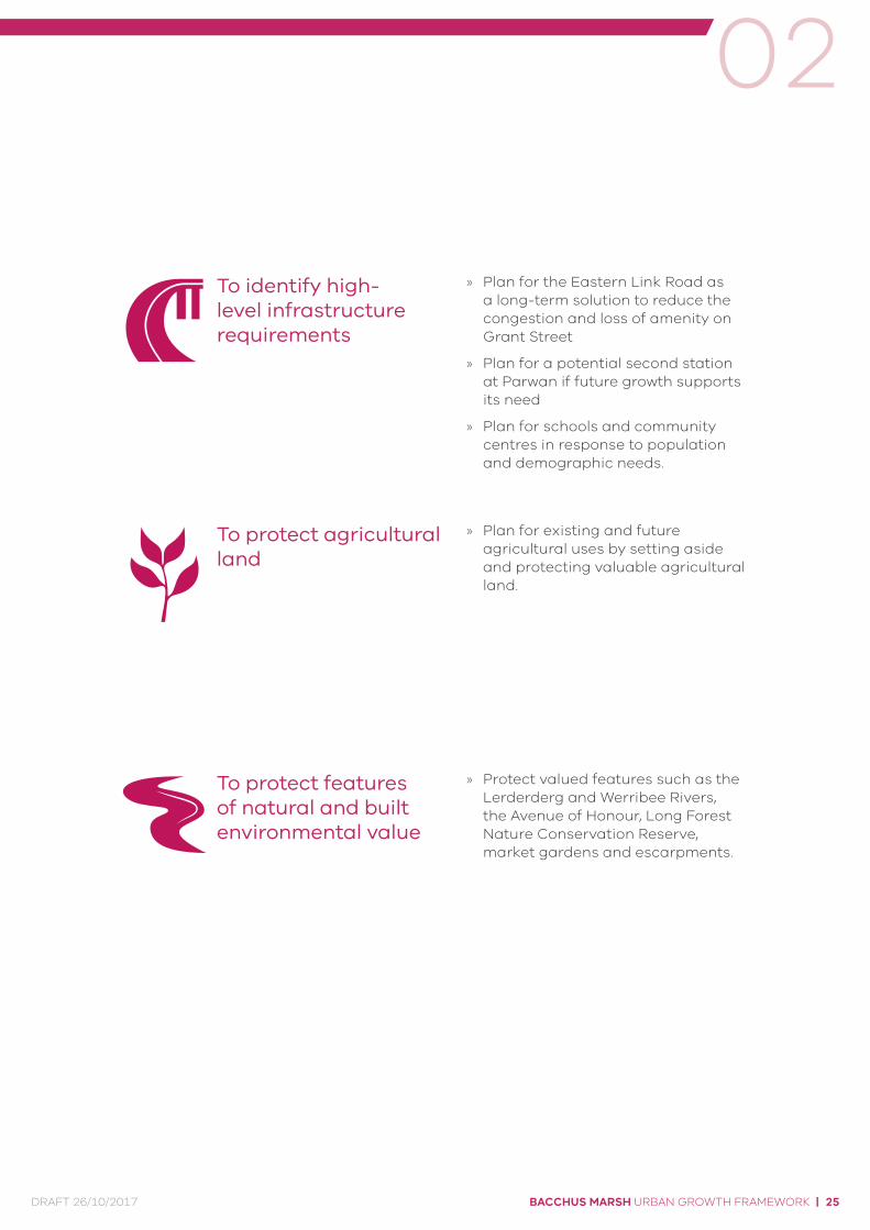
To identify high-level infrastructure requirements
» Plan for the Eastern Link Road as a long-term solution to reduce the congestion and loss of amenity on Grant Street
» Plan for a potential second station at Parwan if future growth supports its need
» Plan for schools and community centres in response to population and demographic needs.
To protect agricultural land
» Plan for existing and future agricultural uses by setting aside and protecting valuable agricultural land.
To protect features of natural and built environmental value
» Protect valued features such as the Lerderderg and Werribee Rivers, the Avenue of Honour, Long Forest Nature Conservation Reserve, market gardens and escarpments.
02
BACCHUS MARSH URBAN GROWTH FRAMEWORK | 25DRAFT 26/10/2017

U G F E L E M E N T S
| BACCHUS MARSH URBAN GROWTH FRAMEWORK26 DRAFT 26/10/2017


