35
Management Planning for the Cheltenham Badlands June 18, 2014
| Date post: | 13-Apr-2017 |
| Category: |
Environment |
| Upload: | francesco-belmonte |
| View: | 99 times |
| Download: | 0 times |

Slide 1
Management Planning for the Cheltenham Badlands
June 18, 2014
Slide 2
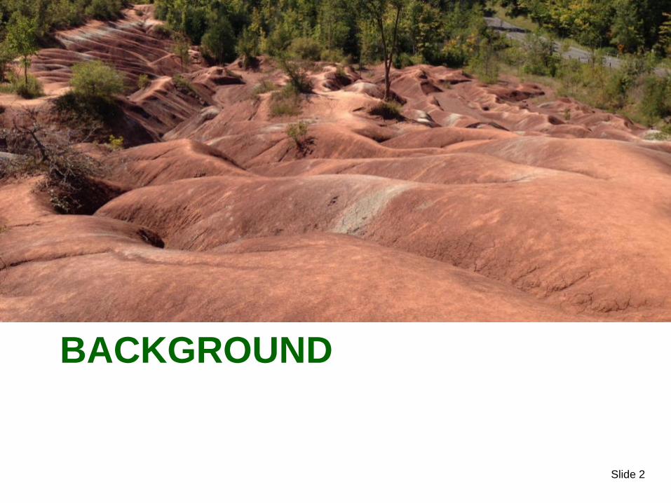
BACKGROUND

Slide 3
N
Slide 4
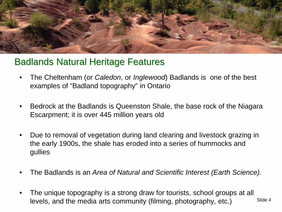
• The Cheltenham (or Caledon, or Inglewood) Badlands is one of the best examples of “Badland topography” in Ontario
• Bedrock at the Badlands is Queenston Shale, the base rock of the Niagara Escarpment; it is over 445 million years old
• Due to removal of vegetation during land clearing and livestock grazing in the early 1900s, the shale has eroded into a series of hummocks and gullies
• The Badlands is an Area of Natural and Scientific Interest (Earth Science).
• The unique topography is a strong draw for tourists, school groups at all levels, and the media arts community (filming, photography, etc.)
Badlands Natural Heritage Features
Slide 5
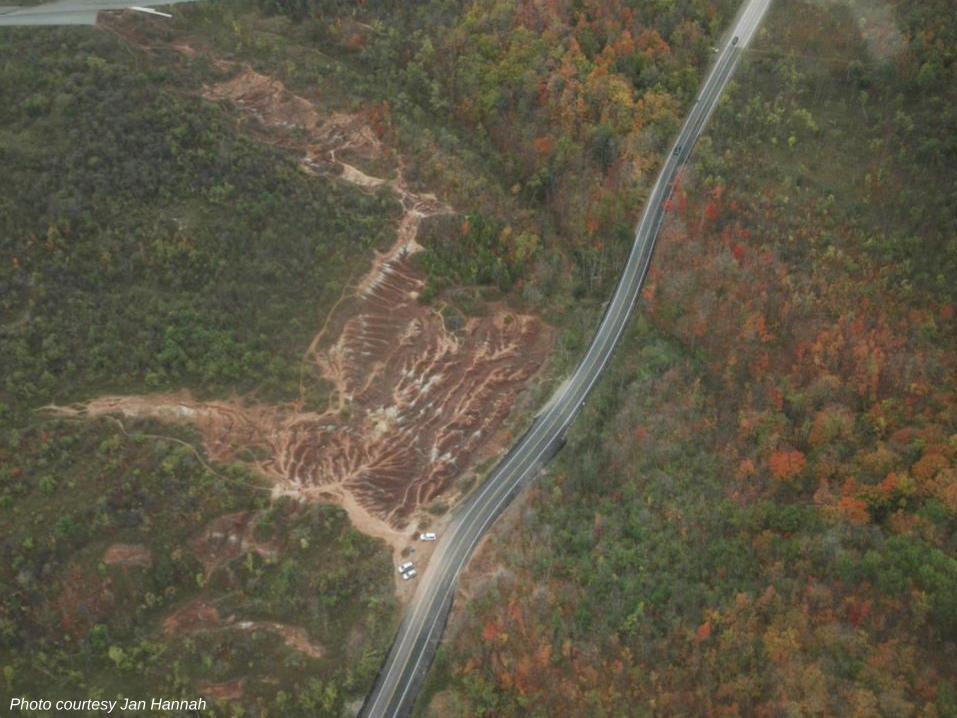
Badlands Location
Photo courtesy Jan Hannah

Slide 6
Badlands Location
Photo courtesy Jan Hannah
Slide 7
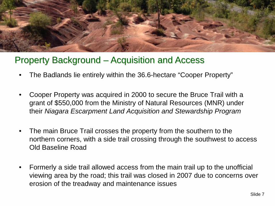
• The Badlands lie entirely within the 36.6-hectare “Cooper Property”
• Cooper Property was acquired in 2000 to secure the Bruce Trail with a grant of $550,000 from the Ministry of Natural Resources (MNR) under their Niagara Escarpment Land Acquisition and Stewardship Program
• The main Bruce Trail crosses the property from the southern to the northern corners, with a side trail crossing through the southwest to access Old Baseline Road
• Formerly a side trail allowed access from the main trail up to the unofficial viewing area by the road; this trail was closed in 2007 due to concerns over erosion of the treadway and maintenance issues
Property Background – Acquisition and Access

Slide 8

Slide 9
• The Ontario Heritage Trust (OHT) holds title to the property, and the BTC has management responsibilities for the site under an agreement with the OHT
• Stewardship of the Badlands property, as with all properties managed by the BTC, is carried out by volunteers (in this case the Caledon Hills Bruce Trail Club and the Caledon Countryside Alliance) with assistance and guidance from the BTC Land Stewardship Committee and BTC staff (Land Stewardship Coordinator, Conservation Stewardship Officer and the Executive Director)
Property Background – Management and Stewardship

Slide 10
MANAGEMENT CHALLENGES OVERVIEW

Slide 11
Management Challenges
• The Badlands are a unique and striking area
• A very common stop for “Day Trip” tourists who will visit for fairly short lengths of time some weekends thousands of people visit the site
• Management challenges appear to be related primarily to high public use of the site and include: o Concerns over safety along the road
adjacent to the site, due to number of visitors and their cars
o Garbage and littering o Vandalism of signage and trail
structures o Creation of trespass or “rogue” trails o Impact from pedestrian and wheeled
traffic on the slopes, trails and in other areas of the site

Slide 12
• The Cheltenham Badlands is considered an “Escarpment Access” park under the Niagara Escarpment Plan (NEP)
• The NEP requires a Management Plan be prepared for the site
• The Management Plan provides guidance to the landowner, land manager and planners on how the site should be used
The Management Planning Process
Slide 13
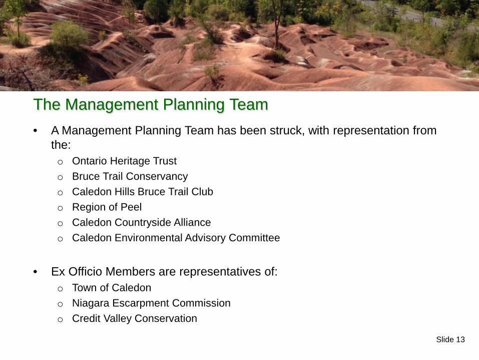
• A Management Planning Team has been struck, with representation from the: o Ontario Heritage Trust o Bruce Trail Conservancy o Caledon Hills Bruce Trail Club o Region of Peel o Caledon Countryside Alliance o Caledon Environmental Advisory Committee
• Ex Officio Members are representatives of:
o Town of Caledon o Niagara Escarpment Commission o Credit Valley Conservation
The Management Planning Team

Slide 14
Management Challenges – Identification of the Issues
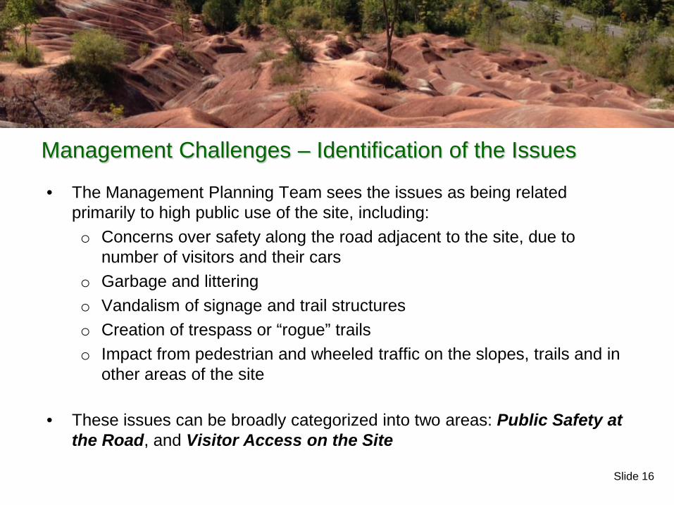
• The Management Planning Team sees the issues as being related primarily to high public use of the site, including: o Concerns over safety along the road adjacent to the site, due to
number of visitors and their cars o Garbage and littering o Vandalism of signage and trail structures o Creation of trespass or “rogue” trails o Impact from pedestrian and wheeled traffic on the slopes, trails and in
other areas of the site
Slide 15
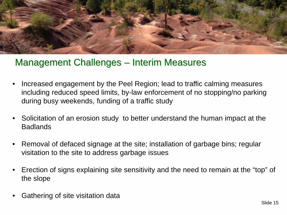
• Increased engagement by the Peel Region; lead to traffic calming measures
including reduced speed limits, by-law enforcement of no stopping/no parking during busy weekends, funding of a traffic study
• Solicitation of an erosion study to better understand the human impact at the Badlands
• Removal of defaced signage at the site; installation of garbage bins; regular visitation to the site to address garbage issues
• Erection of signs explaining site sensitivity and the need to remain at the “top” of the slope
• Gathering of site visitation data
Management Challenges – Interim Measures
Slide 16
Management Challenges – Identification of the Issues
• The Management Planning Team sees the issues as being related primarily to high public use of the site, including: o Concerns over safety along the road adjacent to the site, due to
number of visitors and their cars o Garbage and littering o Vandalism of signage and trail structures o Creation of trespass or “rogue” trails o Impact from pedestrian and wheeled traffic on the slopes, trails and in
other areas of the site
• These issues can be broadly categorized into two areas: Public Safety at the Road, and Visitor Access on the Site
Slide 17
MANAGEMENT CHALLENGES PUBLIC SAFETY
Slide 18
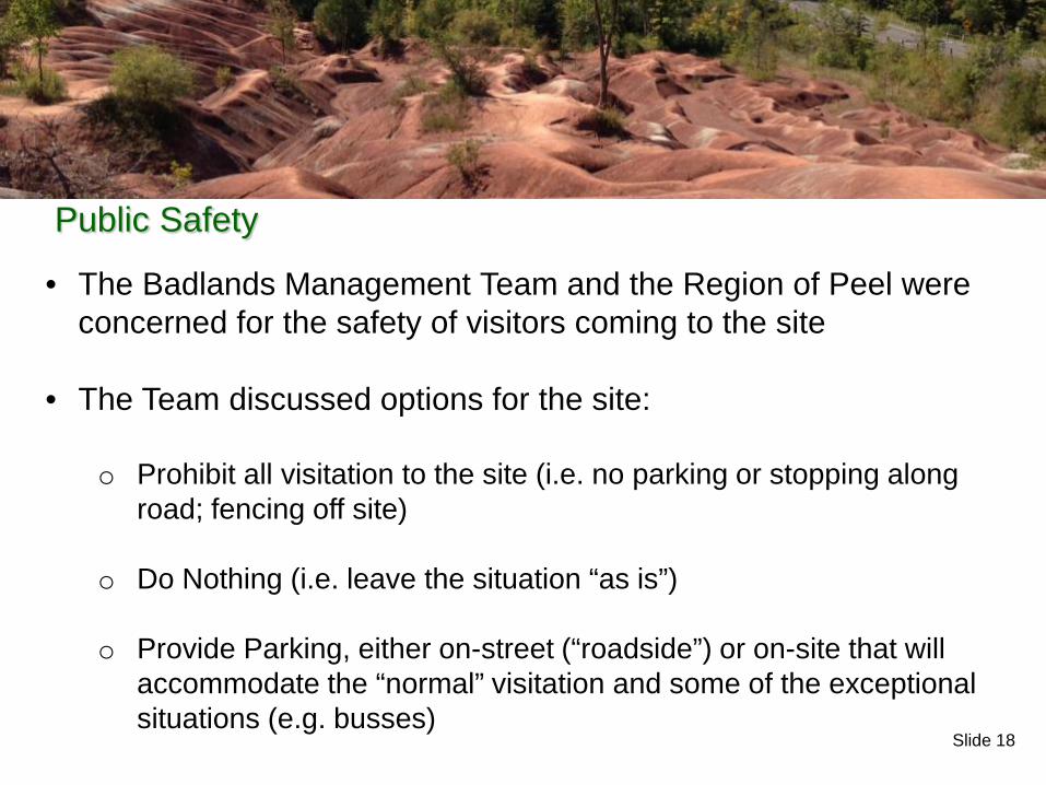
• The Badlands Management Team and the Region of Peel were concerned for the safety of visitors coming to the site
• The Team discussed options for the site: o Prohibit all visitation to the site (i.e. no parking or stopping along
road; fencing off site)
o Do Nothing (i.e. leave the situation “as is”)
o Provide Parking, either on-street (“roadside”) or on-site that will accommodate the “normal” visitation and some of the exceptional situations (e.g. busses)
Public Safety
Slide 19
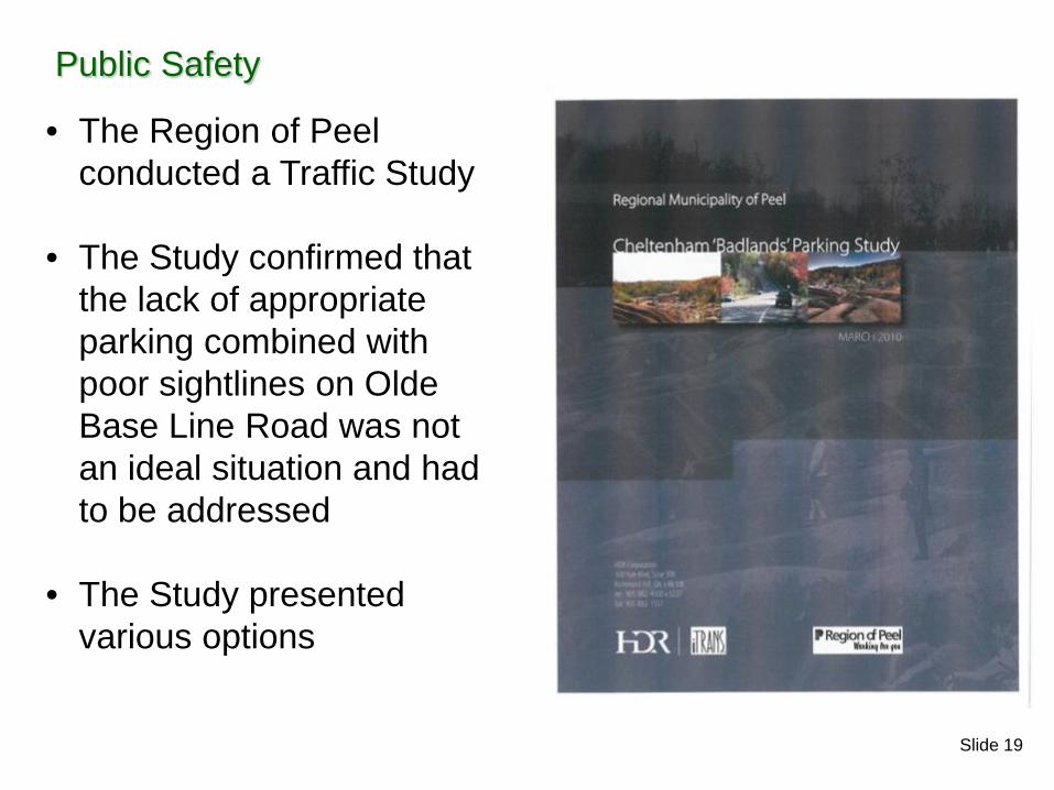
• The Region of Peel conducted a Traffic Study
• The Study confirmed that the lack of appropriate parking combined with poor sightlines on Olde Base Line Road was not an ideal situation and had to be addressed
• The Study presented various options
Public Safety
Slide 20
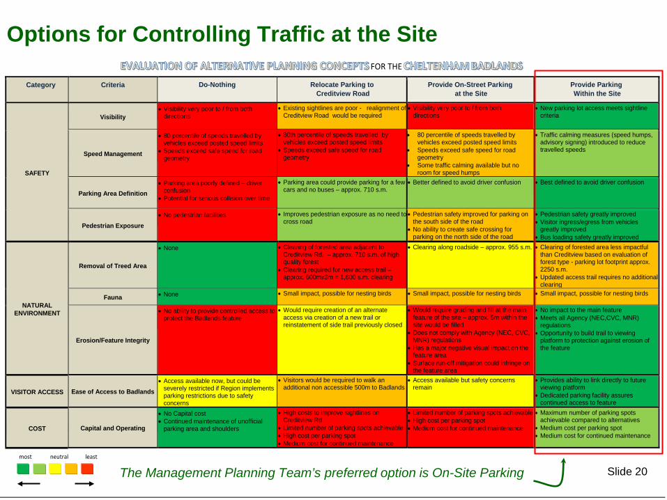
Options for Controlling Traffic at the Site
Category Criteria Do-Nothing Relocate Parking to Creditview Road
Provide On-Street Parking at the Site
Provide Parking Within the Site
SAFETY
Visibility • Visibility very poor to / from both
directions • Existing sightlines are poor - realignment of
Creditview Road would be required • Visibility very poor to / from both
directions • New parking lot access meets sightline
criteria
Speed Management
• 80 percentile of speeds travelled by vehicles exceed posted speed limits
• Speeds exceed safe speed for road geometry
• 80th percentile of speeds travelled by vehicles exceed posted speed limits
• Speeds exceed safe speed for road geometry
• 80 percentile of speeds travelled by vehicles exceed posted speed limits
• Speeds exceed safe speed for road geometry
• Some traffic calming available but no room for speed humps
• Traffic calming measures (speed humps, advisory signing) introduced to reduce travelled speeds
Parking Area Definition • Parking area poorly defined – driver
confusion • Potential for serious collision over time
• Parking area could provide parking for a few cars and no buses – approx. 710 s.m.
• Better defined to avoid driver confusion
• Best defined to avoid driver confusion
Pedestrian Exposure • No pedestrian facilities
• Improves pedestrian exposure as no need to
cross road
• Pedestrian safety improved for parking on the south side of the road
• No ability to create safe crossing for parking on the north side of the road
• Pedestrian safety greatly improved • Visitor ingress/egress from vehicles
greatly improved • Bus loading safety greatly improved
NATURAL ENVIRONMENT
Removal of Treed Area
• None • Clearing of forested area adjacent to Creditview Rd. – approx. 710 s.m. of high quality forest
• Clearing required for new access trail – approx. 600mx3m = 1,800 s.m. clearing
• Clearing along roadside – approx. 955 s.m. • Clearing of forested area less impactful than Creditview based on evaluation of forest type - parking lot footprint approx. 2250 s.m.
• Updated access trail requires no additional clearing
Fauna • None • Small impact, possible for nesting birds • Small impact, possible for nesting birds • Small impact, possible for nesting birds
Erosion/Feature Integrity
• No ability to provide controlled access to protect the Badlands feature
• Would require creation of an alternate access via creation of a new trail or reinstatement of side trail previously closed
• Would require grading and fill at the main feature of the site – approx. 5m within the site would be filled
• Does not comply with Agency (NEC, CVC, MNR) regulations
• Has a major negative visual impact on the feature area
• Surface run-off mitigation could infringe on the feature area
• No impact to the main feature • Meets all Agency (NEC,CVC, MNR)
regulations • Opportunity to build trail to viewing
platform to protection against erosion of the feature
VISITOR ACCESS Ease of Access to Badlands • Access available now, but could be
severely restricted if Region implements parking restrictions due to safety concerns
• Visitors would be required to walk an additional non accessible 500m to Badlands
• Access available but safety concerns remain
• Provides ability to link directly to future viewing platform
• Dedicated parking facility assures continued access to feature
COST Capital and Operating
• No Capital cost • Continued maintenance of unofficial
parking area and shoulders
• High costs to improve sightlines on Creditview Rd
• Limited number of parking spots achievable • High cost per parking spot • Medium cost for continued maintenance
• Limited number of parking spots achievable • High cost per parking spot • Medium cost for continued maintenance
• Maximum number of parking spots achievable compared to alternatives
• Medium cost per parking spot • Medium cost for continued maintenance
FOR THE
most neutral least
The Management Planning Team’s preferred option is On-Site Parking
Slide 21
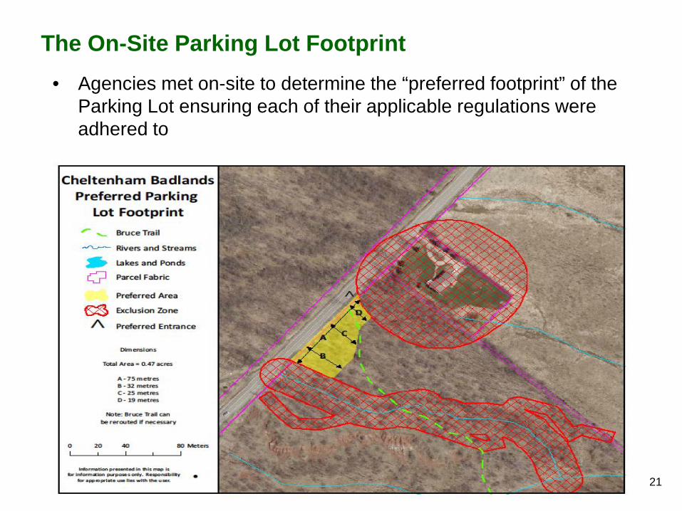
The On-Site Parking Lot Footprint • Agencies met on-site to determine the “preferred footprint” of the
Parking Lot ensuring each of their applicable regulations were adhered to
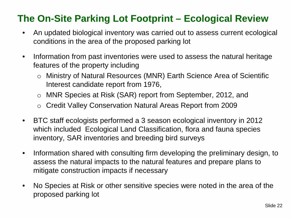
Slide 22
The On-Site Parking Lot Footprint – Ecological Review • An updated biological inventory was carried out to assess current ecological
conditions in the area of the proposed parking lot
• Information from past inventories were used to assess the natural heritage features of the property including o Ministry of Natural Resources (MNR) Earth Science Area of Scientific
Interest candidate report from 1976, o MNR Species at Risk (SAR) report from September, 2012, and o Credit Valley Conservation Natural Areas Report from 2009
• BTC staff ecologists performed a 3 season ecological inventory in 2012 which included Ecological Land Classification, flora and fauna species inventory, SAR inventories and breeding bird surveys
• Information shared with consulting firm developing the preliminary design, to assess the natural impacts to the natural features and prepare plans to mitigate construction impacts if necessary
• No Species at Risk or other sensitive species were noted in the area of the proposed parking lot
Slide 23
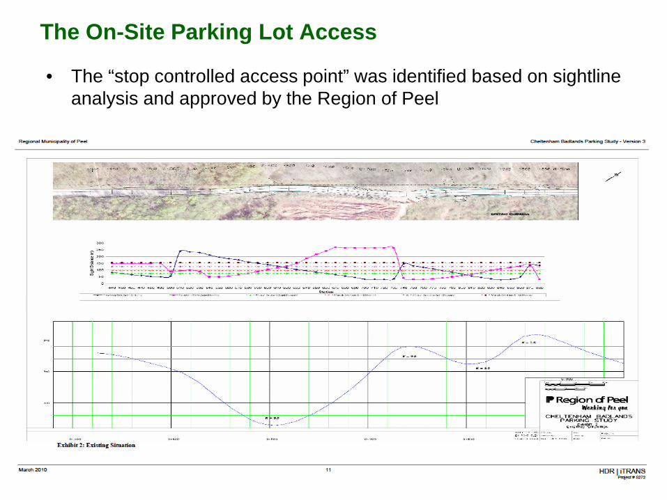
The On-Site Parking Lot Access
• The “stop controlled access point” was identified based on sightline analysis and approved by the Region of Peel
Slide 24
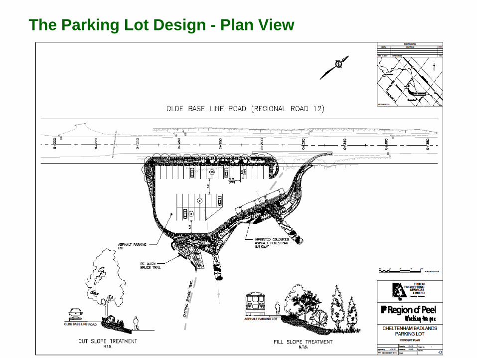
The Parking Lot Design - Plan View

Slide 25
Parking Lot - Artist’s Concept
Slide 26
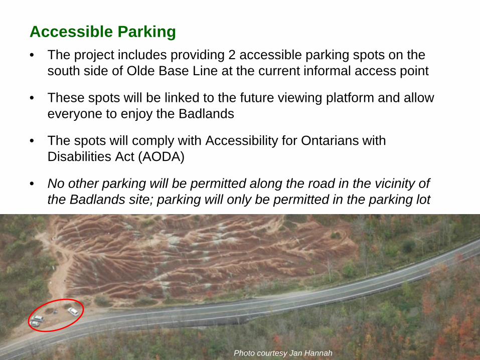
Accessible Parking • The project includes providing 2 accessible parking spots on the
south side of Olde Base Line at the current informal access point
• These spots will be linked to the future viewing platform and allow everyone to enjoy the Badlands
• The spots will comply with Accessibility for Ontarians with Disabilities Act (AODA)
• No other parking will be permitted along the road in the vicinity of the Badlands site; parking will only be permitted in the parking lot
Photo courtesy Jan Hannah

Slide 27
MANAGEMENT CHALLENGES VISITOR ACCESS

Slide 28
Visitor Access • Visitor access and impact on the Badlands site itself is also of concern
• Several “rogue” trails have also been created by people exploring
the site
• The Planning Team partnered with the University of Toronto to study erosion to determine if human impact at the site (walking in the rills and gullies, etc.) was increasing the rate of erosion
• Studies have found that humans are having a significant and measurable impact.

Slide 29
• Considerable erosion has taken place since 1973, caused by both natural and human impacts – As high as 3 m (see Red)
• Human Impacts
– Preliminary results show up to 10 cm of lowering in 3 years at the upper slope area.
– This is 4 times the control rate of natural erosion
• Humans are having a significant
and measurable impact to the badland topography
U of T Erosion Study
Slide 30
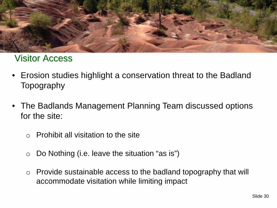
• Erosion studies highlight a conservation threat to the Badland Topography
• The Badlands Management Planning Team discussed options for the site:
o Prohibit all visitation to the site
o Do Nothing (i.e. leave the situation “as is”)
o Provide sustainable access to the badland topography that will
accommodate visitation while limiting impact
Visitor Access
Slide 31
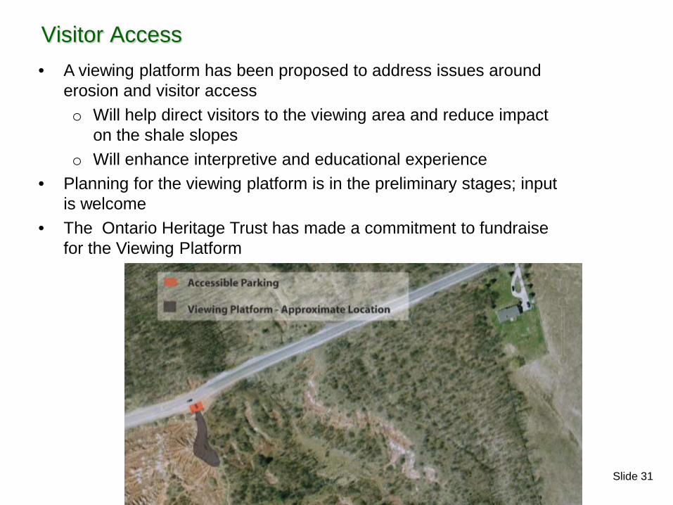
Visitor Access • A viewing platform has been proposed to address issues around
erosion and visitor access o Will help direct visitors to the viewing area and reduce impact
on the shale slopes o Will enhance interpretive and educational experience
• Planning for the viewing platform is in the preliminary stages; input is welcome
• The Ontario Heritage Trust has made a commitment to fundraise for the Viewing Platform

Slide 32
The Preliminary Viewing Platform Design - Overview • The Viewing Platform Design Concept Will:
– Provide access to “Main Viewing Area”/ Upper Slope Area – Ensure that visitors have a safe and enjoyable experience with minimal
impact • Elevated platform with railings to restrict access and improve views
– Provide opportunities to educate and inform the public about the Cheltenham Badlands, the site’s history and conservation
– Structure will be designed to have the lightest touch • Storm water, aesthetics and structural design
• Access to platform primarily via a footpath from the parking area; – Access also to the accessible parking area at the road, and via a path back to
the parking area long the roadway (with a protective barrier)
Slide 33
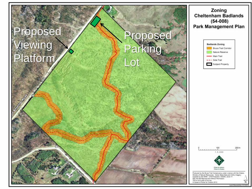
Proposed Parking Lot
Proposed Viewing Platform
Slide 34
PUBLIC INVOLVEMENT
Slide 35
• Public Outreach to Date – 2008 public meeting – Material on BTC and Caledon Hills Club web pages – Regular updates in Caledon Hills Bruce Trail Club newsletters – Regular updates in Councillor Paterak’s newsletter, more recently
mentioning the parking lot concept – Other articles in newspapers – Parking Lot Permit Application: Provides a formal opportunity to
provide public input • Are we addressing all of the issues? What are we missing?
• We welcome your input tonight, or via email to [email protected],
or by mail to: The Bruce Trail Conservancy P.O. Box 857 Hamilton, Ontario L8N 3N9
Public Involvement


![THE BADLANDS COLLECTIVE PRESENTS · THE BADLANDS COLLECTIVE PRESENTS A 35mm presentation THE CINEMA MUSEUM, LONDON March 17, 2018 “[Minnelli’s] work in [melodrama] is as great](https://static.documents.pub/doc/80x56/6020bca4f4df9b765544eadf/the-badlands-collective-presents-the-badlands-collective-presents-a-35mm-presentation.jpg)