Base your answers to questions 48 through 51 on the map of Long Island, New York. AB, CD, EF, and GH are reference lines on the map. 48 Which New York Landscape Region is shown on the map? (1) Erie-Ontario Lowlands (3) Allegheny Plateau (2) Atlantic Coastal Plain (4)
Transcript
Base your answers to questions 48 through 51 on the map of Long Island, New York. AB, CD, EF, and GH are reference lines on the map.
48 Which New York Landscape Region is shown on the map?
(1) Erie-Ontario Lowlands (3) Allegheny Plateau
(2) Atlantic Coastal Plain (4) Newark Lowlands
LANDSCAPES are regions of common climate and bedrock geology that have evolved over
time.
Weathering and biological
activity creates SOIL HORIZONS.
In New York State though, much of the soil
has been eroded and deposited by glaciers.
Greenland glaciers that once covered our area
Retreating glaciers leave behind evidence ON THE LAND…
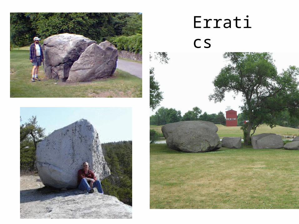
Glacial evidence includes: erratics, striations (parallel scratches), odd land forms, and deposits all over the state.
Erratics
Striations
Drumlins
Kettle Lakes
Eskers
Moraine(glacial deposit)
The diagram shows rock material being transported
by a mountain glacier.
The moraine deposits left when this glacier melts will be
1) all round and smooth
2) flat with small holes
3) all sizes in a u-shaped valley
4) all small in a v-shaped valley
Glaciers pushed material to the south of New York State.
Moraines from glacial melt became LONG ISLAND.
Moraines from glacial melt became LONG ISLAND.
Base your answers to questions 48 through 50 on the map of Long Island, New York. AB, CD, EF, and GH are reference lines on the map.
49 Which agent of erosion transported the sediments that formed the moraines shown on the map?
(1) water (3) ice
(2) wind (4) mass movement
LAKE Ontario!
Most NY water is from melted glaciers.
Water left from melted glaciers also heavily influences the landscape.
Lake Erie
Lake Ontario
Niagara Falls
Glacial melt also heavily influences New York’s economic development.
50 The cross section below represents the sediments beneath the land surface along one of
the reference lines shown on the map.
Along which reference line was the cross section taken?
(1) AB (2) CD (3) EF (4) GH
51 A major difference between sediments in the outwash and sediments in the moraines
is that the sediments deposited in the outwash are