42
Beaches Bolsa Chica
| Date post: | 22-Dec-2015 |
| Category: |
Documents |
| View: | 214 times |
| Download: | 0 times |

Beaches
Bolsa Chica

Beaches
LOS ANGELES, CA - JULY 24: Waves wash up on spectators gathered to watch bodysurfers catch big waves at The Wedge as a winter storm with 50-knot winds in the Southern Hemisphere off Tahiti generates high surf at south-facing southern California beaches on July 24, 2009 in Newport Beach, California. Surf forecasters predict that wave faces at The Wedge could reach 12 to 20 feet at high tide through the weekend. The Wedge is well-known among surfers for its swell that reflects off a jetty and back into other swells in the wedge-shaped water between the beach and jetty to produce dangerously big surf in water that can be as shallow as three feet. Inland, triple-digit heat is driving many people to seek relief at area beaches and is causing heightened wildfire weather conditions. Photo: David McNew/Getty Images Jul 24, 2009

Intro• Beaches
– Loose sediment along coast
– Subject to constant wave attack
– Beaches survive where waves destroy concrete walls
– Beaches maintain because of mobility of sediments
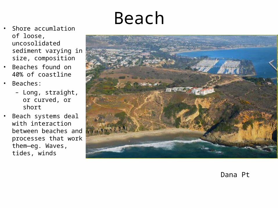
Beach• Shore accumlation of
loose, uncosolidated sediment varying in size, composition
• Beaches found on 40% of coastline
• Beaches:
– Long, straight, or curved, or short
• Beach systems deal with interaction between beaches and processes that work them—eg. Waves, tides, winds
Dana Pt

Beaches Continued
• Beaches next to deep water, shallow water
• Some stable others losing or gaining sediments
• Some change shape or stay the same
Erosion Control on Carlsbad’s Terramar beach – Controversial? You Bet!
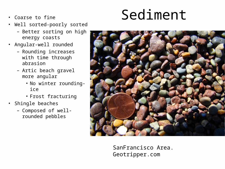
Sediment• Coarse to fine• Well sorted-poorly sorted
– Better sorting on high energy coasts
• Angular-well rounded– Rounding increases with
time through abrasion– Artic beach gravel more
angular• No winter rounding-
ice• Frost fracturing
• Shingle beaches– Composed of well-
rounded pebbles
SanFrancisco Area. Geotripper.com

Shingle Beaches
Photo byWerner Zehnder
UK, Geograph.org.uk
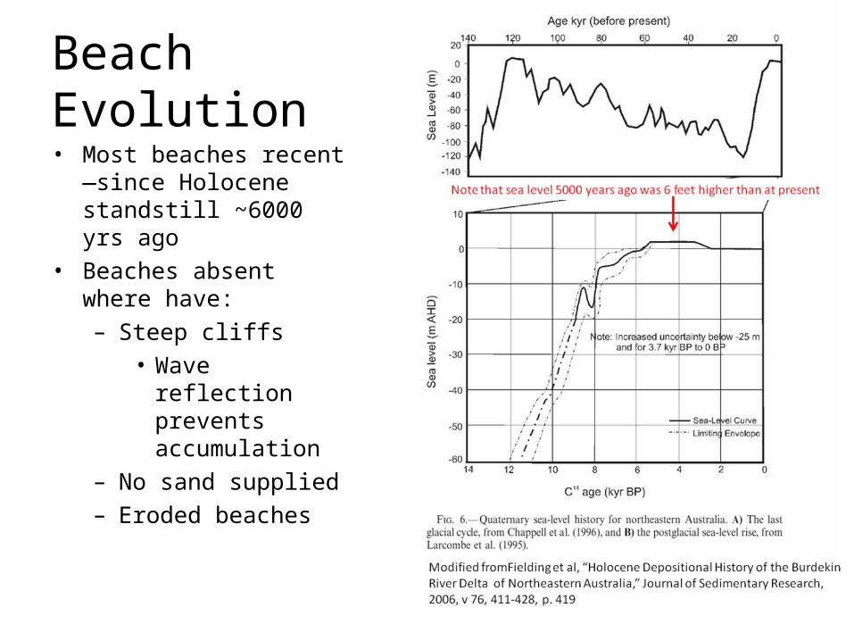
Beach Evolution• Most beaches recent—
since Holocene standstill ~6000 yrs ago
• Beaches absent where have:– Steep cliffs
• Wave reflection prevents accumulation
– No sand supplied– Eroded beaches
Sediment Source
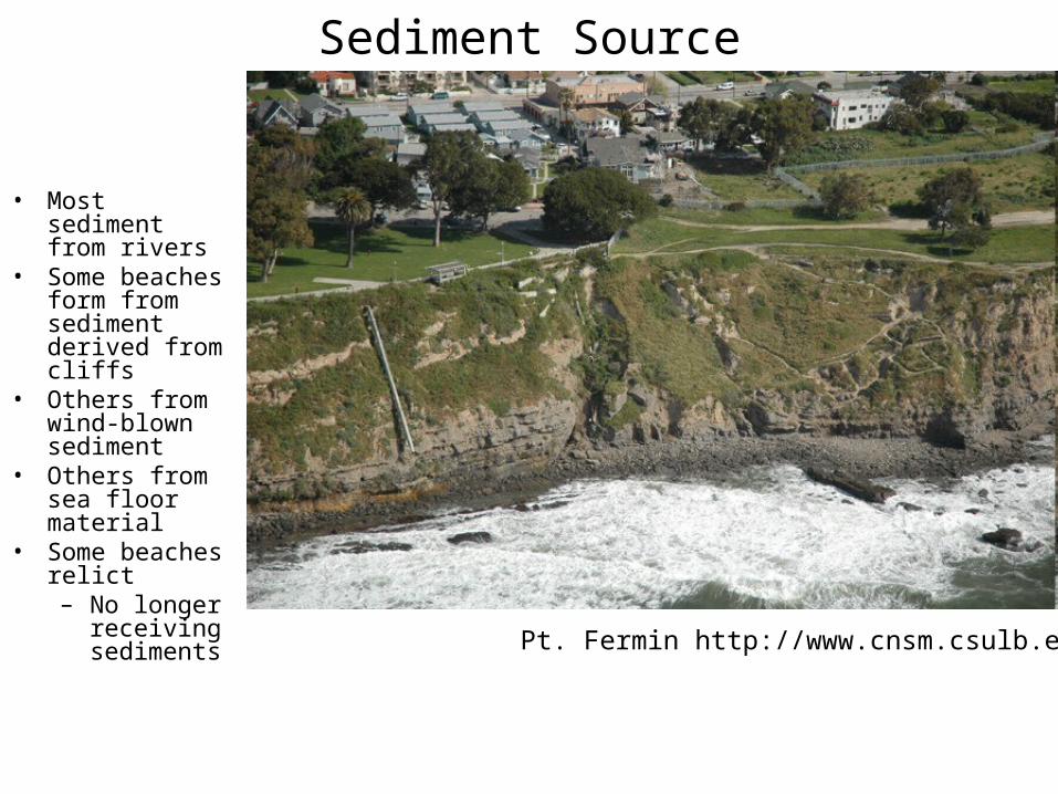
• Most sediment from rivers
• Some beaches form from sediment derived from cliffs
• Others from wind-blown sediment
• Others from sea floor material
• Some beaches relict– No longer
receiving sediments
Pt. Fermin http://www.cnsm.csulb.edu

Pt. Fermin http://www.cnsm.csulb.edu
Portuguese Bend
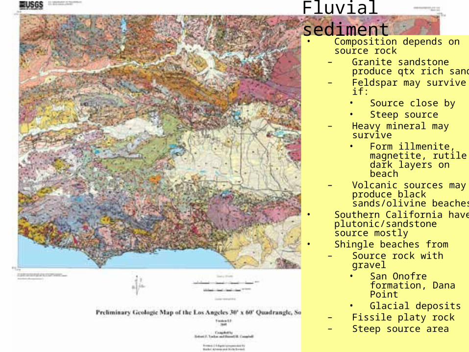
• Composition depends on source rock
– Granite sandstone produce qtx rich sand
– Feldspar may survive if:• Source close by• Steep source
– Heavy mineral may survive
• Form illmenite, magnetite, rutile dark layers on beach
– Volcanic sources may produce black sands/olivine beaches
• Southern California have plutonic/sandstone source mostly
• Shingle beaches from– Source rock with gravel
• San Onofre formation, Dana Point
• Glacial deposits– Fissile platy rock– Steep source area
Fluvial sediment

Beaches from Eroding Cliffs
• Sediment reflects eroding cliffs and wave energy– Sand from sandstone– Shingles from suitable
rock• None from massive
rock-eg granite• Conglomerates• Glacial deposits
– Angular sediment from granite
• Pebbles where have joints/fractures
http://img.geocaching.com

San Onofre Breccia
Dynamics of Subaqueous Gravity Depositional ProcessesR. H. Dott, Jr. AAPG Bulletin Volume 47, Issue 1. (January), Pages 104 - 128 (1963)

Beaches from Offshore Sediment
• Obvious where have no river– Sand or gravel– Depth of seafloor derived sediment governed by
• Waves energy• Seafloor topography• Sediment size
– In southern California, 18 m depth– Emerging shore have beaches derived from shallower
marine sediments– Holocene transgression pushed sediment shoreward– Sandy beaches in Australia mostly marine origin– Shell, coral, algae on beach swept shoreward

Beaches From Windblown Sand
• More common on arid coasts
• Dune advance to coast
NASA
Namibia , earthly-musings.blogspot.c om
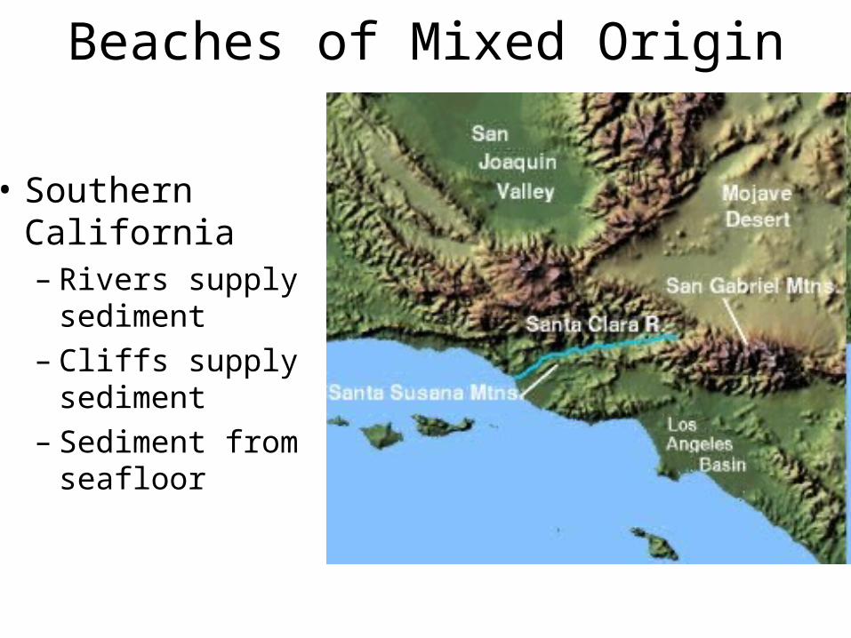
Beaches of Mixed Origin
• Southern California– Rivers supply
sediment– Cliffs supply
sediment– Sediment from
seafloor
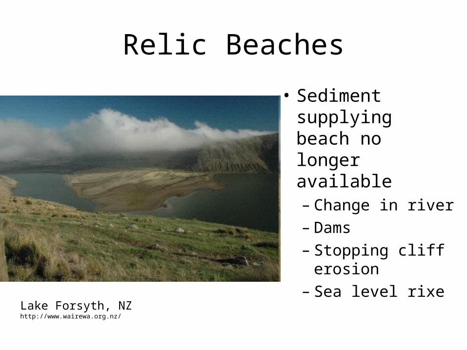
Relic Beaches
• Sediment supplying beach no longer available– Change in river– Dams– Stopping cliff
erosion– Sea level rixeLake Forsyth, NZ
http://www.wairewa.org.nz/

Nearshore Processes
• Waves approach parallel to shore– Move sediment shoreward/seaward
• Waves approach at angle to beach– Move sediment along the beach– Sediments move in zig-zag fashion along beach– Current developed in nearshore
• Lonshore current• Movement of sediment = longshore transport• Most sediment moved in nearshore
– Longshore transport more rapid when wave angle to beach is 40-50 degrees, coastline straight, smooth seafloor
• Increases with wave energy

Beach ProcessesLongshore Current and Transport
• Longshore current moves parallel to shore
– SwashSwash moves sediment onto beach at an angle moves sediment onto beach at an angle– BackwashBackwash moves sediment down perpendicular to shore moves sediment down perpendicular to shore
• Longshore transport moves sediment along shore by LS current Longshore transport moves sediment along shore by LS current
• Zig-zag motion has an overall net transportZig-zag motion has an overall net transport
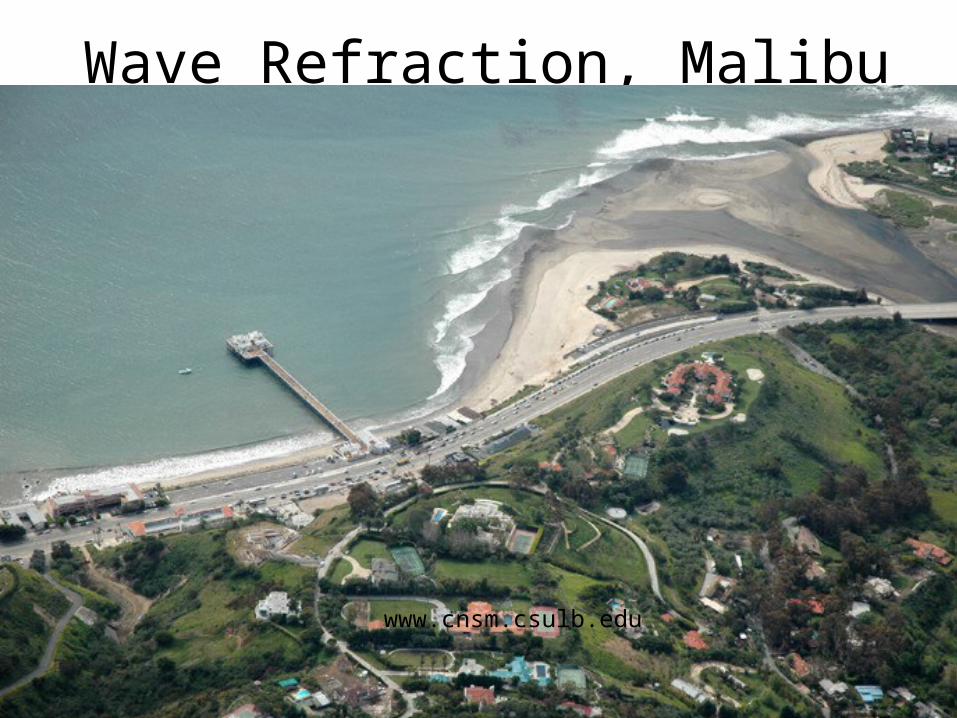
Wave Refraction, Malibu
www.cnsm.csulb.edu

Longshore Transport Directions
• Governed by direction of wave approach– In S. CA mostly
southerly• Storms form in
N. Pacific• Some storms
from S. Pacific
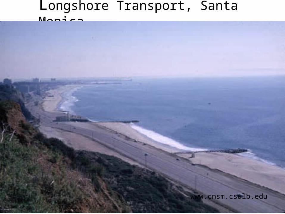
Longshore Transport, Santa Monica
www.cnsm.csulb.edu

Littoral Cells
• Explains appearance and disappearance of beaches
• Describes movement of sediment from source to beach, to along beach to submarine canyon
• Beaches end where sediment encounters submarine canyon

Beach Profile• Beach Definition– From upper limit
of wave action to low water level of spring tides
• Does not include where sediments move along shore by waves—littoral zone
– From upper influence of waves to where sediment movement begins
• Usually at ¼ wave length
• Seaward limit always changing

Profile Description• Berm– Flat-
topped,landward ridge
– Longshore bar• Represents
transition from steep to shallow gradient
– Low tide terrace• Developed by tidal
movement• May have shore
parallel runnels & troughs—especially in shallow gradient beaches
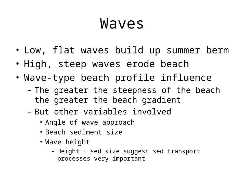
Waves
• Low, flat waves build up summer berm• High, steep waves erode beach• Wave-type beach profile influence
– The greater the steepness of the beach the greater the beach gradient
– But other variables involved• Angle of wave approach• Beach sediment size• Wave height
– Height + sed size suggest sed transport processes very important

BeachesSummer and Winter
• Summer •Winter Winter – Erosive storm wavesErosive storm waves– Gentle wavesGentle waves
– Sand carried seaward Sand carried seaward to offshore sandbarsto offshore sandbars
– Narrow, rocky beachNarrow, rocky beach
– Carry sand to shore but Carry sand to shore but too weak to carry back too weak to carry back to seato sea– Wide, sandy beachWide, sandy beach
summersummer winterwinter
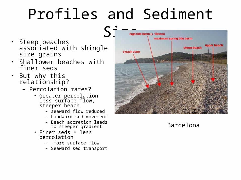
Profiles and Sediment Size• Steep beaches associated
with shingle size grains• Shallower beaches with finer
seds• But why this relationship?
– Percolation rates?• Greater percolation less
surface flow, steeper beach– seaward flow reduced– Landward sed movement– Beach accretion leads to
steeper gradient• Finer seds = less
percolation– more surface flow– Seaward sed transport
Geography fieldwork.com
Barcelona
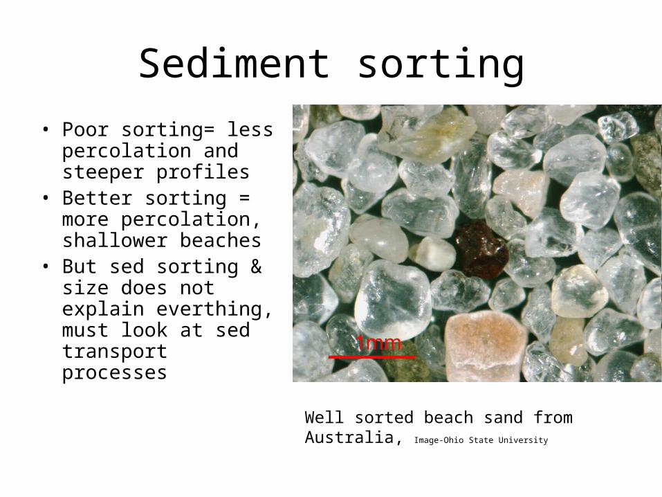
Sediment sorting
• Poor sorting= less percolation and steeper profiles
• Better sorting = more percolation, shallower beaches
• But sed sorting & size does not explain everthing, must look at sed transport processes
Well sorted beach sand from Australia, Image-
Ohio State University

Factors Controlling Beach Profiles
• Waves
• Sediment variability
• Sediment transport processes
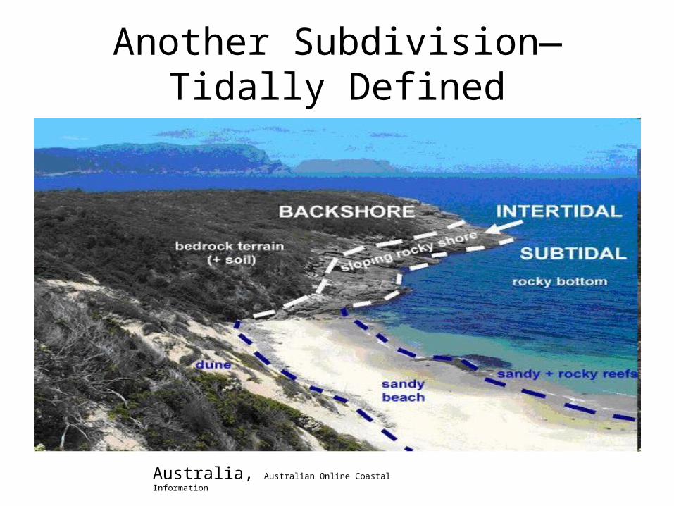
Another Subdivision—Tidally Defined
Australia, Australian Online Coastal Information
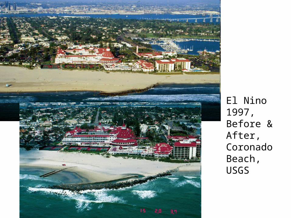
El Nino 1997, Before & After, Coronado Beach, USGS

Alongshore Beach Shape
• Cusps– Coarse sediment horns separated by small
bays of finer sand• Formed by division of onshore wave into two flows
that coalesce during backwash• Flow division causes decreased velocities and
depositon of coarser sediments on horns• Coalescenc of backwash increases velocity causes
erosion of finer material in bays

– What explains regularity is cusp formation• Edge waves
– Waves formed at right angles to oncoming waves– Devlop standing waves, but difficult to see because of
incoming waves– Spacing of cusps = spacing of edge waves

http://www.soton.ac.uk/~imw/worbar.htm
Green Bay, University of Wisconsin

Crescentic Bars
• Larger than cusps—100-2000m– Horns point landward– Regular spacing
• Due to edge waves? Not well understood
Rip Currents
• Seward flowing currents
• Can be regularly spaced
• May form channels with bars on margin

Beach ProcessesRip Currents
• Incoming waves create underwater sandbar close to shore
• Waves cause sandbar to collapseWaves cause sandbar to collapse
• Excess water is pushed through gapExcess water is pushed through gap
• Creates a strong, narrow Creates a strong, narrow current away from shorecurrent away from shore

Shoreline Beaches

Basic Relationships
• Beaches are energy sinks
– Form buffer between waves and coast
– Wave types—spillers, surging
• Energy of wave proportional to square of height
• Rate of energy input depends on wave period
• Beaches receive high energy input at rapid rate during steep waves
• Beaches receive less energy under flat waves
• High rapid energy input dissipitated over wide flat beaches• Low energy can be dissiptated over narrow beaches
Torrance, Image from CSULB

Profile• Summer or winter beach• Best to use steep or
shallow– Does not
attribute/imply origin– But subjective—what is
steep/shallow• Beach gradient
– =tangent of beach angle
– Vary from 0.2 (11degrees)-0.01(0.05)
• Would = beach width from 15m to 300m, assumes 3m tidal range
Sediment Transport• Null point hypothesis
– On a beach, a point of balance is reached where there is no net transport sea ward or landward
– Landward of this point net transport is landward. Exceeds gravity component seaward
– Seaward of this point net transport is seaward due to current, but gravity moves sediments seaward
– Null point varies with grain size• Larger grain sizes, more landward null point


