27
BELL RINGER BELL RINGER • If Sid’s height is 80 centimeters plus half his If Sid’s height is 80 centimeters plus half his own height, how tall is he? own height, how tall is he?
| Date post: | 16-Dec-2015 |
| Category: |
Documents |
| Upload: | clemence-andrews |
| View: | 231 times |
| Download: | 4 times |
BELL RINGERBELL RINGER
• If Sid’s height is 80 centimeters plus half his own height, If Sid’s height is 80 centimeters plus half his own height,
how tall is he?how tall is he?
YESTERDAY’S ANSWERYESTERDAY’S ANSWER
• Twelve thousand, twelve hundred twelve isTwelve thousand, twelve hundred twelve is
• 12,000 + 1200 + 12 = 13,21212,000 + 1200 + 12 = 13,212
GEOGRAPHYGEOGRAPHY(LATITUDE AND (LATITUDE AND
LONGITUDE)LONGITUDE)OBJECTIVES:OBJECTIVES:
•Use absolute location to describe the location of North Use absolute location to describe the location of North
AmericaAmerica
•Draw the Prime Meridian and Equator on a blank mapDraw the Prime Meridian and Equator on a blank map
CLASSROOM RULESCLASSROOM RULES
• Comply with all federal, state and district policiesComply with all federal, state and district policies
• Do not do anything that creates unsafe or unhealthy Do not do anything that creates unsafe or unhealthy
conditions in my classroomconditions in my classroom
• Do not do anything that interferes with your learningDo not do anything that interferes with your learning
• Do not do anything that interferes with anyone else’s Do not do anything that interferes with anyone else’s
learninglearning
• Do not let anyone else interfere with your learningDo not let anyone else interfere with your learning
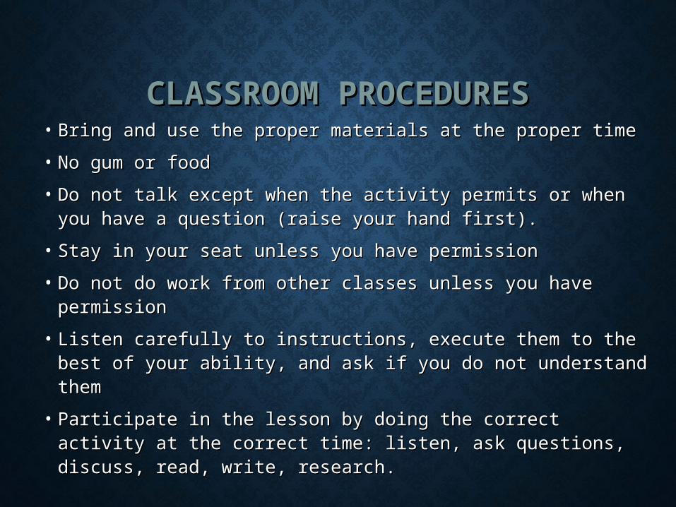
CLASSROOM PROCEDURESCLASSROOM PROCEDURES• Bring and use the proper materials at the proper timeBring and use the proper materials at the proper time
• No gum or foodNo gum or food
• Do not talk except when the activity permits or when you Do not talk except when the activity permits or when you have a question (raise your hand first).have a question (raise your hand first).
• Stay in your seat unless you have permissionStay in your seat unless you have permission
• Do not do work from other classes unless you have Do not do work from other classes unless you have permissionpermission
• Listen carefully to instructions, execute them to the best Listen carefully to instructions, execute them to the best of your ability, and ask if you do not understand themof your ability, and ask if you do not understand them
• Participate in the lesson by doing the correct activity at Participate in the lesson by doing the correct activity at the correct time: listen, ask questions, discuss, read, write, the correct time: listen, ask questions, discuss, read, write, research.research.
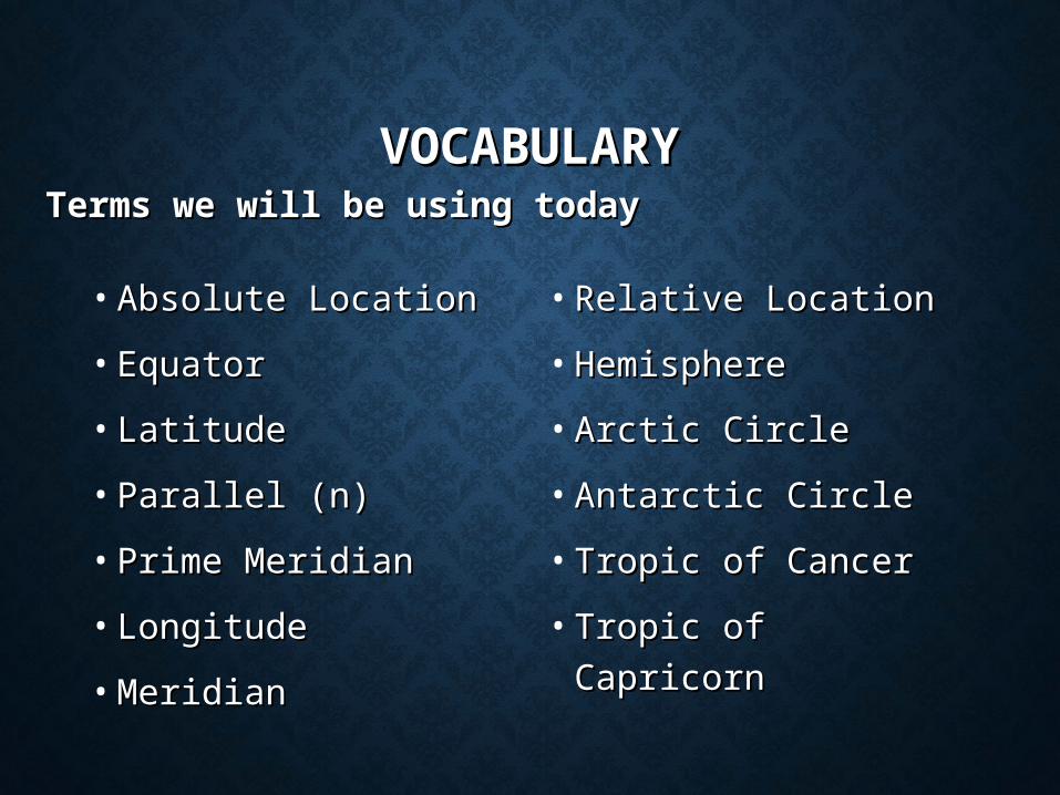
VOCABULARYVOCABULARYTerms we will be using todayTerms we will be using today
• Absolute LocationAbsolute Location
• EquatorEquator
• LatitudeLatitude
• Parallel (n)Parallel (n)
• Prime MeridianPrime Meridian
• LongitudeLongitude
• MeridianMeridian
• Relative LocationRelative Location
• HemisphereHemisphere
• Arctic CircleArctic Circle
• Antarctic CircleAntarctic Circle
• Tropic of CancerTropic of Cancer
• Tropic of CapricornTropic of Capricorn
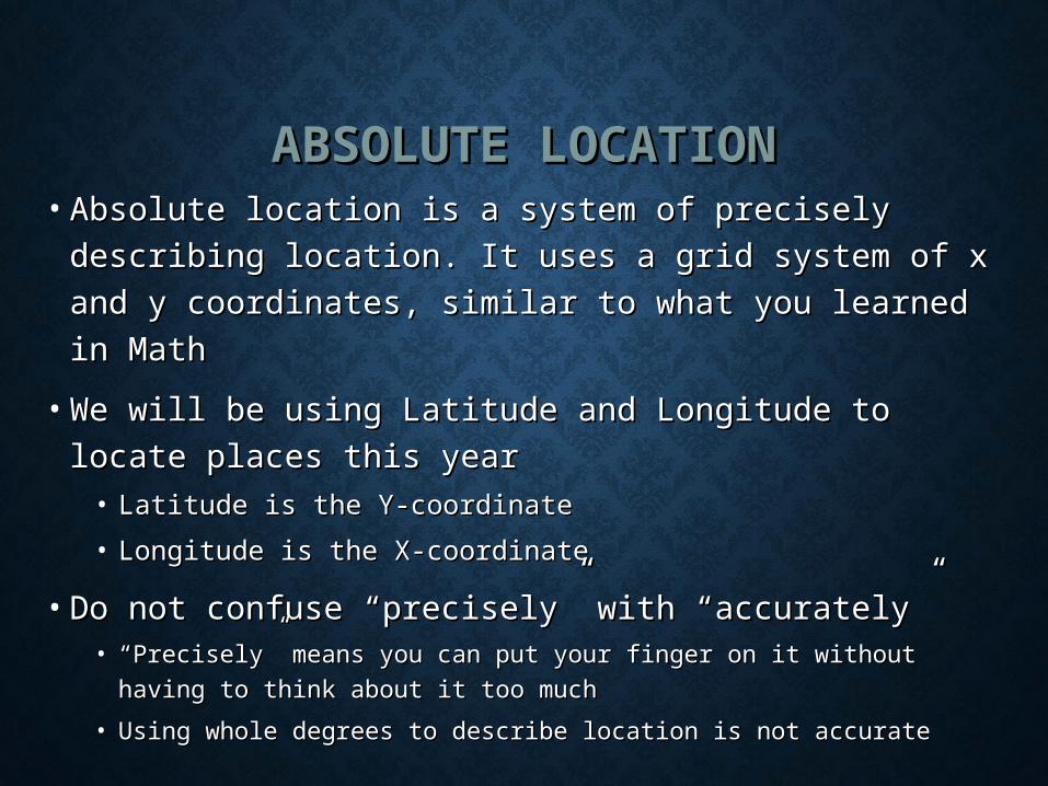
ABSOLUTE LOCATIONABSOLUTE LOCATION• Absolute location is a system of precisely describing Absolute location is a system of precisely describing
location. It uses a grid system of x and y location. It uses a grid system of x and y
coordinates, similar to what you learned in Mathcoordinates, similar to what you learned in Math
• We will be using Latitude and Longitude to locate We will be using Latitude and Longitude to locate
places this yearplaces this year• Latitude is the Y-coordinateLatitude is the Y-coordinate
• Longitude is the X-coordinateLongitude is the X-coordinate
• Do not confuse “precisely” with “accurately”Do not confuse “precisely” with “accurately”• ““Precisely” means you can put your finger on it without having to Precisely” means you can put your finger on it without having to
think about it too muchthink about it too much
• Using whole degrees to describe location is not accurateUsing whole degrees to describe location is not accurate
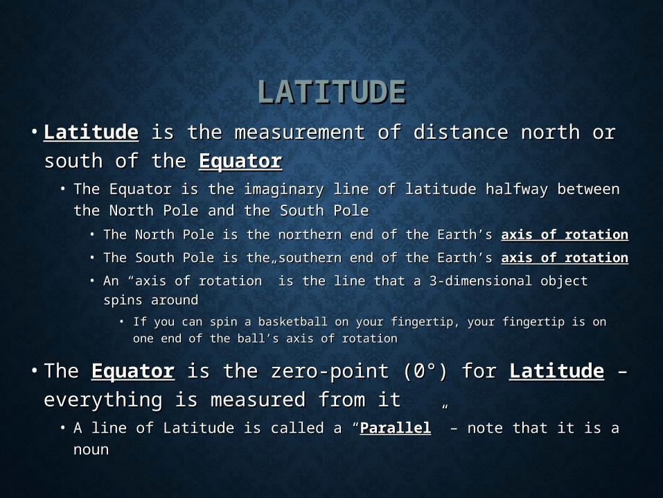
LATITUDELATITUDE• LatitudeLatitude is the measurement of distance north or is the measurement of distance north or
south of the south of the EquatorEquator• The Equator is the imaginary line of latitude halfway between the The Equator is the imaginary line of latitude halfway between the
North Pole and the South PoleNorth Pole and the South Pole
• The North Pole is the northern end of the Earth’s The North Pole is the northern end of the Earth’s axis of rotationaxis of rotation
• The South Pole is the southern end of the Earth’s The South Pole is the southern end of the Earth’s axis of rotationaxis of rotation
• An “axis of rotation” is the line that a 3-dimensional object spins An “axis of rotation” is the line that a 3-dimensional object spins
aroundaround
• If you can spin a basketball on your fingertip, your fingertip is on one end If you can spin a basketball on your fingertip, your fingertip is on one end
of the ball’s axis of rotationof the ball’s axis of rotation
• The The EquatorEquator is the zero-point (0°) for is the zero-point (0°) for LatitudeLatitude – –
everything is measured from iteverything is measured from it• A line of Latitude is called a “A line of Latitude is called a “ParallelParallel” – note that it is a noun” – note that it is a noun
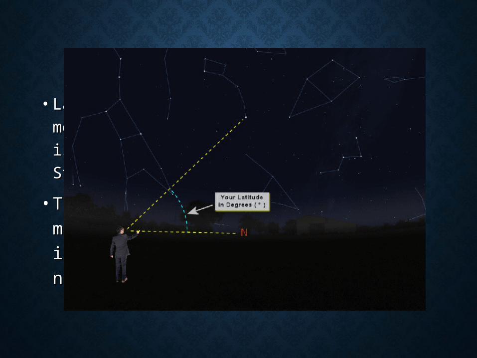
MEASURING LATITUDEMEASURING LATITUDE
• Latitude is the easiest coordinate to measure in Latitude is the easiest coordinate to measure in
the Northern Hemisphere. It is roughly the the Northern Hemisphere. It is roughly the
angle between the North Star and the horizonangle between the North Star and the horizon
• There is no southern pole star, so There is no southern pole star, so
measuring latitude is a bit trickier in the measuring latitude is a bit trickier in the
Southern Hemisphere, but it’s not horribly Southern Hemisphere, but it’s not horribly
difficultdifficult

MEASURING LATITUDEMEASURING LATITUDE• Because Latitude measures distance between the North Pole Because Latitude measures distance between the North Pole
and the South Pole and the Equator (0°) is halfway between, a and the South Pole and the Equator (0°) is halfway between, a
measure of latitude will never be more than 90°measure of latitude will never be more than 90°
South Pole (90°S)
Equator (0°)
North Pole (90°N)North Latitude
(x°N)
South Latitude (x°S)
Equator (0°)
YOU DOYOU DO
• Fold your group’s book cover in half (it should already be Fold your group’s book cover in half (it should already be
folded since we did that on Thursday before putting it folded since we did that on Thursday before putting it
away).away).
• If you need another book cover, let me know.If you need another book cover, let me know.
• On the left half, at either the top or the bottom, write On the left half, at either the top or the bottom, write
“Latitude” in big letters.“Latitude” in big letters.
• You are going to copy the drawing on the next slide onto You are going to copy the drawing on the next slide onto
the left side of your book cover.the left side of your book cover.
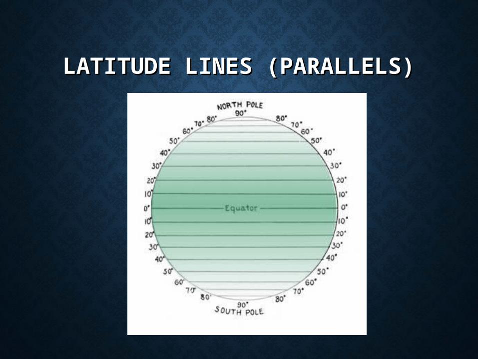
LATITUDE LINES (PARALLELS)LATITUDE LINES (PARALLELS)
LONGITUDELONGITUDE• Longitude is the measure of distance east or west of the Prime Longitude is the measure of distance east or west of the Prime
Meridian, and is the x-coordinate of our grid systemMeridian, and is the x-coordinate of our grid system
• The Royal Observatory in Greenwich (pronounced GREN-ich), The Royal Observatory in Greenwich (pronounced GREN-ich),
England (it’s near London) is designated as 0° England (it’s near London) is designated as 0°
• The location of the Prime Meridian is the result of a treaty, not The location of the Prime Meridian is the result of a treaty, not
some natural feature, like the North Star. In other words, it is where some natural feature, like the North Star. In other words, it is where
it is because everyone agreed to do it that way.it is because everyone agreed to do it that way.
• Longitude describes a circle, so there are 360 degreesLongitude describes a circle, so there are 360 degrees
• If you are east of Greenwich, you use East Longitude (x°E)If you are east of Greenwich, you use East Longitude (x°E)
• If you are west of Greenwich, you use West Longitude (x°W)If you are west of Greenwich, you use West Longitude (x°W)
• If you are halfway around the circle, you are on the International If you are halfway around the circle, you are on the International
Date Line (180°)Date Line (180°)

YOU DOYOU DO
• On the right half of your book cover, at either the top or On the right half of your book cover, at either the top or
the bottom, write “Longitude” in big letters.the bottom, write “Longitude” in big letters.
• You are going to copy the drawing on the next slide onto You are going to copy the drawing on the next slide onto
the right side of your book cover.the right side of your book cover.

LONGITUDE LINES LONGITUDE LINES (MERIDIANS)(MERIDIANS)
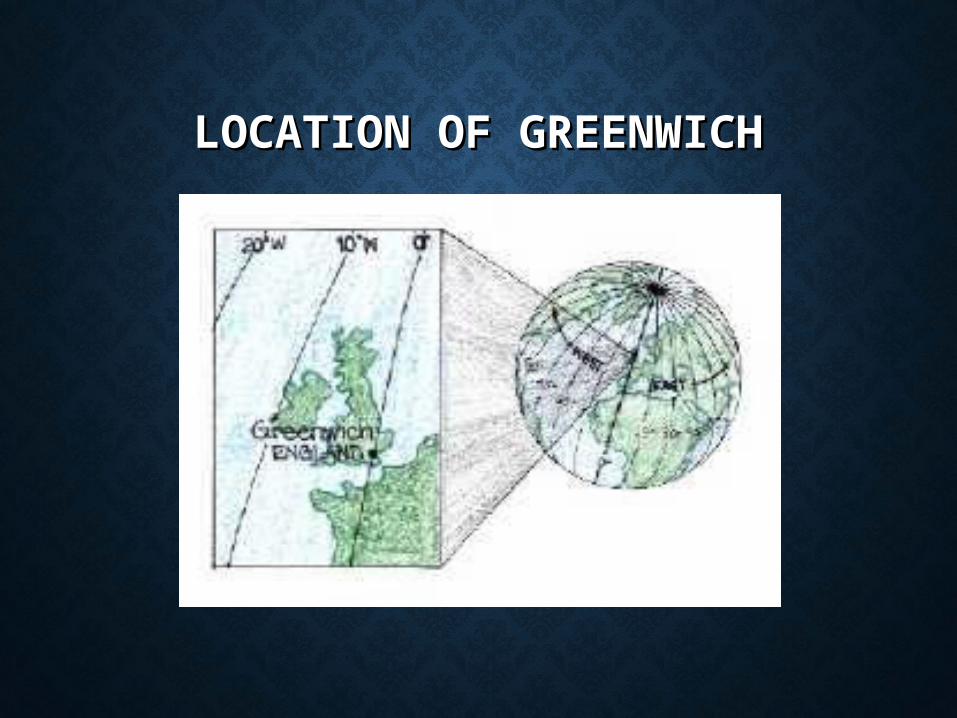
LOCATION OF GREENWICHLOCATION OF GREENWICH
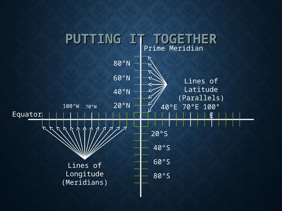
PUTTING IT TOGETHERPUTTING IT TOGETHER
Equator
Prime Meridian
Lines of Latitude (Parallels)
Lines of Longitude
(Meridians)
40°S
20°S
80°N60°N40°N20°N
60°S
80°S
70°W
100°W 40°E 70°E 100°E
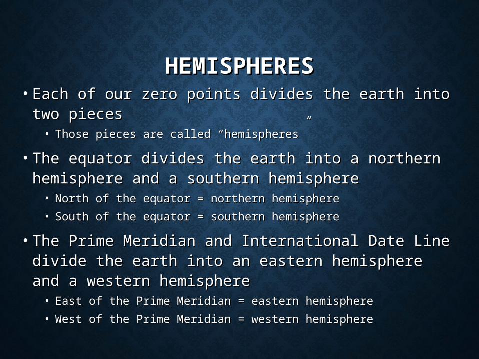
HEMISPHERESHEMISPHERES• Each of our zero points divides the earth into two Each of our zero points divides the earth into two
piecespieces• Those pieces are called “hemispheres”Those pieces are called “hemispheres”
• The equator divides the earth into a northern The equator divides the earth into a northern hemisphere and a southern hemispherehemisphere and a southern hemisphere• North of the equator = northern hemisphereNorth of the equator = northern hemisphere
• South of the equator = southern hemisphereSouth of the equator = southern hemisphere
• The Prime Meridian and International Date Line The Prime Meridian and International Date Line divide the earth into an eastern hemisphere and a divide the earth into an eastern hemisphere and a western hemispherewestern hemisphere• East of the Prime Meridian = eastern hemisphereEast of the Prime Meridian = eastern hemisphere
• West of the Prime Meridian = western hemisphereWest of the Prime Meridian = western hemisphere
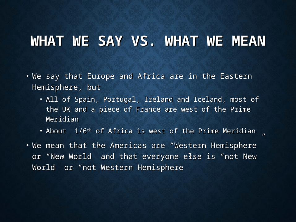
WHAT WE SAY VS. WHAT WE WHAT WE SAY VS. WHAT WE MEANMEAN
• We say that Europe and Africa are in the Eastern We say that Europe and Africa are in the Eastern
Hemisphere, butHemisphere, but
• All of Spain, Portugal, Ireland and Iceland, most of the UK All of Spain, Portugal, Ireland and Iceland, most of the UK
and a piece of France are west of the Prime Meridianand a piece of France are west of the Prime Meridian
• About 1/6About 1/6thth of Africa is west of the Prime Meridian of Africa is west of the Prime Meridian
• We mean that the Americas are “Western Hemisphere” We mean that the Americas are “Western Hemisphere”
or “New World” and that everyone else is “not New or “New World” and that everyone else is “not New
World” or “not Western Hemisphere”World” or “not Western Hemisphere”
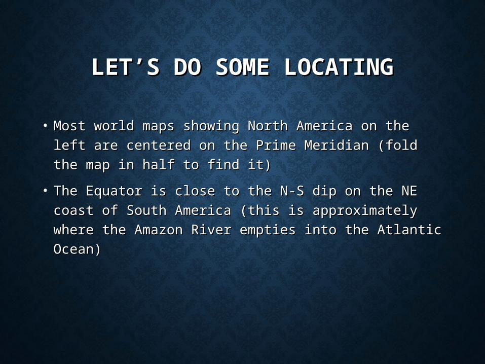
LET’S DO SOME LOCATINGLET’S DO SOME LOCATING
• Most world maps showing North America on the left are Most world maps showing North America on the left are
centered on the Prime Meridian (fold the map in half to centered on the Prime Meridian (fold the map in half to
find it)find it)
• The Equator is close to the N-S dip on the NE coast of The Equator is close to the N-S dip on the NE coast of
South America (this is approximately where the Amazon South America (this is approximately where the Amazon
River empties into the Atlantic Ocean)River empties into the Atlantic Ocean)
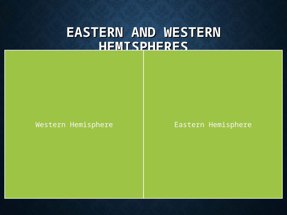
EASTERN AND WESTERN EASTERN AND WESTERN HEMISPHERESHEMISPHERES
Eastern HemisphereWestern Hemisphere
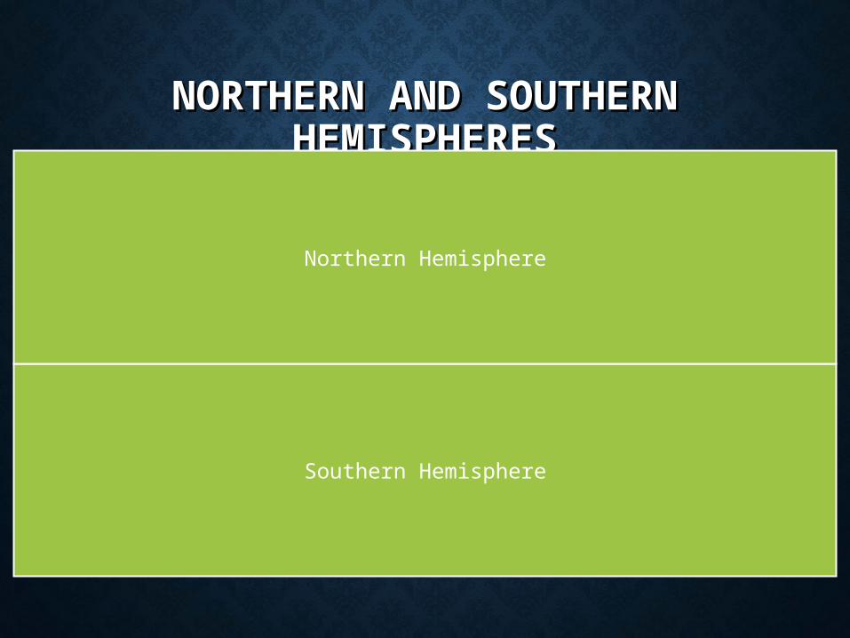
NORTHERN AND SOUTHERN NORTHERN AND SOUTHERN HEMISPHERESHEMISPHERES
Southern Hemisphere
Northern Hemisphere
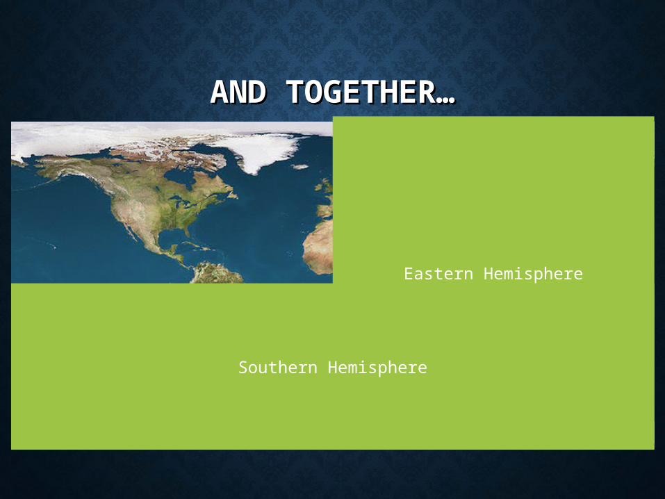
AND TOGETHER…AND TOGETHER…
Eastern Hemisphere
Southern Hemisphere
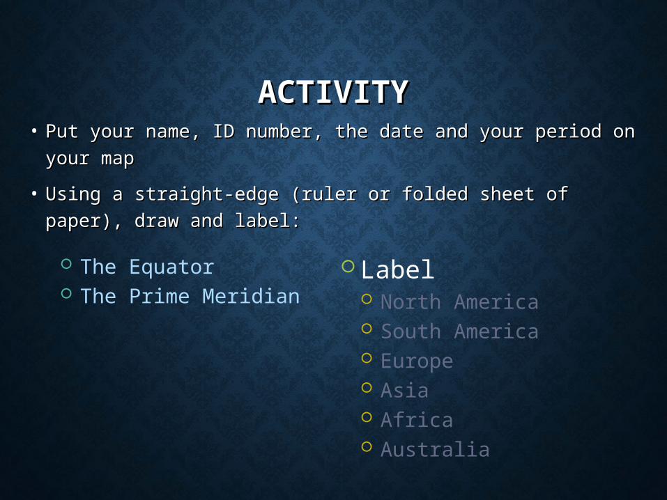
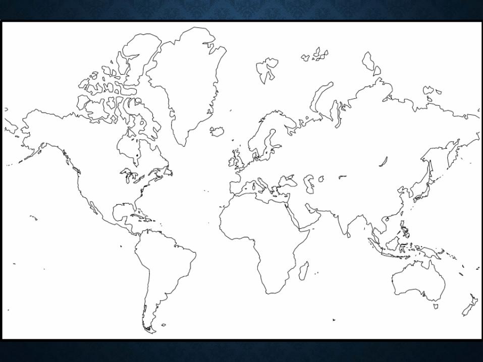
ACTIVITYACTIVITY• Put your name, ID number, the date and your period on your Put your name, ID number, the date and your period on your
mapmap
• Using a straight-edge (ruler or folded sheet of paper), draw Using a straight-edge (ruler or folded sheet of paper), draw
and label:and label:
The Equator The Prime Meridian
Label North America South America Europe Asia Africa Australia
TOMORROWTOMORROW
• We will learn how to use Latitude and Longitude to locate We will learn how to use Latitude and Longitude to locate
things on the Earth’s surface.things on the Earth’s surface.


